Thankfully our reliable guide Sadruddin had ensured we had electricity for our early start the next morning. Well, actually we didn't have any electricity but we did have the luxury of a wood heated hot shower The hotel manager was extremely helpful and on a bleak windy morning we thoroughly enjoyed piles of fried French toast (the bread was dipped in egg, milk and sugar before being deep fried. It may sound hideous but it was quite delicious!). And it was accompanied by huge new containers of fresh butter, homemade jam and coffee. Poor Sadruddin who had to camp the night before had neither a shower nor breakfast.
We had an early start as we were travelling from Naran across the Babusar Pass and then tracking back onto the Karakoram Highway, through Chilas and then onto our evening destination of Rama in the far north-east of Pakistan. The trip was to take us around thirteen hours.
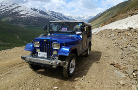
From Naran, the extremely rough roads required a strong four wheel drive jeep. In fact it was a wonder that our little Toyota sedan had taken us that far as the roads were so bad in places that many cars had broken down, overheated by the steep and arduous climb to Naran village. The night before Sadruddin had hired a jeep and a new driver Baijan (meaning "brother") for our trip from Naran to Chilas where we would be meeting Khaja, Ishaq Ali's trusted company driver.
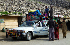
The jeep was old but sturdy and Baijan was a competent, if rather fast driver. We were intrigued however how careful he was about his fuel for the vehicle and would only fill up at a particular petrol station - and even then he would insist on putting the fuel in the car himself. And it was considerably more expensive than other petrol station outlets.
We were told that often petrol is "extended" by cheap fillers, which can of course cause serious engine problems on the dangerous roads leading to and across Babusar Pass. A number of recent fatalities due to these sorts of car breakdowns made us very appreciative of his efforts.
An amazing feature of Baijan's car was that there were no steps to climb into the back seat. You had to step up on the gigantic rear wheels then somehow somersault yourself backwards through the vehicle's struts and into the back. It was even worse getting out. I have always thought that I was quite agile but to Sadruddin's delight, several times I fell backward into the jeep, looking as pathetically helpless as a beetle on its back. My efforts were made even more exhausting at such a high altitude. As usual, Alan's long legs made it imperative for him to sit in the front seat while Sadruddin and I somehow managed to squash in the back. Well, that was his story....
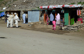
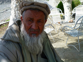
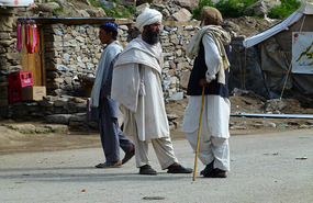
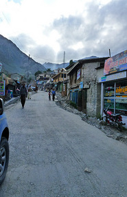
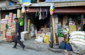
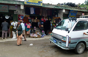
The road may have been rough but the countryside following the Kunhar River was splendid with dramatic views of the Lalazar Plateau and surrounding snow capped mountains. An hour or so out of Naran on the Babusar Road we stopped at Jalkhad Village where Baijan and Sadruddin enjoyed a well earned breakfast. Small food outlets dominated a rather non-descript village. As usual groups of bearded turbaned men chatted idly on the streets, although to our surprise a number of brightly clad women were shopping for food. Seeing women on the streets of small villages in Pakistan is unusual - they are often confined to their homes or chipping weeds in the fields. As in many parts of Pakistan, we wondered what these chatting groups of men did with their time. No-one seems to be in an any sort of hurry in Pakistan. A well spoken man came and introduced himself to us, asking what country we were from. He was from Oman, working in Pakistan for an aid organisation.
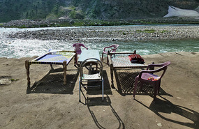
Alan was intrigued with the "beds" obviously used for outside accommodation at Jalkhad in the peak season. They were wooden slats virtually lined with string and rope and looked to be the most uncomfortable places upon which to sleep, although their views being right on top of the Kunhar River were unsurpassed!
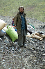
Accompanying us along the rugged road toward the Babusar Pass from Naran were the relentless trails of the Gujar and other nomad tribes. The Gujar are a distinct ethnic nomad group found scattered across India, Pakistan and Afghanistan.
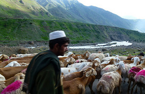
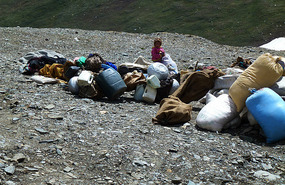
Slowly and tortuously, they led their animals by foot together with all their belongings to the higher grounds for the summer months. Men, women and numerous children were accompanied by a procession of donkeys or horses carrying baggage, food, cooking utensils and tents, along with fat tailed sheep from Afghanistan and herds of goats. Most of the nomads spend their winter months in Chilas or Mansehra before heading for the higher summer pastures. The nomads may well have their freedom but we could not help but think of what a hard and desperate way they had to lead their lives. And also the fact that these children would have virtually no formal education. They were however very friendly and we often thought of what they must have felt about us "so called wealthy" tourists travelling by jeep through their land.
We had always wanted to travel as an alternative to the Karakoram Highway (which stretches north from Islamabad over the Khunjerab Pass to Kashgar in China) through the Kaghan Valley and the Babusar Pass. The road is only open for a short period of time during the height of summer (from May to September) and its just about one lane rough road makes for frequent delays, especially in the holiday season. We had read that the mountainous area and the views of the very famous Nangar Parbat Mountain at an altitude 8,125 m were simply superb.
The surrounding area however is also home to various training camps of the dreaded outlawed Lashkar-e-Taiba, members of whom were to become infamous across the world especially after their deadly attacks on Mumbai, India in 2008. Known literally as "The Army of God", the Lashkar-e-Taiba (LeT) is one of the largest and most active terrorist Islamic organisations in south Asia, operating mostly out of Pakistan. It's aim is to "liberate" Muslims residing in Indian Kashmir - oh yes, just another leg of our forward journey to Kashmir in northern India....
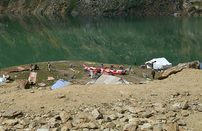
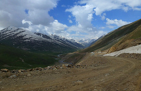
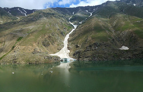
Not far out of Jalkhad the road degenerated to barely a rough and treacherous track. We passed Lake Lulusar, the largest natural lake in the Hazara and the source of the Kunhar River. The lake itself was disappointing to us with dull emerald green colloidal looking water surrounded by a number of rather tacky looking boats for hire. However, a rather gorgeous looking glacier fed slowly but determinedly into the lake, evidence of the lake and river's snow fed origins.
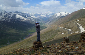
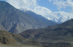
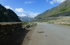
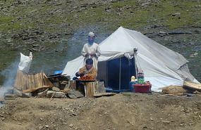
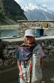
Babusar Pass at a height of 4,175 m was extraordinarily beautiful. Bleak and windy, the scenery was gorgeous and well worth the visit. It signifies the mountainous Pass at the north of the 150 km Kaghan Valley connecting it with Thak Nala and then onto Chilas on the Karakoram Highway and is the highest point in the Kaghan Valley. Well above the treeline, the pass provides splendid views of the Himalaya Ranges and surrounding snow capped peaks. The snow fed valley streams were still icy, despite it being mid summer season. A number of tents with food stalls were set up selling cold drinks and hot foods, their smoky kebabs smelling delicious in the freezing mountain air. We stopped to take in the scenery and to take some photos of the desolate but stunning surrounds.
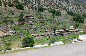
Descending from Babusar Pass the temperature rose remarkably quickly and the vegetation increased correspondingly. Farm houses made from stone and mud camouflaged oddly against the similarly coloured hills surrounding the roads. In fact it was almost impossible to see them, they were so well merged into the countryside. Small terraced plots indicated some sort of farming existence but it was difficult in this harsh environment to see how any family could eke out a living
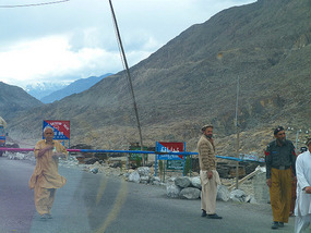
Although Thak Nala is just three kilometres from Chilas, a road blockage caused us an extra 45 kilometer trip along a spine jarring track. We passed through Chilas township, an eerie and seemingly unfriendly village. We were stared at by local groups of bearded men and there seemed to be no local women in sight. Lonely Planet Guide states "Most visitors are here to look at the petroglyphs or to cross the Babusar Pass. There are few other reasons to stop. Foreign women may feel especially unwelcome......"
Chilas is located in the Indus Valley within a largely tribally run area. Though administratively grouped into Gilgit Baltistan Province, the inhabitants of a myriad of tiny republics are by and large leaderless and constantly feuding with each other. Lonely Planet Guide states "though administratively lumped with Gilgit, Chilas and its neighbours are temperamentally more like Indus Kohistan, probably owing to a similarly hostile environment and the same Sunni Muslim orthodoxy."
We were soon to find out just how hostile a place Chilas can be. We did not stop at the village but continued further on to the Shangrila Hotel for lunch.
Lunches during our Pakistan travels were always sumptuous affairs, with heaps of curries, biryanis, vegetable, dahl and rice dishes all served with piles of freshly made chapattis. The hotel owner, a friend of Sadruddin and Ishaq Ali, was a gregarious and friendly man who made us extremely welcome. However, typically of all places in Pakistan there was the usual electricity outage and poor Alan who always has a problem with short door heights, almost managed to knock himself out by hitting his head on the door jam in the total darkness of the men's toilet. He was not impressed. From here on in my line became "Watch your head, watch your step". Needless to say it didn't help much. Alan's head became permanently scabbed and scarred.
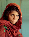
While browsing through the Shangrila's hotel's collection of tourist books, maps and postcards, I came across an old tatty postcard of the very famous "Afghan Girl". Refugee Sharbat Gula was approximately twelve years old when the photograph was taken by journalist Steve McCurry at the Nasir Bagh Refugee Camp just out of Peshawar in the Kyber Pakhtunkhwa Province, Pakistan. It later featured on the front cover of the June 1985 issue of National Geographic Magazine after which it became infinitely famous.
This haunting, astonishing photo had always intrigued me, as it has for many hundreds of thousands of people from all over the world. In fact the photograph has been likened to Leonado da Vinci's Mona Lisa and is often referred to as "The Afghan Mona Lisa". The identity of Afghan Girl remained unknown for over seventeen years and although McCurry made several attempts during the 1990's to locate her, he was unsuccessful. Gula was finally located, then around the age of thirty, in a remote area of Afghanistan. She had never seen her famous portrait until shown by McCurry in January, 2002.
National Geographic in recognition of Gula, established The Afghan Girls' Fund, a charitable organisation with the goal of educating young Afghan women and girls. In 2008, the scope of organisation was broadened to include boys and the name changed to the Afghan Childrens' Fund. Gula also became the subject of a television documentary "Search for the Afghan Girl".
I was delighted to find the Afghan Girl postcard in Pakistan and have since had the image professionally enhanced and framed. It now takes pride of place in our living area where it is frequently commented upon by visitors.
Chilas may have sounded chilling but it was hot. The township had an unpleasant atmosphere and now we were back on the (now very familiar to us) Karakoram Highway heading north to the eastern turn off to Naran via Astore. A severe dust storm consumed us. Visibility was reduced to almost zero. Poor road workers crouched low, covered in blankets to protect themselves from the blinding choking dust.
Chilas comprises almost 100% Sunni Muslims, unlike Gilgit which is further north and comprises roughly a 60% Sunni and a 40% Shiite population. And there are a lot of tensions and resulting fatalities in both these and surrounding townships. Just out of Chilas we sighted a number of what appeared to be burnt out bus frames. A chilling story, Sadruddin told us that just two months before forty or so people had been massacred on the buses which were then torched to the ground. Apparently, it was a reprisal killing following the (Shiite) murder of a Sunni man who was being taken by ambulance to a hospital in Gilgit. As a result three buses carrying Shiite Muslims were attacked and the passengers killed. Those who tried to escape by throwing themselves in to the treacherous Indus River were stoned to death. The exact number of fatalities is not known but according to local people, no-one was ever charged over the murders. Furthermore, we were informed that the local Sunni Mullahs decreed that if a Sunni murders just one Shiite, then they are guaranteed to go to heaven when they die. No wonder poor Pakistan is in such a mess.
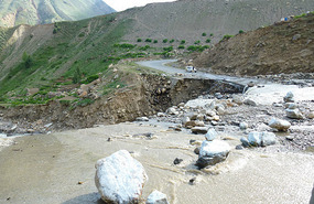
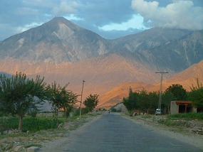
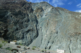
Khaja, North Pakistan Adventures most trusted driver, took over from Chilas. We had met Khaja on previous trips and were pleased to see him as the Karakoram Highway had certainly not improved since our very first journey there in 2007. Typically, the Karakorum degenerated from a relatively good sealed road from Chilas to a rocky, potholed track with frequent evidence of recent landslides resulting in Khaja's nice new four wheel drive having to actually negotiate huge fallen boulders. The scenery however was spectacular with distant snow capped mountains and the usual rocky, dry terrain and scoured scree slopes forging into the colloidal grey fast flowing snow fed waters of the mighty Indus River.
We crossed the famous Raikot Bridge (the leading to road the well known Upper Fairy Meadows) and gazed across to the amazing views of Nanga Parbat*, the great Himalaya massive at 8,126 m and north to Rakaposhi peak at 7,788 m. The turn from the Karakoram Highway to Astore Village was at Talechi at the mouth of the beautiful Astore Valley.
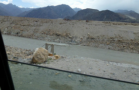
Huge landslides meant two new bridges. These massive slippages made it impossible to repair the roads so we transversed the Astore River twice. It looked like the most unstable area we had ever seen. Huge boulders, some the size of a motor vehicle had recently fallen across the road and goodness knows what would be left of a car if one fell on it.
At one stage we were overtaken at break neck speed by a tatty white station wagon with distinctive blue Gilgit number plates and laden with exuberant young men. How it stayed on the tortuous winding road at that speed was beyond us. Sadruddin explained that these cars are bought in cheaply (for about a third of the normal price) but illegally from Afghanistan. Apparently, they can only be registered in the Gilgit Region and have been involved in many, many fatal accidents. When we asked the obvious question of why they were allowed in Gilgit, Sadruddin was evasive. We were later to find out that government officials also buy them - a good way of ensuring their existence in corrupt Pakistan....
Astore Valley is located about 60 km southeast of Gilgit with four side valleys. It has more than a hundred villages with the local industry being largely subsistence agriculture and livestock.
The hair raising trip to Astore was interrupted by frequent and tedious police and military check points. Astore, being relatively close to the Line of Control with India marks the beginning of the very sensitive military zone and is also heavily policed due to the Sunni-Shiite tensions. From here on we were told that visitors are likely to be under continual surveillance by Inter Service Intelligence Agency (secret police), police and the military. We were later informed by locals that more than 50% of the secret police are Taliban! Whether this was true or not, it made for a good story and of course my entry to this blog!
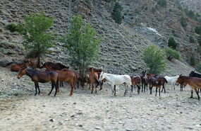
A herd of police owned horses and mules grazed the sides of the road toward Astore. In splendid condition they were obviously well bred, well cared for and hand fed.
For some time it was quite obvious that we were being followed. From the last police check point, a motor bike kept close distance to us and the driver was easily recognised by me as he was a very handsome man! It was in the end quite amusing as we became lost trying to find the main street of Astore and had to stop our car while Khaja asked him directions. And which he most obliging did!
Astore was a disappointing and dreary village. Just a one lane street, it comprised a number of tatty shops and the usual groups of local men. One delight however was seeing a local wedding party on the road from Astore to Rama. Taking up the entire road, the brightly clad women and men waved to us and graciously moved their party aside as we edged though the narrow lane.
Rama reminded us a little of the beautiful village of Duikar in the Hunza region of northern Pakistan. Accessible by a very steep and narrow road, the area was densely vegetated by cedars and spruce with moist park like surrounds, intersected by pretty babbling brooks.
The Rama PTDC Hotel was gorgeously designed and beautifully located in a forest type setting but.....
* In June 2013, Taliban militants targeted a group of foreign climbers at the base camp of Nangar Parbat, killing ten of the party. Those murdered included climbers from the Ukraine, Lithuania, Slovakia, China as well as a sherpa from Nepal. The original motive was to kidnap the climbers but when faced with resistance, the attackers resorted to open fire. The grim event has been a major set back to Pakistan's tourism, especially since the militants specifically sought out foreign tourists in an area not usually known for terrorist activities.
.
Blown Away by Babusar
Sunday, June 24, 2012
 Babusar Pass, Gilgit-Baltistan, Pakistan
Other Entries
-
1Maps of Our Travels
Jun 177 days prior Crowdy Head, Australiaphoto_camera3videocam 0comment 0
 -
2Aboard the Grafton Express for Sydney
Jun 186 days prior Crowdy Head, Australiaphoto_camera7videocam 0comment 0
 -
3A Very Well Kept Secret.....
Jun 195 days prior Shanghai, Chinaphoto_camera9videocam 0comment 0
 -
4City Furthest from a Coastline in the World
Jun 204 days prior Urumqi City, Chinaphoto_camera15videocam 0comment 0
 -
5From Urumqi: A Blistering Hot Welcome to Pakistan!
Jun 222 days prior Islamabad, Pakistanphoto_camera12videocam 0comment 1
 -
6Flight Cancelled - Corruption or Just Bad Weather?
Jun 231 day prior Naran, Pakistanphoto_camera19videocam 0comment 0
 -
7Blown Away by Babusar
Jun 24 Babusar Pass, Pakistanphoto_camera31videocam 0comment 0
 -
8Picturesque Rama - But a Stay That Felt Forever
Jun 24later that day Rama Gilgit-Baltistan, Pakistanphoto_camera10videocam 0comment 1
 -
9A Spiritual Experience & Shoot Only with a Camera!
Jun 262 days later Shigar, Pakistanphoto_camera17videocam 0comment 0
 -
10Stunning Shigar and the King's Bedroom
Jun 262 days later Shigar , Pakistanphoto_camera14videocam 0comment 0
 -
11NEVER, EVER Get Involved in a Political Rally.....
Jun 273 days later Khaplu, Pakistanphoto_camera11videocam 0comment 0
 -
12More Photos of Khaplu
Jun 273 days later Khaplu, Pakistanphoto_camera13videocam 0comment 0
 -
13Another Flight Cancelled - or Chilling at Chilas
Jun 284 days later Chilas, Pakistanphoto_camera15videocam 0comment 0
 -
14Lone Man with a Rifle: Chilas to Islamabad
Jun 295 days later Islamabad, Pakistanphoto_camera22videocam 0comment 0
 -
15Vibrant Exotic Lahore
Jun 306 days later Lahore, Pakistanphoto_camera19videocam 0comment 0
 -
16"A Love Marriage Sir.....?"
Jul 028 days later Amritsar, Indiaphoto_camera14videocam 0comment 0
 -
17Kashmir: Tranquility and Terror
Jul 039 days later Srinagar, Indiaphoto_camera11videocam 0comment 0
 -
18Photo Gallery of Srinagar
Jul 039 days later Srinagar, Indiaphoto_camera30videocam 0comment 0
 -
19A Police Assault, a Yatra & Zozilla Pass
Jul 0511 days later Kargil, Indiaphoto_camera22videocam 0comment 0
 -
20Into Ladakh: "Take Care, Life Has No Spare"
Jul 0612 days later Alchi, Indiaphoto_camera24videocam 0comment 0
 -
21Jule (joo-lay) from Ley!
Jul 0713 days later Leh, Indiaphoto_camera13videocam 0comment 0
 -
22Photo Gallery of Leh
Jul 0713 days later Leh, Indiaphoto_camera26videocam 0comment 0
 -
23"Luxury Camping" Or a Rough Night in Sarchu
Jul 1016 days later Sarchu Heights, Indiaphoto_camera32videocam 0comment 0
 -
24To Manali: "But Sir, We Have a Flight to Catch..."
Jul 1117 days later Manali, Indiaphoto_camera18videocam 0comment 0
 -
25Magical Manali
Jul 1117 days later Manali, Indiaphoto_camera11videocam 0comment 0

 Babusar Pass, Gilgit-Baltistan, Pakistan



2025-05-22