 Big Plain Junction, Utah, United States
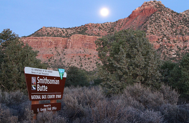
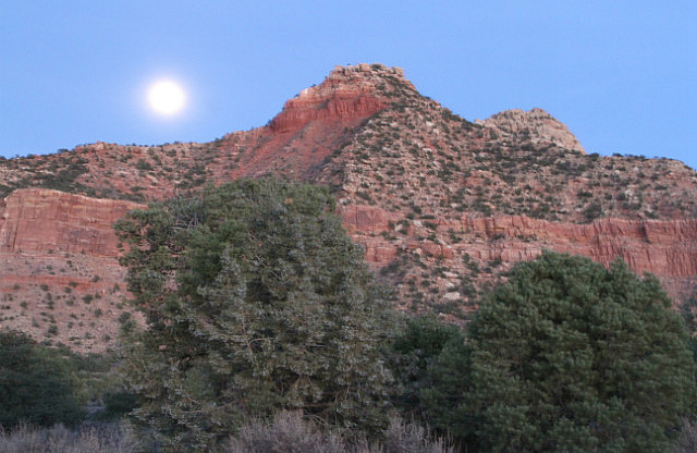
Moon Over Smithsonian Butte National Scenic Byway......
A Road Less Traveled, Or How We Often Make Travel Plans On Impulse
After Bobbi and Sky left, we finished getting ourselves packed and ready to leave
. As we drove out of the Lone Rock campground to the highway, we found ourselves with a dilemma -- which way do we turn? Left, go back to Wahweap and enjoy more of Lake Powell, maybe even go to Lee's Ferry for more paddling --or atke right and head to Heaven -- Zion National Park.
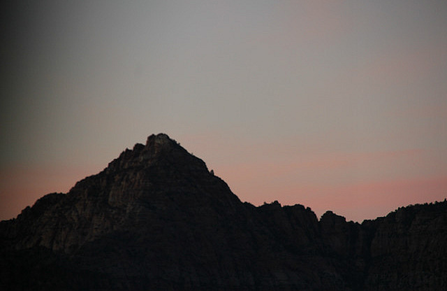
What the heck, its only 2 or 3 hours more, so we headed to the right and to one of the most beautiful areas of the world -- Zion National Park.
From Lone Rock we drove through the colorfull Pariah red rock country to Kanab, Utah, where we had to make a choice of which route to take to Zion.
One route, to the right, the shortest and most direct, requires Park Service approval in order to drive your vehicle through the tunnels. We were concerned that the ranger checkpoint might be closed, and this was confirmed by the clerk where we got diesel in Kanab.
The other route, to the left is much further, via Hurricane, Utah
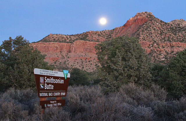
. One way to shorten that route is to take a chance and take the .Smithsonian Butte National Backcountry Byway. backway, which lops off some miles. Assuming no mishaps, you can have an adventure and get there quicker. Theoretically. Robert said. :)
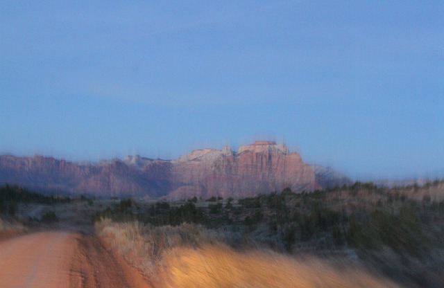
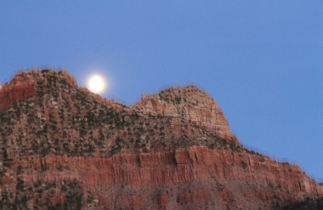
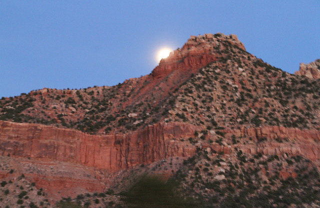
.Smithsonian Butte National Backcountry Byway. a dirt, sand, rock and gravel road through some amazing scenery.... much of which we wouldn't be ogling this time because by the time we got there the sun was setting and the full moon was rising.
We stopped for a quick few pics of the amazing sight of the moon over the red rocks.
.
Check out a map at the following link ....Smithsonian Butte National Backcountry Byway.
Smithsonian Butte National Back Country Byway cuts across from Highway 9 and drops you into Rockville which is a short distance to Springdale, UT and the west entrance to Zion National Park
.
This backway should only be tried in passenger car if it has not rained because there are some places you could really get in trouble! In bad weather 4x4 is advised.
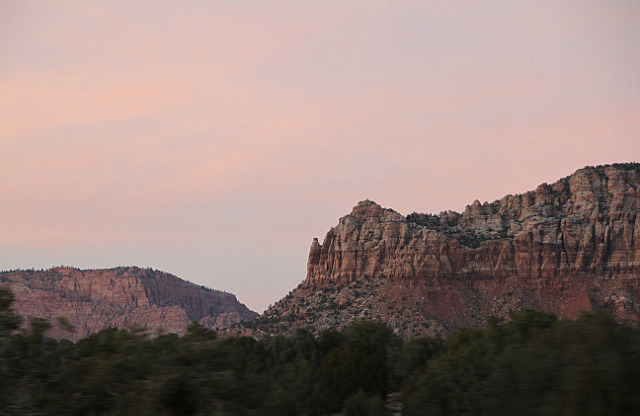
The views are nice, colors constantly changing and except for the last about 2 miles is quite easy to negotiate. It is those last two miles where you really have to go very slow to keep from bumping everything all other the place. Of course those last two miles are the most interesting views. You are up above the park and so you have these magnificent vistas to view.
If you were to come from Springdale to find this road, there is a one lane wooden bridge you cross as you begin this journey. By the time we crossed the bridge it was dark so we decided to look for a private campground to stay for the night.
The Quality Inn in Springdale has a very nice RV park attached to it with very nice showers
. We both took showers, and then walked into town and had dinner at one of the few places that looked open during this off season, Wildcat Wille's Saloon,. Eyes bigger than stomach because we had some to take back with us for future meals.
The woman who waited on us told of all the deer that come down into the town at night. She also said she had seen a mountain lion in her headlights in town one night. This last bit weighed heavy on our minds as we tiredly trudged back to our camper lol.
Moon Over Smithsonian Butte Nat Back Country Byway
Tuesday, November 26, 2013
 Big Plain Junction, Utah, United States
Other Entries
-
Nov 26365 days prior Page, United States
 -
Nov 251 day prior
Page, United States -
Nov 26
Big Plain Junction, United States -
Nov 271 day later
Springdale, United States -
Nov 282 days later
Zion National Park, United States -
Nov 293 days later
Zion National Park, United States -
Nov 304 days later
East Zion National Park, United States

2025-05-22