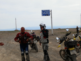
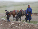
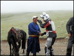
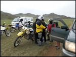
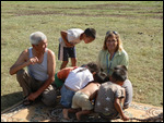
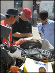
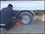
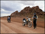
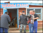
After leaving Ulgii on our way back to UB, we rode east, following the Hovd River, before riding over some very dusty, dry, and rocky hills to descend to Achit Lake, where we had lunch while the crew fixed Chip's flat tire. Shortly after heading north from Achit, it began to rain. The itinerary gave our destination as a local tourist ger "camp next to Uureg Lake." As we ascended the range of hills surrounding Uureg Lake, the mountain fog closed in and we had no idea which of several tracks to follow. Mike tried with little success to get information from a local herder (see photo).
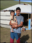
The herder pictured with Mike is wearing a traditional Mongol robe, called a deel
. Read more about the deel here: https://en.wikipedia.org/wiki/Deel_(clothing).
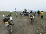
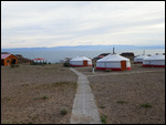
Our route-finding was exacerbated by the departure of Chinzo, who had to return to UB for business reasons. He and Bazo were the only ones who knew the route, and Bazo was driving the Bongo well behind the riders. Consequently, we often waited at forks or crossroads for Bazo to catch up. On this day, we all rode off toward the lake in the rain until we came to a fork in the track. When Bazo arrived to tell us that we had ridden in the wrong direction, we reversed direction and followed the Bongo (still in the rain) along the Lake, vainly searching for the illusive camp. Finally, Bazo borrowed Andy's bike and rode off by himself to find the camp.
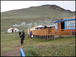
After Bazo left, the Toyota arrived to tell us they had found the camp. Off we rode again to this camp on the lake, which turned out to be the wrong camp. The camp residents gave directions to the right camp and we rode off again
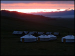
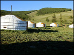
. (This raises a question: How do you give directions when there are no road signs and the tracks run in every direction all over the hills?) Finally, Bazo returned with the news that he had found the camp, which was in the distant hills, not on the lake. The result was another long, tiring day. Fortunately, the dinner was terrific and the bar had plenty of beer for attitude adjustment.
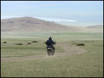
The next morning, we rode east to Ulaan Davaa (davaa = pass) through the grassy steppe populated by thousands of herd animals (goats, sheep, cattle, yaks, horses, and camels). The goats are kept for their coats, which are made into the country's famous cashmere. Sheep provide both meat and wool. Cattle provide meat; yak provide milk and hair for blankets or clothing; camels are pack animals and raised to sell. Horses, of course, are the signature animal of the Mongols--ridden by herders, for transportation and for sport. Animal products are an important part of Mongolia's economy, https://en
.wikipedia.org/wiki/Economy_of_Mongolia.
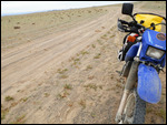
From Ulaan Davaa, we rode deteriorated pavement to Ulaangoom, the dusty capital of Uvs Aimag with a population of about 25,000. After stopping outside of the town for lunch, we continued on pavement to the turnoff to a ger camp on Hyargas Lake, the 10 km to the camp was through deep sand, which gave half the riders great difficulty. After Tom fell twice, injuring his back, Chip, Mike, and Tom elected to ride the Toyota to the camp. Others rode those abandoned bikes to the camp.
After a late start the following morning (July 9), Bazo, Muugi, and Uchka rode bikes for Tom, Chip, and Mike through the sand back to the main road (A18), while they rode in the chase vehicles, thankful they were not struggling in the sand. Our destination this day was Sogino, on highway A18. The pavement had ended at Hyargas Lake, but we managed to utilize some improved sections of the highway under construction
. Upon arrival in Sogino, we met again with Alex and a new-found friend, Sergei from Vladivostok. Our temporary camp was in the nearby hills a few kilometers out of Sogino.
Google Maps link to Uureg Lake camp:
http://maps.google.com/maps?f=q&hl=en&geocode=&q=49.94456,91.27431&ll=49.944
Google Maps link to Hyargas Lake camp:
http://maps.google.com/maps?f=q&hl=en&geocode=&q=49.03299,93.47929&ll=49.032
Ulgii to Sogino, July 7-9
Thursday, July 07, 2016
 Sogino, Dzabkhan, Mongolia
Other Entries
-
1Introduction
Jun 307 days prior Portland, United Statesphoto_camera4videocam 0comment 0
 -
2First Days in western Mongolia
Jul 025 days prior Olgii, Mongoliaphoto_camera24videocam 0comment 0
 -
3Two days in Atai Tavan Bogd National Park
Jul 043 days prior Darihan Nuur, Chinaphoto_camera36videocam 0comment 0
 -
4Yurt or Ger? What's the difference?
Jul 052 days prior Chihertei Lake, Chinaphoto_camera7videocam 0comment 0
 -
5Ulgii to Sogino, July 7-9
Jul 07 Sogino, Mongoliaphoto_camera35videocam 0comment 0
 -
6Sogino to Murun (Moron), July 10-11
Jul 103 days later Murun, Mongoliaphoto_camera11videocam 0comment 0
 -
7Murun to Lake Hovsgol & Return, July 12-14
Jul 125 days later Lake Hovsgol, Mongoliaphoto_camera14videocam 0comment 0
 -
8Murun-Erdenet-UB, July 15-16
Jul 158 days later Erdenet, Mongoliaphoto_camera6videocam 0comment 0
 -
9Ulaanbaatar Scenes
Jul 1710 days later Ulaanbaatar, Mongoliaphoto_camera15videocam 0comment 0

 Sogino, Dzabkhan, Mongolia


2025-05-22