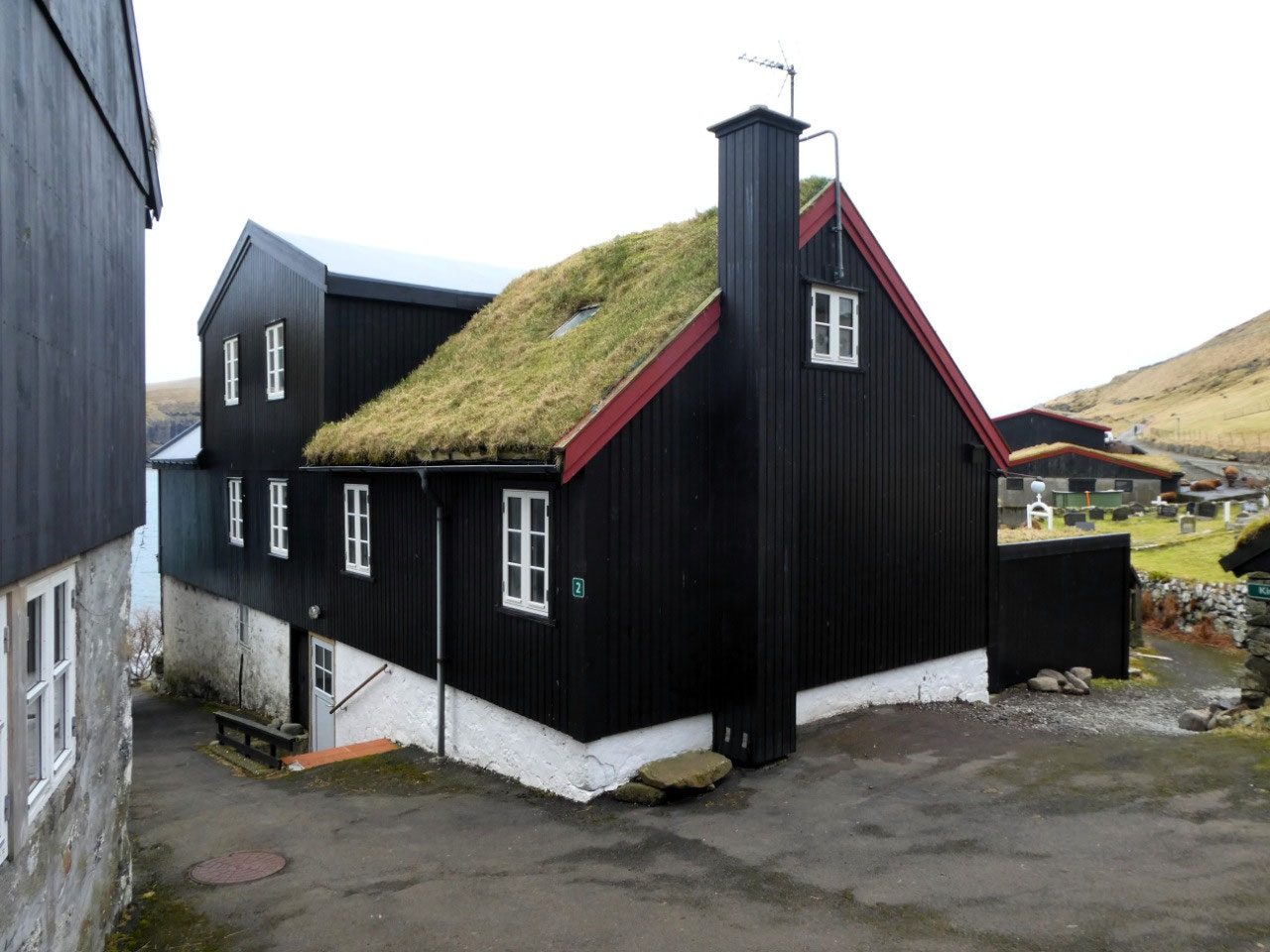
 Tórshavn, Streymoy, Faroe Islands
DAY 2 OR WAS IT DAY 3? VÁGAR ISLAND
About Our Day Tour to Vágar
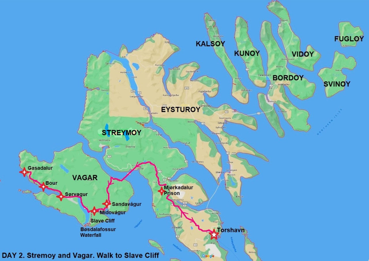
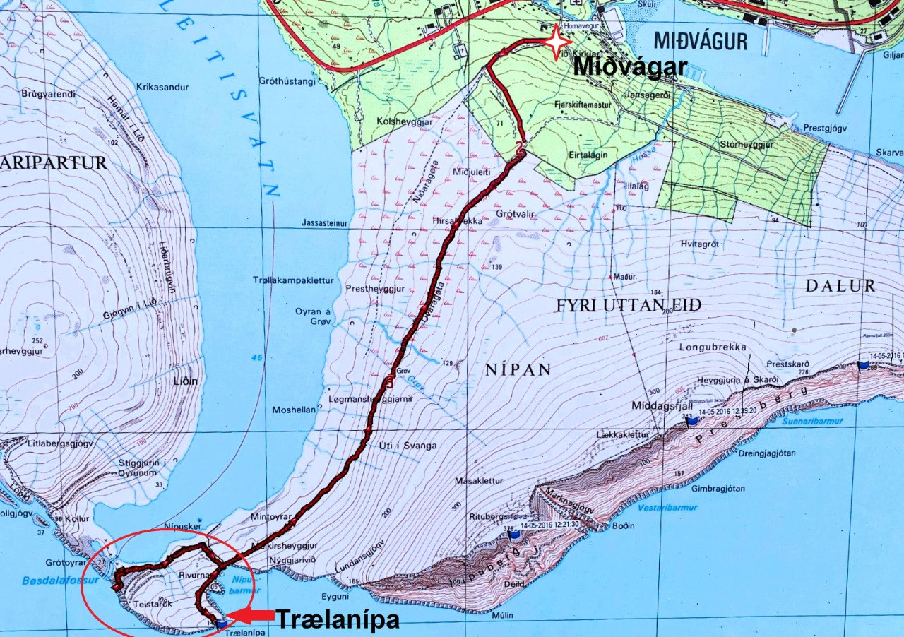
Our schedule for the day was a six-hour car journey to the neighbouring island of Vágar, the most westerly of the larger Faroes Islands. Our tour would involve travelling via a sub-marine tunnel from Stremoy Island to the village of Sandavágur on Vágar, followed by a ten km hike from the neighbouring village of Miðvágur alongside Lake Leitisvatn (also known as Lake Sørvágsvatn) to the formidable, vertical cliff face of Trælanípa and the much-famed Bøsdalafossur waterfall. From there we would head north to the villages of Bøur and Gásadalur.
I was a bit worried about our hike. We were still both quite sick, especially Alan who had not eaten any more than a few spoonsful of food for the last five days. But he was insistent that we kept to schedule. After all, he had missed out on our last day in Svalbard due to his fall on an icy road, and because of a violent gastric attack, had seen nothing of the city of Tromsø, Norway except the four walls of our hotel room. And as he said, at least the weather was fine. Unusually fine, from what we were told, if quite cold. Furthermore, the hike was designated as "easy".
A Note About the Brandan Hotel
And talking of food.... At this stage perhaps it is timely to comment further on our Brandan Hotel. As mentioned, it was a pleasant enough premises, if rather bland.
And although we were very disappointed with our first room, we must say that the staff was very friendly and obliging and as promised, we were upgraded the following night to much better accommodation. But it came at quite a cost with the hotel charging us around USD350 per night.
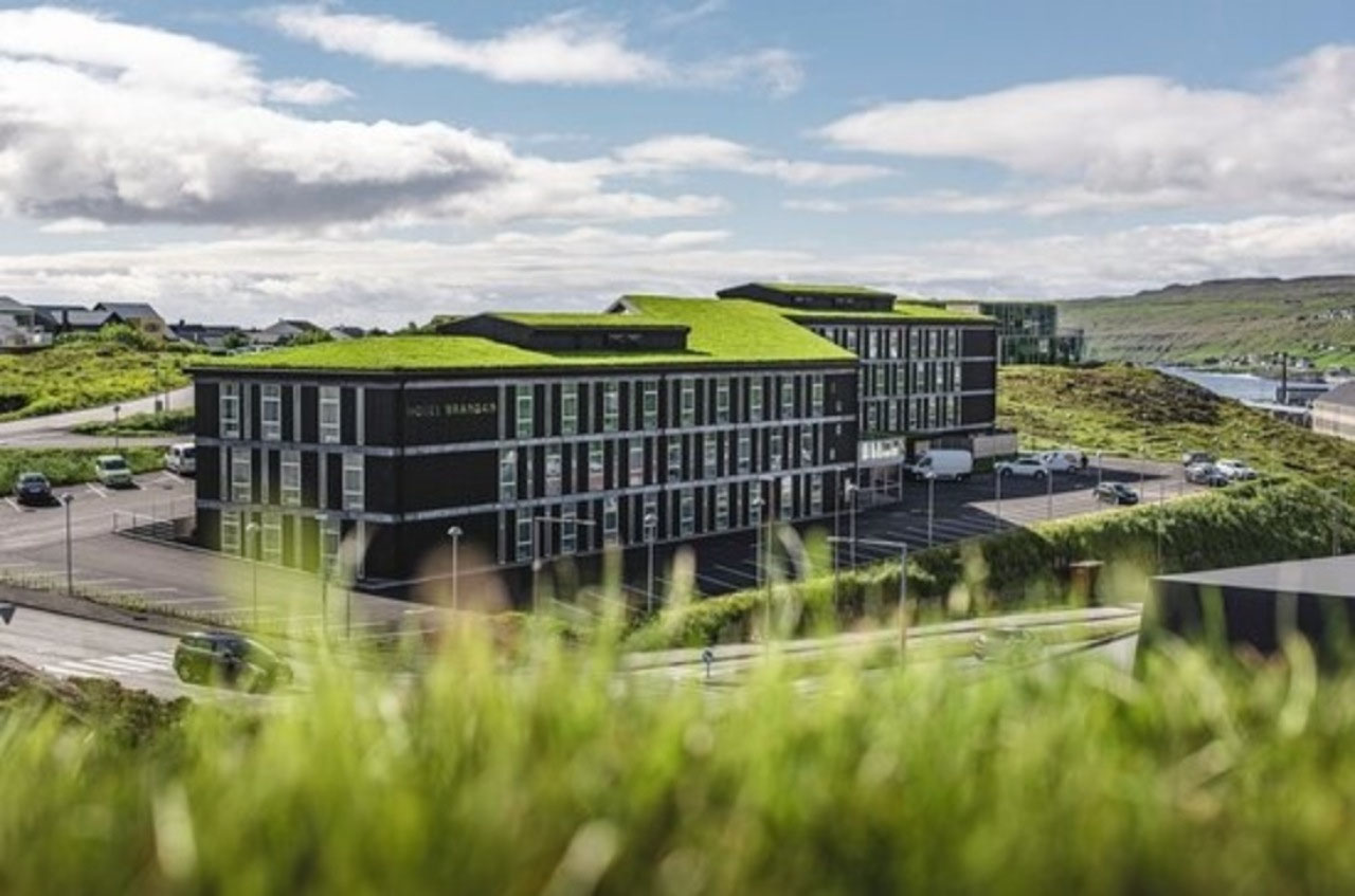
The Brandan Hotel was well away from the main activities of Tórshavn and the harbour; about a twenty-minute walk from the main centre. There was a shopping complex within walking distance and a bus service nearby, but it was certainly not an appealing location nor the most convenient place to stay. And the outlook from the rooms was very ordinary.
And in hindsight, it was just as well we did not need too much food. There were two places to dine at the hotel: the upmarket Husagarður Restaurant or the Bar & Cafe. The latter hardly earned the name of "cafe". It was more of a snack bar with a very limited menu including basics such as tomato soup, toasted sandwiches and cheese platters; the cost averaging around USD30 per meal. Drinks were on the expensive side too, although a welcome Happy Hour at the bar provided guests with a free glass of wine each evening.
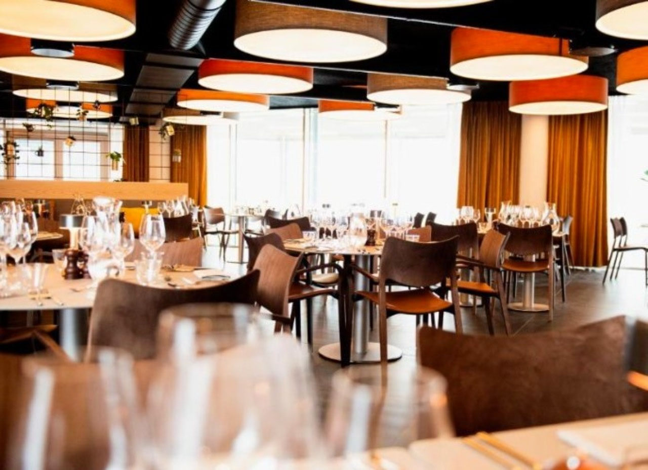
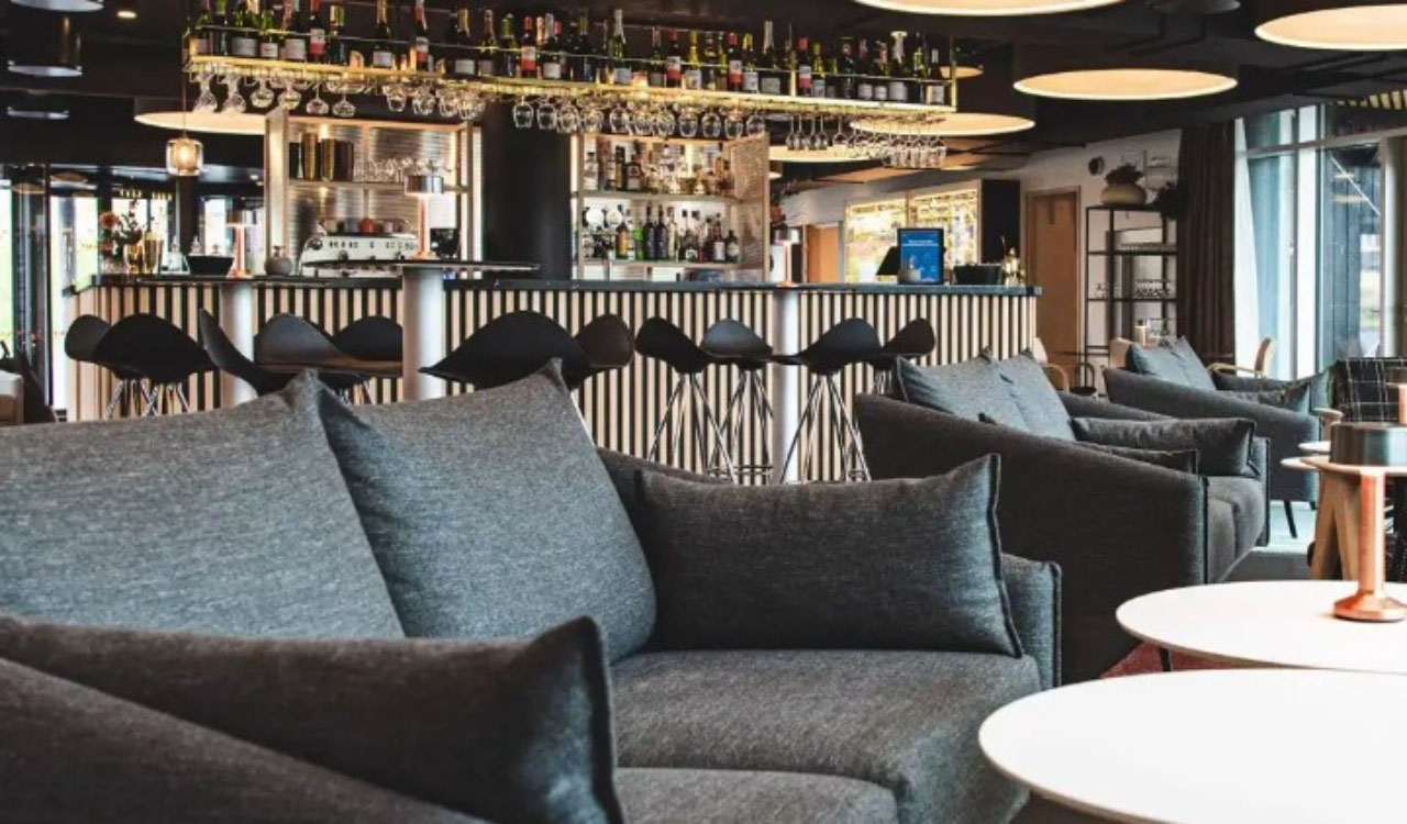
Conversely, the Husagarður Restaurant was at the opposite end of cuisine, with fine dining set course, as well as a la carte menus. Meal costs were in the vicinity of USD130 per head, including wine. Wine was around USD55 per bottle. Basically, if you ate in the hotel you either dined on soup or a toasted sandwich, or sat down to a grandiose and very expensive meal. Given the frenzied night club scene on our first night as well as the above limitations, we would suggest exploring other hotels in Tórshavn.
To Vágar Island - a Time to Absorb the Local Way of Life
For our day tour, we were the sole passengers, having the luxury of our guide Simon and his vehicle totally to ourselves. It worked well. We had quickly established a rather lovely rapport with Simon who in turn, talked frankly about life in the Faroes. He was knowledgeable, relaxed and good fun. And he went "the extra mile" to make our trip as interesting and comfortable as possible.
We were aware from our pre-reading material that the cost of living in the Faroe Islands was high. It was not surprising as after all, most goods and services have to be imported. As a result, transportation, food and accommodation were very expensive. But even from our limited observations, the standard of living looked to be very high as well. Data indicate that the Faroese economy ranks relatively highly amongst world economies, with gross domestic product increasing from DKK8 billion (~USD 1.2 billion) in 1999 to 21 billion (~USD 3 billion) in 2019.
We were particularly interested in the scope, logistics and costs of engineering the very sophisticated sub-marine tunnels that link many of the islands by road. Yes, Simon confirmed, all necessary tunneling equipment had to be shipped over from Europe - presumably from Denmark - and the cost was extraordinarily high. But he was remarkably upbeat about the resulting generation of sustainable tourism, and of the future of the Faroe Islands.
He was also surprisingly realistic about the imperative for high taxation rates - around 42% of income earned, with no deductions. Furthermore, even pensions in the Faroes are liable to taxation.
Simon was also very positive about what appeared to be a progressive Faroese government. He also commended the nation in accepting around 150 refugees resulting from the Ukraine war, and others fleeing from Russia-Ukrainian border areas. Simon, as mentioned, spoke fluent Faroese and taught English and Faroese one night per week; some of his students being refugees.
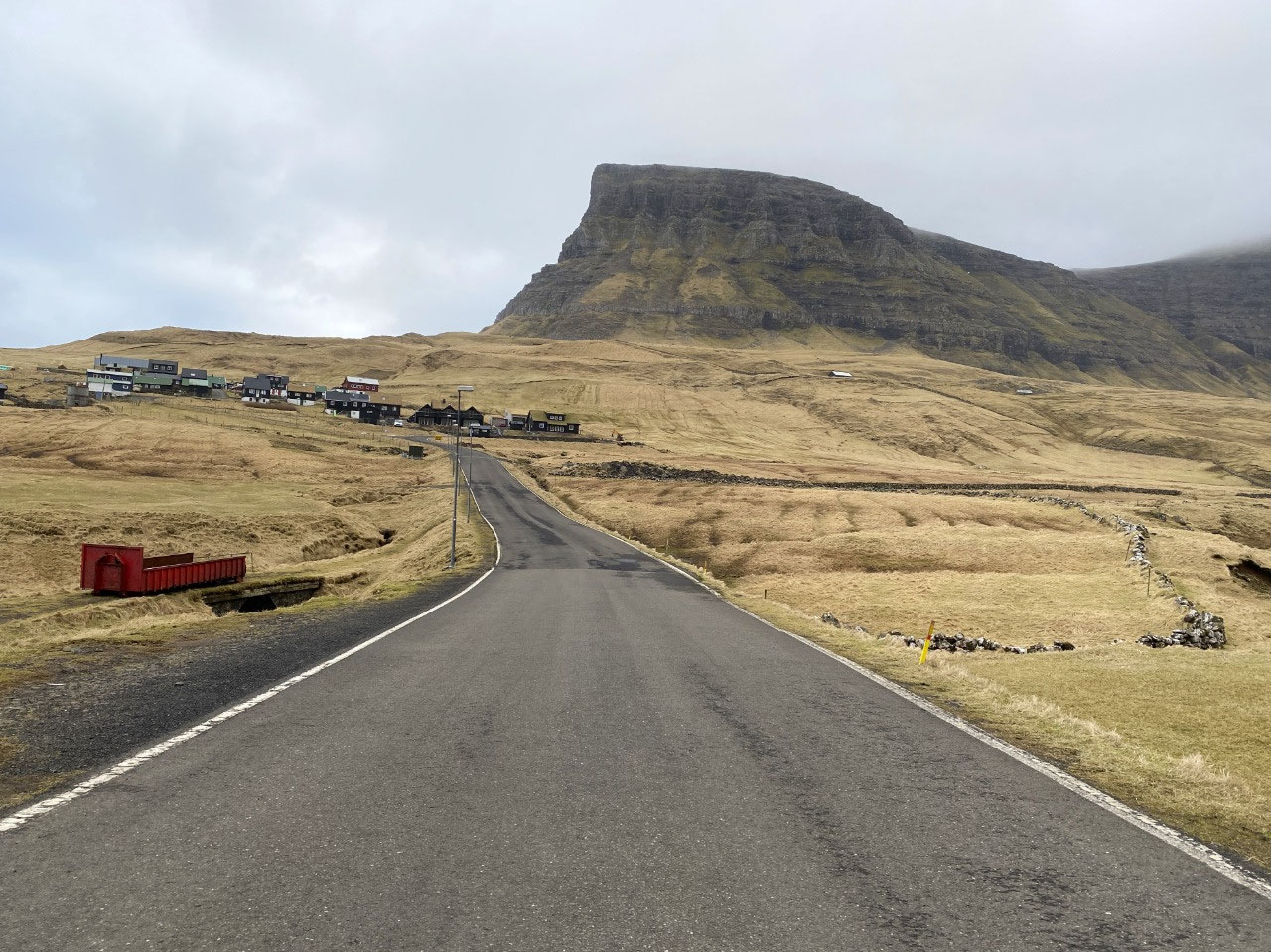
Toward Sandávegur Village, Vágar
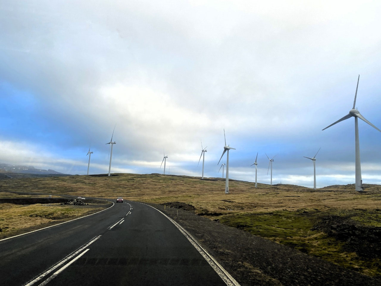
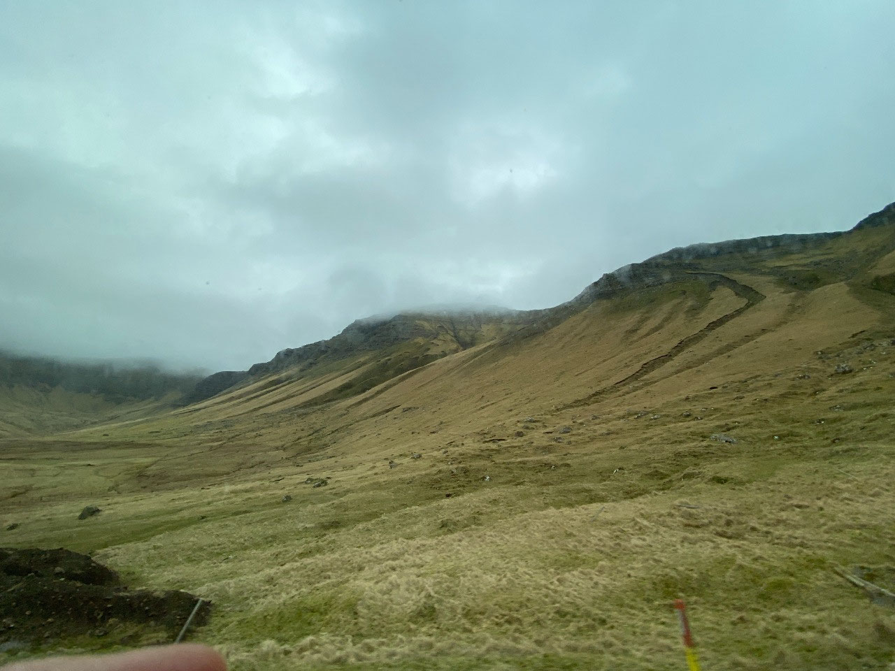
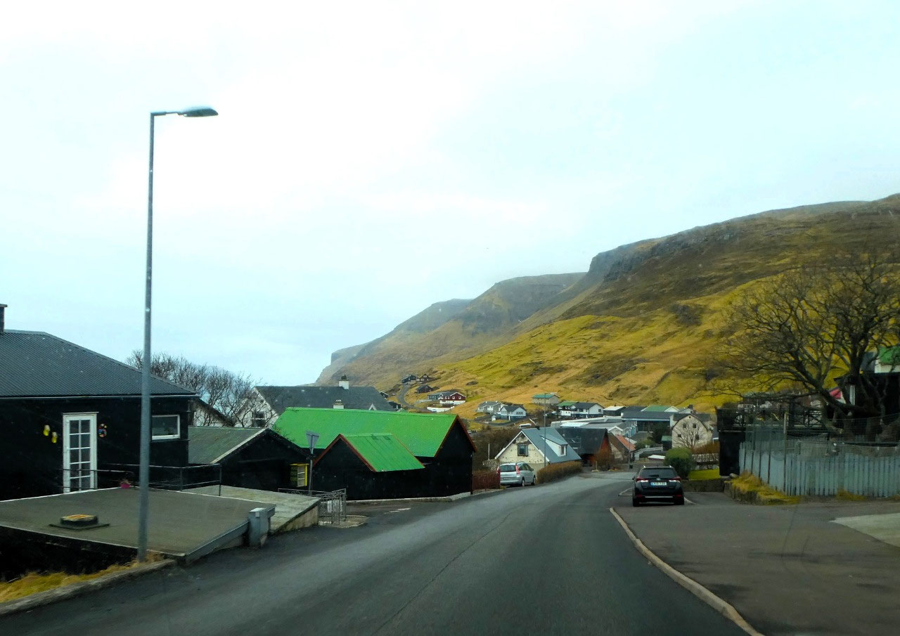
On an overcast, cold and windy day, our journey took us north from Tórshavn, re-tracking some ground we had made the day before on our journey to the five north-eastern islands. Rolling bare hills lined with wildly spiraling wind towers greeted us as we drove toward the Streymoy to Vágar sub-marine tunnel or Vágartunnilin.
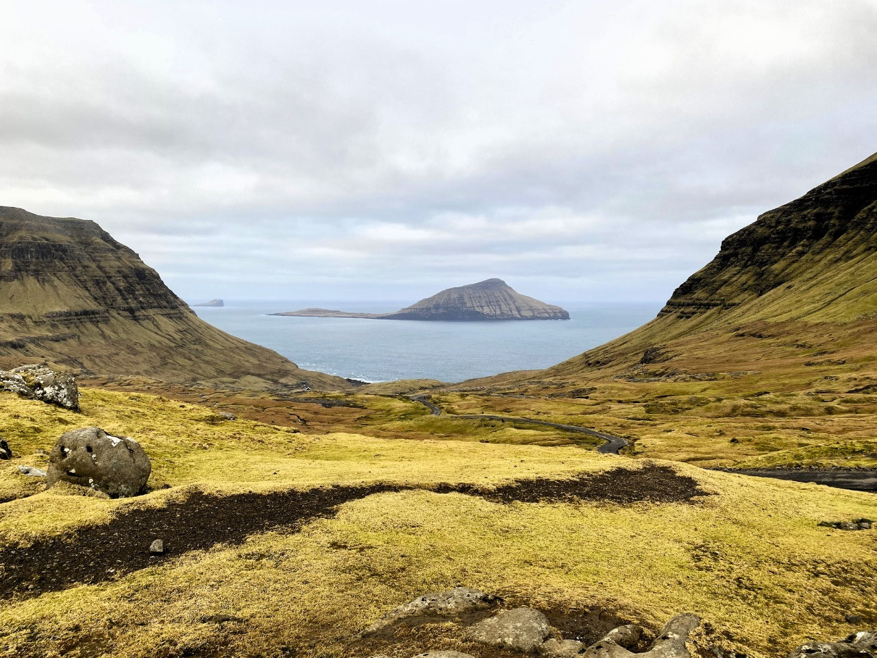
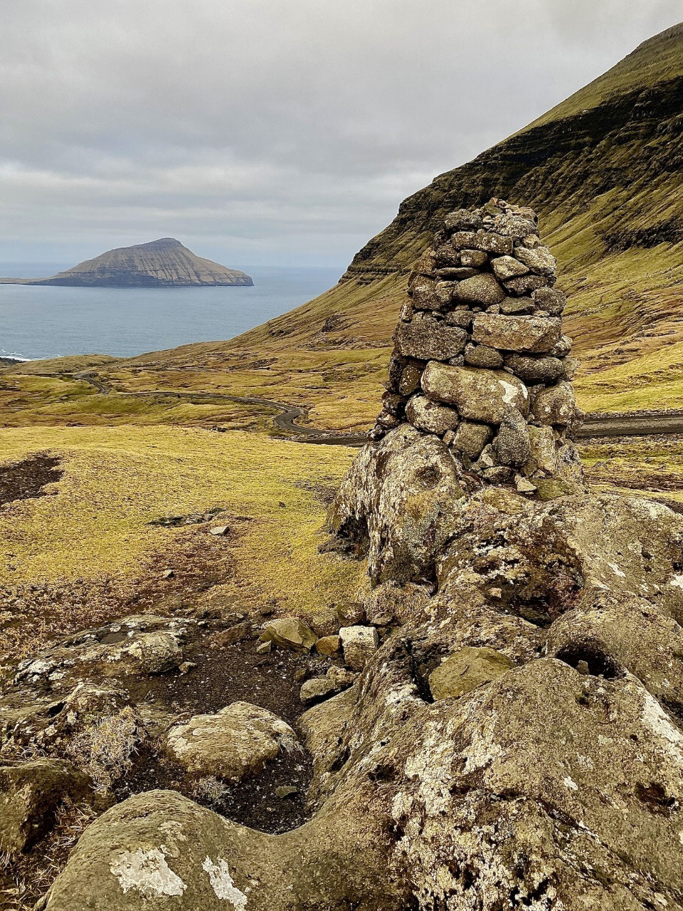
Our first stop was at a lookout with stunning ocean views westward toward the tiny island of Koltur. An uninhabited island meaning "colt", it is the second smallest island in the Faroes. It lies just north of the slightly larger island of Hestur - literal meaning "horse island". The island once had just one settlement, also known as Koltur. It was abandoned in the 1980s by the few sheep-farmers whose sheep flocks grazed on the southern part of the island.
Interesting stone man-made pillars framed our view. At first, we thought they may have had a religious significance like the "ovoos" we had seen in Mongolia. But these ancient structures known as "cairns" were designed with the purpose of guiding travellers who once had no option other than to walk or ride from village to village, over the mountainous islands. In the high rainfall, windy conditions of the Faroes, the trails would often disappear and the sturdy wind resistant cairns or rock pyramids would help travellers find their way. For the safety of others, every traveller would replace any fallen rocks to ensure the cairns remained intact. Even today, they are used by guides and hikers to find their way in often inclement or foggy conditions.
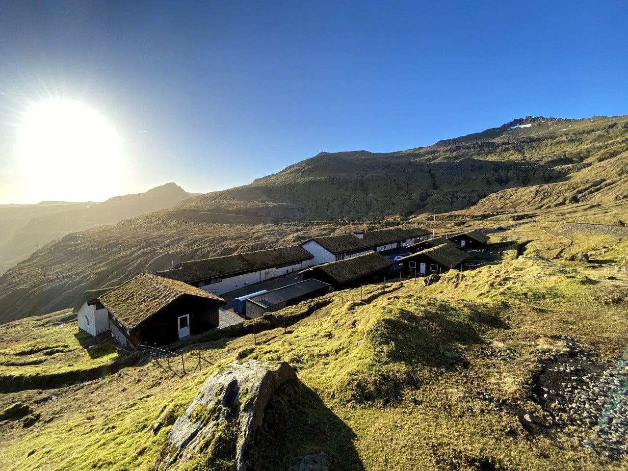
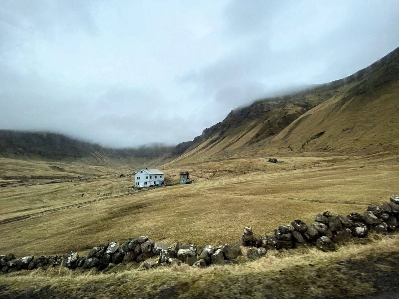
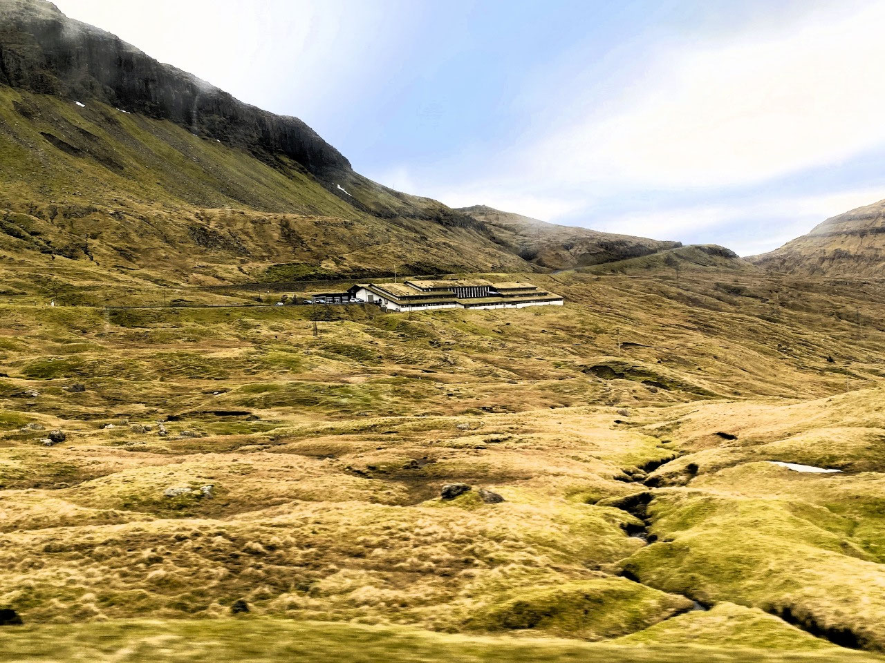
Not far north, we drove past the bizarre Majørkadalur Prison. Located in a most gloriously scenic spot on the fjord coast of Streymoy Island, the attractive turf-roofed, black and whitewashed buildings looked more like an up-market hotel rather than a jail. The prison, which has room for just twelve inmates, is in fact, more of a short-term detention centre and is used only for non-violent offenders serving brief sentences. Serious criminal offenders are shipped to Denmark for incarceration.
At another spot just north of the prison, we were treated to more splendid views east to the tiny village of Kollafjorður nestled on the Kollafjorður fjord.
VÁGAR ISLAND
Arriving in Vágar
Vágar Island is connected to Streymoy Island at Leynar by the Vágartunnilin, a 5 km sub-marine tunnel and the only vehicle connection to the island. The tunnel was the first sub-sea tunnel and was a priority for connecting the capital city of Tórshavn with Vágar Airport, the only airport in the Faroe Islands. Vágar also has a ferry connection to the nearby island of Mykines.
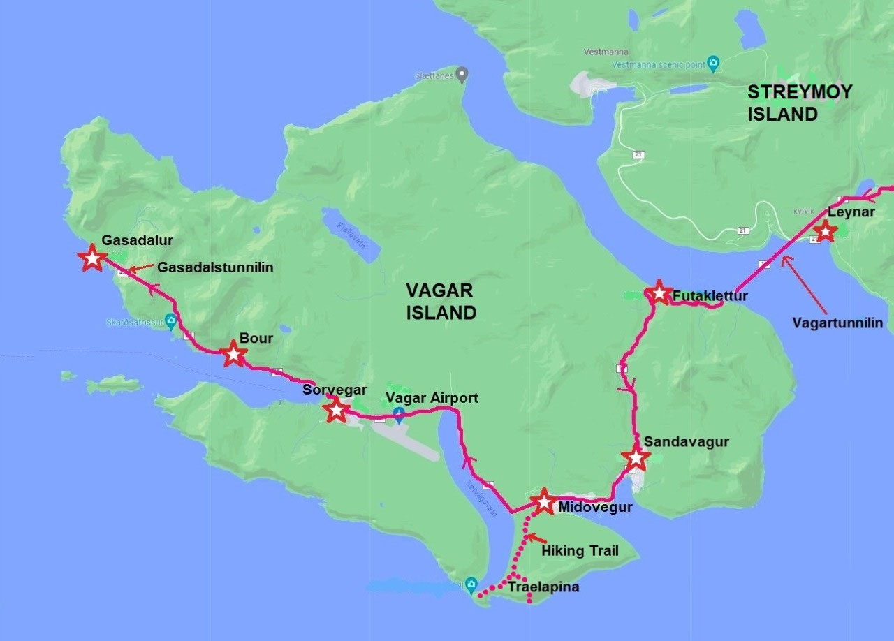
Vágar, which is 178 square km in size, is home to three large villages on the western coast of Miðvágur, Sandavágur and Sørvagur, and the three smaller villages of Bøur and Gásadalur and Vatnsoyrar. There is only one main road on the island which heads north, eventually to the tiny village of Gásadalur.
The eastern side of the island is uninhabited. The population of Vágar is about 3,000.

Simon kept us entertained as we drove toward Vágar. He explained that in Faroese language, Vágar is pronounced more like "Vou-war", the "g" in the word becoming silent if it is surrounded by two vowels. Oh, dear, this was sounding more like Russian language all the time....!
He also explained that contrary to our prior readings, driving in the Faroe Islands had not always been easy. Apparently, there had been a "disagreement" with Google Maps; the company refusing to recognise various landmarks in the Faroe Islands, as well as the local language. As a result, the satellite navigation systems didn't work in the Faroes, leaving drivers new to the islands in very difficult non-navigable situations. He told us of a disturbing story of an American woman who on picking up her hire car from Vágar Airport late in the evening, became hopelessly lost trying to find her way to Tórshavn; the satellite navigation system in her car being virtually useless. Remembering our trip from Vágar Airport along those lonely dark mountain roads, we were once again pleased with our decision to use a driver.
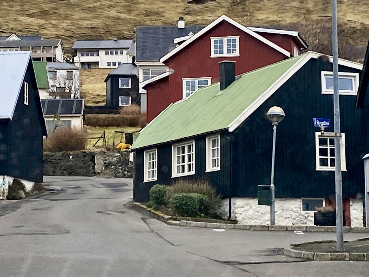
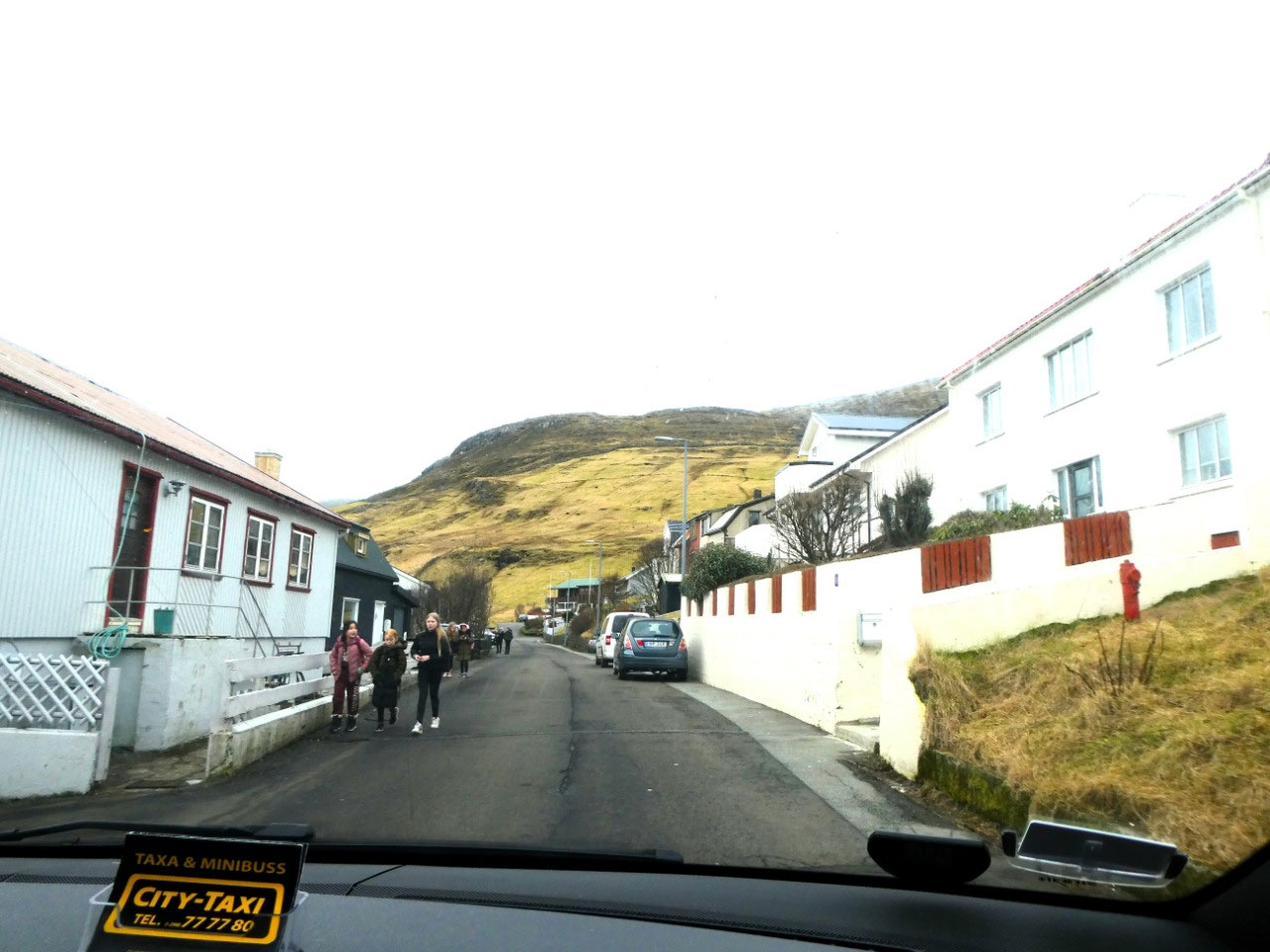
Sandavágur Village
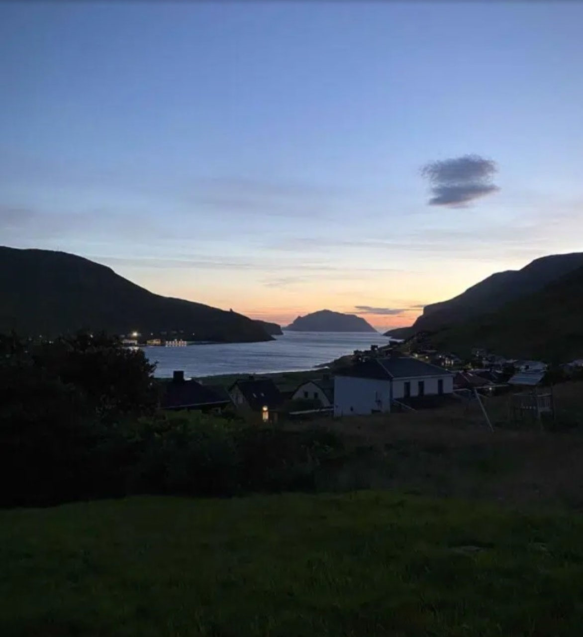
Our first stop on the island of Vágar was at the township of Sandavágur. The name translates to "Sandy Bay" which refers to the sandy strip outside the township which was once much larger than the one lining the shores today. Sandavágur more recently merged with the nearby town of Miðvágur to become the new Vágur Municipality. The town now boasts a population of just over 1,000 people.
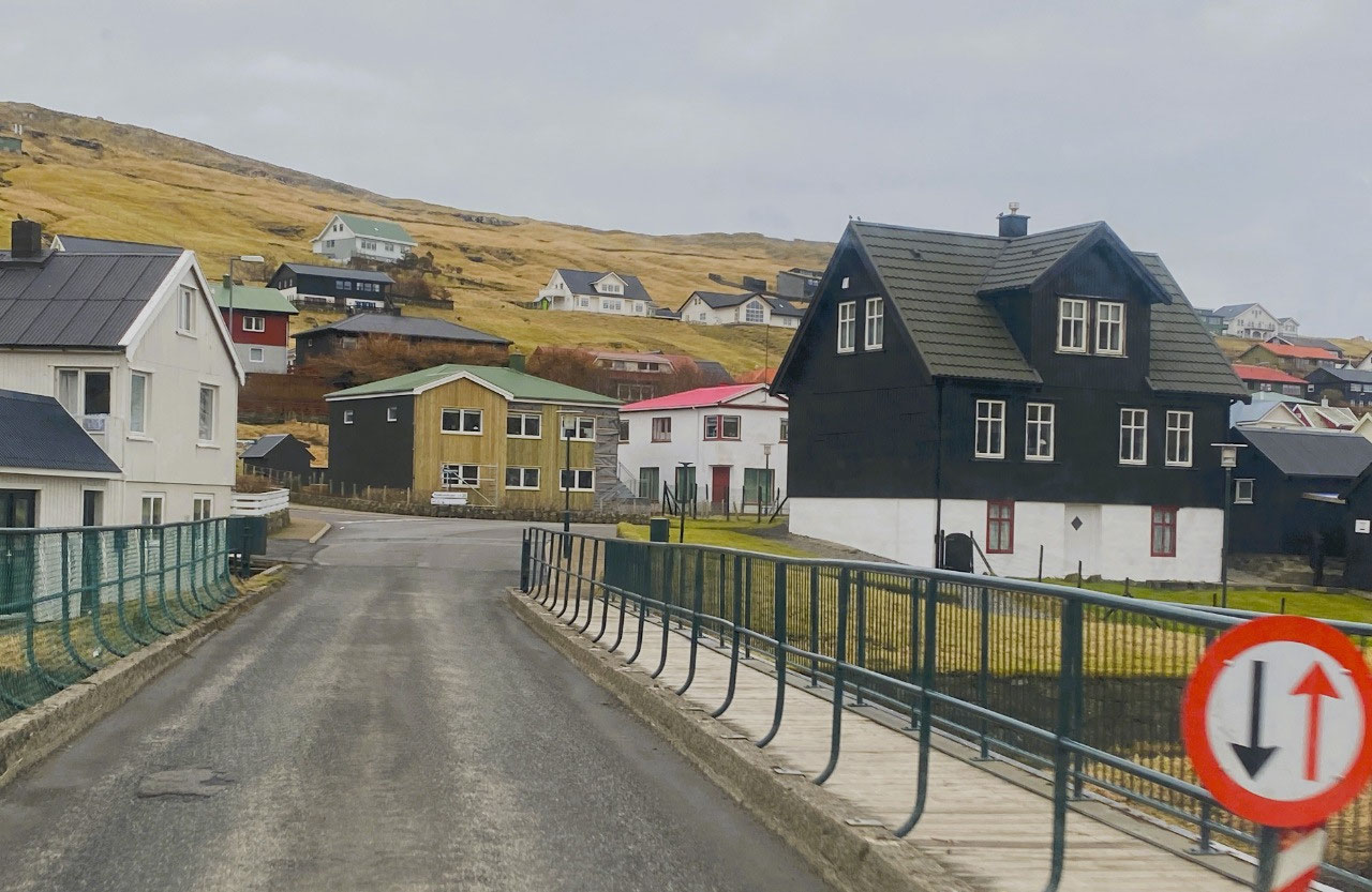
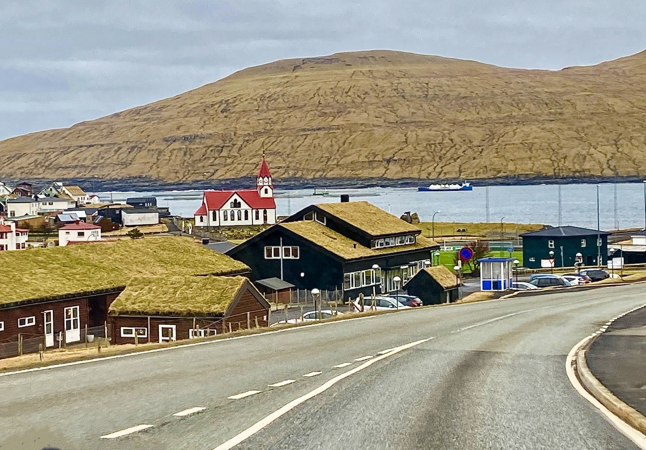
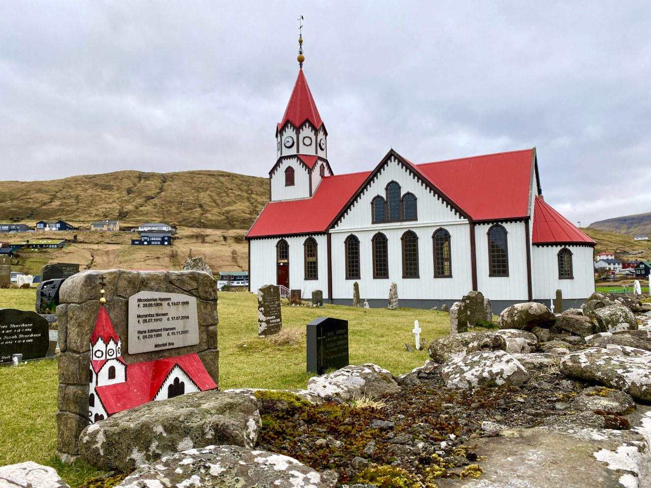
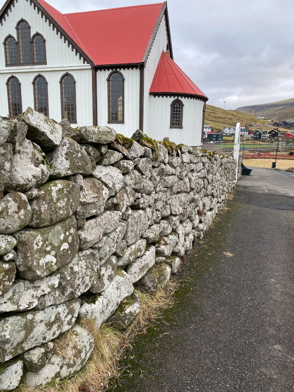
The township was very pretty, housing turf-roofed wooden cottages and the charming brilliant red-roofed Sandavágur Church, with its adjacent old cemetery. A memorial erected outside the church commemorates one of the many ships that were sunk off the Faroe Islands during World War II.
The township has an interesting ancient history. Although the present church is just 100 years old, a 13th century runestone discovered in 1917 bears an inscription stating that the Viking Torkil Onundarson from Rogaland in Norway was the first settler in the area. Apparently, a settlement has been here at least since 1200 AD.
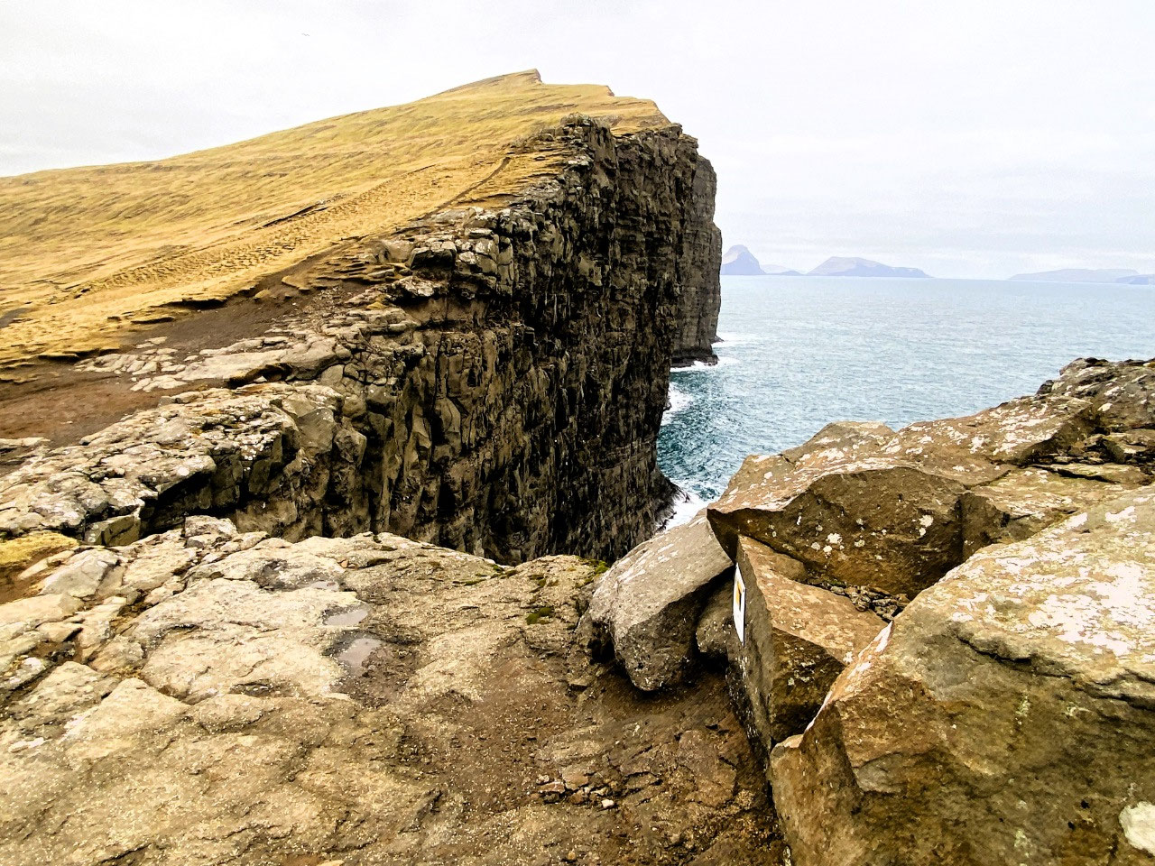
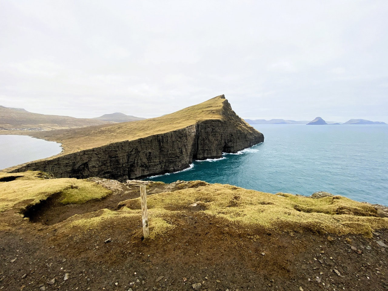
Hike to Trælanípa and the Bøsdalafossur Waterfall
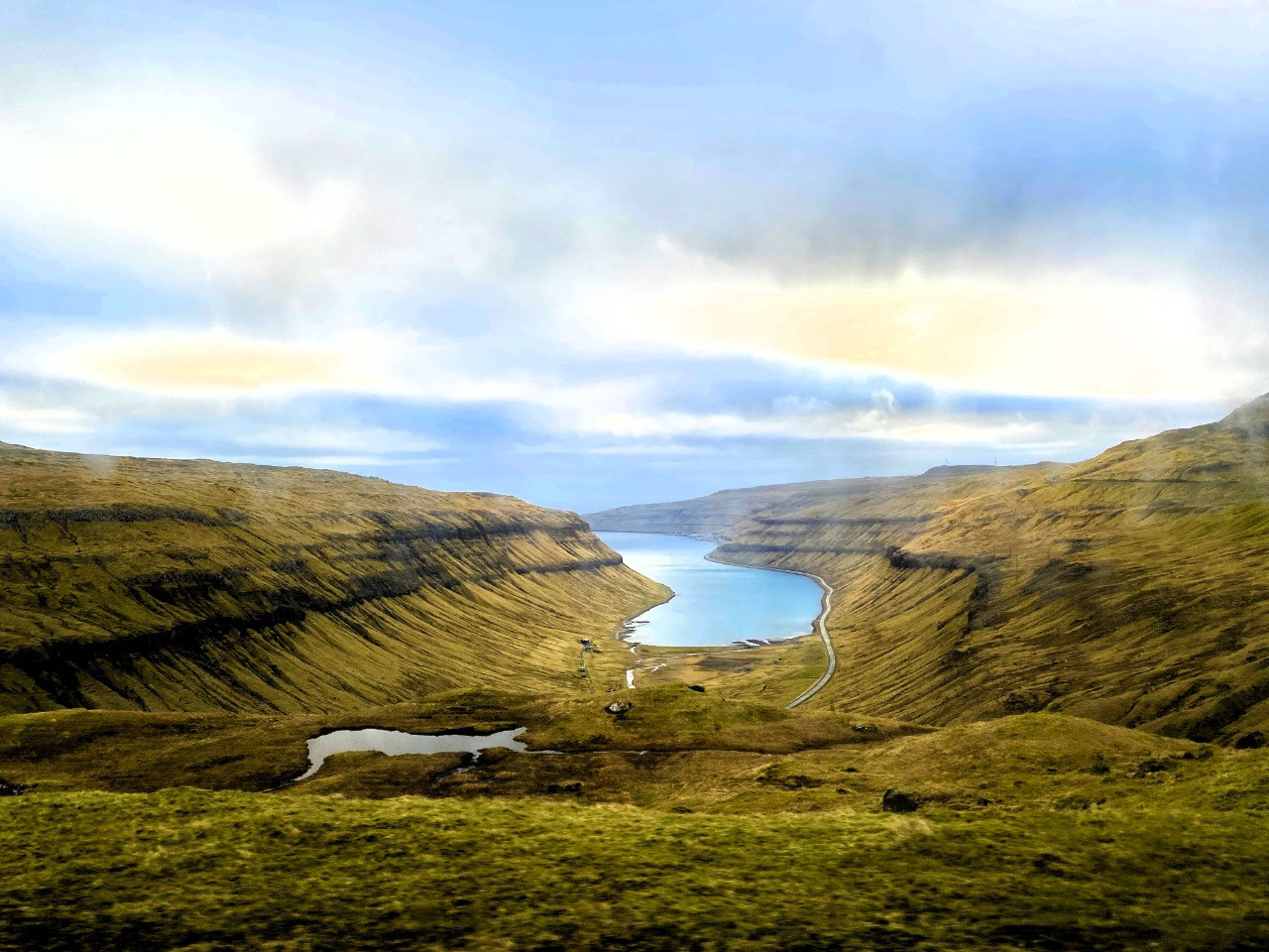
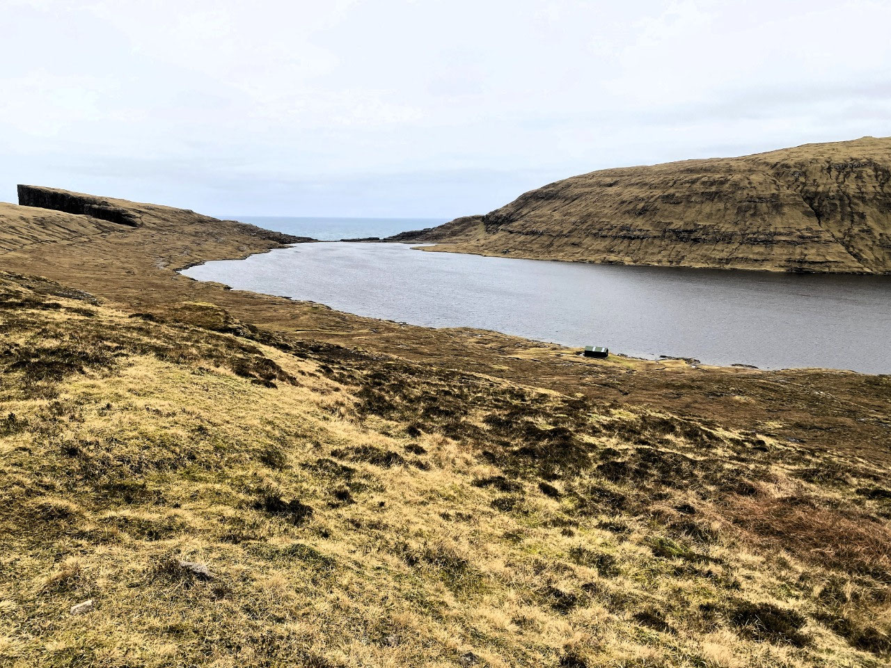
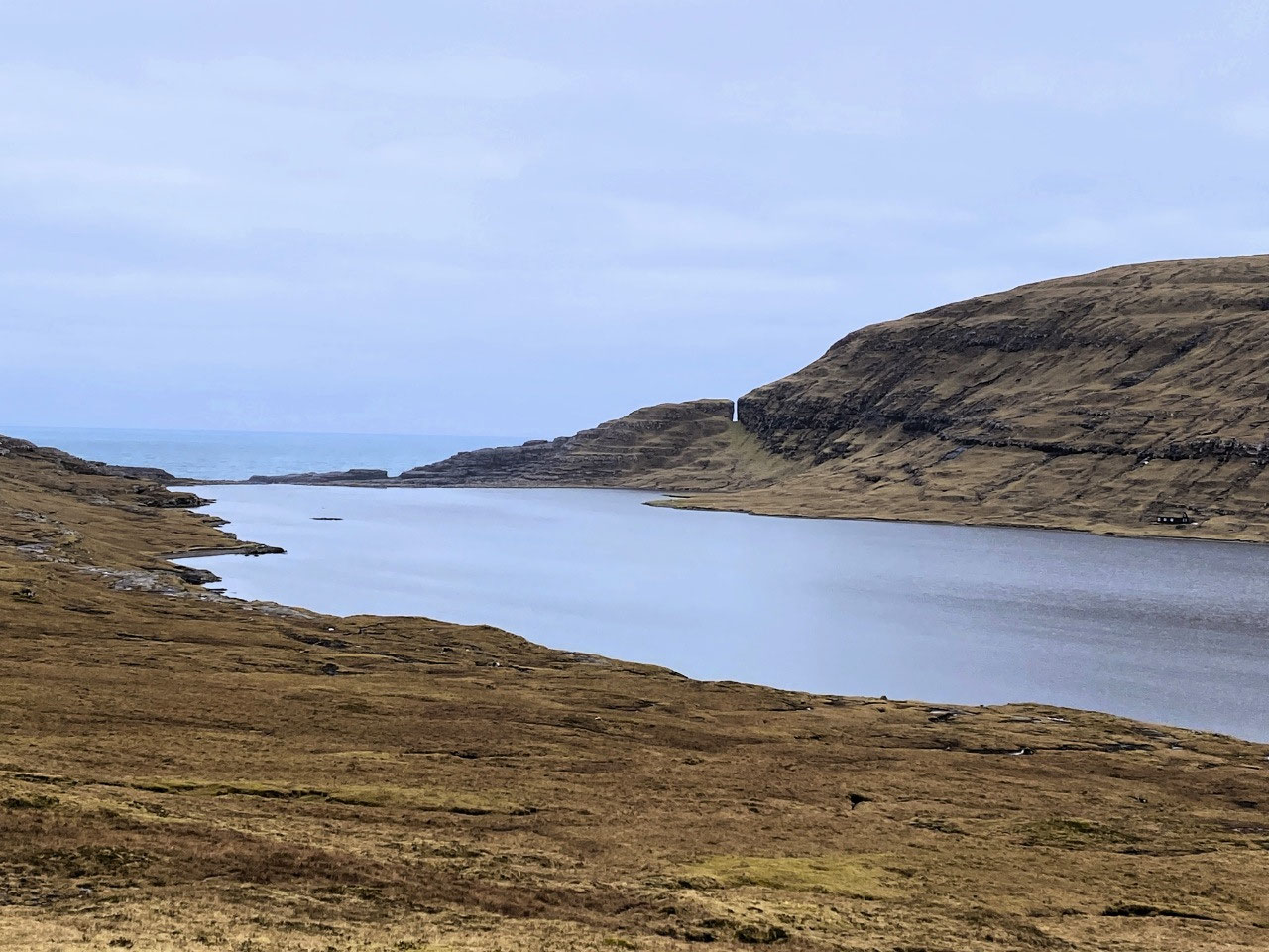
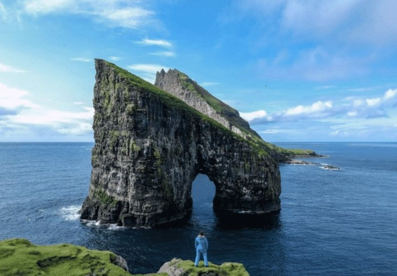
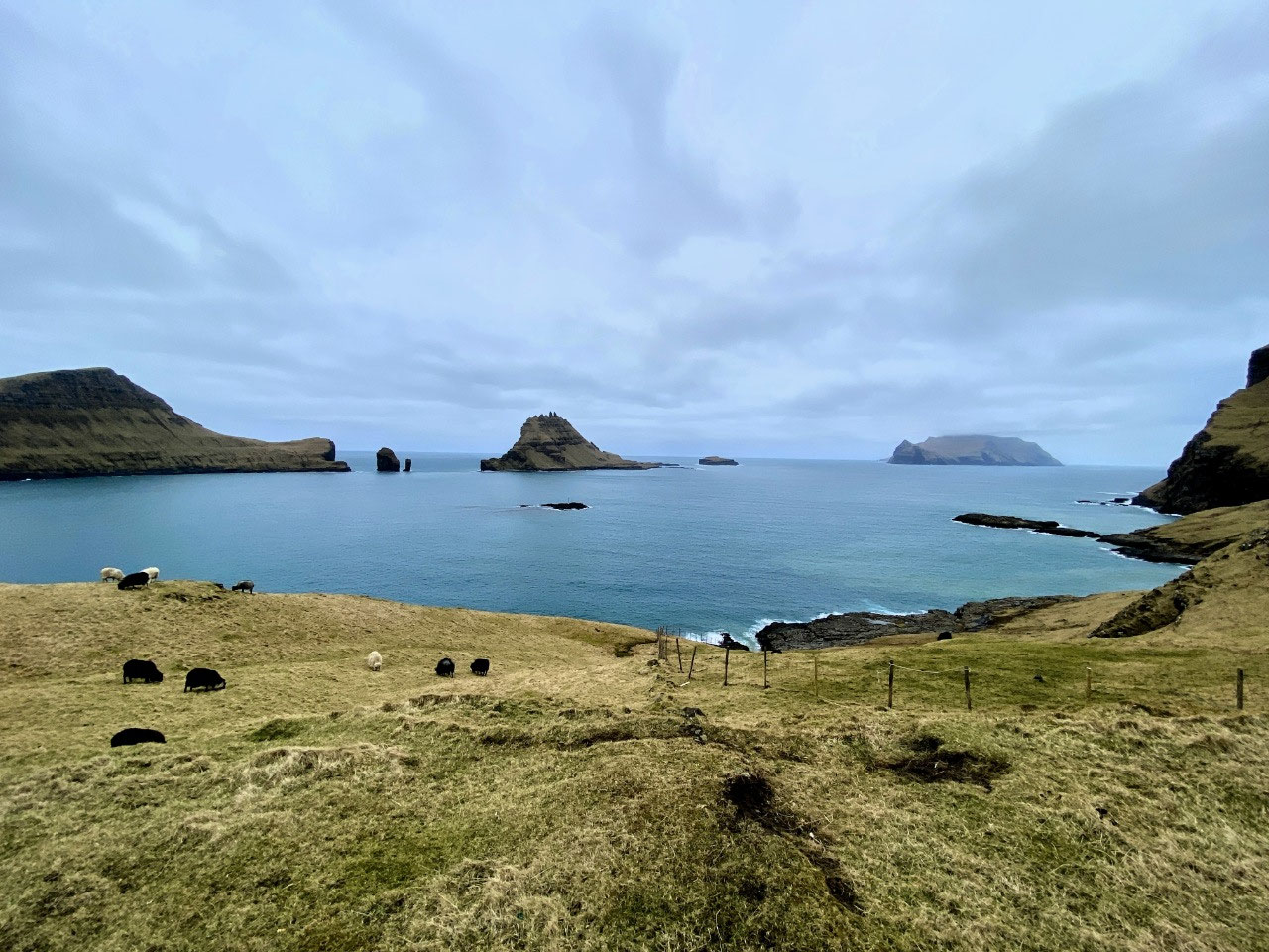
One of the most-photographed and most marketed land formations in the Faroe Islands must be the so-called "hanging lake" of Lake Leitisvatn with the much-famed Bøsdalafossur waterfall, and the sheer cliff face of Trælanípa (otherwise known as Slave Cliff*). Aerial photographs of the formidably steep, yet absolutely spectacular location are nothing short of breathtaking.
The lake above the waterfall which appears to be almost level with the ocean, is however somewhat of an optical illusion, looking much higher above the ocean than it really is. But nevertheless, it is sensational. And even more remarkably, all these attractions are found at virtually at the same location; a ten km or so hike from the village of Miðvágur.
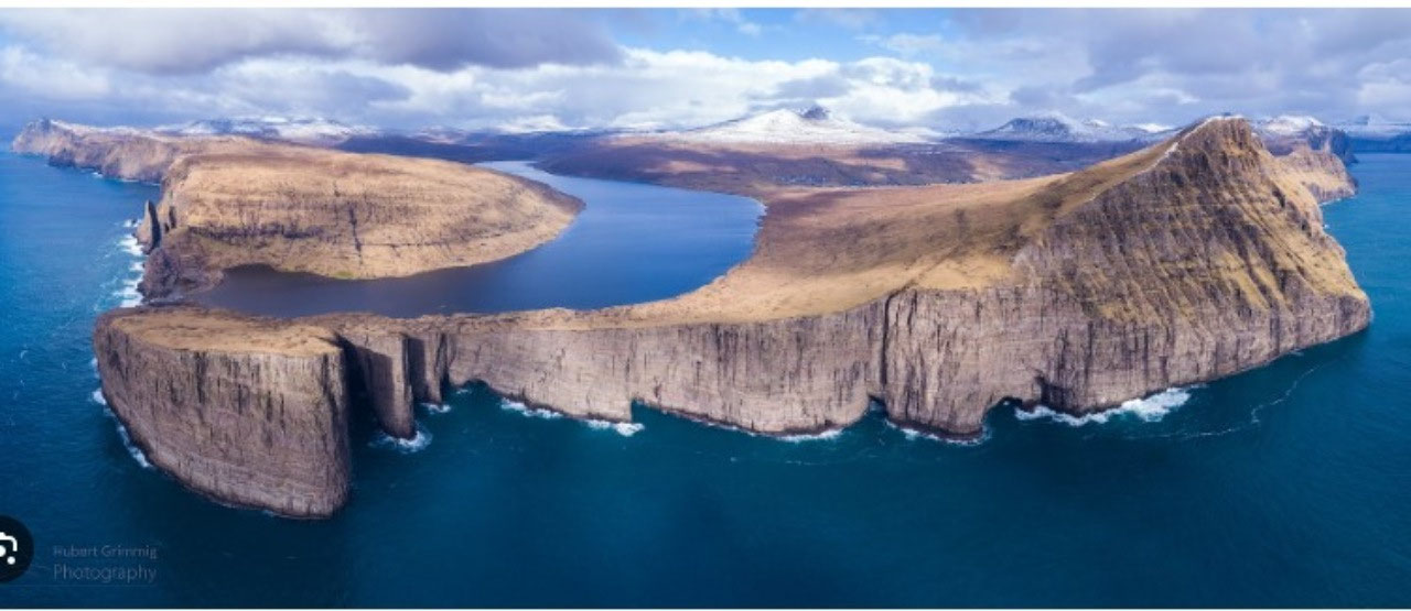
* The name Slave Cliff was thought to have originated from the Viking Age when supposedly old and sick slaves were thrown to their death.
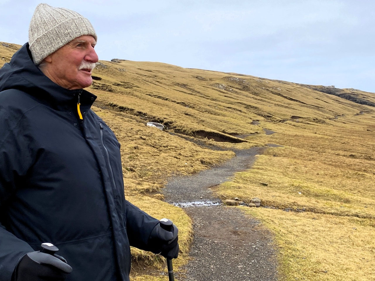
At the very last minute and just before we left home for our travels, we decided to buy some hiking sticks for Alan. It was, we have to admit, something we had never contemplated before. But of course as we age, falls can become a dangerous issue and although it had not really presented any real difficulties, Alan was beginning to notice some changes in his sense of balance. And I am just not comfortable at heights. Furthermore, we were booked on a glacier walk during our travels in Iceland which we imagined would test any of lack of sure-footedness - and where the hiking poles would most probably be really necessary. I decided not to buy poles but to use a monopole which doubled as a camera mount - hopefully for Northern Lights photography.
The poles were a nightmare to carry. Our camping store only had limited stock, so Alan had to make do with a pair which although telescopic, didn't really compress enough to fit into his backpack. So for the duration of our travels, he carried a backpack which resembled a set of bagpipes, the spikey ends of the poles posing formidable challenges for him and a nuisance for anyone nearby - aka "me"!
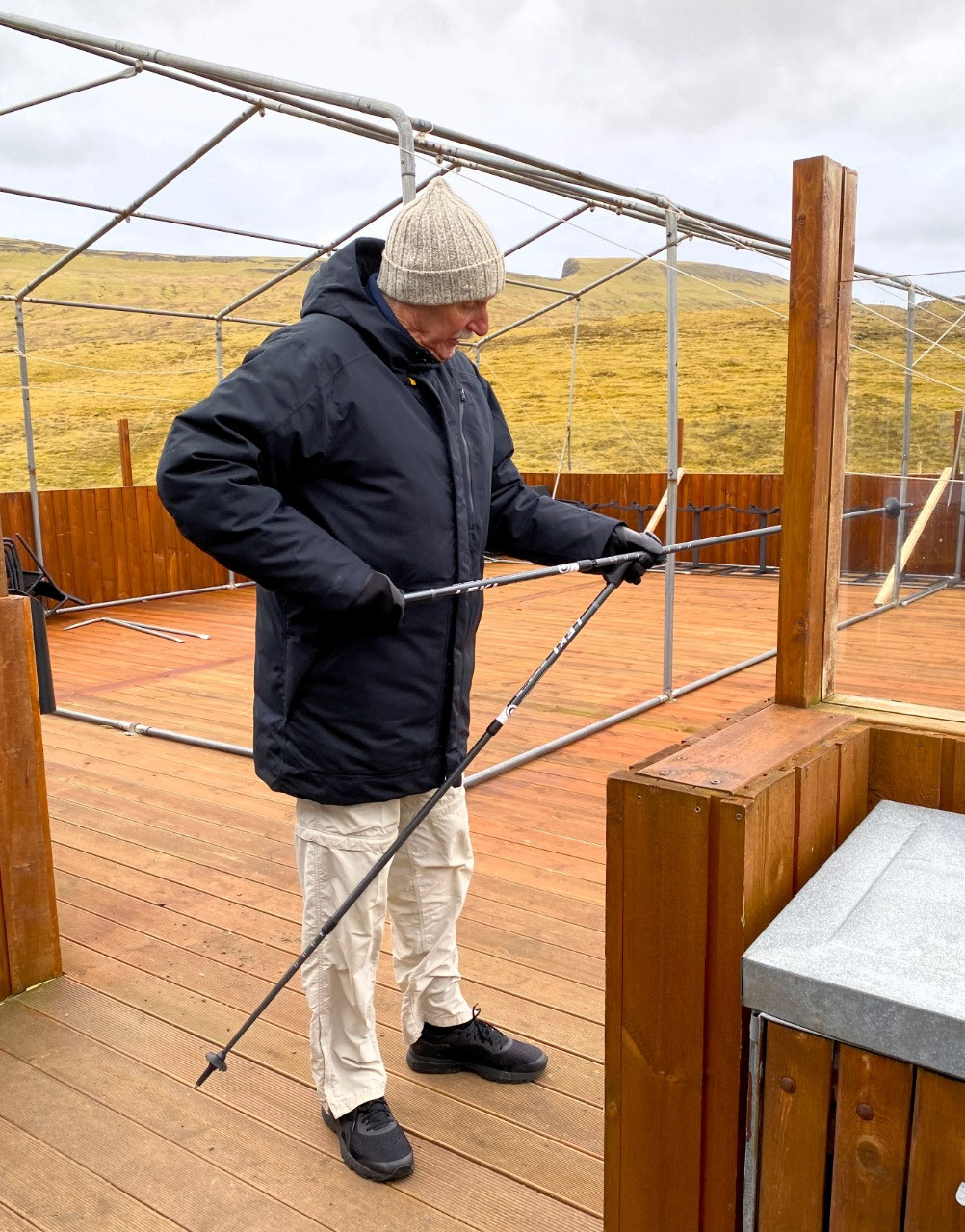
I was surprised that Alan decided to take his poles with him. After all the trail was designated as easy, and it would not we thought, be slippery as it had not rained. As it happened, we were pleased he did.
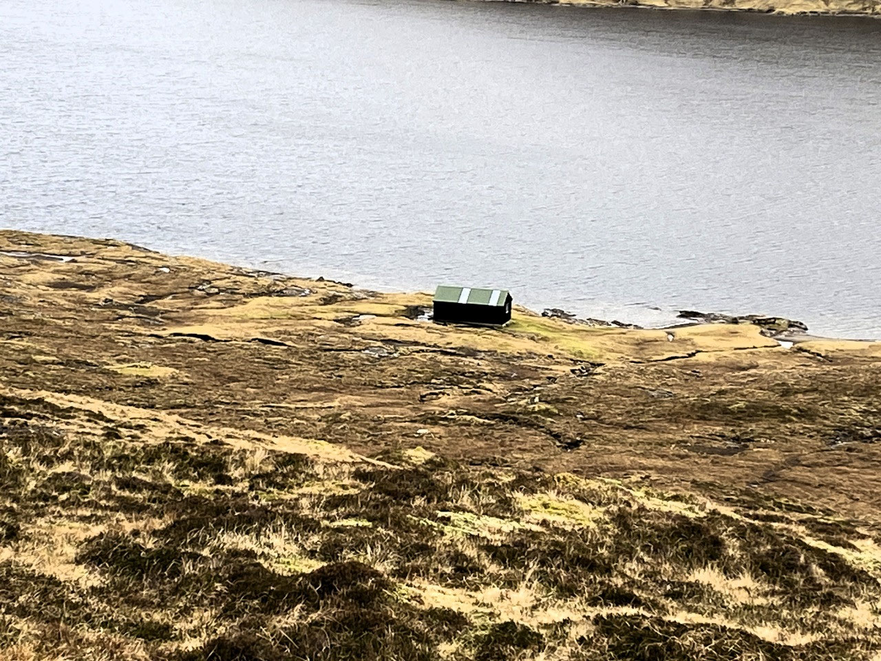
To undertake the hike, a fee of 200 DKK (about USD30) is payable by card or cash at the carpark entrance at the beginning of the trail. The land is privately owned and costs for maintaining the pathway include the use of helicopters for freighting in loads of gravel, toilets and ground maintenance etc. Another likely advantage for the payment of fees would be to limit the number of freeload hikers. As we knew, there were concerns about the level of tourism in the Faroes with resulting damage to property and loss of privacy for the Faroese.
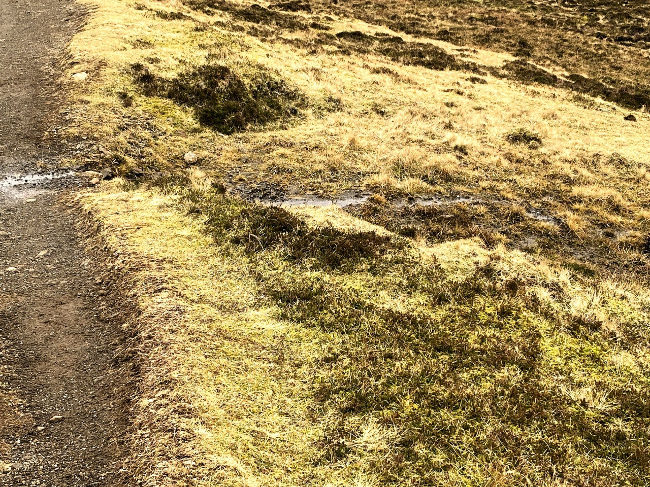
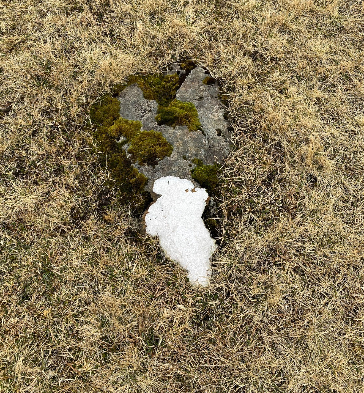
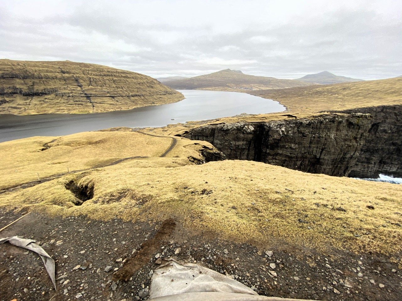
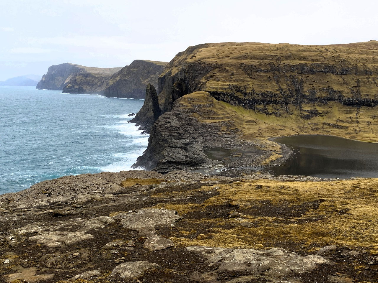
The damp trail followed the shores of a rather miserable looking Lake Leitisvatn. The going was flat although the ground underfoot was boggy and wet. The surrounding soil looked peaty, supporting low tufty grasses, interspersed with occasional rocks covered with brilliantly coloured lichens. The grassy coverage of the surrounding landscape was of a dull yellowish hue. But then again, it was winter and apparently in summer, the countryside in the Faroes becomes a very attractive deep green. On an overcast day with a temperature of no more than 3 degrees C, we were pleased we had worn our down overcoats and warm hats.
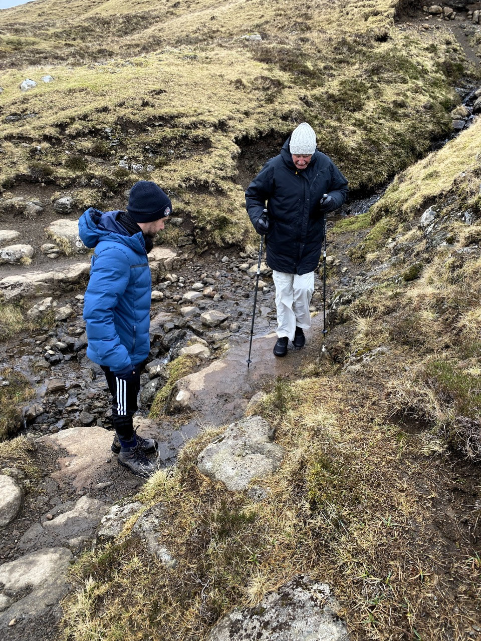
The trail, whilst undeniably easy for most of the early part, was crisscrossed with rivulets and streams. At times, the steep mossy crossings were precarious, and we were pleased Alan's hiking poles were not brought in vain. It was in fact, quite slippery in parts and not quite as "easy" as advertised. Simon was however, very careful to offer us a hand where necessary.
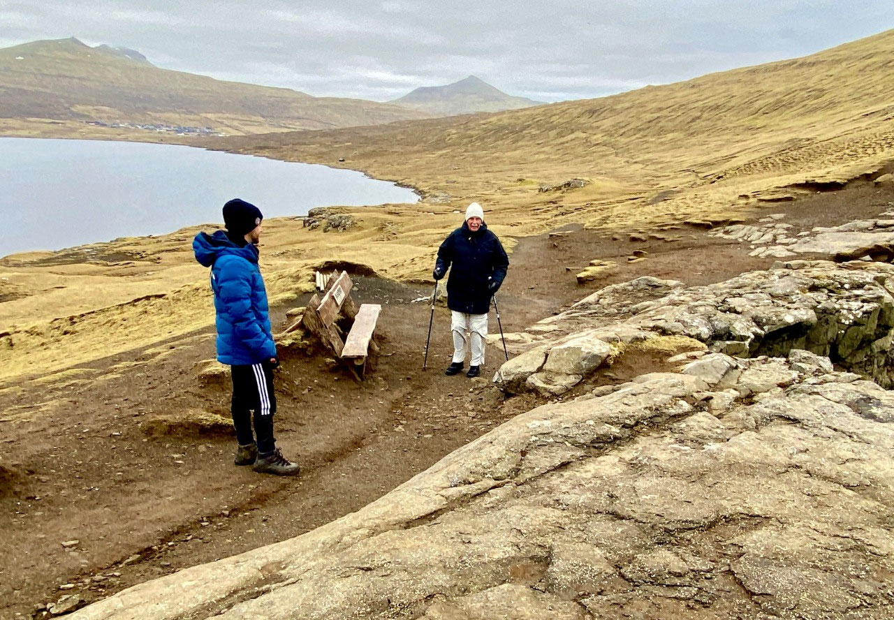
After four kilometers, we left Alan at a wooden bench along the trail. As the remaining part of the hike was apparently very steep, he was more than happy to rest and leave the last part of the walk to us.
Simon was right. The walk to Trælanípa and the Bøsdalafossur waterfall certainly was steep but otherwise, the trail was easy going. Our hike however, was truly rewarded. The views of Trælanípa and its surrounds were truly stunning. Intriguingly, the higher we walked up the 142 m cliff of Trælanípa, the more apparent Lake Leitisvatn appeared to be "hanging" over the waters of the Atlantic Ocean.
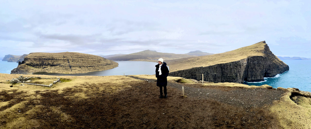
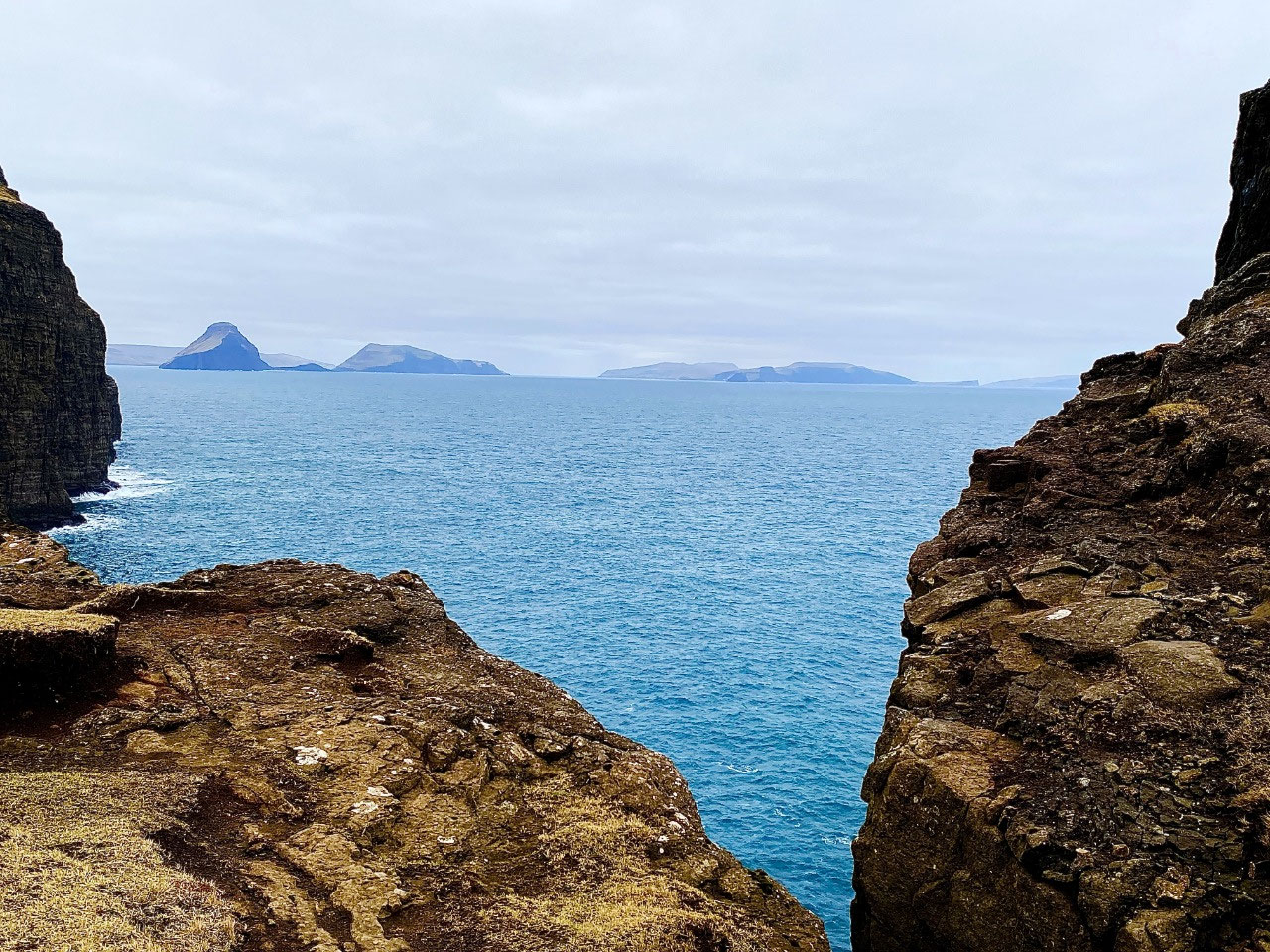
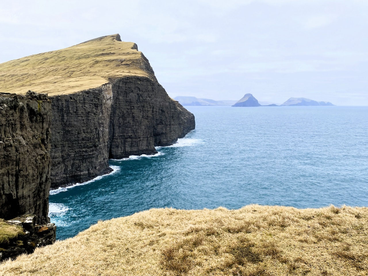
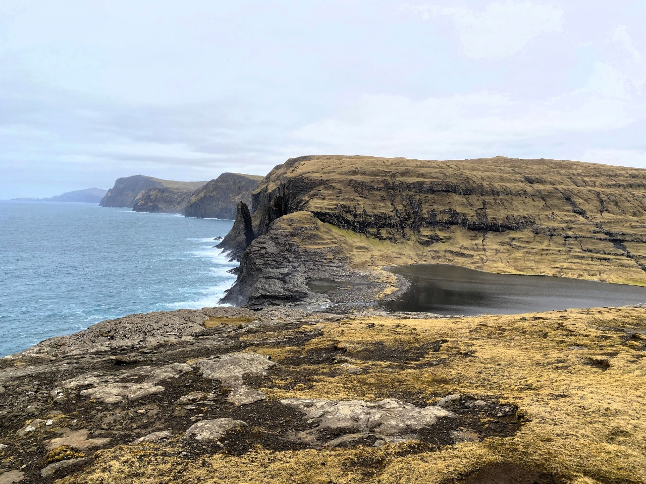
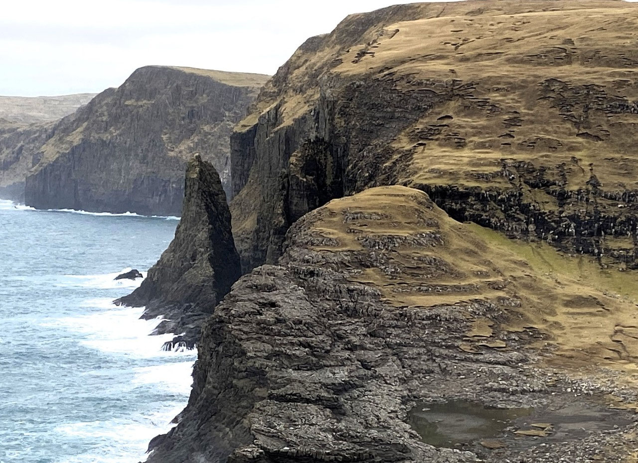
A feeble sun struggled to free itself of clouds as we gazed through gaps in the rocky face of Trælanípa, to view the islands of Koltur, Hestur and Sandoy. To the south-west, we could see the magnificent razor-sharp peak of the Geitisskoradrangur sea stack just off the coastline.
Having left Alan on a lone bench seat some kilometers away, we decided not to walk any further and so we did not view the entire Bøsdalafossur waterfall. At the end of the trail the view of the coastline and hinterland is almost 360 degrees, and I would imagine that the best way to take it all in would have been by helicopter, or even boat. And in all honesty, we had experienced some of the best viewing imaginable. It was also becoming incredibly windy - frighteningly so. In these formidably bleak conditions on the top of a huge bare escarpment, I was more than happy to return back on our trail.
To our relief, on our return Alan was looking happy and relaxed. Away from the cliff faces, the day had warmed slightly and our return trail hike was without any issues. I was greatly relieved. Given how sick and fragile Alan was, he did well to do the entire eight-kilometer walk.
To the Village of Bøur
Our drive from Miðvágur north to Bøur took us through the quaint, sleepy village of Sørvágur, located just a few minutes from Vágar Airport. Sørvágur, which is located on the Faroe Islands' deepest fjord of Sørvagsfjørður, is also where the ferry departs for Mykines Island and also to the famous sea arches of Dragarnir. The village is also home to the well-known Hiddenfjord salmon farming company.
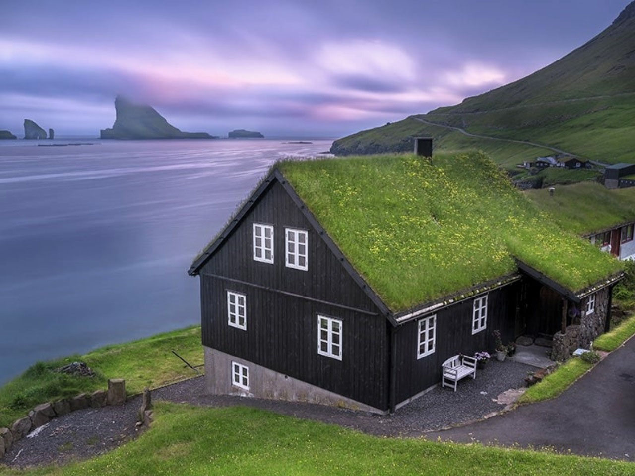
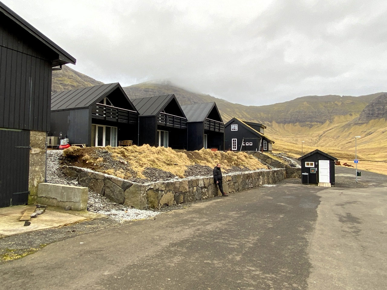
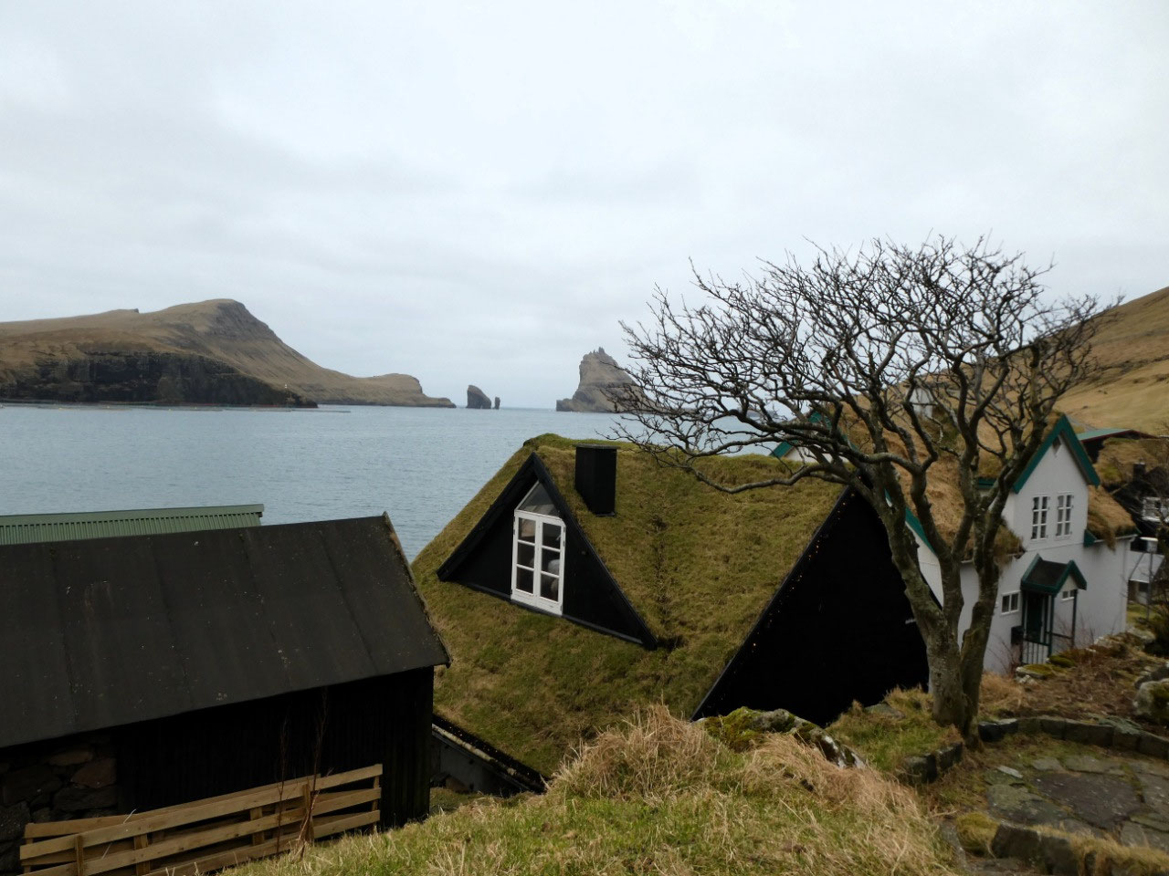
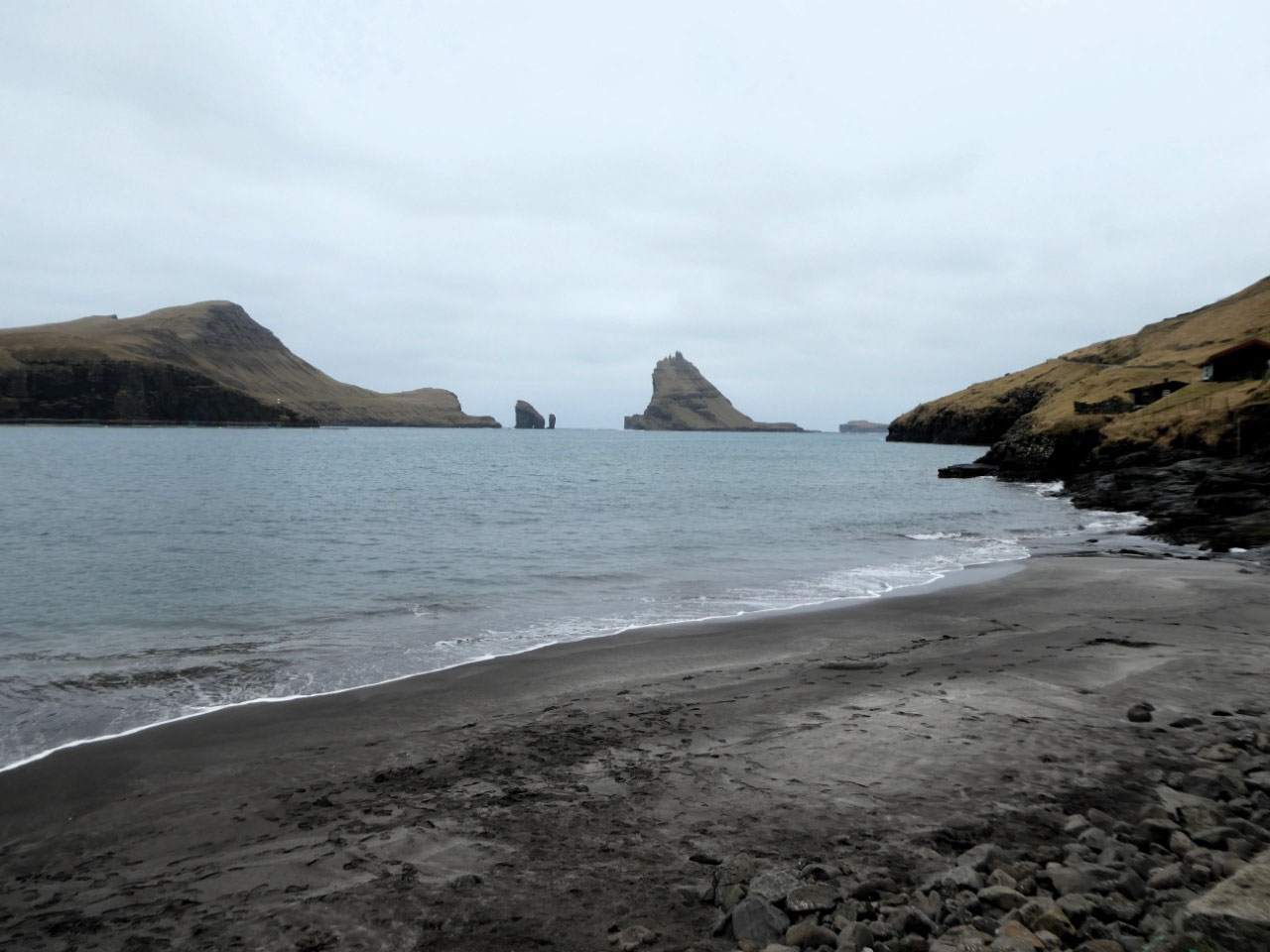
Our next stop was Bøur, a tiny fascinating settlement just four km west of Sørvagur housing a population of just 75 people. A particularly pretty village, it is located right on the southern coast of Vágar Island with spectacular views of the dramatic uninhabited rocky islets of Tindhlólmer, Gáshólmur and the spectacular sea arches of Dragarnir.
The old turf-roofed, black wooden houses of Bøur are clustered together along small laneways, almost as if they are protecting themselves from the wild shoreline of the Sørvagsfjørður fjord.
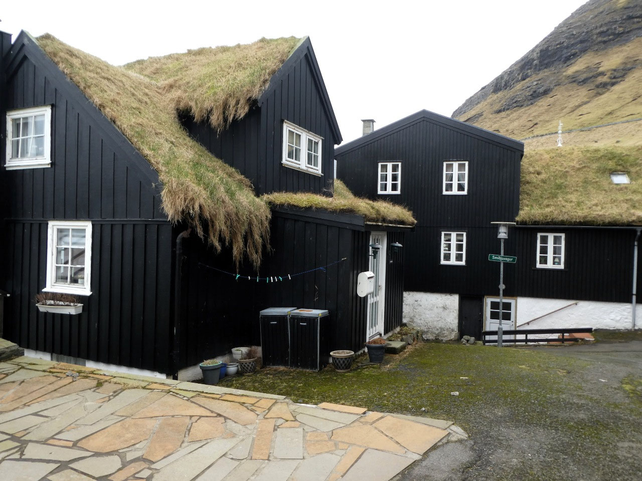


Simon explained the insulation value of the turf roofs, showing us how they first sealed the roof framework with larch bark, then layered with turf which continues to grow on the roofs. With such a seemingly primitive system, we wondered how they didn't leak. But Simon assured us the centuries old technique was absolutely watertight. As it had to be.
We spent an interesting half an hour wandering the quaint back alleys of Bøur village and admiring its spectacular views. A truly fascinating village.
To Gásadalur via the Gásadalur Tunnel (Gásadalstunnilin)
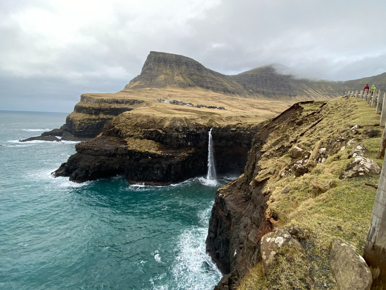
Perhaps one of the most perplexing pieces of engineering we saw in the Faroe Islands was the construction of the Gásadalstunnilin, a 1.4 km single-lane tunnel under the Knúkarnir Mountain linking the village of Bour to the miniscule village of Gásadalur.
Initially opened in 2003 for pedestrians, it was finally opened for vehicle access in 2006.

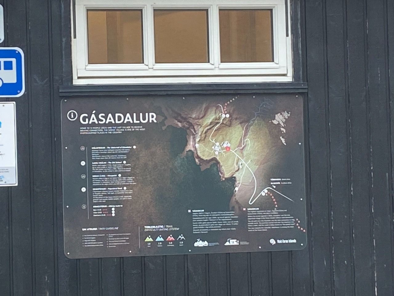
As we approached the Knúkarnir Mountain, Simon explained that before the tunnel was open, the post person had to climb over the steep mountainside (actually a very large steep hill of 80 meters in height) to deliver mail. Not only would it have been a mammoth effort to undertake the return climb - but it was even more mind blowing to think it was for a village with a population of only eleven people! And even more improbable is the fact that a sophisticated tunnel was built to allow access to such a tiny settlement.
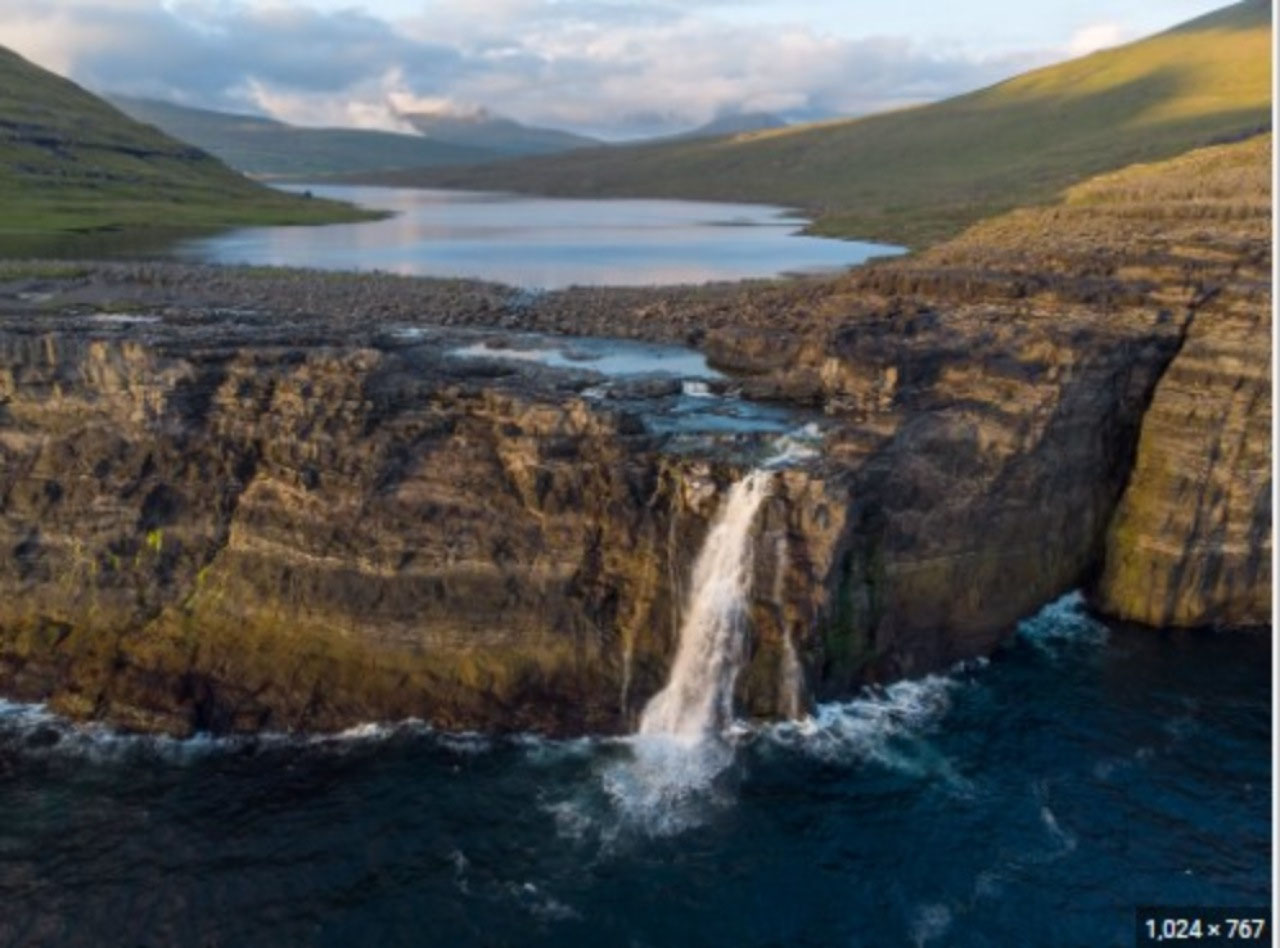
Now Gásadalur certainly is a very pretty village with spectacular views and Múlafossur, one of the most beautiful waterfalls into the ocean imaginable, but the justification for constructing a 1.4 km tunnel was beyond our comprehension. Simon however, was quite philosophical. "Oh, it will be very valuable for tourism" he explained casually.
Well, for us it certainly put the notion of forward planning on another planet!
Change of Plans for Our Tour
As we were driving back to Tórshavn, Simon mentioned that Høgni had called to ask us if we would be interested in changing our tour for the next day (Tuesday) when we were supposed to visit the villages of Saksun and Gjogv on Streymoy and Eysturoy Islands. Another client had requested a day tour for the Wednesday and if we chose, we could share with her. Her tour to both islands was considerably more extensive than our planned day. And although it would mean a much longer day, it would not incur any additional costs. It looked like it would work well for everyone. We had planned a rest day for the Wednesday, so it was merely a matter of swapping days. We were also happy as Simon taught language lessons on Tuesdays, so once again we would have him as our guide.
Everyone was happy!


2025-05-22