Check out Lobo on YOU TUBE:
•••••••••••••••••••••••••••••••••••••••••••••••••••••••••••••••
www
.youtube.com/user/travelswithlobo
**********************************************************
Note: Since the Travelpod map does not recognize Eagle Plains as a destination, Fort McPherson was used as the pin point. It is the next town but it is 200 north of Eagle Plains.
------------------------------------------------------------ --------------
The Dempster Highway - Canada's Last Great Road Trip
While I said in my last blog that I could not pass up this opportunity to drive to the Canada's Arctic, it was far from being a slam dunk.
Since it is a 732 km drive on an isolated gravel and shale road from Dawson City to Inuvik in the Canadian Arctic, the weather forecast was of prime importance.
On that front, the news was good, as the weather forecast for Dawson City and Inuvik called for mostly sunny skies with no forecast of snow. This was great news, since the road had been closed two days earlier due to a snow storm. Being 732 km in length, bad weather along any section of the highway is enough to close the route to Inuvik.
The weather cannot be taken lightly, as I found out later that a trucker had lost his life in the latest snow fall. Accidents are common on this road, often with fatal consequences. The driving is treacherous due to the road conditions and the passage of the occasional semi-trailer truck cruising between Inuvik and the south.
Like the Dalton Highway in Alaska, the Dempster is the domain of the truckers and the rest are just trespassers, in a manner of speaking
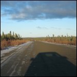
. The truck traffic is not heavy, but therein lays the danger. Most of the time there is no traffic at all, so there is a tendency to be lulled into a state of complacency. This can have dire consequences especially when coming around blind curves just at the moment that a semi is coming in the opposite direction. Moving over into the loose gravel at the side of the road can induce a state akin to hydroplaning. Given that the shoulders of the Dempster Highway are narrow or non existent and often have steep drop offs, the margin of error is razor thin.
I spent the morning of September 23 taking photos in Dawson City and gathering information about the Dempster Highway. Since the tourist office was closed for the season, I had to rely upon the opinions of various people who I encountered.
The most common suggestion made was to get a feel for the Dempster by driving it only part way.
That suggestion became the basis of a mind game. I set various destinations for myself, only to arrive there and then decide to carry on to the next point along the road
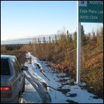
. Frequently mentioned turn around points would have been Tombstone Campground, the Ogilvie Mountain Ridge Rest Area, Eagle Plains, and the Arctic Circle.
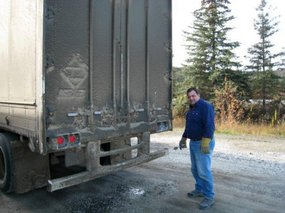
A counterweight to this "piece meal" approach to the Dempster Highway were the words of an Edmonton trucker who seemed to think that there was no problem at all in driving the highway. In a show of bravado, he left the impression that driving the highway was a piece of cake since he put his semi into cruise control most of the time.
That's about all I needed to hear to launch myself up the Dempster Highway even though it was already 14:00.
One cannot launch without gasoline, so I topped up the tank at the Klondike River Lodge located at Dempster Corner or Mile O.
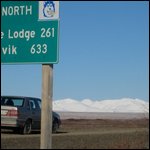
This left me with two options: drive to Eagle Plains (kilometre 370) or drive up the highway about 200 km and then turn around.
Speaking of gasoline, I often wondered what I would have done if I would have been driving a high powered BMW that requires premium gas. In many parts of Alaska and especially in the Yukon, only regular gas is available
. It was already a bit of a problem with the Volvo since it uses a mid-grade blend which was almost never available. Perhaps using the mid-grade gasoline is not needed after all, as the car ran fine on regular gasoline.
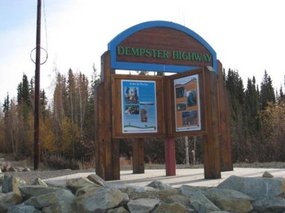
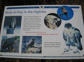
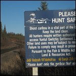
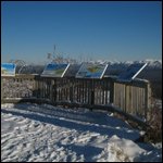
One cannot launch onto this road without reading the information panels posted at the start of the Dempster.
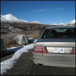
It was reassuring that the various cautions were not as dire as on the Dalton Highway. As a result of the information, I taped the mosquito screen which I normally use to cover the opening in my sunroof, over the grill of my Volvo. Apart from flying stones damaging windshields, they also have the potential of piercing a car radiator which would pretty much have put an end to the trip. Having said that, I am not sure what protection a mosquito screen would provide against a flying rock. My headlights were already protected by a thick plastic film which I applied after my mishap on the Northwest Territories trip.
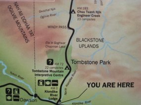
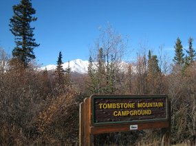
Keeping with the mind game, I decided to drive 70 km to Tombstone Mountain Campground as this was considered to be a scenic drive with not too much risk
.
This beautiful destination is a turn around point for many travelers.
At kilometre 200, I found myself in the same situation as Myles when he is flying his aircraft on pilotage navigation. (see EXCURSIONS: Blog 50) I had to decide whether to go on to Eagle Plains or to turn around. If I drove much further there would not be enough fuel to turn around to the starting point. The consequence would be to sputter to the side of the road with no gas in the tank.
Sputtering to the side of the road on the Dempster is an option that is to be avoided at all cost. Help is far away, parking at the side of the road is dangerous and road shoulders are often non-existent. Danger from flying gravel is omnipresent.
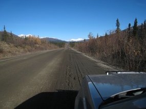
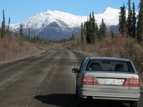
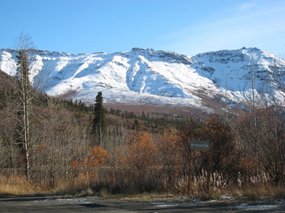
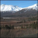
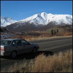
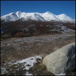
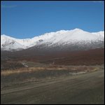
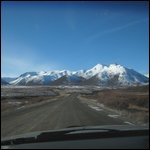
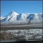
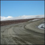
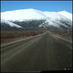
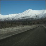
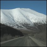
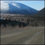
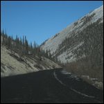
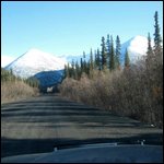
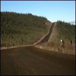
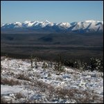
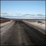
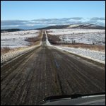
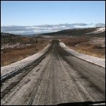
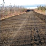
Driving north, I was soon enraptured by the dark grayish brown band of gravel that wound its way through snow capped mountains topped by the resplendent azure blue sky without a cloud. What a day for a drive on the Dempster Highway!
I stopped to have a look at Tombstone Mountain Campground and was pleasantly surprised at its orderly neat appearance
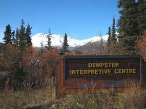
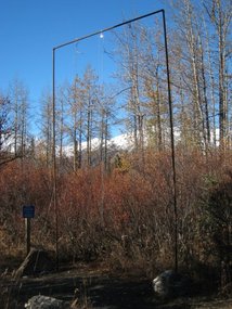
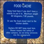
. Besides the roomy and private camp sites, it was equipped with an interpretive center and a food cache. This is a bear proof gallows-like structure made of tubular steel to hang food packs out of harms way to be used by travelers who did not arrive by car.
The superb drive to this point only emboldened me. I could only think of one thing, and that was to head north to Eagle Plains Lodge.
The amazing colours around me were a combination I had not previously encountered on my trip.
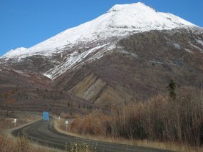
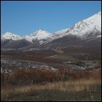
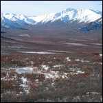
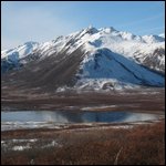
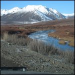
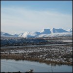
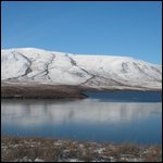
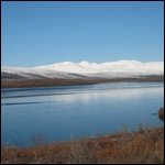
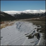
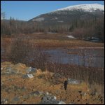
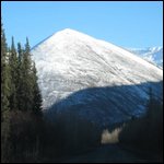
Dominant in the alpine tundra was the dark rusty brown autumn colour of the ground hugging shrubs. Sprinkled among this brown were patches and streaks of white snow. The road itself also was a dark grayish brown, perhaps still darkened by moisture content from the recent snow fall. This was in stark contrast to the pristine white snow cover of the nearby mountains. The whole scene was topped by the azure sky hanging above like a giant swath of brilliant blue paint.
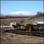
Like my trip through Alaska, there was a disappointing lack of wildlife. Only frequent signs warning of the presence of horses on the road held out a promise of animals to be seen
. This eventually proved to be the case when I passed a small ranch with horses along the side of the highway.
The Dempster continued to gently climb as it approached and passed through the Ogilvie Mountains. The more I drove, the more I became aware of the rising temperature of my face. This warmth was generated by the adrenelin boost which this exciting drive injected into my circulatory system. My face seemed aglow, and I kept telling myself - relax, relax, and relax.
For the most part, there was little traffic coming from the opposite direction and there was certainly no one passing me despite the fact that I was only driving 50 km per hour. From time to time, a semi would came from the opposite direction and I would over react by slowing down to a crawl and drive at the extreme edge of the road. I could hear the odd small rock banging off my car and at some point a rock took a good chunk out of the glass cover of my sun roof.
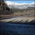
Arrival at the Ogilvie River at kilometer 235 put me in the position of no-return that I mentioned earlier
. There was no turning back; it was only onward and forward. On the other hand, the drive had been beautiful so far, and I had no reason to believe that it would not end on the same note.
Shortly after crossing the Ogilvie River, I came upon a unique experience - a landing strip on the Dempster Highway. Good thing I had a sun roof to give me an extra vantage point. On the other hand, this was not O'Hare International Airport in Chicago and my passage through "the airport" was without incident. I was reminded of Myles, the pilot in Blog 49 who mentioned that in Alaska, any public highway can be used as a landing strip, if the coast is clear.
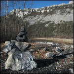
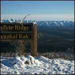
At the Ogilvie River, I was now well into the Ogilvie Mountains. That gave me a good feeling, for I was now driving through a mountain range that previously had not been on my radar screen. Not only was the range unknown, but the drive through it turned out to be a beautiful. Beautiful became spectacular at the Ogilvie Mountain Ridge Rest Area, where the entire horizon was a series of cragged mountain peaks
. Now how many people in Canada have seen this unforgettable sight?
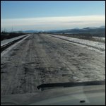
Shortly thereafter, I descended a steep stretch of road covered in snow and ice. At that point, I was overtaken with grave concerns about my ability to gain enough traction to climb back up this steep hill on my way back. The only way I could assuage my trepidation was to tell myself that I was going to buy tire chains at Eagle Plains Lodge. Considering that this was the Dempster Highway, surely they would sell tire chains!
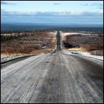
From this point on, the drive became more and more like the "Top of the World Highway" (Blog 48) with an abundance of spectacular ridgeline driving affording breath-taking views of where the road was headed.
Given the scenery, the snowy, sometimes icy conditions, the richness of the colours around me, the beautiful weather and the isolation, there wasn't a place on earth that I would rather have been at that particular period in time.
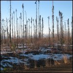
About 60 km before Eagle Plains, the snow and icy gave way to relatively flat terrain covered by stunted pine trees
. I now felt that I had come through the mountains and was on cruise control, albeit at a slow speed, headed towards Eagle Plains Lodge.
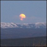
With a spectacular moon sneaking over the Ogilvie Mountains, I arrived at Eagle Plains Lodge around 20:00.
There isn't much there at Eagle Plains except for an outdated motel, a well worn restaurant, a large bar, a small store, a primitive gas station and a repair shop, but it sure was a welcome sight.
What also was a welcome sight was a Honda Civic which was parked in front of the motel. That was the first sedan that I had seen on the entire day's drive. All the rest, the little that there was, were pick-up trucks and semis. The sight of the sedan was reassuring for at least there was one other person who had the audacity to drive this highway, at this time of year, in a sedan.
In the order of priorities, I thought it would be a good idea to fill up my gas tank for the next day.
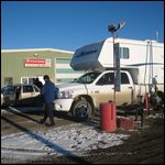
The gas station was about 200 meters removed from the lodge and unfortunately I did not find a gas station attendant there
. At that moment a camper pick-up truck pulled up beside me. Its occupants, a couple, kept staring at me with big question marks on their face. When I engaged them in conversation, I realized that they spoke only German.
Their sense of relief at the realization that I spoke German was palpable. They spoke almost no English and apparently had been told by the management of Eagle Plains Lodge that they could not plug in their camper while overnighting on the hotel parking lot. This would have left them without heat on a night where the temperature dropped to minus 6 C.
That was a situation I could not leave unredressed. After a short conversation with the manager, permission was granted for the couple to plug in their camper. I felt I had done my good deed for the day and Gert and Connie from Thüringen, Germany spent a warm and happy night in their camper.
They were the first acquaintances I made that evening.
Working again on my priorities, I managed to squeeze a meal out of the restaurant even though it was after the closing hour of 20:00
.
The gasoline, it would not be available till tomorrow morning which was fine with me but the news that they did not sell tire chains did not go down well. How was I going to get back up that icy, snow covered hill? My concerns were answered with vague statements like, "we don't use tire chains, we just put sand bags in the back of the truck". That was fine advice for someone driving a front wheel drive sedan.
At that point, I was all set for the evening except for an electrical plug for my laptop as I wished to do some blogging about this eventful day. Well, not exactly about this day, as I was still writing about Fairbanks, Alaska in my blog. That's the beauty of blogging, reliving the trip on many occasions.
I found an electrical plug for my laptop in the restaurant/lounge and was ready to blog and nurse a beer for the rest of the evening when a gentleman at the other side of the room came within conversation distance. "Are you the owner of the Honda Civic?" seemed like a reasonable question under the circumstances.
Indeed he was, and for the next hour or so the gentleman and I exchanged stories about the day's exciting drive and our travels in general
. He introduced himself as John from St. Raphael, California.
When engaged in an iffy activity like driving the Dempster Highway in a sedan, at this time of year, it is always a good idea to have company, and this was no exception.
Coming soon: The Dempster Highway - To the Arctic Circle
Dempster Highway - The Drive to Eagle Plains
Monday, September 24, 2007
 Fort McPherson, Northwest Territories, United States
Other Entries
-
41Denali National Park (A) - Alaska: Part 9
Sep 1014 days prior Nenema Canyon, United Statesphoto_camera64videocam 0comment 0
 -
42Denali Nationl Park (B) - Alaska - Part 10
Sep 1212 days prior Nenema Canyon, United Statesphoto_camera38videocam 0comment 0
 -
43Anchorage - A Great Location
Sep 1212 days prior Anchorage, United Statesphoto_camera37videocam 0comment 0
 -
44Anchorage to Seward - The Kenai Peninsula - P. 12
Sep 1410 days prior Seward, United Statesphoto_camera174videocam 1comment 0
 -
45Seward to Homer - The Kenai Peninsula - Part 13
Sep 159 days prior Homer, United Statesphoto_camera170videocam 0comment 0
 -
46Glenn Highway - Anchorage to Glennallen
Sep 186 days prior Glennallen, United Statesphoto_camera35videocam 0comment 0
 -
47Richardson Highway - Glennallen to Valdez
Sep 195 days prior Valdez, United Statesphoto_camera119videocam 0comment 0
 -
48Trail of the Whispering Giants: Peter Wolf Toth
Sep 204 days prior Valdez, United Statesphoto_camera5videocam 0comment 0
 -
49Wrangell - Saint Elias National Park- Part 1 of 4
Sep 204 days prior McCarthy, United Statesphoto_camera45videocam 0comment 0
 -
50Wrangell - Saint Elias National Park - Part 2 of 4
Sep 222 days prior McCarthy, United Statesphoto_camera69videocam 0comment 0
 -
51Wrangell - Saint Elias National Park - Part 3 of 4
Sep 222 days prior Kennecott, United Statesphoto_camera65videocam 0comment 0
 -
52Wrangell - Saint Elias National Park - Part 4 of 4
Sep 222 days prior Kennecott, United Statesphoto_camera64videocam 0comment 0
 -
53Tok Junction and a Second Chance
Sep 222 days prior Tok, United Statesphoto_camera67videocam 0comment 0
 -
54Top of the World Highway to Dawson City
Sep 222 days prior Dawson City, Canadaphoto_camera42videocam 0comment 0
 -
55Dawson City and the Klondike Gold Rush
Sep 222 days prior Dawson City, Canadaphoto_camera61videocam 0comment 1
 -
56A Third Chance: This One I Could Not Refuse
Sep 231 day prior Dawson City, Canadaphoto_camera2videocam 0comment 0
 -
57Dempster Highway - The Essentials
Sep 231 day prior Dawson City, Canadaphoto_camera18videocam 0comment 0
 -
58Dempster Highway - The Drive to Eagle Plains
Sep 24 Fort McPherson, United Statesphoto_camera69videocam 0comment 0
 -
59Dempster Highway - The Push to the Arctic Circle
Sep 24later that day Fort McPherson, United Statesphoto_camera49videocam 0comment 0
 -
60Dempster Highway - Inspector William Dempster
Sep 251 day later Fort McPherson, United Statesphoto_camera1videocam 0comment 1
 -
61Dempster Highway - North to Inuvik?
Sep 251 day later Fort McPherson, United Statesphoto_camera62videocam 0comment 2
 -
62Dawson City - The Han - "People of the River"
Sep 251 day later Dawson City, Canadaphoto_camera4videocam 0comment 1
 -
63Another Day at the Office
Sep 262 days later Dawson City, Canadaphoto_camera18videocam 0comment 0
 -
64Whitehorse: Robert J. Sawyer: Mr. Science Fiction
Sep 262 days later Whitehorse, Canadaphoto_camera17videocam 0comment 0
 -
65Whitehorse - Frank Turner and the Yukon Quest
Sep 273 days later Whitehorse, Canadaphoto_camera46videocam 0comment 3
 -
66Whitehorse: How I Lost It
Sep 273 days later Whitehorse, Canadaphoto_camera1videocam 0comment 0
 -
67South to Alaska
Sep 284 days later Whitehorse, Canadaphoto_camera78videocam 0comment 0
 -
68Paying Hommage to the Historic Chilkoot Trail
Sep 295 days later Skagway, United Statesphoto_camera48videocam 0comment 0
 -
69Strategizing in Skagway
Sep 295 days later Skagway, United Statesphoto_camera56videocam 0comment 0
 -
70Juneau - The Unique Capital of Alaska
Sep 295 days later Juneau - the Unique Capital of Alaska, United Statesphoto_camera93videocam 0comment 0
 -
71Sitka - Steeped in History
Oct 028 days later Sitka, United Statesphoto_camera35videocam 0comment 0
 -
72Catching the Alaska Ferry to Ketchikan
Oct 028 days later Ketchikan, United Statesphoto_camera100videocam 0comment 0
 -
73Passage to Prince Rupert
Oct 0410 days later Prince Rupert, Canadaphoto_camera9videocam 0comment 0
 -
74Prince Rupert - The New Container Port
Oct 0410 days later Prince Rupert, Canadaphoto_camera46videocam 0comment 0
 -
75Heading Home to Prince George
Oct 0410 days later Prince George, Canadaphoto_camera31videocam 0comment 0
 -
76Alaska / Yukon - THE EPILOGUE
Oct 0511 days later Prince George, Canadaphoto_camera0videocam 0comment 0

 Fort McPherson, Northwest Territories, United States


2025-05-22