I returned from more than two months in the Andean countries in South America on September 11 and was soon in touch with my friends Tim and Toby to do a sponsored "Denver Urbanism" walk in the Union Station around downtown. The monthly walk is put on by a few urban planners and others who take an interest in Denver's new urban development which they highlight in a blogs named Denver Urbanism and Denver. The blog can be found at: www.denverinfill.com
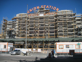
The area known in Denver as LoDo for Lower Downtown lies at the northwestern side of downtown around the city’s Union Station, which for most of twenty-plus years I’ve lived in the Denver area saw little more than a couple AMTRAK trains passing through each week and the Ski Train to Winter Park on winter weekends
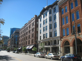
. While much of the rest of downtown Denver underwent urban renewal from the 1960s to the 1980s in which older buildings were demolished for a few modern skyscrapers to be surrounded by massive acreage of parking lots, LoDo fell into dereliction to become the city’s red light district and skid row. That apparently began to change somewhat in the late 1980s with the opening of several businesses including the flagship Wynkoop Brewery, but when I arrived in Colorado in 1991 LoDo was still pretty sketchy and not a place all that safe to walk around at night.
The situation started to change massively soon after with the construction of Coors Field and the Pepsi Center and massive growth in the number of retail, restaurant, and entertainment venues as well as residential construction. By the mid-1990s LoDo was already quite different and a great place to go bar hopping, especially if you like craft beers because of the proliferation of brewpubs.
By that time there were big plans for the large area of vacant land that had once been rail yards on the far side of Union Station
. Around that time I went to a presentation to Denver Association of Business Economists by the company that purchased the property on their plans for developing it. The economic downturns of 2001-2003 and 2008-2011 put temporary slowdowns on progress in developing the area, but it’s now in full throttle again.
Much of that growth relates to plans to make Union Station the hub of a new urban mass transit system made possible by voters passage of FastTracks in the early 2000s to greatly expand the rail lines through the Denver region with the new Union Station serving as the regional transit center. The transit center is scheduled to open in July 2014.
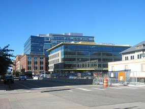
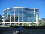
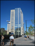
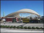
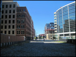
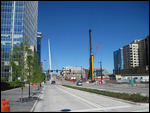
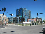
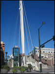
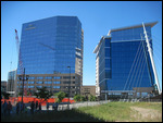
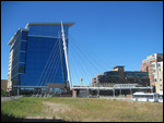
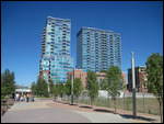
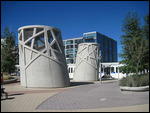
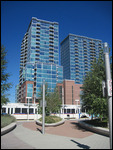
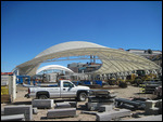
The guided walk by Denver Urbanism lasted a little a little over an hour and covered many of the recently completed buildings, the plans for buildings for many of the holes in the ground around the station, and the transit center including underground bus terminal and new commuter rail station, the frame of which is taking shape
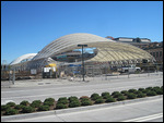
. The area is designed to relate somewhat architecturally to the opposite end of one of the rail lines to be completed in 2015, the tent like main concourse of Denver International Airport which opened in 1995.
I was glad I did the walk for just a small donation to an urban planning students group at CU-Denver. I rarely venture to the opposite side of Union Station, and the photos of development progress and renderings of the completed station I’ve seen didn’t give me an accurate impression of all that was taking place in the area.
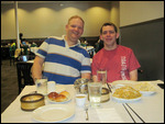
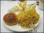
We followed our walk with a drive to Denver’s Little Asia neighborhood on South Federal Boulevard for an authentic dim sum brunch. I suppose it wasn’t very urban of us to drive to an outlying neighborhood of the city when we could have been hip and found some place to brunch in LoDo, but who cares!
Denver Urbanism Union Station Area Walk
Saturday, September 21, 2013
 Denver, Colorado, United States
Other Entries
-
55Denver Art Museum
Sep 12374 days prior Denver, United Statesphoto_camera82videocam 0comment 0
 -
56Denver Dining Out
Sep 13373 days prior Denver, United Statesphoto_camera28videocam 0comment 0
 -
57Georgetown - History on the Way to the Mountains
Sep 15371 days prior Georgetown, United Statesphoto_camera42videocam 0comment 0
 -
58Oktoberfest in Breckenridge
Sep 16370 days prior Breckenridge, United Statesphoto_camera39videocam 0comment 0
 -
59Across Boreas Pass to South Park
Sep 17369 days prior Como, United Statesphoto_camera54videocam 0comment 0
 -
60Cataract Lake - Eagle's Nest Wilderness Loop Hike
Sep 18368 days prior Heeney, United Statesphoto_camera71videocam 0comment 0
 -
61Hoosier Pass & Wheeler Lake Hike
Sep 19367 days prior Alma, United Statesphoto_camera45videocam 0comment 0
 -
62Fairplay & Weston Pass - Colorado's South Park
Sep 20366 days prior Fairplay, United Statesphoto_camera35videocam 0comment 0
 -
63Camp Hale & Vail Oktoberfest
Sep 21365 days prior Red Cliff, United Statesphoto_camera32videocam 0comment 0
 -
64The President Comes to Town
Oct 24332 days prior Denver, United Statesphoto_camera18videocam 0comment 0
 -
65Debbie Does Denver - My Cousin Comes to Town
Mar 12193 days prior Denver, United Statesphoto_camera44videocam 0comment 0
 -
66Biggest Saint Patrick's Day Parade West of Chicago
Mar 16189 days prior Denver, United Statesphoto_camera61videocam 0comment 0
 -
67Denver's Cinco De Mayo Parade
May 05139 days prior Denver, United Statesphoto_camera30videocam 0comment 0
 -
68Pike's Peak - Purple Mountain Majesty
May 27117 days prior Green Mountain Falls, United Statesphoto_camera34videocam 0comment 0
 -
69Manitou Springs - Funky Mountain Town by Pikes Pea
May 28116 days prior Manitou Springs, United Statesphoto_camera42videocam 0comment 0
 -
70Colorado Springs - In the Shadow of Pike's Peak
May 29115 days prior Colorado Springs, United Statesphoto_camera46videocam 0comment 0
 -
71Red Rocks - The World's Best Concert Venue
Jun 08105 days prior Morrison, United Statesphoto_camera26videocam 0comment 0
 -
72Denver Urbanism Union Station Area Walk
Sep 21 Denver, United Statesphoto_camera21videocam 0comment 0
 -
73Spruce Creek Trail Hike
Sep 232 days later Breckenridge, United Statesphoto_camera8videocam 0comment 0
 -
74Hanging Lake - Colorado's Most Popular Hike
Sep 243 days later Dotsero, United Statesphoto_camera28videocam 0comment 0
 -
75Mount Massive - Colorado's Second Highest Peak
Sep 254 days later Twin Lakes, United Statesphoto_camera18videocam 0comment 0
 -
76Booth Falls - Autumn Hike near Vail
Sep 265 days later Vail, United Statesphoto_camera31videocam 0comment 0
 -
77Stranahan's - A Denver Distillery
Oct 0514 days later Denver, United Statesphoto_camera10videocam 0comment 0
 -
78Life and Times at Warren's Man Cave
Oct 2534 days later Denver, United Statesphoto_camera28videocam 0comment 0
 -
79Denver - Dale Chihuly at the Denver Botanic Garden
Jun 15267 days later Denver, United Statesphoto_camera68videocam 0comment 0
 -
80New Belgium - America's Best Brewery Tour
Oct 111116 days later Fort Collins, United Statesphoto_camera33videocam 0comment 0
 -
81Back in Denver - The Colorado Railroad Museum
Nov 132975 days later Golden, United Statesphoto_camera28videocam 0comment 0

 Denver, Colorado, United States


2025-05-22