Southern Armeina lies wedged between the self-proclaimed Republic of Nagarno Karabakh to the east and the Azeri enclave of Naxcivan to the west. To the south it shares a brief border with Iran, its only friendly neighbor in the region besides Georgia. These remote parts are linked to Yerevan and the rest of the country by a single highway that winds through Vayots Dzor (Gorge of woes), a name acquired due to a history of earthquakes in the region.
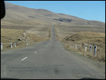
We took a shared taxi from Yerevan and headed to the town of Goris located in the southern province of Syunik, a 5 hour journey through endlessly winding roads
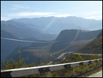
. Much of Armenia is mountainous and southern Armenia seems specially so with roads repeatedly descending down canyons only to climb again over the next pass within a few kilometers. Several commercial trucks with Persian plates passed by in both directions bringing to mind how close Iran was from here.
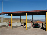
Many vehicles in Armenia use natural gas for fuel instead of petrol. Refueling a natural gas tank can take up to 15 minutes to complete and safety regulations require that all passengers leave the vehicle and stay a few meters away from the refueling bay. Our shared taxi had to stop twice for refueling enroute to Goris, adding at least a half hour to the overall time taken. It was late afternoon when we arrived in Goris and fortunately for us we got dropped off at our guesthouse doorstep.
While Goris is a destination in its own right, our reason for being there was that it was a convenient stopover on our way to Stepanakert (see next blogpost) and also an excellent base to visit Tatev monastery which is just 30 kms away
.
If you have begun to wonder whether we have suddenly found religion and are turning this trip into some kind of pilgrimage, rest assured that this is not the case. The reason monasteries have been featuring heavily in our travels (and blogposts) recently is that both in Georgia and in Armenia, many monasteries are located in remote areas, often set against stunning backdrops, sometimes on the top of a mountain or by a beautiful lake, and they are a good excuse to visit these beautiful places.
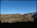
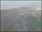
We hired a taxi for 3 hours to make the round trip to Tatev and a few other nearby attractions. Built on a rocky fortress at the edge of the Vorotan Canyon, Tatev was a spiritual and educational center in the middle ages and considered one of the masterpieces of Armenian architecture. The road to it is a spur off the main Yerevan-Goris highway and approaches the northern edge of a steep gorge down which it descends over 400m only to ascend up the southern lip
.
An ariel tramway called "Wings of Tatev" has been constructed to span the distance and is reputed to provide an incredible views on the way. Our guesthouse host highly recommended it and we intended to take it at least one way. We are told that this is the longest in the world (at 5.7 km) and is in the Guinness Book of World Records. But when we got to the tramway station we found that it was not functioning. (We later found out that there had been an incident just a few days earlier and they were still fixing the problem). So we took the only other alternative, which was to drive all the way and back.
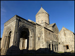
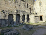
The monastery was founded in the 4th century at the site of a pagan temple. There was a church and a few monks living there. Over the centuries other churches, hall for pilgrims and other buildings were added. The main church, Surp Poghos-Petros (St. Paul and St. Peter) was built in the 9th century by the bishops of Syunik to house important relics. At the beginning of the 10th century a school was founded in Tatev and students studied the sciences and illustrated manuscripts and the monastery is reputed to have played an active role in the development of sciences and arts in its heyday
. The 11th-century Surp Grigor (St. Gregory) church is right next to it. In 1387, Timur's army (yes, him again) got here and burned and looted the place.
In the courtyard is an octagonal pillar which has an interesting construction plan. The pillar is made of several stone sections surrounded by metal bands with hinges and was engineered in a way that it could 'swing' or 'shake'. According to one theory, this would serve as a monitoring device in the event of earth tremors. The other says it was designed as a type of defense, when pushed it would bend over and safely right itself and it is reported to have terrified Seljuk warriors and sent them fleeing from the demonic tower.
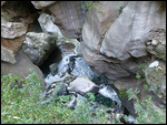
On our way back we stopped at the deepest part of the canyon where the Vorotan River has created some interesting geological formations due to erosion by constant water flow. Known as Devil's bridge, people come here to soak in the natural hot water springs around it. But it was completely deserted when we got there.
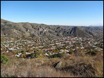
Back up on the northern side, we made a final stop at a strategically placed lookout from the edge of the canyon at Halidzor. Light was failing us by this time and we could barely see the Tatev monastery that we had visited just a short time ago. But the wide panorama in front of us was worth the short hike that it took to get there.
Google Maps Link
Tatev (Give Me Wings)
Tuesday, October 30, 2012
 Goris, Armenia
Other Entries
-
74Some History Lessons
Oct 0228 days prior Tashkent, Uzbekistanphoto_camera5videocam 0comment 2
 -
75From Slave Market to Museum
Oct 0426 days prior Khiva, Uzbekistanphoto_camera14videocam 0comment 1
 -
76How Much Renovation is Just Right?
Oct 0624 days prior Bukhara, Uzbekistanphoto_camera32videocam 0comment 3
 -
77Timur Land
Oct 0921 days prior Samarkand, Uzbekistanphoto_camera28videocam 0comment 1
 -
78Goodbye To The 'Stans
Oct 1020 days prior Tashkent, Uzbekistanphoto_camera6videocam 0comment 2
 -
79Still In Asia Or Is This Europe?
Oct 1317 days prior Baku, Azerbaijanphoto_camera28videocam 0comment 1
 -
80Foothills Of The Caucasus Mountains
Oct 1416 days prior Lahic, Azerbaijanphoto_camera16videocam 0comment 2
 -
81Vikings Originally Came From Azerbaijan?
Oct 1614 days prior Sheki, Azerbaijanphoto_camera13videocam 0comment 1
 -
82An Azerbaijani Family
Oct 1614 days prior Sheki, Azerbaijanphoto_camera0videocam 0comment 3
 -
83A Change of Faith
Oct 1911 days prior Tbilisi, Georgiaphoto_camera16videocam 0comment 3
 -
84Dzhugashvili and Svetitskhoveli
Oct 2010 days prior Gori, Georgiaphoto_camera17videocam 0comment 2
 -
85A Border Runs Through It
Oct 219 days prior Davit Gareja, Georgiaphoto_camera15videocam 0comment 2
 -
86In the Greater Caucasus Mountains
Oct 237 days prior Qazbegi, Georgiaphoto_camera15videocam 0comment 1
 -
87The Pink Capital of Armenia
Oct 264 days prior Yerevan, Armeniaphoto_camera22videocam 0comment 2
 -
88Colors Of The North - Dilijan and Lake Sevan
Oct 273 days prior Dilijan, Armeniaphoto_camera14videocam 0comment 2
 -
89The Armenian Apostolic Church
Oct 282 days prior Echmiadzin, Armeniaphoto_camera13videocam 0comment 0
 -
90Two Monasteries And A Winery
Oct 291 day prior Areni, Armeniaphoto_camera9videocam 0comment 0
 -
91Tatev (Give Me Wings)
Oct 30 Goris, Armeniaphoto_camera10videocam 0comment 0
 -
92The Nagarno Karabakh Republic
Oct 311 day later Stepanakert, Azerbaijanphoto_camera18videocam 0comment 2
 -
93Homer in Turkish
Nov 012 days later Tbilisi, Georgiaphoto_camera1videocam 0comment 1
 -
94From Caspian Sea To Black Sea
Nov 034 days later Batumi, Georgiaphoto_camera11videocam 0comment 1
 -
95A Short Distance, But A World Apart
Nov 045 days later Trabzon, Turkeyphoto_camera16videocam 0comment 1
 -
96Rock-cut Tombs and a Deep Valley
Nov 067 days later Amasya, Turkeyphoto_camera11videocam 0comment 3
 -
97Cold and Rainy in the Capital
Nov 089 days later Ankara, Turkeyphoto_camera14videocam 0comment 4
 -
98Ottoman Architecture and Computer Architecture
Nov 1011 days later Safranbolu, Turkeyphoto_camera15videocam 0comment 2
 -
99Fairy Chimneys and Whirling Dervishes
Nov 1213 days later Goreme, Turkeyphoto_camera26videocam 0comment 6
 -
100Turquoise Coast
Nov 1516 days later Fethiye, Turkeyphoto_camera18videocam 0comment 2
 -
101Aphrodisias
Nov 1718 days later Geyre, Turkeyphoto_camera21videocam 0comment 6
 -
102Hierapolis
Nov 1819 days later Pamukkale, Turkeyphoto_camera22videocam 0comment 2
 -
103Ephesus - Three in a row!
Nov 1920 days later Selcuk, Turkeyphoto_camera25videocam 0comment 3
 -
104Smyrna - Running on empty and a wild goose chase
Nov 2021 days later İzmir, Turkeyphoto_camera16videocam 0comment 1
 -
105Finally in Istanbul!
Nov 2122 days later Istanbul, Turkeyphoto_camera23videocam 0comment 1
 -
106The Seat of Ottoman Power
Nov 2324 days later Istanbul, Turkeyphoto_camera19videocam 0comment 3
 -
107Both Ancient and Modern
Nov 2526 days later Istanbul, Turkeyphoto_camera26videocam 0comment 1
 -
108You know you are in Europe when...
Nov 2627 days later Thessaloniki, Greecephoto_camera27videocam 0comment 3
 -
109In the Shadow of the Acropolis
Nov 2930 days later Athens, Greecephoto_camera25videocam 0comment 1

 Goris, Armenia



2025-05-22