Being locked down and having your roaming range limited to a few miles radius does have some beneficial side effects. It makes the exploration of nearby parks and open spaces appear a lot more attractive than normal. We soon found ourselves exploring these every other day on foot or bicycle. An obsessive interest in birding that involves scouring reports of bird sightings and following up with the hope of a sighting sustains the momentum. After several weeks of active birding locally, we had built up our own wish list of birds that were sighted by others (the excellent eBird website provides plenty of support for this activity) in the vicinity but had still eluded us. It sort of became a running joke of the season where we would contemplate visiting a particular spot and then ask ourselves “But what are the chances that we would spot a Lazuli Bunting there at this time of day?”. Or it could be one of several Grosbeaks. Of course, we would not be talking about the Resplendent Quetzal for which you have to get out of the country. These are realistic wishes with a decent chance of fruition.
A brief description of the smartphone apps that assist the birder would help make sense of what is a main theme of this report. The Merlin app asks you to answer three simple questions about a bird you are trying to identify and it will come up with a list of possible matches. It offers quick identification help for all levels of bird watchers to learn about the birds across the Americas, Europe, Asia and Australia. Don’t like answering questions? Snap a photo of a bird, or pull one in from your camera roll, and the app will offer a short list of possible matches. It works completely offline, so you can identify birds in the photos you take when you are far from cell service.
But what if you don’t know any answers and don’t have a photo and the bird won’t cooperate by showing itself? But it is more than happy to make itself heard? What if it is totally unfamiliar and is hence a potential lifer (first ever sighting of a bird in your entire life)? This is where the compute power of machine learning (ML) comes to the rescue. The BirdNet app allows you to make a recording of the call and in a few seconds of ML magic return a short list of matches to your device. Of course, this compute power is beyond the scope of handheld devices and requires an array of computers somewhere in the cloud. But what if you are offline? Well, you can still record the sound and play it back. Birds are notoriously self-unaware (ever seen one battling with its own image on the side view mirrors of cars?) and would likely respond and get closer thinking you a mate or a rival. And increase the chances of identification, a satisfactory viewing through binoculars and if you are really lucky maybe even pose for a brief second for your excited and shaky fingers to get your camera to focus and capture an image with the correct aperture and shutter speed.
As soon as we heard the news of the reopening of Yosemite National Park for limited entry, we lost no time in securing a permit for the opening day (June 11th). Since the park campgrounds won’t open till later, we had to find lodging just outside the park for a multi-day trip or be content with a day trip. Given our 200 mile distance from the park, we chose the former option and after educating ourselves on the risks posed by staying in hotels and using public restrooms, we felt comfortable enough to proceed.
You can get to Yosemite from the San Francisco Bay Area via three routes. Depending on which part of the Bay Area and which part of the park you wish to explore first would determine your choice. The shortest route from the SF Peninsula would be to head east on the San Mateo-Hayward Bridge and continue on I-580 past Altamont Pass to Manteca and then on Rte 120 passing through the towns of Escalon, Oakdale and Don Pedro Reservoir on the foothills of the Sierras. Then climb steeply on the Priest Grade (you have the option of taking the longer New Priest Grade which twists through several blind corners with no option to pass that slow truck for several miles or drive on the much shorter but steeper Old Priest Grade) and through the town of Groveland before the steady descent into Yosemite Valley via the Big Oak Flat entrance. The second alternative is to avoid this elevation gain/drop (you have to do plenty of that in the park anyway), by heading south from Manteca on the freeway (CA-99) till Merced and then head east on Rte 140 which follows the Merced River (which is the arterial channel that runs through Yosemite Valley having been obliged to fall from the heights as Nevada Falls and Vernal Falls) along a scenic canyon and enter the park through the Arch Rock entrance. This is longer but avoids the slow rural route and the elevation gain and drop that Rte 120 mandates. But what it adds is the extra distance of having to go further south only to retrace back north. A sort of a flat version of the up-down profile of the first route. The third alternative is to head further south on CA-99 and then turn sharply north to enter the park through its southern Wawona entrance on Rte 41. This would make sense if you are visiting the Mariposa Grove with its giant Sequoias or the various destinations on Glacier Point road and want to get there without going through the congested Yosemite Valley area. We opted for the second option since our lodging reservation was by the Merced River. It did not matter much since we got an early start which would have meant that we could only check in after spending the first day’s afternoon in the park.
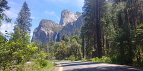
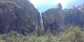
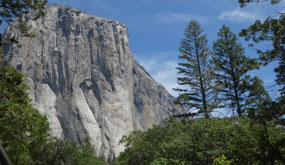
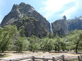
It took us over 4 hours to get to the park entrance and we had to wait in line behind a dozen cars. However with 2 parallel queues, we got our 7 day pass stickers in after they verified the name on the reservation. All no contact behind glass doors. We pulled into the parking lot inside and polished off our Subway sandwiches purchased a couple of hours ago in the Central Valley. We drove east into the valley with the other two roads 120 and 41 joining in. The valley driving loop is mostly one way to ensure smooth flow of traffic with the occasional crossover points. The familiar sights of Bridalveil Falls and El Capitan greeted our entry and we paid our respects with a brief photo of each before moving on further east. Yosemite Falls was not in full spate and the winds interrupted its vertical fall sporadically. Normally the 2 one-way lanes are filled with cars in June, but we could now stop without pulling over as there were no cars behind us. The day use parking lot at the far end of the park near Curry Village was fairly full and the temperature was a comfortable 85 degrees (down from the 100 in the Central Valley).
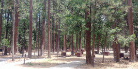
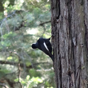
We tried to drink in the unusual sight of a completely empty Upper Pines Campground normally filled with tents and people. A White-headed Woodpecker (not seen in the Bay Area) caught our eye and we followed it a bit but could not get a satisfactory photo before it flew away. Even the American Robins and Brown-headed Cowbirds looked different in the atmosphere of the park. But these are common everyday birds where we live, so we did not give them a second look as we cut across the empty campground on our way to the Mirror Lake Trailhead. We waved to the Park official sitting inside the campground registration kiosk but thought better of asking him if we should take extra precautions due to heightened bear activity caused by lack of human visitation. While the crowds were conspicuous by their absence, there were enough visitors to ensure that human voices carried on the trails, which should warn bears off. Not that it would be bad to have an encounter at a safe distance.
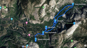
A half mile walk along the road brought us to the Trailhead. Despite the Mirror Lake Trail being one of the most popular among valley visitors due to its easy level nature, we had not had occasion to walk this trail before except for a brief winter excursion that V undertook as part of a company outing. That was a wholly different experience with the entire ground under several feet of snow. No other memory lingered from that experience.
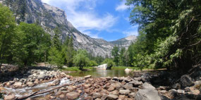
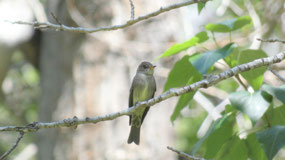
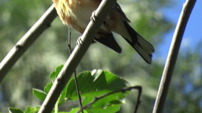
The brief mile-long walk brought us to Mirror Lake, looking more like a pond but we saw there was more to it with a larger extension a few feet higher and separated by a gently flowing waterfall. A couple of families were cooling off in the water. Despite the 85 degree air, the water was expectedly chilly to our fingers. The middle of the day is not the best time for birding but we were still excited to be in a national park looking for birds. An American Robin, Brown-headed Cowbird and Western Wood-Peewee were all we could sight and these were commonly seen on our local walks. A fleeting flash of yellow did not yield any positive identification. We still managed to get a photo of a tail and a video pointed in the general direction. What sort of a warbler could this be? Wilson’s? Townsend’s? McGillvray’s? It did not make any call, so we could not record anything and it did not respond to the stock calls from our app. (Back home, by process of elimination, we identified it as a McGillvray’s due to its pink feet). But a persistent call from another unseen bird was quickly identified as a Cassin’s Vireo by M, every busy with her phone apps, not unlike an avid fisher trying to hook one out. But it resisted all our attempts to show itself. There were a few other unfamiliar calls and M was busy using her memory and the phone to identify and flush them.
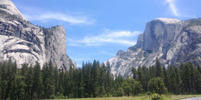
The trail got out of the woods and onto a boulder field and it got hotter due to the reflected heat. We were right under Half Dome’s chopped face now expanded to its fullest due to our position. M paused briefly intent in concentration focusing on one particular bird call and trying to keep out the others. She had captured a recording of one call and after registering the returned result looked up sharply. Lazuli Bunting!
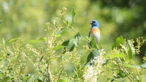
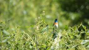
The world froze for the next half hour as we kept playing a variety of Lazuli Bunting calls. The small whitish fronted bird that emerged from among the tall trees did not look like the prized catch it was and while it was clearly interested in the call, it kept flitting across from tree to tree all around us and would not settle. We were able to use our binoculars to confirm it was indeed what we thought it to be with its unmistakable blue head and rust breast. Once it came close enough, there was no mistaking the brilliant appearance. It’s stops were too brief to allow our cameras to focus. It would take both of us to decide to walk off without a photo for this type of sighting and we did manage to make that collective decision after several attempts. But we could not resist one last attempt and we retraced our steps to the same spot and our patience was finally rewarded. First sitting atop a wildly swinging tree branch in the wind and then on bare tree stumps in the distance.
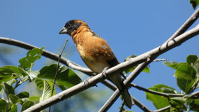
Now what can top that on a warm Yosemite afternoon with no crowds? Surely not another uncommon sighting! Within a quarter hour, a Black-headed Grosbeak’s call was identified and in a few minutes the app flushed it out. A much less flitty bird with its distinctive beak and rusty body capped by black head, it was much easier to spot and get closer to and photograph.
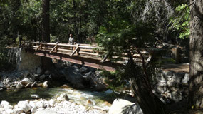
We turned back at the Tenaya Creek Bridge to cross the creek and walk back the other side. A Cassin’s Vireo did show itself and yet another appearance of the White-headed Woodpecker at the campground rounded off a satisfactory afternoon.
For the full Photo Album with 60+ photos, click the link below.

 Mirror Lake Trailhead, California, United States

Kishore
2020-06-28
The bird apps you mention sound pretty natty!