Next morning. Despite our eagerness to maximize the potential of a full summer day in Yosemite, we could not resist the lure of a riverbank opposite our lodge and spent an interesting half-hour with a big flock of Acorn Woodpeckers (with their distinctive clown faces). A solitary duckling that seemed to have wandered off on its own and a red-winged blackbird were other species spotted there.
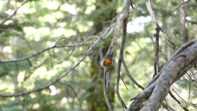
As expected, we were waved through the entrance with our prominent pink sticker on our windshield. At the junction just outside the valley, we turned right on 41 (Wawona road) on our way to Glacier Point Road. But first, the stop at Tunnel view, that is one of the world’s most photographed vistas and is also on a specialty California license plate. Morning light is not the best to photograph the view with the sun directly in front of the lens. Restless Violet-green Swallows were flying about and we even caught a picture of one that rested briefly on a tree branch. A shrieking set of similar but larger birds were quickly identified as swifts (no photos were possible in that light and with their fast movements). But their distinctive vocalization is what made the identification possible.
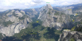
Wawona road climbs quickly around the south rim’s large mass and heads towards the park’s south entrance. A left turn at Chinquapin leads to Glacier Point Road, a 16-mile dead-end road that twists and winds its way to the rim and terminates at Glacier Point - one of the best vistas of Yosemite Valley and the surrounding granite peaks on both rims. Also a massive magnet for the crowds as the road stops here.
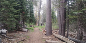
We drove 14 miles to Taft Point Trailhead with our morning’s plan to hike the Taft Point-Sentinel Dome Loop covering a distance of about 5 miles and getting close to the rim at a few points which we had not been to before. Having visited Yosemite several times in the past 20 years and walked many trails at different points, we were looking forward to a new set of vista points. To a first time visitor, these viewpoints may not look much different from the one at Glacier Point (which does not require any hiking) but to a repeat visitor these alternate vistas provide glimpses that are unique and distinct from others. It is akin to the culture of a collector or, dare we say it, a birder!
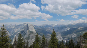
What is it about Yosemite that generates such enthusiasm and devotion? Of course, the proximity of the park to where we live is, no doubt, a factor. But still it is a 4-hour drive at the best of times and in peak normal seasons much more. I’ll attempt to give the unfamiliar reader a satisfactory answer to the above question. First of all, there is the dramatic setting of Yosemite Valley and the vertical rise of the exposed granite cliffs that tower over the valley. These cliffs possess unique shapes that create an impression of different personalities on the viewer. Add to this are a set of rivers and creeks that emerge from the snowy heights and drop down to the valley (Bridalveil, Yosemite, Nevada, Vernal and Illilouette Falls are the prominent ones) to increase the drama. And then there are these vistas all around the rim that reveal different profiles of the various landmarks - Half Dome, El Capitan, Cathedral Rocks, The Three Brothers, Clouds Rest as well as distant peaks like Mt. Starr King, Mt. Lyell and Mt Florence. Several points on the rim are reachable via motor car or hiking trails ranging from easy walks to long strenuous hiking days. Each visit makes memories that are recalled whenever you encounter a new vista and spot somewhere you’ve been on a previous visit or just a few hours ago earlier in the day. And, of course, given its vastness there is always something new to discover.
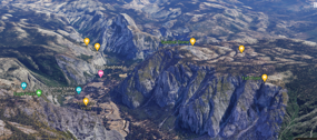
If you have a few minutes, here is a playlist of 3D virtual tours of Yosemite taken on a Google Maps ride.
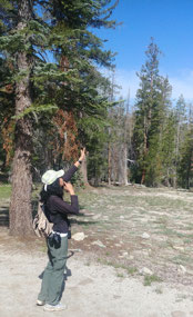
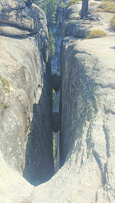
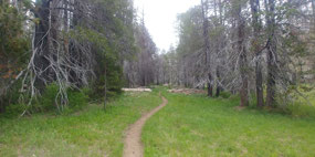
Unlike the previous afternoon’s warmth at the valley floor, this was a cool morning with temperatures in the 60s at the higher elevation (7700 ft.) on the southern rim. A grey bodied flycatcher occupied us for a few minutes right at the start. We quickly identified it as Dusky Flycatcher and moved on, reaching the rim’s edge within the hour, a distance of 1 mile from the trailhead. The flat surface is broken here by deep cracks known as The Fissures.
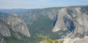
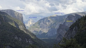
At one point on the edge of the rim is a steel frame barrier that gives even the squeamish the courage to approach the edge and look down at the valley below. The view of El Capitan from this point is unparalleled especially with the morning light illuminating its profile. On our side to our left are the Cathedral Rocks. Directly across on the other side are Eagle Peak and the Three Brothers. Further to east is Yosemite Falls but only with its Upper portion the switchbacks on the trail leading to it visible. We recalled with pleasure our hike up this trail in 2005.
As we retraced our path back to the junction with the Pohono Trail, we enjoyed encounters with the Rufous-crowned Sparrow and a Fox Sparrow. Back among the woods and away from the rocky rim, we encountered a bright yellow forehead. M quickly narrowed it down to a Golden-crowned Kinglet. She played its song from the library and what emerged to this was a similar bird with an orange head! So, why would a Ruby-crowned Kinglet respond to a Golden-crowned Kinglet’s call? But all was clear in the next few minutes with M coming to the rescue with the explanation - the Golden-crowned Kinglet’s display includes a spectacular unfurling of an orange tuft. So, it was the same bird whose interest had been piqued by our artificial call. We hope that it bore its disappointment well.
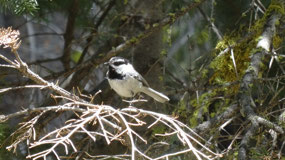
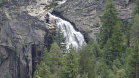
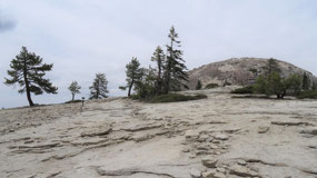
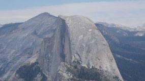
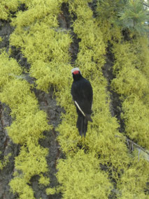
This was followed by leisurely encounters with a Mountain Chickadee, Red-breasted Nuthatch and a White-headed Woodpecker. Further east, the Pohono Trail stayed close to the rim as more of the Lower portion of Yosemite Falls came into view. We broke for lunch (packed pesto-cheese sandwiches and trail mix) before continuing on to Sentinel Dome. The trail skirted around the dome and as it turned right, Tenaya Canyon, Half Dome and to the right, Nevada Falls and Liberty Cap came into view. Vernal Falls was too low to be seen from this point. We did not have any interest in climbing to the top of the dome, so we returned back to the parking lot and drove the remaining distance to Glacier Point with a stop at Washburn Point on the way. We had never stopped at this point deeming it close enough to Glacier Point. What you get to see here is a view of Illilouette Gorge and the eponymous falls and part of the Panorama Trail. Happy with this new discovery, we got to Glacier Point where we eventually saw what it is famous for! Crowds! Not as much as normal but we had been spoilt by the previous day and this morning. This just reinforces the lesson - if you want to get away from the crowds, get on the trails! And the further you get from the parking lot, the better.
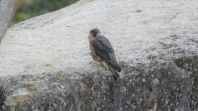
After renewing memories from past visits to Glacier Point and a closer look at Vernal Falls and the Mist Trail granite steps adjacent and a good look at a Peregrine Falcon that landed just below the overhanging rock, we headed back on the road to our final stop for the day. Something totally different, like a walk in McGurk’s meadow. No granite peaks or waterfalls here but green boggy grass and wildflowers. There were only a few this time of the year, they shoot up later in the season. Dark clouds threatened rain but we managed to get back dry. There was a hint of yellow on a bird’s head as it flew past and vanished without a sound. Could it have been a Black-backed Woodpecker? Who knows!
We considered exiting the park’s southern entrance but decided against it and retraced back to the valley and then exited via the Big Oak Flat entrance as thick fog rolled in and reduced visibility on the road. Once we descended to lower elevations, the light improved and the sun started shining again. Restaurants in Groveland were open for indoor dining for the first time after the shutdown, but we were not comfortable with the idea and opted to take out some Michoacan food and dine at a vista spot overlooking Don Pedro reservoir watching the sun set over the water.
For the full Photo Album with a 100 (!) photos click the link below.

 Taft Point Trailhead, California, United States



2025-05-22