 Mesa Verde National Park, Colorado, United States
Forecast for today is for rain all day, including heavy rain
and thunderstorms. Nothing we can do
about that, so we set out to do what we had planned to do: drove down the eastern side of the park and
stop at the various spots for exploring.
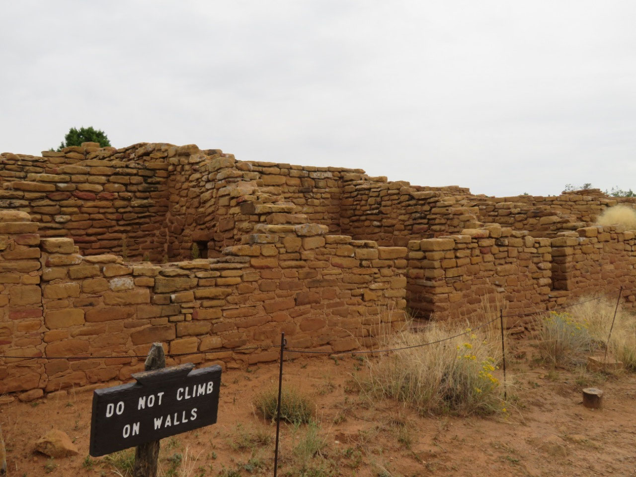
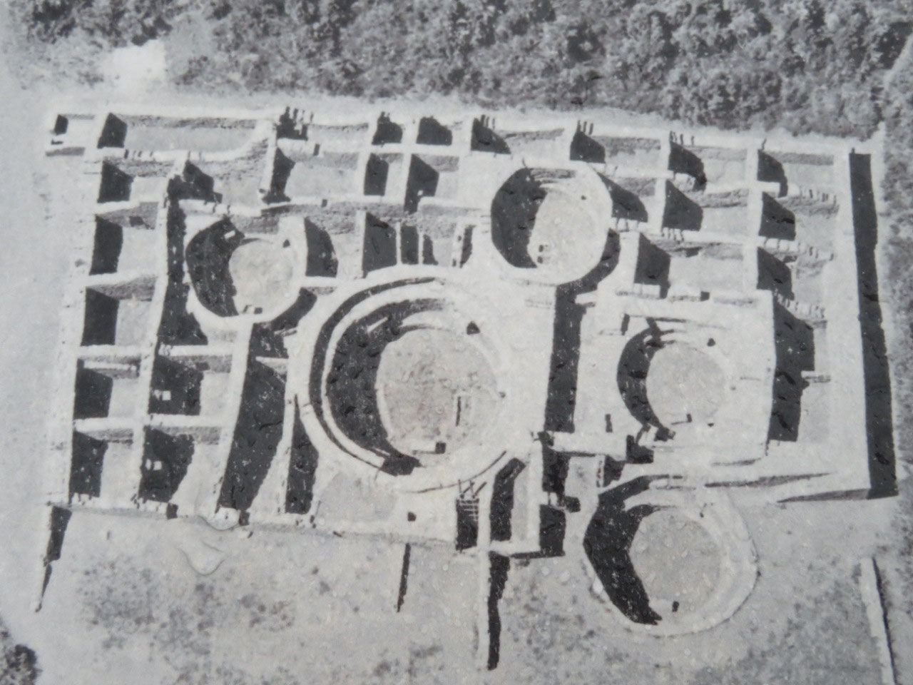
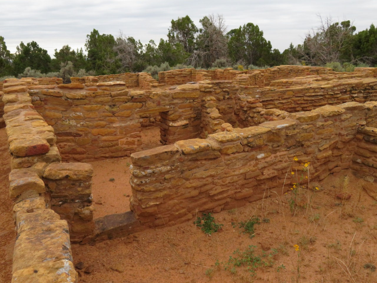
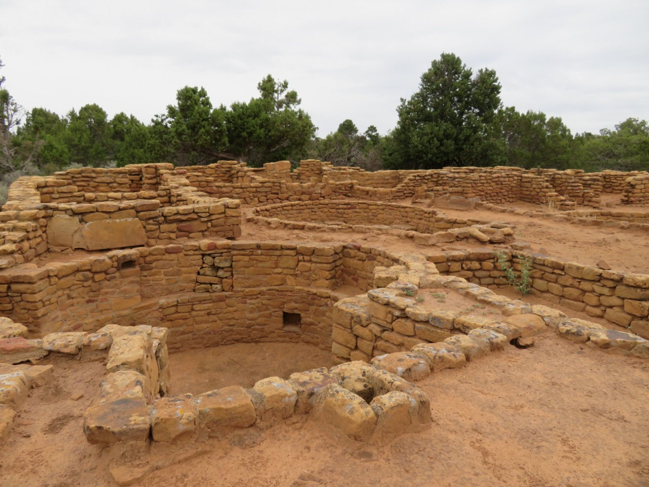
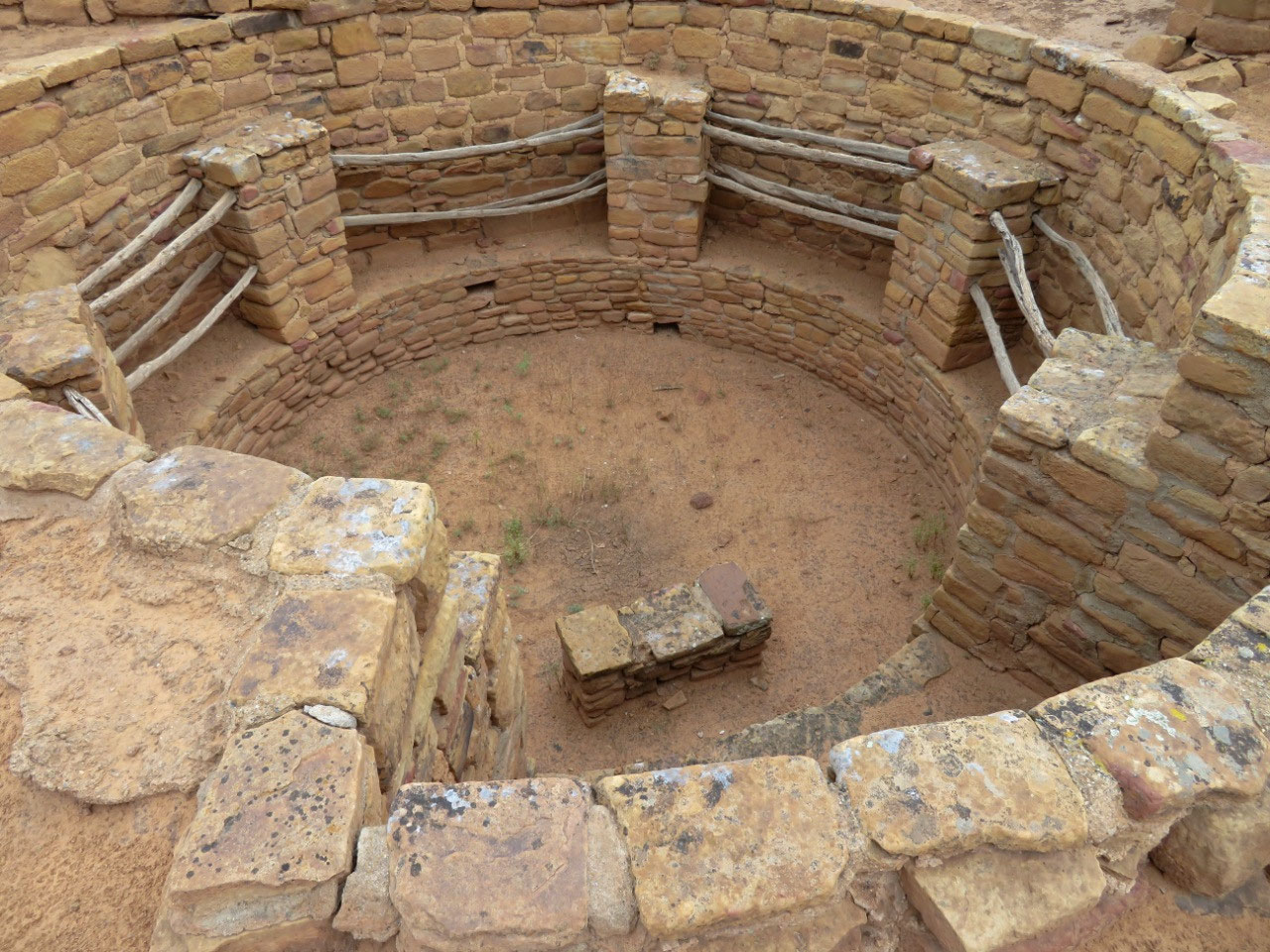
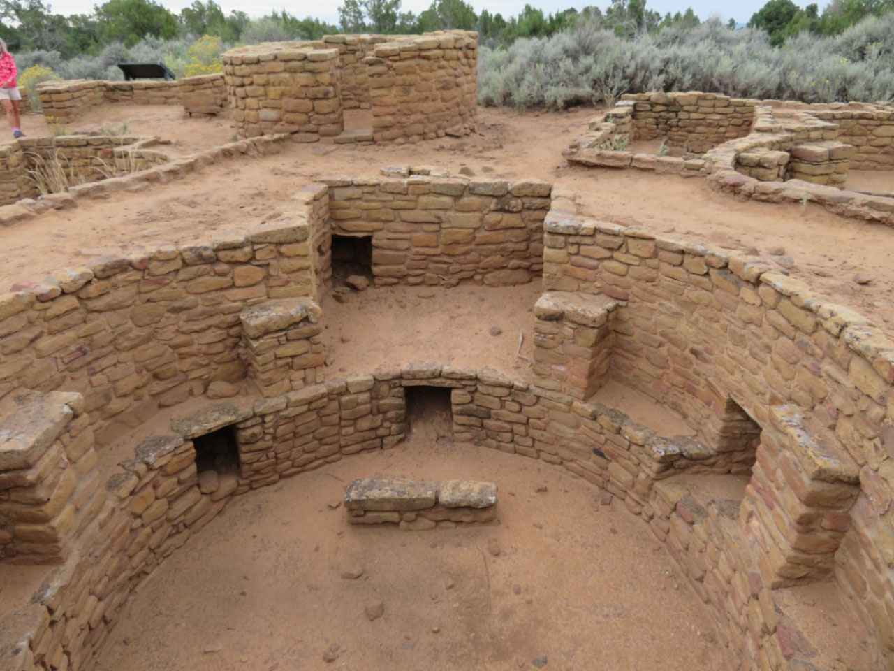
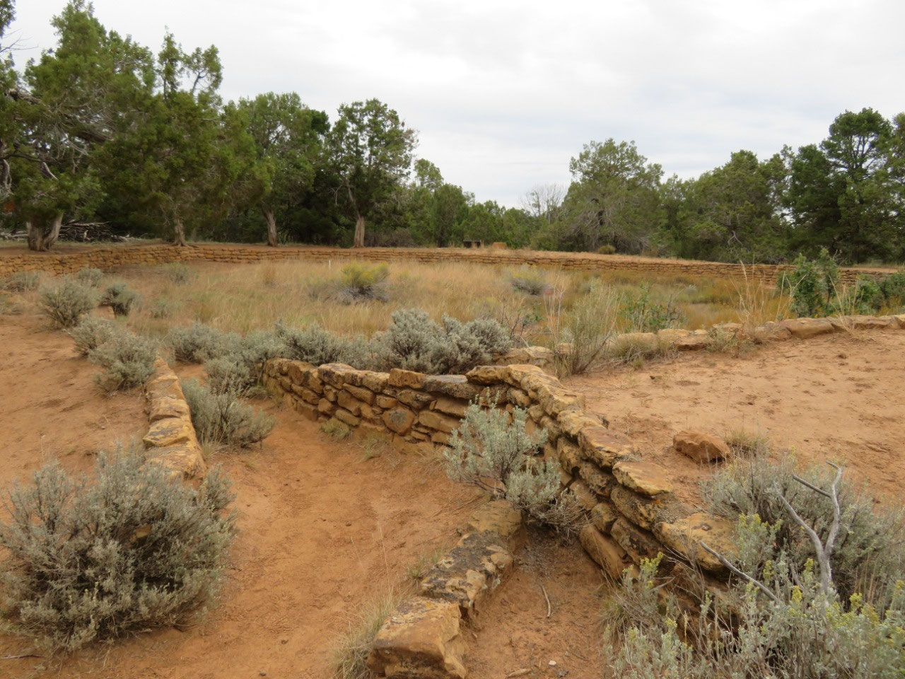
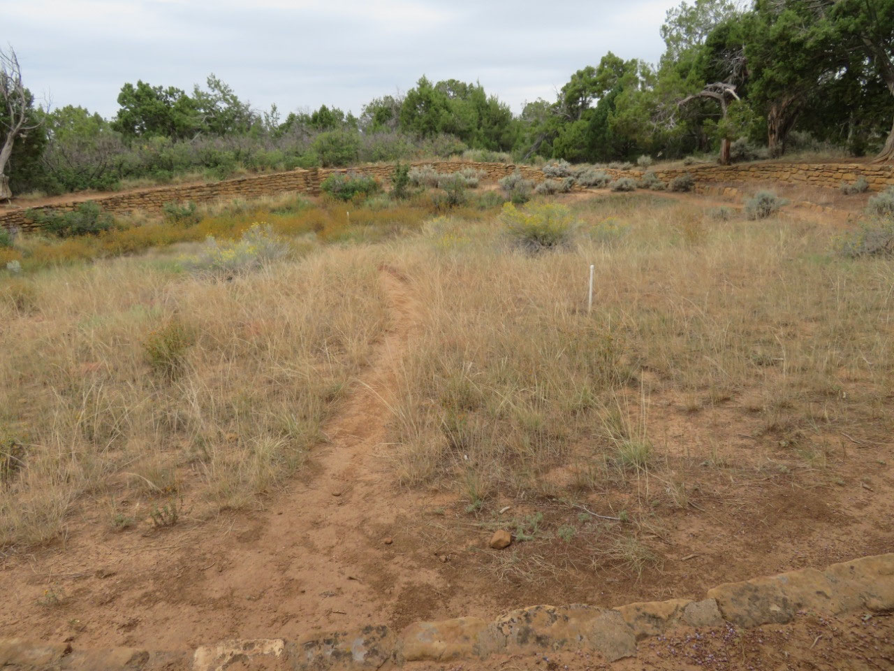
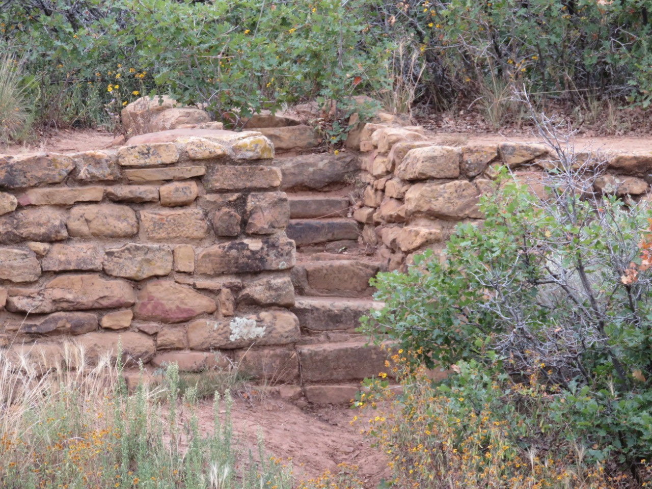
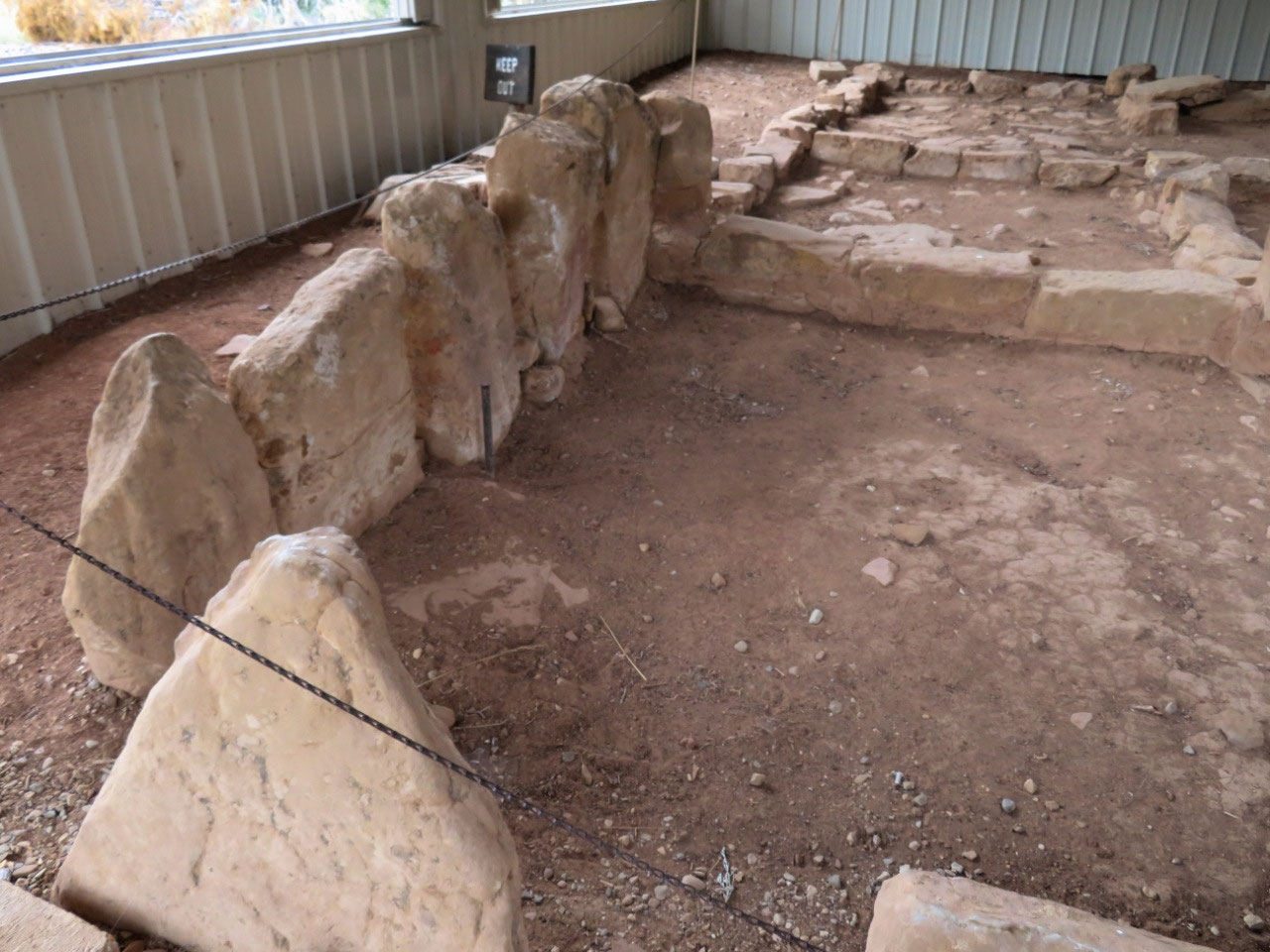
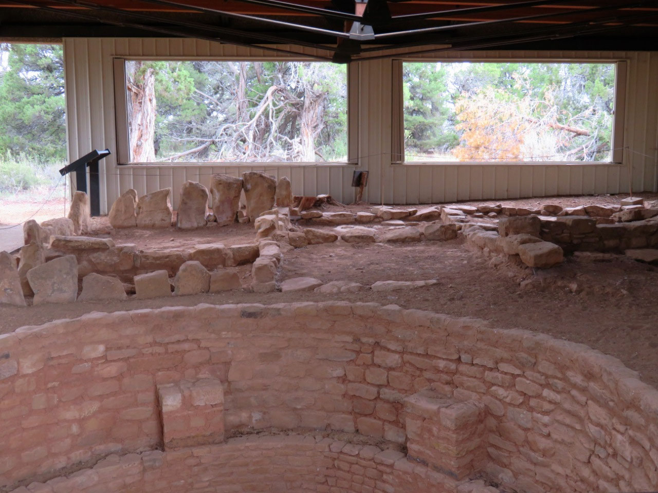
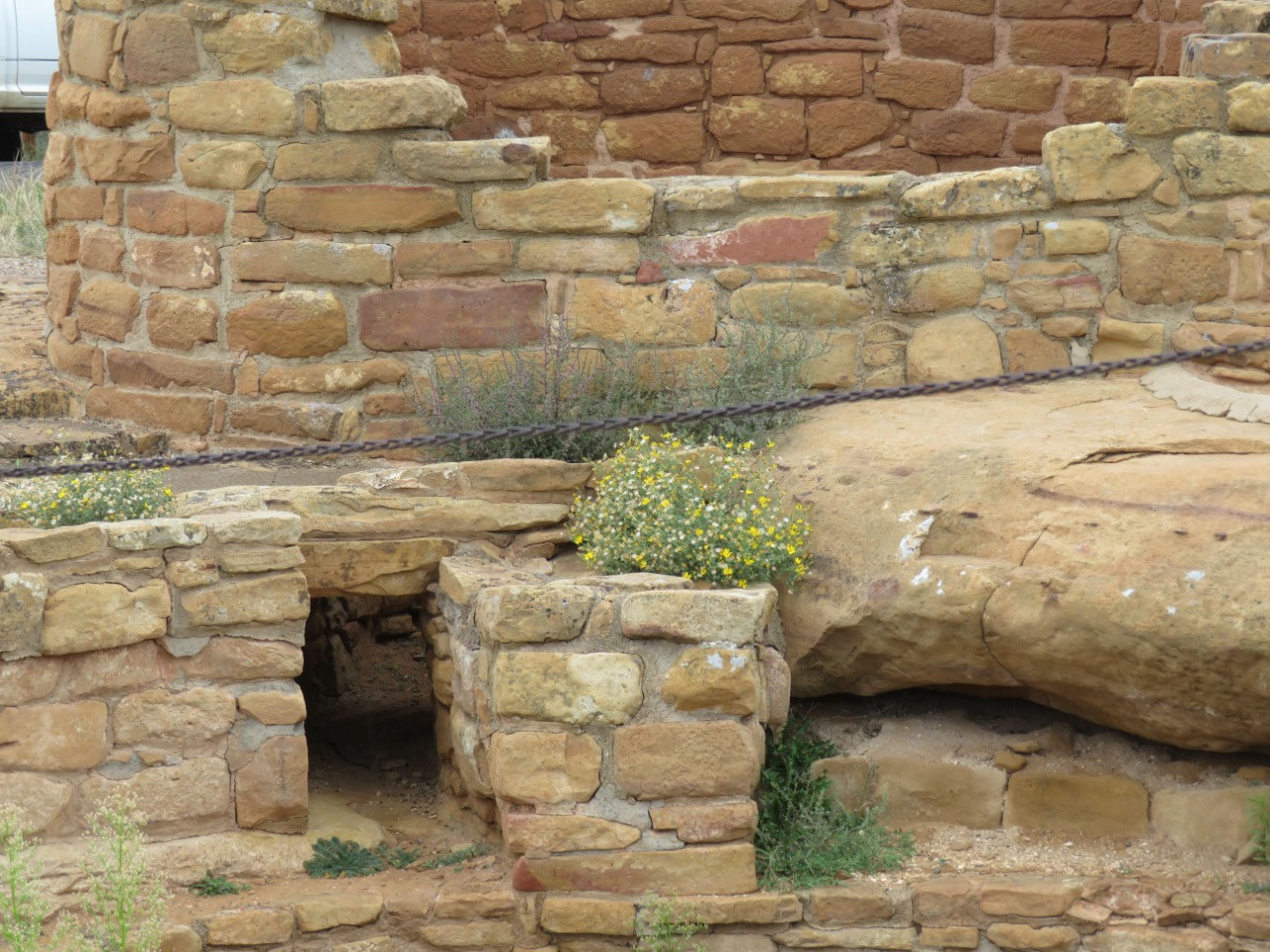
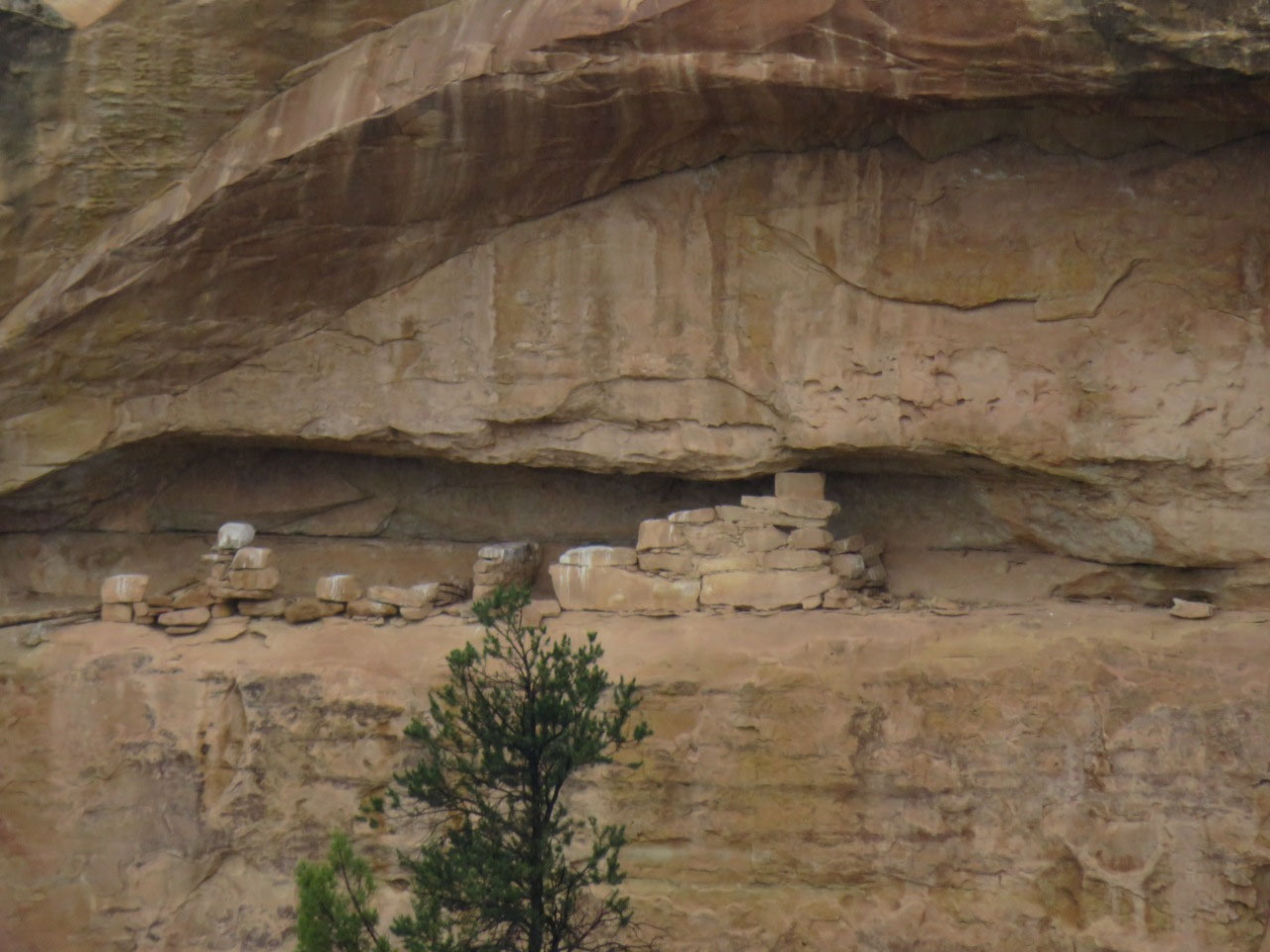
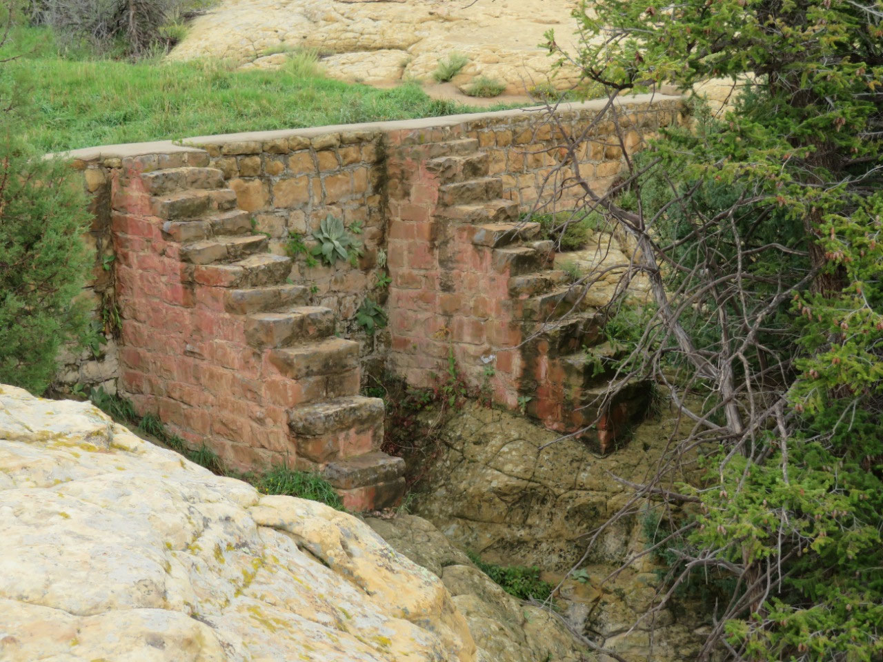
The first stop was a place called Far View Sites, which
turns out to be a collection of buildings, including some houses—one very large
one called Far View House which had something like 90 rooms originally, Coyote
Village, near to the Far View House, but a residence for many families—a
reservoir, something we have not seen anywhere else—and a tower. There is also a single-family dwelling (extended
family), which we have not seen anywhere else. Notes on photos.
I had some trouble here with the altitude; I was under the
impression that all these sites were very close together. I thought we would be walking a quarter or
third of a mile, and so I did not bring my water. Big mistake.
It turned out the loop was more than 2 miles, with one long (gradual)
uphill stretch, and I cannot walk that far at this altitude without the
water.
I got to a point where I couldn’t
get enough air, and my most excellent husband went all the way back to the car
for water for me. I think he must have
run most of the way—I don’t know how he did it.
After that, I was fine all day. I
have drunk 100 ounces of water a day for the past four days: at this altitude
you don’t realize how much of it evaporates out of you. I don’t really
understand why drinking a lot of water makes it easier to breathe at this
altitude, but it makes a difference to me. Keep on drinking!
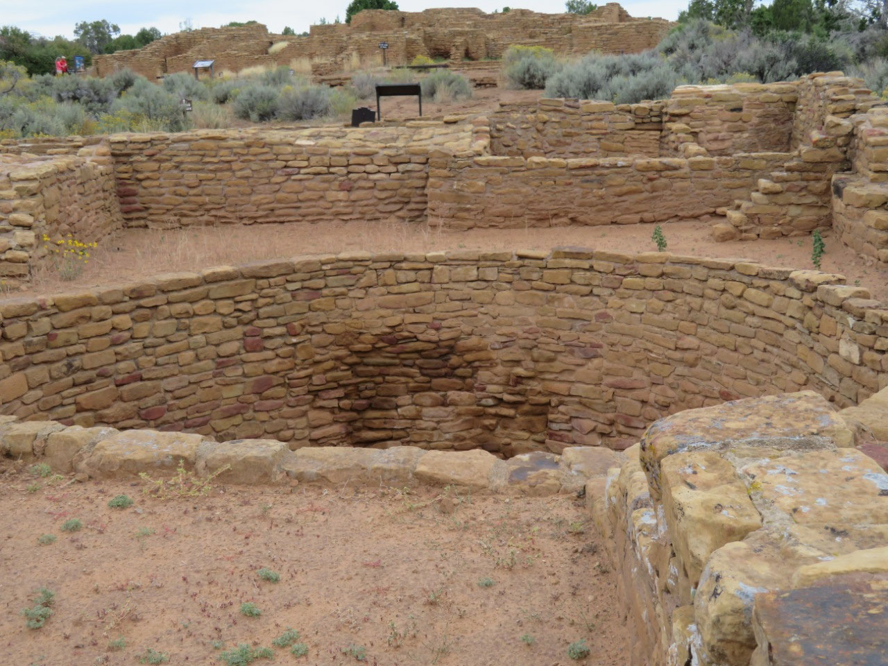
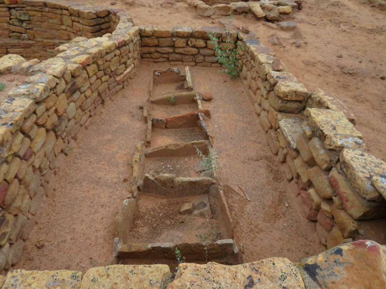
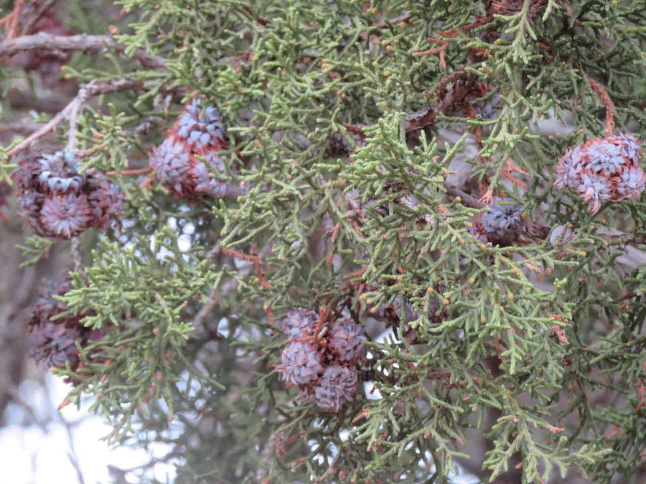
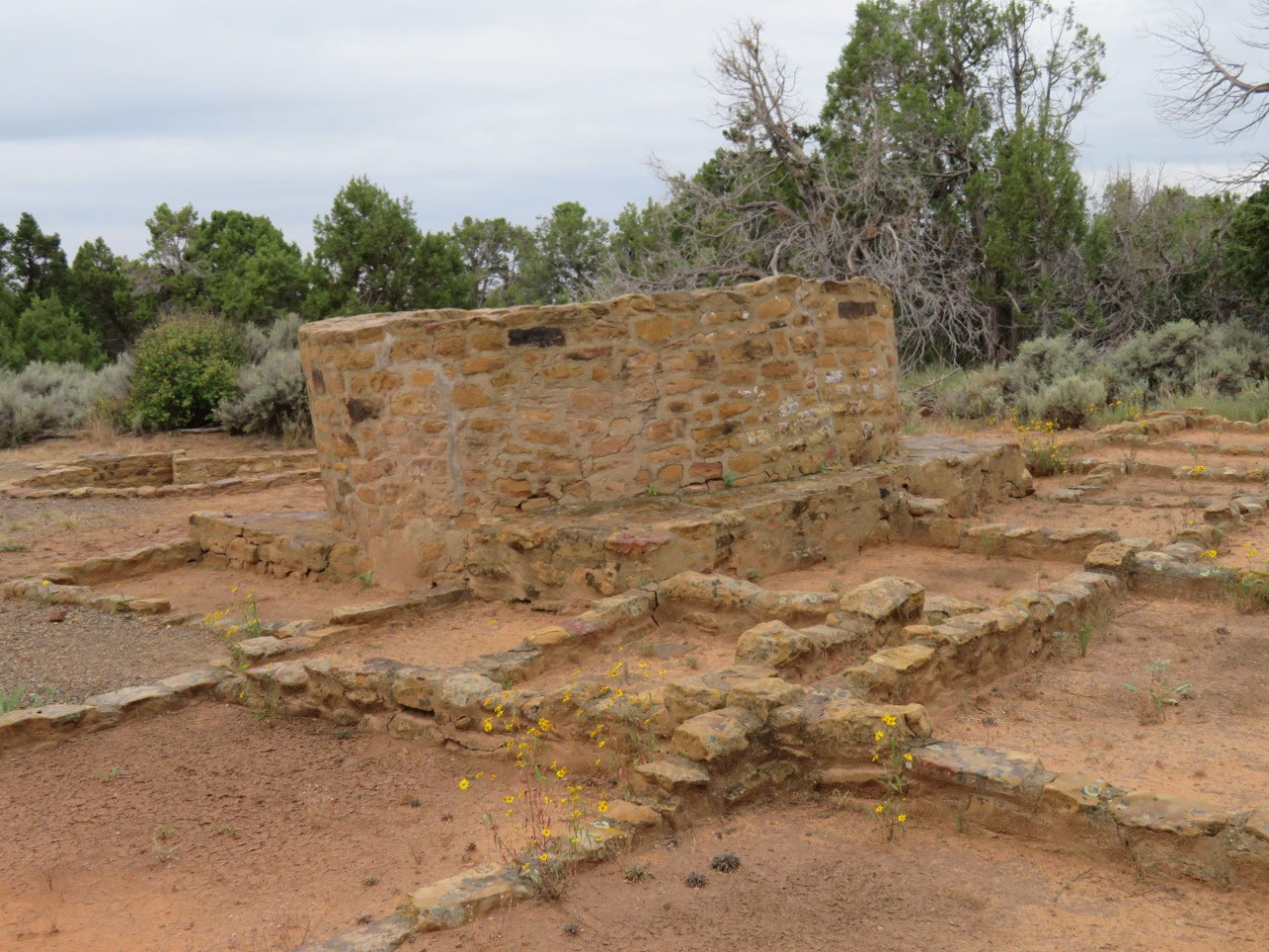
The next stop was Cedar Tree Tower. There is a tower at Far View as well, and
there are about 60 in the park.
Archaeologists do not seem to know much about what these were built
for. They speculate that they may have
been used as observation towers, but apparently not all of them are located in
such a way as to command a long view.
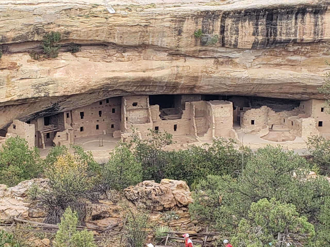
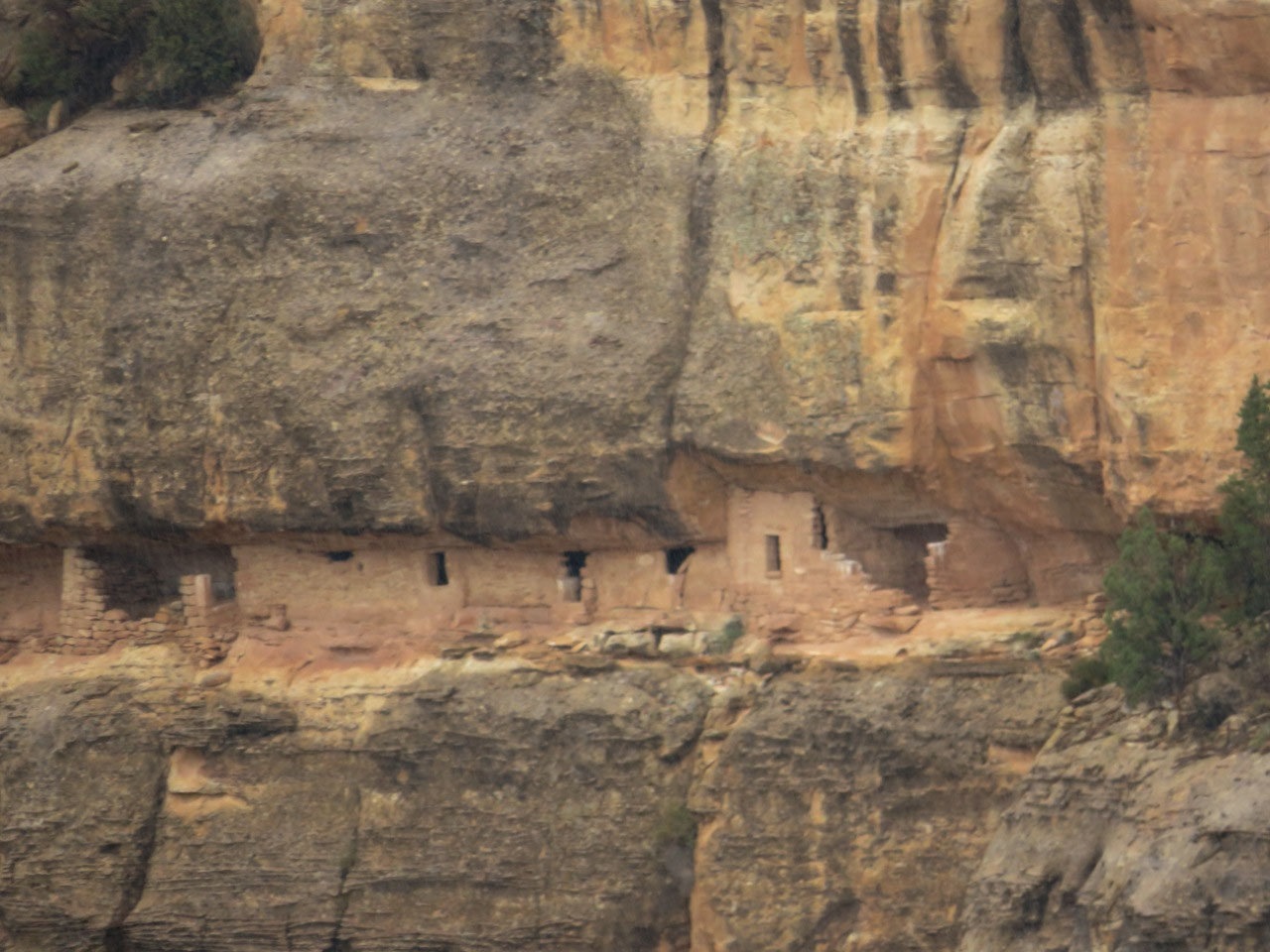
The next stop of the morning was at Spruce Tree House. “Spruce
Tree House” was named a long time ago by someone who thought that the trees in
the area were Spruce trees.
They are not. They are Douglas Firs. Maybe “Douglas Fir House” doesn’t have the
same ring? There used to be a trail out
to the house and you could take a self-guided tour, and, in fact, this trail is
on all the maps and signs. When you get
to the spot, however, you discover that the trail is closed—and has been closed
since 2015! Seems odd that that fact is
not better advertised to tourists these days.
I’m guessing permanent closure; seems like 7 years would have been long
enough to do whatever they needed to do.
Maybe they need money.
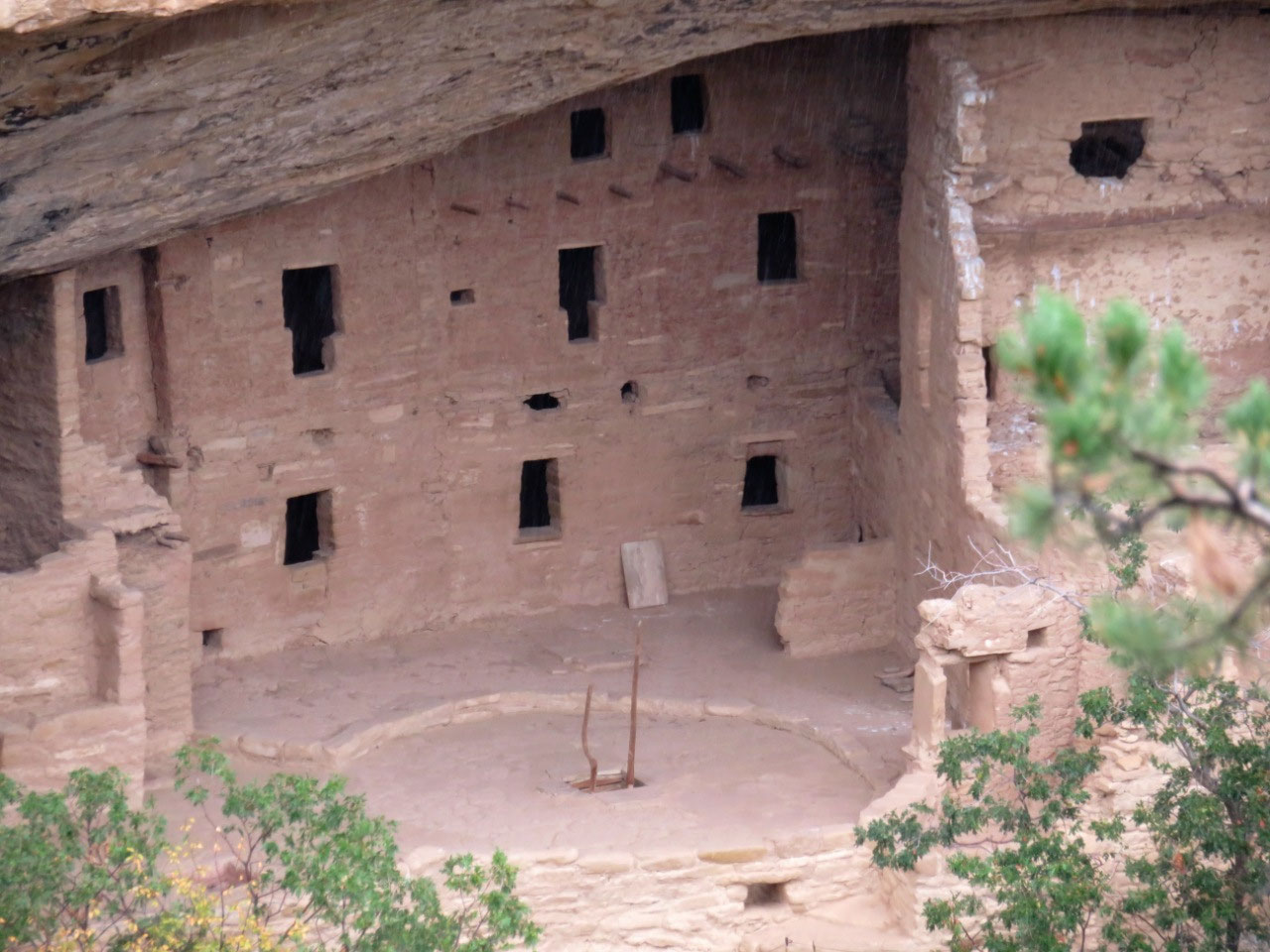
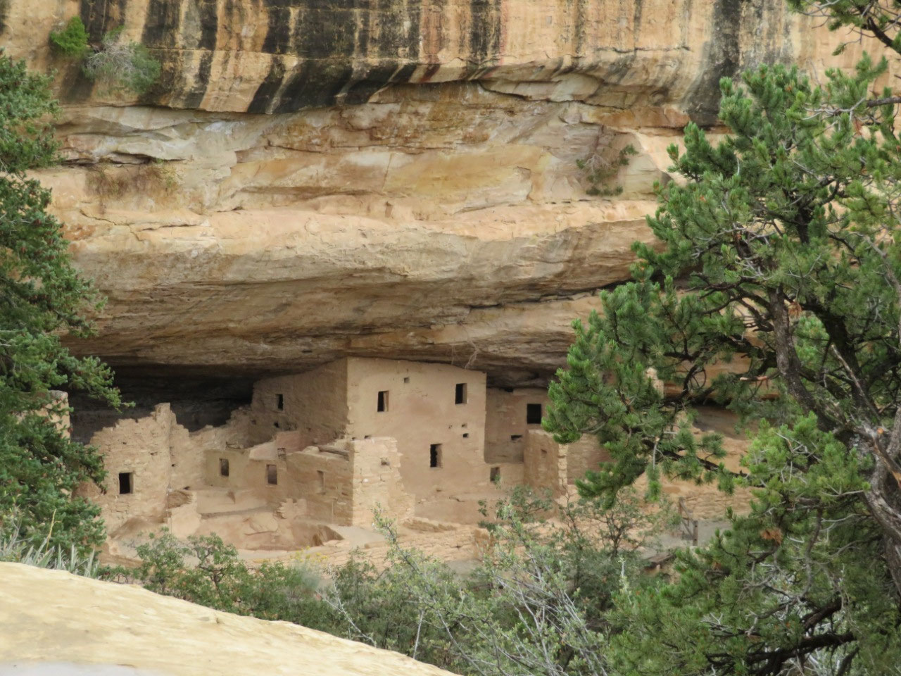
There is a viewing platform, however, that gives you a great
view of Spruce Tree House. This is the
best preserved house in the park, and you can get a really good sense of what
these cliff dwellings looked like when they were intact. It’s pretty remarkable.
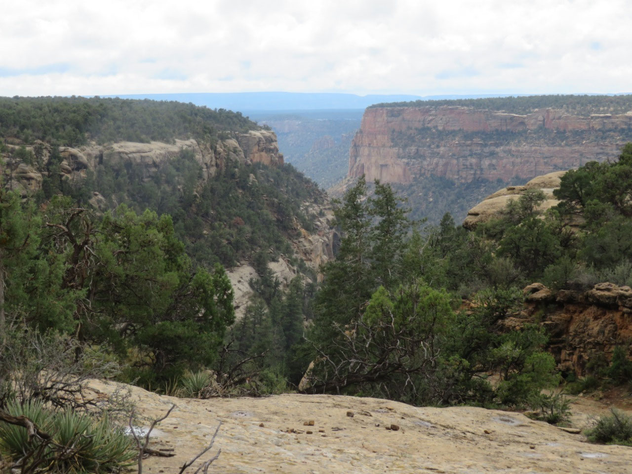
There are two long trails at this spot, which are open, and
one of them goes to a set of petroglyphs which is supposed to be particularly good,
but the trail is 2.4 miles long, VERY steep down into the canyon and then VERY
steep back up, and it was raining.
I was not eager and Tim was not eager to
tackle it in the rain, so we decided to give it a pass and head on around the Cliff
Palace loop.
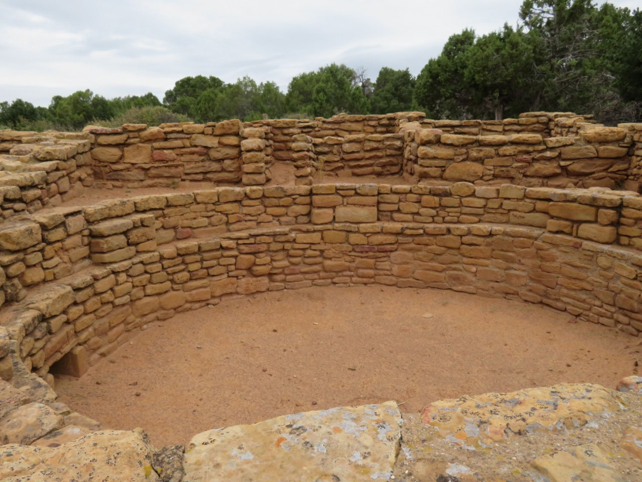
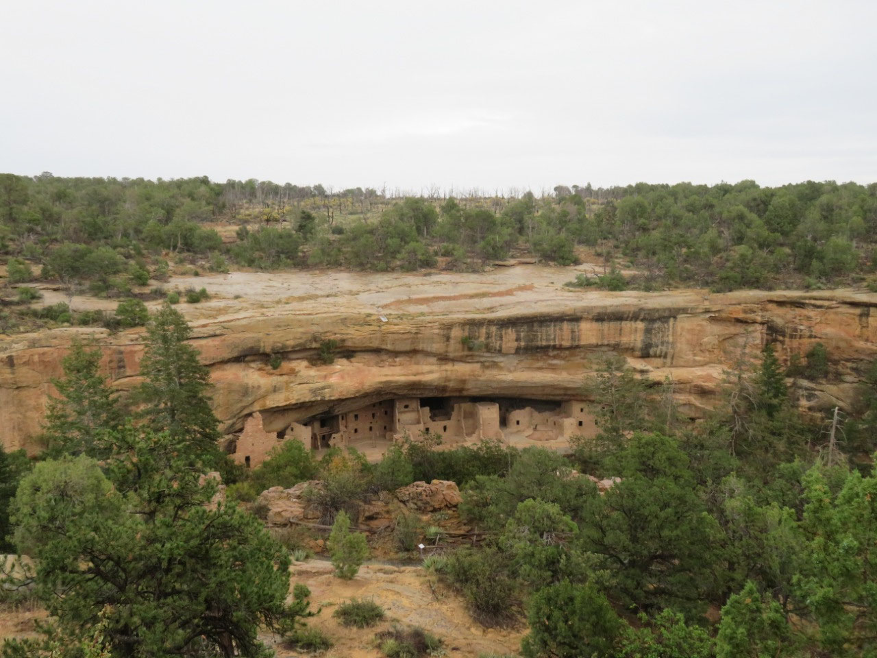
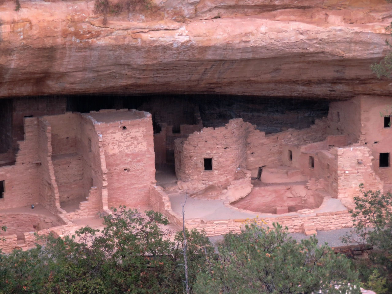
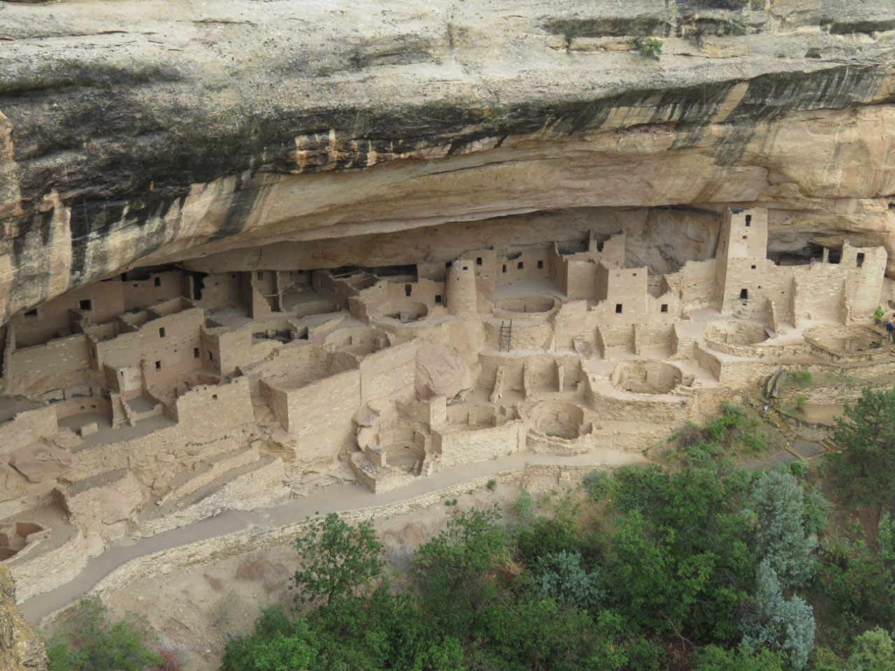
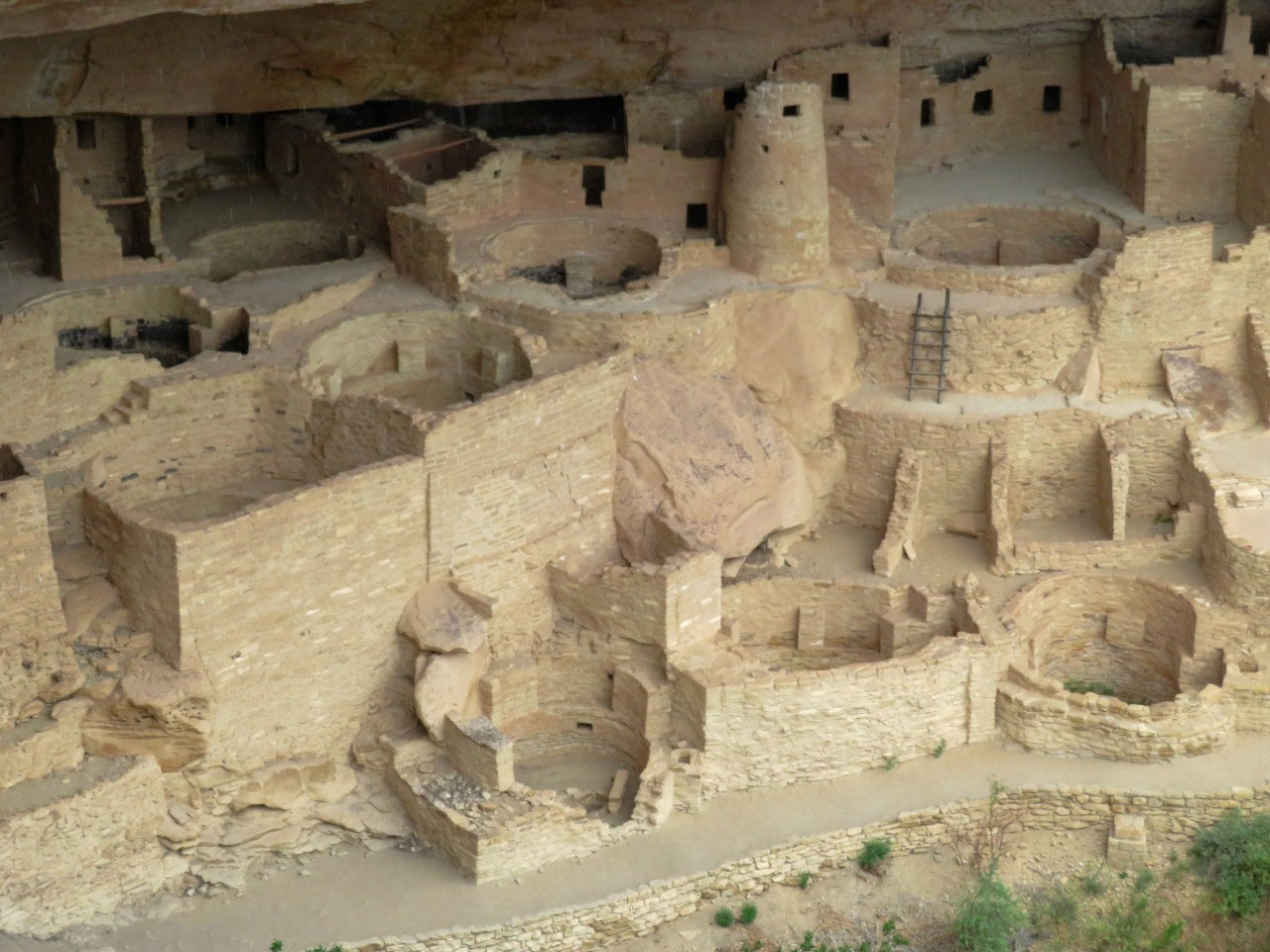
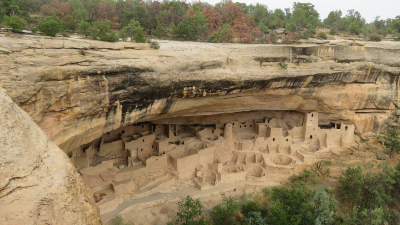
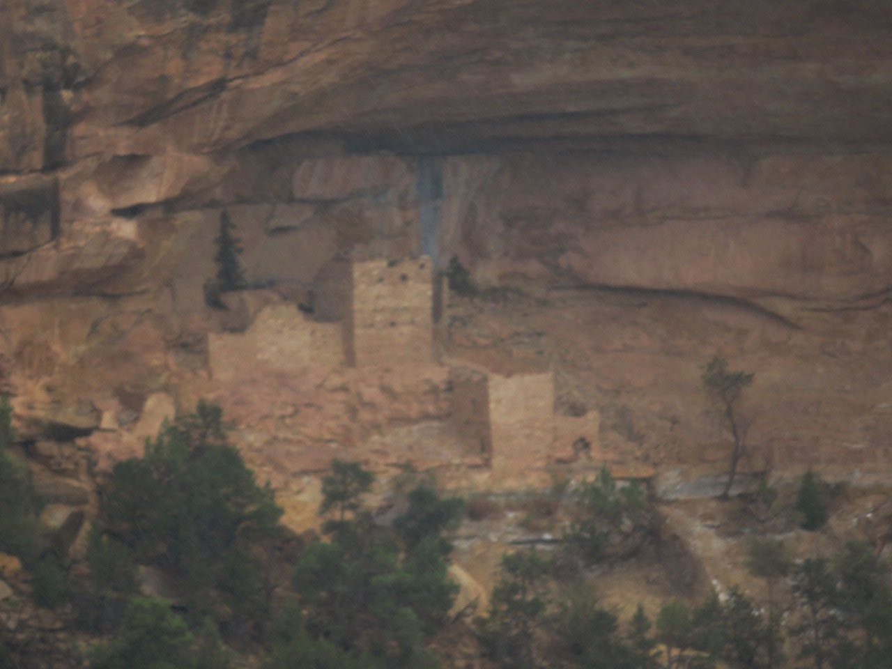
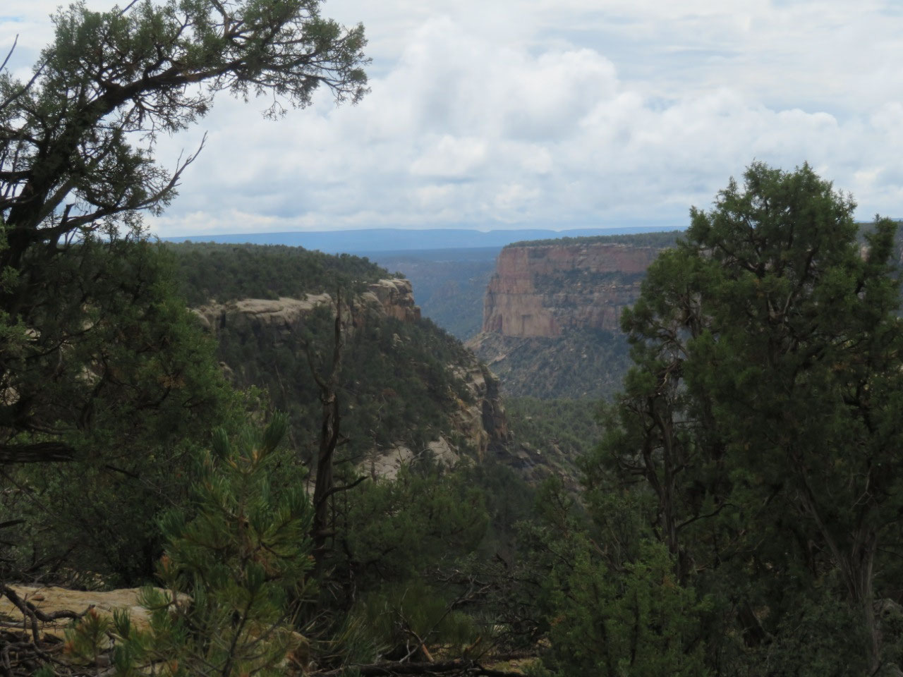
The Cliff Palace is the biggest cliff house in the park, by
just a little bit over Long House. We
did not sign up to take the Cliff Palace tour (it’s actually pretty hard to get
on a tour—they are on sale online 2 weeks in advance of the date you want, and
they sell out FAST!). We heard from some
other people that the Cliff Palace tour is good, but you can’t go up into the
house like you can at Long House. You
walk along the front edge of the house.
Still, you get a great view. The
deal-breaker for me is the climb out.
You have to climb up a REALLY long ladder, and the ladder is set at a
sharper angle than the ones at Long House.
I would not have known that in advance, of course, so I would have been
stuck, but my advice to you is skip it, unless you are part monkey! The prehensile tail would come in handy. There is a viewing platform for Cliff Palace,
and you can get a very nice look at it from up above.
Which we did.
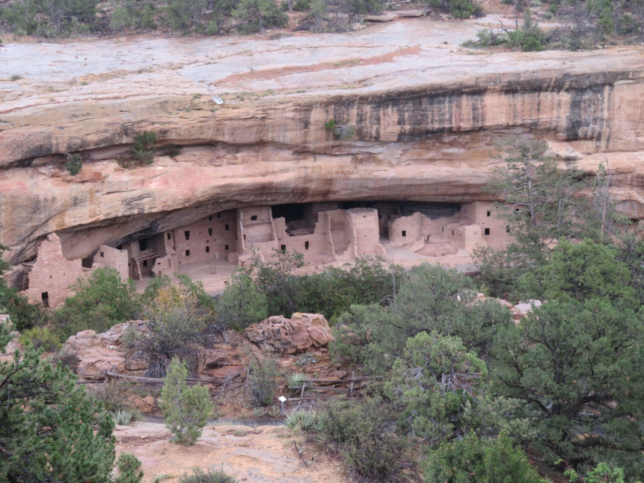
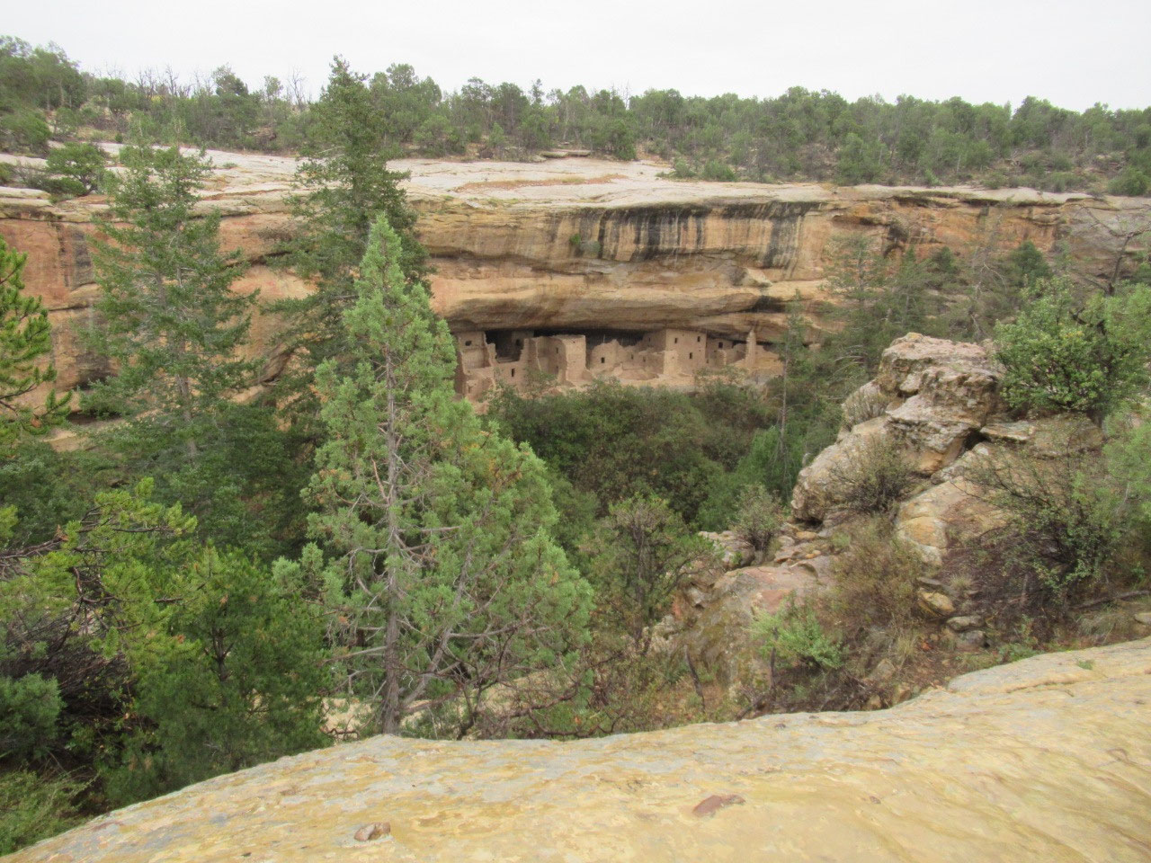
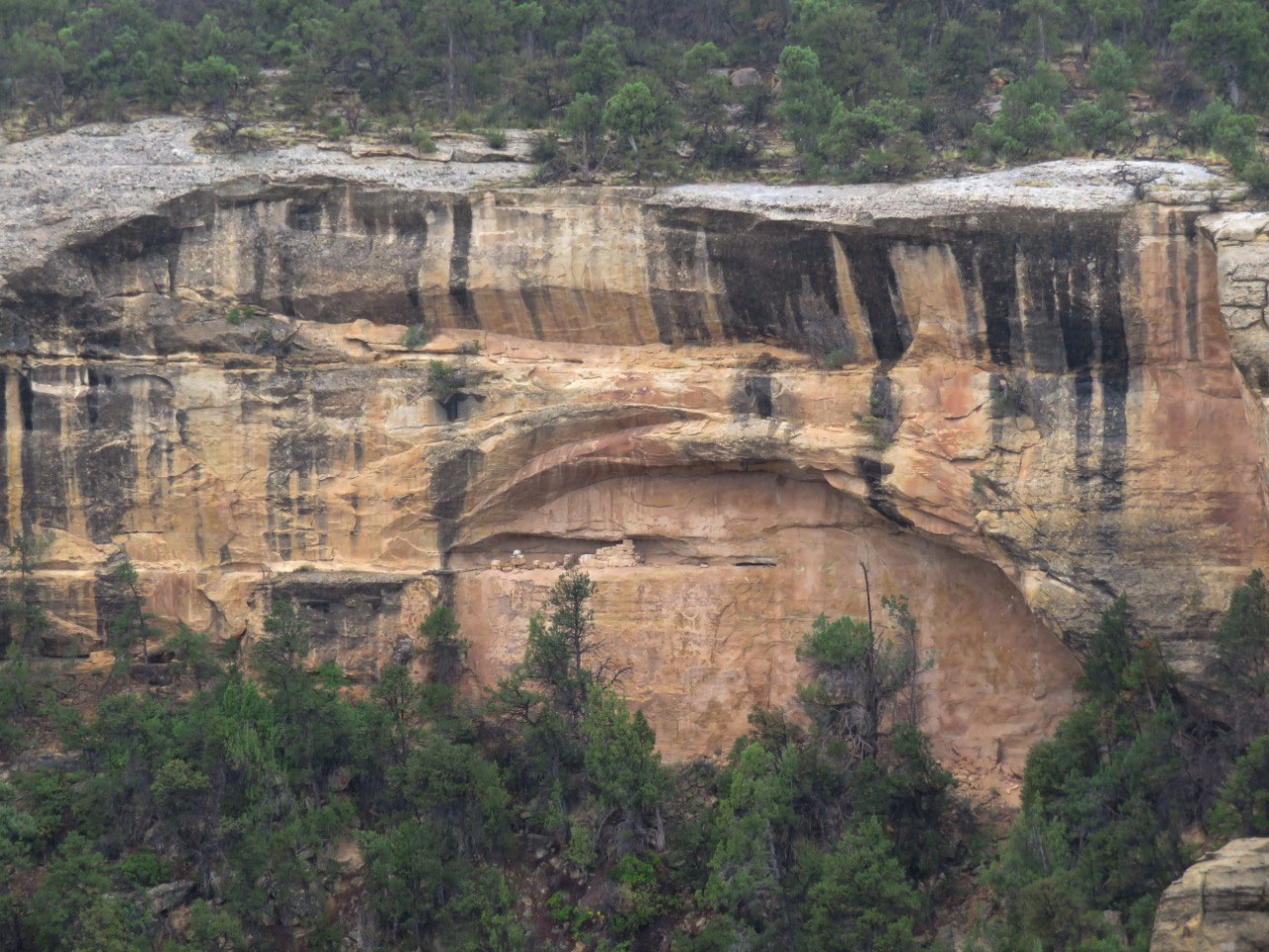
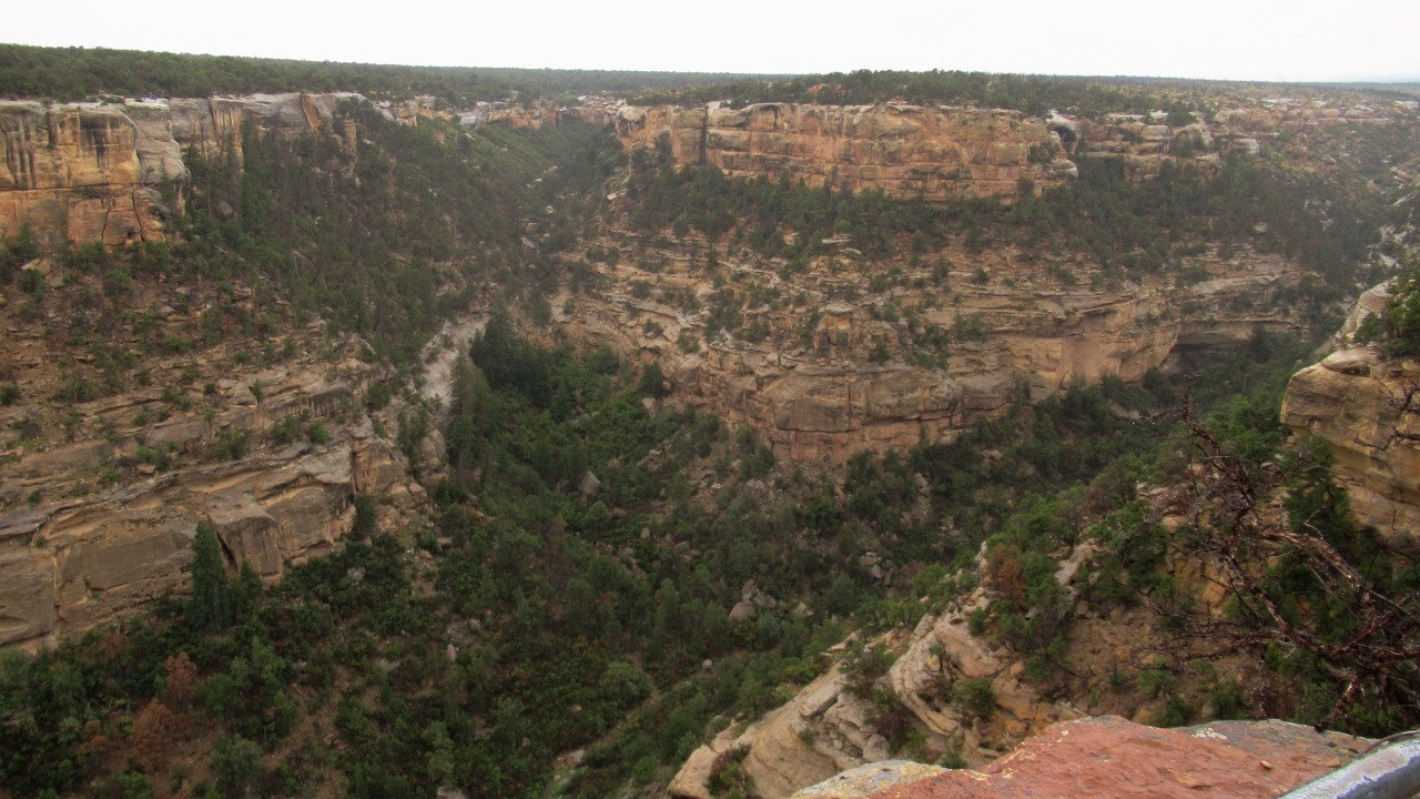
There are a couple of other overlooks on the loop, including
one which is not marked on the map and
is called something like “Canyon View” on the sign. It turned out to be a very nice overlook,
with a view into several cliff dwellings, as well as a great view of the canyon. While we were there, we ran into two
gentleman from Oklahoma who had been on the petroglyph trail. They showed us pictures—which were pretty
amazing. They also suggested that the
way to visit the petroglyphs is to start where the loop comes out and go
backwards, then turn around and come back.
That way, the whole approach is essentially flat, until the very end,
when you have to drop down to the level of the cliff where the petroglyphs are.
This encounter whetted our appetite for seeing the
petroglyphs ourselves, and, after lunch (which we had to buy, as it was raining
and there wasn’t a single covered picnic table in this end of the park), we
decided to give it a go. It actually
stopped raining just about the time we finished lunch, and the sun started to
come out.
This was encouraging.
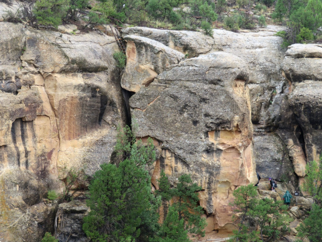
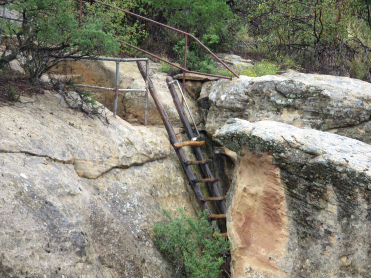
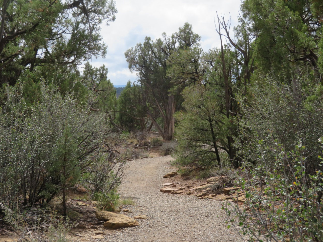
We set out at 2:00, armed with water and umbrellas. The walk was, indeed, mostly flat all the way
to the last 100’, where we did, indeed, have to drop down to the level of the
petroglyphs. We ran into a few people
climbing up, all of whom warned us that this drop was very hard and that we would
need to be extremely careful.
They were not kidding.
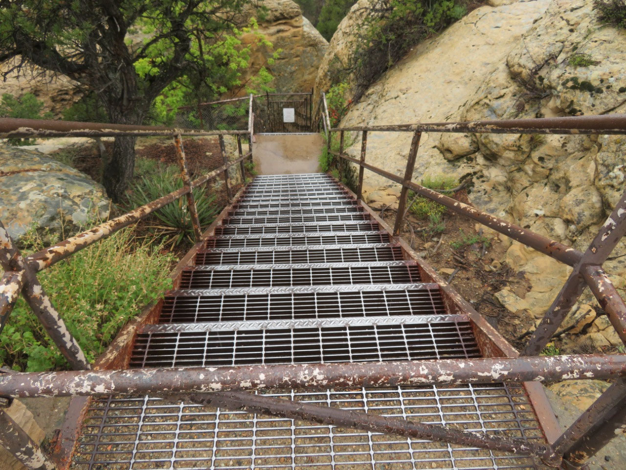
The drop was not far off vertical.
There were some places where the park service has made steps out of
stones, but a lot of the journey requires you to clamber down the rocks that
were already there. Imagine a 10-story
staircase with steep, uneven, steps and no hand rails. I went down a significant chunk of it sitting
on my batootsie, because that was the best way to keep my center of gravity
back against the cliff, and to figure out where to put my feet next. I didn’t
take a single step down without being absolutely certain that I was going to be
stable. Tim went first and gave advice
about what to look out for which was VERY helpful.
Right at the end, there’s a spot where you
have to use a handhold which someone carved into the rock so you can step onto
a small ledge and then down. Made me
feel like those Ancient Pueblo people who clambered up the cliff side on little
hand- and foot-holds carved into the rock.
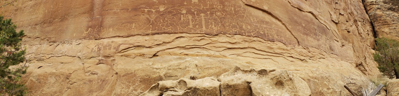
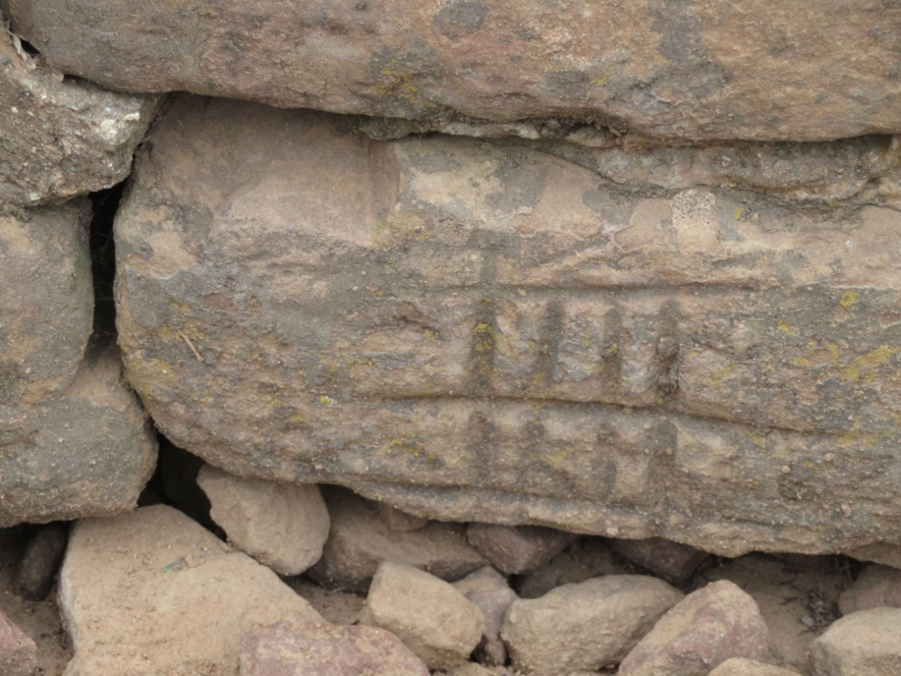
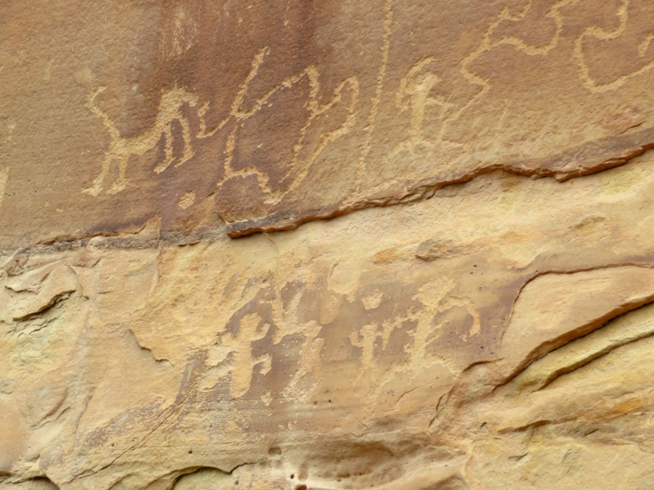
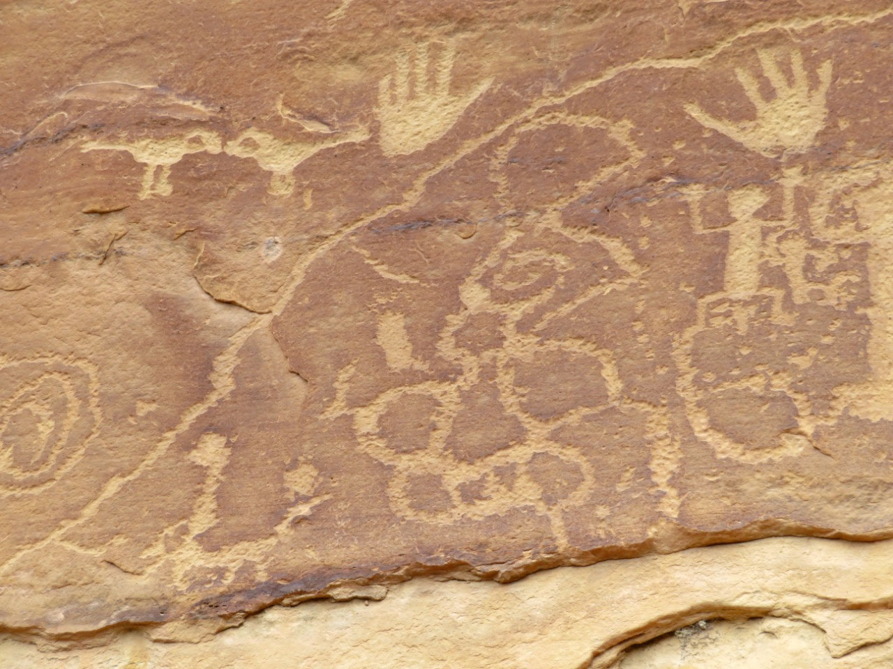
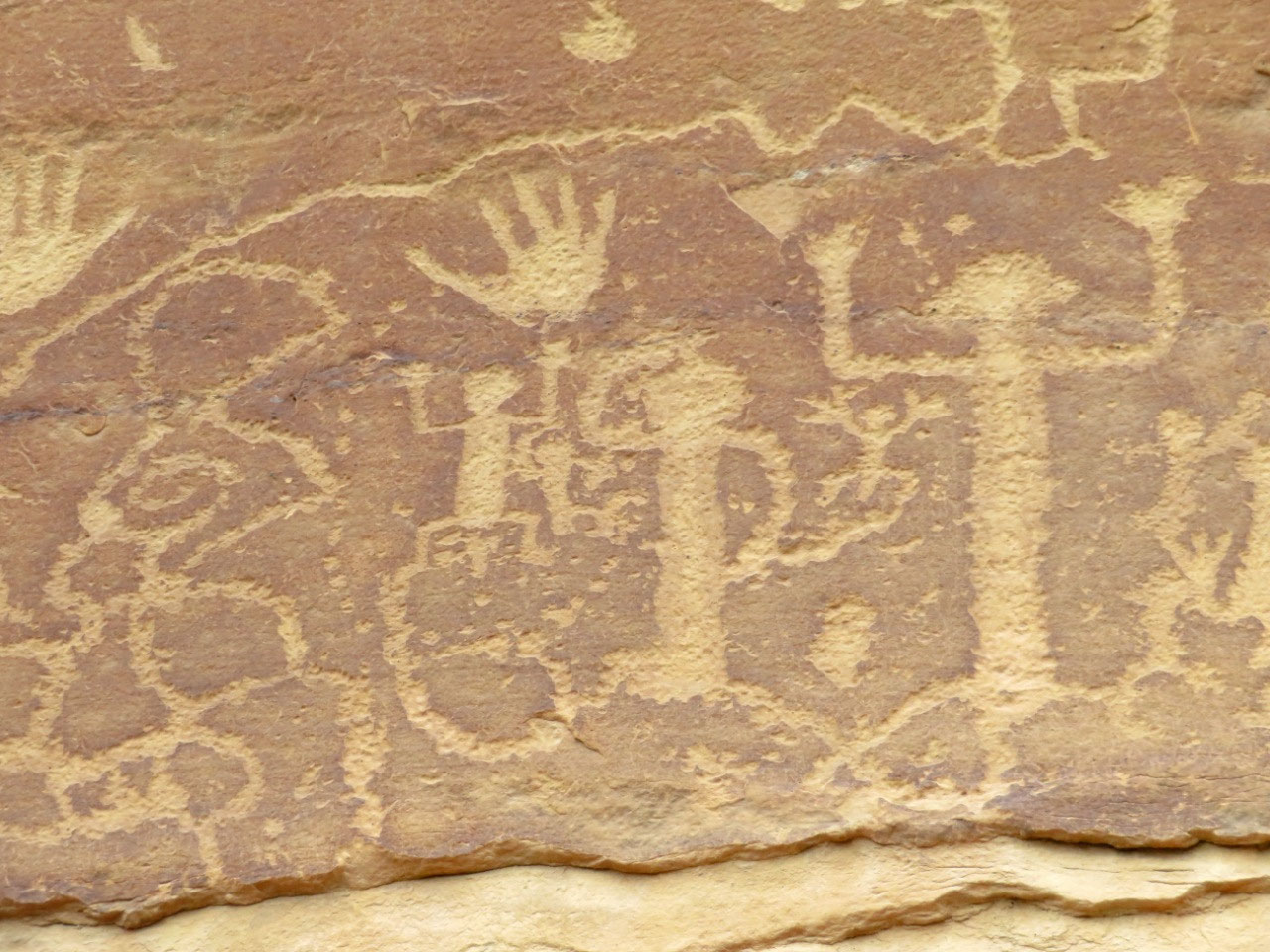
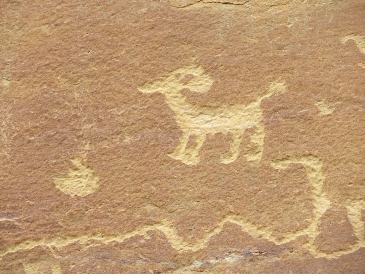
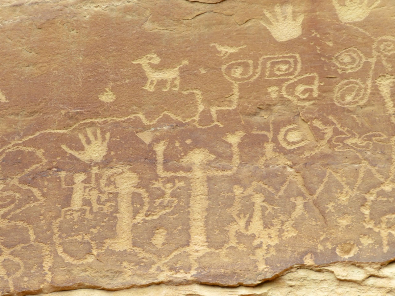
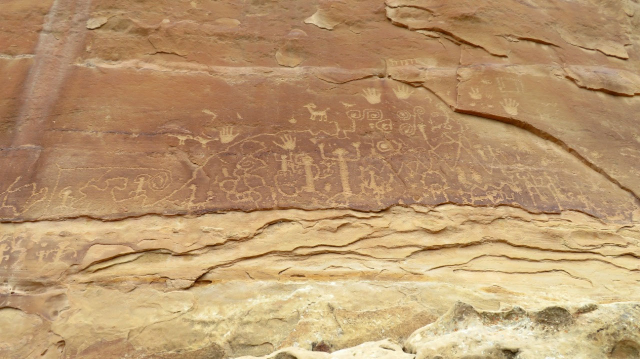
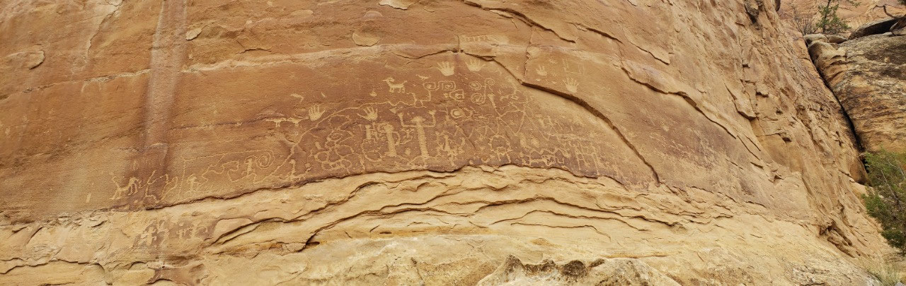
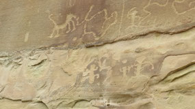
We made it down, however, and, I have to say, the trip was
worthwhile. The petroglyphs are
spectacular. They are also just high
enough above the trail (such as it is) that they have been safe from modern
human vandalism. The panel is maybe 20’ wide
and 10’ tall in the center. The drawings
curve downward from that middle high point to make a shape like an arch. I am posting lots of photos of the
petroglyphs, because they are the hardest-won of the trip, and the sight is
pretty darned spectacular.
The trip back was easier—going up that narrow, steep, rocky,
“staircase” is easier than going down. You
can use your hands to stabilize yourself up above your current position, and
your center of mass is already leaning in toward the cliff.
I bet I made it up in half the time I made it
down, still without ever taking a step I wasn’t absolutely sure about.
We got back to the car at 4:00—exactly 2 hours after we
left. Fitbit says it was a 4-mile round trip, which is longer than park
literature says. In my opinion, it’s
totally worth the effort, but you do really have to be aware of the
difficulty. The way we went was the easy
way. If you go around the loop they way
that the park service suggests, you have to climb way down into the canyon and
back up (about 175 feet elevation change each side), AND you have to climb up
that “staircase” we used. Down the
staircase is harder than up, but it’s not harder than the climb down and up the
canyon.
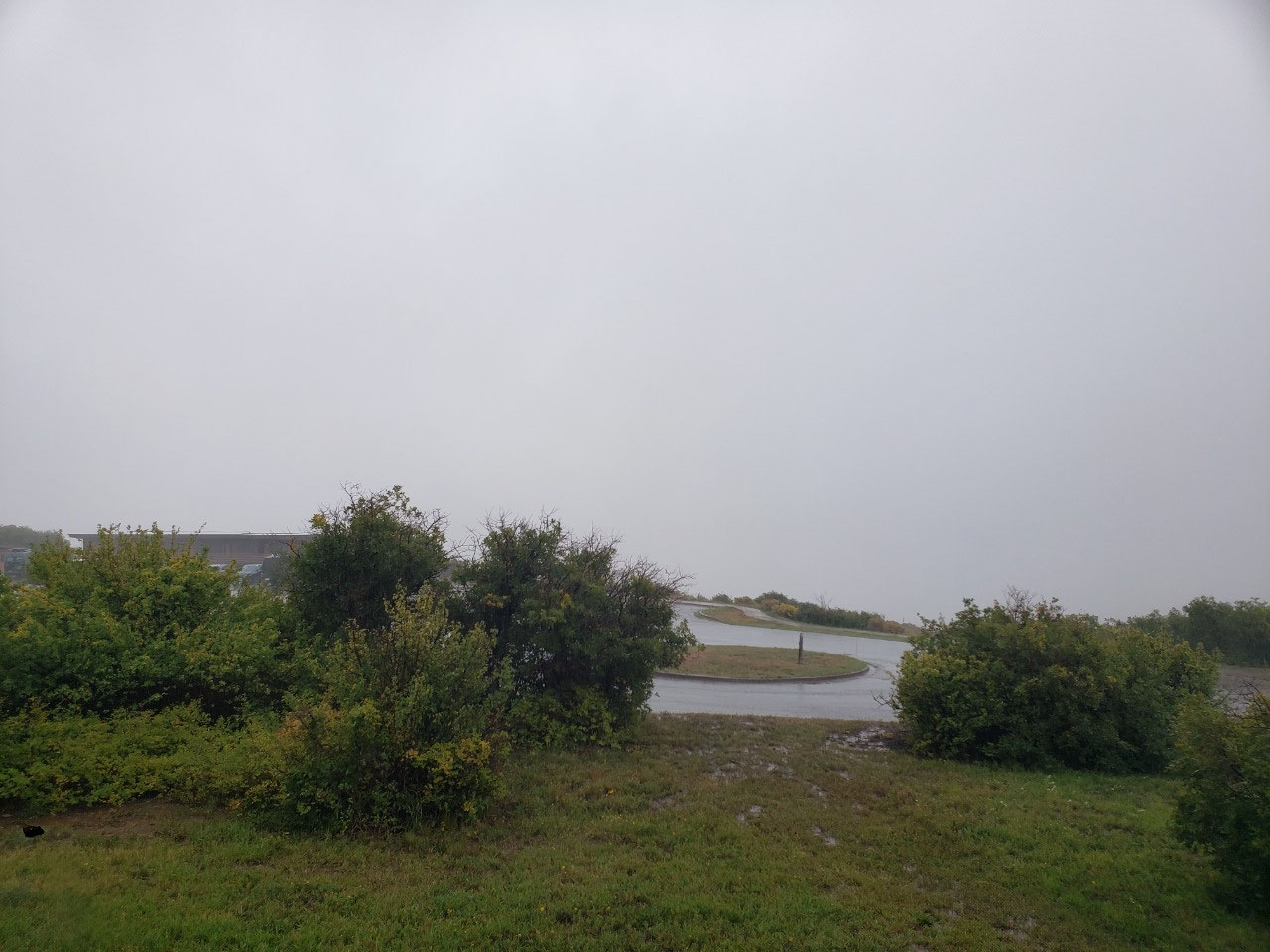
We got back to the lodge about 4:30, and by 4:45 it was
raining hard, including thunder. By 5:00
it was pouring, and there was no visibility beyond the parking lot. Temperature
is 54 degrees down at the bottom of the mountain; must be colder here. I had to turn the heater on in the room! We were very fortunate, today, with the
weather: it did not keep us from doing anything we wanted to do.
This is our last day in the park, and it has been a great
experience. If you ever get the chance
to visit here, do it!

2025-05-22