 Ein Gedi, South District, Israel
With an early start, we successfully retrieved the car from its tight parking spot and managed to negotiate the narrow neighborhood streets, pick up our luggage and find our way out of
Jerusalem with reasonable efficiency. In this instance Shabbat worked in our favor as there were very few other cars on the road. Although you expect a drive to a whole other region of the country to take a while, Israel is so small that we were there in less than an hour and a half.
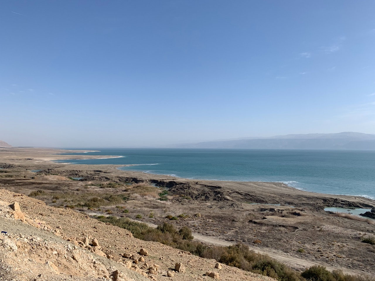
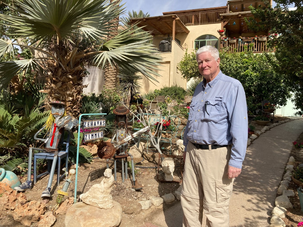
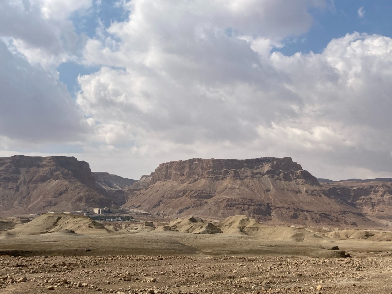
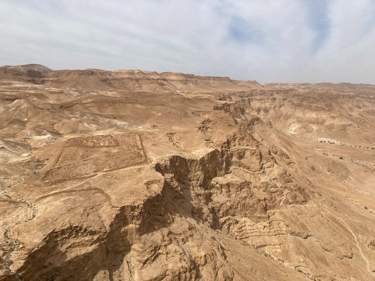
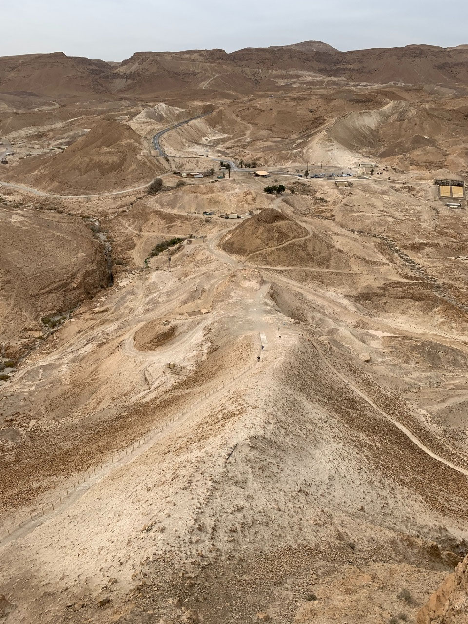
We met Zehava and Danny, our AirBnB hosts, at the En Gedi Kibbutz. Like Orna, they had no problem letting us check in early, after which we headed about 15 kilometers south to Masada. The fortress of Masada sits atop a small plateau with steep cliffs on all sides. The
main construction on the plateau was done by King Herod as a palatial fortress in 37-31 BCE and later supplemented by a variety of groups including, most famously, a group of Jewish rebels when the Great Revolt began in 66 CE. The Romans did not take kindly to the occupation of Masada by the rebels and sent an army to roust them in 73 CE. Initially the rebels were able to hold them off as the only access was by a winding "snake" trail up the side of the steep cliffs. However the Romans eventually just built a dirt ramp up the shorter side of the plateau, a testament to the famed Roman engineering skills. When it became apparent that the next day the Romans
would be able to invade the fortress the rebels all committed suicide, cementing the place in legend (two women and five children survived to tell the tale) and creating a national mantra, "Masada will not fall again". At least that is the most common version; some scholars believe a mass suicide never took place (or if it did, it was not particularly admirable) and that the Jewish defenders were a radical group called Sicarii who were extremists known for killing other Jews at the time. Always two sides to history, if not more.
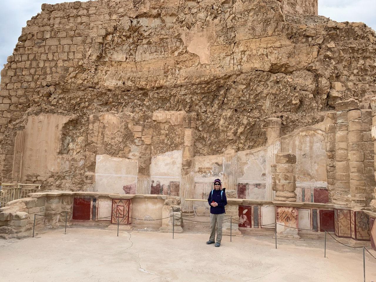
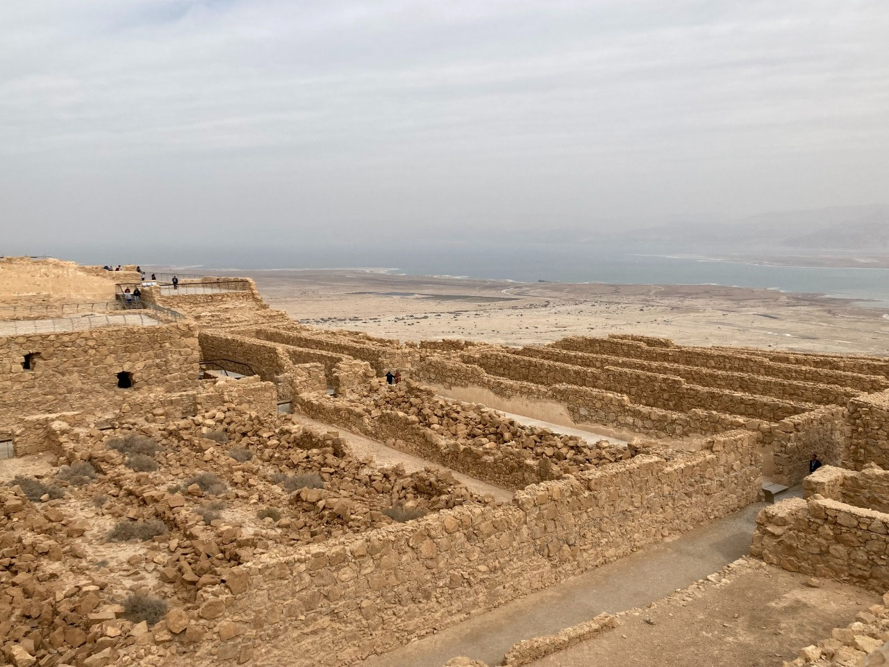
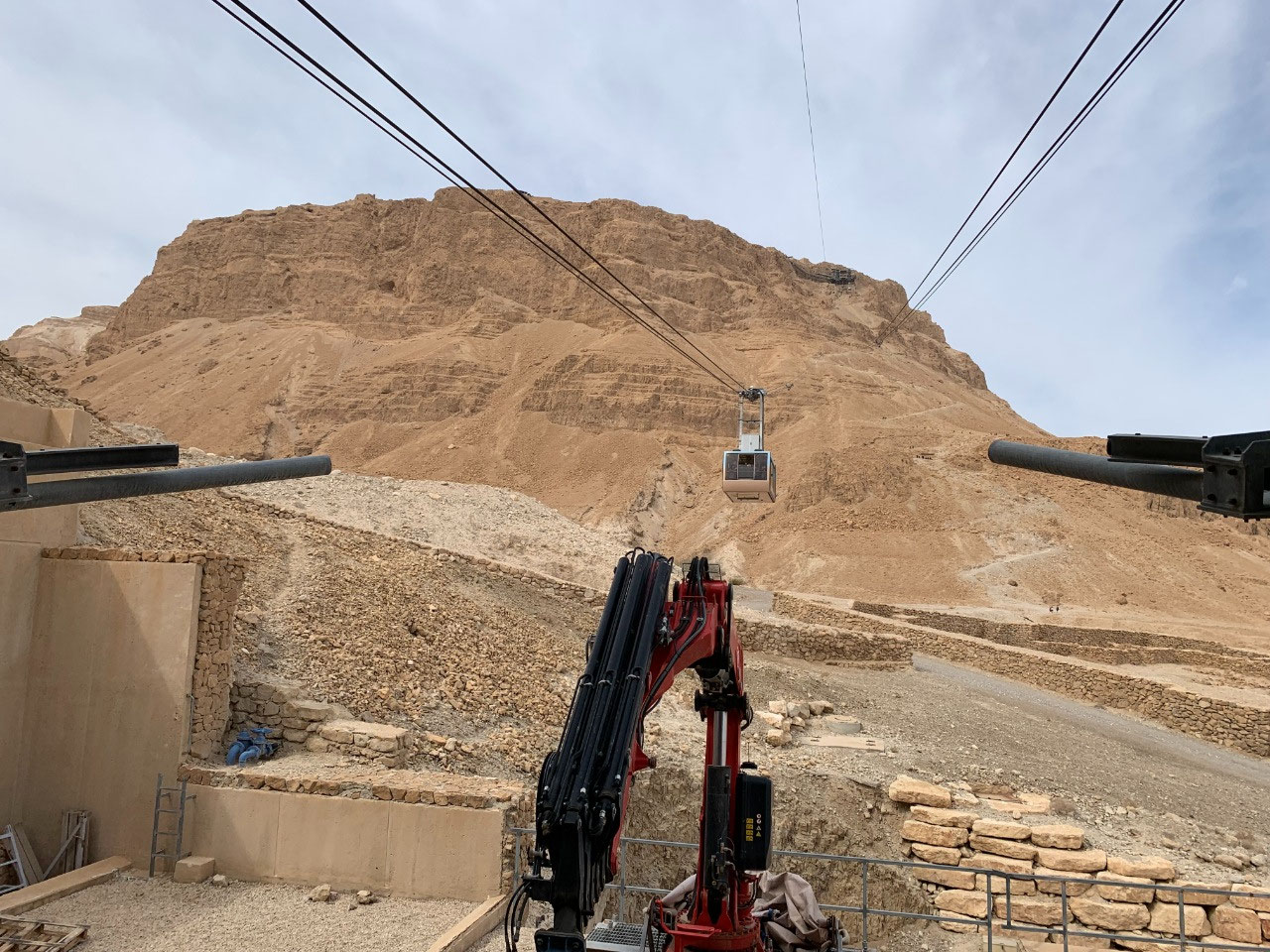
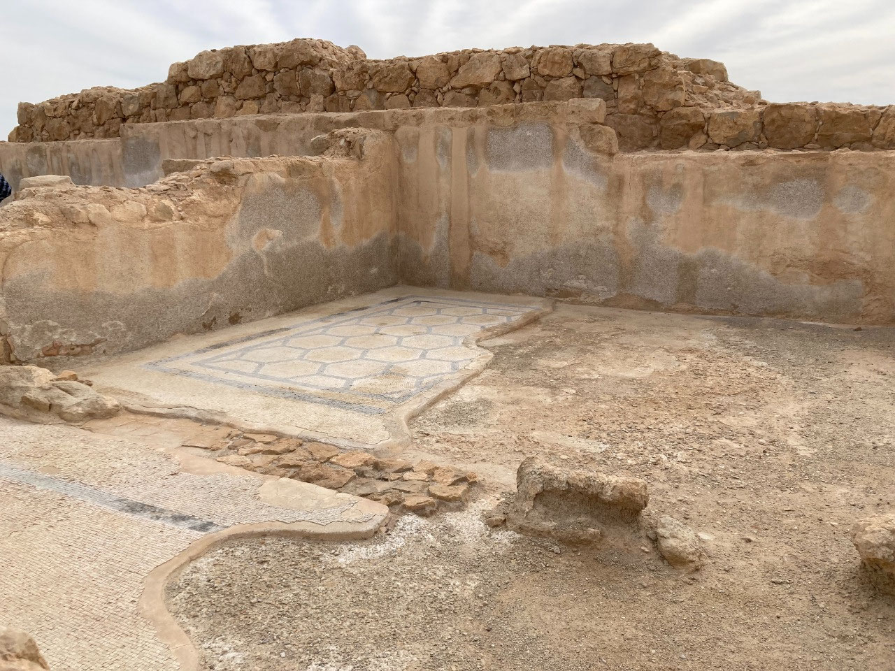
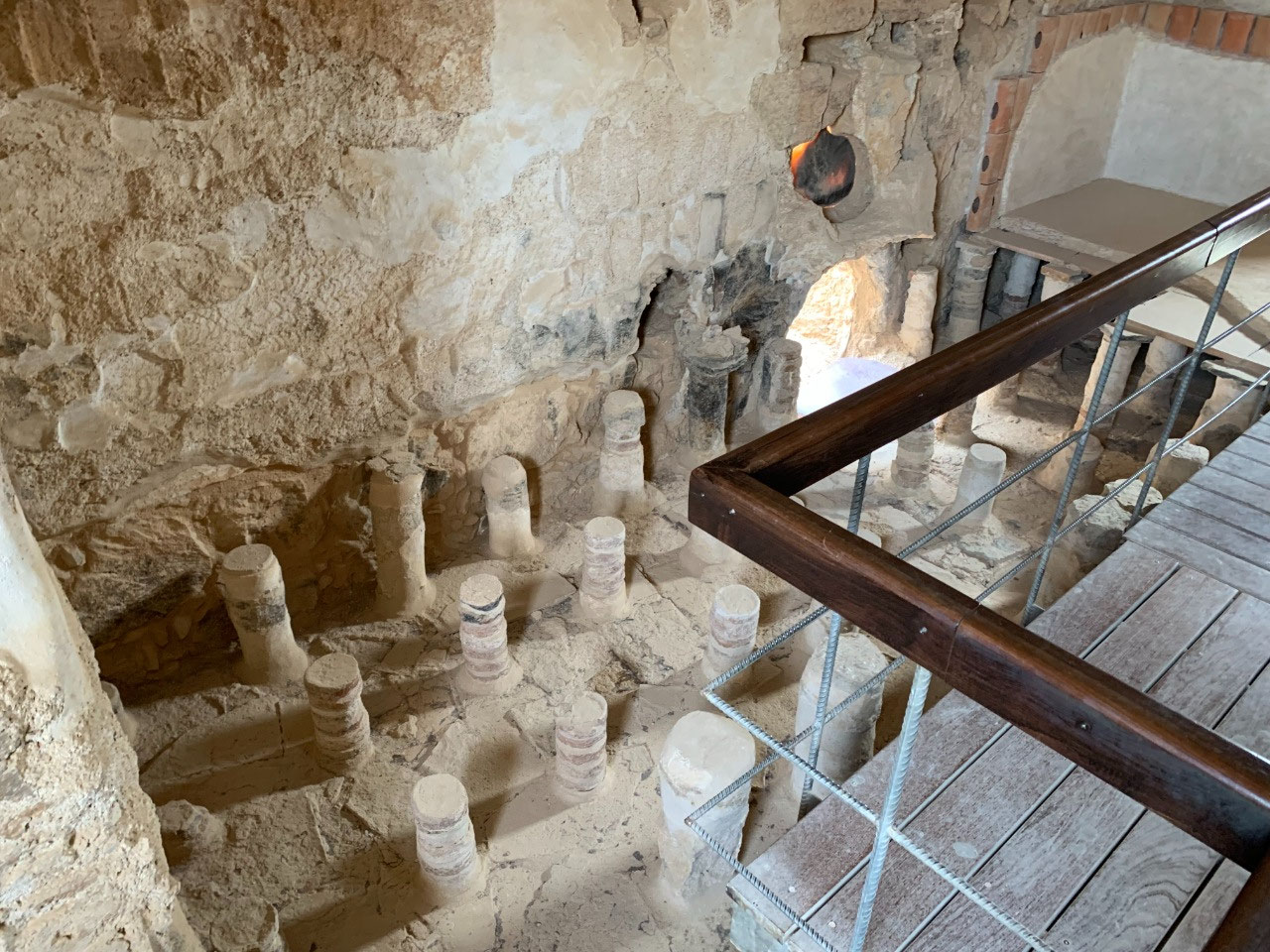
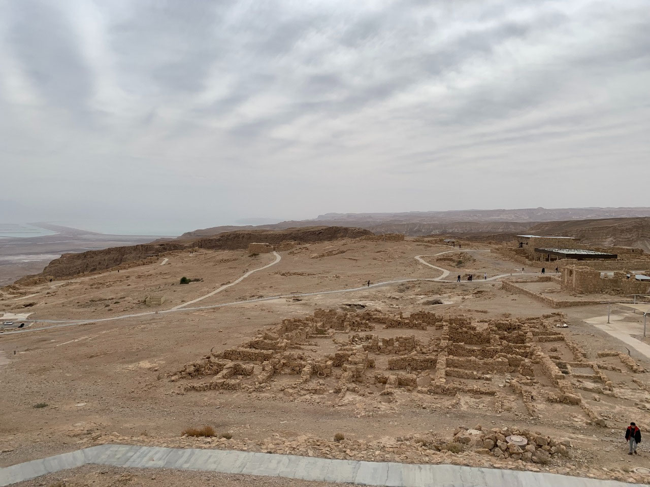
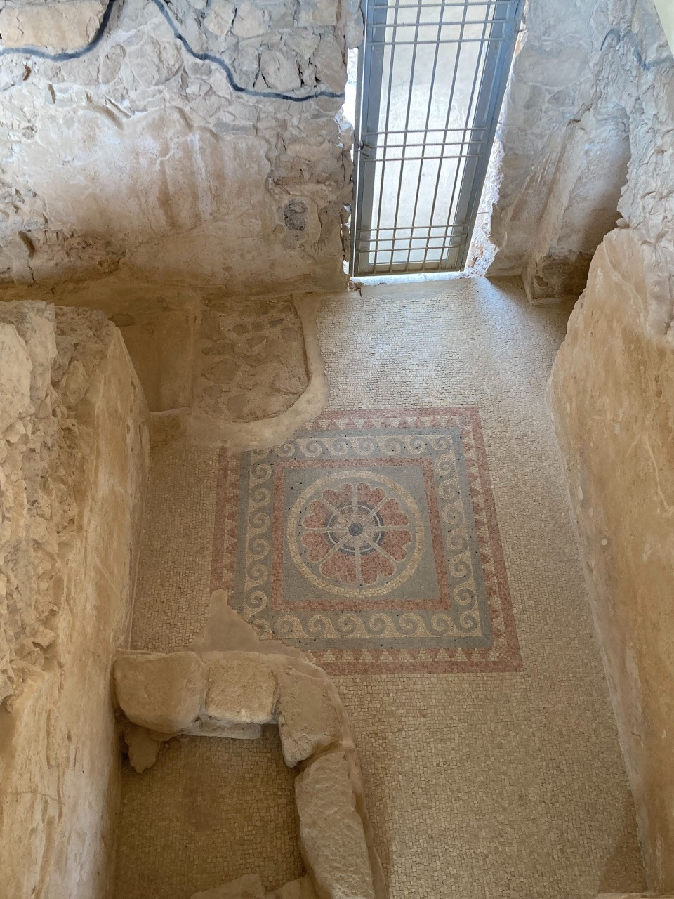
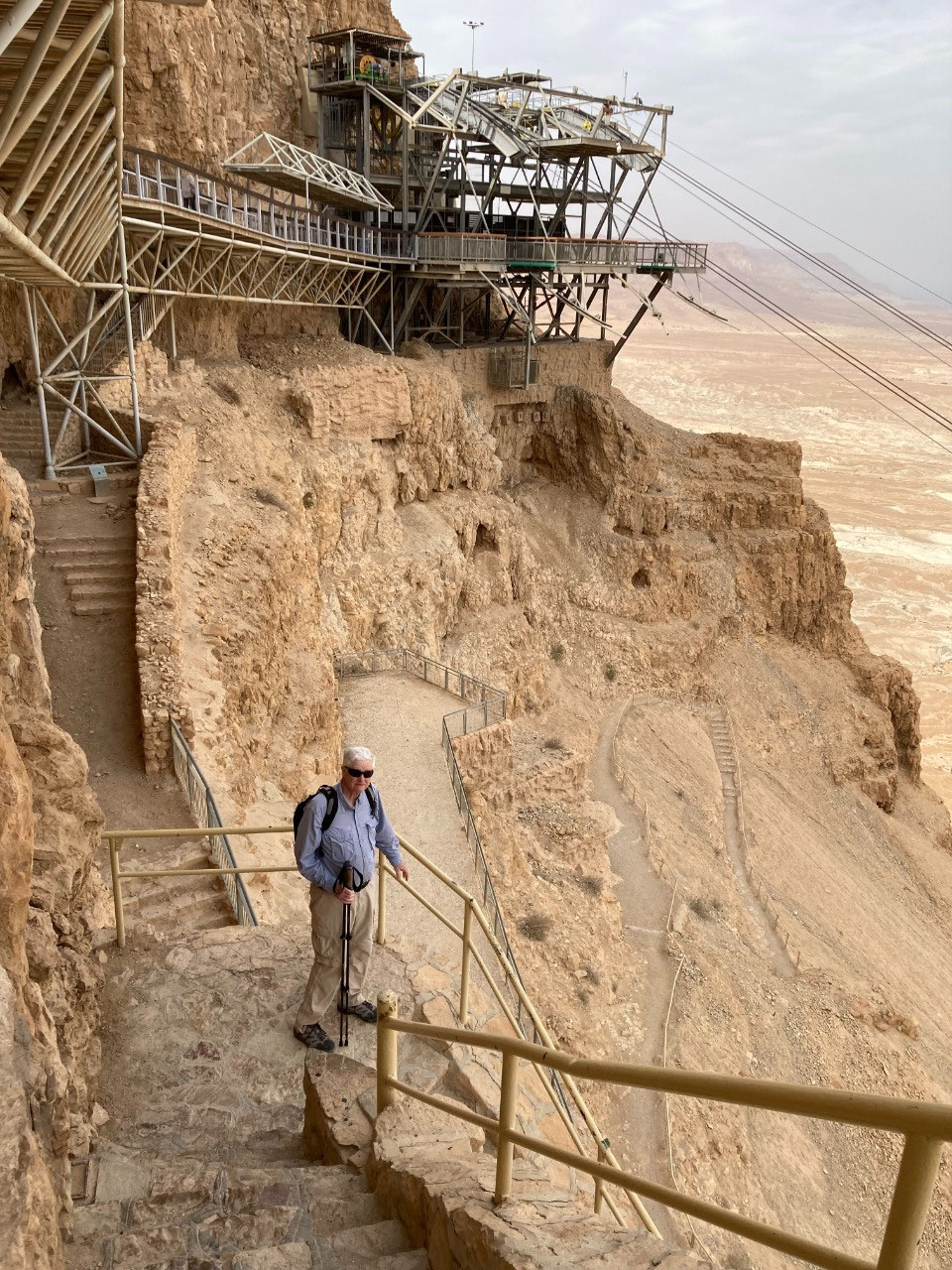
Craig visited Masada 50 years ago when it was primarily accessed by walking up the Roman Ramp and had been subjected to very little archaeological excavation. Now you can zoom to the top in a cable car and the ruins are well excavated and in many places walls are
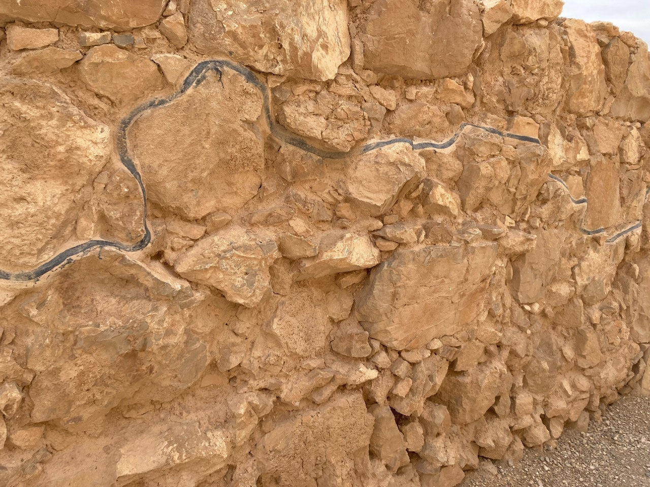
restored to their original height and form. (There is a dark painted line that runs through almost all the structures that shows the original height of the ruins.) Also some of the most interesting places such as Herod's palace on the north end were inaccessible because there was no way to safely reach them. Today there are nice secure stairs along the sheer cliffs that lead you to the lower levels. Another big change brought about primarily by that cable car is the number of people. Fifty years ago there were few tourists; today there were many tour buses in evidence. Craig found it interesting that in 1973 the sense of the place was mostly about the zealots and their fight against the Romans. While that is certainly the backdrop to the site today, the
archeological efforts now seem to point you more towards the site in the time of King Herod. Not sure this is an improvement but hey, Craig's gotten old, he doesn't like change; deal with it.
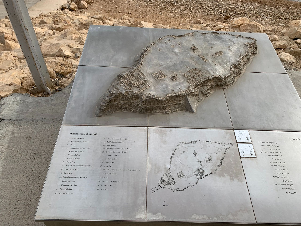
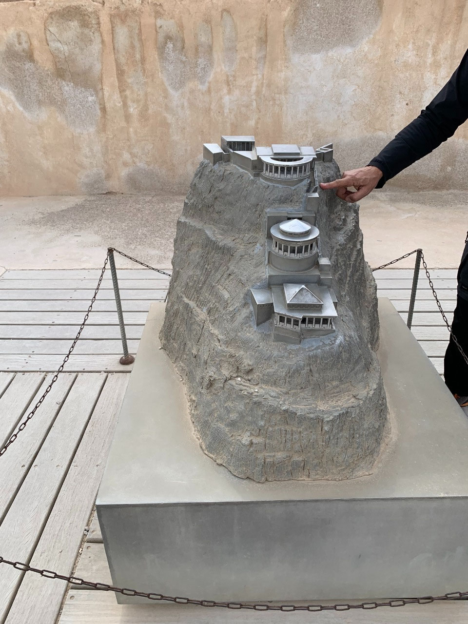
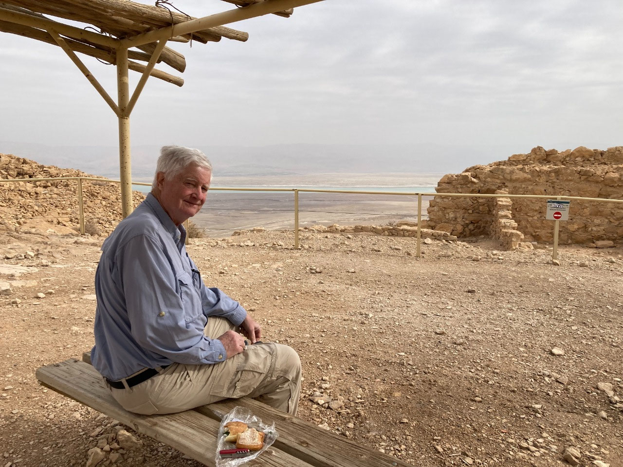
In spite of his grumblings, Craig had to admit that the palace levels on the north end were nothing less than spectacular. Three levels, stepping down the nose of the almost sheer cliff face; Herod had a rock cut staircase connecting the levels that he used but we modern mortals have to use a steep metal external staircase. The view was spectacular for Herod and his invitees (the Northern Palace was open only to a limited few).
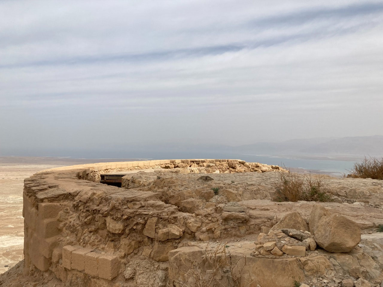
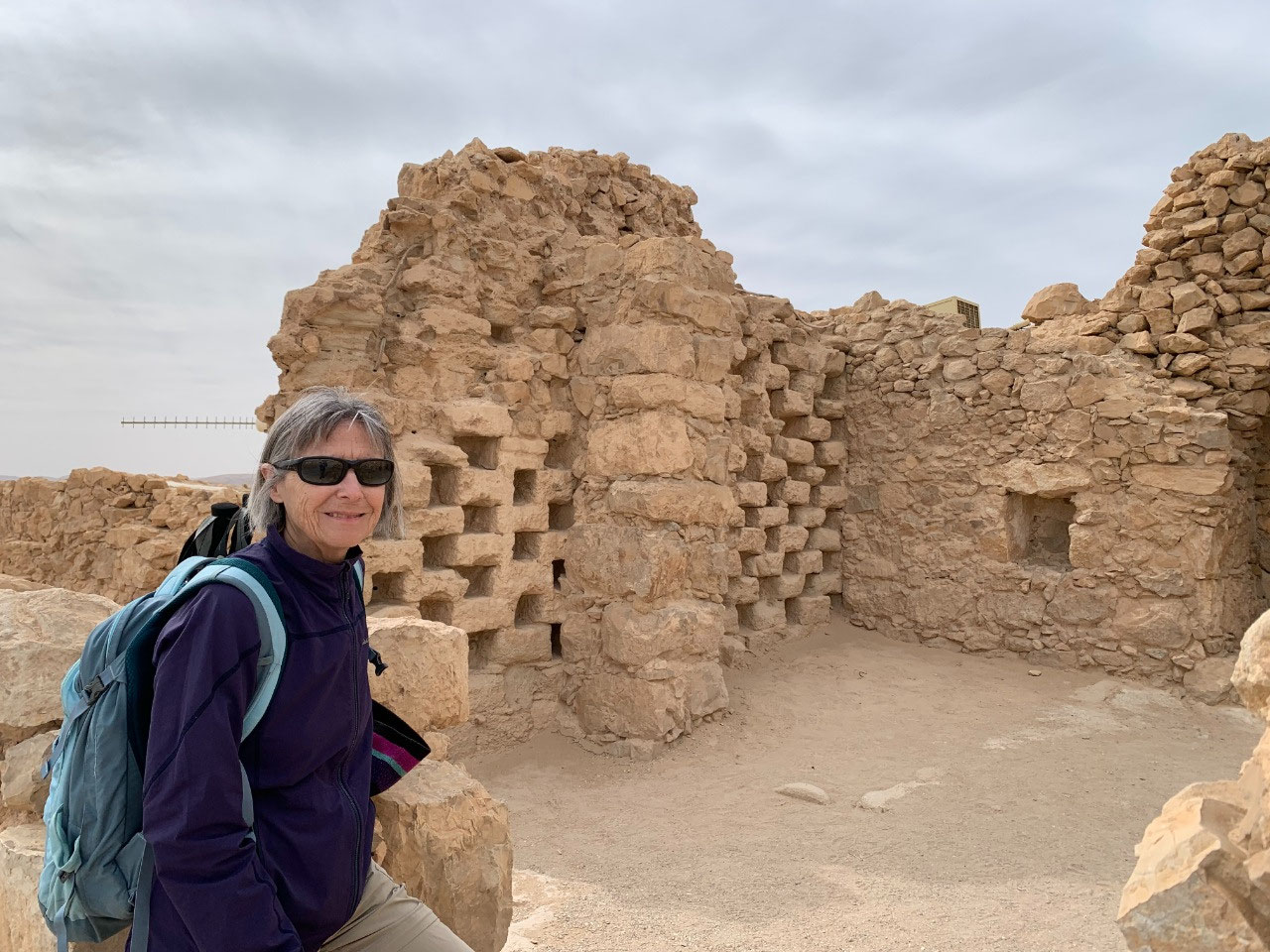
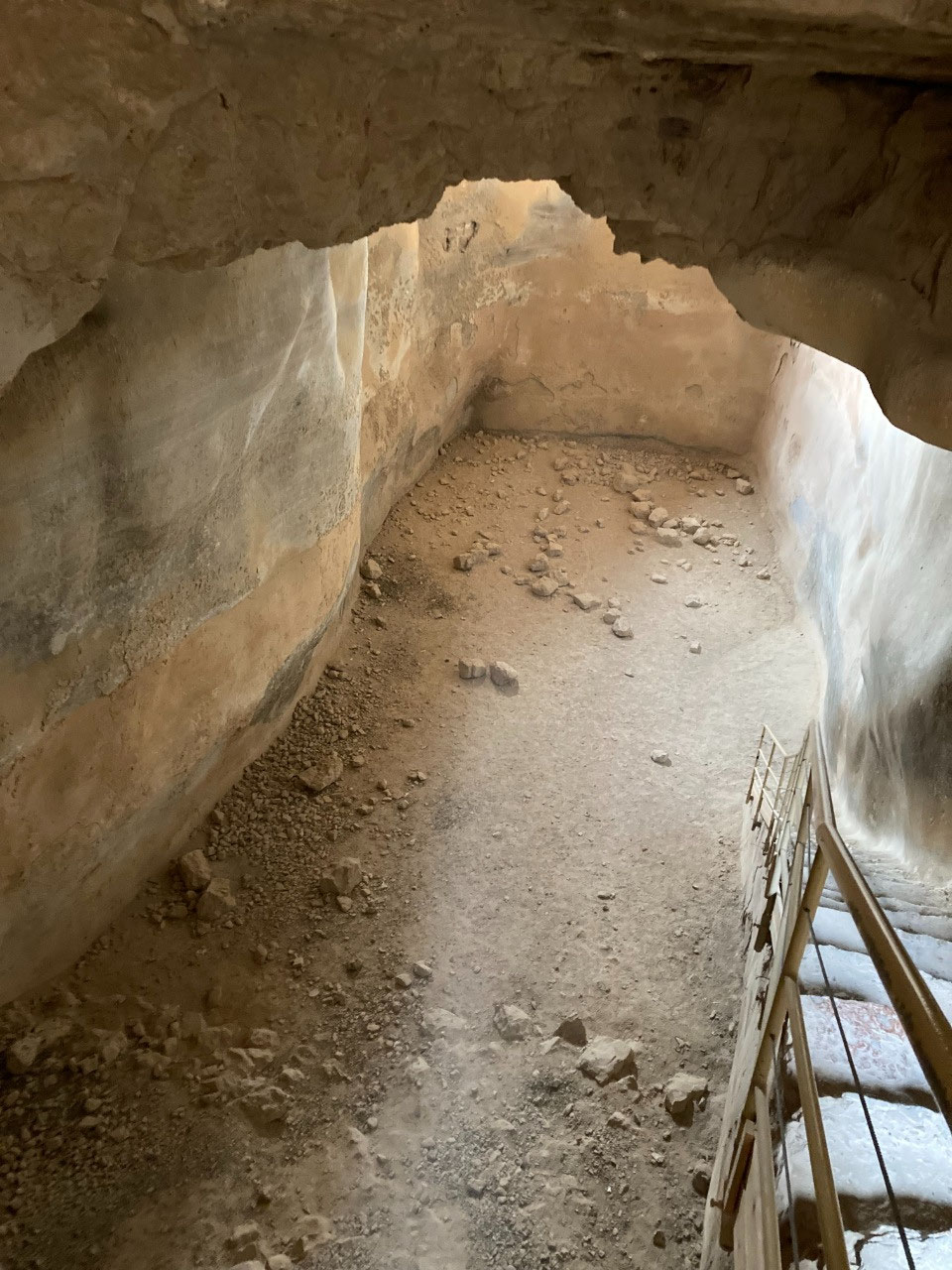
The rest of the site was also pretty spectacular. The Water Gate; we looked at the signs and models but still do not quite understand how water coursed part way up the massif to large cisterns in the western side. We do understand that from there donkeys carried loads of water up a trail that no longer exists to the top to fill other cisterns. Throughout the ruins there are numerous dovecotes, where pigeons were raised for their meat and droppings to be used as fertilizer. Ruins of structures on the southern half of the plateau, including several other lesser palaces, a massive water cistern, and a public bathing pool. Also a fortress on this southern end, which surprised us because the sheer sides on the south looked pretty
impregnable but apparently afforded some access in ancient times. Several earthquakes have hit this site, and perhaps that accounts for the different southern cliffs in modern times.
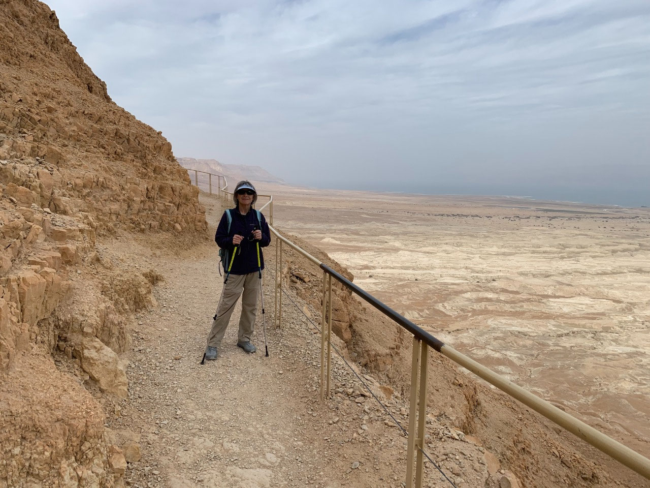
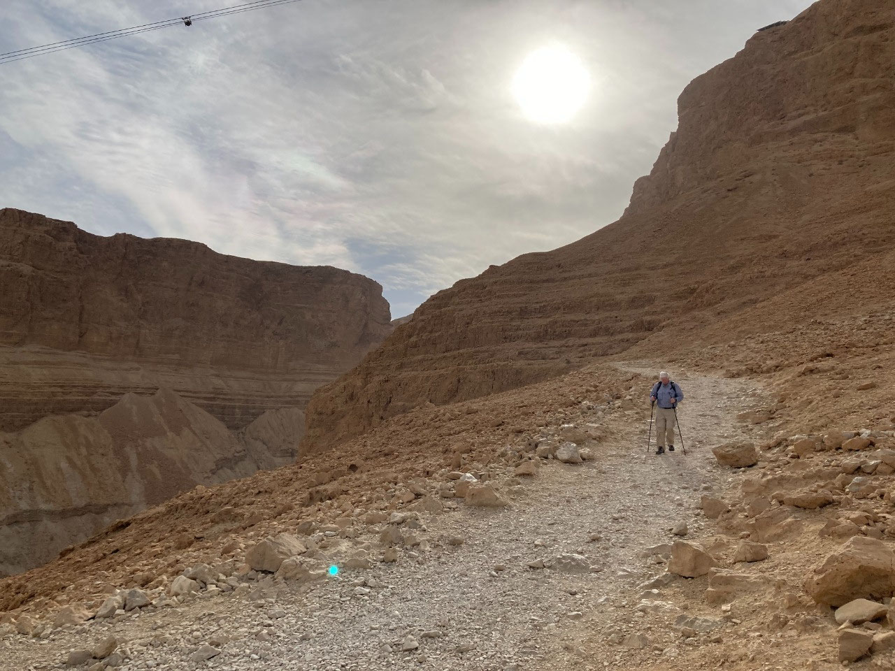
We left Masada the old fashioned way, via the Snake Path, eschewing the cable car down. We were surprised to pass several groups walking up, even though they were not likely to arrive at the top much if any before closing time. Perhaps just to check off their to-do list of hikes?
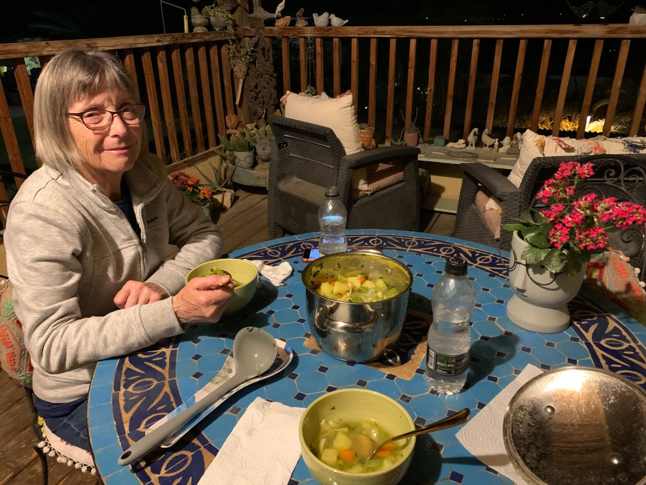
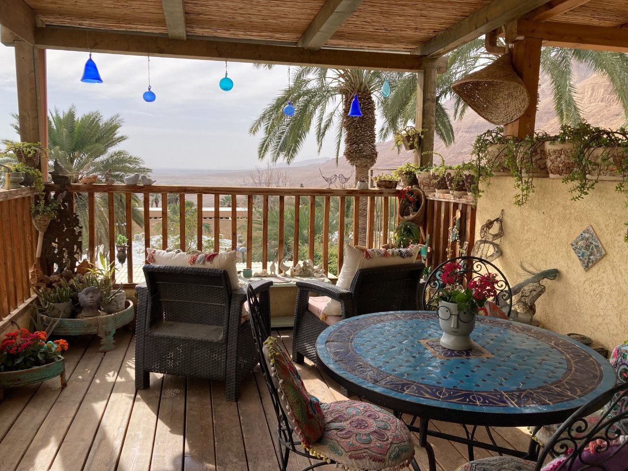
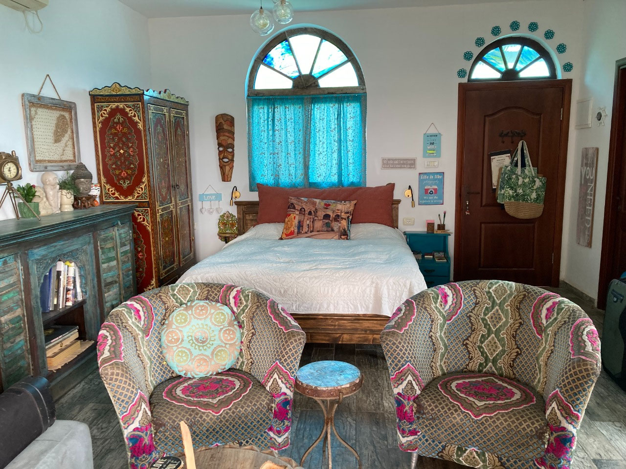
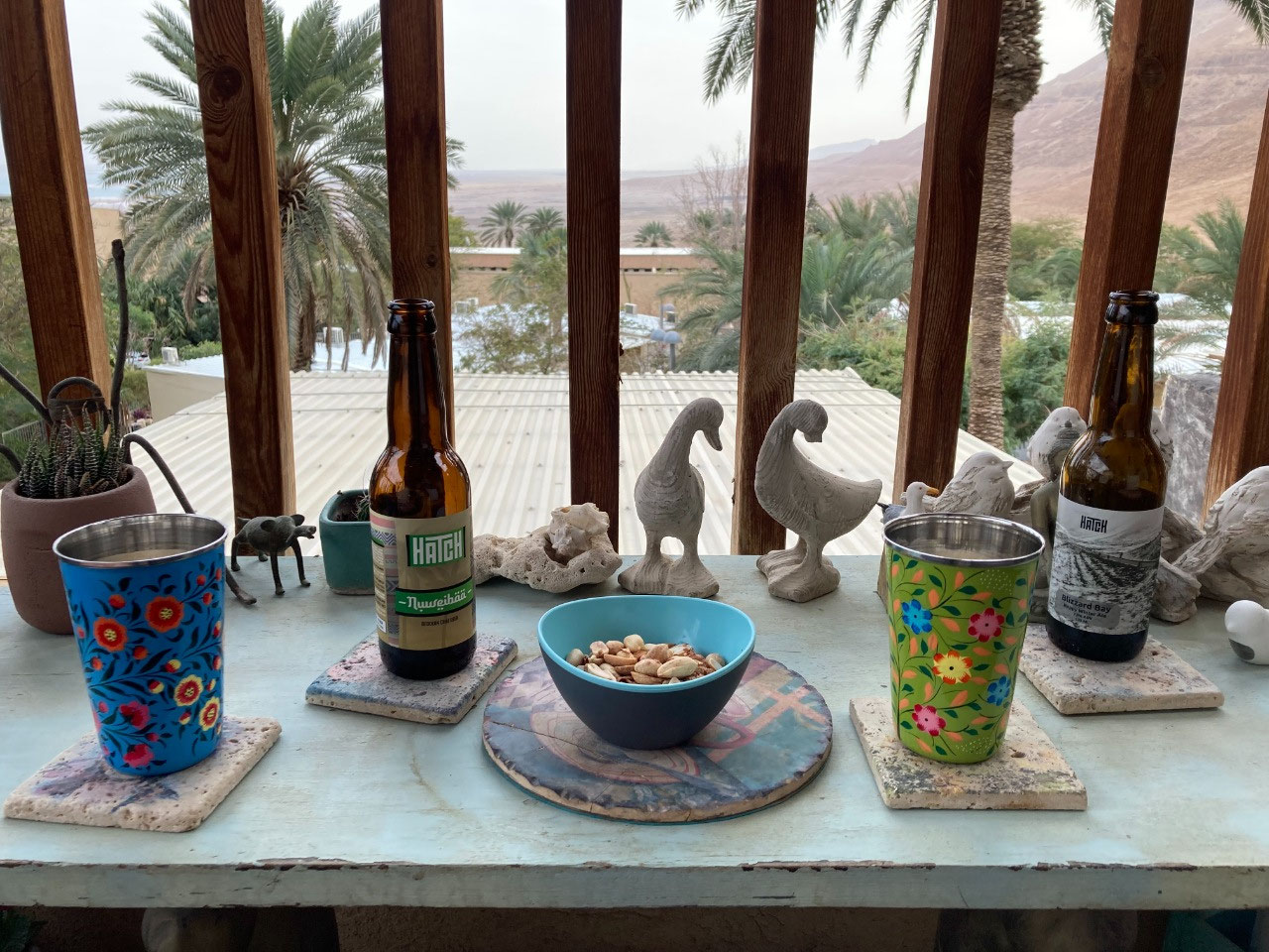
We returned to Zehava's Zimmer in time for the cocktail hour on the deck, using a couple of our Hatch beers, and finding a text from Zehava announcing she was cooking a large pot of vegetable soup for our supper. We were not expecting this but it was very welcome and very good. This woman is a fount of energy (and more than a little eccentricity, based on the apartment furnishings!). We fell asleep completely satisfied with our day.


2025-05-22