_________________________________________________
YOU TUBE - http://www.youtube.com/user/TravelsWithLobo
---------------------------------------------------------------------------------
Date: June 23, 2007
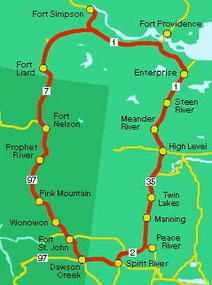
Distance Driven - 517 km - from Fort Nelson, BC to Fort Simpson, NWT
Distance on the Liard Highway - 255 km
Total Time: 14 hours
------------------------------------------------------------ ----------------------------------------------
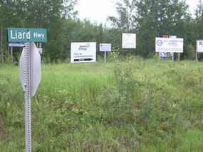
Driving the Liard Highway (Trail) - Day 3
One of the neatest things about driving the Liard Highway (Trail) is the angst that one feels the evening preceding the actual drive.
I think I even dreamt about it.
In my dream, cars drove the Liard Highway in conveys for security reasons while following a lead car. I was greatly concerned about this because I could not join this convoy since I had to stop and take photos. I was also preoccupied with the idea of carrying a second spare tire.
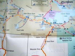
It truly is a drive into the unknown, considering that I was able to find out very little about the highway. It crosses some serious wilderness on its way into the North-West Territories and there is only one hamlet, Fort Liard, between Fort Nelson and my destination - Fort Simpson, NWT a distance of some 517 km.
So on the morning of my drive there are a few things that have to be taken care of before hitting the road.
Firstly is the matter of the car: fill the gas tank, check the oil as well as the tires, including the spare.
Secondly there is the matter of buying the survival rations - a big bag of oatmeal, a large yogurt, water, apples and bananas.
If I am to have a breakdown out on the Liard Trail, cell phone service is out of the question. The only recourse would be to sit and wait for help to arrive which could take quite a while since cars passed very infrequently.
This brings me to a delicate point. Would I stop for someone else along the route? I have decided that I would stop for anyone with a car in need of help but that I would probably, rightly or wrongly, not stop for any hitchhikers.
These are some of the preoccupations when one is about to embark on a wilderness drive.
Since there is no McDonald's in Fort Simpson, I have breakfast at A & W. I am disappointed to see that I paid about the same price as McDonald's but without the side order of pancakes.
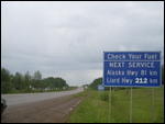
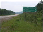
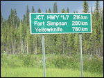
As I leave Fort Nelson a road sign indicates that the next gas for the Liard Highway is in 220 km. That is the hamlet of Fort Liard.
The first part of the trip leads west on the Alaska Highway but only for 28 km. At that point the Liard Highway heads north into the North-West Territories.
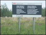
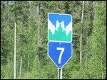
In British Columbia it is paved Highway No. 77 and at the border with the North-West Territories it changes to No. 7. It is interesting to note that at that point one crosses the 60th parallel, keeping in mind that the 49th is the border with the United States.
The No. 77 is like a lot of BC highways an elevated road with steep slopes on either side and with minimal shoulders. Even to change a flat tire, one would end up with the car taking up half the right lane. I am glad that I have an orange warning cone in my trunk.
When driving a remote highway, it is a natural instinct to keep a close tab on the kilometer markers which provide a location reference. However, with the aforementioned lack of cell phone service, a call to the CAA for help at kilometer mark 218 is out of the question. So no matter where you are, in case of trouble, all you can do is wait for someone to pass by and hope that they stop.
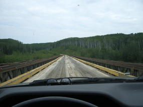
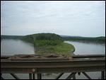
At the 40 km mark, one crosses the majestic Nelson River bridge It is a narrow one lane, wooden bridge that spans this beautiful river at a great height. There is no problem stopping in the middle of the bridge to take photos since I have not seen a car since I started driving on the Liard Highway. .
Along the way, I see quite a few bear cubs but they are all very uncooperative with respect to having their photos taken. Getting out of the car to get a better view is out of the question. Where there are cubs there is undoubtedly a vigilante mother that would not take kindly to any perceived threat to her cubs.
As the first car approaches I have a tendency to flash the high beams or to wave. I decide to do nothing and the oncoming car does the same, so much for the esprit de corp of driving a wilderness highway.
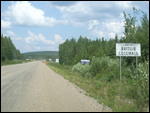
After about two hours of driving a distance of137 km, I arrive at the border with the North-West Territories. It is a special moment because I have never been here before and I appreciate every moment of the crossing from BC to the NWT.
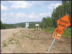
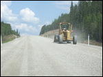
Yes, sure enough, the pavement stops and a sign warns of construction for the next 37 km. and unpaved road.
Right on cue as soon as I cross the border, the car is surrounded by a swarm of big black flies which, I found out later, are called bulldogs by the locals.
No matter, I have to get out of the car to take photos of the various signs. To my surprise, there is a lot of buzzing by the bulldogs but no biting and no attempts to get into the car.
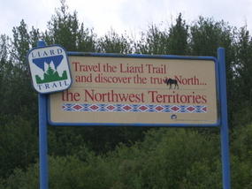
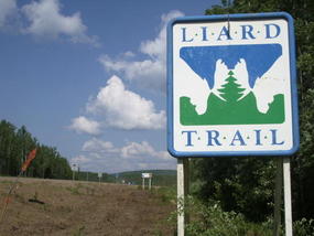
I am fascinated with the lovely sign for the Liard Highway. It is one of those signs which contained two images in one - two bull moose touching racks, while at the same time showing a coniferous tree and mountains. This was after all the highway which had attracted me to this region.
From this point Fort Liard is 43 km further and the MacKenzie Highway, another of the gravel legends of the north, is 255 km to the north.
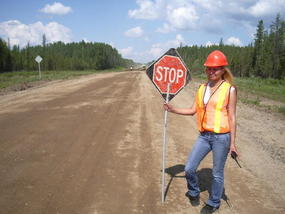
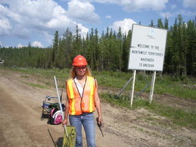
Then comes a surprise. As I approach the construction site, I am stopped by a traffic director who almost causes me forget that I am crossing into the North-West Territories. Well, let's just say her appearance is a bit unexpected, not what one would anticipate finding in the middle of nowhere.
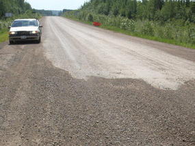
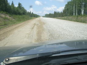
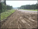
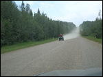
My driving at this early stage on the Liard Highway is very cautious because the road is covered with rough chunks of gravel and I am sort of groping along at the edge of the road trying to keep at least one wheel on flat ground. This does not auger well, as I am driving along at about 30 km per hour.
My curiosity is piqued by a sign warning of wood bison on the road. That would be neat since I couldn't remember the last time, if ever; I had seen bison in the wild.
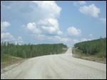
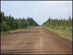
After about an hour of this tenuous driving the roadway all of sudden became quite smooth and inviting. Hey, this I can handle.
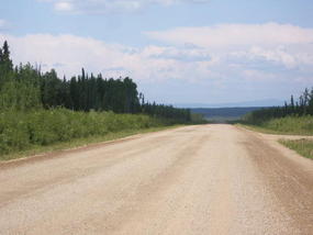
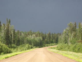
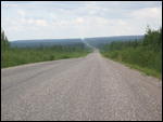
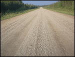
As I progressed, I become more and more impressed with the state of the Liard Trail. It might be gravel road but a lot of technology must have gone into the building of this highway. It is not only smooth and easy to drive but along the entire length I do not find the slightest evidence of the wash board patterns which are so common on gravel roads and which just shake a car to its inner core.
However, every once in a while, there are patches of road with some softness which results in the car slightly fishtailing. For the most part, I keep my speed at around 80 km per hour. Considering the beautiful scenery that is around me, the speed seems just right. I also keep repeating to myself, my goal was to make it safely to Fort Simpson and that time did not matter.PHOTO_ID_R=imgp8474.jpg
The landscape for the most part is flat with views from time to time of the higher mountains of the Nahanni Range.
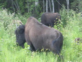
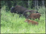
Suddenly something large and black appears off in the distance by the side of the road. It is my first of many views of bison herds grazing by the side of the road.
For the most part they are docile animals but a charging bull can make quite a dent in a car. I reflect on the fact that these animals, the wood buffalo, are the biggest land animals in the Americas. They are beautiful and majestic animals living in the thick forests and using the side of the road as their own private pasture. Their cousin, the plains bison, is somewhat smaller.
I never get tired of looking at them, especially the huge bulls with their massive heads and manes.
During all of this drive I might have come across 6-8 cars coming from the opposite direction and no one passed me.
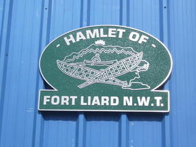
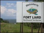
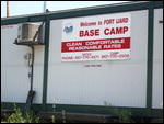
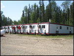
At the 35 km marker (from the NWT border) one finds the hamlet of Fort Liard nestled in a deep valley.
One is introduced to this hamlet of about 600 by young, First Nations men flitting about in their ATVs.
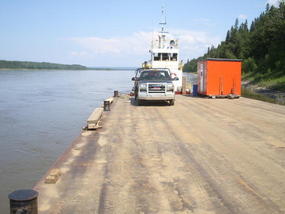
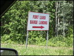
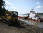
Just before the actual hamlet I notice a barge launching site.
I am trying to understand why there would be barges located here and where they would be going. That is the beautiful thing about travel; one is literally forced to learn.
So it is that I am confronted with a huge river the width of the Mississippi in Baton Rouge, Louisiana (I really don't know, but it sounds good). I must confess I did not know of the existence of this huge river which lends its name to the highway.
The barges are used to transport people, vehicles and equipment to the other side, where for the most part, it provides access to various natural resource based industries. I have to chuckle at the use of two Caterpillar earth movers to pull the barges to shore for loading. It seems like a huge investment but they are also used to keep the access road, a dirt road, in good condition.
During the winter time this whole process is switched to an ice bridge which allows for traffic of all sorts to flow freely.
I have to marvel at the ingenuity of the whole process in getting the job done to allow commerce to flow in summer and winter.
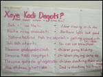
The hamlet of Fort Liard with its population of 460 is mostly populated by people from the Acho Dene Koe First Nation. As such, they are a part of the Denne which make up a large part of the population of the NWT. The primary language spoken is Slavey. Fort Liard was originally established as a trading post by the North-West Trading Company in 1805.
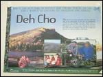
As an aside, I find surprising ignorance in terms of finding answers to questions about First Nations in the area. For instance, in the Acho Dene crafts shop as well as in the Liard Fuel Center no one could tell me what the word "Acho" signified. Some people were baffled by "Deh Cho" as well.
Deh Cho is a name that one sees a lot of in these parts and in Slavey it means "Big River" meaning the MacKenzie River. As a matter of fact, the tourist circuit which I am driving, apart from the part going to Yellowknife is promoted as "The DEH CHO Travel Connection".
There is also a smattering of non-First Nations residents.
In my conversations with various persons around town I find out that a common complaint is the lack of a paved road.
The argument goes that considering the wealth from royalties that the federal government gets from diamond mining near Yellowknife plus all the other resources, there should be enough money flowing back into the NWT to allow for the paving of the Liard and MacKenzie Highways.
All the residents I speak with loved living in Fort Liard. They feel it was a nice, safe place where leaving doors unlocked is not uncommon.
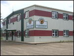
Jobs are available here in the resource sector. The First Nations Band has their own business called Beaver Enterprises which provides an economic infrastructure for the First Nations population.
I am interested in what happens in case of medical emergencies and apparently a medical evacuation to Yellowknife would occur in about two hours time by helicopter- a reality of the North.
Like other First Nations communities, Fort Liard, is not immune to health problems such as diabetes, alcohol abuse, drug abuse, TB, spousal abuse and early pregnancy.
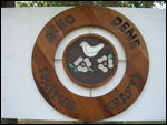
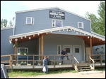
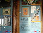
Of interest is the Acho Dene Native Crafts Center and Tourist Office. They truly have beautiful items for sale especially the hand made birch bark baskets.
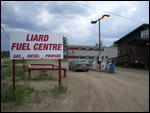
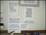
Not to be forgotten is the Liard Fuel Center where regular fuel is available for the long trip to Fort Simpson. The small store must have had problems with lingering students because there are ample signs forbidding students to enter during school hours and even banning some persons from coming there.
Of course the Liard General Store is a good place to speak with some of the locals. I was amazed to learn that milk costs $8 for four liters. (or was that for one liter?)
Older residents remember the days when there was no Liard Highway, since it was built in 1983. Travel to Fort Nelson was by water or through forest trails.
The NWT has no "territorial sales tax", just the 7% GST like the rest of Canada. Say what you like about the GST, and Brian Mulroney who introduced it, but it put Canada's financial house in order. The federal government has been having surpluses ever since with even our national debt being paid down as a result of it.
My food of choice during this entire day is yogurt and raw oatmeal. Since I don't have an ice box I have to eat the yogurt before it goes bad. I am always puzzled by this concept, since I have the impression that in order for this milk product to turn into yogurt it has already turned bad, so how can it get "bader". Anyway, just to make sure, I eat it during the course of the day along with some apples and bananas.
As I head north from Fort Liard, I cross the Muskeg River at the 48 km mark. There is another promise of mountains on the horizon but they keep their far distance throughout the trip much to my disappointment.
I still have three more hours of driving on the Liard Highway till I get to Checkpoint Junction. At this point it meets the MacKenzie Highway and from there it is another hour to Fort Simpson.
I am now enjoying every minute on this amazing road. I have been able to push thoughts of a flat or car breakdown out of the back of my mind. The old Volvo is humming along just nicely. I have come to the conclusion that this is about as good as a gravel road can get and it would not be unreasonable to push my speed to 90 km per hour but I don't.
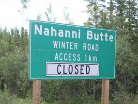
Ninety-three kilometers after Fort Liard, I arrive at Nahanni Butte.
Well more precisely, I arrive at the point where a winter road leads 24 km into the wilderness to the First Nations village of Nahanni Butte.
.
When I originally saw Nahanni Butte on the map I envisioned that there would an information center for the world famous Nahanni National Park Reserve. This is a wilderness park which is well known for beautiful Virginia Falls which is twice as high as Niagara Falls.
There was of course no information about the Nahanni Park; in fact there was nothing except clear evidence of a winter road leading into the wilderness.
When I get out of the car to have a close look, I realize that the mosquito situation is not to be ignored. They are ferocious, to say the least, and for whatever reason, I am loath to spray on the Deep Woods with Deet which I have with me. As a result, I obviously come out as a loser in my encounter with the mosquitoes.
I quickly scurry back to the car in which, previous to leaving Prince George, I had installed a mosquito screen in my sun roof. It seems to do the job of keeping out the mosquitoes while letting in some fresh air.
Surprisingly it is quite warm and I have the air conditioning going at the same time as I head another 126 km north towards Checkpoint Junction, the meeting of the Liard and MacKenzie Highways.
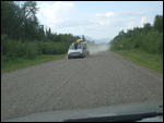
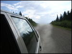
I notice that I am kicking up a lot of dust while driving. When I get to Fort Simpson, I see to my surprise that the inside of the trunk is coated in thick dust that had come in through my open sun roof. To get more space I removed part of my back seat before leaving which allowed the dust to accumulate in the trunk. This is odd since I never noticed any dust around my sun roof, just behind the car.
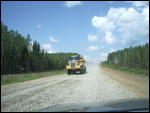
Speaking of dust, I always make a point of slowing down and pulling over as far to the right as possible for the few cars that I encounter. Other than the dust, I also feek that a flying piece of gravel would obviously do less damage at a lower speed.
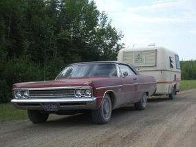
A car that I did notice was a 1970 something Plymouth Fury pulling a small trailer parked in a pull out. I see no evidence of anyone being there but I have to admire the courage of someone taking what essentially is an antique car into this wilderness pulling a trailer to boot. To be towed out from here could easily amount to a $500 bill.
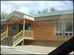
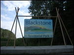
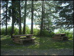
I stop at Blackstone River Territorial Park which has a beautiful visitor's center and camp ground by the Liard River which at this point looks like a lake.
The mosquitoes are particularly ferocious here. I am fascinated by one in particular that I see on the driver's side window. It is made translucent by the rays of the afternoon sun and it glows a bright red as it is full of my blood.
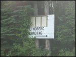
I was told by folks back in Fort Liard to pull into Lindberg's Landing. I am glad that this was pointed out to me for I would surely have driven by the shabby sign that signaled its presence.
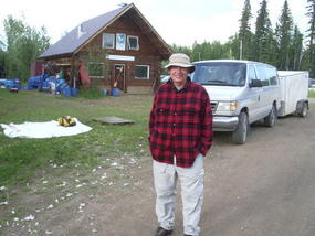
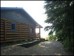
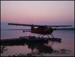
Here is a small collection of houses which includes the log cabin of an outfitter that provides supplies, flights by sea plane and group travel into the Nahanni Park.
It is here that I run into Doug who along with his three teen aged grand-daughters is about to be flown into the park for a 10 day tour which of course includes Virginia Falls and the South Nahanni River. I admire his courage but Doug has a long history of exploring wilderness parks, so he is undaunted with the challenge which is before him.
If I had any doubts before, the point is certainly brought home to me, that to see the wilderness parks of Canada and for that matter the Far North, one has to spend a lot of money. But on the other hand, why should every park be accessible by car?
Lindberg's Landing may have a shabby sign by the road but Google will find it and lead you to a Self Guided Nahanni website which is full of information about exploring the park. You are invited to ask for a quote.
http://www.nahanni.com/rentals/
As I hit the road again I encounter another heard of wood buffalo. I pass in silence and admiration for the elders and the young calves. I am still 160 km from Fort Simpson and it is around eight in the evening. Of course there is no sign of darkness.
As I cross the Popular River I hear for the first time the sound of song birds. It makes me smile for the NWT is supposed to be famous for song birds. For the record, that is the one and only time that I hear these beautiful melodies.
I reach the end of the Liard Trail at 21:45. But wait a minute; it is actually 22:45 because I forgot to factor in the time change as I cross into the NWT. My heart leaps with joy as the prospect of seeing a mid-night sun are now very real.
I am now driving the MacKenzie Highway north-west to Fort Simpson. Like the Liard it is one of Canada's great gravel roads. However, the stretch leading from here to Fort Simpson is paved. It may be paved but it is not without potholes which almost makes it worse to drive than the Liard. There is lots of construction going on as well as the road is in the process of being repaved in various parts. The part that puzzles me about the paved highways in the NWT is how they can suddenly turn into 100 meters or so of gravel road. What happened to the pavement that was there?
There is a break in the action shortly into the trip as there is a ferry crossing across the mighty MacKenzie River. This ferry is run by Merv Hardie during the non-winter months. During the winter the crossing can be made on an ice bridge.
My second last highlight of the day is going to the historical confluence of the MacKenzie and Liard Rivers in Fort Simpson. I feel privileged to be in this historical spot where two of Canada's great rivers meet. Alexander MacKenzie was the first European to pass this confluence in 1789 on his way to the mouth of the river that bears his name.
I later became aware that the MacKenzie, with its length of over 1,700 km, is the second largest river in North America after the mighty Mississippi. It is a fast flowing river which winds its way from Great Slave Lake, where I am going tomorrow, to the Arctic Ocean.
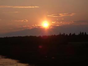
The last highlight of the day is, of course, the experience of a total lack of nightfall. The sun however sets just before midnight but the daylight just will not quit.
This of course upsets the biological clock greatly and that feeling of tiredness in the evening just won't come. The adrenalin flows in observing this unusual phenomena and sleep is sporadic, when it finally comes because there is a need to keep checking to see if it is finally dark. Well no, it is darker but it is far from dark.
Tomorrow is the summer solstice and I should be in Yellowknife if everything goes according to schedule.
In conclusion, all my ennui about driving the Liard is for not as the drive turns out to be one of the highlights of the trip. I hesitate to say that because the entire trip was such a journey of discovery that I thoroughly enjoyed every part.
However, it was the siren's call of the Liard Trail which prompted me to undertake this trip which gives it a special significance.
_________________________________________________
YOU TUBE - http://www.youtube.com/user/TravelsWithLobo
---------------------------------------------------------------------------------
The Liard Highway - Day 3
Saturday, June 23, 2007
 Fort Liard, British Columbia, Canada
Other Entries
-
1Bear Alley - Highway 37 to Stewart/Hyder Alaska
Oct 04262 days prior Stewart BC, Canadaphoto_camera35videocam 0comment 2
 -
2Stewart BC -- Historic Gateway to Alaska
Oct 05261 days prior Stewart BC, Canadaphoto_camera34videocam 0comment 2
 -
3Stewart BC -- Ripley Creek Inn and the Estuary
Oct 05261 days prior Stewart BC, Canadaphoto_camera41videocam 0comment 0
 -
4Hyder, Alaska -- Fish Creek and Salmon Glacier
Oct 12254 days prior Hyder, United Statesphoto_camera59videocam 0comment 3
 -
5One of Nature's Great Stories
Oct 18248 days prior Adams River, Canadaphoto_camera63videocam 0comment 0
 -
6Prince Rupert -- The New World Port
Jan 14160 days prior Prince Rupert, Canadaphoto_camera3videocam 0comment 0
 -
7Prince Rupert: Sinking of the Queen of the North
Apr 0381 days prior Prince Rupert, Canadaphoto_camera3videocam 0comment 0
 -
8On The Road Again - Northwest Territories
Jun 203 days prior Prince George, Canadaphoto_camera1videocam 0comment 0
 -
9Prince George to Dawson Creek - DAY 1
Jun 212 days prior Dawson Creek, Canadaphoto_camera38videocam 0comment 0
 -
10Dawson Creek to Fort Nelson - Day 2
Jun 23earlier that day Fort Nelson, Canadaphoto_camera55videocam 0comment 0
 -
11The Liard Highway - Day 3
Jun 23 Fort Liard, Canadaphoto_camera73videocam 0comment 2
 -
12Fort Simpson to Yellowknife - Day 4
Jun 241 day later Yellowknife, Canadaphoto_camera61videocam 0comment 0
 -
13Yellowknife - The Old Town - Day 5
Jun 263 days later Yellowknife, Canadaphoto_camera41videocam 0comment 1
 -
14Yellowknife - The New Town - Day 5
Jun 263 days later Yellowknife, Canadaphoto_camera41videocam 0comment 0
 -
15Yellowknife - Frame Lake - Day 5
Jun 263 days later Yellowknife, Canadaphoto_camera53videocam 0comment 0
 -
16Yellowknife - The Legislative Assembly
Aug 0442 days later Yellowknife, Canadaphoto_camera30videocam 0comment 1
 -
17Yellowknife - Prince of Wales Northern Heritage Ct
Aug 0644 days later Yellowknife, Canadaphoto_camera22videocam 0comment 0
 -
18On The Road Again - Discovery Coast
Aug 1250 days later Prince George, Canadaphoto_camera0videocam 0comment 0
 -
19Discovery Coast Passage - Part 1 of 12
Aug 2058 days later Alexis Creek, Canadaphoto_camera55videocam 0comment 0
 -
20Discovery Passage - Part 2 of 12
Aug 2058 days later Tatla Lake, Canadaphoto_camera57videocam 0comment 2
 -
21Heckman Pass to Bella Coola - Part 3
Aug 2058 days later Tweedsmuir Provincial Park, Canadaphoto_camera62videocam 0comment 2
 -
22Bella Coola - the Port - Part 4
Aug 2563 days later Bella Coola, Canadaphoto_camera26videocam 0comment 0
 -
23The Discovery Coast Passage - Part 5
Aug 2765 days later Bella Coola, Canadaphoto_camera80videocam 0comment 3
 -
24Port Hardy to Campbell River to Parksville
Aug 3068 days later Campbell River, Canadaphoto_camera2videocam 0comment 0
 -
25Cathedral Grove in MacMillan Provincial Park
Aug 3068 days later Coombs, Canadaphoto_camera4videocam 0comment 0
 -
26Port Alberni - Gateway to the Pacific Rim - Part 8
Aug 3068 days later Port Alberni, Canadaphoto_camera2videocam 0comment 0
 -
27Pacific Rim -- Tofino and Ucluelet - Part 9 of 11
Aug 3068 days later Tofino, Canadaphoto_camera13videocam 0comment 0
 -
28Chemainus - Finding a Way to be Noticed - Part 10
Sep 0170 days later Chemainus, Canadaphoto_camera25videocam 0comment 0
 -
29Victoria - The Return - Part 11 of 12
Sep 0170 days later Victoria, Canadaphoto_camera48videocam 0comment 0
Comments
2025-05-22
Comment code: Ask author if the code is blank

 Fort Liard, British Columbia, Canada


_andrew_
2007-07-27
Awesome highlights
Lobo,
Nice job documenting the highlights of your trip. You narrate it quite well, and keep it interesting. I'm looking forward to the summaries of your future trips... For the mean time, I'll read up on some of your past trips. Travel well!
Kayly
2010-06-10
So basically you rode in on your high horse judging people and the towns youve visited? Good work. I hope you review your blogs, due to your lack of information, I can see you dont show respect to the locals