_________________________________________________
YOU TUBE - http://www.youtube.com/user/TravelsWithLobo
---------------------------------------------------------------------------------
Fort Simpson to Yellowknife - Day 4
The Mackenzie Highway (gravel portion)
-------------------------------------------------
Date: Sunday, June 24, 2007
Distance Driven: - 623 km
Total Time: 13 hours
------------------------------------------------------------ ----------------
Located on an island at the confluence of the Mackenzie and Liard Rivers, Fort Simpson is the largest community in the area with a population of 1,300 composed mostly of First Nations people. It was established in 1822 when the Hudson Bay Company opened a fur trading post at this location and named it after one of their chief representatives in North America - Sir George Simpson.
The Nahanni Inn is the only full-service hotel in town while the Deh Cho Inn provides tourist home accommodations.
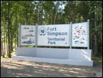
Also located within minutes of the town centre is Fort Simpson Territorial Park with 32 campsites starting at $15.
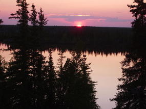
I arrived at the campsite near midnight. Considering the extended daylight, my late arrival was not a problem. However, the swarming mosquitoes made tent pitching difficult and the situation was not helped by my stubborn resistance to using mosquito spray.
Sleeping was also challenging as the lingering daylight was not conducive to feeling tired.
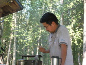
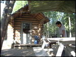
It was during my check-out the next morning that I encountered Doug, the park ranger.
Since he was of the Deh Cho First Nation, I was naturally interested in finding out a little bit about his life.
A few minutes into the conversation revealed that summer for him was just a season to put up with until winter arrived.
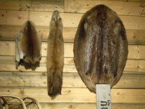
Winter allowed him the freedom of living the life style he loved. This meant roaming the frozen lakes and forests with his beloved dog team in the pursuit of his passion for hunting and trapping.
I mentioned my concerns about getting lost in the forest which he brushed off with comments about the sun, the moon and the stars and a few roads running north and south as reference points. No, he had never gotten lost in the woods.
He described his attachment to his dog team and the role of the alpha male lead dog whose role is occasionally challenged by some of the younger dogs in the team. Doug's forearms bore evidence of attempts to separate such encounters among the dogs.
He also spoke of a day when the alpha male loses the desire to lead and has to be retired from the team.
Stories of sleeping out in the open and having bears sniff and walk over him on four different occasions (presumably without the dogs) only enhanced my amazement at the harmony of man and nature.
I wish I could have engaged him in further conversation but the arrival of other campers who were checking out put an end to our conversation.
Just outside the camp entrance, on the edge of the Mackenzie River, is the location of a large grassy park known as the Papal Flats. This name is in recognition of the visit of Pope John Paul II in 1987.
In 1984, I remember reading that the Pope was unable to fly to Fort Simpson due to fog. At that time he promised to return at some future date and did so in 1987.
At that time and until my visit, I had no idea where Fort Simpson was located. Hence my own personal conviction that traveling is "History and Geography for Dummies". I guess that is why I like it so much.
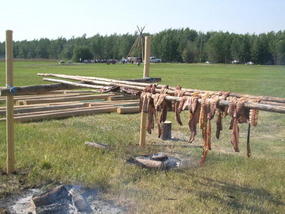
During my visit to Fort Simpson, the Papal Flats were being prepared for the Open Sky Festival the coming weekend (June 29 - July 1).
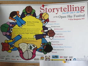
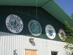
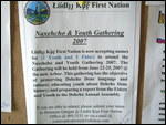
This is an annual festival for the Deh Cho First Nation of the Western sub-arctic. This includes the First Nation communities of Fort Simpson, Fort Providence, Wrigley, Fort Liard, Hay River Reserve, Kakisa, Nahanni Butte and Trout Lake. The last two communities are only accessible by air and ice roads in the winter.
Each community is known by its own First Nations name. For instance the Deh Cho of Fort Simpson is known as the Lllidi Koe First Nation. They belong at the same time to the Deh Cho First Nation and the Denne people. The language spoken is Slavi.
This year's festival will feature: story telling performances with the aim of passing culture from the elders to the younger members of the community, visual arts, traditional crafts exhibitions, workshops, drum dances, a concert, and a dance. Much of this would have the underlying theme of preserving the old way of life of hunting, trapping and fishing for whitefish and trout.
For more information: www.openskyfestival.ca
Suffice it to say, had I stayed for the Open Sky Festival I would have found further details to satisfy my curiosity about the Deh Cho. It was with regret that I moved on.
In realty, the weekend would have transpired in the Slavey language and I am not sure how welcome non First Nations people would have been.
Breakfast on this day was not to be Menu Item No. 1 at McDonald's (there is none in Fort Simpson) but instead "the breakfast special" at the Nahanni Inn. Overheard conversation at the next table centered on the next door neighbour who "shot the bear", "I heard the shots" and talk about dogs and wolves.
My attention was also drawn to a huge native man who was having breakfast near me wearing a transparent mosquito shirt to cover his bare torso. His ample girth and visible layers of rolling fat did not seem appropriate to the situation.
The mosquito shirt was a contradiction to that which I had been told by a local. "First Nations People are not bitten by mosquitoes". That, however, would have to be left to the TV show - "Myth Busters" to determine.
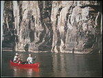
Unwilling to let go, I paid another visit to the historic confluence of the Mackenzie and Liard. These rivers were of course the super highways of early northern explorations, not to mention the canoe routes for many generations of First Nations peoples.
I couldn't resist another opportunity of getting a better insight into the local lifestyle by posing the question "What do you like about living in Fort Simpson?" to a lady walking her dog.
Her answer touched on: her love of the North, the lack of traffic, her feeling of safety here, the fact that everyone knows each other, and the willingness of people to help each other, even when traveling through other communities. In case of emergency, she did have a satellite phone which is the only assured calling service as one travels many of these northern roads.
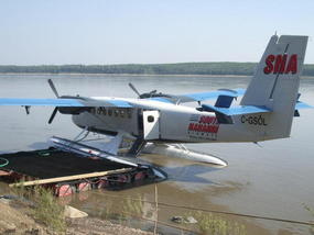
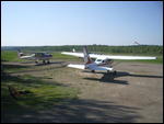
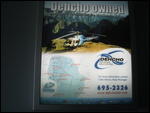
On the shores of the Mackenzie River I found the air terminal for South Nahanni Airways.
Here I had my first sighting of the legendary DHC-6 Twin Otter. This multi-purpose (land, water, snow) STOL (short lake off and landing) aircraft was developed by de Havilland Canada in the 1960's. The company has passed into the history books and the production of the aircraft stopped in 1988.
Recently, I was happy to read about the rebirth of this historical series of aircraft which did so much in the exploration of the Canadian North and other parts of the world.
In April 2007, Viking Air of Victoria, BC announced the production of a "400 Series" DHC-6 Twin Otter to be built in Calgary, Alberta. Apparently the vital role of this aircraft had not been filled by any other manufacturer which led to the renaissance of this successful chapter in Canadian aircraft history.
Nahanni South Airways is an important means of getting into Nahanni National Park Reserve with the Otter aircraft being able to carry up to 17 passengers and equipment.
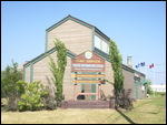
My final stop was at the Tourist Office where a young employee was waiting for someone to bring the key to open the office.
In the ensuing wait there was time to talk about the community. As a retired (occasional) high school teacher I was especially interested in the local high school the young man was attending. Discipline problems and drug use seemed to be not outside of the norm. I was surprised, however, that the graduating class was only 12 students and the estimate was that only half would pass.
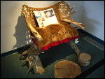
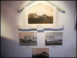
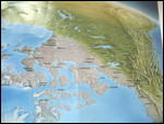
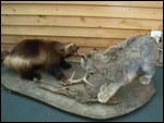
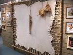
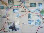
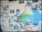
The Tourist Office has an interesting collection of maps, photos and exhibits about the region.
Around 11:00 it was time to hit the road for the long drive to Yellowknife.
Again I had a sense of excitement (but then, when do I not) about the day which was about to unfold.
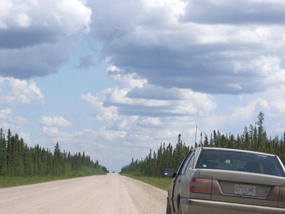
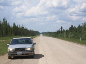
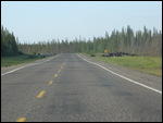
Having already driven one of Canada's great northern all-weather (gravel) highways, the Liard, I was now about to drive another, the Mackenzie Highway.
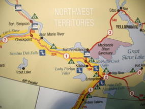
The Mackenzie Highway starts in Grimshaw, Alberta and ends in Wrigley, NWT - a distance of 1,159 km. The 224 km section between Checkpoint Junction and the junction near Fort Providence is not paved and that was the part I was about to drive.
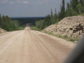
The all-weather (gravel) part of the Mackenzie Highway did not quite produce the same effect as the Liard Highway for several reasons.
There was more traffic which largely removed the sense of isolation which made the Liard exciting. The road bed was also not as good as the Liard Highway which made driving a little less enjoyable since it required a bit more attention to road conditions.
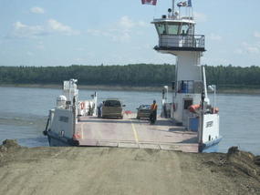
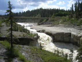
The three major attractions along the route are the crossing of the Mackenzie River (15 km outside of Fort Simpson), a sign for the 126 km Ice Road to the Deh Cho village of Trout Lake (151 km from Fort Simpson) and Sambaa Deh Falls Park (185 km from Fort Simpson)
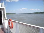
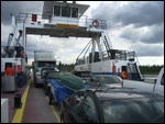
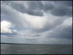
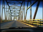
The crossing of the Mackenzie by ferry again brings home .the fact of exactly how wide this river is. The crossing also provides a calm moment to reflect on how beautiful this trip to the North has been.
.
One of the wonders of the north is the network of Ice Roads which greatly extend the scope of transportation of the Territories during the winter season. Their purpose is to facilitate the supplying of remote settlements and mining operations in the North. So as one passes the sign for the 136 km Ice Road to Trout Lake one can only imagine the thrill of driving such a road.
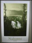
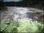
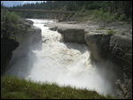
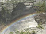
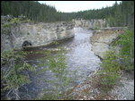
Sambaa Deh Falls and the Canyon arrive just in time to break up the long drive. You can stretch your legs while exploring the stunning falls and canyon.
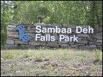
Also located here is a Territorial Park by the same name with an interesting Visitor Center and campground. Mosquitoes are intense so spraying is advised.
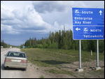
At the intersection of paved Highway No. 3 I turn north in the final part of my trip to Yellowknife.
Twenty four kilometers later, there is another ferry crossing of the Mackenzie River to get to Fort Providence. Like all ferry crossing in the North, this one is free.
Ferry crossings are priceless because they set the stage for a little contact with the local population.
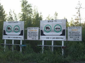
This is how I learned that a pick up truck driver lived in Rae Lakes, 230 km by Ice road or aircraft north of Yellowknife. He worked there for a diamond mine, a major industry in the Yellowknife region.
When I commented on how that would be an expensive life style, he noted that high salaries in the diamond mines made up for the higher cost of living and transportation.
I was further fascinated by the fact that he had two trucks. One is located in Yellowknife and another is located back in Rae Lakes. Because the southern truck accumulated much greater mileage a switch is made every winter on the ice road to balance mileage on the trucks.
Certainly this is a life style quite different from that which I have experienced in Ottawa and Prince George.
The fact that I was still 309 km from Yellowknife at 21:00 was meaningless in view of the endless, albeit subdued, daylight.
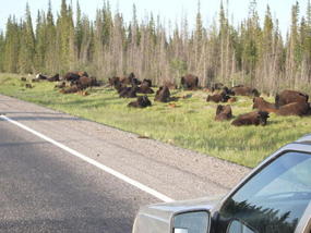
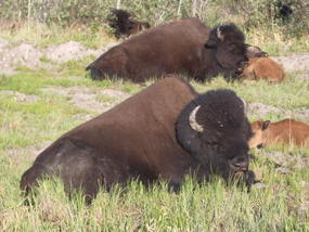
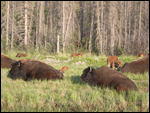
Driving north, my attention was drawn to the sign warning of bison. The highway was the western border of the huge Mackenzie Bison Sanctuary so it was not surprising that I made numerous sightings of bison herds along the road.
I was reminded that the wood bison is the largest native land animal in North America. However, having recently seen the size of a Clydesdale horse at the Calgary Stampede, I wonder about that claim. Maybe it is not considered a native animal.
After the Bison Sanctuary I drove through vast stretches of muskeg which seemed impenetrable except for the elevated road. It was a very inhospitable terrain, unforgiving to any trespasser.
The last hour of driving into Yellowknife was extremely pleasant with the remaining golden rays of sunshine.
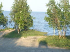
At Edzo, 209 km from Fort Providence, I came upon a special moment as I had my first sighting of Great Slave Lake. Ever since High School I had been fascinated with the name of this lake and here, after some 47 years, I finally got to see the lake!
Shortly thereafter, I paused to study the entrance to the 200 km Ice Road to Rae Lakes and Wah Ti. There is plenty there to let the imagination roam
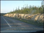
Shortly after Rae I start to notice the rock cuts along the highway. They are the first sign of the Precambrian or Canadian Shield which so dominates Yellowknife.
As I approach Yellowknife, I am re-energized by the last rays of sunshine casting their golden pallor on the north-western sky.
Very close to town, I had difficulty restraining myself from driving into the sandpits. These pits are similar to salt flats and provide a ready made party place for the local young crowd. My curiosity led me to try and take a closer look. However, I soon concluded that my 15" Volvo wheels were no match for the sandy surface. I beat a hasty retreat!
Of course this is a great playground for four-wheel drive vehicles. Young people must have a field day out here as any police presence would be long noticed before their actual arrival. This would give plenty of time to get rid of any evidence of illegal activity.
I arrived in Yellowknife around 00:30 and while there was still subdued daylight, the town was deserted. The drawn blinds are a necessity of the north during this time of year as without them, the daylight (or nightlight) prevents most people from getting any sleep.
Fatigue was not in the cards for me as I had the desire to see the sleeping town in subdued light.
However, after a short tour of the town, it was time to head for the campground and wait for the dawn of another beautiful day.
_________________________________________________
YOU TUBE - http://www.youtube.com/user/TravelsWithLobo
---------------------------------------------------------------------------------
Fort Simpson to Yellowknife - Day 4
Sunday, June 24, 2007
 Yellowknife, Northwest Territories, Canada
Other Entries
-
1Bear Alley - Highway 37 to Stewart/Hyder Alaska
Oct 04263 days prior Stewart BC, Canadaphoto_camera35videocam 0comment 2
 -
2Stewart BC -- Historic Gateway to Alaska
Oct 05262 days prior Stewart BC, Canadaphoto_camera34videocam 0comment 2
 -
3Stewart BC -- Ripley Creek Inn and the Estuary
Oct 05262 days prior Stewart BC, Canadaphoto_camera41videocam 0comment 0
 -
4Hyder, Alaska -- Fish Creek and Salmon Glacier
Oct 12255 days prior Hyder, United Statesphoto_camera59videocam 0comment 3
 -
5One of Nature's Great Stories
Oct 18249 days prior Adams River, Canadaphoto_camera63videocam 0comment 0
 -
6Prince Rupert -- The New World Port
Jan 14161 days prior Prince Rupert, Canadaphoto_camera3videocam 0comment 0
 -
7Prince Rupert: Sinking of the Queen of the North
Apr 0382 days prior Prince Rupert, Canadaphoto_camera3videocam 0comment 0
 -
8On The Road Again - Northwest Territories
Jun 204 days prior Prince George, Canadaphoto_camera1videocam 0comment 0
 -
9Prince George to Dawson Creek - DAY 1
Jun 213 days prior Dawson Creek, Canadaphoto_camera38videocam 0comment 0
 -
10Dawson Creek to Fort Nelson - Day 2
Jun 231 day prior Fort Nelson, Canadaphoto_camera55videocam 0comment 0
 -
11The Liard Highway - Day 3
Jun 231 day prior Fort Liard, Canadaphoto_camera73videocam 0comment 2
 -
12Fort Simpson to Yellowknife - Day 4
Jun 24 Yellowknife, Canadaphoto_camera61videocam 0comment 0
 -
13Yellowknife - The Old Town - Day 5
Jun 262 days later Yellowknife, Canadaphoto_camera41videocam 0comment 1
 -
14Yellowknife - The New Town - Day 5
Jun 262 days later Yellowknife, Canadaphoto_camera41videocam 0comment 0
 -
15Yellowknife - Frame Lake - Day 5
Jun 262 days later Yellowknife, Canadaphoto_camera53videocam 0comment 0
 -
16Yellowknife - The Legislative Assembly
Aug 0441 days later Yellowknife, Canadaphoto_camera30videocam 0comment 1
 -
17Yellowknife - Prince of Wales Northern Heritage Ct
Aug 0643 days later Yellowknife, Canadaphoto_camera22videocam 0comment 0
 -
18On The Road Again - Discovery Coast
Aug 1249 days later Prince George, Canadaphoto_camera0videocam 0comment 0
 -
19Discovery Coast Passage - Part 1 of 12
Aug 2057 days later Alexis Creek, Canadaphoto_camera55videocam 0comment 0
 -
20Discovery Passage - Part 2 of 12
Aug 2057 days later Tatla Lake, Canadaphoto_camera57videocam 0comment 2
 -
21Heckman Pass to Bella Coola - Part 3
Aug 2057 days later Tweedsmuir Provincial Park, Canadaphoto_camera62videocam 0comment 2
 -
22Bella Coola - the Port - Part 4
Aug 2562 days later Bella Coola, Canadaphoto_camera26videocam 0comment 0
 -
23The Discovery Coast Passage - Part 5
Aug 2764 days later Bella Coola, Canadaphoto_camera80videocam 0comment 3
 -
24Port Hardy to Campbell River to Parksville
Aug 3067 days later Campbell River, Canadaphoto_camera2videocam 0comment 0
 -
25Cathedral Grove in MacMillan Provincial Park
Aug 3067 days later Coombs, Canadaphoto_camera4videocam 0comment 0
 -
26Port Alberni - Gateway to the Pacific Rim - Part 8
Aug 3067 days later Port Alberni, Canadaphoto_camera2videocam 0comment 0
 -
27Pacific Rim -- Tofino and Ucluelet - Part 9 of 11
Aug 3067 days later Tofino, Canadaphoto_camera13videocam 0comment 0
 -
28Chemainus - Finding a Way to be Noticed - Part 10
Sep 0169 days later Chemainus, Canadaphoto_camera25videocam 0comment 0
 -
29Victoria - The Return - Part 11 of 12
Sep 0169 days later Victoria, Canadaphoto_camera48videocam 0comment 0
 -
30Vancouver - Best Place to Live? Part 12 of 12
Sep 0169 days later Vancouver, Canadaphoto_camera41videocam 0comment 0

 Yellowknife, Northwest Territories, Canada



2025-05-22