Back in Colorado from my long summer stay with my parents in New Jersey and travels on the East Coast, I was eager to get some mountain hiking in during the cooler sunnier days of September when thunderstorms are less frequent than in summer. I was also interested in attending the Scottish-Irish Highland Festival in Estes Park this year on the weekend after Labor Day since it's something that’s been "On My List" for quite a while. I decided to make a three day loop out of it with two day hikes in Grand County and Rocky Mountain National Park and then attend the opening Tattoo and first day of the Highlands Festival.
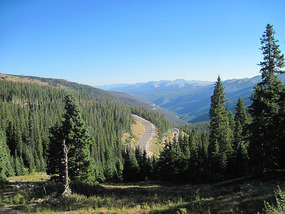
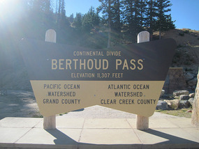
Grand County is north of I-70 and across 11,300 foot Berthoud Pass from Denver on U
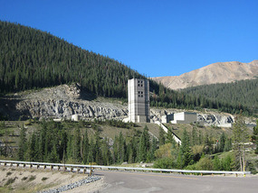
.S. 40, a road that has approaches to the top from both sides that have always struck me as particularly treacherous in snow compared to the interstate or even Loveland Pass. I thought I’d make a quick stop at the Empire Mine a short detour from the road on the way up to the pass. On the other side of the pass lies Winter Park ski area, one of the larger ones in Colorado but one more popular with Front Range skiers than a resort attracting multitudes of the beautiful people from the coasts.
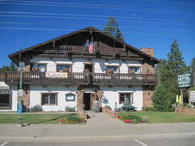
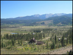
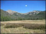
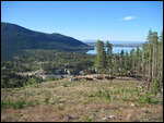
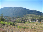
The Fraser Valley north of Winter Park includes the towns of Fraser and Granby and has some ranches but is mostly covered with evergreen trees. It’s often the coldest place in the U.S. when there are no major outbreaks of polar air which give that daily honor to spots in Minnesota or North Dakota.
My original plan was to head into a valley northwest of Winter Park ski area on some forest service roads and climb/hike a 12,500 foot peak I found described in a guidebook
. That’s a local area I’ve never been into and thought would be some interesting new scenery. I was stopped, though, by a forest ranger. The road into the area was closed for a few days for road maintenance. Foiled!
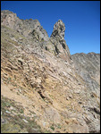
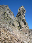
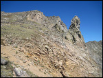
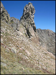
My alternative hike was on the other (eastern) side of the Fraser Valley, the hike to The Devil’s Thumb along the Continental Divide in the Indian Peaks Wilderness. The Devil’s Thumb is a tall rock that juts up near the top of the ridge far from any similar formations and can be seen from miles around. I’ve been on hikes in the valleys of the east side of the Divide in the region but had not done one from the west.
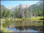
The drive to the trailhead was quite a few miles and on some fair dirt roads, nothing for which a four wheel drive is needed. The trail started off as a pleasant level walk in the woods but then climbed quite steeply and consistently for about 2,500 feet (that’s about three hours in Warren speed) through thick evergreen forest
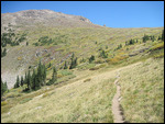
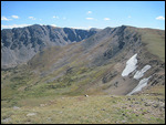
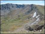
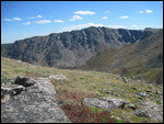
. The trees shrank to shrub size towards the top and the last half mile or so of zigs and zags to the ridgeline were in the open tundra. That’s what I like – hiking with a constant view!
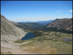
The Devil’s Thumb is just to the east of the ridgeline and doesn’t become visible on the trail from the west side until almost the summit. It’s one of those knock-your-socks off views, but is it a thumb? I can think of other body parts it might resemble.
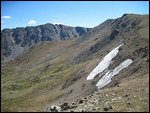
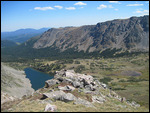
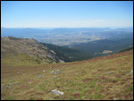
You realize then you’re on the Continental Divide and you might be tempted to pee so that some eventually flows to the Atlantic via the Platte, Missouri, and Mississippi Rivers and some to the Pacific via the Colorado River. There’s no one around, so you don’t have to worry about anyone seeing you! A few miles to the south the Rollins Pass Road was in view. It made me realize I could have driven to the top of the Continental Divide here on the four wheel drive track and done a nice easy ridge hike to the Devil’s Thumb rather than dragging my chubby body uphill through the forest for hours
.
Rollins Pass isn’t a through road anymore, though. I tried to do that once in the early 1990s from the east side. There was a tunnel collapse that has never been fixed, so you can only access the summit from the Grand County side.
I barely recall my hike back down through the forest. It either went very fast because I had gravity on my side, or maybe I was just high on endorphins from exercise and euphoric. It was quite a long drive on fairly rough dirt roads to get back to U.S. 40 in a northwesterly direction rather than backtracking my way in.
I spent the night car camping in Grand Lake, a resort town on a natural lake of the same name below the spectacular peaks of Rocky Mountain National Park. Grand Lake is the first significant lake below the headwaters of the Colorado River and the town is a kind of western gateway to the national park. I passed it many times on the road, but this was my first time turning off and spending some time in the pleasant town.
Devil's Thumb Hike, Indian Peaks Wilderness
Wednesday, September 05, 2012
 Fraser, Colorado, United States
Other Entries
-
33Mummy Range Hike in Rocky Mountain Nat Park
Sep 25711 days prior Rocky Mountain National Park, United Statesphoto_camera31videocam 0comment 0
 -
34Leadville -Colorado's Ultimate Wild West Mine Town
Sep 28708 days prior Leadville, United Statesphoto_camera55videocam 0comment 0
 -
35Aspen - Most Expensive Town in America
Sep 29707 days prior Aspen, United Statesphoto_camera57videocam 0comment 0
 -
36Ashcroft - Deep in the Elk Range of the Rockies
Sep 29707 days prior Ashcroft, United Statesphoto_camera56videocam 0comment 0
 -
37The Beautiful Roaring Fork River Valley
Sep 30706 days prior Snowmass, United Statesphoto_camera36videocam 0comment 0
 -
38Hike Around the Maroon Bells - Earthly Paradise
Sep 30706 days prior Crystal, United Statesphoto_camera110videocam 0comment 0
 -
39Marble - Remote Backwoods Colorado
Sep 30706 days prior Marble, United Statesphoto_camera36videocam 0comment 0
 -
40From North Fork Valley through West Elk Range
Oct 01705 days prior Paonia, United Statesphoto_camera42videocam 0comment 0
 -
41Crested Butte - On The Other Side of the Elk Range
Oct 01705 days prior Crested Butte, United Statesphoto_camera55videocam 0comment 0
 -
42From Taylor Park to Saint Elmo - Sawatch Range
Oct 01705 days prior Tincup, United Statesphoto_camera37videocam 0comment 0
 -
43Buena Vista & Mt. Princeton Hot Springs
Oct 02704 days prior Buena Vista, United Statesphoto_camera16videocam 0comment 0
 -
44Colorado Springs Balloon Festival
Sep 05366 days prior Colorado Springs, United Statesphoto_camera44videocam 0comment 0
 -
45Garden of the Gods - Paradise in Red and Green
Sep 06365 days prior Colorado Springs, United Statesphoto_camera35videocam 0comment 0
 -
46U.S. Air Force Academy - Where Flyboys are Made
Sep 07364 days prior Monument, United Statesphoto_camera18videocam 0comment 0
 -
47University of Denver Campus
Nov 15295 days prior Denver, United Statesphoto_camera15videocam 0comment 0
 -
48National Western Stockshow Parade-Denver Tradition
Jan 12237 days prior Denver, United Statesphoto_camera43videocam 0comment 0
 -
49Tour de Fat - A Celebration of Bicycles & Beer
Sep 014 days prior Fort Collins, United Statesphoto_camera215videocam 0comment 0
 -
50Devil's Thumb Hike, Indian Peaks Wilderness
Sep 05 Fraser, United Statesphoto_camera31videocam 0comment 0
 -
51Hike to Mount Ida, Rocky Mountain National Park
Sep 061 day later Rocky Mountain National Park, United Statesphoto_camera39videocam 0comment 0
 -
52Scottish Highlands Festival in Estes Park
Sep 072 days later Estes Park, United Statesphoto_camera56videocam 0comment 0
 -
53Downtown Denver - You've Come a Long Way, Baby!
Sep 105 days later Denver, United Statesphoto_camera86videocam 0comment 0
 -
54Denver Civic Center & Arts District
Sep 116 days later Denver, United Statesphoto_camera75videocam 0comment 0
 -
55Denver Art Museum
Sep 127 days later Denver, United Statesphoto_camera82videocam 0comment 0
 -
56Denver Dining Out
Sep 138 days later Denver, United Statesphoto_camera28videocam 0comment 0
 -
57Georgetown - History on the Way to the Mountains
Sep 1510 days later Georgetown, United Statesphoto_camera42videocam 0comment 0
 -
58Oktoberfest in Breckenridge
Sep 1611 days later Breckenridge, United Statesphoto_camera39videocam 0comment 0
 -
59Across Boreas Pass to South Park
Sep 1712 days later Como, United Statesphoto_camera54videocam 0comment 0
 -
60Cataract Lake - Eagle's Nest Wilderness Loop Hike
Sep 1813 days later Heeney, United Statesphoto_camera71videocam 0comment 0
 -
61Hoosier Pass & Wheeler Lake Hike
Sep 1914 days later Alma, United Statesphoto_camera45videocam 0comment 0
 -
62Fairplay & Weston Pass - Colorado's South Park
Sep 2015 days later Fairplay, United Statesphoto_camera35videocam 0comment 0
 -
63Camp Hale & Vail Oktoberfest
Sep 2116 days later Red Cliff, United Statesphoto_camera32videocam 0comment 0
 -
64The President Comes to Town
Oct 2449 days later Denver, United Statesphoto_camera18videocam 0comment 0
 -
65Debbie Does Denver - My Cousin Comes to Town
Mar 12188 days later Denver, United Statesphoto_camera44videocam 0comment 0
 -
66Biggest Saint Patrick's Day Parade West of Chicago
Mar 16192 days later Denver, United Statesphoto_camera61videocam 0comment 0
 -
67Denver's Cinco De Mayo Parade
May 05242 days later Denver, United Statesphoto_camera30videocam 0comment 0
 -
68Pike's Peak - Purple Mountain Majesty
May 27264 days later Green Mountain Falls, United Statesphoto_camera34videocam 0comment 0

 Fraser, Colorado, United States


2025-05-22