 Port Augusta, South Australia, Australia
By the end of today we will be in Port Augusta, but we intend to visit a
few towns on the way and go from Wilmington, through the Flinders Ranges to the
Augusta Highway or the A1, that iconic road that circles Australia.. And we have decided to go via Burra.
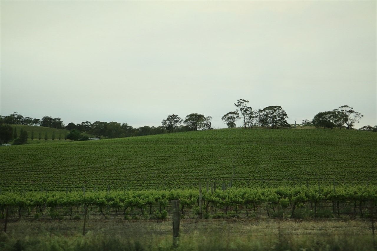
We left Clare by 9.00am and took Farrells Flat Road and headed
east. It was a distance of only only 43 kilometres to Burra and a nice
drive through some of the many vineyards in the Clare Valley. One can
understand why those that enjoy visiting the wineries, would come to this area
and spend a few weeks. So many different roads to travel and small towns
to visit, within a 50 kilometre radius of Clare.
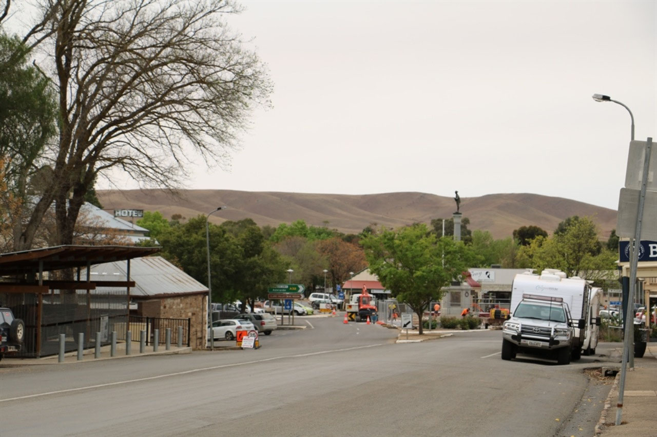
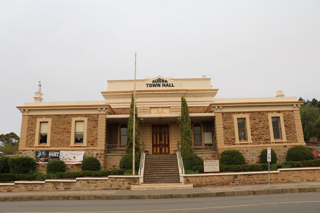
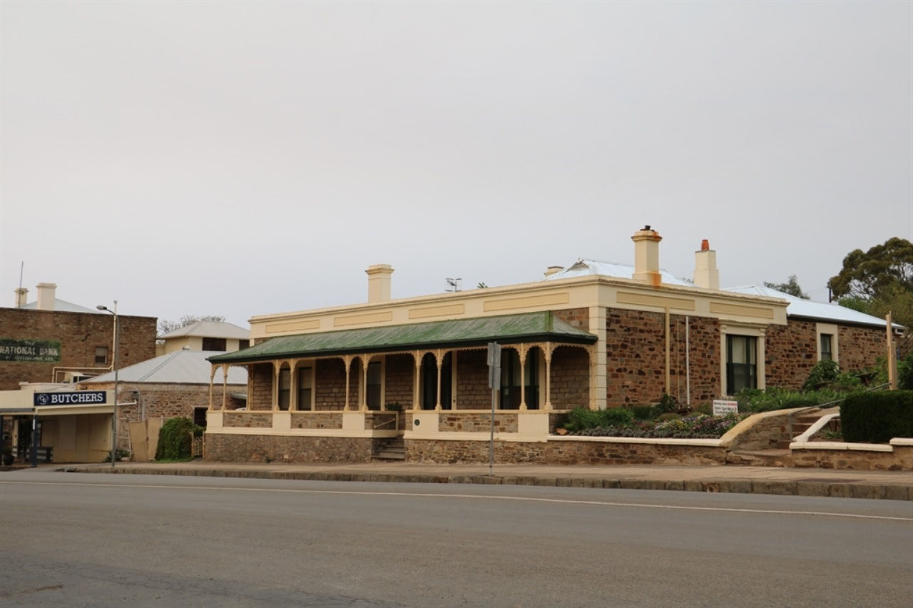
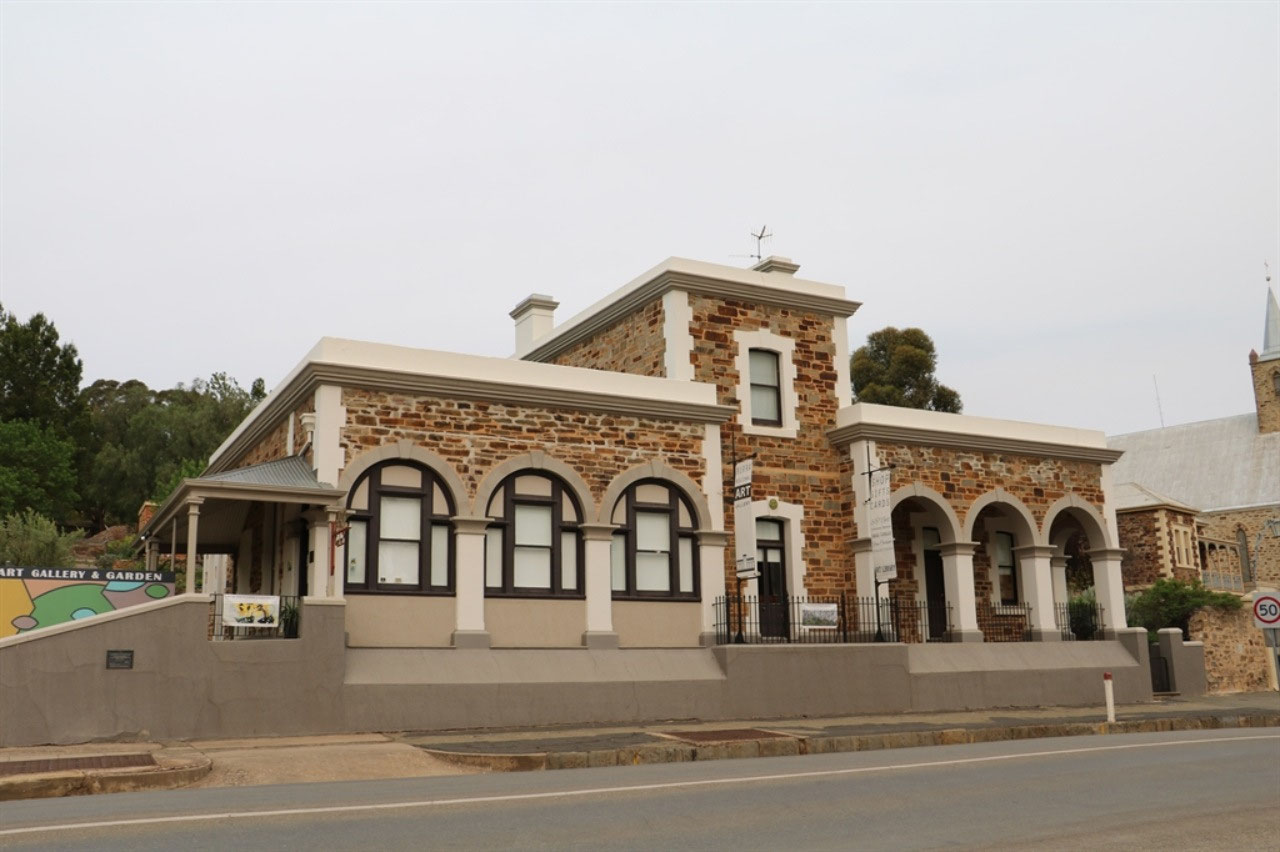
Burra is one of Australia's earliest, largest and best-preserved 19th century mining towns. The Burra copper mine contributed significantly to South Australia's early prosperity, before the town evolved into a service centre for agriculture. The entire town has been designated as the 'Burra State Heritage' area.
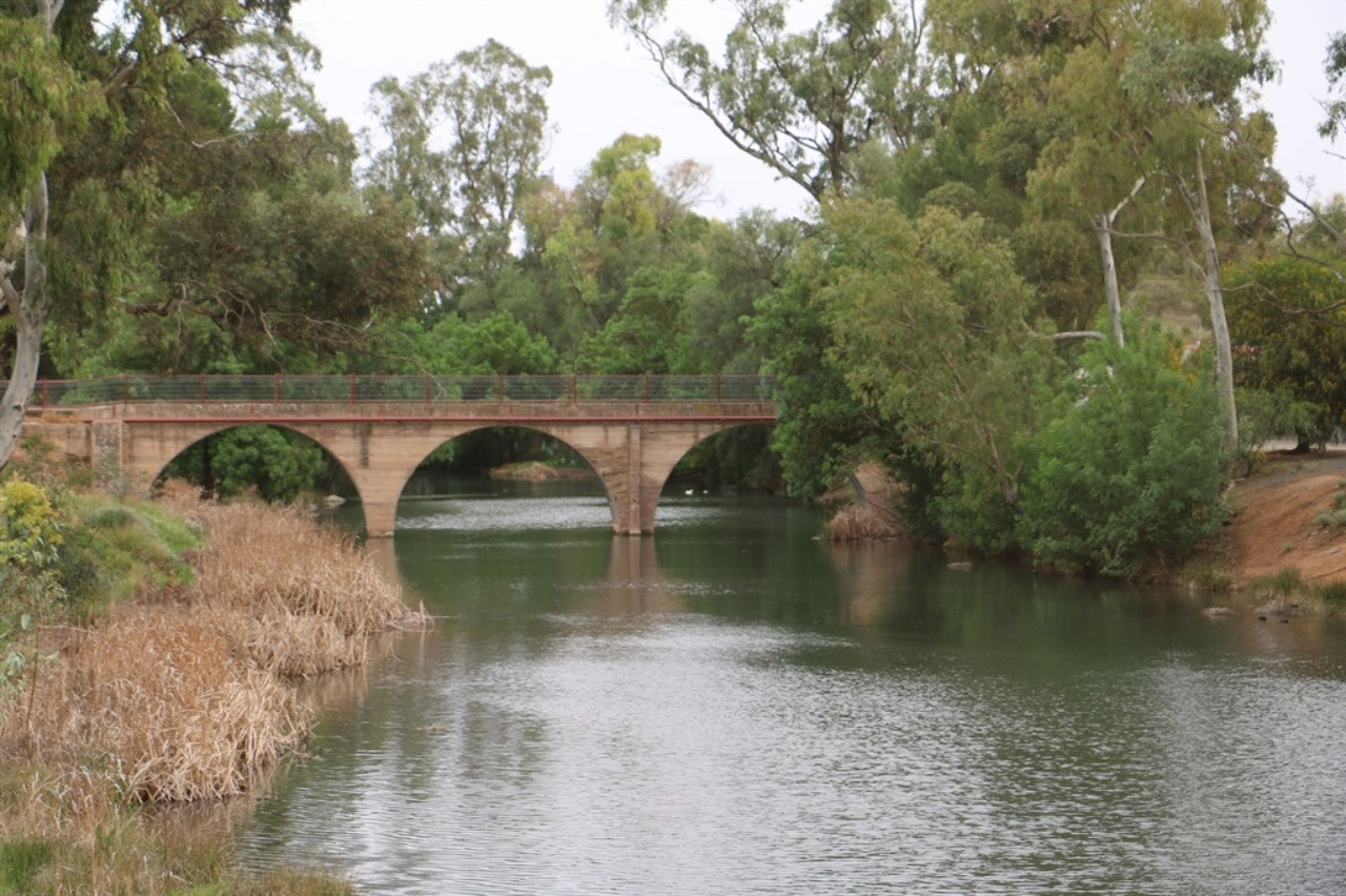
Burra is in the Bald Hills range, which is part of the northern Mount
Lofty Ranges. The Burra Creek runs through the town. The
town began as a single company mining township that, by 1851, was a set of
townships (company, private and government-owned) collectively known as 'The
Burra'. The Burra mines supplied 89% of South Australia's and 5% of
the world's copper for 15 years, and the settlement has been
credited (along with the mines at Kupunda) with saving the economy of
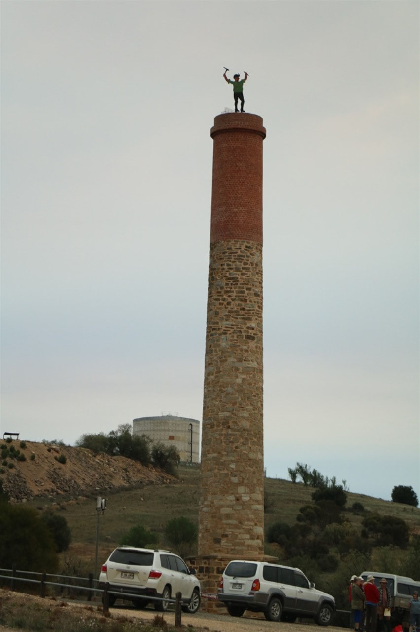
the struggling new colony of South Australia. The Burra Burra Copper
Mine was established in 1848, mining the copper deposit which was discovered
in 1845. Miners and townspeople migrated to Burra primarily from Cornwall,
Wales, Scotland and Germany. The mine first closed in 1877, briefly opened
again early in the 20th century and for a last time from 1970 to 1981. As
we left the town we saw people possibly doing a mine tour.
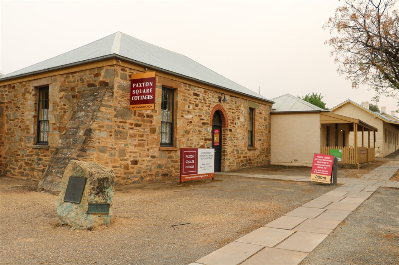
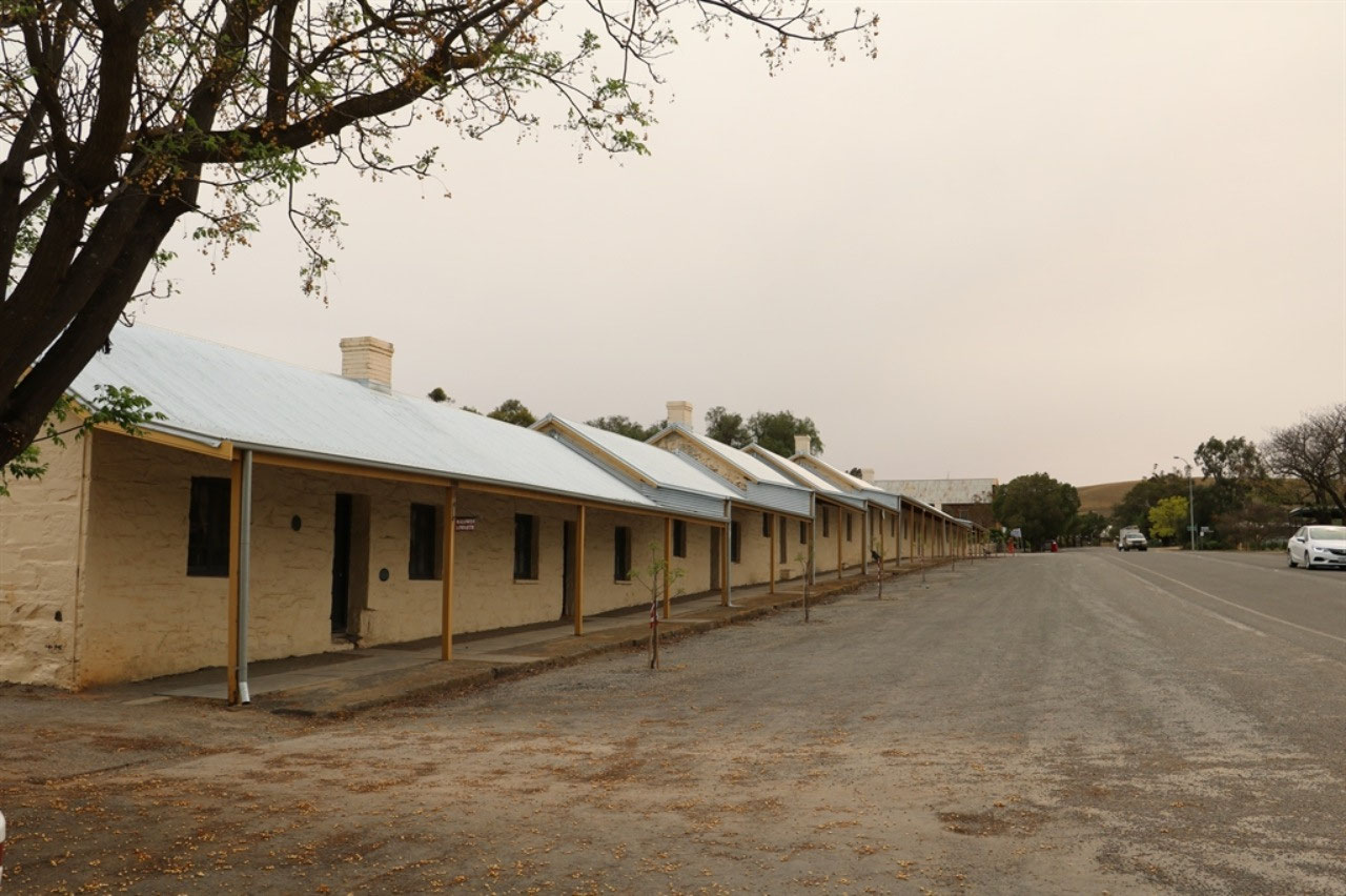
The 'Paxton Square Cottages' were built for miners. They were the earliest mining company housing scheme in Australia. The first of the 33 cottages were built for the South Australian Mining Association from 1849 - 1852. They were leased to miners for 3 shillings a week. In 1913 the Hon John Lewis purchased the cottages for 500 pounds 'to house the poor and needy of Burra'. In 1980 the Lewis Trust vested them in the District Council of Burra Burra. Today they are renovated and owned by the Regional Council of Goyder. They are popular affordable accommodation.
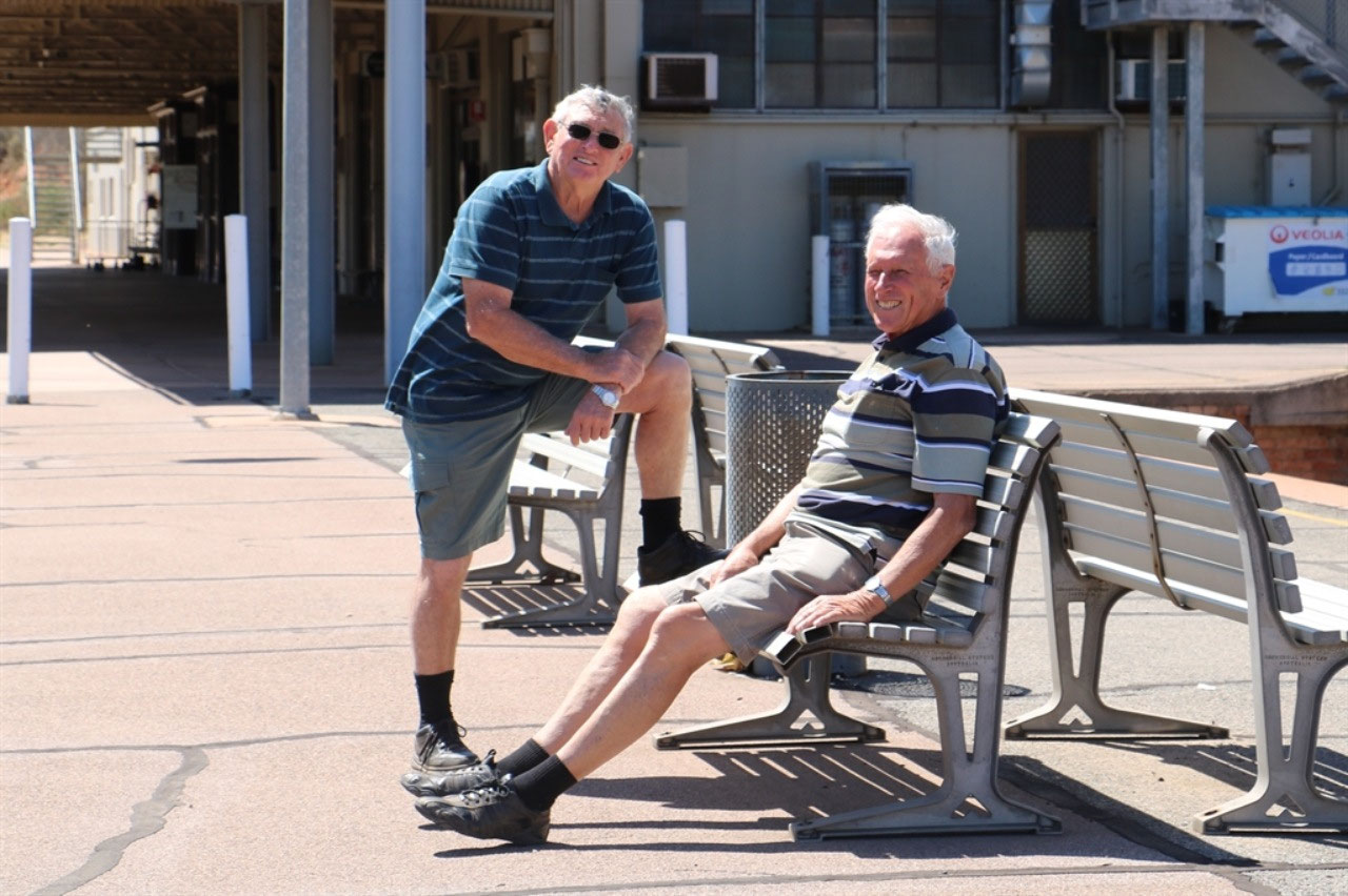
We spent about an hour in the town, walking the main street
photographing the historic buildings and the plaques on them. Peter headed towards the Burra Creek and
found just the fella to have a chat with in the carpark, as soon as we arrived. They must have chatted
for half an hour. This fella was a retired farmer aged 72 and he grew up on a farm about 20 kms
from Burra. Obviously ended up with a farm and sold out some years
ago. He now lives in Burra and has a
small block not far from town. He said "He had been talking with
younger farmers only a matter of days ago and the drought is the worst the
district has experienced”.
We had seen a lot of hay cut in this area also. Peter's friend
said "It is because of the drought, but some areas have been badly frosted".
It is so devastating when what little crop you do have is frosted. You
definitely have to be resilient to live on the land! Pete's Burra mate had actually
asked the young farmers why they were cutting Canola. It was too green to be swathing. They are actually going to bale it and sell
it to the feed pellet companies as straw.
The return is the value of about half a tonne of grain. Burra is just inside the South Australian
Goyder Line. Peter did talk to his mate about the 'Goyder Line' and he said "When it was drawn, the ‘Goyder’ bloke, purely took the line of the small mallee
trees". And a little more information about rain in the district. During the 1950’s and 60’s when Pete's new mate was a boy, the three creeks on
their farm ran every time it rained, and he couldn’t get to school. Since the mid-seventies they haven’t seen the
creeks run. Some of Peter's contribution to this blog.
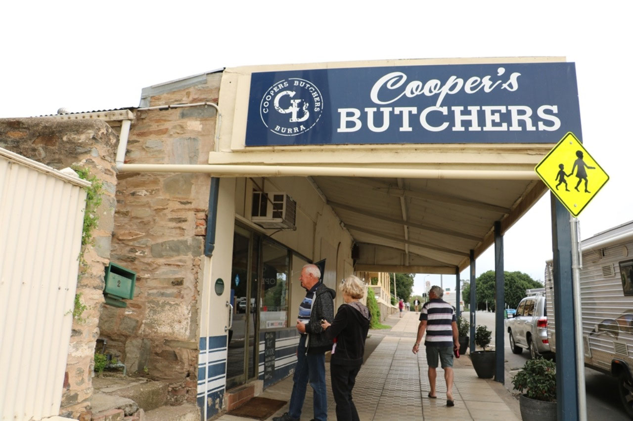
We had parked outside the Butcher Shop, so we purchased some meat for
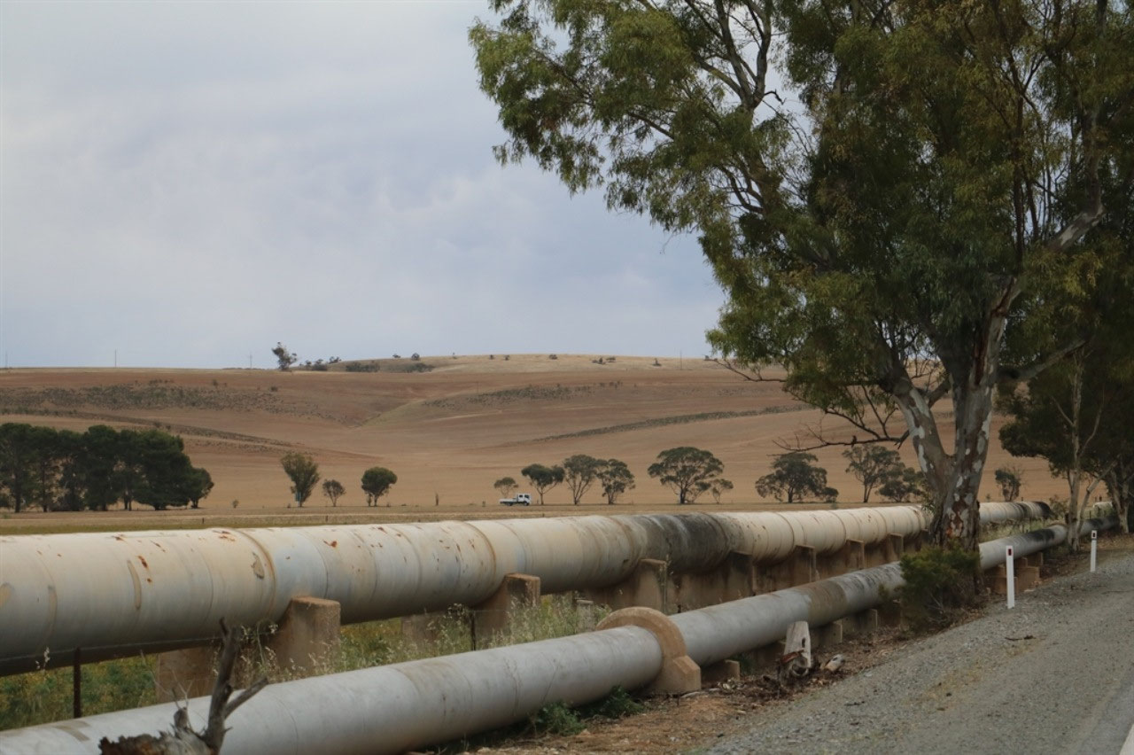
dinner, drank our coffee and then headed towards the town of
Spalding. The pipeline alongside the road had us guessing as to
where the water was being pumped from.
It is actually piped from Morgan. The Morgan to Whyalla Pipeline is in fact two pipelines. There is a small one beside the large. The first was the large and it was built in the 1940's to service the BHP steel mill in Whyalla.
Engineers visited Western Australia to inspect their achievements in above-ground pipelines, notably the Goldfields Pipeline. The pipeline from Morgan goes through to the coast at Port Pirie and then north to Port Augusta and around the top of Spencer Gulf to Whyalla. The second pipeline was built in the 1960's to cater for a growing population in the Upper Spencer Gulf and it goes across Spencer Gulf travelling underwater for 14 km to Whyalla. The pipeline is 379 kilometres long and the water is treated at the beginning of the pipeline, as it is pumped into the system. The dual-pipeline system can now deliver 66,000 megalitres of water annually.
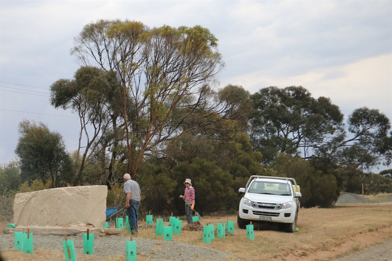
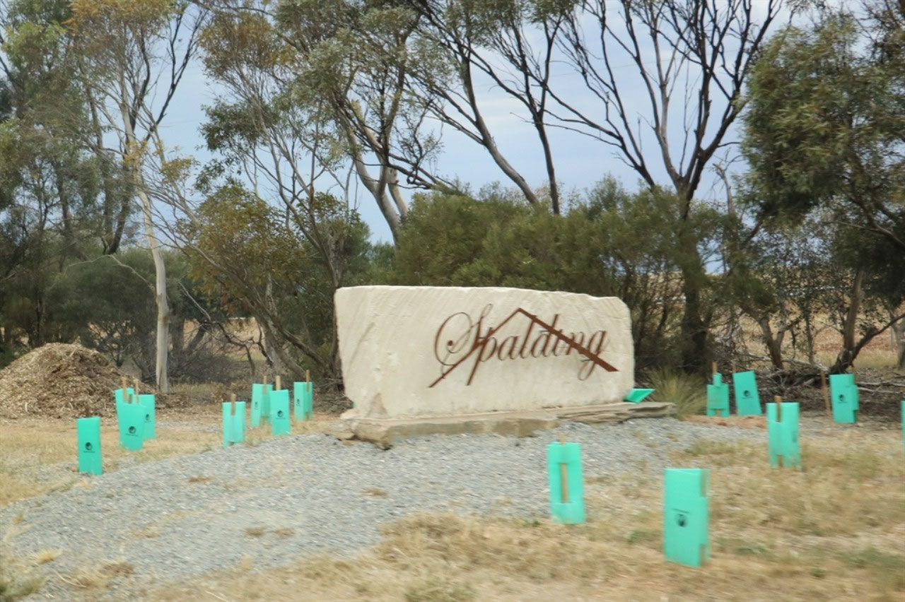
There is very little at Spalding, but I was happy with the snap I
managed of an elderly couple planting trees at the entrance to the town.
The population of the town is only 200. The oldies in the community were still
doing their bit to keep the town looking inviting.
From Spalding we took a road west and we were then back on the Horrocks
Highway. We were about 60 kilometres north of Clare. We travelled north through Georgetown to
Gladstone, where we took a right turn at the grain silos, taking us into the
centre of the town. The Viterra grain
receival site at Gladstone is reported as the largest inland grain storage facility in Australia, with a storage capacity of in excess of 600,000 tonnes. Mingenew storage is 403,000 tonnes, so it cannot be the largest inland grain storage facility in the Southern Hemisphere as is reported on the web!
Peter was really keen to find out about the old water channels we had
seen in our travel. So he went across to
the Information Centre, while we took in the War Memorial area that has
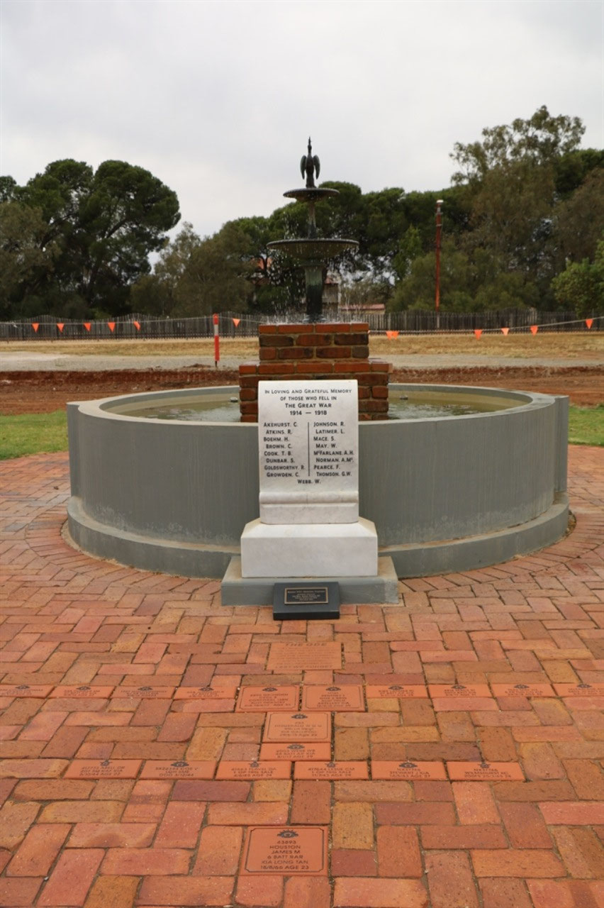
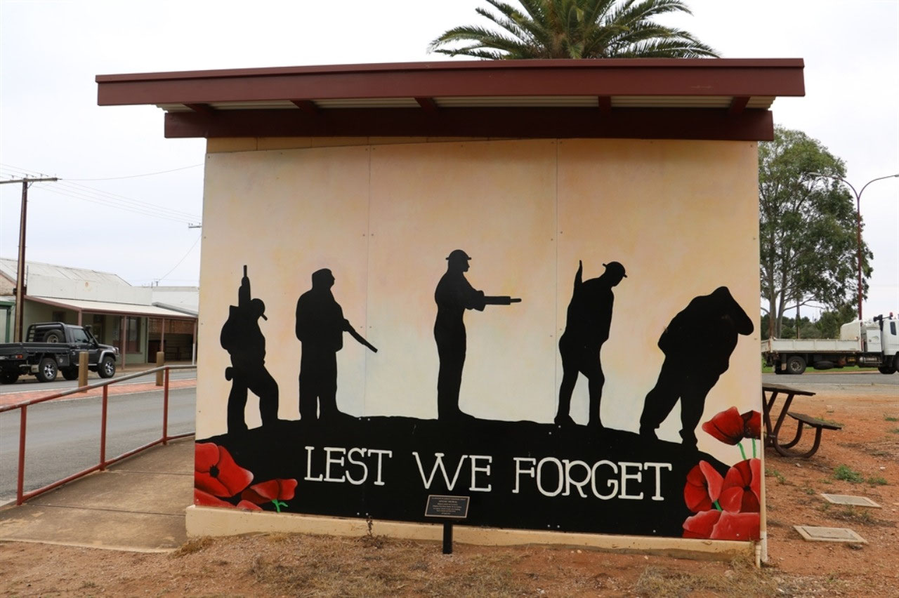
recently been restored. The ‘100 Years
of Anzacs – We Will Remember Them’ project funding has certainly enabled communities
to restore original War Memorials and add to them in some instances. In
Gladstone a mural has been painted on the wall of the public toilet, adjacent to the War Memorial. The WWI Memorial Fountain has been restored and was officially re-opened on 26th April 2015.
The story of the water channels was that they were built to collect water many years ago. The water was for
community use in these isolated locations.
The channels go to a lake that we had passed halfway between
Spalding and Gladstone. We had noticed a
pumping station on the edge of the lake.
The lady could remember when the town water was a bit muddy after rain. The pumping station is no
longer used. All the town water comes
from the Murray River, via the pipeline from Morgan. Peter also found himself a mate with this lady. She was happy to keep chatting with him. It was 'Have a Chat' day. So more blog info from Pete.
It was a little early for lunch, so we decided to get a few more
kilometres north, particularly as the weather forecast was not looking good. Strong
winds were predicted. We spotted a
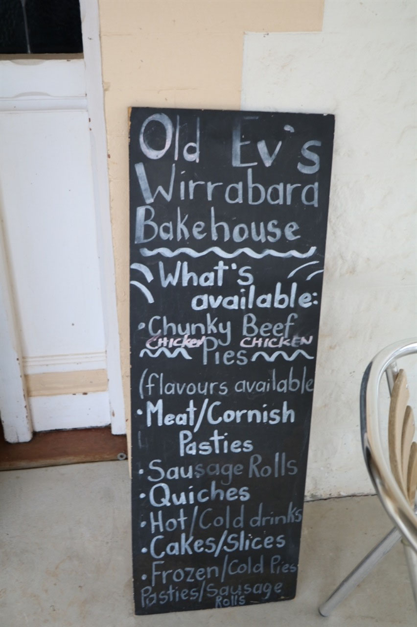
bakery sign at Wirrabara and as the winds were starting to pick up, Peter decided
another pastry for lunch was the go. The
bakery was named ‘Old Ev’s Bakery’!
There was a comment or two made, and not by me. I told Ev, that Evelyn was my mother in-laws
name. Peter’s idea was that we would eat
our lunch as we walked back up the street to the vehicles, but by the time we came out it was
raining. So we stood on the veranda and
ate! Not good when we could have sat at
the table, but that's Pete. We had places to go and that Range to go through! Eating on the verandah did enable Peter to go back into the Bakery, to tell ‘Old Ev’ that it was the best pastie he had had for some
time. His mother made a pretty good pie too!
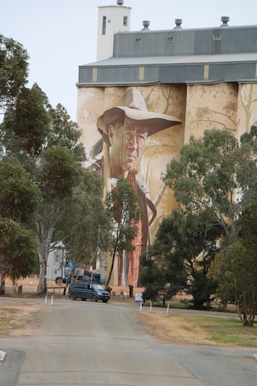
Walking to the Bakery enabled us to get a
photo of the newly painted Silo Art in Wirrabara. There is considerable money being spent on Silo Art in South Australia. I think I read somewhere that the cost of this Silo Art is something like $60,000, but I don't seem to be able to substantiate that figure yet! This art was finished just a few weeks ago. We were guessing who the fella might be. I thought maybe Slim Dusty and Dorothy
suggested John Wayne. Seems that the face on the silos is that of Dion Lebrun and he lives in Tumby Bay. Dion was involved with the painting of the silos in Tumby Bay and the same artist was commissioned to paint the Wirrabara silos. The story is that the artist asked Dion if he would like to be the 'Face'! The Wirrabara Community Tourism and Development Group believe that local people did not want to pick a particular local resident as they did not want people to feel overlooked.
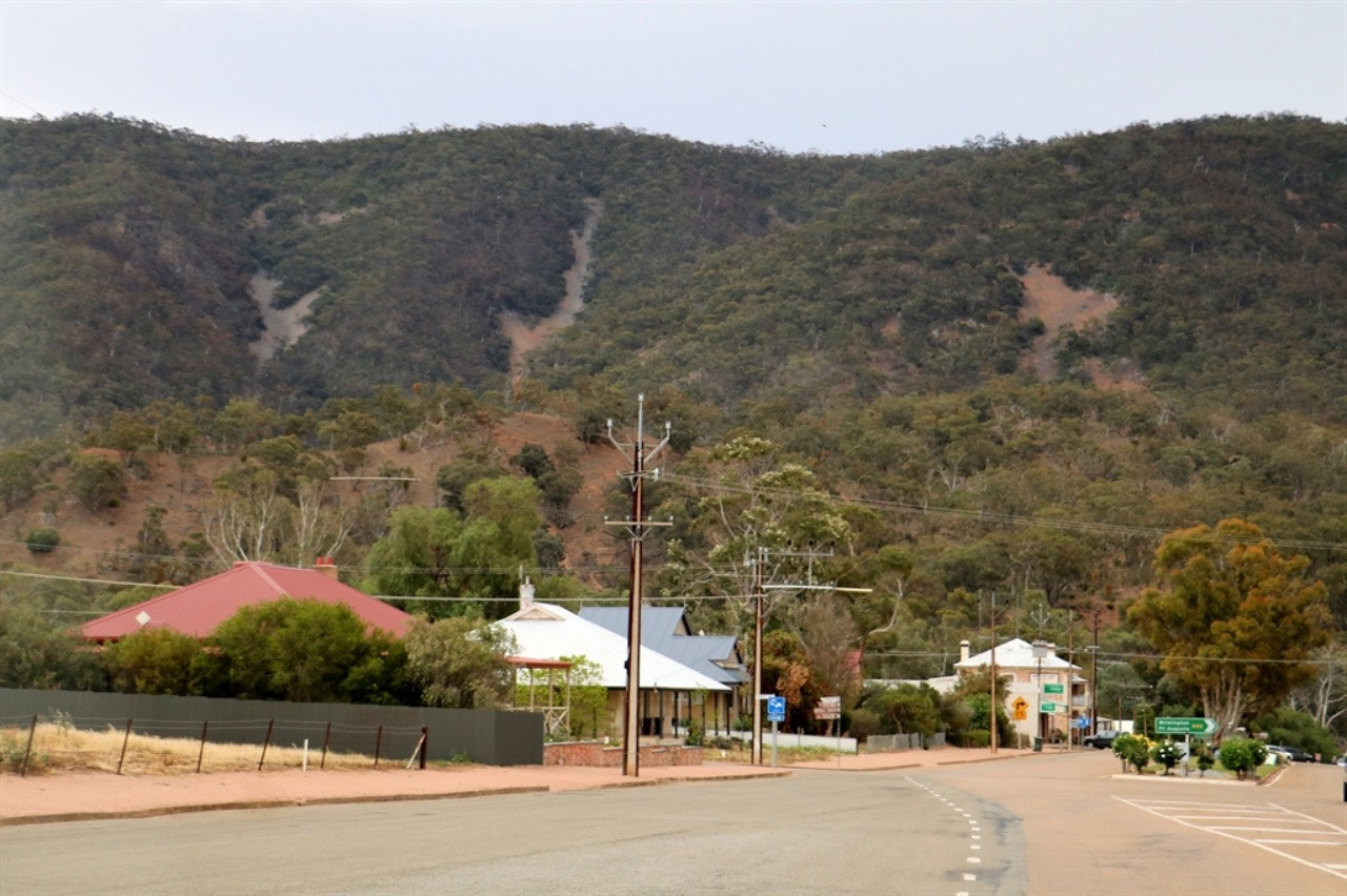
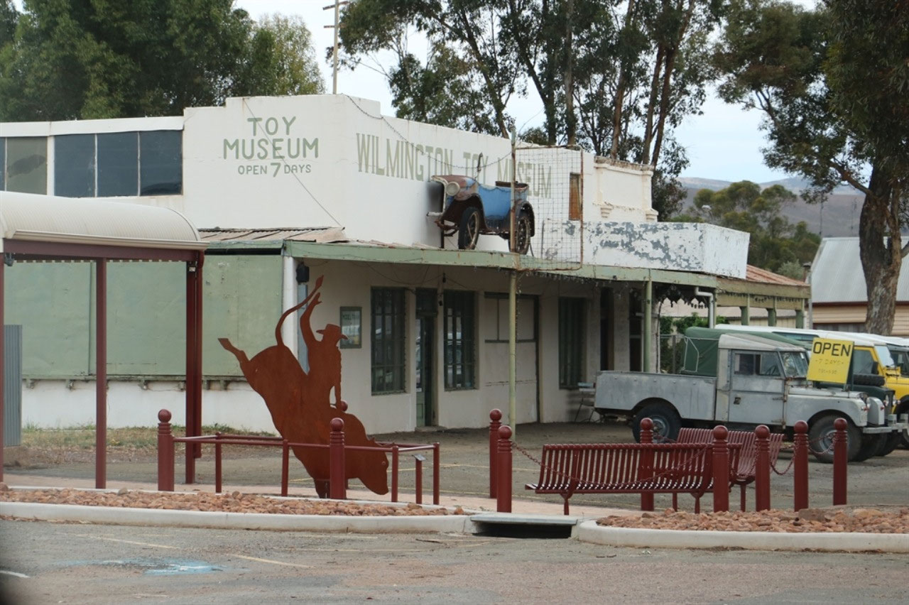
No more stops and we travelled further north through Laura, Melrose and then
Wilmington. Melrose is at the bottom of
Mount Remarkable and looked a quaint little town for a stopover. In travelling from Melrose to Wilmington, we
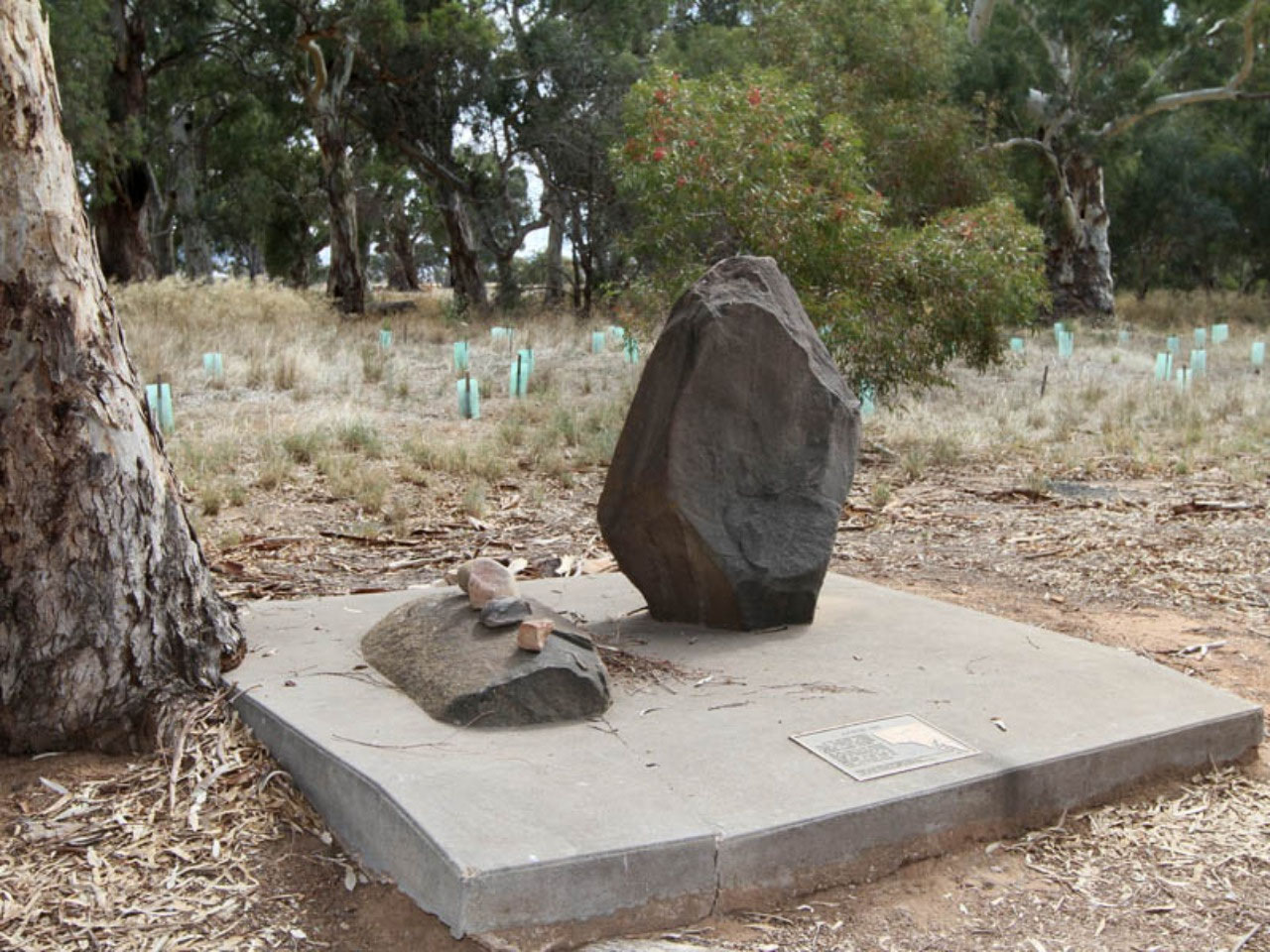
crossed the Goyder Line. There was a sign on the side of the road, pity neither John nor I managed a snap. Damn! We
have talked so much about the ‘Goyder Line’. But I did copy an image from the web of a rock or Cairn that marks 'The Line'!
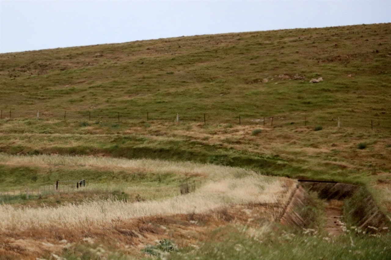
The Flinders Ranges were very dry but there was no hassle coming through. The distance through the range is less than 20 kilometres and there is only about five kilometres of climbing the range, to wind your way down the other side.
By the time we arrived in Port Augusta the temperature was over 30 degrees and it was blowing dirt everywhere. You couldn't see the ranges. Some West Australians came into the park and they had travelled from Broken Hill. She said "It had been blowing dirt all day". With the season as it is, it would be terrible! So that was 'Day One' of our two night stay in Port Augusta.
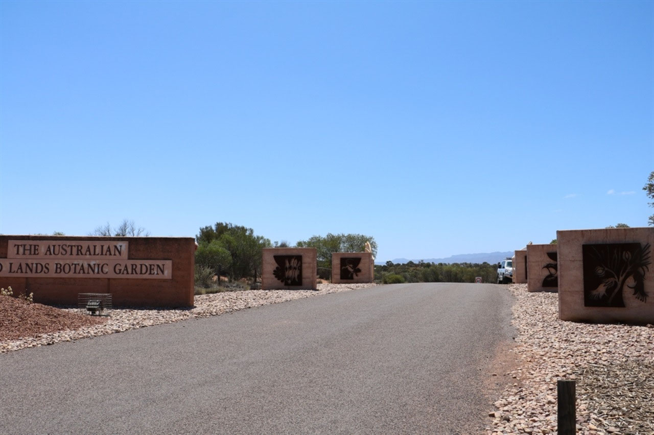
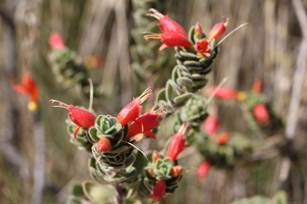
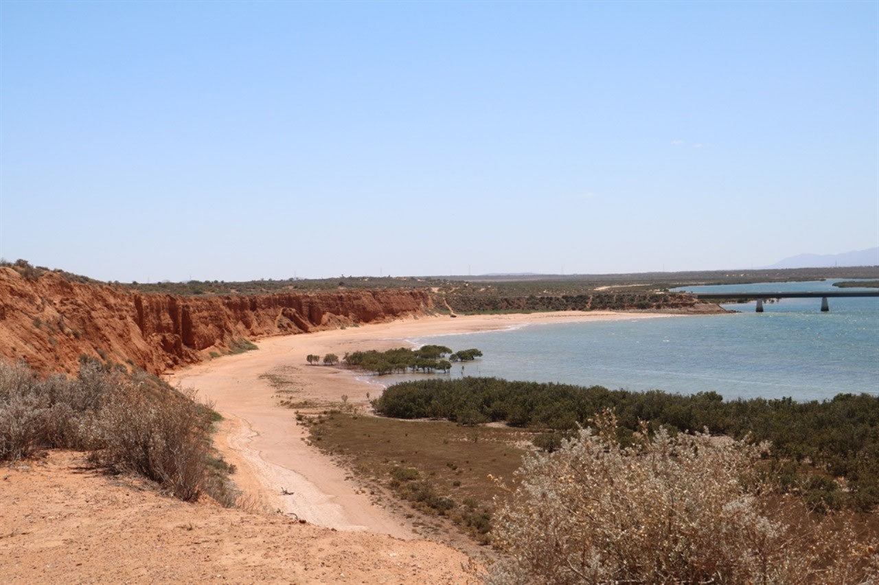
On Saturday, with the washing done, we went to the Australian Arid lands Botanical Gardens, a few kilometres north of Port Augusta on the Stuart Highway. It is what is is! Dry and arid and in a year such as 2018, it was even dryer than it would normally be. One does take their hat off to the committee and those with the vision to create these gardens. You do get spectacular views across Spencer Gulf to the Flinders Ranges, from the Matthew Flinders Red Cliff Lookout in the gardens. The Botanical Gardens have been established on more than 200 hectares of land. Many of the plants have been grown from seeds collected by Robert Brown, the botanist that sailed with Matthew Flinders. And we found our first geocache at the Arid Gardens.
After lunch we visited the Platform Gallery at the Port Augusta Railway Station. It is the home of the Curdnatta Art Group. The old booking office at the station and the adjoining rooms, are now a retail outlet for local artists work. There was a couple of interesting murals at the station to photograph. No trains stop at the station anymore.
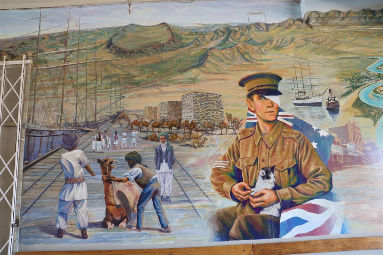
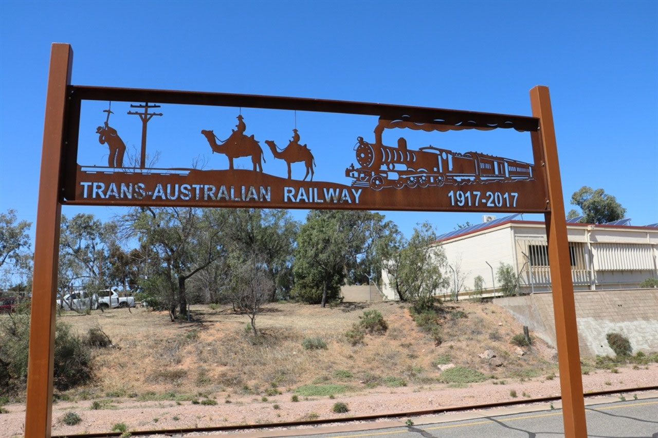
The Trans-Australian Railway between Port Augusta and Kalgoorlie was constructed between 1912 and 1917. The 1,690 kilometres of 1435 mm (4 foot 8 1/2 inch) standard gauge railway line united the east and west of the continent and realised commercial and strategic benefits flowing from Federation. It was the largest Australian construction project up to that time and involved the first use of mechanical track-layers in Australia. A 478 km section between Ooldea and Nurina is the longest railway straight in the world.
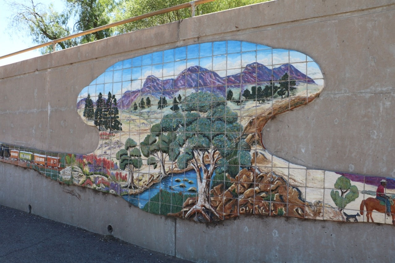
Then we found the 'Mural on the Hill'. It has been placed on the wall of the All Saints Catholic Church on Flinders Terrace and is named 'Our Story, Our Pride'. It features 2,500 hand painted tiles and interprets the story of Port Augusta from Aboriginal Dreaming to European settlement, through to present day.
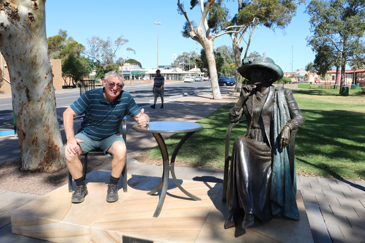
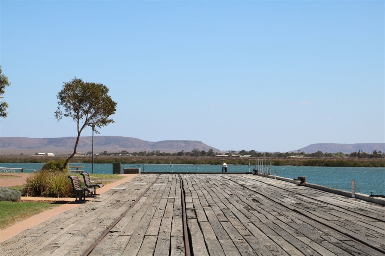
After a walk along the old wharf area and a little grocery shopping in the car, we found the sculpture of the late Mayor Joy Baluch AM. The bridge on the main highway over Spencer Gulf, built in 1972 is also named in Joy's honour. Joy was a dedicated and passionate Mayor of Port Augusta for nearly 30 years. You are encouraged to take a seat and have a chat with Joy.
History of Port Augusta: In 1802 Captain Matthew Flinders navigated and named Spencer Gulf in his ship 'The Investigator'. He examined the head of the Gulf in a cutter, hoping to find a waterway to the interior. The botanist in the party was Robert Brown and Mount Brown was named after him. Mount Brown is in the Flinders Ranges about 20 kilometres east of the town. Edward John Eyre passed through the district several times in 1839/40. John Ainsworth Horrocks also explored the district, as settlers began to farm the fertile country north of Mount Remarkable in the 1840's. The first pastoral leases were granted in 1851. The town was named in May 1852 after Augusta Sophia Marryat,who at the age of 22, married Sir Henry Young, the first civilian Governor of South Australia. In the early years of settlement Port Augusta had no reliable drinking water. Water was sourced from a creek below Mount Brown and brought to Port Augusta in casks on drays. In 1865 a pipeline was laid from Woolundunga Springs in the Flinders Ranges into Port Augusta. There were various attempts during the 1920's and 1930's to overcome water shortage issues. Finally the water supply from Morgan was secured in 1944, due to the need in Whyalla. It took industry and not people for that water supply to be financed!
Saturday was a much nicer day. During a drink together we reflected on what we have learnt over the last two days. Like Gladstone having the largest grain storage facilities, the person that is depicted on the silo art mural at Wirrabara, the pipeline from Morgan and agriculture in South Australia. It was nice to be able to sit out in the sunshine. Hopefully we will have nice weather in Streaky Bay during the next two days.

Jenny
2018-10-22
Yay! You found a geocache...you go girl! Love those murals and the WWI tributes have been fantastic to see. Gee Pete, I bet you would have run a mile if that statue had spoken to you :-)