 Narrogin, Western Australia, Australia
We have had a really interesting day today, travelling approximately 450 kilometres and ending up at Narrogin. If we had gone straight north from Albany, it would have only been 270 kilometres! We said 'Goodbye' to J & D this morning, until we are both back in Geraldton next week. They intend to take a few tracks in the south west and be back in Perth by the weekend to visit family. We intend to wander out in the wheatbelt for a few days. I'm not convinced we will 'Wander' in what I believe is the true sense of the word, but we will travel the wheatbelt and plan to arrive at Woodlands Farm by Thursday night.
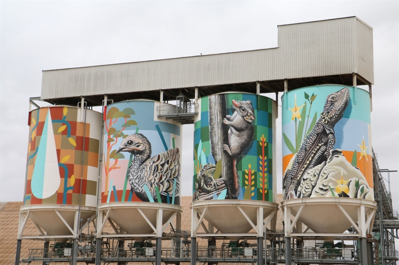
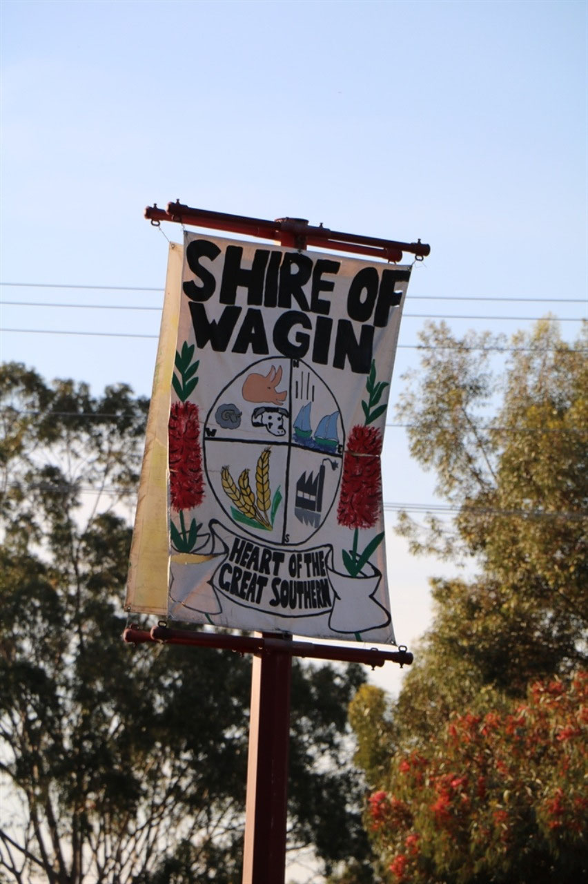
After seeing the silo art at Ravensthorpe, I googled to see what other silos had art work on them in Western Australia. I had remembered reading something about the silos at Merredin being painted before we went away. When we saw there were a number of silos in the Lower Southern region that make up the 'Public Silo Trail', we decided 'The Trail' was a possible way to travel home.
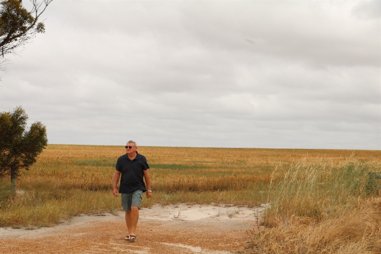
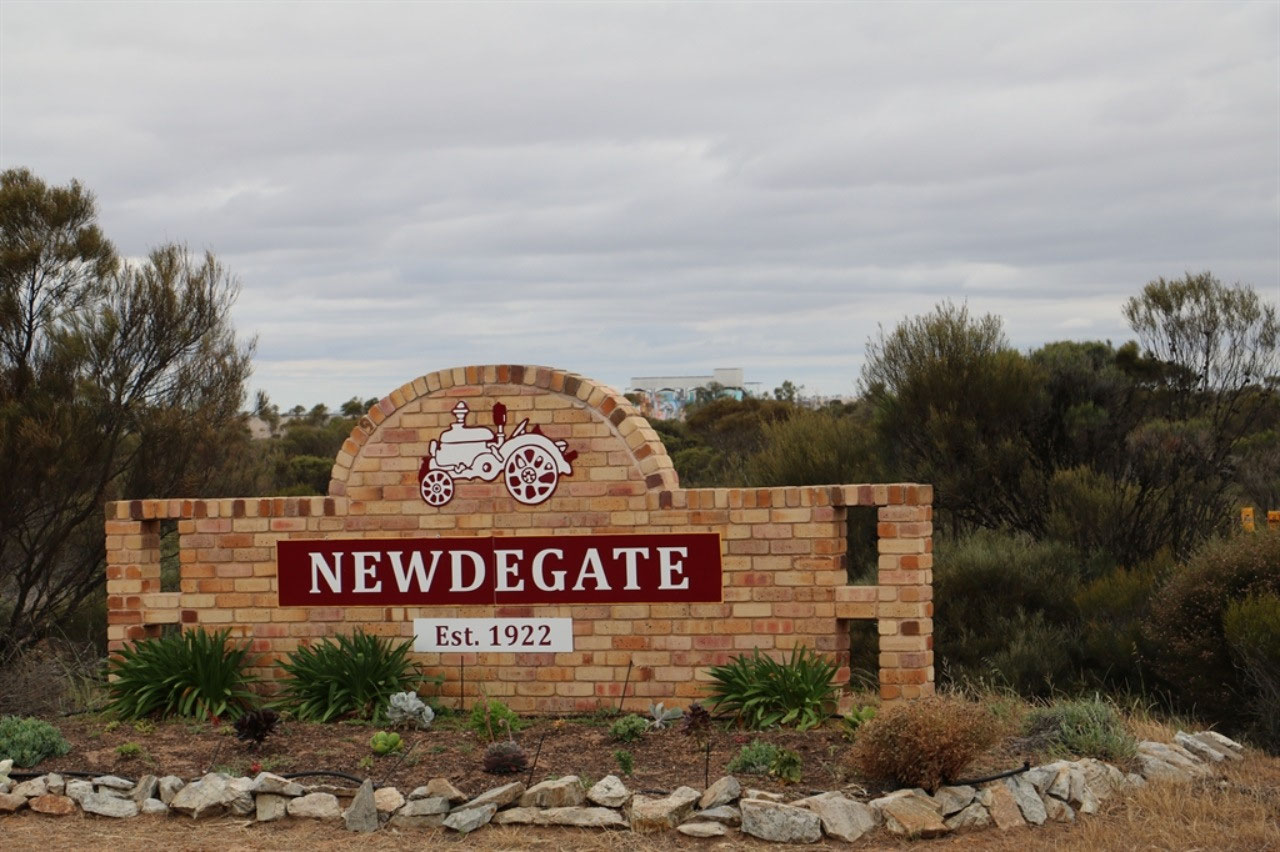
We have had to give Katanning a miss this trip, but we did go all the way out to Newdegate to capture a snap of the silos there. And of course Peter has enjoyed estimating what a crop here and there would yield and he has been happy to stop for a cache here and there too! I actually think he is starting to think/believe that there is more to geocaching, than just searching for something someone has hidden! It gets you out of the car, you see more of the countryside and towns, and the information provided with the caches is very informative.
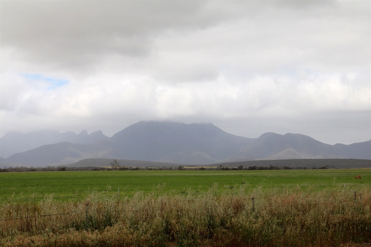
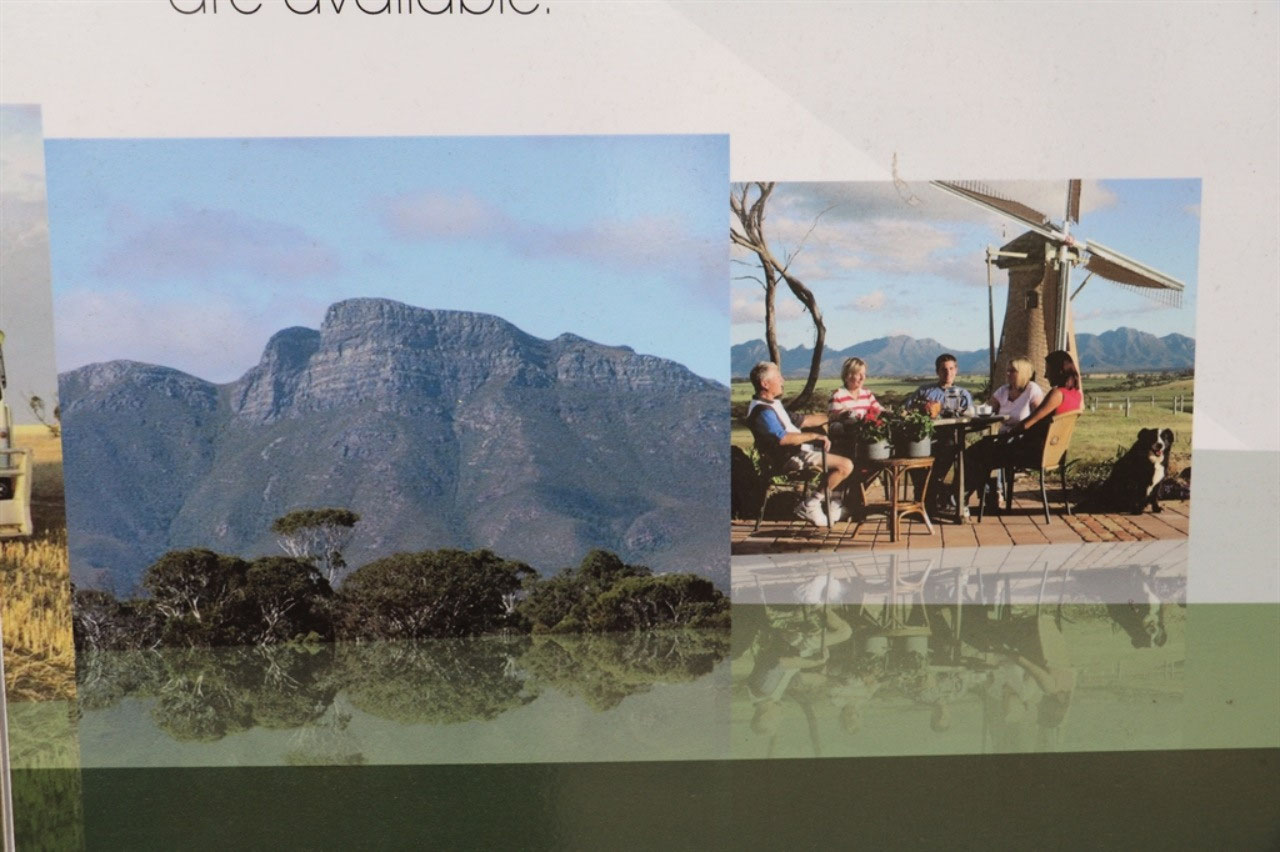
Borden: This was our first stop, just over 100 kilometres from Albany. The road we travelled was the Chester Pass Road and this took us through the Stirling Ranges and the National Park. Both John and I had tried to get good snaps of the Stirling Ranges as we came into Albany from Jerramungup. We got a couple, but it wasn't easy trying to dodge the trees. The Stirling Ranges span 65 kilometres from east to west and Bluff Knoll is the highest peak at 1095 metres. It is the highest peak in South Western Australia. I did not realise we would be so near to Bluff Knoll today. It was a shame that the peak was in the clouds, but the road was very good and we would consider going through Borden and the National Park on another trip south to Albany. You would travel east from Broomehill to Gnowangerup and then down to Borden and Albany.
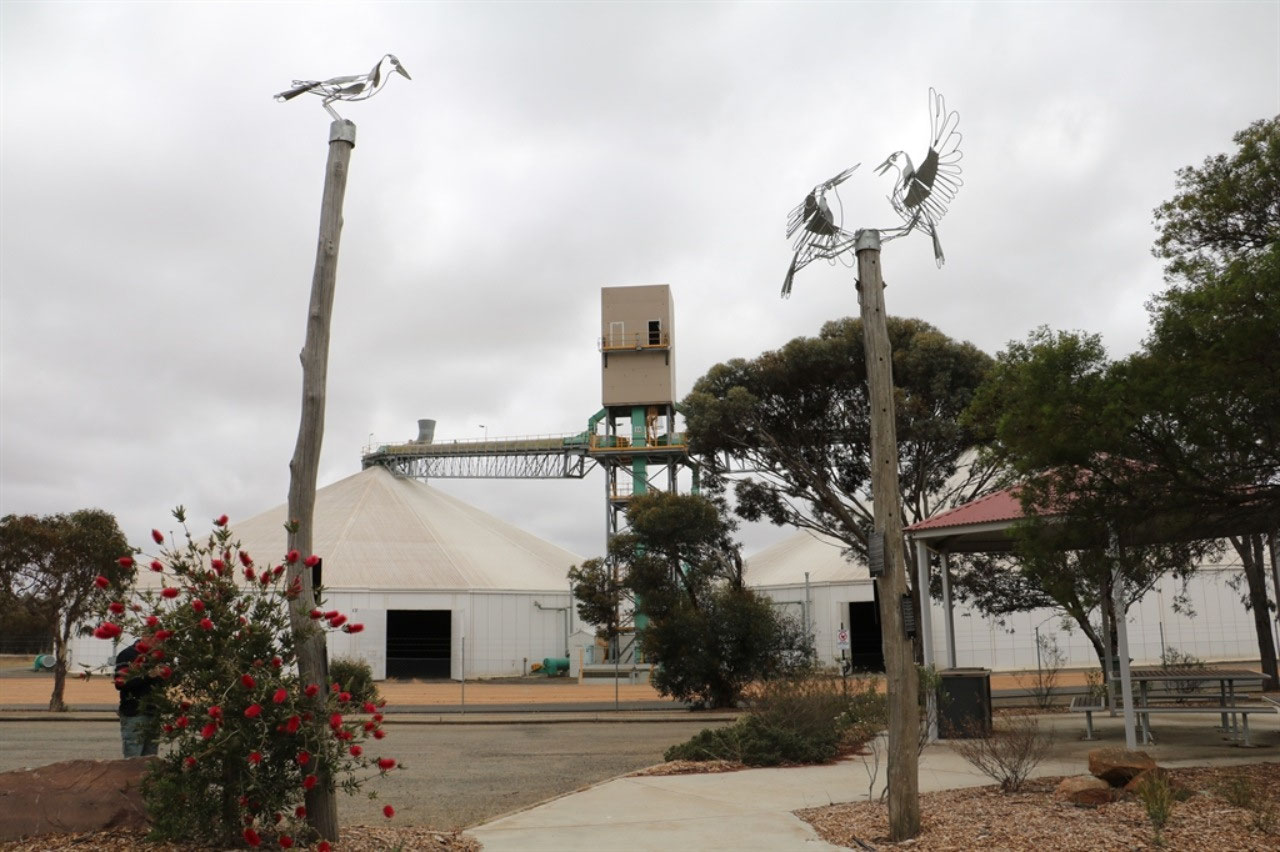
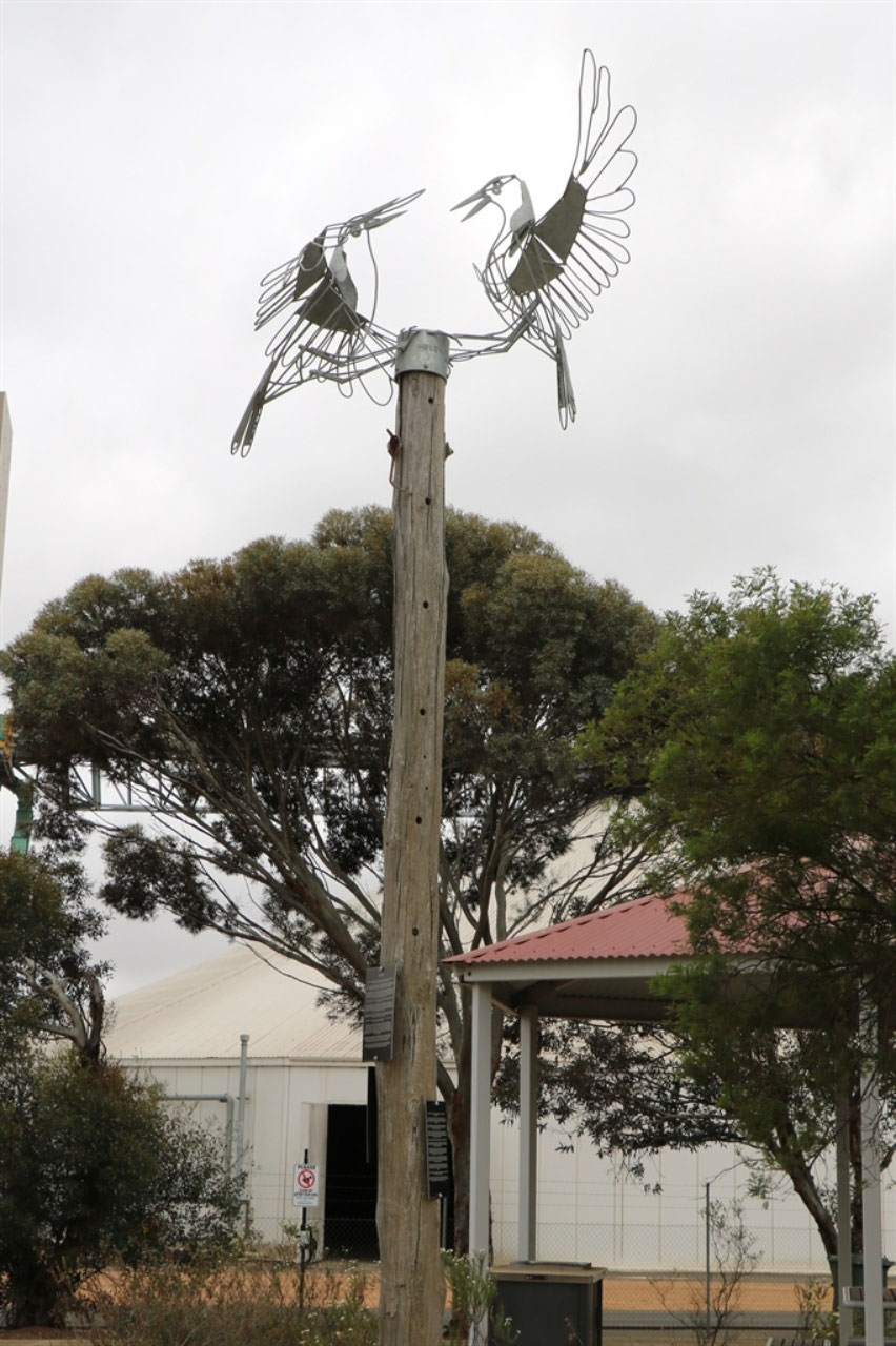
Many Australian towns have been named for strange reasons but the decision to name Borden after Sir Robert Laird Borden, the Prime Minister of Canada from 1911-1920, ranks as one of the strangest choices in the country. There was not a lot at Borden, but the town promotes itself as the home of the 'Borden Bombers', with crafted Magpies on poles around the town. Every town in Australia could have a "magpie flight path" but tiny Borden was the first and each pole has a plaque recounting stories of the area. The population of the town is less than 200 and probably not likely to increase.
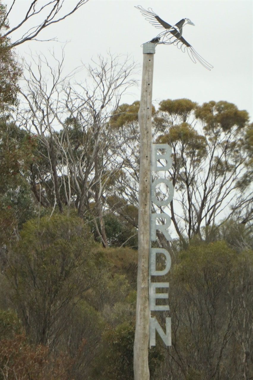
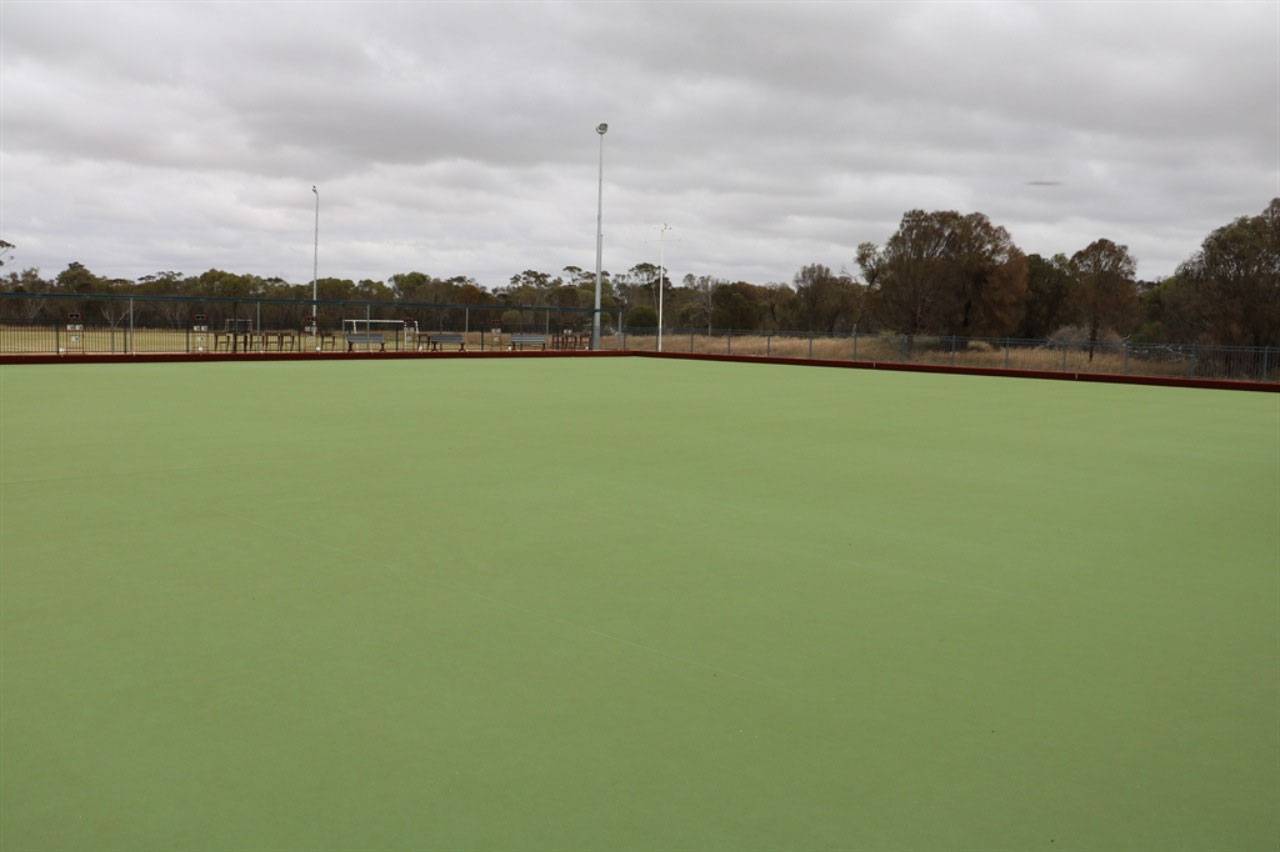
The grain receival site stretches for the full length of the town, so it must be a busy little town during harvest. It has a capacity to hold 300,000 tonnes and, as such, is one of the state’s primary grain receival points. We found the cache and checked out more of the local history provided in the park opposite the General Store. Peter asked the lady in the store if she knew of Neil Eastough? She had to think for a bit and then said "Oh yes, you mean 'Bucket"! She told Peter where they had moved to and where Eve was teaching, but I will have to confirm that with Wendy and Maureen. I think Pete might have got the 'Ups' mixed up! We had not been in the park long when John and Dorothy turned up. We had not realised they intended to come this way. Dorothy had a friend that had settled or come from Borden. They were heading to Gnowangerup. We checked out the new sporting facility together and said 'Goodbye' again. In a week we will both be back in Geraldton and a week after that, we will probably be thinking "Did we really do this trip around Australia"? It normally doesn't take long to get back into the swing of things at home!
Pingrup: Onwards for us to Pingrup, out on the road towards Ongerup, before turning off and heading north. All these 'Ups' in this area. There's Badgebup, Amelup, Tambellup, Porongurup, Kendenup and Kojonup! I have found the following on the web which satisfies me now why so many towns in areas of WA are named as they are. The suffix originated in a dialect of Noongar, an Indigenous Australian language, in which "-up" means "place of". The suffix "-in" or "-ing" has a similar meaning in a related dialect of Noongar. Places tended to be named after their distinctive features, whereby the place names could be used to create a "mental map" allowing Indigenous Australians to determine where water, food and other raw materials could be found. These sites were often located near sources of fresh water, leading to the common misconception that "up" and "in" mean "near water". There are 99 WA towns ending with 'up', listed on Wikipedia.
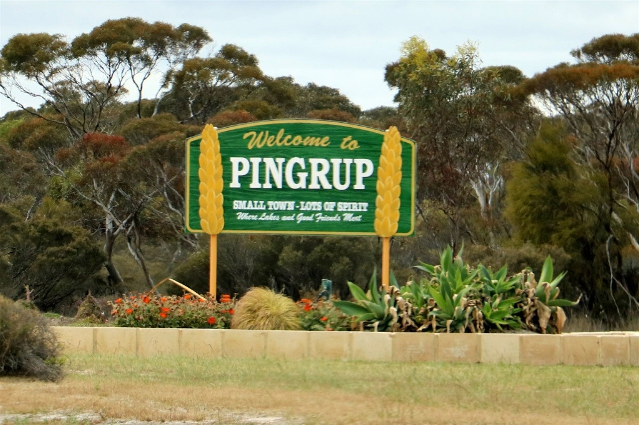

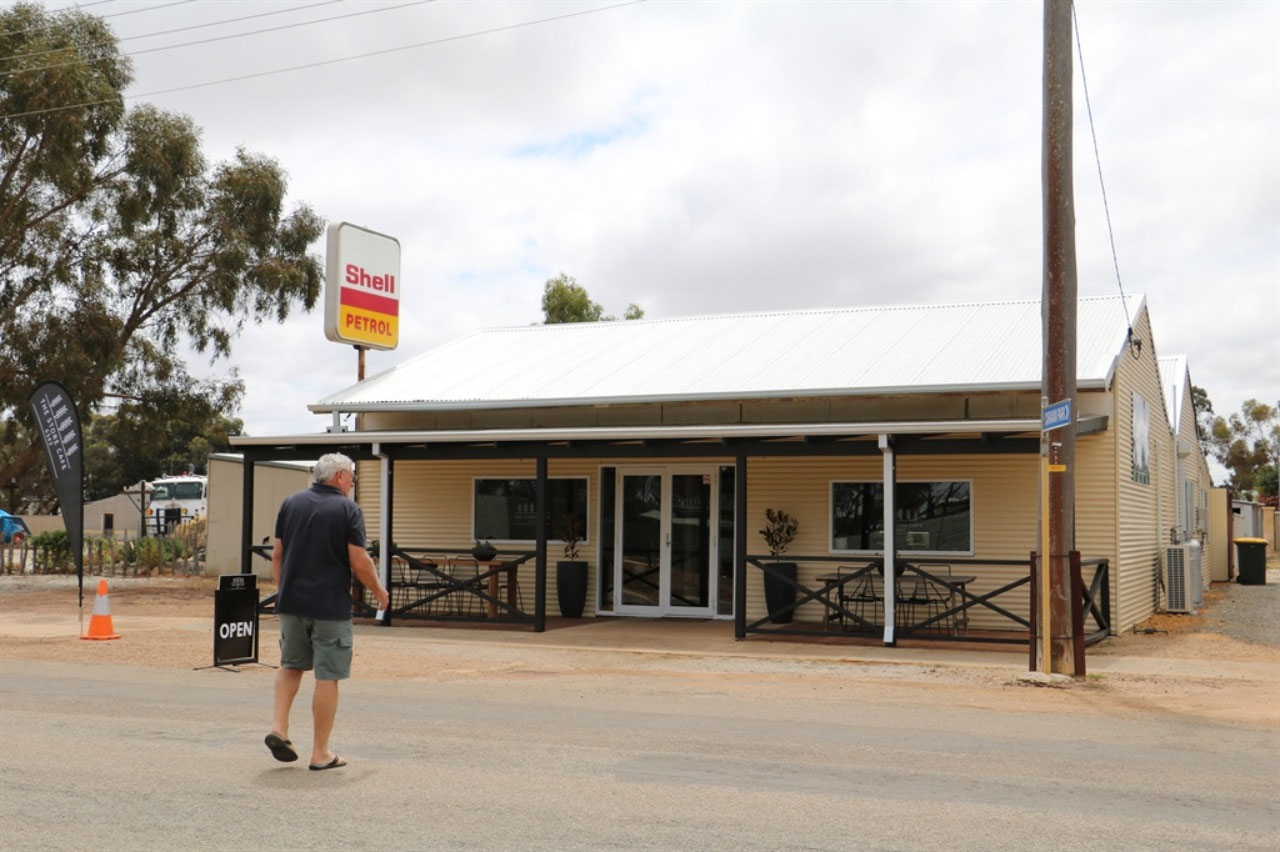
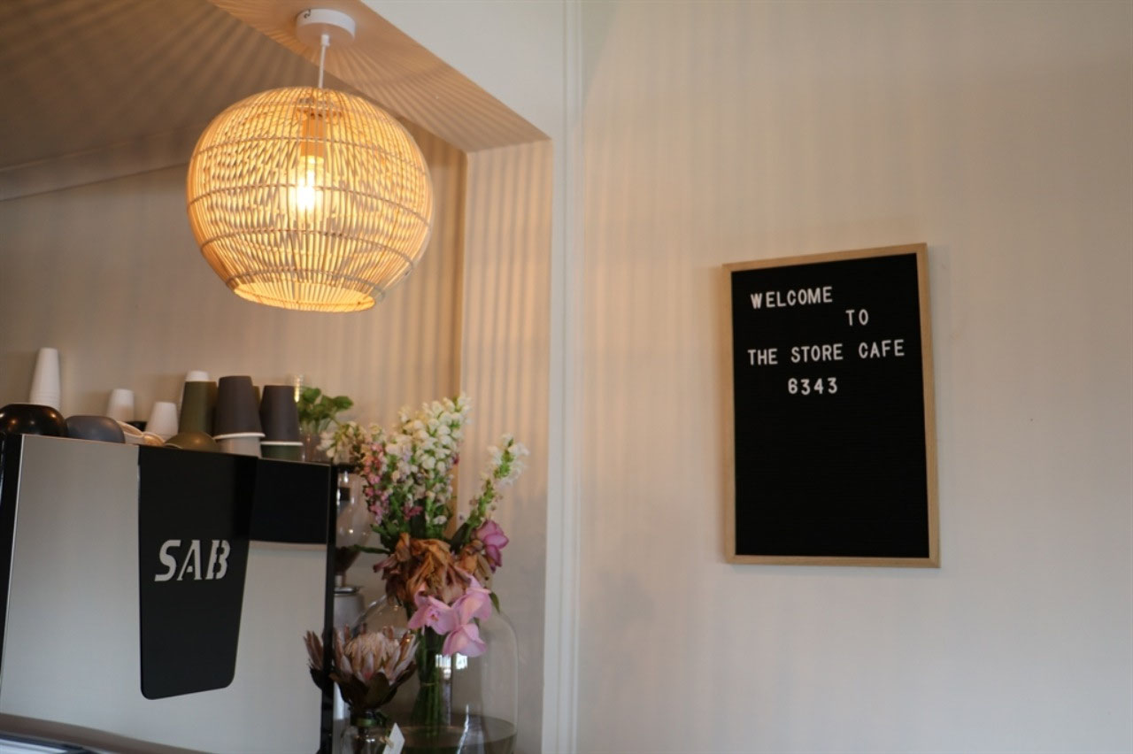
Pingrup was a really nice little town and one we would not have considered visiting with out the desire to do the 'Public Silo Trail'. I'm sure the silo art work will be a great boost for these small towns. We parked in a nice park opposite the Store Cafe 6343 and we enjoyed a ham croissant and coffee for lunch at the cafe. Then Pete spotted some rocky road that had been made in Kulin, then we decided to share a slice of chocolate caramel slice! So we would have provided 30 tourist dollars to the town by the time we left.
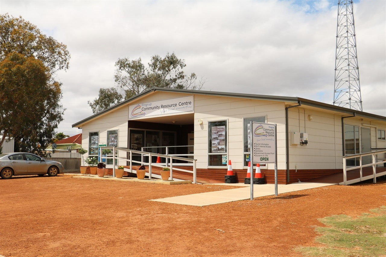
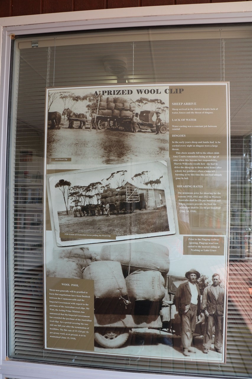
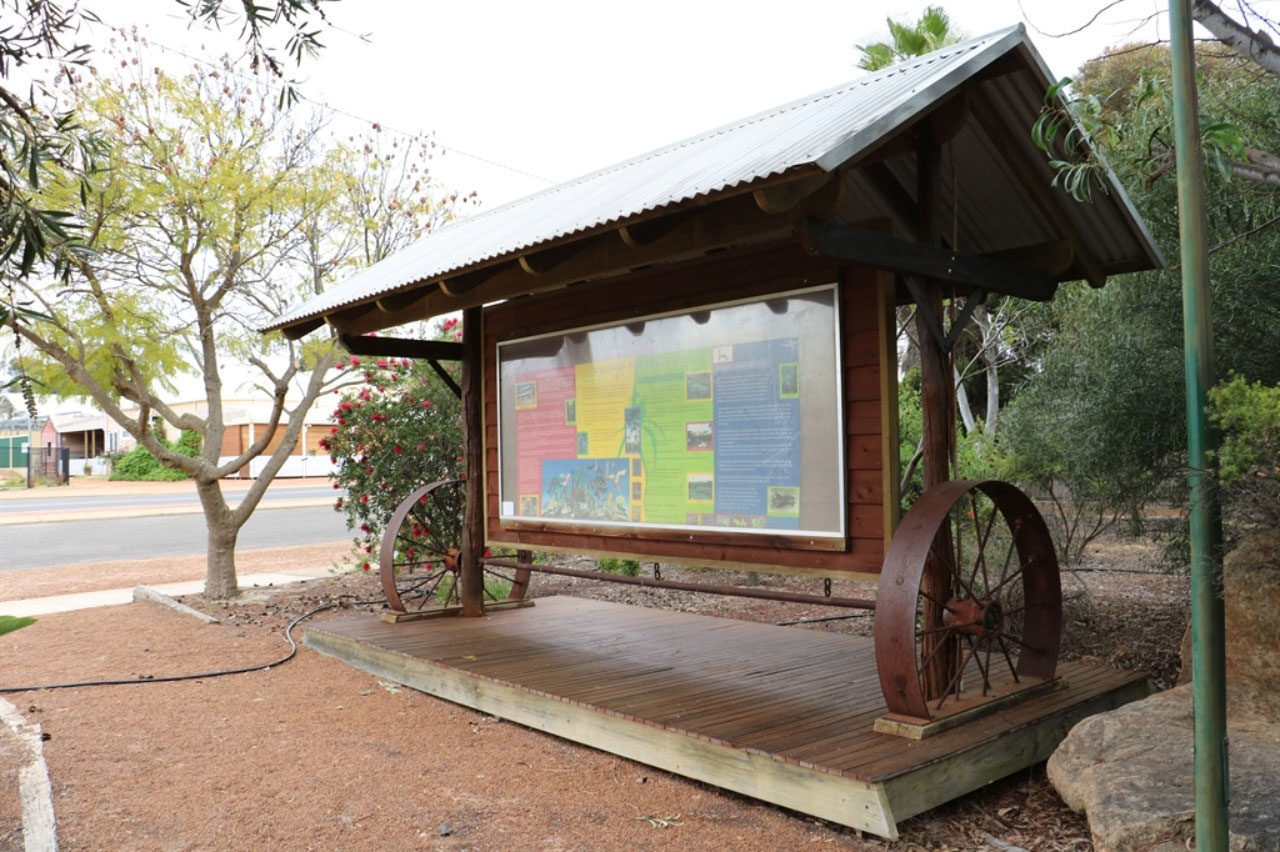
We really liked the way Pingrup have displayed their history at the Resource Centre too. More ideas to bring back home. The Pingrup Community Resource Centre has been operating since July 2000. There are over 100 Resoirce centres across the State, initiated through the Royalties for Regions and they are now supported by the Department of Primary Industries and Regional Development. Pingrup is a small peaceful community with a population of approx 100, situated in the Shire of Kent. The town was officially established in 1924 although the first settlers arrived in Pingrup in 1911. The history boards had stories on the following topics; Hardships, The Changing Faces of Pingrup, Early Farming, Cutting Hay, Early Schooling in Pingrup, War Heros of Pingrup, Early Buildings in Pingrup, Dam Sinking, Mail Service, A Prize Wool Clip and the Railway Line Opens in 1925.
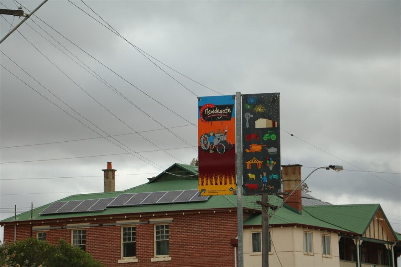
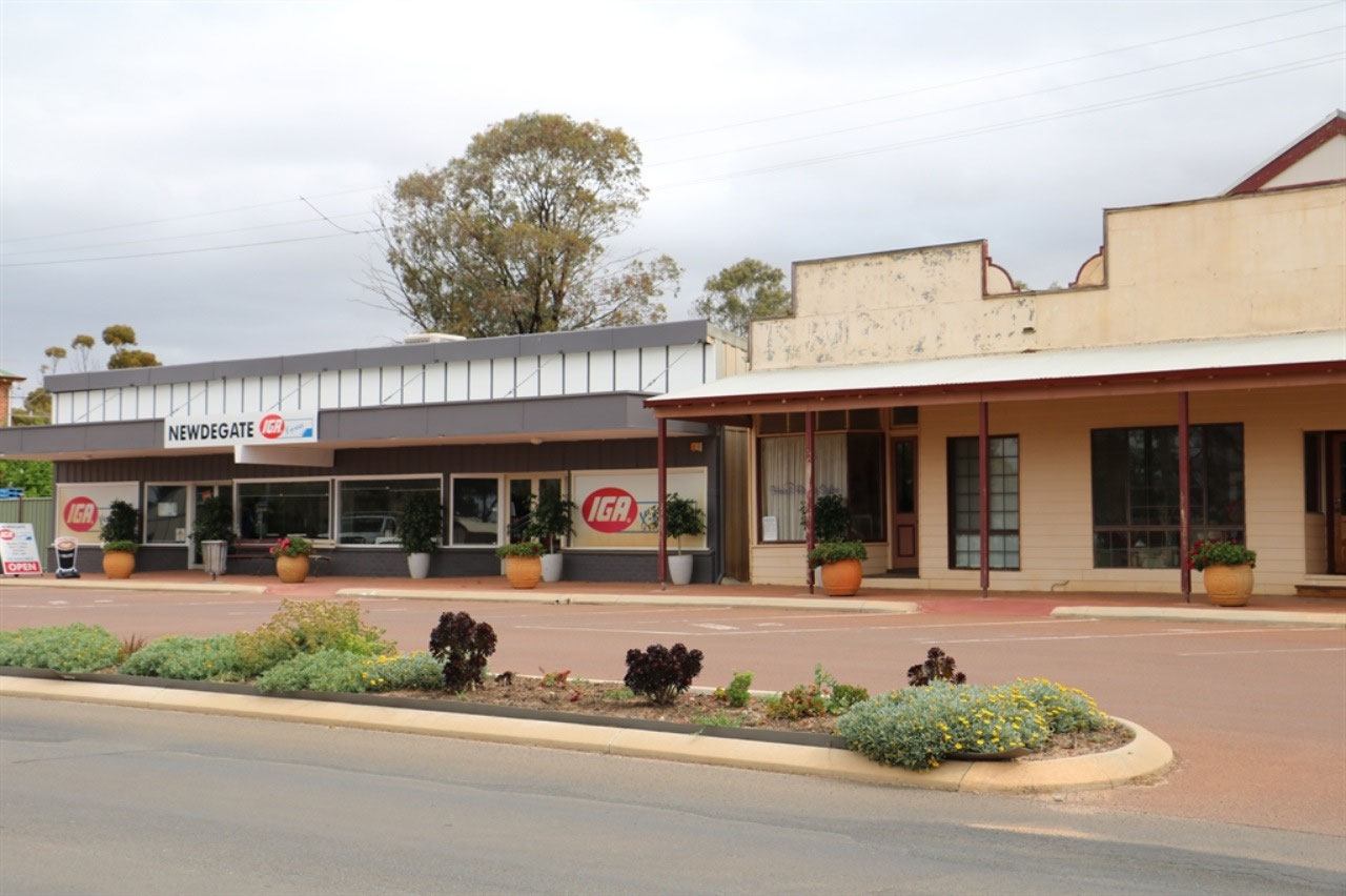
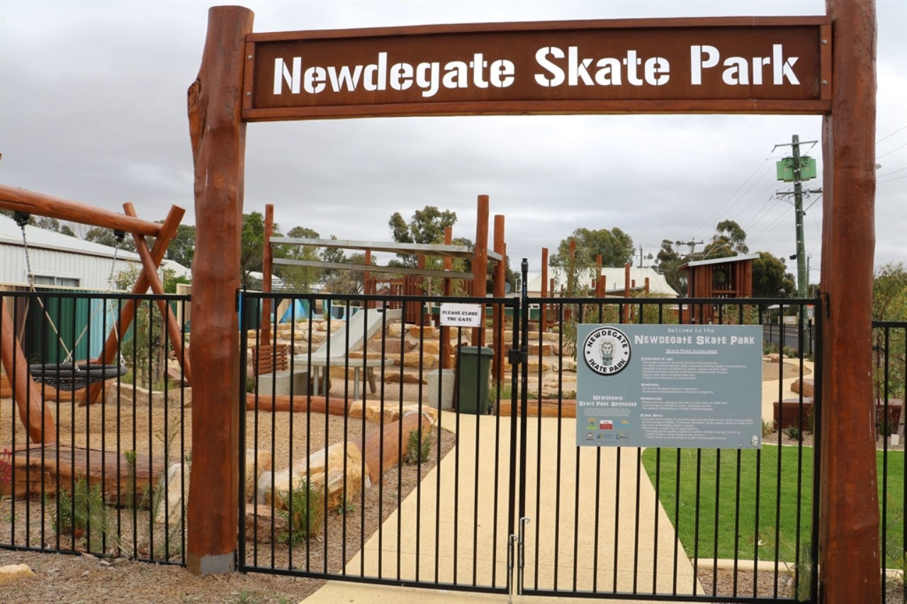
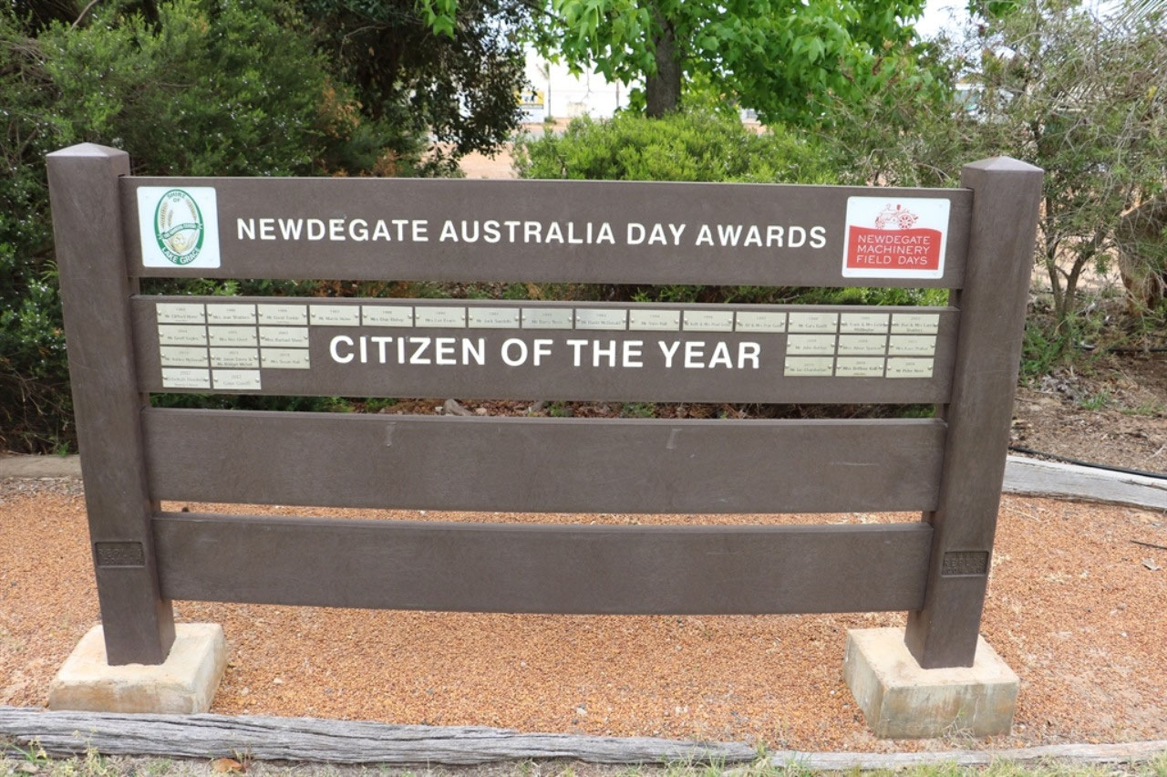
Newdegate: At Newdegate Peter fueled up while I went to the local IGA store for a couple of things. I took my camera around my neck so I could get a few town snaps, whilst walking to the store and back. The lady in the supermarket (only one I do believe) said "I must love photography"! Well that was a justified comment. I guess I did look a bit strange! So I preceded to tell her about our trip and how I now felt the need to photograph and blog about towns in our own State. It was a few quick snaps in the local park and once again there was an idea to take on board, before we made our way to the silos to picture the Newdegate artwork. Both Pingrup and Newdegate are so much more appealing than Albany. The lady at Borden asked Peter "Which way were we going and had we seen Albany"? I won't record what her thoughts and words were on the art.
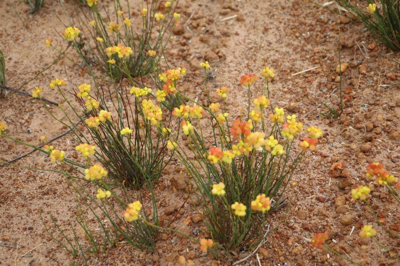
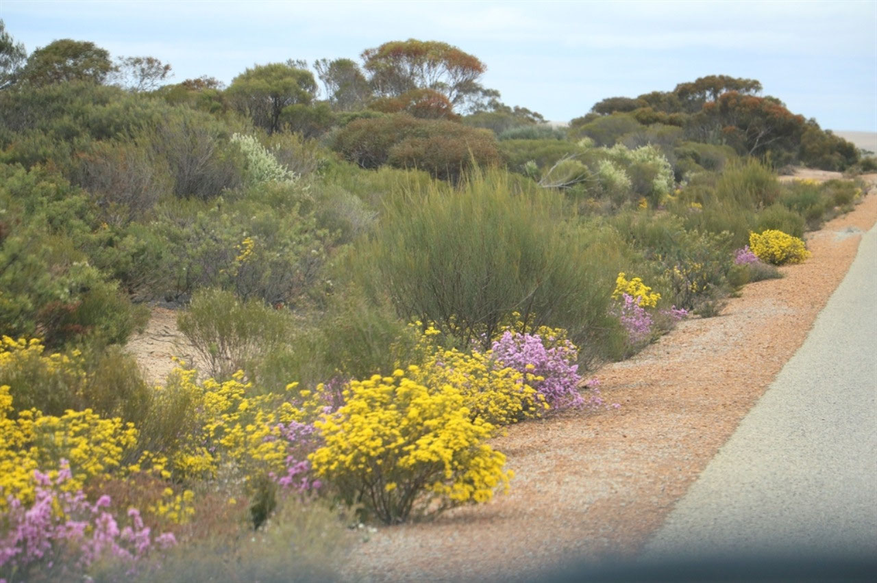
The wildflowers on the road from Pingrup to Newdegate were magnificent. The best we had seen all the time we had been travelling. It is that bit later down here, so they were still in full bloom. This was a minor road and the bitumen was quite narrow. Peter said "The edges had been well graded a couple of years ago, encouraging the new growth". I love the fact my husband is always happy to stop for a photo of wildflowers. He loves them as much as I do!
Newdegate is well known for its agricultural field day at the beginning of September each year and it has been held for 46 years, the first being held in 1973. The townsite was gazetted in 1925 and honours Sir Francis Newdegate, the Governor of Western Australia from 1920 to 1924. There is a Department of Agriculture and Food research Stations at Newdegate, one of the 13 research stations in the State. The area is a very successful grain and sheep farming area.
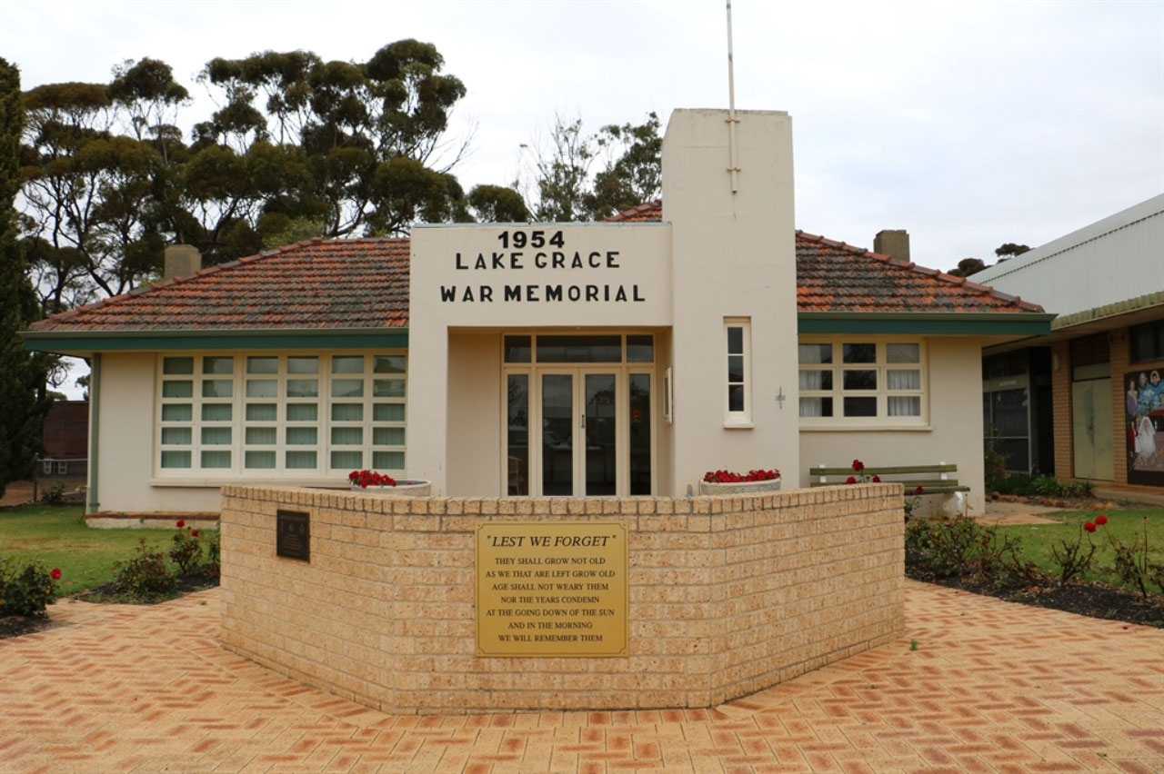
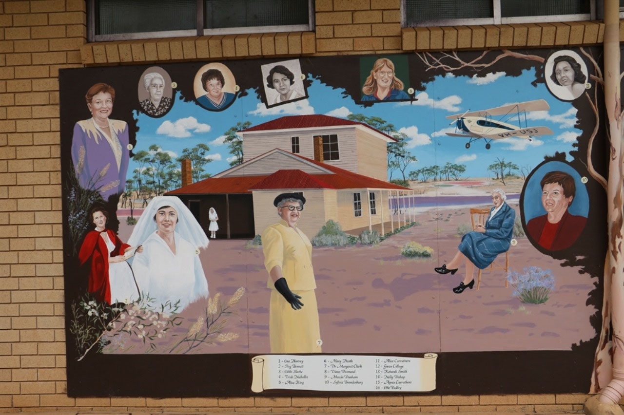
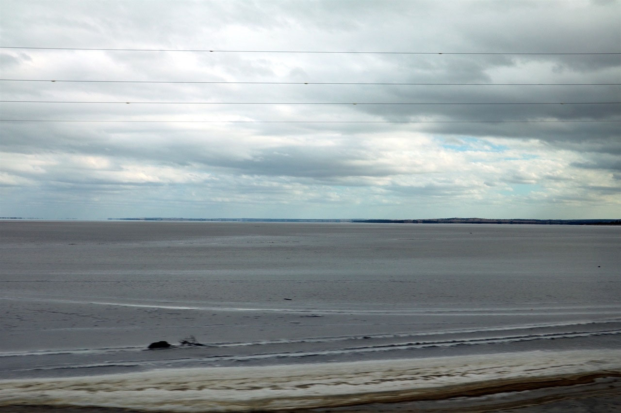
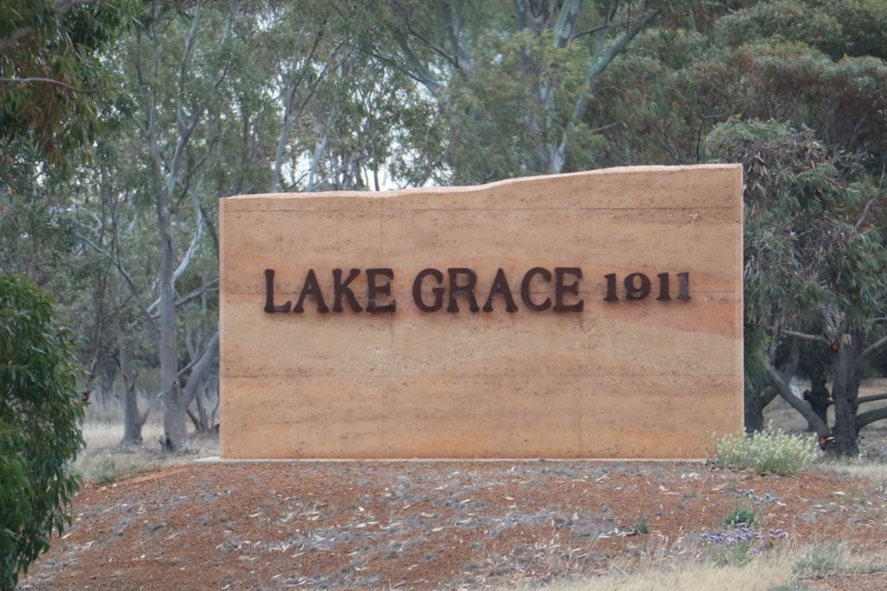
Lake Grace: We stopped in Lake Grace as there were some murals on the wall of one of the shops and it did attract our attention as we drove into the main street. It was beside the Memorial Hall and the War Memorial was at the front. The murals were recognising the 'Women of the Salt Lake Country' and there has been a book published. The natural salt lakes around Lake Grace are fascinating and do reflect hues of pink, mauve and green. I'm looking forward to a bit more research about these women and the book that has been written. I'm sure their stories will also reflect the colours of the lake and much more.
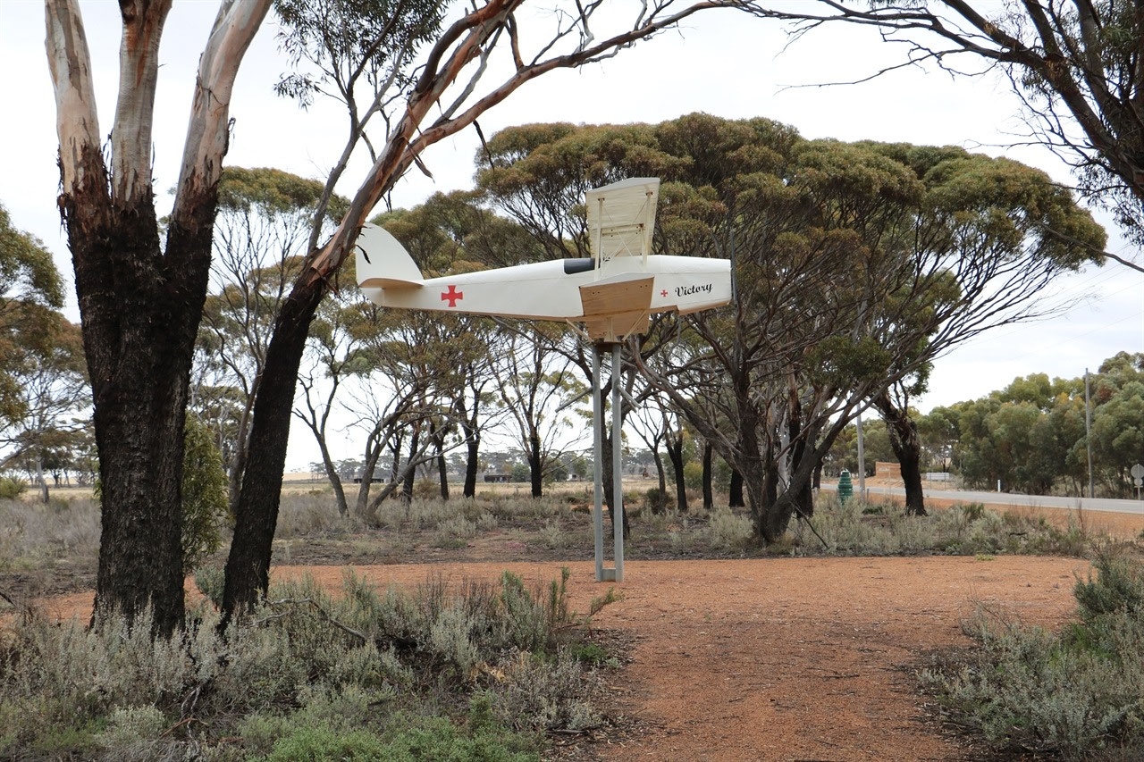
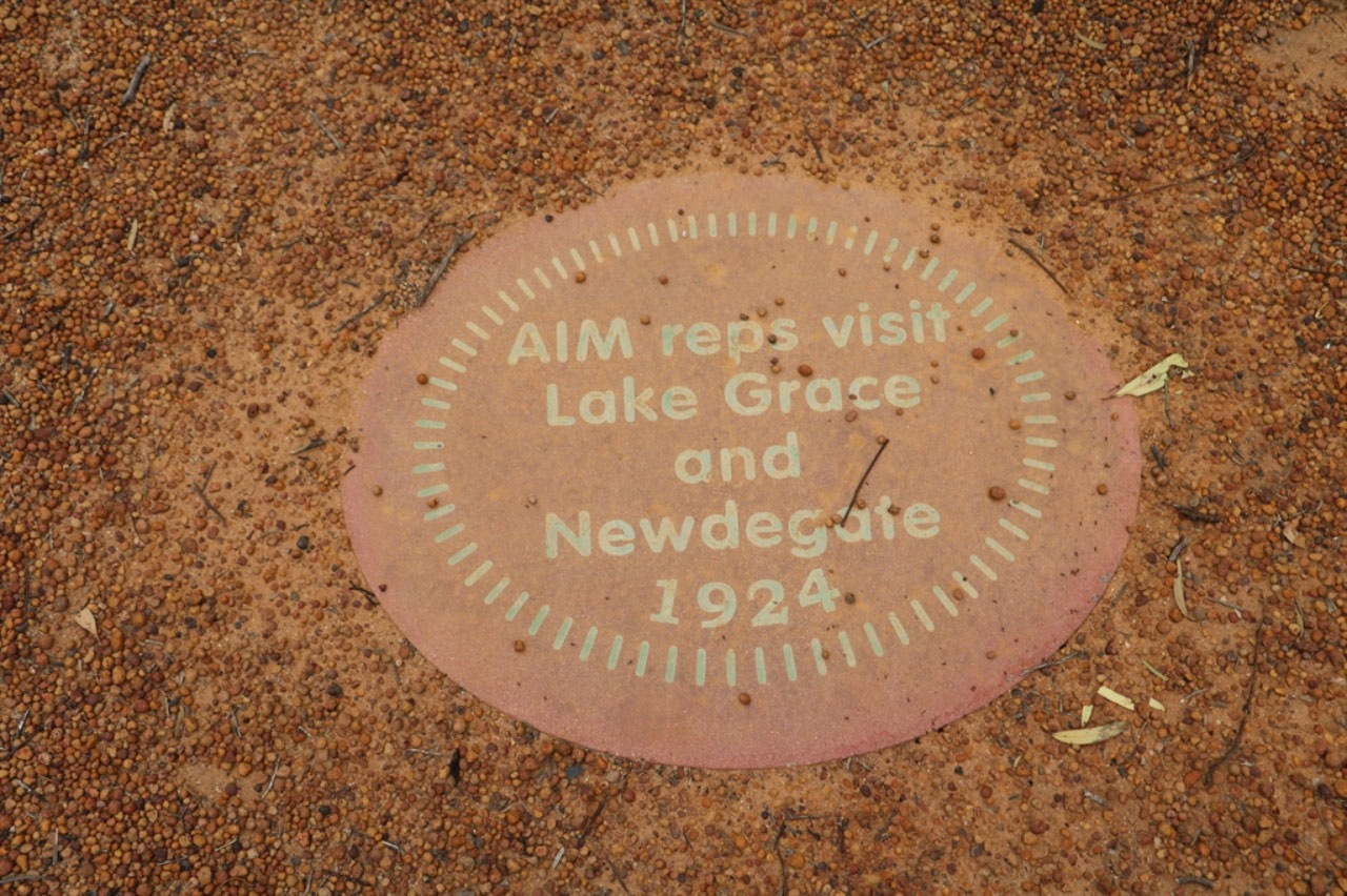
The 'Wheatbelt Science Trail' has placed caches throughout the area and there was one at the heritage listed 'Australian Inland Mission Hospital'. We found that cache quite easily, although there was no need to park the caravan up at the hospital. There is a parking area, just a little further on than the entrance to the hospital, and from here you walk past the cache and up to the hospital along a mosaic path. Each mosaic records the history of the establishment of the 'Australian Inland Mission Hospital' at Lake Grace. There are only three of these 'Inland Mission' hospitals left standing in Australia and the one at Lake Grace is the only one in W.A. There is another which is heritage listed at Birdsville, but I can't find where the third hospital is in Australia.
In 1923 Stubbs MLA lobbied the Government for a hospital and that same year the Postmistress Eileen West began fundraising. In 1924 Crown land was reserved for a hospital and the community donated nearly 444 pounds for the project. In the same year AIM representatives visited ;lake Grace and Newdegate. In 1925 the AIM agreed to the Lake Grace hospital and a line of pennies from the Post Office for the hospital appeal raised funds. A hospital bazaar and bricklaying raised 176 pounds in 1925 also and the foundation stone was laid by Stubbs MLA. In 1926 the AIM hospital opened and the first baby was born.
The story of how the hospital at Lake Grace was saved is very similar to the story of the now heritage listed Upper Chapman Road Board building in Nanson. The Lake Grace story is; From 1952 until the early 1970's the AIMH in Lake Grace, was used as school teacher and nurse’s accommodation. By 1983 the building had fallen into disuse and was in desperate need of repair. The state government at the time decided to demolish the building but through public protest it was saved. Almost 100 enthusiastic volunteers helped to raise funds and spent countless hours replacing floorboards, guttering and fences, filling cracks painting walls and re stumping verandas. The Lake Grace Australian Inland Mission Hospital Museum opened in October 1992 and the building is now listed with local, state and national heritage registers.

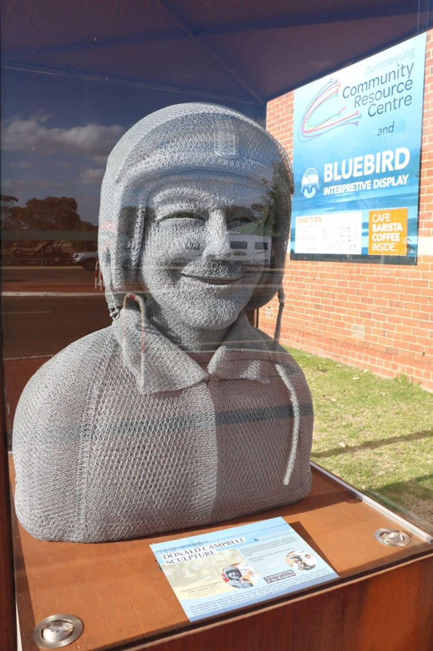
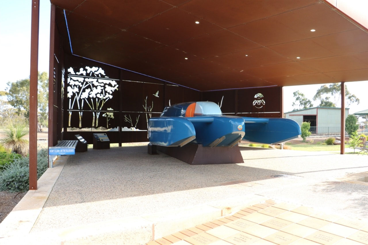
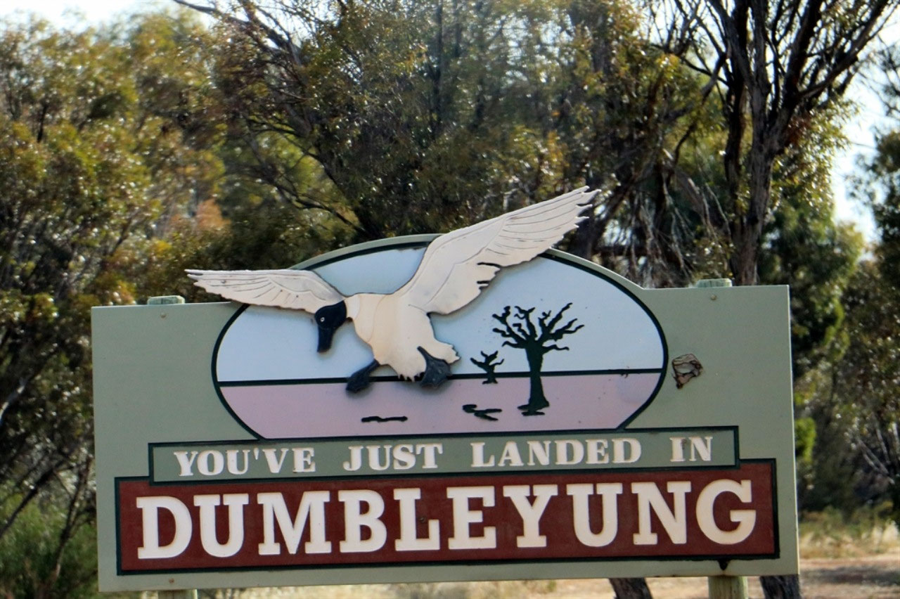
Dumbleyung: We had not ever been through Dumbleyung and once again we were impressed with this small town. Famous of course because Donald Campbell set a record in his 'Bluebird' on Lake Dumbleyung in 1964. Campbell remains the only person to have broken both the World Land Speed Record and World Water Speed Record in the same year. Campbell died on Coniston Waters, UK in 1967 attempting to break his own record. Campbell's land record is 403.10mph (648.73km/h) at Lake Eyre SA and water 276.33mph (444.71km/h at Lake Dumbleyung WA. In 2016 Australian Ken Warby broke the World Water Speed Record at 317.6 mph (511.1km/h) which had been reached in 1978 at Blowering Dam in NSW.
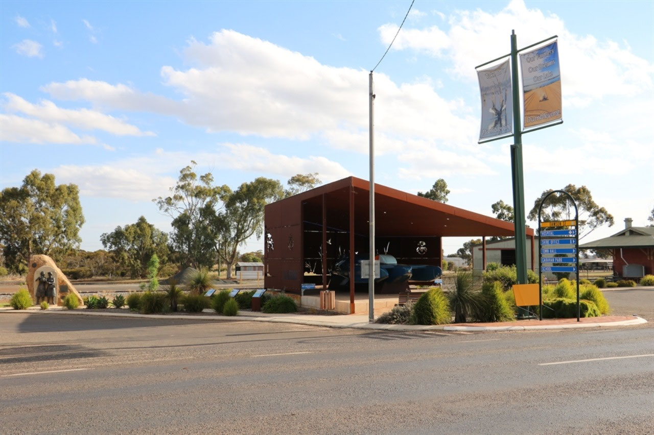
The 'Bluebird K7'' replica was 50 years in the making. Thousands of dollars of community fundraising, volunteer hours and shire contributions enabled the presentation of the final replica, that can be seen in Dumbleyung today. The full scale replica hull was fabricated with extraordinary attention to detail and rolled into Dumbleyung in time for the 50th anniversary of the World Water Speed record and celebrations on 31st December 2014.
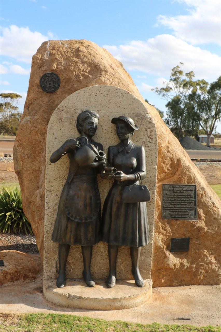
And also standing proudly in the park, not far from the structure that houses the 'Bluebird' replica, is the sculpture that the Dumbleyung CWA had made when the branch sold their CWA Centre and the branch disbanded in 2013. The branch formed in 1930 and for over 80 years, they were an active group for women in Dumbleyung, providing companionship and support in the community. On the plaque are the words; We acknowledge the time and effort of our founding members who worked so hard to establish and maintain a vibrant branch - 'Through Country Women, For Country Women, By Country Women'. The sculpture was unveiled on 31st August 2013.
Lake Dumbleyung is located to the south-west of Dumbleyung, At the lake is the Dumbleyung Yacht Club and the memorial to Donald Campbell on Pussy Cat Hill. Lake Dumbleyung is the largest natural body of inland water in West Australia. It is approximately 13 km long by 6.5 km wide with a catchment area which extends 64 km north towards Kulin, 64 km south towards Narrangerup and 55 km east to Tarin Rock. It was discovered by explorers is 1843.
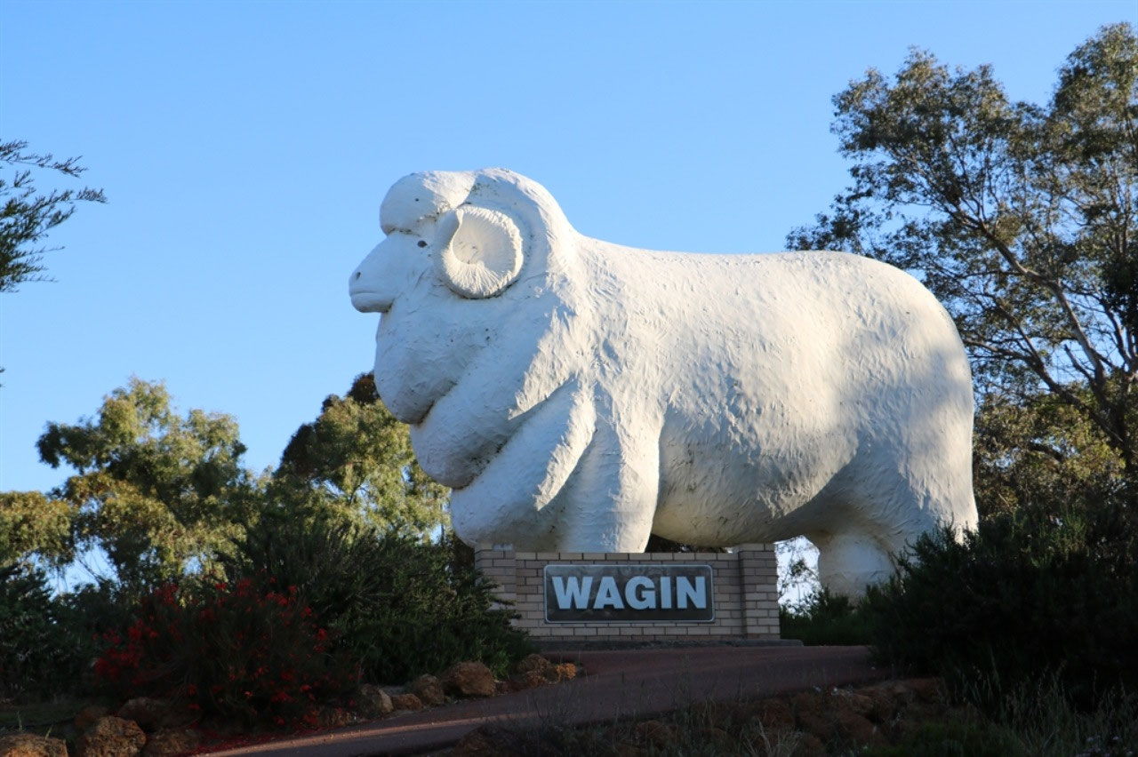
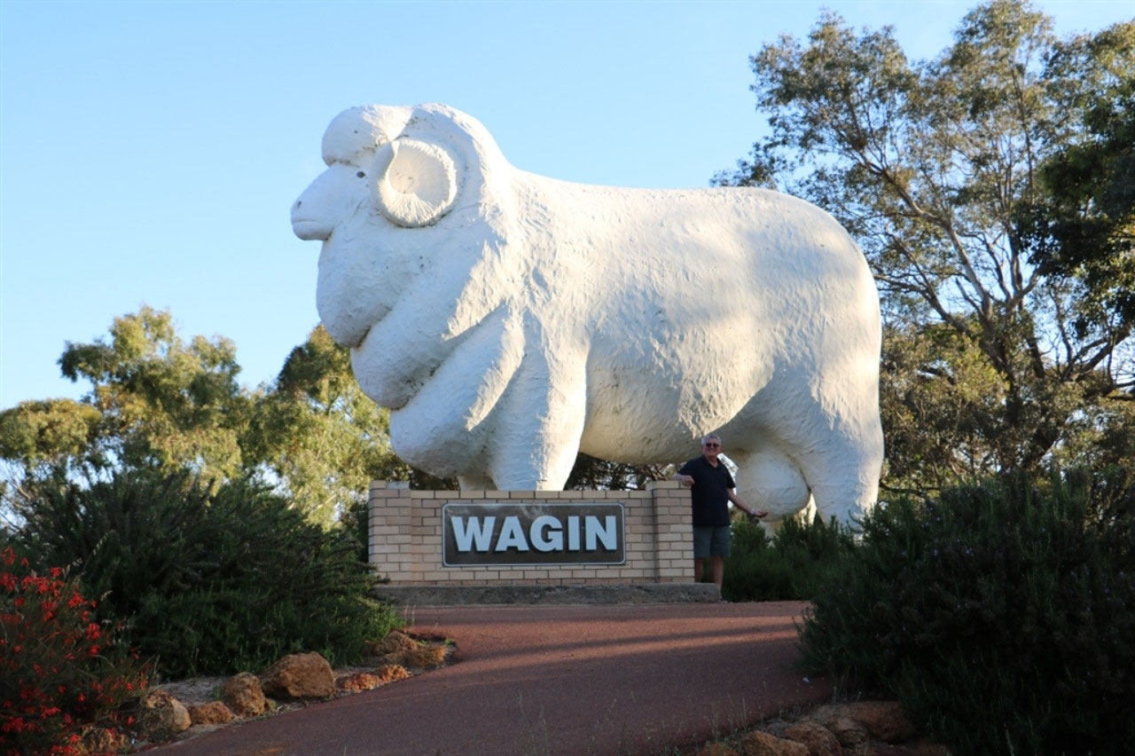
Wagin: In Wagin we stopped for a photo of the 'Big Ram'. The last of the 'Big Aussie Icons' that will be photographed this trip. I think we have done very well in tracking down most of the icons that have been published in the book that the Edwards Family gave Peter in 2013. The park in Wagin that is home for the 'Big Ram' has been developed very nicely. There was plenty of area to have a picnic or barbecue, a children's playground to be enjoyed and plenty of area to just sit and rest a while. The Visitor Centre was alongside. All were in the main street.
Peter rang the caravan park in Narrogin and the lady said she would not close the office until we got there. The office closed at 6.00pm and we wouldn't be too far away by then. It has been a full day, as we left Albany at 8.30am. But when I suggested to Peter, perhaps we should have stayed in Wagin, his comment was "Why! We haven't done that many kms"! So he must have also enjoyed our day of zig-zagging! But I do have to say, he did make a favourable comment, when the Sat Nav showed we were heading north!

Wendy
2018-10-31
Bucket now lives at Kendenup and Eve teaches at Mount Barker, the two children bus to Albany to High School. Enjoy your last days travelling
pamandpete
2018-10-31
Thanks Wendy. The lady did tell Peter they lived at Kendenup, but I couldn't see that she would be travelling to teach, where Peter thought the lady had said! See you soon.