 Northam, Western Australia, Australia
We have travelled lots of wheatbelt roads over the last two days. Some crops have not been too good, others really good, and unfortunately we have seen some that appear to have been frosted. The lady at the IGA store in Newdegate said that a number of crops in the area had been badly frosted and cut for hay. She did say that the area had had four good years previously.
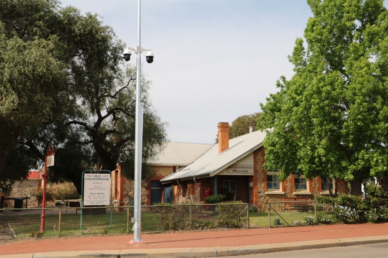
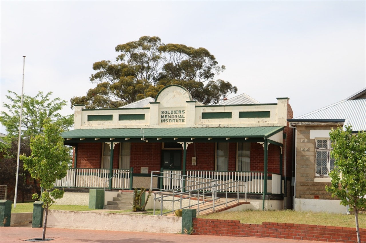
Narrogin: We left Narrogin by 8.30am and whilst Peter was fueling up, I took a few photos. We were opposite some of Narrogin's heritage buildings, one being the 'Old Courthouse'. In 1894 the 'Old Courthouse' was built as a Government school. It remained a school until 1905 when it was converted into the local courthouse. It became the local branch of the Agricultural Bank between 1924 - 1945 but returned to a courthouse in 1970. It has been a museum since 1976. The Soldiers Memorial Institute was built on Crown Grant land in 1924/25, as the soldiers own memorial building. It is heritage listed and was classified by the National Trust in 2000. It was built as a result of soldiers initiative and determination to have their own.
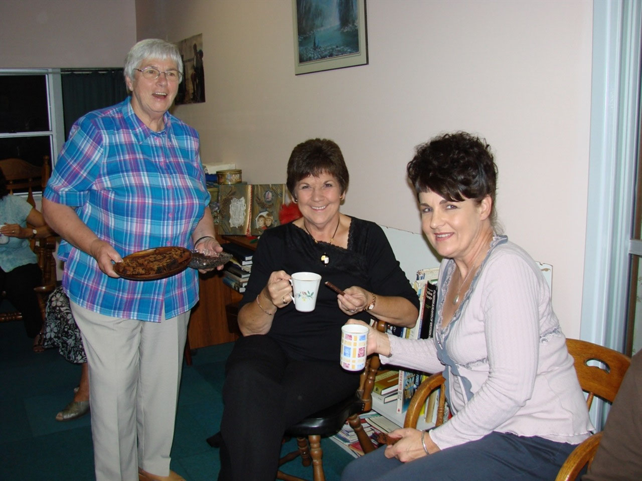
We have both visited Narrogin on a number of occasions. We have brought Dorpers to the town many times and have stayed at the Albert Facey Motel the same amount of times. I have been on a number of occasions for CWA and have enjoyed the hospitality of CWA members in Narrogin.
Narrogin is 192 kilometres south east of Perth, so an easy two hour drive from the city. Narrogin is an aboriginal name, having been first recorded as 'Narroging' for a pool in the area in 1869. The name has had many spellings but it has always meant 'a place of water'. The first Europeans came to the area in 1835 and it was settled in the 1860s and 1870s. The population was so scattered that there was no incentive to establish a town and it took until June 1897 for the town to be declared. The early years of settlement were hard with farmers relying on sandalwood cutting and the bark from mallee trees, which was used as a tanning agent, to compensate for poor returns from wheat and sheep.
The arrival of the Great Southern Railway in July 1889 initiated the first hint of a town. The company that had won the railway contract duly purchased Narrogin Pool. Narrogin was connected to six separate railway destinations and in the age of steam engines, Narrogin was one of the largest railway operation hubs in the southern part of Western Australia. Narrogin remained a major rail centre until the late 1970s when competition from road transport saw a reduction in the railways workforce. In 2011 the population of the town was 4219.
Local Government in the Narrogin area has always been somewhat interesting. There were two local government entities. The Shire of Narrogin for the outer region and the Town of Narrogin for the town itself. In 1999 and again in 2004, referendums were held to amalgamate the Shire with the Town, but both were lost. On July 1st 2016 the two entities did amalgamate and the new entity retained the designation of Shire.
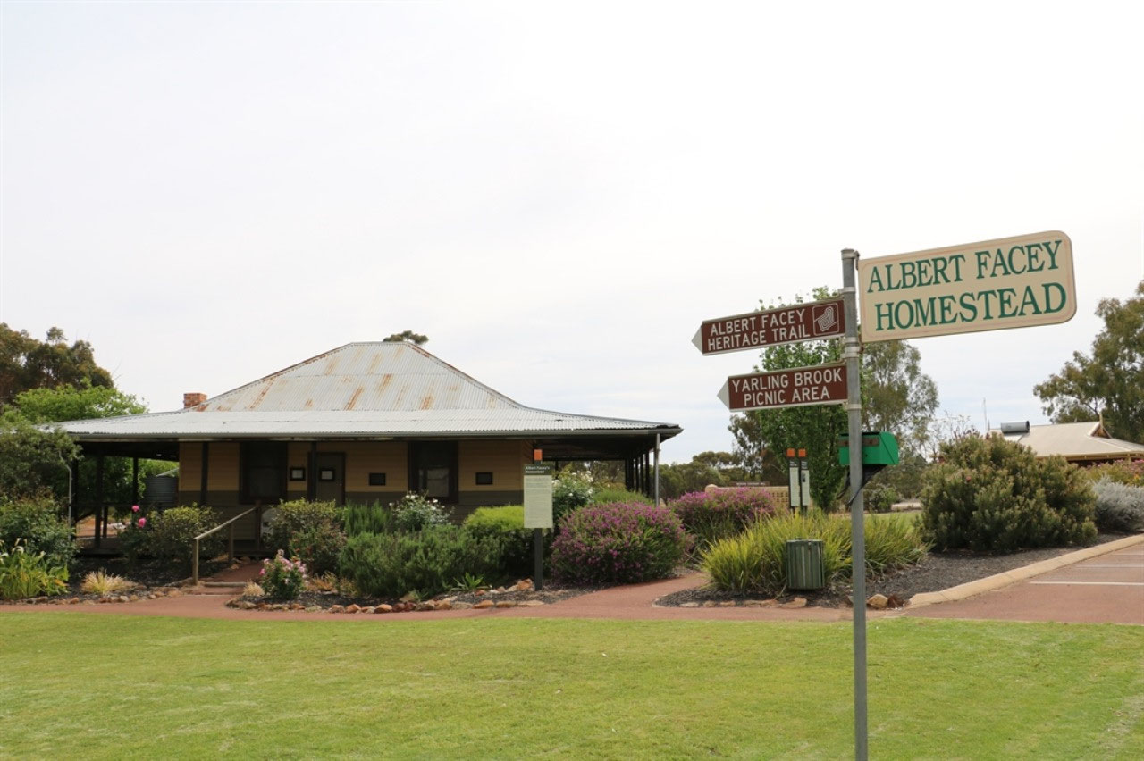
Wickepin: Wickepin is only 39 kilometres from Narrogin and is a prosperous and flourishing agricultural district with its own Shire. We had not visited this town before. It is a very nice little town and hopefully we can visit again for a bit longer next time. I missed getting a photo of the entrance sign to the town, but I'm sure it says 'Wickepin - A Fortunate Place'. Shires make the most of connecting something or someone prominent to promote their towns, and for Wickepin it is Albert Facey.
Albert farmed at Wickepin with his wife Evelyn from 1922 until 1934. Albert was a drover, boxer, soldier, farmer, tram driver and later an autobiographer. He took great enjoyment from his life, a life that was far from fortunate. The 'Albert Facey' home was donated to the Shire of Wickepin by the White family in 1999 and in 2000 it was moved to the township by the Shire.
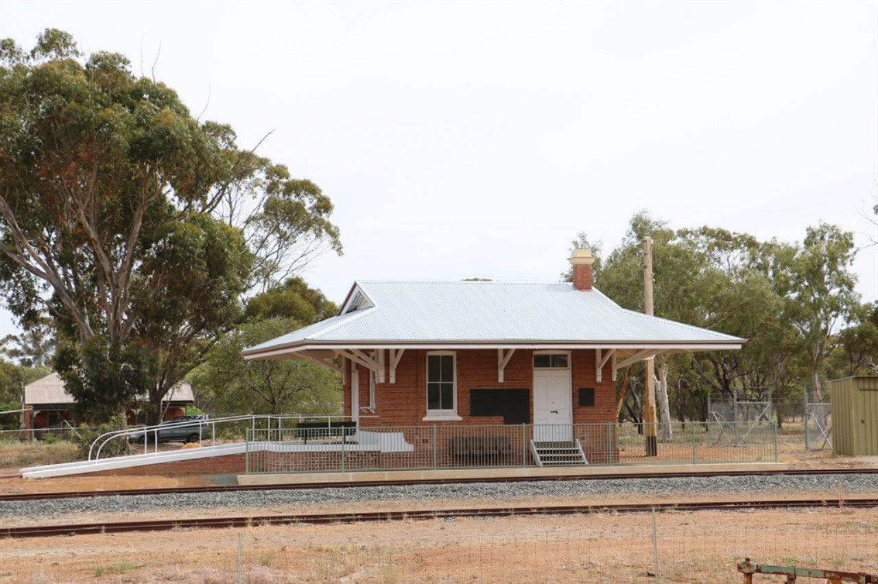
Until 1908, the area was sometimes known as Yarling and the name Wickepin is aboriginal but the meaning is not known. The town was gazetted in 1908 when the railway was extended from Narrogin The only trains that pass by Wickepin Station these days are the grain and super-phosphate haulers, but there is a heritage walk from the town centre that takes you across the railway line with information panels along the way. The station is one of the few remaining of its type in the wheatbelt and is hertitage listed.
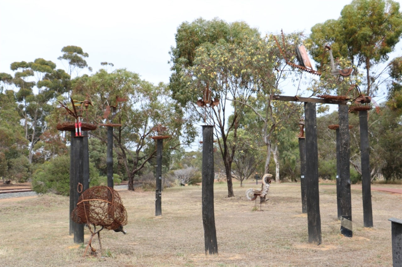
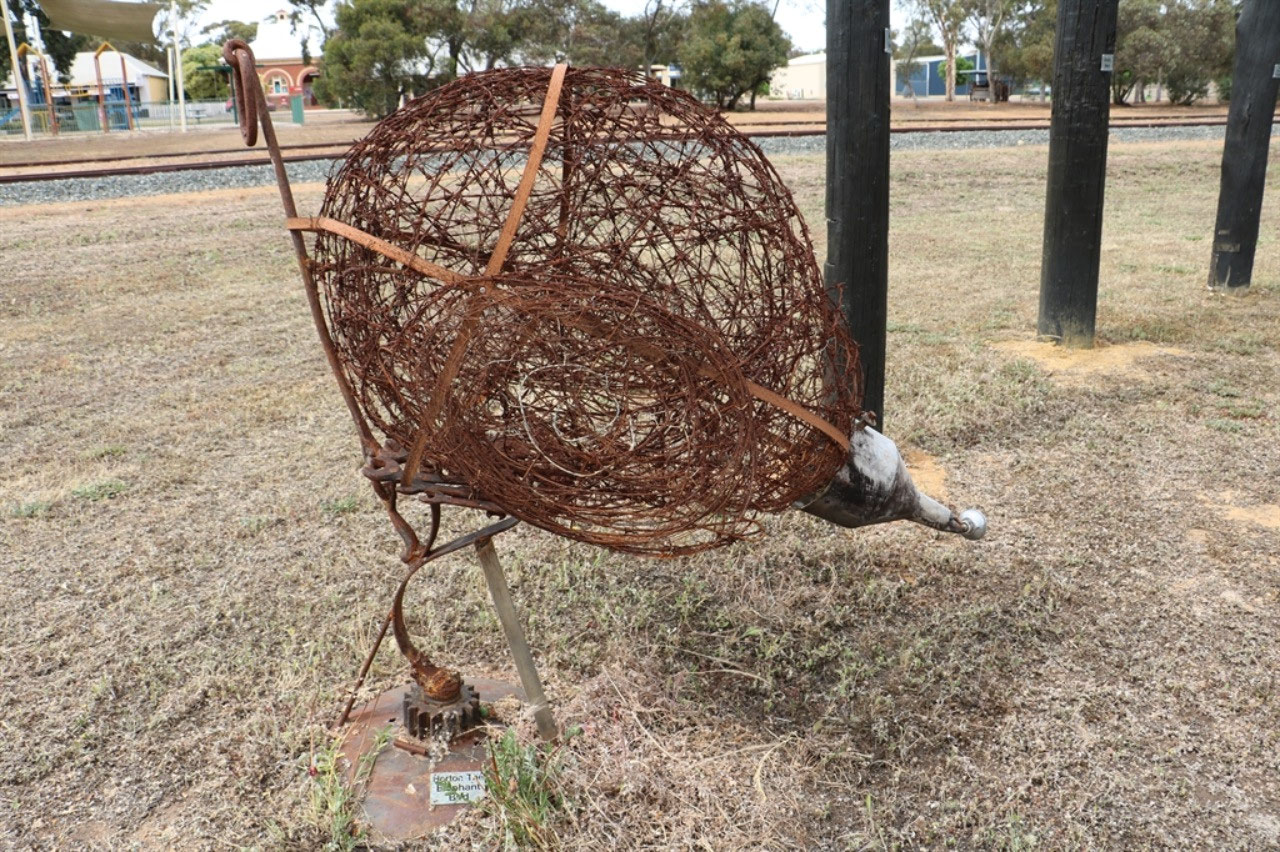
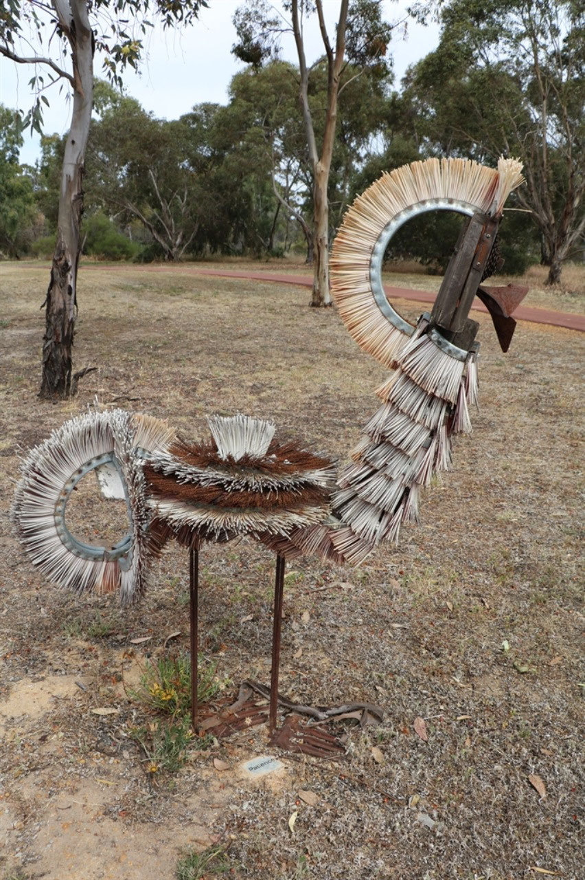
On my walk across the railway line, I found a number of bird sculptures that had been placed in a circle and it is known as the 'Bird Park'. Funding was provided for a series of sculpture workshops. Participants created works for themselves and also contributed to a community sculpture. It is recorded the 'Bird Park' took flight.
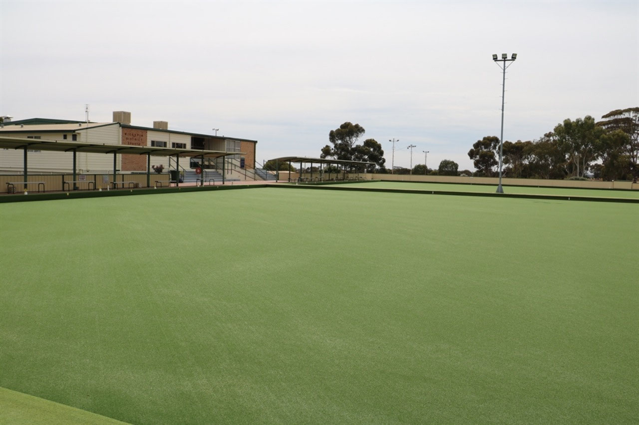
Before leaving Wickepin we did check out the Bowling Club, because it was here that the Ladies Zone Fours was held earlier in the year. We thought it strange that this town was chosen as there is little accommodation in the town and many of the bowlers travelled from Narrogin to play each day. But the two synthetic greens were very impressive and we could understand why the venue was chosen.
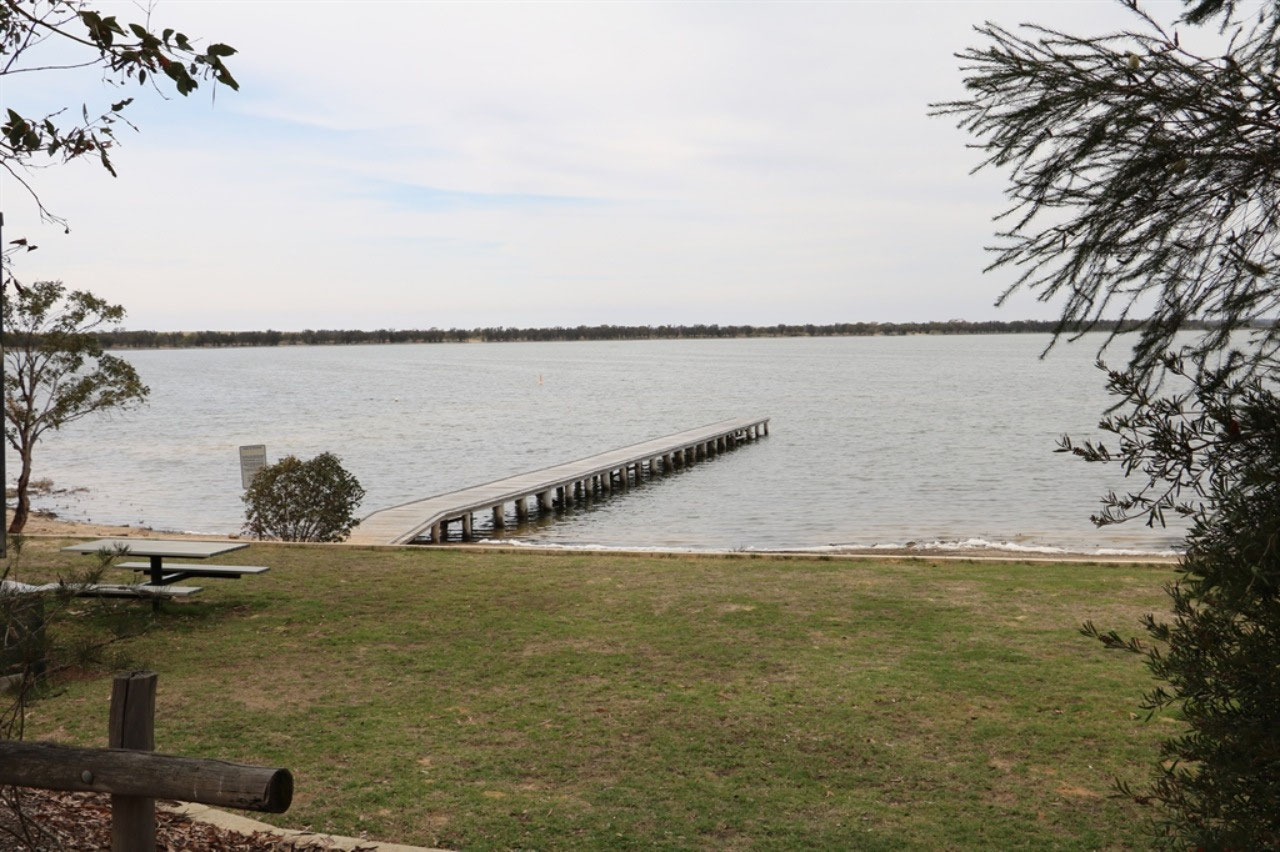
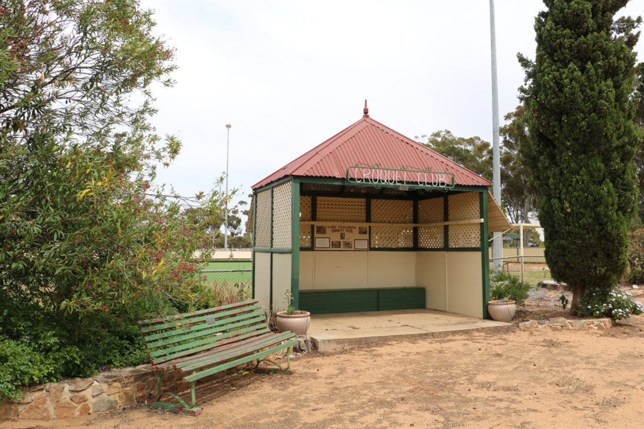
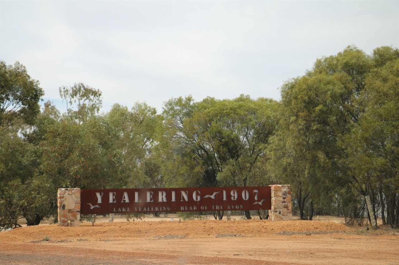
Yealering: This little town was a real surprise. It is on the edge of Lake Yealering which is the start of the Avon River. There is a large parking area beside the lake and all the recreational facilities seemed to be in this area. A synthetic bowling green is nearby and the old Croquet Club shed is still proudly standing. One can imagine the croquet green in front. There was memorabilia on the wall of the shed as a reminder of bygone days. We enjoyed morning tea beside Lake Yealering. The population of Yealering is only 104, but it does service a large agricultural district in the northern Wickepin Shire. The general store was opposite the town hall.
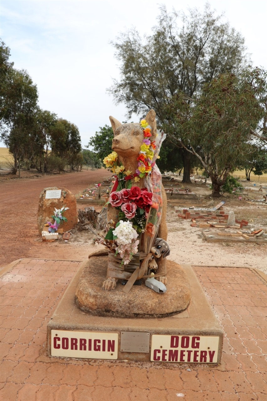
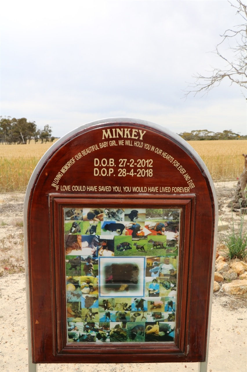
Corrigin: It was not quite 50 kilometres to Corrigin. We stopped at the 'Dog Cemetery' to find the cache named 'Sick Puppy'. It was an easy one and it is good to get easy caches from time to time. It keeps you interested! This dog cemetery was quite something and without the cache we wouldn't have stopped. Some of the dogs graves were very elaborate. The 'Dog Cemetery' is listed as a place for tourists to visit in the town.
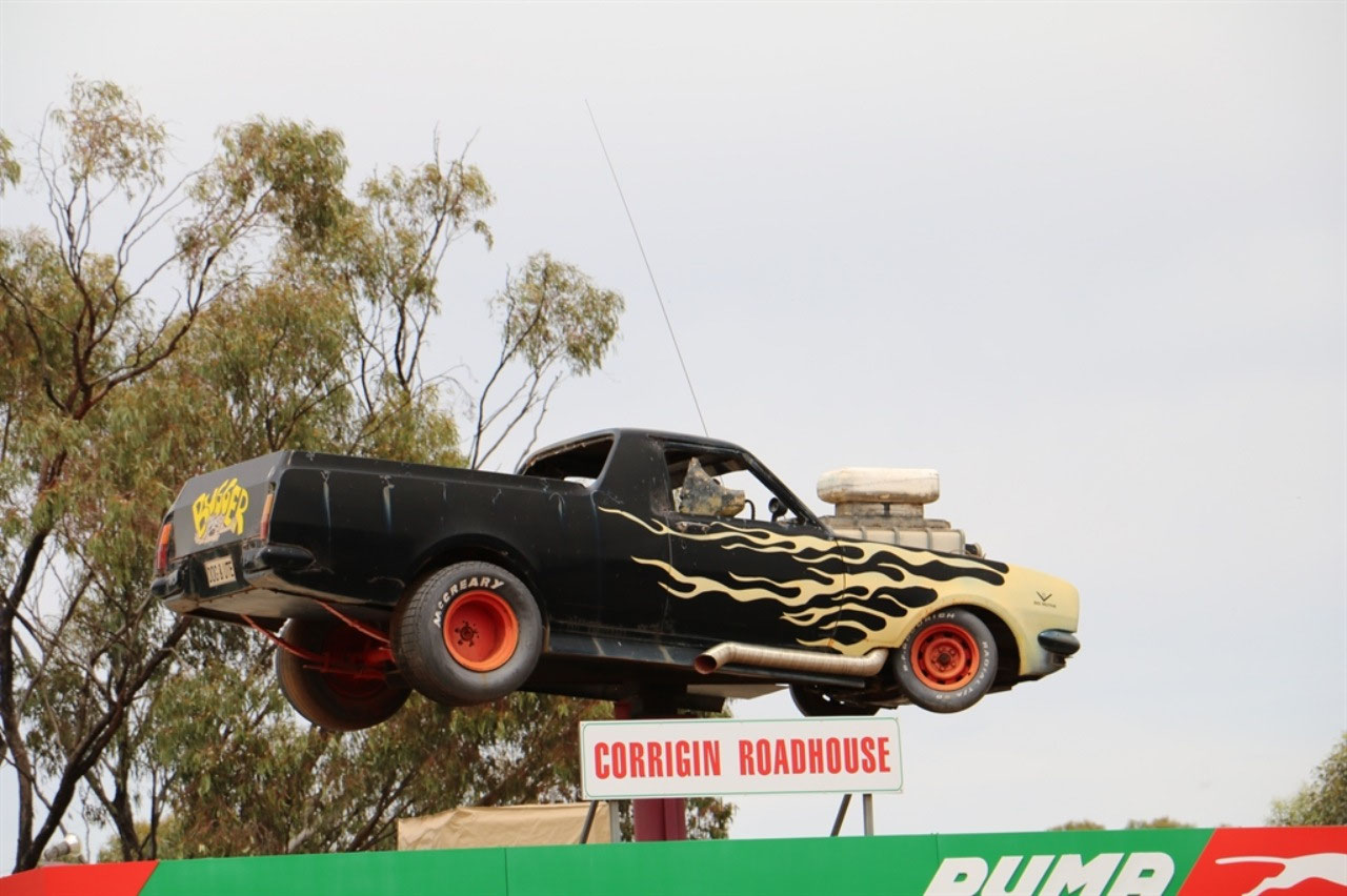
Corrigin is known for its parade through the town with 'Dogs in a Ute'. There is a ute with a dog sitting in the drivers seat, positioned prominently above the roadhouse, and a big black dog on the other side of the road in the park. The dog is advertising that Corrign holds the record for the number of 'Dogs in Utes'. I actually thought it was something that was done to promote the town and I guess it has done that, but it was actually the brain child of a Apex member, who decided Corrigin should attempt to beat the world record set by St Arnaud in Victoria. The world record was set in 1997 with 214 'Dogs in Utes'. The following year the Corrigin Apex Club organised an event and the record was changed to 699. Victoria regained the title in 2000, with 797 'Dogs in Utes and on 13th April 2002, Corrigin got serious and still hold the world record with 1527 'Dogs in Utes'. Over 350 utes took part in the event. The local Apex Club runs the event every few years and money is raised for local charities. Over $100,000 has been donated to the Royal Flying Doctor Service over the years.

Corrigin has a population of 903 and is a key agricultural centre for a district focused mainly on wheat and sheep farming.
Bruce Rock: We were in Bruce Rock by around lunchtime and today we prepared lunch in the caravan at the Stan Farrell Park. The cache there we could not find, so we have another sad blue face on the geocache app. We actually have a few of those now and we are starting to get the feeling that people put these caches around, but do not necessarily maintain them. I need to make sure I read the 'Attributes', before I suggest we stop.
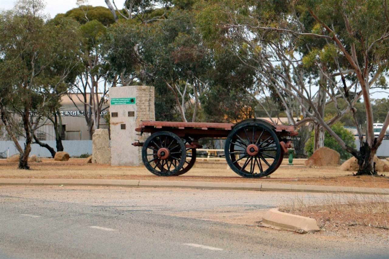
There is a huge piece of stone in the park with plaques attached. Each of the three recognises a family with one hundred years of continuous farming within the Shire of Bruce Rock. The Kilminster, Foss and the Powell families each have plaques on the piece of stone. I can't find why the park is named after 'Stan Farrell', but what I did find in my searching is that the Shire launched their new 'Brand Story' and logo in July this year. The video is quite good and it can be viewed at https://www.brucerock.wa.gov.au/news/our-brand-story/2. I really like the way the logo comes together.
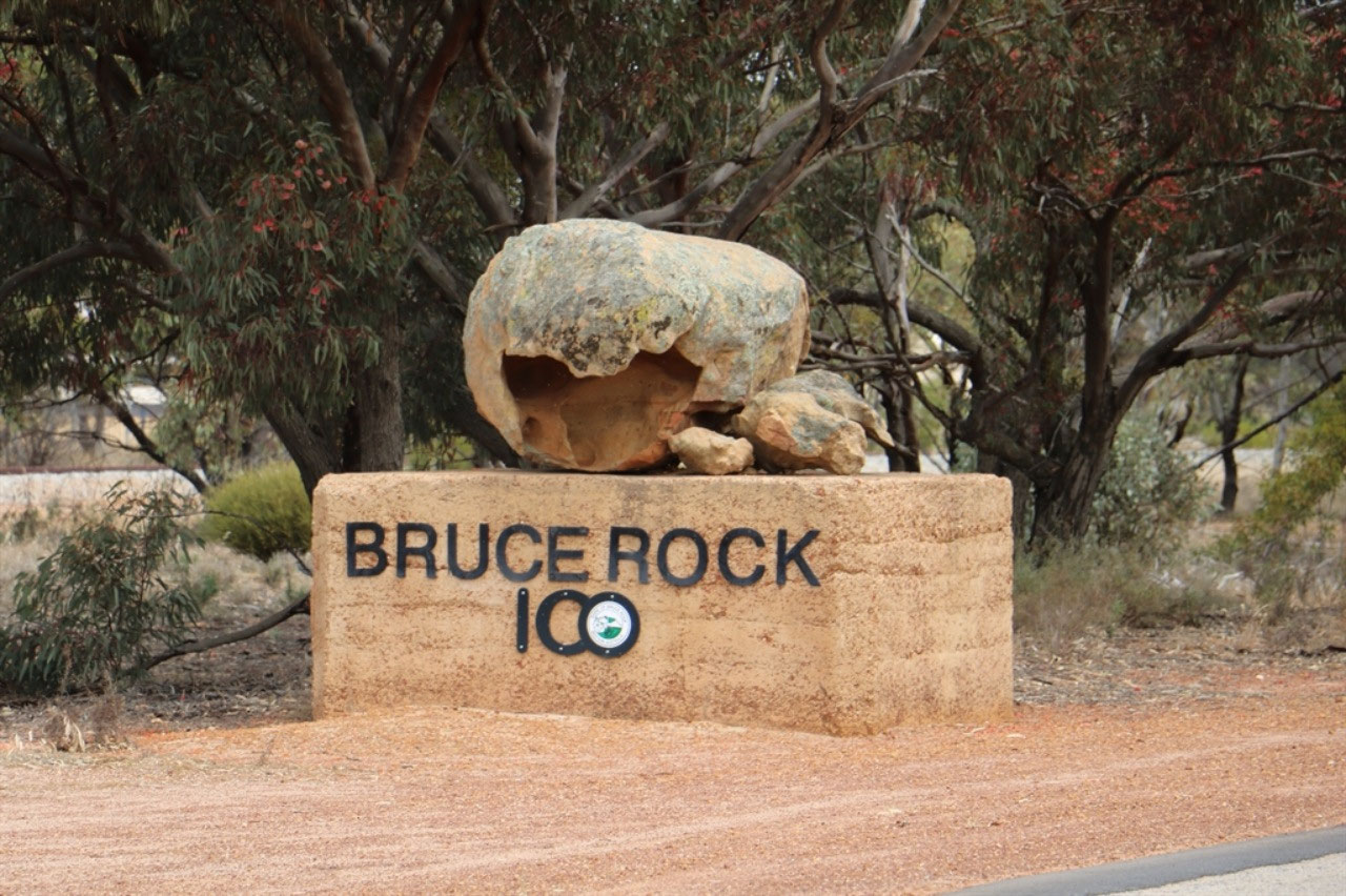
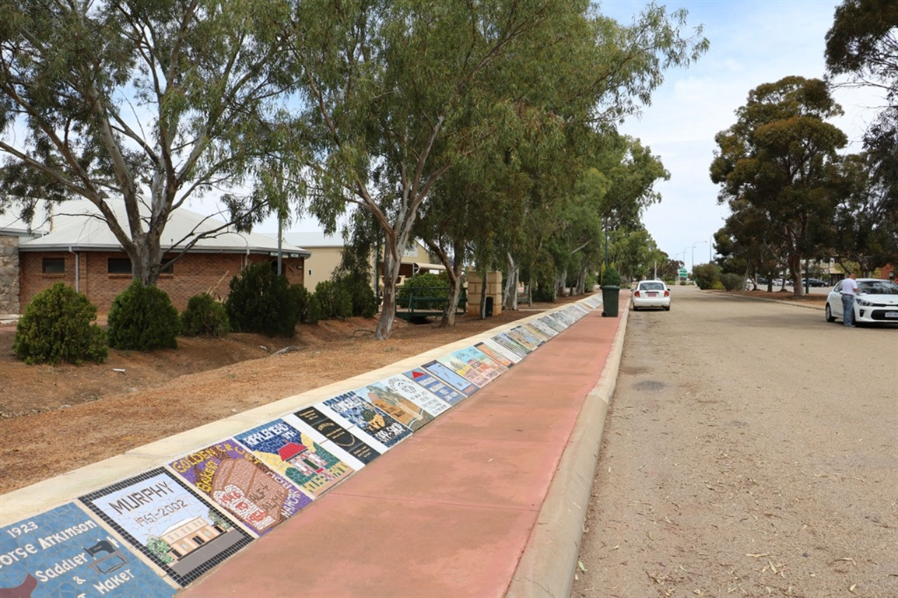
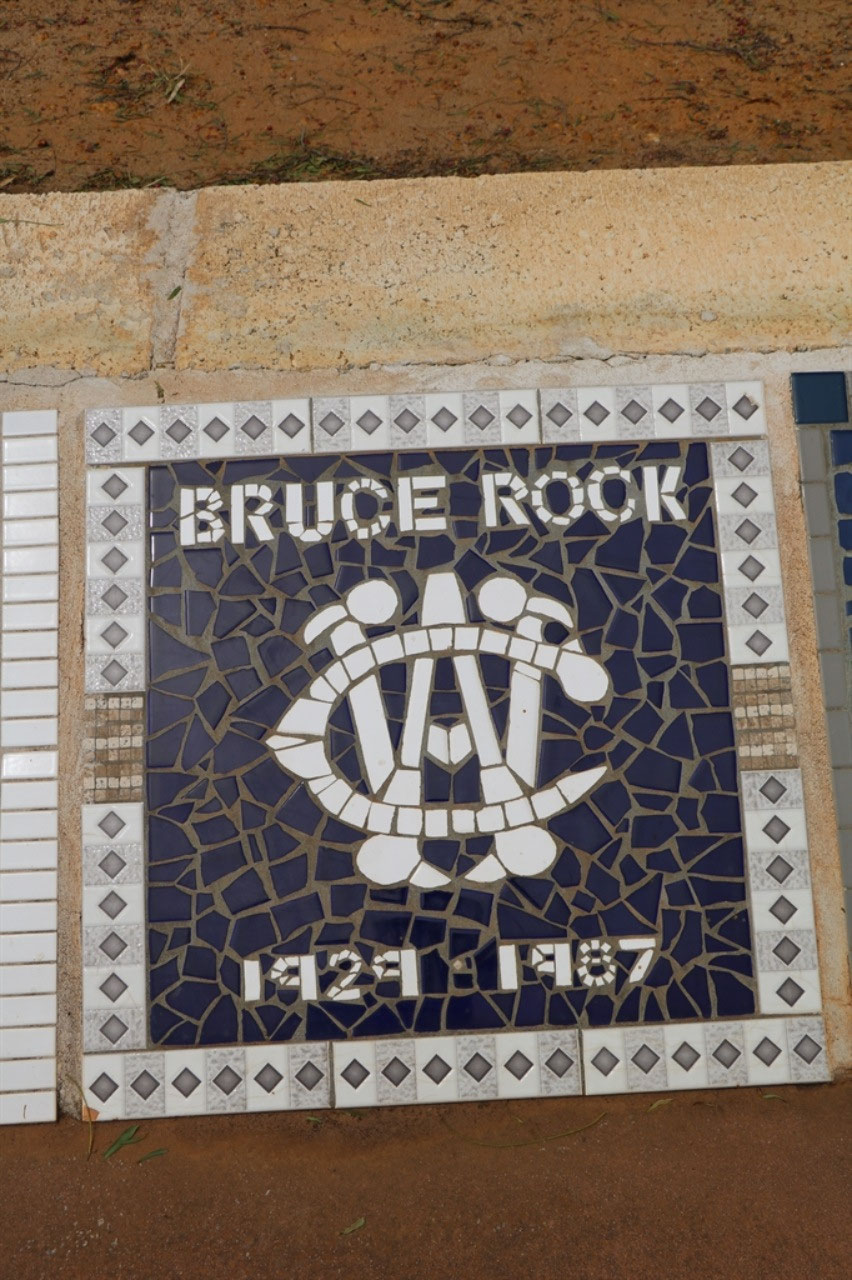
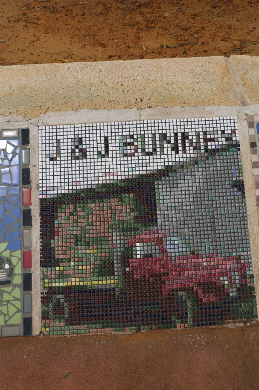
1200 people make up the Shire of Bruce Rock and the Shire celebrated 100 years in 2013. A mosaic pathway was created to celebrate the centenary and over 300 mosaic slabs depict the farms, buildings, churches, sporting groups, shops and families from days gone by. The town got its name from a low granite outcrop which lies to the east of the town which was named after a sandalwood cutter named John Rufus Bruce who set up his camp near a soak at the base of the rock. Although settlers had been allocated land around Bruce Rock township since 1860, the town of Bruce Rock was not gazetted until 1913.
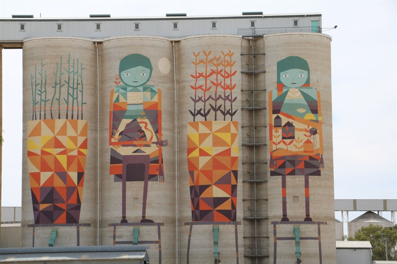
Merredin: There was no reason to stop in Merredin, except to photograph the silo art. We though this one was only 'Okay' and Pingrup is still our favourite. What we saw of Merredin on Great Eastern Highway is very tired. Once again we have both been to Merredin before for CWA and I came quite a few times as a child. Way back then, it seemed to be much more of a regional centre than it appears to be today.
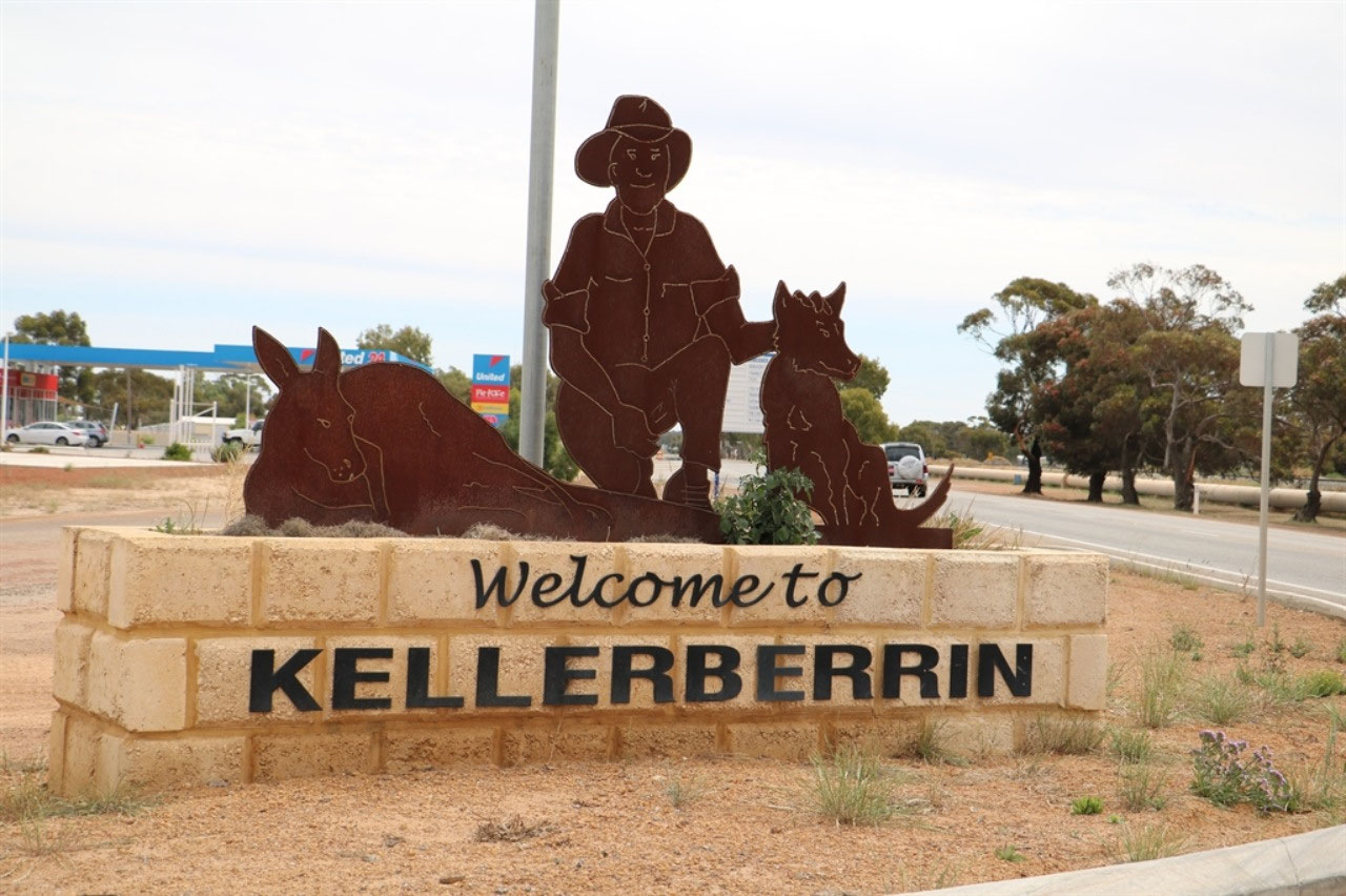
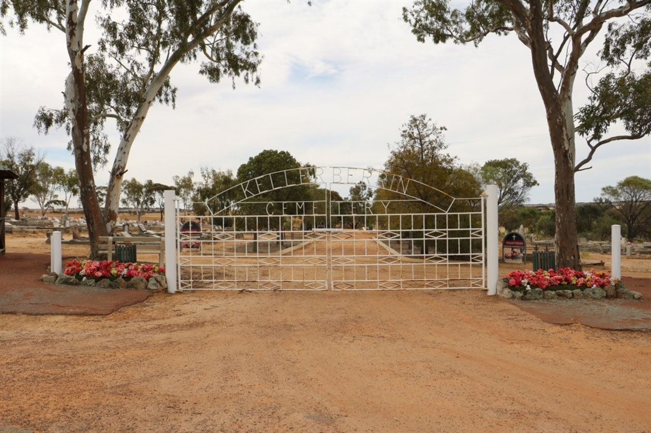
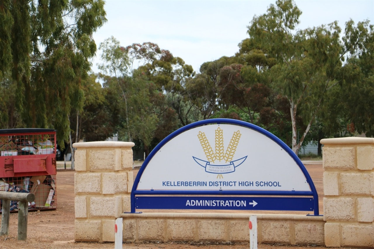
Kellerberrin: This is the town I was born in and where I was educated. I attended the Kellerberrin District High School to Junior Certificate level. That being Year 10 way back in those days! We visited the Kellerberrin Cemetery and found the graves of two my Dad's sisters and their husbands. We also found the grave of my older cousin Jacqueline, whom I never had the chance to know. She was killed in a car accident on the 2nd October 1954, at the age of 15.
Tammin: We stopped at Tammin and purchased a coffee at the roadhouse. There only appears to be the roadhouse that operates in the town now. A section on the side of the roadhouse was named 'Silos' and seemed to be a bit of a local store. There were CWA logos visible in the building, racks of clothes were covered and there seemed to be craft items in baskets, that appeared to be for sale. We did find another cache at the information sign down in the centre of the town. The Bowling Club is still functional as I know my cousin now travels to Tammin from Kellerberrin, for pennant bowls.
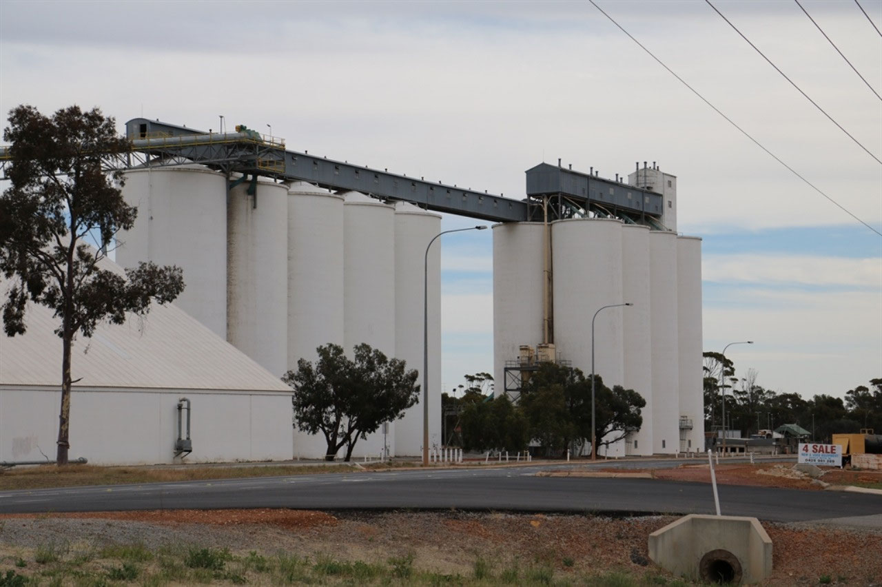
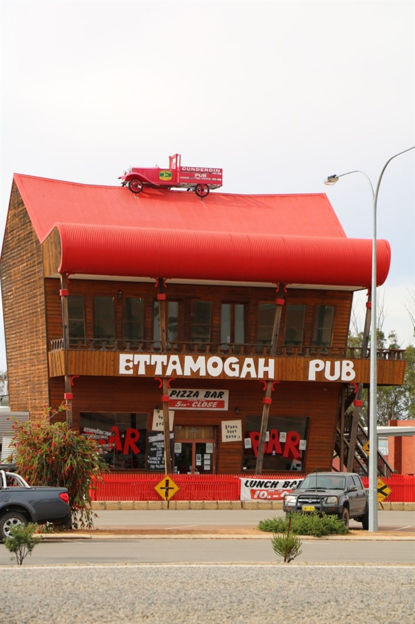
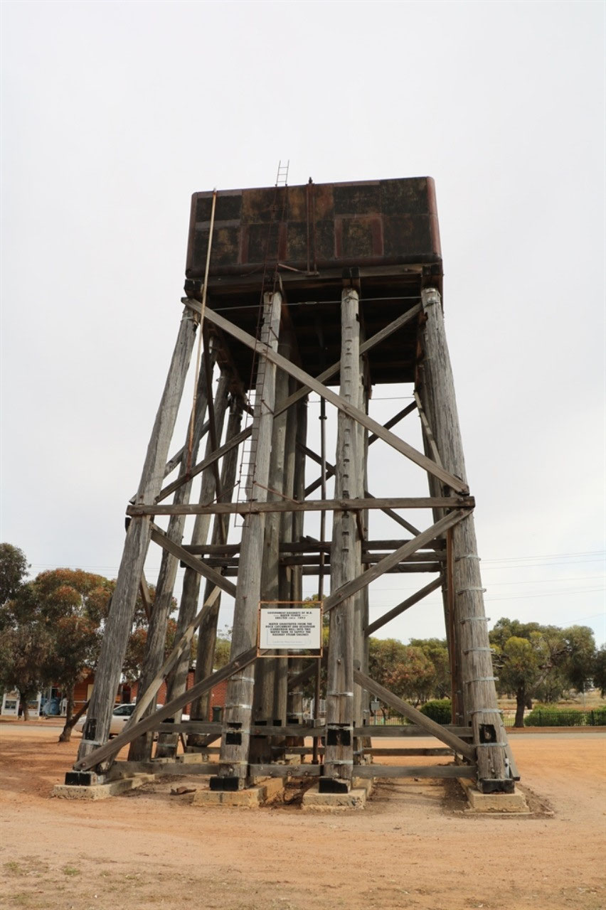
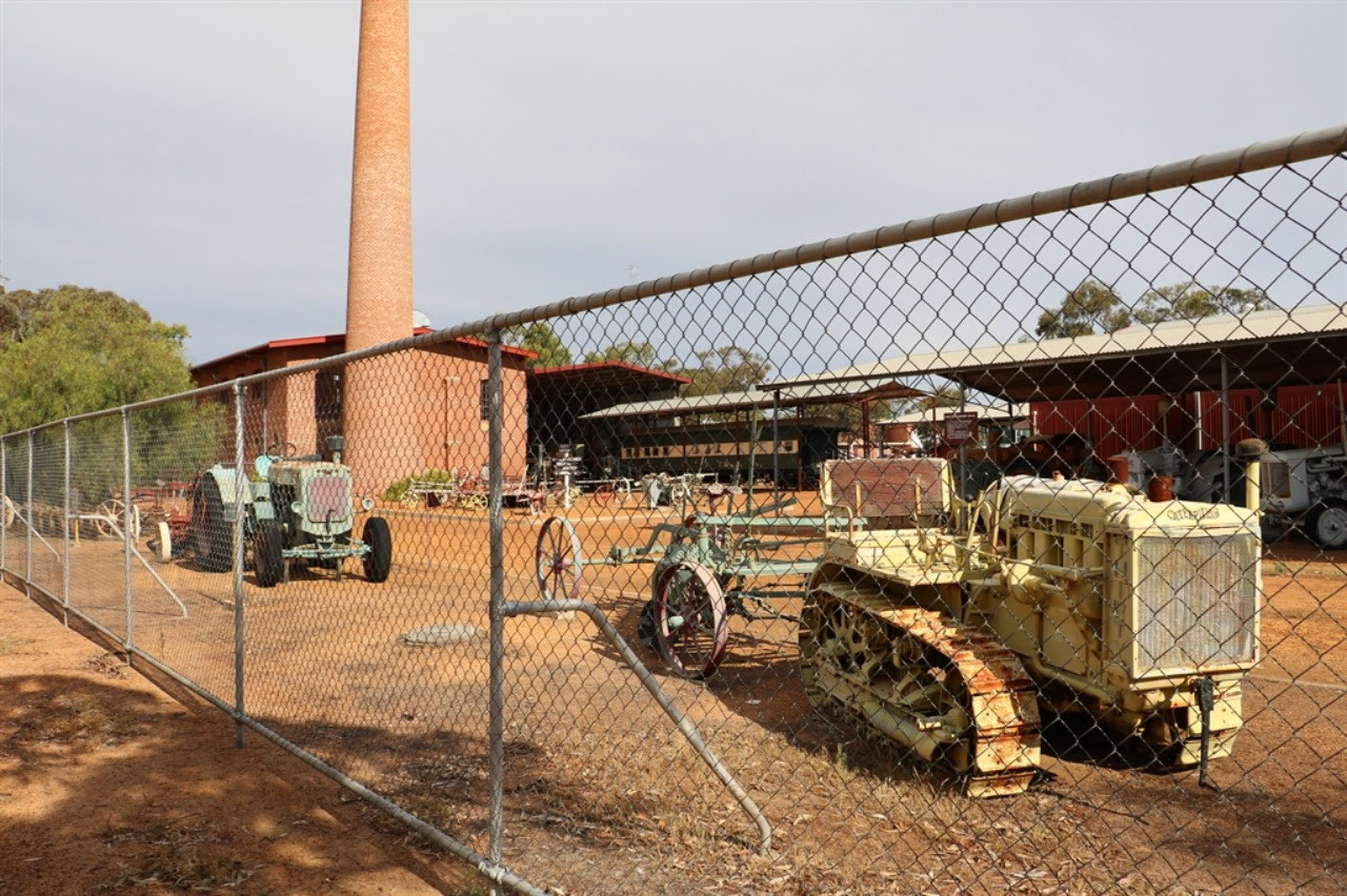
Cunderdin: This town has the 'Pumping Station Machinery Museum'. We did stop to check out the railway water tower, but we only managed to get another blue face for the cache. No way could we find it on the tank stand. Great though to get the history of the railway water tank and a photo of the Ettamogah Pub across the road.
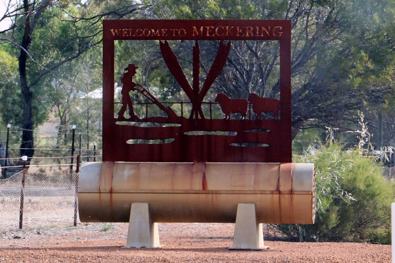
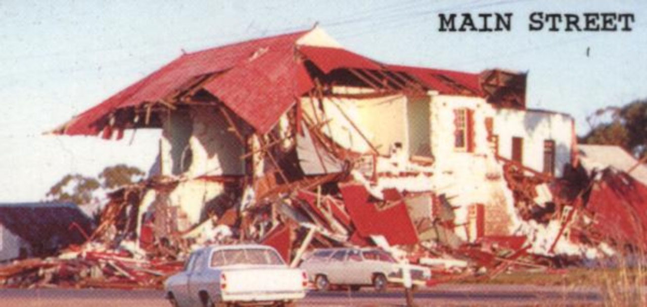
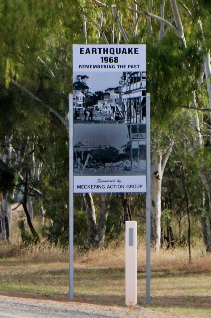
Meckering: It was 50 years a couple of weeks ago, since the Meckering earthquake destroyed the town. The magnitude of the Meckering earthquake was 6.9 on the Richter Scale, making it one of the largest recorded in the seismic history of Australia. The earthquake lasted 45 seconds and was felt over an area of 700kms in radius and caused damage in many towns. The quake focus was 7km deep and had the force equivalent of 10 Hiroshima type atomic bombs. The principal fault scarp of the Meckering earthquake was originally 37 km long. Trenching across the scarp took place in 1990, and it was concluded that the Meckering earthquake was the result of the reactivation of an old fault line, possibly tens of thousands years old. There were three signs on the highway, the first one was 'Remembering the Past' and this had photos of the destroyed buildings, the second was about the Memorial Rose Garden which 'Celebrates the Present' and the third was about Agriculture and 'Farming for the Future'.
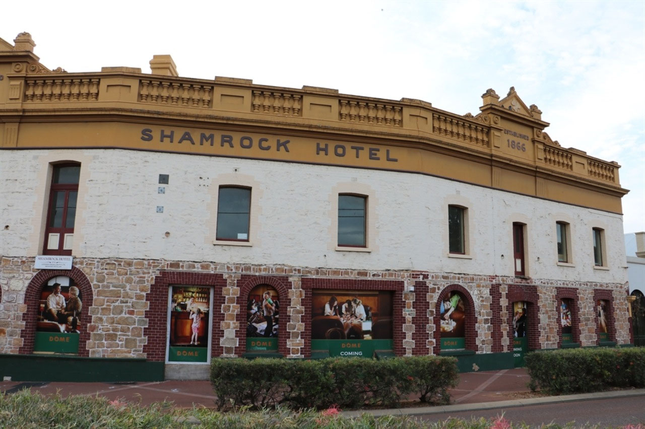
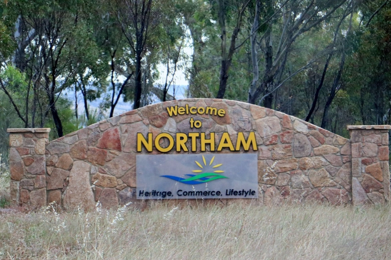
Northam: These days Northam is no longer the regional centre it used to be. I can remember when it was such a 'Big Thing' to go to from Kellerberrin to Northam to shop! The town had so many more shops and was a busy and exciting regional centre. These days it is looking very tired. The old Shamrock Hotel is about to become a Dome, so that should provide a bit of a boost to the town. Today travel is so much easier and quicker. Better roads and faster cars. I guess in a sense that is part of the reason for the demise of centres like Northam, only just over an hour from Midland. Farms continue to increase in size, technology continues to improve and less people are living in the country.
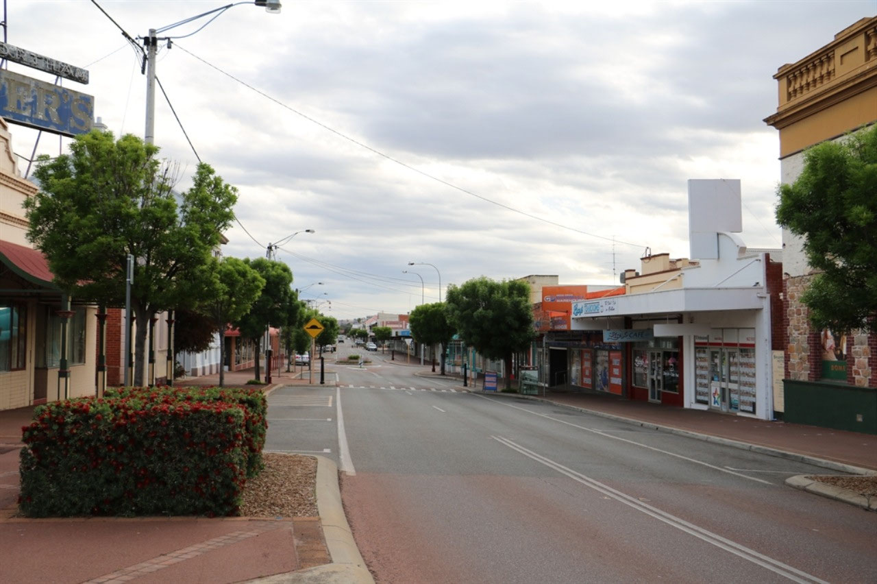
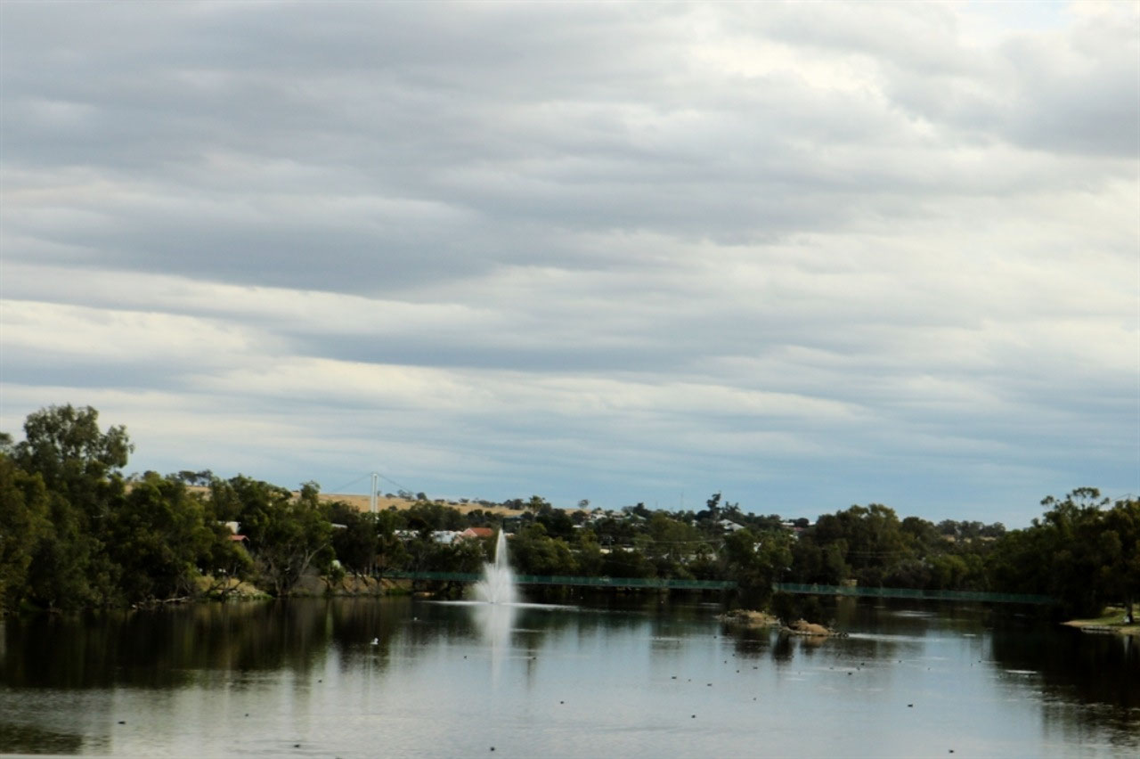
Northam is situated on the confluence of the Avon and Mortlock Rivers and at the 2016 census, had a population of 6,548 people. It is the largest town in the Avon district and is also the largest inland town in the state, not founded on mining. It was named by Governor Stirling, probably after a village of the same name in Devon, England. The arrival of the railway made Northam the major departure point for prospectors and miners heading east towards the goldfields.

My goodness, when you are researching info on the net to include in your blog you find out all sorts of things! I have just found that the 'Northam Army Camp' became a huge migrant centre, just like we visited at Bonegilla, near Albury in NSW. Places like the Northam Army Camp were able to be quickly transformed into large-scale accommodation. The Northam Migrant Accommodation Centre closed in September 1951. It had been the first place of residence in Western Australia for approximately 15,000 immigrants from the European countries. During the peak immigration period, Northam had the largest immigrant receiving facilities within the State and the third largest in Australia. By 1950, the camp housed 4,000 people and two new blocks of huts were built to accommodate them all. Although the camp had closed, in 1954 it was estimated that 23,000 migrants had passed through the Northam Camp. A significant number of these post-war arrivals eventually settled in the Northam area. Peter went to Northam Army Camp for a couple of years doing CMF training. For a short time the Northam Camp was a POW camp for Italians during WW2.
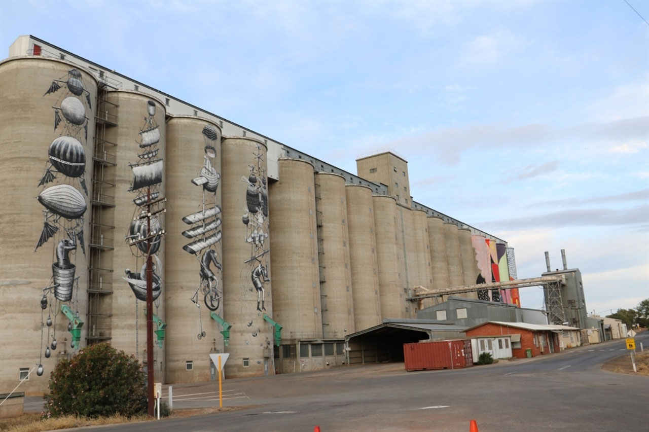
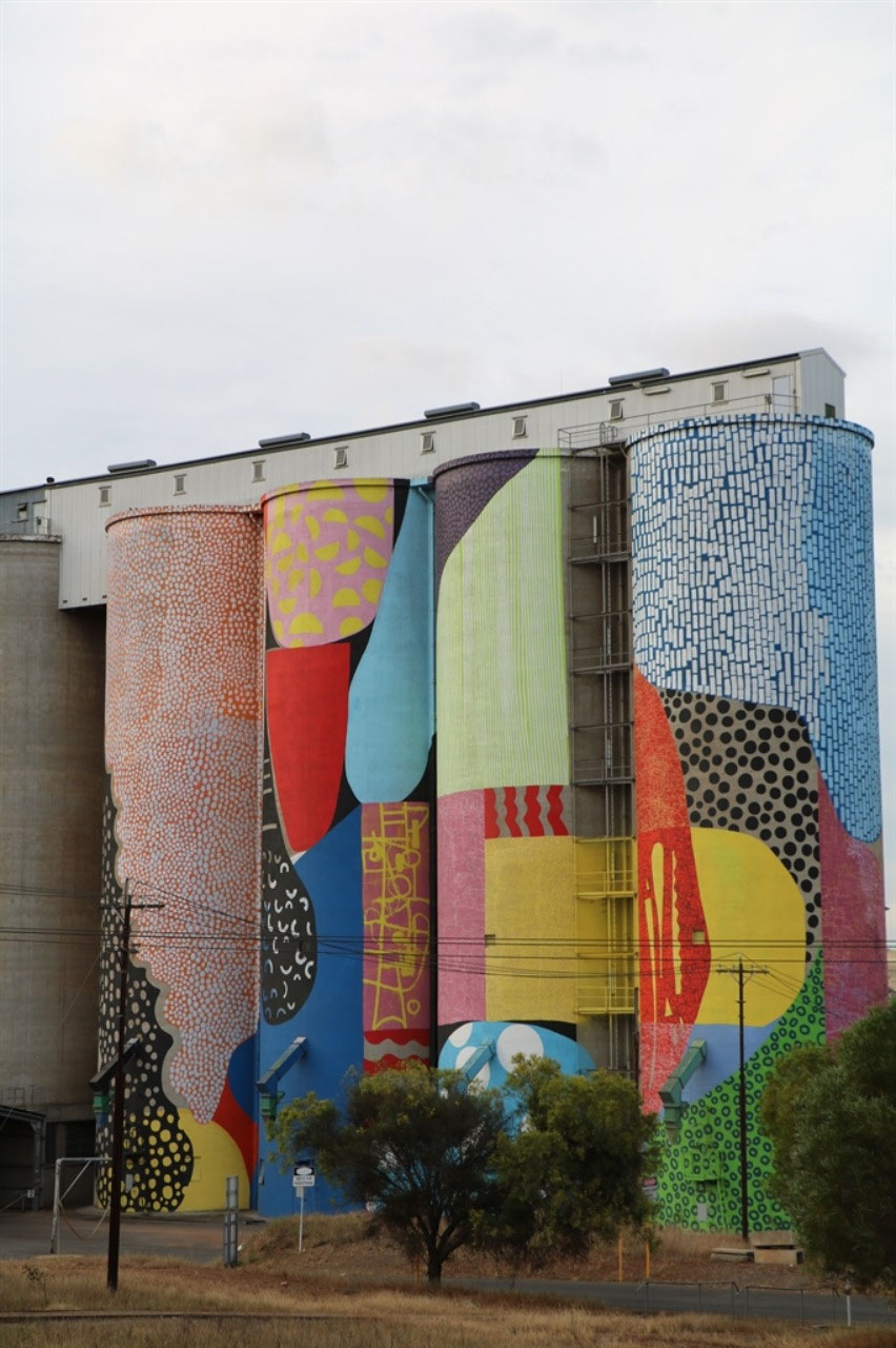
We stayed the night at the Northam Caravan Park. It was really tight to get the van into the bay and we did check out a couple of alternatives, before Peter reversed and reversed etc to get us parked. The gardens at the park were nice, but the facilities were very tired. We unhooked and went to find the silo art. Some work does need to be done so that people can safely park to view the artwork at this 'Public Silo Trail' site. It was completed in 2015 and hopefully with the promotion the trail is now getting, better parking will happen. There are lots of cell silos at Northam, so this one was different. At one end four silos have black and white images and at the other end there are four silos with colour. The art was a bit different here as well. We still favour the art work at Pingrup, which was only completed in September of this year and the web says it is the last!
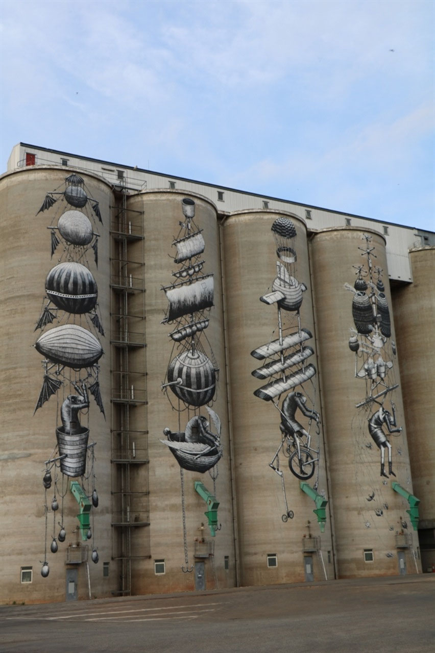
I have looked up a bit of information about the organisation FORM, which seems to be promoting the 'Public Art Trail' and they were also involved in the 'Field of Light' at Albany. FORM is an independent, non-profit cultural organisation that develops and advocates for excellence in creativity and artistic practice in Western Australia. We see creativity as a catalyst for positive change, and we believe that the best, most vibrant places to live are the ones that nurture dynamic creativity, showcase cultural diversity, insist on quality, and are shaped with people in mind.
We managed a bit of shopping before it was time to call it a day for these two tourists. A more leisurely look at Northam will have to happen some other time!

Jenny
2018-11-01
Ah Yes, the trick is to read the attributes as too many DNFs mean it's probably gone. Mind you, Bob likes a challenge and will often still have a look and has come up trumps...sometimes. The silos look great, maybe Geraldton will get their act together one day, but then again...if Oakagee happens!!