 Shap, England, United Kingdom
One of U2's biggest hits, 'Beautiful Day' includes the lines:
You're on the road
But you've got no destination.
You're in the mud
In the maze of her imagination.
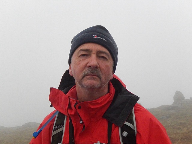
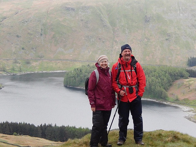
Now, these lyrics came to mind as we trudged the top of a boggy Kidsty Pike, covered in cloud and blowing a gale, and uncomfortably close to rather too many sheer drops. There we were, wondering whether this had all been a terrible mistake, when I turned round to see Tim with his new hat on. And shock horror, standing right in front of me, was the lead guitarist of U2 known simply as 'The Edge'. Well, of course, my first reaction was of some mild surprise, as I really didn't have The Edge down as a keen rambler. But then, as the mist lifted a little, I saw that it was Tim after all, but the likeness was truly uncanny as you will note from the photos below:
Ok, so you will have probably got the format of these blog entries by now.......I ramble on (excuse the pun) for a bit about something completely random, then I get back to the real story! So here goes.
Dinner at Old Water View was excellent and Ian Moseley was a superb host. He a very experienced Coast to Coaster himself and even has a 10 year old daughter who has already done the C2C three times! We have eaten so well on this trip already; just thank goodness that we've been doing the exercise to eat up the calories.....hopefully! A beer in the bar, then the rest of the guys went to bed while I stayed in the bar to bring this blog up to date.....it was the only place where you could get wi fi. But it was worth it. After two days without wi fi, I was able to catch up......11.30 before I got into bed, but I had to give the public what they wanted!
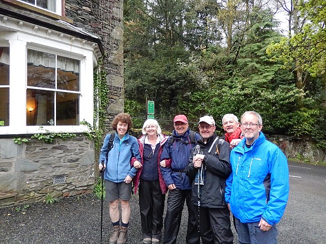
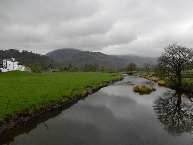
Today was always going to be a tough day; 16.5 miles from Patterdale to Shap, but with a long, initial climb of 3-4 hours up to Kidsty Pike at over 2500 feet. We left about 9.30, took the obligatory group photo and donned our wet weather gear to face the elements. It had rained hard during the night (as Tim & Jim can testify, with the rain lashing on the velux window in their roof, for big chunks of the night,) and this morning we were met with extremely low cloud cover, mizzly rain, but with the forecast saying that it should clear by lunchtime - by the way it didn't! Even with the grey conditions, I got a lovely pic of the river as we left town.
We left Patterdale and started climbing almost straight away. Ian had mentioned that, we would climb hard for an hour, slightly less hard for another hour and then a final push to the summit of Kidsty Pike at a similar intensity to the first hour. On the way we would pass Borderdale Hause, Angle Tarn, Satura Crag, the Knott and Kidsty Peak, before descending again. This was hard! The books all say this is the hardest leg of the walk. Not because it is the longest, but due to it being the toughest! Some say that you will end up cursing Wainwright's name by the end of it and they're probably not wrong!
We reached Angle Tarn after 75 minutes and the mist was already closing in and the wind was blowing a howling gale. We pressed on past Satura Crag where the navigation was really difficult.......we actually met a couple of army guys coming towards us, but who told us they were heading for Shap as well; they had got disorientated in the mist and were going completely the wrong way!! After sorting them out (!), we found the right trail and climbed a long and steep ascent to The Knott and then Kidsty Pike, about 3 hours in. By this time, the cloud cover was so low and thick, you could barely see more than 50 yards in any direction and any beautiful views could be forgotten! But we made it and even better news, Marie treated us all with a bar of chocolate!
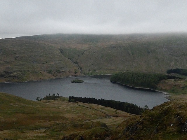
At this point (and after briefly getting a phone signal!), we had the option to descend the recommended route or to follow a ridge-top route suggested by Ian, but only if we could see Haweswater Reservoir from the peak! Well, fat chance of that, so we went the recommended route. After descending for about 30 minutes, Jim was the first to spot the lake peering through the clearing mist as we descended. A few more minutes and it was clear, although very grey and Haweswater came sharply into view. What a welcome sight!
We ate our sandwich lunch and then carried on our descent to Haweswater, yet another tricky section. By the time we reached the reservoir, we had been going nearly four and a half hours, albeit with a 20 minute stop for lunch......AND we still weren't half way!! But at least we were down from the fells and walking should be easier now. So we took a deep breath and went for it, only to have to go up yet another stiff climb!! But once over that rise, we did, at last, get a pace on and the going alongside the lake was pretty good, certainly easier than it was by Ennerdale Water all those days ago.
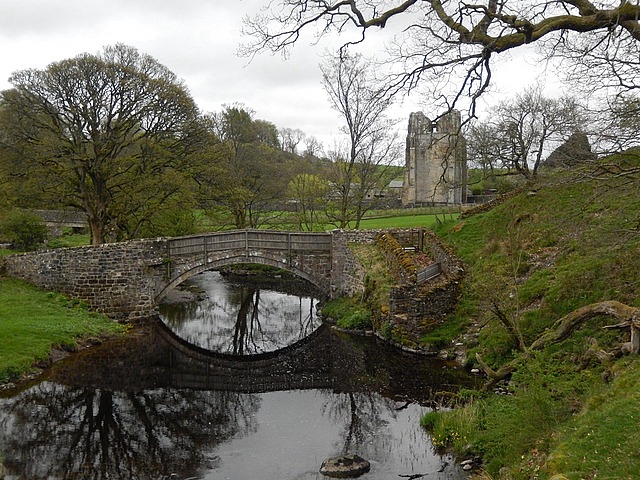
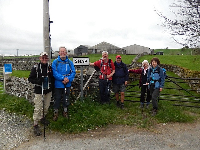
The lake seemed to go on for ever (over 4 miles, in fact) but we eventually came to the end of the water and reached civilisation, first in the small hamlet of Burnbanks, then skirting Rosgill Bridge, before reaching the ruins of Shap Abbey, an imposing tower dating back to 1199......but still 1.5 miles from Shap itself!! The rest of the route was along a tarmac road and about 20 minutes later we saw it, the beautiful, welcoming village sign of 'Shap' and boy, were we glad to see it! But still, this leg didn't give up its' hold on us; the village high street was probably almost a mile long and the pub we were aiming for was right at the far end of it! Finally, we arrived at the King's Arms, bang on 6pm, after eight and a half hours on the road!!
We ate straight away at the pub because, guess what, our B&B for tonight was another kilometre further down the road.....the last house before you leave the village....it just had to be! But before we got there, dinner at the King's Arms was tip top and really excellent value.......plus, treacle sponge!! We were all pretty tired, but also pretty exhilarated; a really tough and challenging and, at times, quite scary day, but we made it. And made it in pretty good time in the end and, all still together!
That last half mile or so to Brookfield House was unwelcome, being both tired and a bit chilly, but we arrived at the B&B to a warm welcome from Margaret........Margaret, who has recently had a hip replacement, yet still had managed to take all our heavy bags upstairs before we arrived. Brookfield House is lovely and Margaret is yet another legend of the trail!
So that's another leg done. Nearly 70 miles so far and around one third distance. Today we bade a sad farewell to the Lake District, its magnificent splendour and its backbreaking challenges. Tomorrow is a shorter 7 mile trek to Orton, but with yet another challenge to face; another major obstacle on the C2C, splitting the country in two. No........not the Pennines.....something far scarier....the Mighty M6!!!!!!
Not sure whether these final facts are interesting or not, but here are few more anyway:
* The Lake District covers nearly 900 square miles, has 3 mountains over 3000 feet and over 200 fell tops;
* Shap is a linear village split down the middle by the A6 - Shap Chippy smelt fantastic!
* Haweswater Reservoir was created in 1929 after the construction of the Haweswater Dam and controversial flooding forever of the villages of Mardle and Measeland. The reservoir supplies water to the city of Manchester;
I think we might be too close to The Edge!!
Thursday, May 01, 2014
 Shap, England, United Kingdom

Other Entries
-
Apr 292 days prior Grasmere, United Kingdom
 -
Apr 301 day prior
Patterdale, United Kingdom -
May 01
Shap, United Kingdom -
May 021 day later
Orton, United Kingdom -
May 032 days later
Kirkby Stephen, United Kingdom -
May 043 days later
Keld, United Kingdom -
May 054 days later
Reeth, United Kingdom -
May 065 days later
Richmond, United Kingdom -
May 076 days later
Ingleby Cross, United Kingdom -
May 087 days later
Clay Bank, United Kingdom -
May 098 days later
Blakey Ridge, United Kingdom -
May 109 days later
Grosmont, United Kingdom -
May 1110 days later
Robin Hoods Bay, United Kingdom

Comments
2025-05-22
Comment code: Ask author if the code is blank
Lily Forbes
2014-05-03
Amazing story, what endurance you stalwart walkers. Now, I am definitely glad I decided not to join you but hats off to you all. You will have such amazing memories to treasure.
Paul, your narrative is superb.