Today is a day about elevation as we continue our zig-zag path across Arizona. According to multiple motorcycle magazines, the road we are riding today, The Coronado Trail, or US-191 from Eagar to Clifton is supposed to be one of the best motorcycle rides. At 120 miles long, it's certainly one of the longest. Most people begin the trip in Clifton and head north to Eagar, but in the interest of doing everything backward if we can, we are doing it starting in Eagar and going south to Clifton. I should mention here, that the original route number of this road used to be US-666, but too many road signs were being stolen for the "Highway to Hell", so they changed the number.
Since our hotel in Eagar was already on US-191, we began our journey at 9:00 when we left the hotel parking lot
. Eagar is already at 7100 ft elevation, so the morning temperature was a comfortable upper 70's. We started out in the alpine meadows that surround that area, but quickly our elevation began to rise. It wasn't too long before we were up at over 9100 ft riding easy turn mountain roads. This was the easy part of the ride, just some back and forth turns and we were at the top. Things leveled off for a while, and we began to head back down again. There was a lot of evidence of forest fire, many trees were badly burned, but the forest floor was back to green, so the forest was recovering.
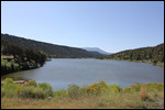
One of our first stops was at the Nelson Reservoir, a local fishing haunt. Sure enough, there were several people fishing when we were there. It's not a very big lake, but it sure is beautiful among the mountains. The road continued down to about 8000 ft, when we arrived at the small town of Alpine. This is where US-180 breaks away from US-191 and the real fun begins. It was also the place where we gassed up the bike, because there was very little gas along the rest of US-191
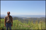
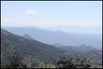
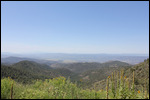
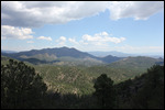
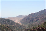
. The scenery began to change even more into heavy forest as we wound our way through the Apache Sitegreaves National Forest. For the 40 or 50 miles, the elevation went up and down to 9100 ft down to about 7000 ft and then back up. There were a number of scenic overlooks, and we took pictures whenever we could. The problem with mountain roads in forests, is that sometimes the scenic view is blocked by trees, so there weren't as many opportunities for pictures.
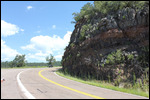
Once we hit the 60 mile mark, we were thinking, what a nice, leisurely mountain ride, lots of twists and turns, some riding near the edge, but nothing too difficult. Then we saw the sign: "All vehicles over 40 ft, turn around now" and we knew we had come to the fun part of the ride. And sure enough, just as we had hoped, it was switchback after switchback, mostly the 180 degree 10-15 mph ones that we like best. Plenty of riding near the edge, with steep, no-guardrail drop offs. The road also kept switching sides of the mountain, as sometimes the drop off was on the left, and other times it was on the right
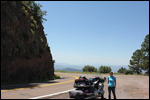
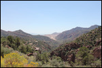
. There was very little time for me to observe the scenery, I was kind of preoccupied with keeping the bike upright and on the road. But Jody said the scenery was beautiful, and I tried to catch a glimpse whenever I could. There were several scenic overlooks, where we could stop, drink some water, and take some pictures. For the most part, the temperature was staying in the low or middle 80's depending on the elevation.
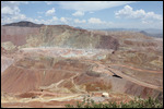
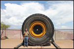
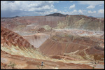
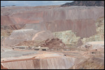
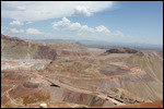
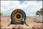
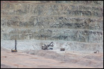
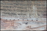
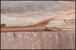
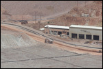
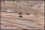
As we came to the final scenic overlook before our descent into the town of Morenci, we could see activity and heavy equipment in the valley in the distance. The descriptions of the ride mentioned something about passing by an active copper mine, but nothing prepared us for the Morenci Copper Mine. This thing was HUGE! And we didn't pass BY the copper mine, we passed THROUGH the copper mine. US-191 literally passed through the excavation. There were huge earth moving equipment on both sides of the road, with signs to turn off cell phone and CB radios and to be prepared to stop in the event of blasting nearby
. There were flagmen permanently on the road, blocking traffic whenever any of the heavy equipment needed to cross over the highway to the other side of the mine. There was dust everywhere! You could barely see the pavement of US-191 with all the dust from the mine.
But it was cool! They had a couple of scenic view spots where you could watch the heavy equipment at work and take pictures. Which we did, of course. Evidently, this copper mine has been in existence since the 1870's and is the largest copper mine in the US. Beyond the excavation sites, there was lots and lots of smelting equipment, and conveyor belts and just all kinds of stuff. As we reached the end of the mine, there was a series of very steep and sharp switcbacks that took into the town of Morceni. Judging by the bars and strip joints we saw in this town, it didn't look like the kind of place to visit if you didn't belong. So we kept on going into Clifton, a little less forbidding town, and the end of the scenic portion of our day
.
From there is was just US-75 to US-70 which turned into I-10. It was all flat and straight, and time to put on the cruise control and crank up the tunes. Along the way, there was a long series of billboards advertising a Continental Divide Gift Shop, which seemed to sell just about anything a person could want to buy. We had some time, so we stopped in, but it was a little disappointing as it didn't have anything that we wanted to buy. But while we were in there, the weather had changed dramatically. We looked down the road on I-10, and everything was black. There were bolts of lightning on the left and what looked like black sheets of rain to the right.
We were less than 30 miles from the hotel, and there was nowhere really to go, so we did what any motorcycle rider would do, we stopped under an overpass and put on our rainsuits. We got them on just in time. It began to rain almost immediately, but fortunately it wasn't raining very hard. The real problem was that the wind had picked up significantly to well over 30 knots
. We just slowed down enough that the wind wasn't overwhelming, bore down and kept going. Sure enough, about 10 miles out, the wind died down and the rain slowed and it looked like we had survived. By the time we got to the hotel, the wind and rain had stopped, but the sky was still looking a little threatening.
Tonight we are staying in a LaQuinta which is usually a pretty good hotel. And this one is very nice, the room is great, and there are a couple of other nice hotels next door. The problem is that there are no restaurants whatsoever. I looked at Around Me and TripAdvisor, and the nearest restaurant was 2-3 miles away. With the weather looking as threatening as it was, we decided that tonight would be Domino's Pizza, delivered.
Tomorrow, we have the final leg on our journey to Carlsbad Caverns. Carlsbad is one of the parks we have been looking forward to since the beginning, so we can hardly wait. It should be fun!
255.4 miles today
15,712.4 miles total
4.138 gallons today
371.999 gallons total
Day 86 - Awesome Day on the Coronado Trail
Monday, August 17, 2015
 Deming, New Mexico, United States
Other Entries
-
70Day 69 - Best Car Collection Ever - Nethercutt!
Jul 3117 days prior Sylmar, United Statesphoto_camera73videocam 0comment 0
 -
71Day 70 - Finished the PCH, Made it to San Diego!
Aug 0116 days prior San Diego, United Statesphoto_camera8videocam 0comment 0
 -
72Day 71 - Balboa Park - Museums, Museums, Museums
Aug 0215 days prior San Diego, United Statesphoto_camera74videocam 0comment 0
 -
73Day 72 - San Diego Zoo is THE Best Zoo!
Aug 0314 days prior San Diego, United Statesphoto_camera56videocam 0comment 0
 -
74Day 73- Motorcycle Tires & the Last of Balboa Park
Aug 0413 days prior San Diego, United Statesphoto_camera29videocam 0comment 0
 -
75Day 74 - Goodbye San Diego - Hello Hot! Hot! Hot!
Aug 0512 days prior Yucca Valley, United Statesphoto_camera22videocam 0comment 0
 -
76Day 75 - Tale of Two Deserts
Aug 0611 days prior Henderson, United Statesphoto_camera42videocam 0comment 2
 -
77Day 76 - Hoover - A Damn Fine Dam
Aug 0710 days prior Henderson, United Statesphoto_camera50videocam 0comment 0
 -
78Day 77 - Red Rocks to Cruise Control
Aug 089 days prior Kanab, United Statesphoto_camera25videocam 0comment 0
 -
79Day 78 - Zion is Spectacular!
Aug 098 days prior Cedar City, United Statesphoto_camera59videocam 0comment 0
 -
80Day 79 - Utah, So Many Parks, So Little Time
Aug 107 days prior Torrey, United Statesphoto_camera60videocam 0comment 0
 -
81Day 80 - Parks, Rain, More Parks
Aug 116 days prior Monticello, United Statesphoto_camera56videocam 0comment 0
 -
82Day 81 - Great Rock Formations, Ancient Ruins
Aug 125 days prior Williams, United Statesphoto_camera51videocam 0comment 0
 -
83Day 82 -Grand Canyon, On a Motorcycle, In the Rain
Aug 134 days prior Williams, United Statesphoto_camera62videocam 0comment 0
 -
84Day 83 - We Got Our Kicks on Route 66
Aug 143 days prior Williams, United Statesphoto_camera12videocam 0comment 0
 -
85Day 84-Who Needs a Roller Coaster After Jerome,AZ
Aug 152 days prior Mesa, United Statesphoto_camera32videocam 0comment 0
 -
86Day 85 - Climbed Another Mountain!
Aug 161 day prior Eagar, United Statesphoto_camera32videocam 0comment 2
 -
87Day 86 - Awesome Day on the Coronado Trail
Aug 17 Deming, United Statesphoto_camera22videocam 0comment 0
 -
88Day 87 - Not Everything is Big in Texas
Aug 181 day later Carlsbad, United Statesphoto_camera20videocam 0comment 0
 -
89Day 88 - Carlsbad Caverns - Best Cave & Bats Too!
Aug 192 days later Carlsbad, United Statesphoto_camera64videocam 0comment 0
 -
90Day 89 - Searched for Aliens & Found a Ghost Town
Aug 203 days later Santa Fe, United Statesphoto_camera21videocam 0comment 0
 -
91Day 90 - Back in the Mountains With Indian Ruins!
Aug 214 days later Mesa Verde National Park, United Statesphoto_camera44videocam 0comment 0
 -
92Day 91 -More Indian Ruins & Better Motorcycle Road
Aug 225 days later Mesa Verde National Park, United Statesphoto_camera42videocam 0comment 0
 -
93Day 92 - We Just Kept Climbing Higher & Higher!
Aug 236 days later Salida, United Statesphoto_camera36videocam 0comment 0
 -
94Day 93-We Just Kept Climbing Until We Hit 12,183ft
Aug 247 days later Estes Park, United Statesphoto_camera54videocam 0comment 0
 -
95Day 94 - A Wonderful Ride & A Return to 6000 ft
Aug 258 days later Manitou Springs, United Statesphoto_camera18videocam 0comment 0
 -
96Day 95 - As High As We Can Get - 14,115 ft
Aug 269 days later Manitou Springs, United Statesphoto_camera60videocam 0comment 0
 -
97Day 96 - The Sad Farewell Tour of the Mountains
Aug 2710 days later Pueblo, United Statesphoto_camera34videocam 0comment 0
 -
98Day 97 - Started Slow But Ended in Gunfire!
Aug 2811 days later Dodge City, United Statesphoto_camera46videocam 0comment 2
 -
99Day 98 - Death Camps to Wind Farms to Oil Wells!
Aug 2912 days later Edmond, United Statesphoto_camera2videocam 0comment 0
 -
100Day 99 - One Night In Paris
Aug 3013 days later Paris, United Statesphoto_camera20videocam 0comment 0
 -
101Day 100 - The Last Adventureless Day
Aug 3114 days later Vidor, United Statesphoto_camera1videocam 0comment 0
 -
102Day 101 - New Orleans At Last!
Sep 0115 days later New Orleans, United Statesphoto_camera6videocam 0comment 1
 -
103Day 102 - Jody's Birthday in New Orleans
Sep 0216 days later New Orleans, United Statesphoto_camera38videocam 0comment 0
 -
104Day 103 - Crazy Day In New Orleans
Sep 0317 days later New Orleans, United Statesphoto_camera46videocam 0comment 0
 -
105Day 104 - Back In Florida! Almost Home!
Sep 0418 days later Crestview, United Statesphoto_camera2videocam 0comment 0

 Deming, New Mexico, United States

2025-05-23