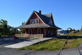
We left our motel at North Sydney and drove through Sydney on our way to the town of Louisbourg. This was much easier to navigate and certainly quicker than through its Australian counterparts. Our first sight in Louisbourg was the old Louisbourg Railway station which was once owned by the Sydney and Louisburg Railway to transport coal from various mines to the ports of Sydney Andrews Louisbourg.
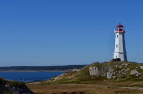
An important part of the Loiusbourg harbour was its lighthouse. Besides the current light on the hill are the ruins of two previous lighthouses. One of these was Canada's first, built by the French and lit in 1734.
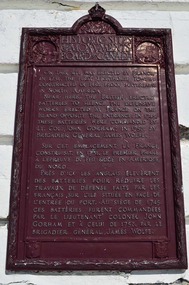
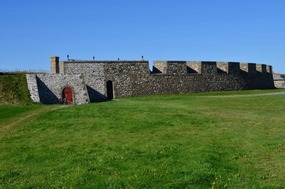
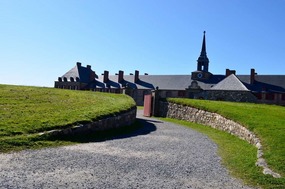
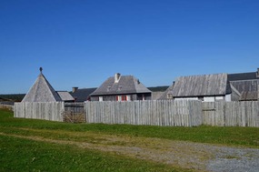
The Fortress of Louisbourg is a National Historic Site on the coast near Loiusbourg. The original settlement was founded in 1713 by the French and developed over several decades into a thriving centre for fishing and trade. Fortified against the threat of British invasion during the turbulent time of empire-building, Louisbourg was besieged twice by the British before finally being destroyed in the 1760s to prevent the town and port from being used in the future by the French. The site lay untouched until well into modern times, when archaeologists began to reconstruct the fortress as it was in the 18th century. The reconstruction project, which began in 1961, is ongoing.
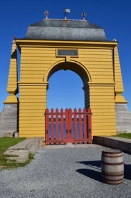
Throughout the site are people in period costume who provide visitors with information about the history of the Fortress and life during those times. The visit begins at an ornate arch through which most of the people and merchandise of the colony would have passed. The gate's name honours the Minister of the Marine, Jean-Frederic Phelypeaux (yes, for you Francophones there should be a lot of acute accents in this name but my keyboard is English only). The construction of the gate in 1742 completed Loiusbourg's fortifications.
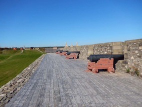
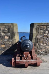
Walking along wharf leads to the Dauphin Demi-Bastion (Semi-Circular Battery) which forms part of the Fortress's defence system. The cannons are reproductions of French guns that fired round iron balls each weighing almost 12 kg.
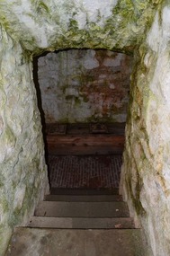
The Dauphin Gate houses a drawbridge across a moat and the guardhouse located nearby has all the amenities needed by the soldiers: the latrine has two seats next to each other to enable the occupants to discuss important affairs of state.
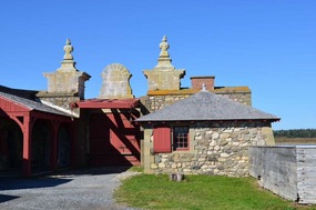
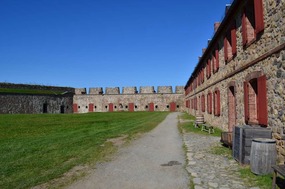
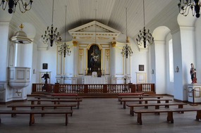
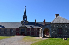
Further back from the fortifications is a large building that housed the Governor's Apartments, the Military Chapel and King's Bastion Barracks. Most of the governors who lived here were naval officers, more knowledgeable in military affairs than in government. A bit like our Governors-General in Australia today. Their lives were a little more lavish than the 500 soldiers who resided in the barracks nearby. Service men were housed in small rooms, 12 to 16 per room and two per bunk. There were no mess halls and the men cooked, ate, drank and smoked in their room. The military chapel also served as a parish church to the civilian population since a community church was never built. We spoke to a "French soldier", who lives in the town of Louisbourg, about the great weather we were enjoying. She (Who knew the French were so enlightened regarding gender equality in ancient times?) pointed out that the area normally experienced thick fogs that lasted well into the day or gale-force winds or rain. Little did we realise how the weather was about to change for the worse.
A number of sentries that were supposed to be posted around the Barracks to assist us tourists were sheltering from the heat in the nearby Guardhouse. Typical French wimps who don't know what real heat is. The Guardhouse was an area where soldiers mustered for guard changes.
While unmarried officers lived in a section of the building near the Governor's Apartments, married officers lived in their own homes within the town.
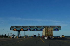
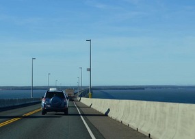
We could have spent more time here, as the history of the Fortress and town is very interesting. However, we planned to arrive on Prince Edward Island tomorrow so we set off to our next overnight stop at Truro in Nova Scotia before crossing to the Island over the Confederation Bridge. The 12.9 km bridge is the longest in the world and spans the Abegweit Passage of Northumberland Strait. It links the provinces of New Brunswick and Prince Edward Island. It took four years to construct at a total cost of one billion dollars and was opened to traffic on 31 May 1997. Certainly a magnificent engineering feat. One could opine that if the ACT government was in charge the bridge would still be under construction.
Louisbourg on Cape Breton
Saturday, October 08, 2016
 Truro, Nova Scotia, Canada
Other Entries
-
7Day trip to Radium Hot Springs
Sep 0929 days prior Radium Hot Springs, Canadaphoto_camera4videocam 0comment 0
 -
8Overnight snow on peaks
Sep 1226 days prior Canmore and Kananaskis, Canadaphoto_camera1videocam 0comment 1
 -
9Kananaskis Country
Sep 1325 days prior Kananaskis Village, Canadaphoto_camera5videocam 0comment 1
 -
10Exploring Lake Louise
Sep 1424 days prior Lake Louise, Canadaphoto_camera9videocam 0comment 0
 -
11Boom Lake
Sep 1622 days prior Boom Lake, Canadaphoto_camera3videocam 0comment 0
 -
12Lake Minnewanka Trail to Aylmer Pass Junction
Sep 1919 days prior Aylmer Pass Junction, Canadaphoto_camera15videocam 0comment 2
 -
13Icefields Parkway Hwy 93
Sep 2117 days prior Columbia Icefields Discovery Centre, Internationalphoto_camera21videocam 0comment 0
 -
14Saskatchewan Glacier
Sep 2216 days prior Saskatchewan Glacier, Canadaphoto_camera9videocam 0comment 0
 -
15Wilcox Pass Trail
Sep 2315 days prior Wilcox Pass, Canadaphoto_camera15videocam 0comment 0
 -
16Hike in Kananaskis with our Vancouver friends
Sep 2513 days prior Canmore and Kananaskis, Canadaphoto_camera11videocam 0comment 1
 -
17Leaving the Rockies
Sep 308 days prior Calgary, Canadaphoto_camera0videocam 0comment 0
 -
18Arriving in the Maritimes
Oct 017 days prior Halifax, Canadaphoto_camera0videocam 0comment 0
 -
19It's raining in Halifax
Oct 026 days prior Halifax, Canadaphoto_camera5videocam 0comment 1
 -
20Halifax to Lunenberg coastal drive
Oct 035 days prior Peggy's Cove, Canadaphoto_camera15videocam 0comment 0
 -
21Cape Breton Island
Oct 044 days prior Cheticamp, Canadaphoto_camera2videocam 0comment 0
 -
22Cape Breton Highlands National Park
Oct 053 days prior Cheticamp, Canadaphoto_camera15videocam 0comment 0
 -
23Leaving Cape Breton Highlands National Park
Oct 071 day prior North Sydney, Canadaphoto_camera8videocam 0comment 0
 -
24Louisbourg on Cape Breton
Oct 08 Truro, Canadaphoto_camera16videocam 0comment 0
 -
25Prince Edward Island and the weather has changed
Oct 102 days later Charlottetown, Canadaphoto_camera3videocam 0comment 1
 -
26Prince Edward Island - Points East
Oct 113 days later Charlottetown, Canadaphoto_camera6videocam 0comment 0
 -
27Bay of Fundy - Highway 114 to Alma
Oct 124 days later Alma, Canadaphoto_camera9videocam 0comment 0
 -
28Fundy National Park and all the Saints
Oct 135 days later St. Stephen, Canadaphoto_camera13videocam 0comment 0
 -
29St Stephen to St John
Oct 146 days later Saint John, Canadaphoto_camera8videocam 0comment 0
 -
30St John to Fredericton
Oct 168 days later Fredericton, Canadaphoto_camera4videocam 0comment 0
 -
31A chocolate river Tidal Bore
Oct 179 days later Amherst, Canadaphoto_camera15videocam 0comment 0
 -
32Bay of Fundy - Amherst to Truro
Oct 1810 days later Truro, Canadaphoto_camera9videocam 0comment 0
 -
33Bay of Fundy - Truro to Kentville
Oct 1911 days later Kentville, Canadaphoto_camera9videocam 0comment 0
 -
34Bay of Fundy - Kentville to Digby
Oct 2012 days later Digby, Canadaphoto_camera11videocam 0comment 0
 -
35Kejimkujik National Park
Oct 2113 days later Digby, Canadaphoto_camera9videocam 0comment 1
 -
36Leaving Bay of Fundy - Digby to Yarmouth
Oct 2315 days later Yarmouth, Canadaphoto_camera5videocam 0comment 0
 -
37A foodies guide to Lunenburg
Oct 2416 days later Lunenburg, Canadaphoto_camera6videocam 0comment 0
 -
38Leaving the Maritimes
Oct 2719 days later Halifax, Canadaphoto_camera0videocam 0comment 0
 -
39Back in Vancouver
Oct 2719 days later Vancouver, Canadaphoto_camera0videocam 0comment 0
 -
40Last day in Vancouver before flying home
Oct 3022 days later Vancouver, Canadaphoto_camera5videocam 0comment 1
 -
41Back Home
Nov 0124 days later Canberra, Australiaphoto_camera0videocam 0comment 1

 Truro, Nova Scotia, Canada


2025-05-22