 Inverness, Scotland, United Kingdom
We headed for John O'Groats hoping for fine weather but the forecast proved to be optimistic. Fortunately I was wearing warmer clothes and had spare cooler ones in a bag that was never opened. It wasn’t really wet but it was cool and in the wind actually cold. It is hard to believe we sweltered when we were here with Irene.
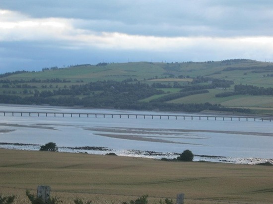
The bridges across the Black Isle were good and we were soon heading up the coast
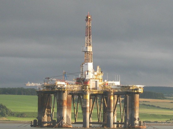
. We enjoyed seeing the Shetland ponies at the side of the road and the oil rigs in the sea. The wildflowers were also plentiful and made a nice splash of colour. Every so often it was hot as the sun came out for about a minute but it was more typical that we saw smoke out of a number of chimneys. On a few clothes lines the clothes were blowing horizontal.
After about an hour, we sidetracked to find a cache. It was along a definite one land road but it had a lot of passing places and the hedgerows are not high here. I had told John we had to find this as he likes wind farms, but the main motivation was that we were the 'first to find’ (FTF). I knew it had not been logged before today but you can never be sure someone hasn’t beaten you to it. It seems odd to get an FTF so far from home and we got another later also at a wind farm as the owner had been setting a few at such places. We had to change our route back to the main road as we met a digger clearing the drains and there was no way we could pass
.
As we moved further north, the vegetation became lower and more sparse. Although there were some newer homes a number had been abandoned and many had yellow moss covering the slate roofs. It was attractive enough but did not look warm.
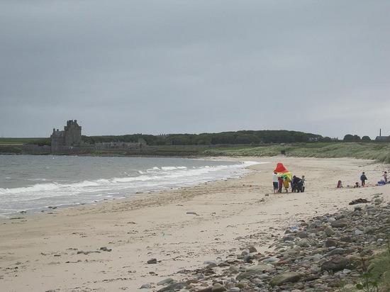
We did another cache at a beach. The beach was by a golf links so the carpark was not quite empty but it was very quiet. We saw one group who seemed to be having fun on the sand and a man was walking his dog but otherwise it was deserted. I was dressed in the sort of clothes I would wear on a normal winter’s day so swimming was not on the agenda. At the same time, it was nice to see a beach that you didn’t have to pay to park at and was not full of people.
We stopped for lunch at Wick, a town a few miles south of the top. There was a market operating but it was a European one. They had French cheese, German sausages and other international food as well as a few bags and ornaments for sale
. I bought a couple of pastries to eat in the car but we had lunch in a café. We should have eaten at the market!! We only ate there because we had heard there was nothing at John O’Groats.
The last part of the drive north took us through more mainly bare land. There was a cache that was meant to give good views of the top and the islands off-shore but the notes advised wearing solid shoes so we gave it a miss. We found there was something at John O’Groats – 3 souvenir shops, one place where we could have eaten, a number of BnB’s and a few boats offering nature trips. We didn’t buy the tee shirt but did buy a fridge magnet. We also saw the ‘last house’ on the Scottish mainland.
We then went along the top coast and saw the furtherest north place on the mainland, Dunnet Head. This does not have much recognition because it is not occupied. We did a short walk in the Dunnet Forest but when we heard a car alarm we shot back to the car park in case our car was being burgled – it wasn’t
. We aimed to stop at Thurso to have a cuppa but couldn’t find a park or see a place to eat so gave up and headed south.
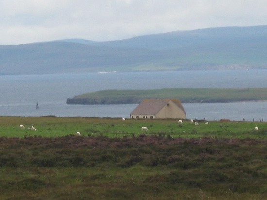
On our way back we passed a sign telling us this town was twinned with another but there was no town there?? We did find a couple of settlements but no where for a drink. We stopped on the coast again to find a cache and also found a lovely seaside village. While it was still too cold to swim, the lack of wind made a big difference. We stopped to take a few photos and even found a few places open. The hills around here looked like paintings with swirls of colour. There were browns, greens and purples in abstract designs. They really looked lovely.
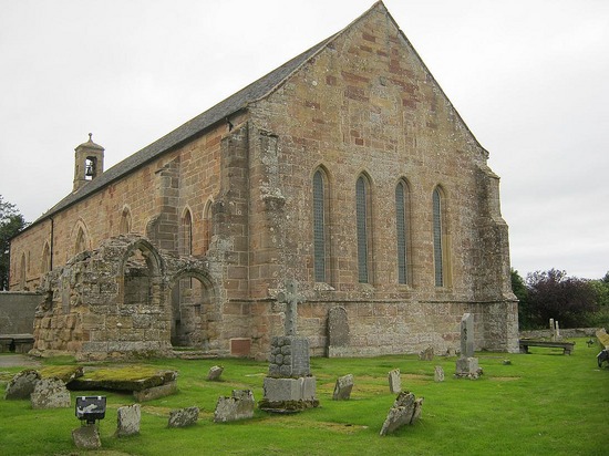
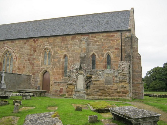
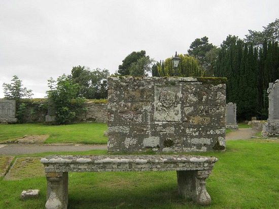
We decided to find a few more caches and have a meal in the country. We chose a random spot and ended up at Fearn Abbey. There is a church still operating on the site and the ruins of the abbey, dating back to the 13th century, are around it. The abbey church had become the parish church after the dissolution of the monasteries
. On Sunday 10 October 1742, the church was struck by lightning during a service and the stone-flagged roof collapsed on the congregation, killing as many as 50. The Minister, who had been saved by the bulk of the pulpit, insisted a new church be built to the south, using stone from the remains of the dormitory and cloister, and from the west end of the church. This is the church still in use today. Everywhere you seem to be able to find places with amazing history.
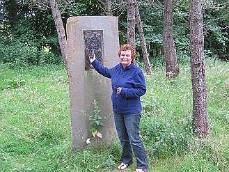
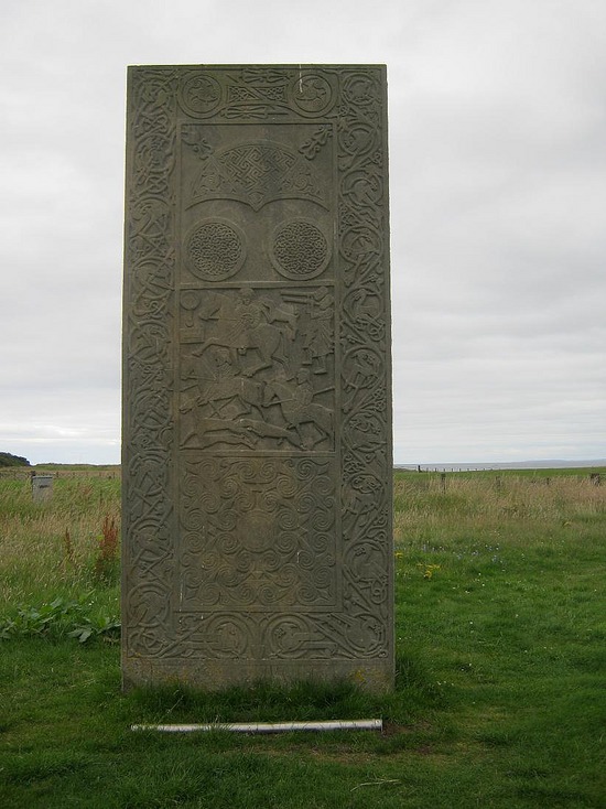
We then found another local cache and it had links back to the abbey. It was at a replica stone that was placed near where the original stone was rediscovered about 800AD. The stone had been intended for Fearn abbey but vandalized so never got there. The replica was carved out of a 7 tonne slab of sandstone, to as closely as is known match the original.
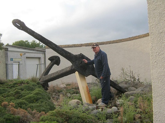
After a pub meal we did 2 other linked caches. On was at the cemetery where a number of the sailors on the HMS Natal were buried and the other was at the site of the ships anchor. In the middle we were redirected by police and then saw a huge transporter go past with equipment that looked as though it was going to one of the oil wells. We could see one very clearly from this town. We finished by doing a cache on the Black Isle (the island we had crossed over in the morning) and one near the main Inverness football ground.
To the top at John O'Groat's
Friday, August 13, 2010
 Inverness, Scotland, United Kingdom
Other Entries
-
Aug 112 days prior Lochearnhead, United Kingdom
 -
Aug 121 day prior
Inverness, United Kingdom -
Aug 13
Inverness, United Kingdom -
Aug 141 day later
Dumfries, United Kingdom -
Aug 152 days later
Dumfries, United Kingdom -
Aug 163 days later
Shrewsbury, United Kingdom -
Aug 174 days later
Shrewsbury, United Kingdom -
Aug 185 days later
Cardiff, United Kingdom -
Aug 196 days later
Cardiff, United Kingdom -
Aug 207 days later
Brampford Speke, United Kingdom -
Aug 218 days later
Brampford Speke, United Kingdom -
Aug 229 days later
Brampford Speke, United Kingdom -
Aug 2310 days later
Brampford Speke, United Kingdom -
Aug 2411 days later
Chichester, United Kingdom -
Aug 2512 days later
Chichester, United Kingdom -
Aug 2613 days later
Chichester, United Kingdom -
Aug 2714 days later
Chichester, United Kingdom -
Aug 2815 days later
London, United Kingdom -
Aug 2916 days later
London, United Kingdom -
Aug 3017 days later
London, United Kingdom -
Aug 3118 days later
London, United Kingdom

2025-05-22