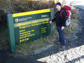
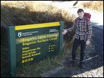
We stayed in Turangi 2 nights and organised our Tongariro Northern Circuit hike. This is a 36km (22.5mile) multi-day hike, one of the New Zealand 'Great Walks' and argued as one of the best hikes in the world.
We had to organise the shuttle from Turangi to/from the start of the trail (Extreme Backbackers $45), a sleeping bag each (discovered its best to have your own as struggled to rent them), booked the department of conversation overnight huts ($32 per night) and packed our backpack with hiking gear & 2days of food (tuna, bread rolls, cheese, chocolate, biscuits, banana, apples, muesli bars & 2l of water).
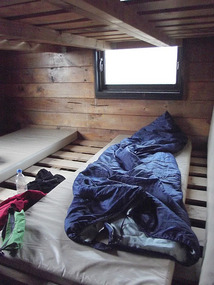
We studied the terrain maps and decided to do this walk over 2days. Although the circuit is advertised as a 3-4day walk, we felt confident that the 36km over 2 days would be achievable and would avoid carrying extra food. The 3 day versions of the walk included a short second day, which would make the walk easier but would involve more time in the mountain huts. The huts provide toilets, a mattress, water and a gas cooker, but once it gets dark there is very little to do.
Day 1: 16km (Mangatepopo - Red Crater - Blue Lake - Oterer Hut) 7½ hours
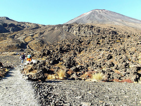
The shuttle service dropped us at Mangatepopo car park at 8.40am (1100m). This option (rather than Whakapapa Village) shaved 3hours walking from day1, only missing out 6km of flat landscape. The first section of the walk was 1hr 30mins over flat volcanic landscape to Soda Springs. At this point we faced the 'Devils Staircase', a 500m 1hr ascent up stairs and steep paths. This was felt particularly hard carrying a full backpack.
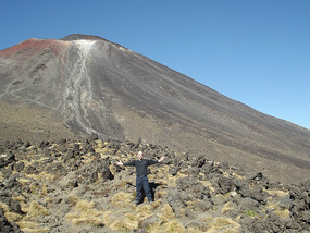
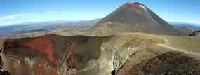
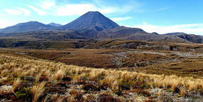
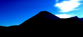
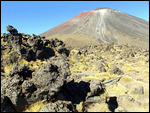
At the top we were rewarded with amazing views over Mount Ngauruhoe (2287m), an active volcano that last errupted in 1975, uses as Mount Doom in the Lord of the Rings films. An amazing sight.
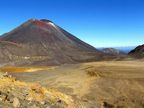
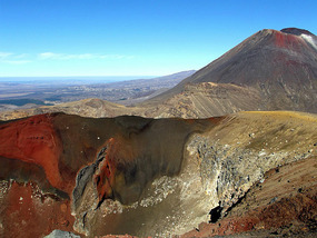
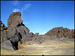
We then hiked over a flat volcanic plateau, followed by a 200m ascent up to Red Crater (1868m). The landscape all around was like mars, unbelievable to be so close to the volcanic
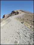
craters, lava flows and volcanic boulders. Red Crater was spectacular and very colourful. After this was a very steep ascent down 200m over loose rock. It involved more sliding than
walking, but was fine once you mastered the technique and balance.
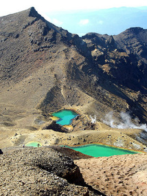
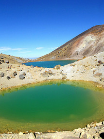
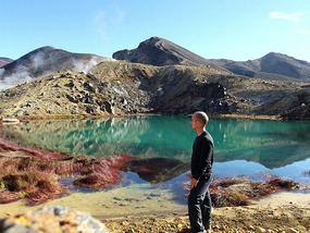
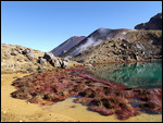
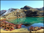
At the bottom were Emerald Lakes, 3 blue-green sulphur mountain lakes, providing dramatic bright colours against the red/black volcanic landscape. The day was getting better and better.
We arrived at the Emerald Lakes at about 12noon and had plenty of time to look around, then take a 30minutes detour to Blue Lake. Here we sat on the black sand on the edge of the
lake, had lunch and dozed for 30minutes in the sun.
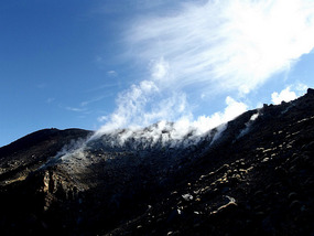
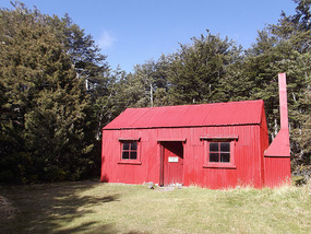
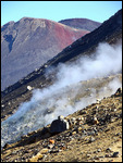
At 2pm we headed back to Emerald Lakes then on another 1hour 30minutes to the Oturere Hut. We past active fumaroles, vents on the side of the red crater with gases escaping. We arrived at Oturere Hut (1730m) at 4pm and it felt nice to put our backpacks down and take our boots off.
The hut was very quiet, with only 4 other people and the warden. We ate some food and it got very dark by 6pm. The warden gave us an updated weather forecast and had a chat for a while. With little to do and the temperature falling we were in our sleeping bags by 9pm and asleep at 10pm.
Day 2: 20km (Oturere Hut – Waihohonu Hut – Whakapapa Village) 7 hours
With 2 layers of clothes and sleeping bags it was still a little chilly during the night. It must have dropped down to 5 degrees or less in the hut as it was very cold getting ready in the morning.
After eating we started walking at 8am as it was too cold to hang around. My feet felt numb in my boots until the walking warmed them up.
During the first 2 hours of walking there was a mist over the volcanoes and lava valleys, but as we walked it cleared and blue skies emerged. The weather was great for the 2days we hiked, with bright blue skies and little wind. Later in the week rain and even a bit of snow was forecast.
We walked 2hours till we reached the Waihohonu hut. Here we said hello to 3 hunters who were sitting in the sun, hunting knifes on their waists and guns leaned up against the wall.
We walked onto the historic Waihohonu hut, built in 1903, then continued for another 2hours. There was a 30 minute steep ascend through a forest and endless baron terrain. The previous days hiking and the weight on our backs were taking their toll, with the hour before lunch proving very tough. This section of the walk was just a case of making progress.
By 1.30pm we reached the Tama Saddle with a signpost for Whakapapa village. With only 6km left reaching this point provided us with renewed energy. We increased our walking speed and arrived at Whakapapa village at 3.15pm. My feet were sore, legs very tired and right knee hurting from the hard ascending/descending. It was very nice reaching the end of the track and checking into a hotel.
Walking 36km over 2 days had been hard work especially over some steep ascents, but the amazing volcanic landscape had been unlike anything I'd ever seen. Definitely my highlight of New Zealand and glad we went for less popular 2 day option.
After this great walk we chilled out in Turangi for a day then got a 6hour coach to Auckland. I found Auckland slightly disappointing as it lacked obvious points of interest, grand architecture or unique culture. The most exciting aspect of Auckland was getting locked in the Auckland university clock town building and having to phone security, witnessing an anti-privatisation protest, looking around the art gallery and using the gym.
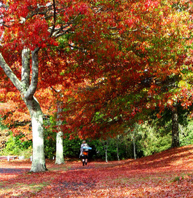
New Zealand for me has been all about amazing natural landscapes. I have hiked some of the worlds most beautiful natural environments. I leave New Zealand as it heads into Autumn. Onto Asia!!! 39 degrees in Bangkok is going to be a shock.
Tongariro Northern Circuit - Hiking volcanoes
Friday, April 27, 2012
 Tongariro National Park, North Island, New Zealand
Other Entries
-
11Byron Bay and Nimbin
Feb 2661 days prior Byron Bay, Australiaphoto_camera23videocam 0comment 2
 -
12Surfing Competition at Coolangatta
Feb 2760 days prior Coolangatta, Australiaphoto_camera16videocam 0comment 1
 -
13Chilling out in Noosa
Mar 0157 days prior Noosa, Australiaphoto_camera26videocam 0comment 2
 -
14Fraser Island (from Rainbow Beach)
Mar 0652 days prior Fraser Island, Australiaphoto_camera27videocam 0comment 4
 -
15Hervey Bay
Mar 0751 days prior Hervey Bay, Australiaphoto_camera11videocam 0comment 1
 -
161770 and Lady Musgrave Island
Mar 0850 days prior Agnes Water, Australiaphoto_camera18videocam 0comment 0
 -
17Emu Park and Great Keppel Island
Mar 1345 days prior Great Keppel Island, Australiaphoto_camera30videocam 0comment 4
 -
18Sailing in Whitsunday - Airlie Beach
Mar 1840 days prior Airlie Beach, Australiaphoto_camera29videocam 0comment 1
 -
19Magnetic Island and unexpected stop in Townsville
Mar 2236 days prior Magnetic Island, Australiaphoto_camera35videocam 0comment 6
 -
20Cairns - half way through 4month
Mar 2632 days prior Cairns, Australiaphoto_camera23videocam 0comment 0
 -
21In prison at Christchurch
Mar 2929 days prior Christchurch, New Zealandphoto_camera23videocam 0comment 13
 -
22Hiking in Arthurs Pass
Apr 0324 days prior Arthurs Pass, New Zealandphoto_camera19videocam 0comment 0
 -
23Campervan Hamner Springs, Buller Gorge, Hokitika
Apr 0522 days prior Hamner Springs, New Zealandphoto_camera31videocam 0comment 2
 -
24Camervan - Frans Josef and Fox
Apr 0918 days prior Franz Josef/Waiau, New Zealandphoto_camera33videocam 0comment 0
 -
25Campervan: Fox - Wonaka - Queenstown - Te Anua
Apr 1314 days prior Fiordland, New Zealandphoto_camera25videocam 0comment 5
 -
26Campervan: Dunedin - Mount Cook - Christchurch
Apr 1710 days prior Dunedin, New Zealandphoto_camera29videocam 0comment 2
 -
27Picton and Wellington
Apr 225 days prior Picton, New Zealandphoto_camera20videocam 0comment 2
 -
28Tongariro Northern Circuit - Hiking volcanoes
Apr 27 Tongariro National Park, New Zealandphoto_camera35videocam 0comment 0
 -
29Bangkok
May 069 days later Bangkok, Thailandphoto_camera36videocam 0comment 0
 -
30Loved Cambodia
May 0811 days later Phnom Penh, Cambodiaphoto_camera34videocam 0comment 2
 -
31Bangkok to Krabi to Rai Leh
May 1013 days later Krabi, Thailandphoto_camera27videocam 0comment 0
 -
32Rai Leh
May 1417 days later Railay Beach, Thailandphoto_camera46videocam 0comment 4
 -
33Patong and Kamala (Phuket)
May 1922 days later Patong, Thailandphoto_camera21videocam 0comment 0
 -
34Ko Racha Yai (Raya island)
May 2124 days later Ko Racha Yai (Raya Island), Thailandphoto_camera27videocam 0comment 2
 -
35Last entry: Patong to Bangkok to London
May 2629 days later London, United Kingdomphoto_camera25videocam 0comment 4

 Tongariro National Park, North Island, New Zealand












2025-05-22