Cradle mountain and south.
Up early and on our way but it is raining and we have booked & paid for Cradle Mt valley caravan park, as there is no camping allowed. It rained all the way there , no good stopping at the lookout as you could not see for the mist hanging around. Cradle mountain stands 1545 metres tall.
It is still raining when we get to our site so can not put the rooftop tent up. It is a good job they have a fantastic camp kitchen, all enclosed with open log fires. The fires were set alight and a few of us cooked and stayed in there.
A man died trying to do the mountain walk that day, one of the men in the camp kitchen carried his back pack down and said the man had all ready got heart problems and had been advised not to do the walk.
Signs all over no sleeping in kitchen , but the weather too bad for them to come and check, we hope. I get worried and go sleep in the car, Larry stays on one of the comfy window seats.
One of the men staying in the next site to us was on his way to race in the annual world penny farthing race at Evandale here in Tassie. I took photo of it outside his van , but he never puts it out complete, it would go missing. We have not heard how he went but he was to do an interview on radio that day. We would have liked to go see the race but it was not the direction we are going.
After breakfast we go to the information centre to get the shuttle to the start of all the walks and walk registration centre. We find out another person has died on one of the mountain walks, he died of hypothermia and was not prepared for the bad weather, he was a 22or 23 year old Chinese man.
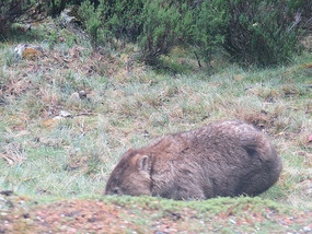
We are only going to walk the 3 hour walk around Dove lake as it is still very cold and wet.Then maybe a couple of smaller walks to see different parts of this area. On the way back out on the shuttle bus we come across a wombat , the bus can not stop as only one way dirt road and it getting busy. Quick photo.
We move on through Rosebury to Montezuma falls, one of the tallest waterfalls in Tassie.. The walk into the falls follows the old tracks used to get the silver and tin ore out years ago. So after the climb to the tracks it is a mostly flat dirt road in , but because of all the rain in the area it has wet patches and I have to roll up my pant legs as they are collecting mud and water. This is another 3 hour walk but you get there and have to walk out onto a swing bridge to see the falls , and yes it was worth the walk.
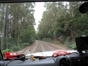
We drive on to Queenstown , a very beautiful cold Rain Forrest drive, very twisty and up and down steep slopes. We pass a lot of push bikers, we thing there is some sort of race going on , lot of support people at intersections but no signs.
Queenstown a mining town but quite nice, we stop for fuel, bread. We pull up at lookout across Quenstown showing a waterfall. Photo.
We push on to Meadowbank Lake to camp. Even though we are moving most days the places here are not far apart , so if it was a flat road we would only be driving an hour maybe a day.Takes longer some times because of the roads .
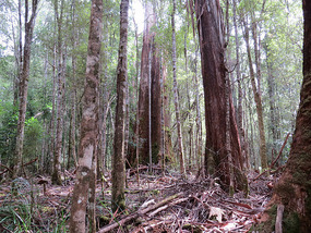
The sun is out again , hooray, so its walking again first is Nelson falls nature trail an hour walk showing how this rainforest would have been millions of years ago.
Next is Donaghys hill lookout. I should have guessed lookout means an up hill climb and what a climb very steep and this is classed as easy. Well worth the walk.
We then head for Lake William campground just before Lake St. Clair, where we heading the next day.
Lake St. Clair is part of the Cradle Mountain National park. The south end.
We walk part of the lake and and the area were platypus are to be found , no we do not find any.
We head for Mt Field national park with a overnight stop at Meadowbank lake.
We pass through the area of the Highlands Hydro scheme. Huge dams in the wilderness were built to feed the hydro station.Some of the lakes and rivers below here are not so full, like the Lake William we stayed at, because some of the rain water is been collected in the dams and not flowing into rivers as before.The pipes full of water from the dams run down the hills into hydro station.
Mt. Field National Park
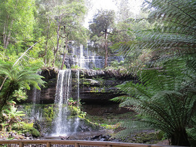
This is the oldest NP in Tassie and the second oldest in Australia. It has some of the worlds tallest eucalypt forests, they are swamp gums and forest full of deciduous beech which turn gold and red in autumn , they are just starting to colour. We walk through the forest to Russell falls , a 3 tier waterfall ,Horseshoe falls, Lady Baron falls.
Camping here you have to have your parks pass, which we have a 2 month one for all National parks, then pay to camp depending on facilities, this one has very hot showers, laundry and power so pay $10 for night.
The park has 13 plant species recorded as rare in Tassie, is habitat for eastern barred bandicoot, 4 invertebrates listed as threatened or vulnerable, Tassie tigers used to roam here, the last to be trapped was in 1933 here in one of the valleys .During the Paleocene era a permanent snowfield covered Mt. Field , with glaciers to valleys . The largest 12 kilometres long , remnants of which are visible with Triassic & Jurassic rocks showing links with mountains in Antarctica.
During the night we had possums climbing our ladder but found nothing else.
We head from here down south to Cockle creek and the most southerly made road in Australia, which is gravel but a made road. Then on even more south to The National Park down a not so good road to camp close to the ocean.
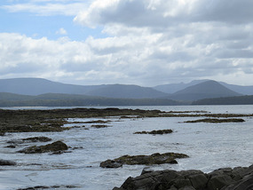
This area is a world heritage area and was first settled when the french scientific expedition discovered it by accident in 1792. The bay was named Recherche Bay after the captain .
This area has been used for whaling then, mining & logging from 1830.
Whales were southern right whales that used to come and shelter and calve over winter, making them an easy target. They where pushed to near extinction by the 1900s and became the first whales to be protected in 1935.
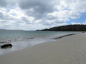
We walk up to a bronze whale sculpture then on to Fishers Point about 2-3 hours. Mostly along the beach and rocks and some inland forest. Past where some of the large smooth dolerite rocks were used by whalers to drag up the whales for for butchering. At fishers Point look out you look out to southern ocean or east to Bruny island , this is the next destination.
Just the other side our camp we found a very dark tiger snake out trying to get some sun. We think the tiger snakes here are so dark to utilise colour to gain as much heat as possible in this not so hot place.
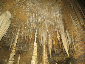
On the way back up to Hobart to get across to Bruny island we stop in at Hastings caves and thermal pools. If you do the cave tour you get free pass into pool. We did the cave tour it has 500 steps altogether, is a permanent 9 deg C and has only a cave spider and a cricket as wildlife but good stalagmites and stalactites.
Then jump in the pool to a great shock it is only 28deg C not even as hot as the hydro pool back at our local aquatic centre. We had some exercise though and relaxed then had a very hot shower before setting out for our next camp.
Heading to south Tasmania
Friday, February 28, 2014
 Cradle mountain Tasmania, Tasmania, Australia
Other Entries
-
16Not to be
Sep 14167 days prior Mossman, Australiaphoto_camera14videocam 0comment 0
 -
17Our adventure camping
Sep 15166 days prior Cape York, Australiaphoto_camera9videocam 0comment 0
 -
18Cape York to Cooktown & back to caravan
Oct 04147 days prior Cape York to Cooktown, Australiaphoto_camera16videocam 0comment 0
 -
19At long last Dive Reef
Oct 15136 days prior Cairns, Australiaphoto_camera11videocam 0comment 0
 -
20The Cassowary Coast
Oct 23128 days prior Tully, Australiaphoto_camera11videocam 0comment 0
 -
21More waterfalls and creeks
Oct 28123 days prior Ingham, Australiaphoto_camera20videocam 0comment 2
 -
22Time in Townsville
Nov 04116 days prior Townsville, Australiaphoto_camera15videocam 0comment 0
 -
23Heading across Queensland again
Nov 10110 days prior Ravenswood and Charters Towers, Australiaphoto_camera12videocam 0comment 2
 -
24Hot ,dry ,country
Nov 11109 days prior Hughenden, Australiaphoto_camera10videocam 0comment 1
 -
25Mining Town
Nov 19101 days prior Mount Isa, Australiaphoto_camera11videocam 0comment 1
 -
26Mount Isa to Birdsville
Nov 2595 days prior Birdsville, Australiaphoto_camera18videocam 0comment 0
 -
27Hot Dry Track
Dec 0387 days prior Birdsville Track, Australiaphoto_camera17videocam 0comment 0
 -
28Flinders ranges
Dec 0981 days prior Arkaroola, Australiaphoto_camera18videocam 0comment 1
 -
29SA to NSW
Dec 2367 days prior Broken Hill, Australiaphoto_camera16videocam 0comment 1
 -
30Riverina area
Jan 0950 days prior Wentworth, Australiaphoto_camera8videocam 0comment 1
 -
31Narrandera to Benalla
Jan 2534 days prior Narrandera, Australiaphoto_camera12videocam 0comment 2
 -
32North West Tasmania
Feb 208 days prior Devonport Tasmania, Australiaphoto_camera18videocam 0comment 1
 -
33Heading to south Tasmania
Feb 28 Cradle mountain Tasmania, Australiaphoto_camera14videocam 0comment 1
 -
34East Coast Tasmania
Mar 1414 days later St Helens, Australiaphoto_camera21videocam 0comment 1
 -
35Last ten Days Tasmania
Mar 2424 days later Devonport, Australiaphoto_camera17videocam 0comment 0
 -
36On the move again -at last
May 2889 days later Warrnambool, Australiaphoto_camera15videocam 0comment 0
 -
37Just waiting around
Jun 0294 days later Mount Gambier, Australiaphoto_camera11videocam 0comment 0
 -
38Coastal National Parks and quite
Jun 11103 days later Beachport Limestone coast, Australiaphoto_camera11videocam 0comment 0
 -
39Murray Bridge to Whyalla
Jun 20112 days later Whyalla, Australiaphoto_camera15videocam 0comment 2
 -
40Eyre peninsular
Jun 30122 days later Port Lincoln To Ceduna, Australiaphoto_camera16videocam 0comment 1
 -
41Across the Nullarbor to WA
Jul 07129 days later Eucla WA, Australiaphoto_camera20videocam 0comment 1
 -
42The WA side of Nullarbor
Jul 14136 days later Hyden WA, Australiaphoto_camera20videocam 0comment 1
 -
434 months of surprises
Feb 07344 days later Benalla, Australiaphoto_camera11videocam 0comment 0
 -
44Are we on the move again
Feb 07344 days later Benalla, Australiaphoto_camera5videocam 0comment 0
 -
4510 days on Kangaroo island in Rooftop tent
Feb 07344 days later Kangaroo Island, Australiaphoto_camera12videocam 0comment 0
 -
46Jervis Bay to Ceduna
Feb 14351 days later Rapid Bay to Ceduna, Australiaphoto_camera13videocam 0comment 1
 -
47Ceduna and on west to Albany WA
Mar 07372 days later Albany, Australiaphoto_camera28videocam 0comment 0
 -
48To Bunbury and finally past Perth to Bindoon
Mar 21386 days later Bindoon, Australiaphoto_camera23videocam 0comment 0
 -
49Bindoon to Mullewa
Mar 29394 days later Mullewa, Australiaphoto_camera26videocam 0comment 0
 -
50Change of direction to get to same place
Apr 06402 days later Carnarvon, Australiaphoto_camera23videocam 0comment 1
 -
51Cape Range NP and Ningaloo Reef marine park
Apr 27423 days later Exmouth, Australiaphoto_camera24videocam 0comment 5
Comments
2025-05-22
Comment code: Ask author if the code is blank

 Cradle mountain Tasmania, Tasmania, Australia

Wilma
2014-03-07
I am so so envious. What a wonderful time you are having. When Kevin walked the Overland Track a guy fell off a cliff. Also he and I went into the camp area another time and stayed in a shared cabin, (with a very ignnorant man!!!). The weather was exactly as you experienced and we also were very thankful for that big camp kitchen and a fire.
Keep us posted.
Cheers,
Wilma