Ceduna SA
pop 3800
1900 from Perth and 780 from Adelaide
This is the service centre for the area for grain, fishing and mining industries.
We stay here for 3 days trying to get an auto electrician to have a look at one of the cables that goes from the car to the caravan. The one that after charging the 2 car batteries ,while we are driving,sends any extra charge to are van battery system. We had got it trapped some how and it had shorted out. The auto electrician did not have the sort of stuff we had used to replace ours so he did patch job for us that will keep us going until we are in a position to change all again. Cost $60.00 cash, at least we can now continue.
We leave here and head to Fowlers Bay for one or two days.
Fowlers Bay conservation park
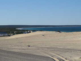
This is the start of the Great Australian Bight and a conservation park. We stay at the caravan park, there are only 16 permanent residents here. We walk the sand dunes and look for the old whaling station where there is supposed to be whale bones. Scientists dug up full skeletons but took them away. We find some bones and keep checking the ocean for live whales but do not find any. We will be seeing them soon when we get to the Head of the Bight but occasionally whales are sighted here.There used to be a lookout point here when whaling happened, that finished in 1843.
From here we pass through a couple of little places on our way to the Nullarbor Roadhouse and the start of the Nullarbor plain.
We stay the night at roadhouse so we can leave the van and take a 4wheel drive track out to some caves.
So some stuff about the Nullarbor.
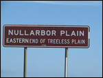
The Nullarbor national park stretches from the Great Australian Bight and inland, covering 2,867,000 hectares from the roadhouse to the WA border.It is believed to have been created 25 million years ago when it lifted up from the sea. Lime secreting marine skeletons and shells littered the sea floor and these deposits with sand sediments created the limestone of the Nullarbor plain to a depth of 15 to 60 metres. Dissolving of this limestone in places has created a network of caves, caverns and underground lakes. Only one set of caves is approved for public access. The Murrawijinie caves which we went to see. We did not get to go inside as we are not as agile as we used to be , getting to the cave entrances you have to climb down some loose rocks and boulders, we got part of the way on one but if we went further, getting back up would have proven very difficult.
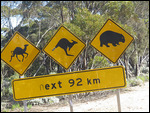
The cave had a masked owl living in it and bones of a endangered Western barred Bandicoot have been found. We did find a part of a jaw bone of something further along the track near a wombats hole, so we took photos.
The Nullarbor roadhouse was originally the Nullarbor sheep station .
The Eyre highway passes through traveling mostly along the coast and a little bit of the true Nullarbor plain.
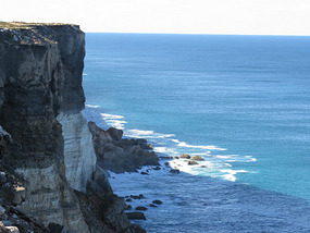
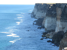
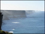
The Nullarbor cliffs stretch unbroken for 209km from the Head of the Bight to Wilson's Bluff at the WA border. It can plummet some 90metres in places to the ocean. Viewing areas along the coastline make good rest areas to sea lions, dolphins ,great white sharks and of course whales.
Most people stop at the Head of the Bight Centre to see the whales. We of course visit and have to double back 20 odd km to get there. This is a 12km drive down to ocean from the hwy.
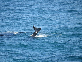
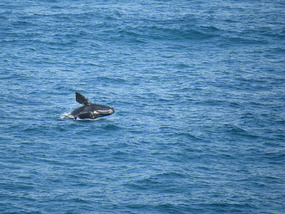
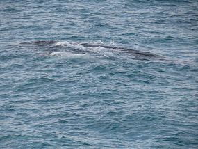
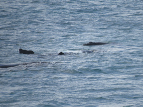
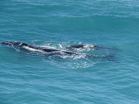
The main whale here is The Southern Right Whale as a few use this area as a breeding ground ,leaving the cold waters further south to come here to give birth and mate in our warmer waters. This bay gives them some shelter for the new borns and a bit of protection from the sharks.
The Southern Right Whale named because it was right to catch and kill giving the most whale oil for lighting and industry.
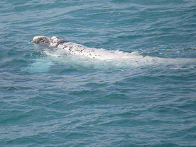
This whale grows to 18metres long and weigh up to 50-90 tonnes. Has a champagne glass shaped tail that is 5 metres across. The heads are covered in barnacle like bumpy bits that are callosites—white lumpy patterns on the skin which can make identification of each whale easier.
We are here for 6 hours only going out to the van for hot soup and tea and to shed some clothes as it warmed up. I must tell you after taking off some layers and going back it got cold and rained for a couple of hours.
We did however see a white calf with its mum and about 20 mums and babies. I think we did see a big male come in to see if any female was up for a bit of !!!!. because a couple of females with young did roll onto their backs. This happens when they do not want the babies to feed or to let the male know they do not want his advances.
We ended up with over 1500 photos and videos we had to sort through, got it down to about 400 I think.
We stayed the next night on the cliffs down a sandy road only about 70kms from the whales as we were tired.
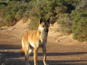
While we were levelling the van a dingo passed by and stood for a while checking on us and probably the food situation. This was about 5pm so we had a quick look around the cliffs before dinner. We would not be straying far from the van in the dark as it was a long drop down to ocean only 20 metres away.
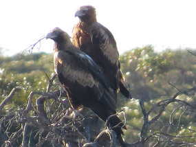
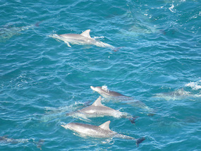
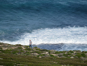
We stopped 5 nights across the Nullarbor starting at Fowlers bay and the last night over looking the ocean just 25km from the WA border and the quarantine station. We also stopped at most of the stops and even some they have been closed for cars to drive to far so we walked to cliffs. Some of these walks were up to 2kms. One we got to cliff edge just in time to see a pod of dolphins pass by, also two wedge tail eagles sitting ontop of a small bush.
We get to the border and have no fruit or vegetables left, but do have honey and this can not go into WA so we have to leave it, but we are here in WA at last. Honey here is pasteurised to make sure they do not get the pest that is troubling other states. Rest up for the night in Eucla for the night do washing and use their power to charge everything.
Across the Nullarbor to WA
Monday, July 07, 2014
 Eucla WA, Western Australia, Australia
Other Entries
-
24Hot ,dry ,country
Nov 11238 days prior Hughenden, Australiaphoto_camera10videocam 0comment 1
 -
25Mining Town
Nov 19230 days prior Mount Isa, Australiaphoto_camera11videocam 0comment 1
 -
26Mount Isa to Birdsville
Nov 25224 days prior Birdsville, Australiaphoto_camera18videocam 0comment 0
 -
27Hot Dry Track
Dec 03216 days prior Birdsville Track, Australiaphoto_camera17videocam 0comment 0
 -
28Flinders ranges
Dec 09210 days prior Arkaroola, Australiaphoto_camera18videocam 0comment 1
 -
29SA to NSW
Dec 23196 days prior Broken Hill, Australiaphoto_camera16videocam 0comment 1
 -
30Riverina area
Jan 09179 days prior Wentworth, Australiaphoto_camera8videocam 0comment 1
 -
31Narrandera to Benalla
Jan 25163 days prior Narrandera, Australiaphoto_camera12videocam 0comment 2
 -
32North West Tasmania
Feb 20137 days prior Devonport Tasmania, Australiaphoto_camera18videocam 0comment 1
 -
33Heading to south Tasmania
Feb 28129 days prior Cradle mountain Tasmania, Australiaphoto_camera14videocam 0comment 1
 -
34East Coast Tasmania
Mar 14115 days prior St Helens, Australiaphoto_camera21videocam 0comment 1
 -
35Last ten Days Tasmania
Mar 24105 days prior Devonport, Australiaphoto_camera17videocam 0comment 0
 -
36On the move again -at last
May 2840 days prior Warrnambool, Australiaphoto_camera15videocam 0comment 0
 -
37Just waiting around
Jun 0235 days prior Mount Gambier, Australiaphoto_camera11videocam 0comment 0
 -
38Coastal National Parks and quite
Jun 1126 days prior Beachport Limestone coast, Australiaphoto_camera11videocam 0comment 0
 -
39Murray Bridge to Whyalla
Jun 2017 days prior Whyalla, Australiaphoto_camera15videocam 0comment 2
 -
40Eyre peninsular
Jun 307 days prior Port Lincoln To Ceduna, Australiaphoto_camera16videocam 0comment 1
 -
41Across the Nullarbor to WA
Jul 07 Eucla WA, Australiaphoto_camera20videocam 0comment 1
 -
42The WA side of Nullarbor
Jul 147 days later Hyden WA, Australiaphoto_camera20videocam 0comment 1
 -
434 months of surprises
Feb 07215 days later Benalla, Australiaphoto_camera11videocam 0comment 0
 -
44Are we on the move again
Feb 07215 days later Benalla, Australiaphoto_camera5videocam 0comment 0
 -
4510 days on Kangaroo island in Rooftop tent
Feb 07215 days later Kangaroo Island, Australiaphoto_camera12videocam 0comment 0
 -
46Jervis Bay to Ceduna
Feb 14222 days later Rapid Bay to Ceduna, Australiaphoto_camera13videocam 0comment 1
 -
47Ceduna and on west to Albany WA
Mar 07243 days later Albany, Australiaphoto_camera28videocam 0comment 0
 -
48To Bunbury and finally past Perth to Bindoon
Mar 21257 days later Bindoon, Australiaphoto_camera23videocam 0comment 0
 -
49Bindoon to Mullewa
Mar 29265 days later Mullewa, Australiaphoto_camera26videocam 0comment 0
 -
50Change of direction to get to same place
Apr 06273 days later Carnarvon, Australiaphoto_camera23videocam 0comment 1
 -
51Cape Range NP and Ningaloo Reef marine park
Apr 27294 days later Exmouth, Australiaphoto_camera24videocam 0comment 5
 -
52Gorge time
May 15312 days later Karijini National Park, Australiaphoto_camera31videocam 0comment 0
 -
53Karijini to Port Hedland
May 23320 days later Port Hedland, Australiaphoto_camera27videocam 0comment 0
 -
54Cape Keraudren. Broome .Derby
Jun 09337 days later Derby, Australiaphoto_camera24videocam 0comment 1
 -
55The Gibb river road.
Jul 12370 days later Derby, Australiaphoto_camera38videocam 0comment 0
 -
56East Kimberley
Aug 01390 days later Lake Argyle WA, Australiaphoto_camera20videocam 0comment 0
 -
57Crossing the border
Aug 18407 days later Katherine, Australiaphoto_camera36videocam 0comment 0
 -
58Katherine & Kakadu
Sep 06426 days later Kakadu National Park, Australiaphoto_camera31videocam 0comment 0
 -
59From Kakadu to Mataranka
Sep 23443 days later Mataranka, Australiaphoto_camera29videocam 0comment 0

 Eucla WA, Western Australia, Australia

2025-05-22