Millewa and north to Carnarvon
March 30 Monday.
With all phone calls and emails in from where we want to go , weather forecast telling us rain for next 3-4 days, our travels have to change directions a little. The river is not going down anytime soon so we head west to North West Coastal Hwy.
Before leaving Millewa we find an engineer to weld our caravan step bracket that is tearing at the bolt holes, things don't come in singles with us our microwave stopped working too. Not that we use much as we generally do not have power to run it, but I was preparing meals for a few days while we did have 240 volt power ,not just 12 volt from our solar and batteries, using it for thawing and making sauces quickly. This will not be replaced until we get back to places that have more than a dozen shops.
We head to Geraldton, stopping there only for fuel, bread and milk. With a lot of panicking, at the tight turns in for fuel, having to go around the block twice ,as some pumps closed because they are running out of fuel. We ended up coming in from wrong direction to get to diesel pump. Yes it was me panicking, Larry getting snappy with all, but we did get our fuel 8cents a litre off.
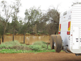
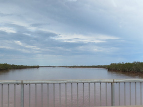
We head north past Kalbarri [ we have been there before] and stop beside the river in a 24hour rest stop. This is the Murchison river and it is very full and flowing, we would have had to cross this upstream on a dirt road if we were still going the other way. This way we have a big road bridge that crosses it.
Tuesday 31 march
Up early no walking as the flies are so bad we are wearing head nets, the flies have all hatched because of cyclone. Travelling towards Shark Bay stopping at another 24 hour rest stop Narren Narren rest area and playing with our sp;ar tele dish. Larry getting good at lining this up.
Up early again going to Overlander Roadhouse with their phone reception ,as we have to ring for a permit to camp in the Shark bay conservation area on the day you wish to camp. Because they have some space as the Easter and school holiday lot don’t arrive for a couple days, we are allowed a permit for a couple of days. 24 hours a permit is the norm. School holidays here starts the day before Easter.
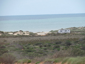
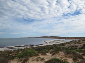
We are to camp at Eagle Bluff on the area below the bluff and beside ocean and a little inlet.
We are the only caravan in here but do get camper-vans with backpackers in with us, and some men catching these little fish for bait. A fishery and wildlife man arrives and checks their permits to catch these fish and checks us for fish, as if i'm going to catch baby fish to catch bigger fish.
On the way into our camp spot we stop at Shell beach and Hamelin pool with the Stromatolites, we saw these 11 years ago, things have changed a little.
Stromatolites of the Hamelin pool marine & nature reserve are the oldest living fossils on earth. They are colonies of micro-organisms that look exactly like fossils found that are 3.5 billion years old, but these are alive. They grow here because of the extra salty water and the calcium bicarbonate in it and the limited circulation of water.
Shell beach is made of shells of the Hamelin cockle. In the past large amounts of shells settled on the shoreline ,many metres deep, rain washing through the shells caused them to cement together. Early settlers cut blocks from the cemented shells and used them as building blocks. The quarry is still here as are some of the buildings of shell blocks in Hamelin station, Nanga Bay and Denham.
We did not go into Monkey Mia and only passed through Denham.
Denham population 800 and is Australian western most town and grew out of the pearling settlement. Found by Captain Dirk Hartog of a Dutch trading ship, the area was charted in 1858 by Captain h H Denham. 1860 brought the pastoralists. 1870 the pearling started and now it is manly tourism and fishing.
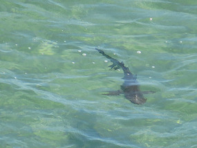
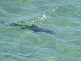
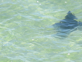
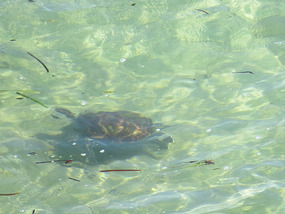
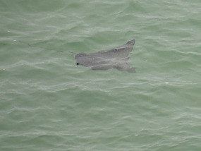
We drive up to Eagle bluff lookout and walk along the walkway . Looking down onto the indian ocean we find sharks from 2- 4 metres we think are lemon sharks, eagle rays, cow tail rays , bull rays and loggerhead turtles. The second time up here the next day we see a tiger shark about 5 metres long with another shark , not known what , swimming beside him .All the rays we were watching left when this shark arrived.
We also visited Whalebone bay and Goulet bluff but no sign of marine life only from Eagle bluff.
Shark Bay is a world heritage area and in 1990 the state government of WA purchased Peron station at the tip making the Peron Peninsula National park. A fence was put across the narrowest point of the peninsula and all feral animals removed such as foxes, wild cats , goats, rabbits. Project Eden started to put back native animals like the Shark bay mouse, Banded hare wallaby, rufus hare wallaby, western barred bandicoot, some birds like the white winged fairy wren, sandhilll frog. Only a few survive on peninsula now with some still living on 2 islands off shore.
We did not find the thorny devil lizard that is here, and to the north, but we did find a couple of other lizards. A lozenge marked dragoon and another member of the ctenophorus dragons.
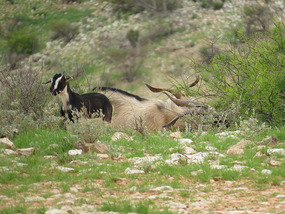
It is time to leave here and head towards Carnarvon, with a stop for lunch at Gladstone Lookout , good scenery and wild goats. We stop for the night at another 24 rest area before arriving in Carnarvon for 4 days.
We are here to get fuel, restock food and water, check both the van and car as we are heading first to Ningaloo station for a few days then into Cape Range national park on the same peninsular as Exmouth. All surrounded by the Ningaloo marine park. We will be here for a couple of weeks to try and see the coral spawning.
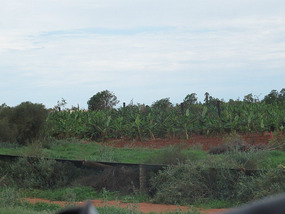
Carnarvon was hit by a cyclone 3 weeks ago and lost all its bananas with the plants all broken . This area produces most of the bananas for WA and is a large mango, bean, tomato, melon grapes and citrus growing area. There is also prawn and scallop fishing .
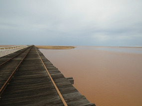
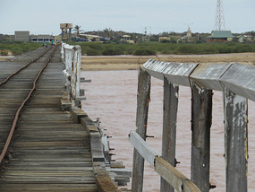
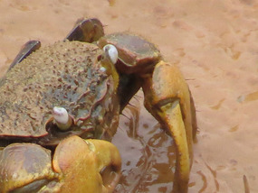
We go for a walk along the one mile jetty, but first walk 2.5 km along old rail track out to the jetty, which is now a nature walk. The jetty built 1897 is one of the southern hemispheres longest jetty. A steam train used to run from town out to the jetty and then along jetty to off load and load from ships. It crosses the Gascoyne river mouth and mangrove mud flats. There are signs of the cyclone like the very muddy ocean close to shore, some of the side rail is missing and the very last bit is closed on the jetty. The jetty looks like it was in a very run down state before the cyclone as the wooden beams and planks we are walking on are very rotted and unsafe. We did find some mangrove crabs amongst the mud.
Some of the trees in town and the row of palms along the beach have all suffered damage. The Gascoyne river that gives the fruit and veg growers of the area water via bores under it. It is in flood this is unusual as it is usually a dry river bed with underground water protected from evaporation by the sand. It is 830kms long and is the other river stopping us going to MT. Augustus.
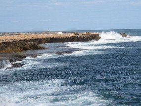
Today we went out to the blow holes and point Quobba as there is a beach which is sheltered by the coral reef. As long as you watch what you are doing you can snorkel in the bay , but high tide would be a problem as there can be king waves around here. We went snorkelling and found more fish and coral alive than we thought would be here after the cyclone. Tomorrow is shopping , and washing day before we leave.
We tried the banana bread the growers association is making from damaged bananas . They are freezing bananas , making bread and freezing it then sending to supermarkets. They say they have enough fruit for 10 months bread making , which is the time it will take to get the next crop. They had to get money some how to get new plants going. Bread very nice if alittle sweet, $6.99 loaf.
Change of direction to get to same place
Monday, April 06, 2015
 Carnarvon, Western Australia, Australia
Other Entries
-
33Heading to south Tasmania
Feb 28402 days prior Cradle mountain Tasmania, Australiaphoto_camera14videocam 0comment 1
 -
34East Coast Tasmania
Mar 14388 days prior St Helens, Australiaphoto_camera21videocam 0comment 1
 -
35Last ten Days Tasmania
Mar 24378 days prior Devonport, Australiaphoto_camera17videocam 0comment 0
 -
36On the move again -at last
May 28313 days prior Warrnambool, Australiaphoto_camera15videocam 0comment 0
 -
37Just waiting around
Jun 02308 days prior Mount Gambier, Australiaphoto_camera11videocam 0comment 0
 -
38Coastal National Parks and quite
Jun 11299 days prior Beachport Limestone coast, Australiaphoto_camera11videocam 0comment 0
 -
39Murray Bridge to Whyalla
Jun 20290 days prior Whyalla, Australiaphoto_camera15videocam 0comment 2
 -
40Eyre peninsular
Jun 30280 days prior Port Lincoln To Ceduna, Australiaphoto_camera16videocam 0comment 1
 -
41Across the Nullarbor to WA
Jul 07273 days prior Eucla WA, Australiaphoto_camera20videocam 0comment 1
 -
42The WA side of Nullarbor
Jul 14266 days prior Hyden WA, Australiaphoto_camera20videocam 0comment 1
 -
434 months of surprises
Feb 0758 days prior Benalla, Australiaphoto_camera11videocam 0comment 0
 -
44Are we on the move again
Feb 0758 days prior Benalla, Australiaphoto_camera5videocam 0comment 0
 -
4510 days on Kangaroo island in Rooftop tent
Feb 0758 days prior Kangaroo Island, Australiaphoto_camera12videocam 0comment 0
 -
46Jervis Bay to Ceduna
Feb 1451 days prior Rapid Bay to Ceduna, Australiaphoto_camera13videocam 0comment 1
 -
47Ceduna and on west to Albany WA
Mar 0730 days prior Albany, Australiaphoto_camera28videocam 0comment 0
 -
48To Bunbury and finally past Perth to Bindoon
Mar 2116 days prior Bindoon, Australiaphoto_camera23videocam 0comment 0
 -
49Bindoon to Mullewa
Mar 298 days prior Mullewa, Australiaphoto_camera26videocam 0comment 0
 -
50Change of direction to get to same place
Apr 06 Carnarvon, Australiaphoto_camera23videocam 0comment 1
 -
51Cape Range NP and Ningaloo Reef marine park
Apr 2721 days later Exmouth, Australiaphoto_camera24videocam 0comment 5
 -
52Gorge time
May 1539 days later Karijini National Park, Australiaphoto_camera31videocam 0comment 0
 -
53Karijini to Port Hedland
May 2347 days later Port Hedland, Australiaphoto_camera27videocam 0comment 0
 -
54Cape Keraudren. Broome .Derby
Jun 0964 days later Derby, Australiaphoto_camera24videocam 0comment 1
 -
55The Gibb river road.
Jul 1297 days later Derby, Australiaphoto_camera38videocam 0comment 0
 -
56East Kimberley
Aug 01117 days later Lake Argyle WA, Australiaphoto_camera20videocam 0comment 0
 -
57Crossing the border
Aug 18134 days later Katherine, Australiaphoto_camera36videocam 0comment 0
 -
58Katherine & Kakadu
Sep 06153 days later Kakadu National Park, Australiaphoto_camera31videocam 0comment 0
 -
59From Kakadu to Mataranka
Sep 23170 days later Mataranka, Australiaphoto_camera29videocam 0comment 0
 -
60East and west McDonnell Ranges and Alice Springs
Oct 22199 days later Alice Springs, Australiaphoto_camera35videocam 0comment 0
 -
61Rainbow valley, Kings Canyon, Uluru.
Nov 01209 days later Uluru-Kata Tjuta National Park, Australiaphoto_camera37videocam 0comment 0
 -
62Oodnadatta and Stzelecki tracks
Nov 23231 days later Cameron Corner , Australiaphoto_camera34videocam 0comment 0
 -
63Here we go again
Mar 30359 days later Moree, Australiaphoto_camera26videocam 0comment 1
 -
64Into Queensland again.
Apr 17377 days later Mareeba, Australiaphoto_camera31videocam 0comment 0
 -
65On our way to Cape York
Apr 22382 days later Mt. Carbine , Australiaphoto_camera14videocam 0comment 0
 -
66First half trip up Cape York
May 15405 days later Seisia / loyalty beach, Australiaphoto_camera33videocam 0comment 0
 -
67Second half of Cape York
Jun 01422 days later Cooktown, Australiaphoto_camera32videocam 0comment 0
 -
68Last part of our Cape York trip.
Jun 18439 days later Mareeba, Australiaphoto_camera37videocam 0comment 0

 Carnarvon, Western Australia, Australia

2025-05-22