7am pickup (ugh) for our full day 4wd volcano tour today.
Our native French driver Vincent was funny, informative, drove like a maniac and chain smoked every time we had a stop
.
He filled our heads with lots of different volcano facts and seemed to find it quite a privilege to live on an island which is home to one of the most active volcanoes in the world.
Some of the volcano facts he shared:
The volcano, "Piton de la Fournaise" (Peak of the Furnance) erupts on average 3 times a year with large eruptions every 3,500 years or so and oh goody, were nearing the end of the current 3,500 year period so it could go "boom" in the biggest firework at anytime.
Reunion island has been created entirely by volcanic action and it's a steep drop of 4,000m to the sea floor. Add that to the highest peak of 3,000m and you have 7,000m (that's 7kms!) of lava making a bloody tall island!
And on top of this, the tallest peak used to reach 8,000m above sea level before a massive eruption >1 million years ago which blew "a lot" off the top. So it used to be 12km from sea floor to mountain top. Hard not to be impressed by that.
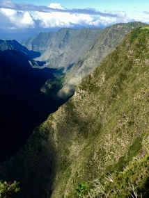
Because it rains so much here there is also lots of erosion - resulting in 456 ravines around the island. There's a lot of very high and very wide bridges on the round island road to cross these ravines.
The current volcano used to be separate from the rest of Reunion island then an eruption filled the gap between the older cones (which make the three cirques) and the active volcano
. This plateau is where most of the flat land in Reunion is and therefore also where most of the sugar cane plantations are.
Every year it snows on the highest peak in Reunion but it normally doesn't last once it hits the ground. One year they had snow falling and lava erupting at the same time which is pretty freaky.
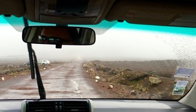
After a drive up, up, up and over the most amazing potholes at about 80kms an hour (well ... felt like it) we reached the "Mars" plain just before the crater rim. This area receives 14 meters of rain per year. Even though the road is graded 4 times a year all that rain plus the "trembles" cause erosion and movement in the road to create these huge potholes.
There's a massive subterranean lake beneath the Mars plain which holds a whopping 15 million cubic meters of water!
After the bouncy ride to the edge we
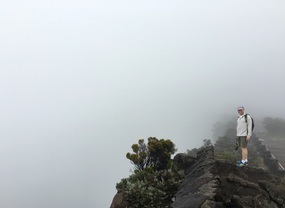
... didn't see the volcano as there was too much rain and cloud. Poop and damn you nature!
Never mind, after Vincent sucked down 4 cigarettes in rapid succession he told us some more interesting though random facts on the drive down, like:
- Picnicking is the national sport of Reunion.
- Reunion buys 3% of whiskey produced by Johnny Walker.
- Patchouli grows wild and is good for under eye bags and mosquito bites.
- Those massive spiders we keep seeing can't walk as their legs can't support their body weight, but they can "fly" by inflating their abdomen. That makes us feel so much better!
We drove through many picturesque towns along the way, including Le Tampon. Jeff wanted to make lots of bad jokes about this, especially as it was raining. Over-ruled!
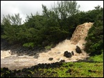
We drove down to the south where there once again was lots of rain. Apparently it rains quite a lot on the southern side of the island (something they kept quiet about in the tour brochure) but the upside was seeing the flash flooding in the ravines
. Normally they are dry, but when it rains the amount of water coming down some of these is truly amazing!
At one point Vincent pointed out an old suspension bridge which was really high above the ravine it spanned and told us that during a particularly torrential downpour that the ravine water was washing over this bridge!! I don't know the height but believe me when I tell you that must have been an obscene volume of water.
We kept driving along the coast. It's such a changing environment. Up near the volcano it looks like Mars, parts high in the mountain looked like Switzerland (complete with cows) and further down it felt like driving through Tasmania or Olinda.
Stacks of tree ferns and wild ginger and so green plus lots of fog drifting around. Pretty pretty.
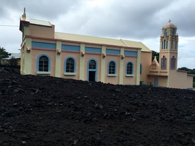
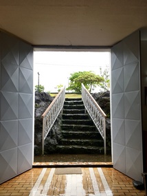
Once down on the flattish flat, we visited a church which narrowly escaped being wiped out by lava. The 1977 eruption destroyed 35 houses and stopped at the church
. Divine intervention obviously!
Lava flowed down to the sea and increased the size of Reunion by 5 hectares.
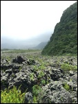
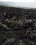
As we continued along the coast we drove over several old eruption sites. The biggest recent one in 2007 dumped 145 million cubic meters of lava, increasing the size of the island by 47 hectares.
In some places the lava from that eruption is 100m deep and still 100 degrees on the surface. The national road was closed for 6 months after this eruption as the lava had flowed across it.
Finally it was time for lunch at 2pm in the middle of cane fields at a spice garden where we were served ... you guessed it - more Creole food.
Our starter was a shredded Heart of Palm salad in vinaigrette which was quite tasty. And then one of the mains also had some cooked Heart of Palm in it. A little like potato in consistency and tasted good.
After lunch we drove back along the coast for an hour or two and somehow made it safely back to our hotel despite lunatic driving by Vincent. He mentioned he had a speeding ticket to pay. We gather from today's efforts that he's going for the bulk discount!
After a little rest we headed into nearby Saint Gilles for dinner, this time having more traditional French fare of goat cheese salad. Very nice.
Very tired so off to sleep ready to get up early again the next day.
Goodnight Captain Lava.
Lava, lava, lava ... flying spiders!
Monday, May 08, 2017
 Saint-Paul, Pamplemousses District, Reunion
Other Entries
-
1On our way to the land of the Dodo!
Apr 308 days prior Triolet, Mauritiusphoto_camera5videocam 0comment 0
 -
2Think we just ate a dead Dodo
May 017 days prior Triolet, Mauritiusphoto_camera5videocam 0comment 0
 -
3Massive waterlillies at Pamplemousse gardens!
May 026 days prior Triolet, Mauritiusphoto_camera5videocam 0comment 0
 -
4A trip to sunny Ile aux Cerfs
May 035 days prior Triolet, Mauritiusphoto_camera8videocam 0comment 0
 -
5Isle de la Reunion and the Chompys
May 044 days prior Saint-Paul, Reunionphoto_camera2videocam 0comment 0
 -
6A twisty drive to Hellbourg (Jurassic Park)
May 053 days prior Saint-Paul, Reunionphoto_camera8videocam 0comment 0
 -
7An "easy" walk to an amazing view at Mafate
May 062 days prior Saint-Paul, Reunionphoto_camera9videocam 0comment 0
 -
8Cilaos - the final Cirque
May 071 day prior Saint-Paul, Reunionphoto_camera8videocam 0comment 0
 -
9Lava, lava, lava ... flying spiders!
May 08 Saint-Paul, Reunionphoto_camera9videocam 0comment 0
 -
10A heli over Reunion and back to Mauritius
May 091 day later Flic en Flac, Mauritiusphoto_camera6videocam 0comment 0
 -
11Basking at La Pirogue
May 102 days later Flic en Flac, Mauritiusphoto_camera11videocam 0comment 0
 -
1226th anniversary playing with the big kittehs
May 113 days later Flic en Flac, Mauritiusphoto_camera9videocam 0comment 0
 -
13Rhum Rhum Rhum
May 124 days later Flic en Flac, Mauritiusphoto_camera4videocam 0comment 0
 -
14Dolphins, dirt, duty free disaster and departure
May 135 days later Flic en Flac, Mauritiusphoto_camera8videocam 0comment 0

 Saint-Paul, Pamplemousses District, Reunion


2025-05-23