Volcan Cosiguina
Monday, September 20, 2004
 Potosi, El Salvador
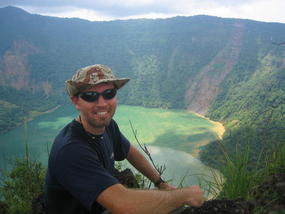
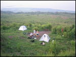
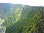
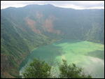
This past weekend, I finally got to do the only hike we offer that I had not done yet; Volcan Cosiguina. If you look at the map of Nicaragua to the right(click to enlarge), Volcan Cosiguina forms the peninsula you see at Nicaragua´s upper left corner where Honduras, El Salvador and Nicaragua come together. From atop Cosiguina, you can look over the Gulf of Fonseco to Honduras and El Salvador. The volcano is huge but inactive. The crater stretches over a mile wide and is filled with water forming a glowing blue-green lake. This is a 3 day trip and begins by spending most of the first day on a bus to the village of Potosi. The road is more like an old mine field filled with Jeep-challenging potholes and ravines. My spine felt more like a "slinky" (remember those things?) when it was over but we were rewarded with a refreshing swim in the gulf. The following day, we hiked to our campsite
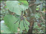
and the crater´s edge. This is our "greenest" hike through amazing rain forest and jungle where we observed huge colonies of leaf-cutter ants, enormous spiders, and the occasional free ranging horse and cow. Our campsite was made and used by Sandanista rebels during the war against the US government funded Contras back in the 80´s. Perhaps Ollie North and the Iran-Contra affair sound familiar? On the third day, we returned to Potosi for a dip in a spring filled swimming hole, lunch, and the long bus ride home. This was probably my last adventure with Quetzaltrekkers. I need to exit the country by October 3. I get 90 days in my passport for Nicaragua and either need to cross a border and return with another 90 days, or just continue traveling. As of right now, I am interested in getting to Costa Rica and Panama and then on to a new continent; South America!!!
Other Entries
-
36Guns, Guns, everywhere but not a shot fired
Jun 08104 days prior San Salvador, El Salvadorphoto_camera5videocam 0comment 0
 -
37Small town...
Jun 10102 days prior Suchitoto, El Salvadorphoto_camera4videocam 0comment 0
 -
38Still here in the expensive city
Jun 1498 days prior San Salvador, El Salvadorphoto_camera3videocam 0comment 1
 -
39Smooth sailing...
Jun 1597 days prior Nueva Ocotepeque, Hondurasphoto_camera1videocam 0comment 0
 -
40Mayan Ruins
Jun 1696 days prior Copán Ruinas, Hondurasphoto_camera8videocam 0comment 0
 -
41Let's go diving
Jun 2389 days prior Utila, Hondurasphoto_camera11videocam 0comment 0
 -
42Certified!!!
Jun 2983 days prior Utila, Hondurasphoto_camera3videocam 0comment 0
 -
43Back to the mainland...
Jul 0478 days prior Trujillo, Hondurasphoto_camera0videocam 0comment 0
 -
44Honduras´ Capital City
Jul 0577 days prior Tegucigalpa, Hondurasphoto_camera0videocam 0comment 1
 -
45Another poor country
Jul 0775 days prior Estelí, Nicaraguaphoto_camera9videocam 0comment 0
 -
46Hiking Volcan Momotumbo
Jul 1270 days prior León, Nicaraguaphoto_camera23videocam 1comment 0
 -
47Still in Leon
Jul 2161 days prior León, Nicaraguaphoto_camera4videocam 0comment 2
 -
48Volcan Telica
Jul 3052 days prior León, Nicaraguaphoto_camera9videocam 0comment 0
 -
49Volcan Cerro Negro
Aug 0942 days prior León, Nicaraguaphoto_camera9videocam 0comment 0
 -
50Weekend get-away
Aug 1833 days prior Granada, Nicaraguaphoto_camera9videocam 0comment 0
 -
51Are you a Dung-Beetle?
Sep 0119 days prior León, Nicaraguaphoto_camera1videocam 0comment 1
 -
52Still alive and well....
Sep 164 days prior León, Nicaraguaphoto_camera17videocam 0comment 0
 -
53Volcan Cosiguina
Sep 20 Potosi, El Salvadorphoto_camera8videocam 0comment 2
 -
54Semi-annual Report
Sep 244 days later León, Nicaraguaphoto_camera0videocam 0comment 1
 -
55Farewell León
Oct 0717 days later Granada, Nicaraguaphoto_camera3videocam 0comment 0
 -
56Quick Update
Oct 1828 days later Granada, Nicaraguaphoto_camera3videocam 0comment 0
 -
57Heading for the border...
Nov 0445 days later Isla de Ometepe, Nicaraguaphoto_camera9videocam 0comment 0
 -
58Adios Nicaragua
Nov 0849 days later La Fortuna, Costa Ricaphoto_camera3videocam 0comment 0
 -
59Pura Vida
Nov 1455 days later San José, Costa Ricaphoto_camera13videocam 0comment 0
 -
60The last country in Central America
Nov 2061 days later Bocas del Toro, Panamaphoto_camera2videocam 0comment 0
 -
61A somewhat "normal" Thankgsgiving
Nov 2667 days later Guadalupe, Panamaphoto_camera4videocam 0comment 0
 -
62The Panama Canal
Dec 0172 days later Panama City, Panamaphoto_camera23videocam 0comment 0
 -
63More exploring....
Dec 0172 days later Panama City, Panamaphoto_camera31videocam 0comment 0
 -
64SOUTH AMERICA !!!!
Dec 2091 days later Cartagena, Colombiaphoto_camera16videocam 0comment 0
 -
65Old Town Cartagena
Dec 29100 days later Cartagena, Colombiaphoto_camera13videocam 0comment 0
 -
66Tourist Central
Jan 09111 days later Santa Marta, Colombiaphoto_camera9videocam 0comment 0
 -
67La Ciudad Perdida .... The Lost city
Jan 16118 days later Santa Marta, Colombiaphoto_camera26videocam 1comment 4
 -
68The colorful side of Colombia
Jan 31133 days later Santa Marta, Colombiaphoto_camera10videocam 0comment 0
 -
69Carnaval !!!!
Feb 09142 days later Barranquilla, Colombiaphoto_camera16videocam 0comment 0
 -
70Professor Jeff
Feb 22155 days later Santa Marta, Colombiaphoto_camera1videocam 0comment 0
 -
71Run for the border
Mar 14175 days later Maracaibo, Venezuelaphoto_camera0videocam 0comment 0

 Potosi, El Salvador


2025-05-22