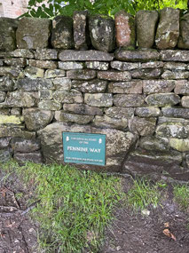
Despite being prepared for a rainy day, we were a bit nervous when we awoke to texts from Bryan saying that today’s forecast was for thunderstorms and due to how exposed the walk was we needed to think about what to do. Nevertheless, we got kitted up and grabbed our bags, meeting Lee outside our hotel and then walking down the hill to meet Bryan and Ros. Our taxi drove us through the drizzle to Edale, about half an hour from Buxton and the location of the official start of the Pennine Way. After a bit of a wait under an umbrella outside a closed café, Paul and Aurelia arrived and we loaded up their car with our big bags. Luckily when we’d bought supplies last night we’d bought plastic ziplock bags, as we ended up putting basically all our belongings in these. Once Aurelia had taken the obligatory photo of us by the start sign, off we went!
The first part of the trail ran up under a little woodland area so we were initially sheltered by the trees, although we soon passed through a gate that led to a flagstone path across fields. This was the first mile or so of the walk, soon leading down into a tiny village and through some farms before beginning to ascend towards Jacob’s ladder. I’d read online that this was a torturous ascent so was actually somewhat surprised when it wasn’t so bad – reasonably well maintained and not too steep. The problem was the rain though, which alternated between drizzle and light rain at this stage.
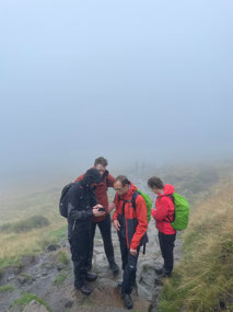
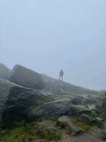
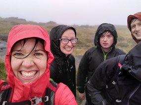
As we ascended the mountain though, the fog rolled in and we could barely see 20 metres ahead of us. We passed a couple of other groups and plodded our way towards the summit. After another obligatory photo (luckily another group was passing so they took one of all of us), we continued along the path, being buffeted by the wind which had really ramped up as we reached the top. On top of the wind and rain, there was a lot of water on the path so we had to choose our footing very carefully. Luckily we weren’t missing a view by watching our feet though, as we couldn’t see anything past the mist! At some stage, a woman who had passed us came back and gave us the advice that ‘it gets worse before it gets better’, as she headed back along the path towards Edale.
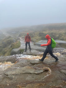
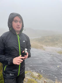
Not long after this we reached our first ‘ford’. What had presumably been a tiny trickle of stream on the Ordnance Survey map was a rushing waterfall. Luckily there were still visible stones on either side and we were able to fairly easily do a bit of a hop across, making sure there were people on each side to catch if necessary! This gave us a bit of confidence and we kept walking through mud, hopping across stones and dodging streams as we went. That was until we got to Kinder Downfall though! This waterfall, which was marked with a ‘ford’ notation on the Ordnance Survey map, was raging with all of the extra water from the rain and pouring over the edge of a precipitous drop. We definitely couldn’t hop across the stones where you were clearly usually supposed to cross, and it widened into quite a river the further back we walked.
After speaking to a couple of walkers as we went, we determined that there was nowhere we could easily hop across and that we just had to wade. We picked the narrowest and shallowest-looking spot that we could find and helped each other to wade across in as few steps as possible. On the other side we took a moment to empty boots and wring out socks before putting them back on and squelching onwards.
The next few miles were mostly head down and trudging on, with a couple of snack stops and a few little peeks of views when the clouds momentarily lifted. Just as we were finally heading down a steep descent a hail storm set in, briefly but viciously slamming us with stinging rain and tiny hailstones as we made our way to the bottom. Luckily it cleared as quickly as it had started and we were left with a brief moment of respite as we made our way up a gentle hill along flagstones. This was the path for most of the walk to Snake Pass, where Aurelia was waiting with the car.
We sat in the shelter of the car eating lunch for about half an hour, but eventually the biting wind and rain was getting a bit chilly and we needed to keep walking. This was at about the 10 mile mark (16km in – all the OS maps are in miles!), which was about two thirds of the walk. We’d discussed giving up there and adding the last 5 miles to tomorrow’s walk but ultimately decided to just stick it out and get it done. I’m not sure if this was the best choice, as the weather was pretty brutal in the last few hours, but I think it would have been a nightmare to add it to the next (13 mile) day as well. As we made our way through the peat moors, the path was just a complete river for most of the first third or so, which made for slow navigation as we tried to ensure we were staying on the right route. It wound upwards, and was supposed to pass a WW2 B29 crash site, but we just couldn’t see it in the fog and rain.
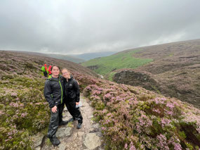
We managed to stay on the path through stinging, driving rain and made our way through a peat-covered landscape dotted by rocks. This led across the windy peak of another hill before we had to ford another river – luckily one that was reasonably easy to get across with a bit of a jump. From this point we found ourselves on a ridge through gorgeous purple heather, and the clouds finally cleared and we had a bit of sun. The path was straight on from there until reaching a final steep descent down into a tiny settlement near Torside, where Aurelia met us with the car. 25.75km with a 610m ascent – not bad for a day’s work!
As it was about a 40 minute drive back to Huddersfield, Aurelia first dropped Lee, Peter and I at a pub down the road while she took the others back to her and Paul’s house. She returned for us about an hour later and dropped us at our Airbnb, after a quick food stop at the supermarket. We were almost falling asleep at the table as we prepared some steak and veg for dinner… and then headed straight to bed!

 Edale, England, United Kingdom



2025-05-23