QLD south into NSW
Saturday, November 05, 2016
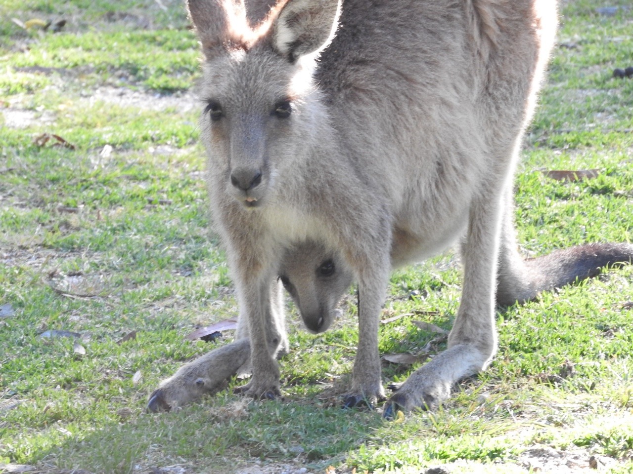
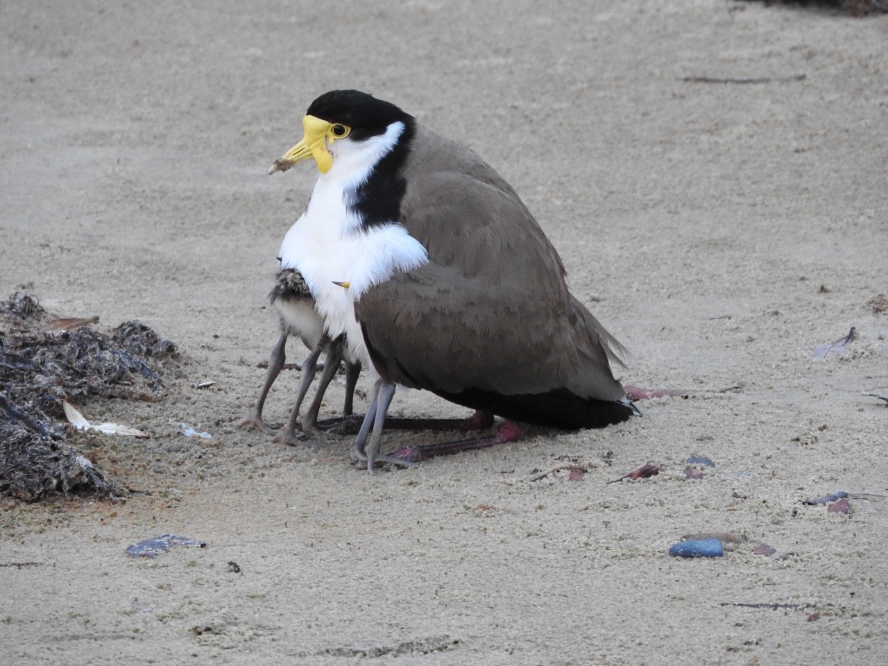
 Port Stephens, New South Wales, Australia
 Port Stephens, New South Wales, Australia
12 oct-to Sat 5 November
On our way to Girraween national park we stop at Delveen and leave the caravan so we can go to the apple juice and cider factory. They certainly like the tourists as a bottle of cider is $15 so I,m afraid these are not added to the produce baskets i'm making up. . At the cheese factory it was the same but we did buy some jelly from the jam place. Back at the caravan Larry went
walking and I walked to the only shop in town . The post office that also so sells some craft work and is next-door to a little boutique clothes manufacture. Not bad mostly T shirts with sayings and local stuff.
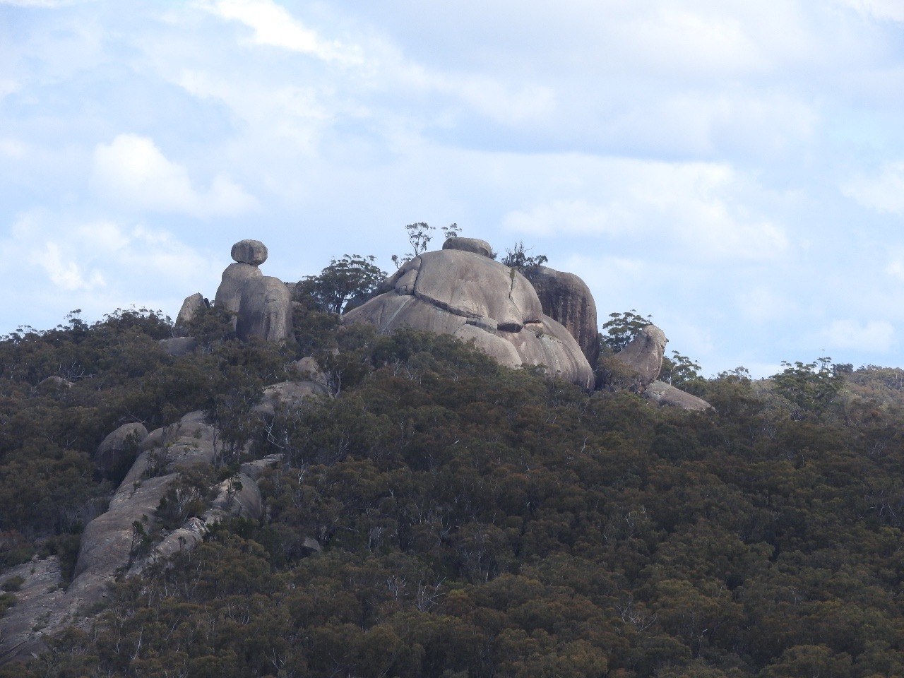
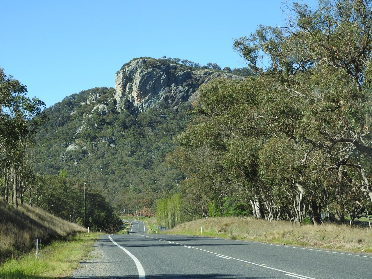
Girrawen National Park and Castle rock
camping area.
As we arrive of course the weather
turns cloudy and cold and threatening storms, as usual and no
generator use . Always happens national park cloudy no solar.
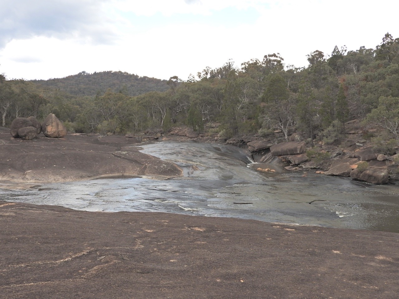
We did manage to walk the eastern walking tracks from the car park. To Underground creek is 2.8km then on to Dr Roberts waterhole another 1.2km . We get back for a late
lunch and its getting very dark threatening storms so we go out again, we have to see this place before we can not. So we walk from camp starting from Bald rock creek circuit 2.2km then from this to The Junction 5.2km. This is the junction of 2 creeks, then back to join the circuit and find Granite Arch 1.6kmwith some ups and downs but not too bad.
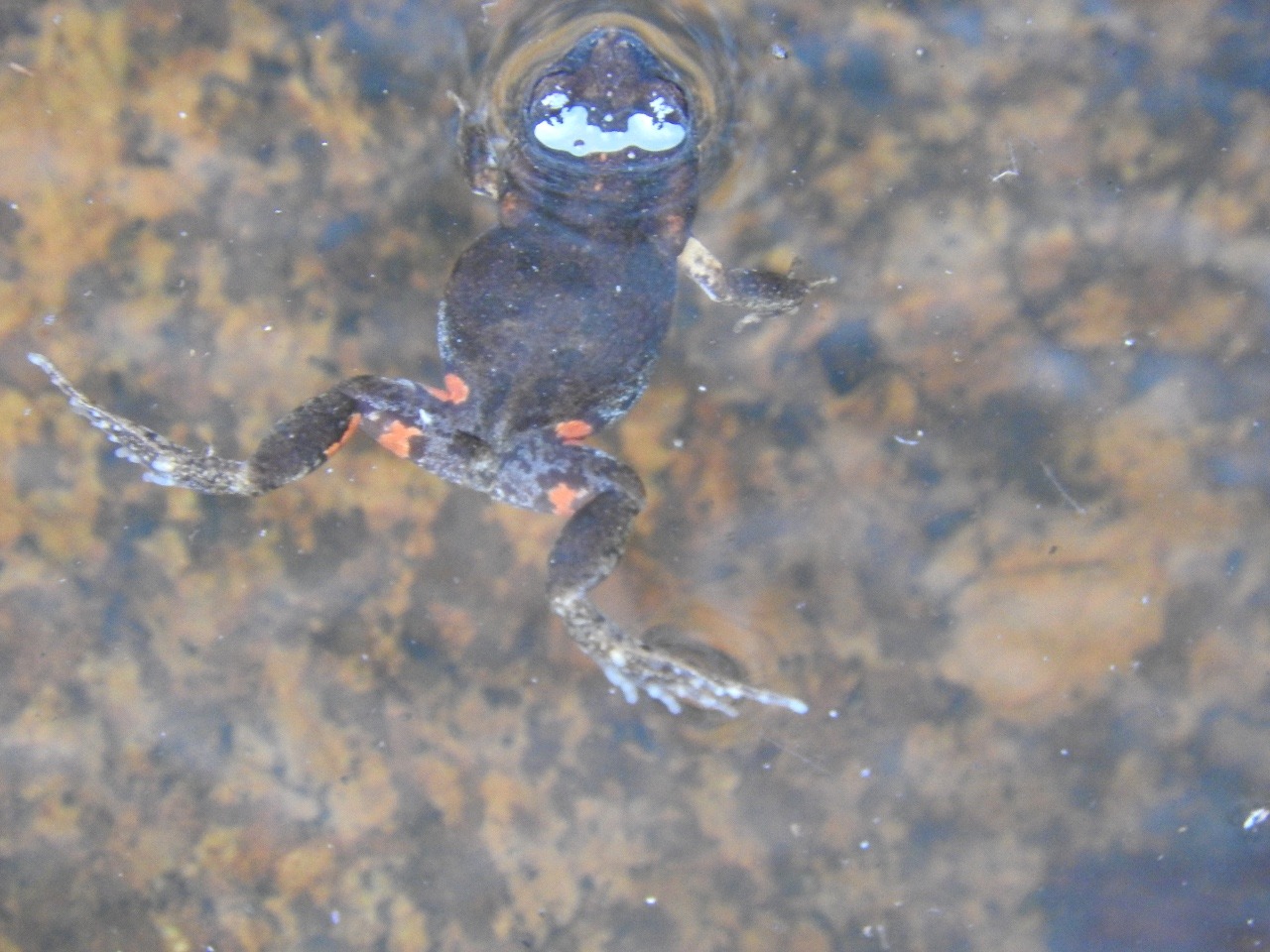
I was getting a bit cold though in shorts and t-shirt but I did find a frog in a little rock pool. It
was a Eastern Gungan we find out from the ranger and because we have photos it is going in the new book of the National park.
Slept well and was up early to have quick cup of coffee before heading to a part of the creek that
platypus are sometimes seen. Larry on one part me further around but neither of us found one. So back and have breakfast before heading to the Pyramid only 3.7km up but with a warning of how strenuous the walk is, but good views. You have to start with the creek circuit
again then start the up bit , no I did not make it Larry got to the last bit.
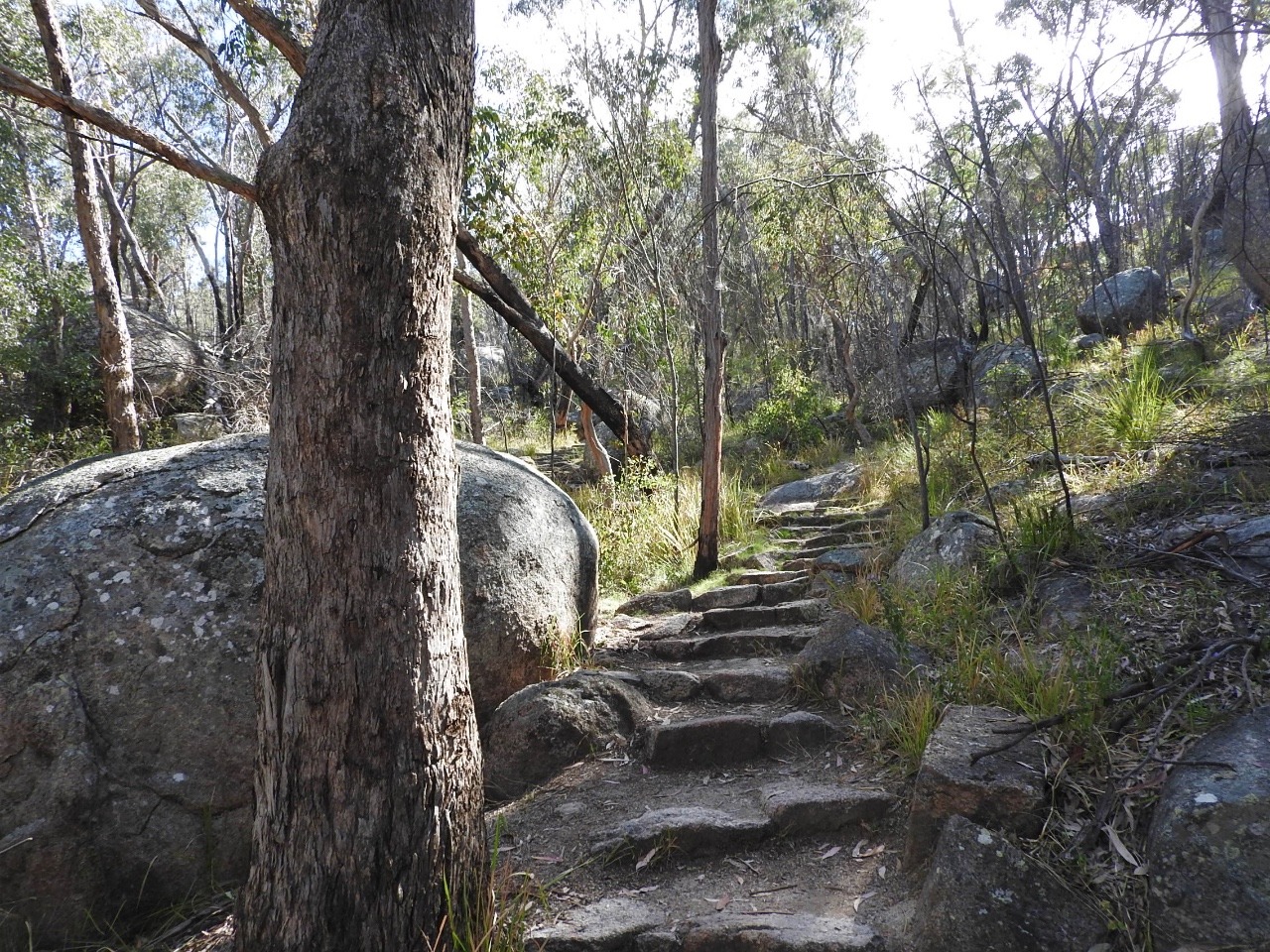
First photo shows the start with the steps then you see the next photo the white paint dashes is the track up. Then it gets even stepper last bit being straight up with loose rocks and stones.
Larry took video and photos from close to the top.
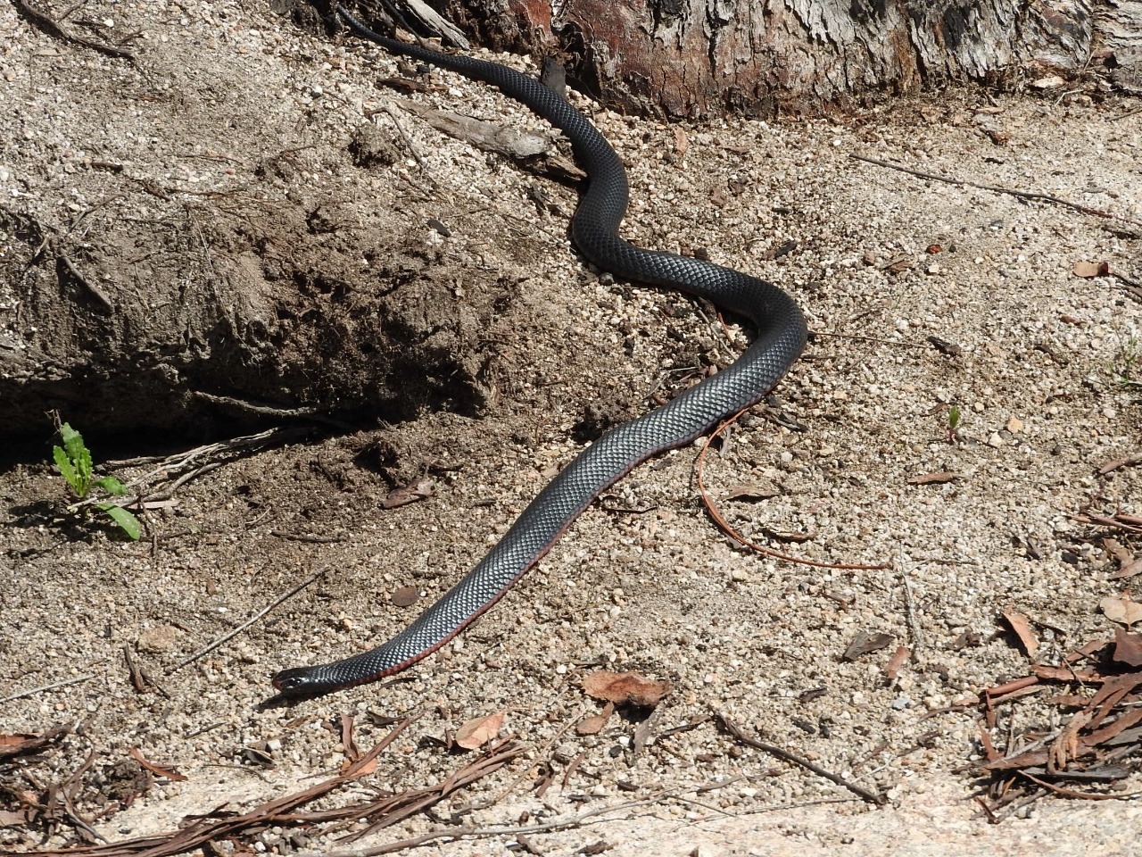
Afterwards we walked back to camp via the Bald rock creek circuit. As I stood beside the water looking for more frogs or lizards Larry shouts lookout , as I turn towards him I see heading straight for my feet along the rocks is a red bellied black snake. I step back and it changes direction towards the waters edge and the sedge grass. It had obviously been moving across the
rocks the other side of the plants to where I decided to stand disturbing it, my fault , I was lucky it did not get too much a surprise at me and turned away.
The weather improves a little so up early again to look for platypus. Then its a walk to Castle rock
5.2km then a further 2.2km to the Sphinx and Turtle rocks. Both suppose to look like their names.
Once again I did not make the top to Castle rock another strenuous walk. Larry made it up but not the walk to the other rocks. Photos show the Sphinx and Turtle rocks from the
top of Castle rock.
The day we leave before breakfast the platypus area was checked again then we walked the creek circuit again but see nothing more.
We cross into NSW and stop at
Tenterfield showgrounds while we see the area. Tenterfield has a
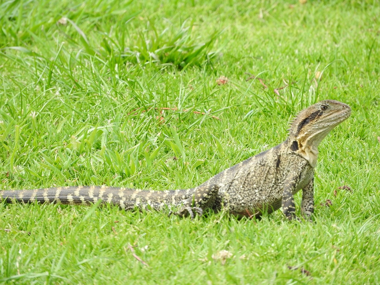
river walk that stretches the length of town through seperate
different named parks. Lots of water dragons out on the banks and a
little skink.
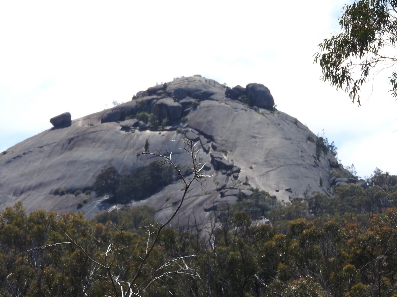
We drive the Mt. Mackenzie Drive ,this is 38km mostly dirt road through sheep grazing country, with granite rocks. The first promoted sight is a rock that looks like a man's nose so it is called Doctors nose because it was a doctor who first lived here.
The second sight is a large rock named Small Bald rock because we are close to Australias largest granite rock named Bald Rock. This we could see from Girraween National park.
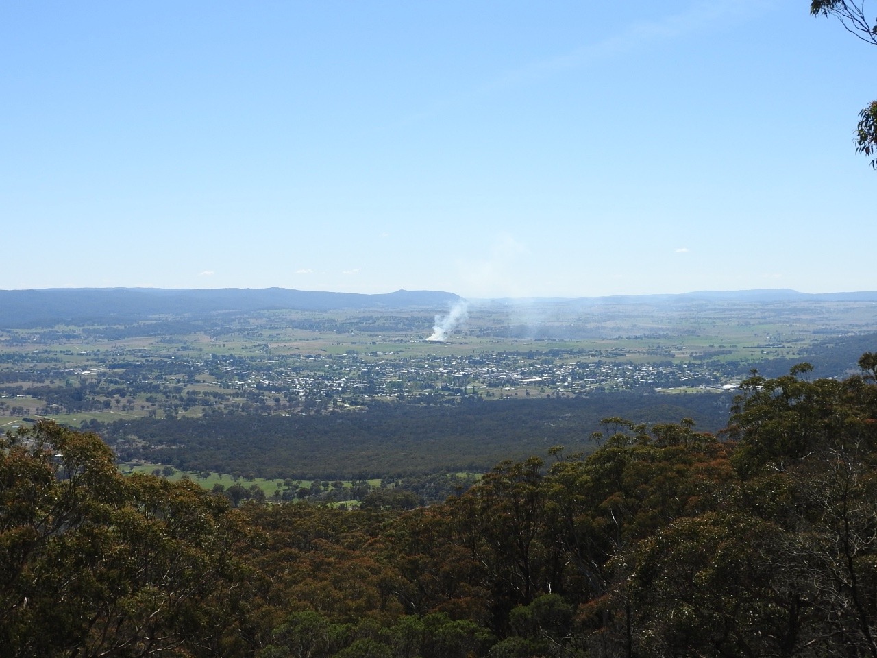
It is then up to a lookout to look back across the mountains to southern Queensland and Tenterfield township. Then you get to Mt. Mackenzie lookout
at 1298 m above sea level.I'm glad we did not have to walk the steep dirt track to the top.
Tenterfield was first gazetted as a town in 1851 and is now a designated Australian Federation town because on 24 October 1889 the then Premier of NSW Sir Henry Parkes made his now famous speech with the cry-”One People One Nation”. This speech led to the movement which in turn led to the Federation of Australia.
So the town of Tenterfield is known as “The Birthplace of our Nation' and has lots of historic buildings. We are at the top of the New England Tablelands 882m above sea level.
After walking most of the conservation areas , Monday was spent walking around the shops for me which did not take too long as population is only 6996.
We went to look at the dam but because of work being done there we could not see it properly.
Bluff rock just out of town on the New England hwy is a sight seeing area. It is a granite rock of cooled underground magma of 225 million years ago . It was pushed up by the earths plate movement and resists erosion because it has not many cracks in it to let the water in. Large crystals of pink feldspar, dark mica and quartz give it its speckled look. Hope photo shows this.
Bluff rock also has a dark past as back 150 years ago it was the place of an Aboriginal massacre. The Aboriginals would help themselves to a few sheep from local properties and one time they killed a Shepard from Bolivia station . They took sheep and fled to Bluff rock and men from Bolivia station tracked and caught them and threw them from the top of the rock.
Some died some injured but no more Aboriginals were seen here again.
We move on stopping the night just outside Glen Innes . This is called Celtic country as it was settled mostly by people from Scotland starting in 1838.
Its bloody cold up here in the mountains , their summers only average 25c. Sapphires, emeralds and topaz have been found here. They have an annual Celtic festival and one called Minerama for sapphire and gem fossickers in March.
They also had their own Bushranger named Thunderbolt. Between Tenterfield and Glen Innes in a place called Deepwater there is a annual scarecrow festival.
Next place up here is Guyra population 2200 and 1330m above sea level, average rainfall is 900m. They have an annual lamb and potato festival in January. It occasionally snows up here and is the highest town on the New England plateau so the wind blows all the time.
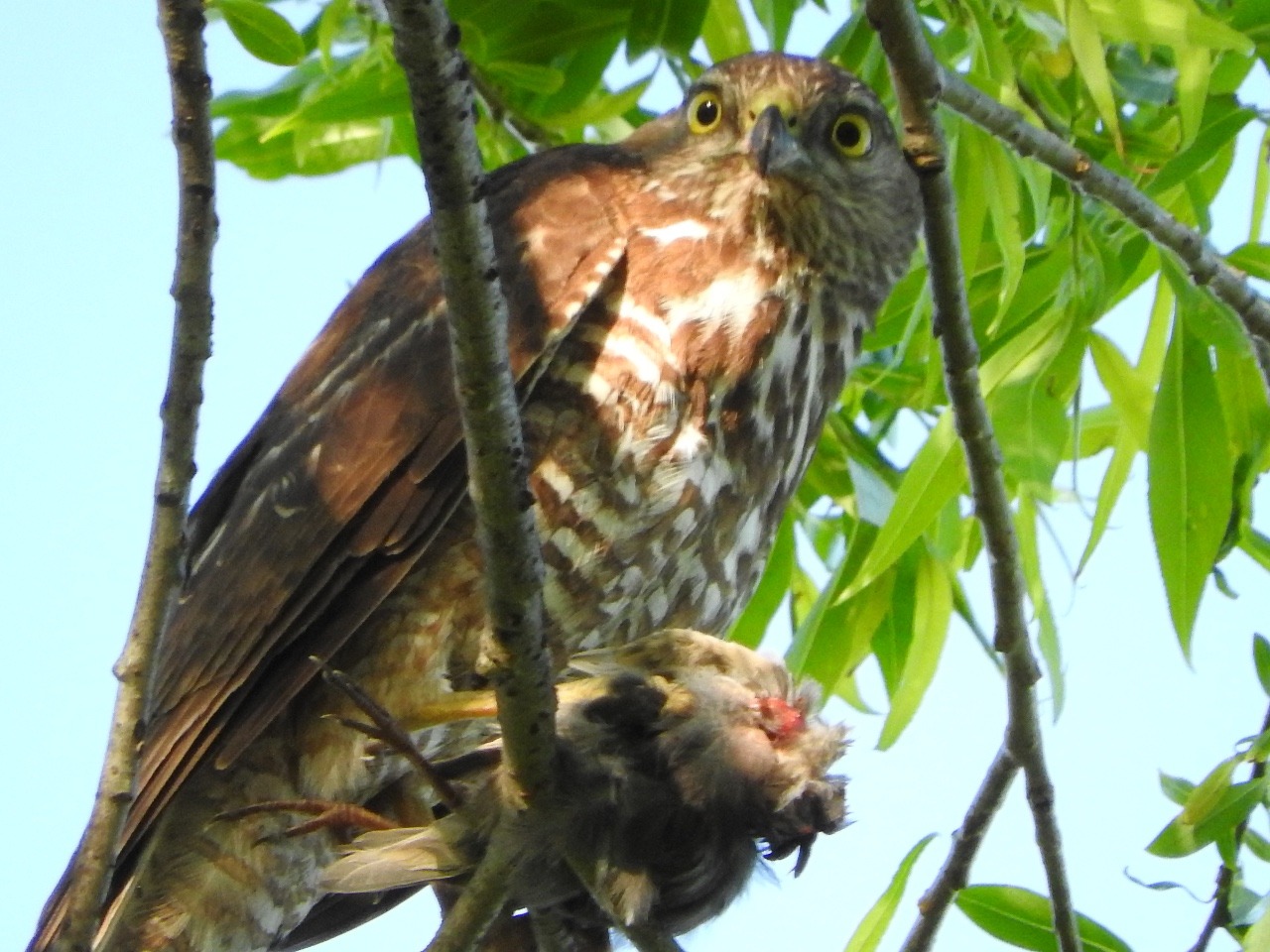
We stay at Mother of Ducks Lagoon and
Larry gets a photo of a Brown Goshawk having breakfast of either a Magpie lark or Starling as there plenty of these around. Both were attacking it to try to make it move on . We found plenty of young trying out their wings for the first time.
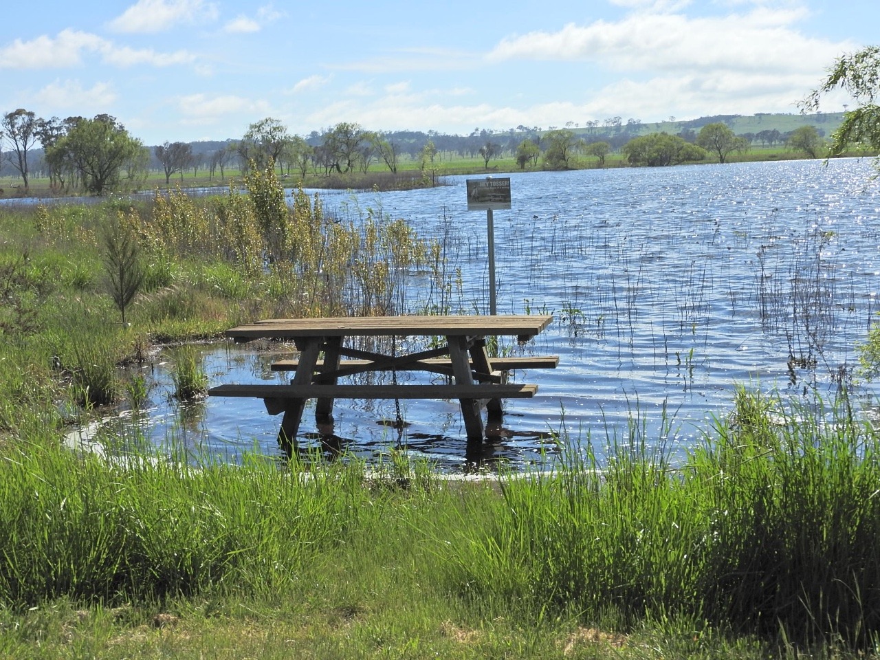
On our way towards the coast again and a stay at Apsley Gorge and falls we stop at Dagar dam which was very fall of water. Just look at where the picnic table is , would be fine on a very hot day to sit with your feet in water.
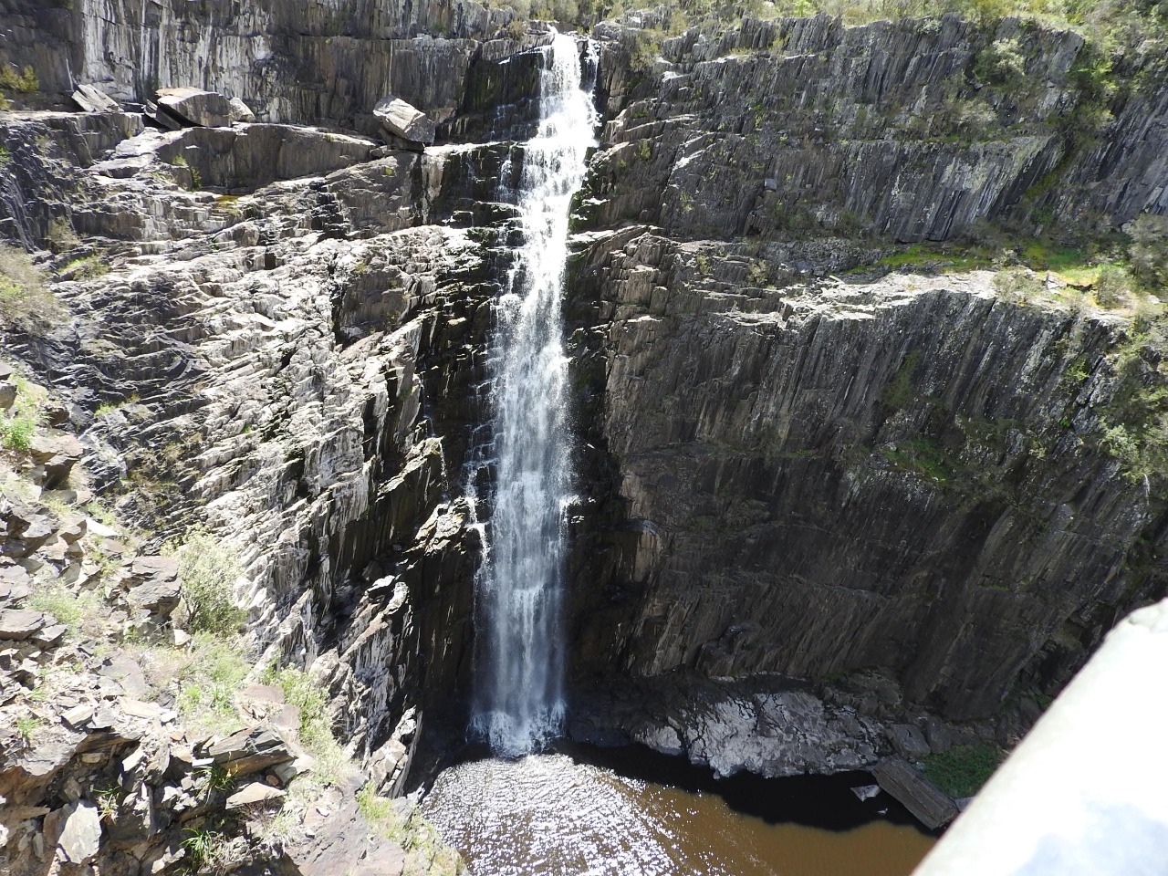
Apsley Gorge / falls is in the Oxley Wild river national park. We get to walk around the falls from one side then cross a swing bridge and get to a lookout from the other side. The first falls lookout you have to go down some steep steps to see falls , which means its steep steps up again . The swing bridge is over the river before it starts the waterfalls. Thats a shame but nice, even better would be if it was closer to the falls. From the other lookout you can see more of the bottom pool which has water dragons , turtles sitting on some of the rocks, and ducks around the edge.
We had an eagle in the sky being chased by a magpie and we found a Fantail cuckoo.
Leaving the National park we go to Ellenborough reserve camp area where we were going to stay for a few days leaving the van so we could se the area into Port Macquarie. Our plans change because the weather changes again and rains on our first night and is pretty overcast the next day. So we took the caravan over the rest of the mountain range to south of Port Macquarie into
Christmas cove beside Queens lake nature reserve for a few days. The trip over the mountains was raining and not one of the best roads over the mountains, narrow and very tight corners most sign posted at 25km or 35km, one lane each way and we did not get above 50km at any
stage of the 100km which took 2 ½ hours. Larry had to drive and keep adjusting the breaks on the caravan with the controller under the steering wheel on some of the very tight down hill corners. Just think how we would hold up traffic going up this road, we would make it ok but very slowly. The road did not improve much until we turned onto the hwy to head south of Port Macquarie.
It rained during the night again but we headed up North Brother Mountain to the lookout and I;m very glad we got to drive up . We just walked to the 3 lookouts up on top . Once a year the locals stage a fundraising run up the mountain and its used by Hang gliders as jump off point.
We drove the road out to Crowdy bay
National park as this was the next place for the caravan to go.
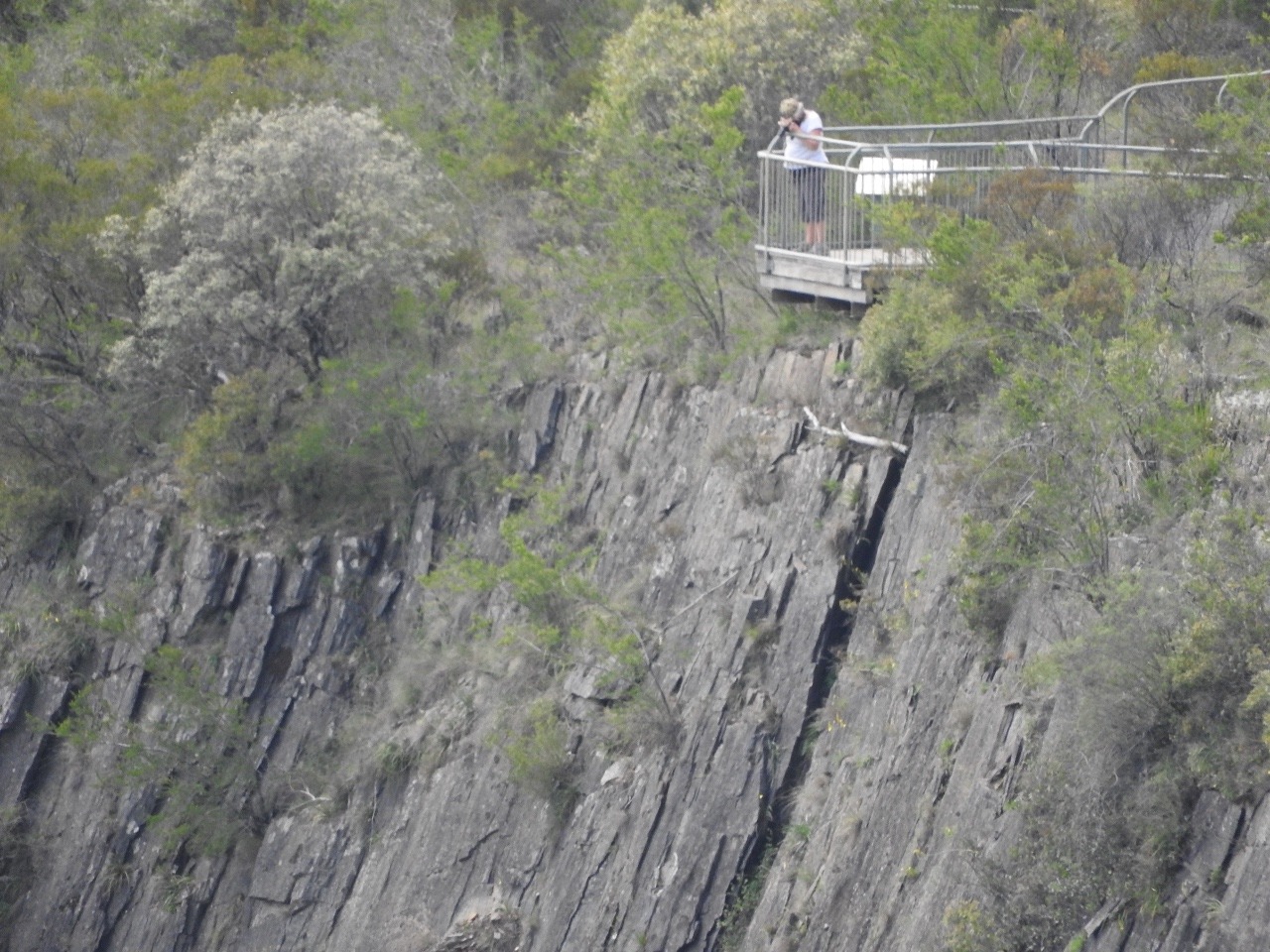
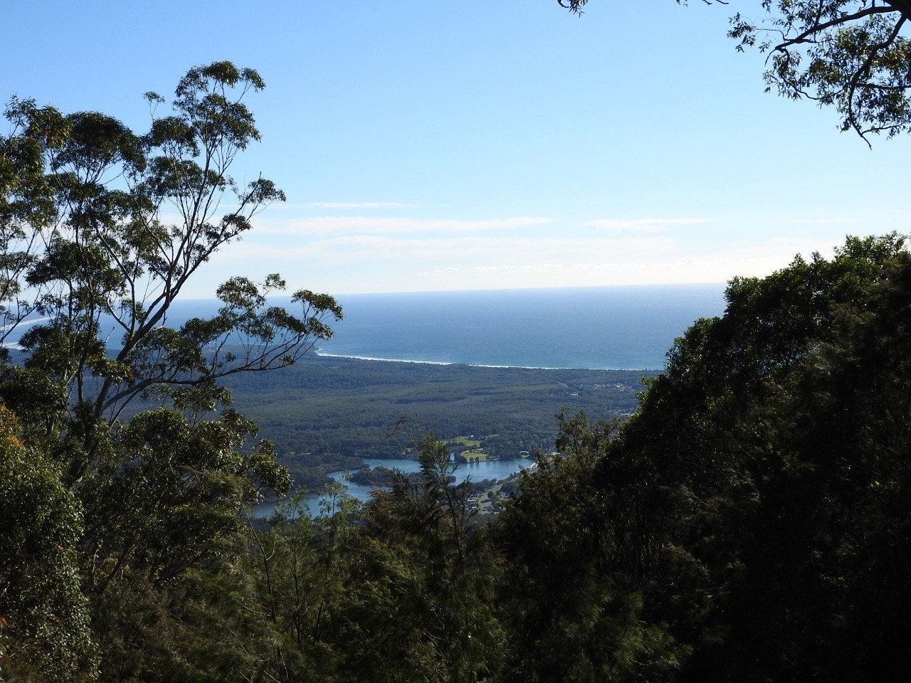
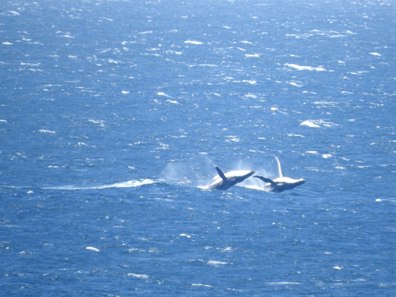
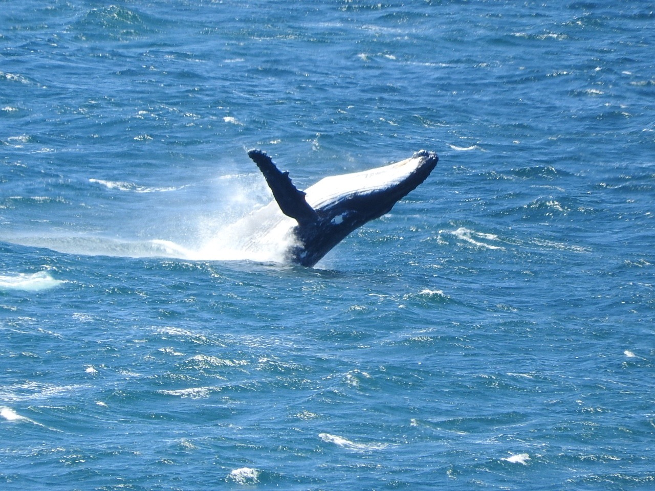
The next day was a better weather day so we went to Kettang nature reserve at the end of Camden head to whale watch. We walk all the tracks to the lookouts over Wash house
beach, Pilot beach and walk out to Perpendicular Point. The track, of course has steep bits but it was worth it to get to see some female Humpback whales and their young playing as they travel south back to Antartic waters for the summer.
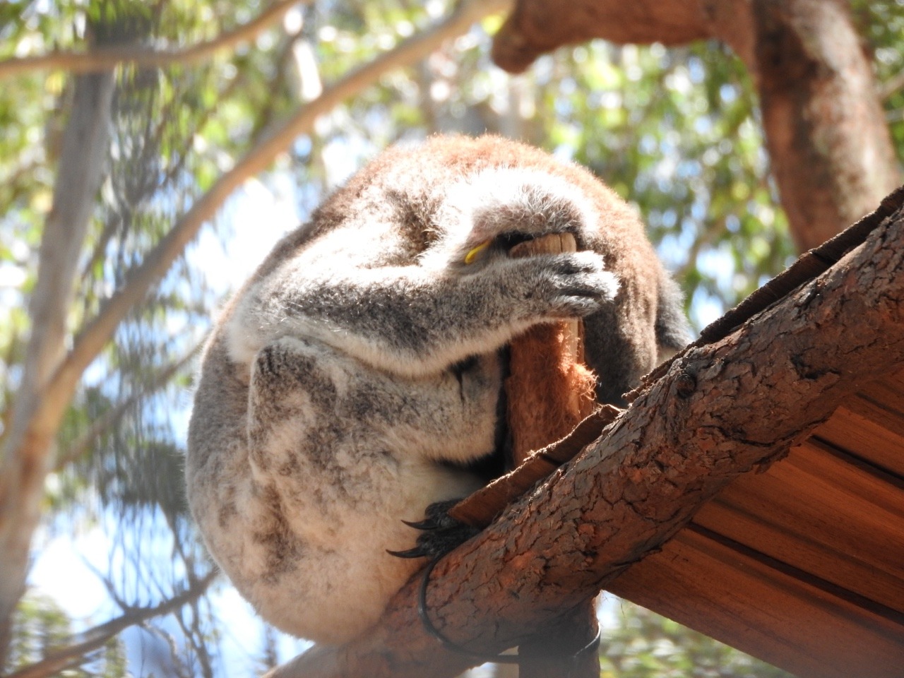
To round out our stay here we visit the Koala hospital which was established in 1973. They have been granted permission to keep a few koalas permanently. These are ones that would not make it if they were released. One is totally blind from chlamydia, one a bush fire victim that is now disfigured enough to make climbing nearly impossible, and the list goes on for another 4
including dog attack victims, so they are used as to educate people. There was some in the rehabilitation area away from people waiting for complete recovery to be released.
Crowdy bay national park is our next stop at Diamond head camp.
We walked the Mermaid track to the lookout its only 2km and has views of Dunbogan beach and back to North Brother mountain we were at a few days before.
The Diamond Head loop walk 4.8km goes up to 113m above sea level with views of south Crowdy Bay head and north back to Perpendicular point where we say whales2 days ago.
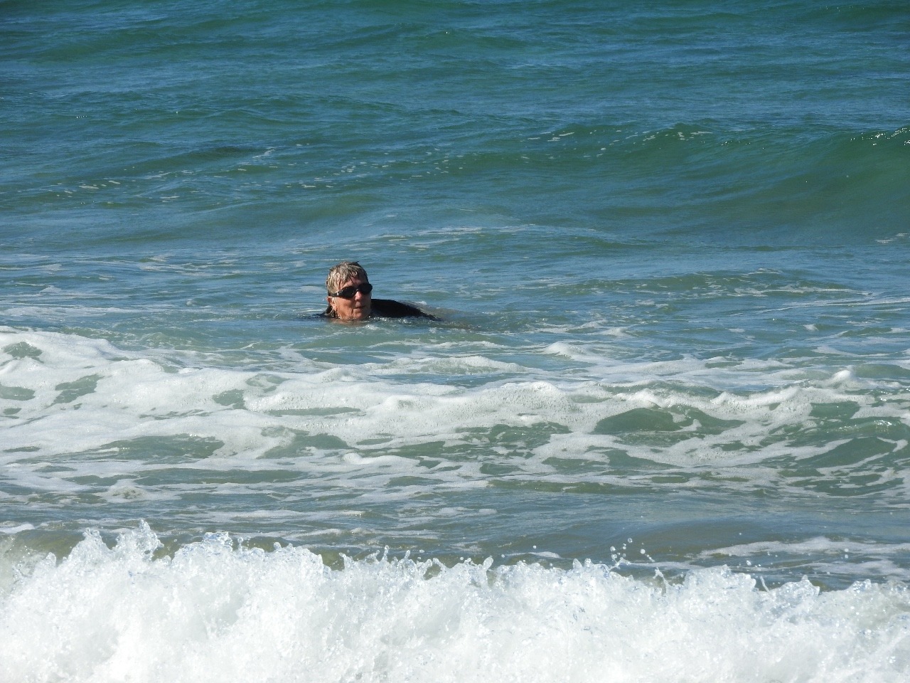
This walk joins Indian head camping area and back on the forest walk. After all this walking I got in the sea for a swim and cool off before my cold shower.
After breakfasts the next day we drove to Indian head camp ground to walk the track to Kylie's cabin and beach hoping to see the koalas, no luck.
During WW11 the Australian author Kylie Tennant moved to nearby Laurieton -Queens lake and she met local bushman/ recluse/ farmer Ernie Metcalf. He owned Diamond Head and he
built the cabin for her as a retreat for her to write. Diamond head may have been named
because from the sea looking back the quartze in the cliffs sparkles in the sunlight.
Crowdy Head was named by Captain Cook as he sailed past in 1770 a crowd of Aboriginals gathered on the headland. Now Crowdy Bay. Sand mining took place here 1960s to 1970s
Another of our trips out was to Cattai wetlands set up in 2003 to improve water quality of Manning river .
This is next to Crowdy Bay NP, the walk is 2.3km and has extra to a steep lookout but after the day before s hard walks I did not.
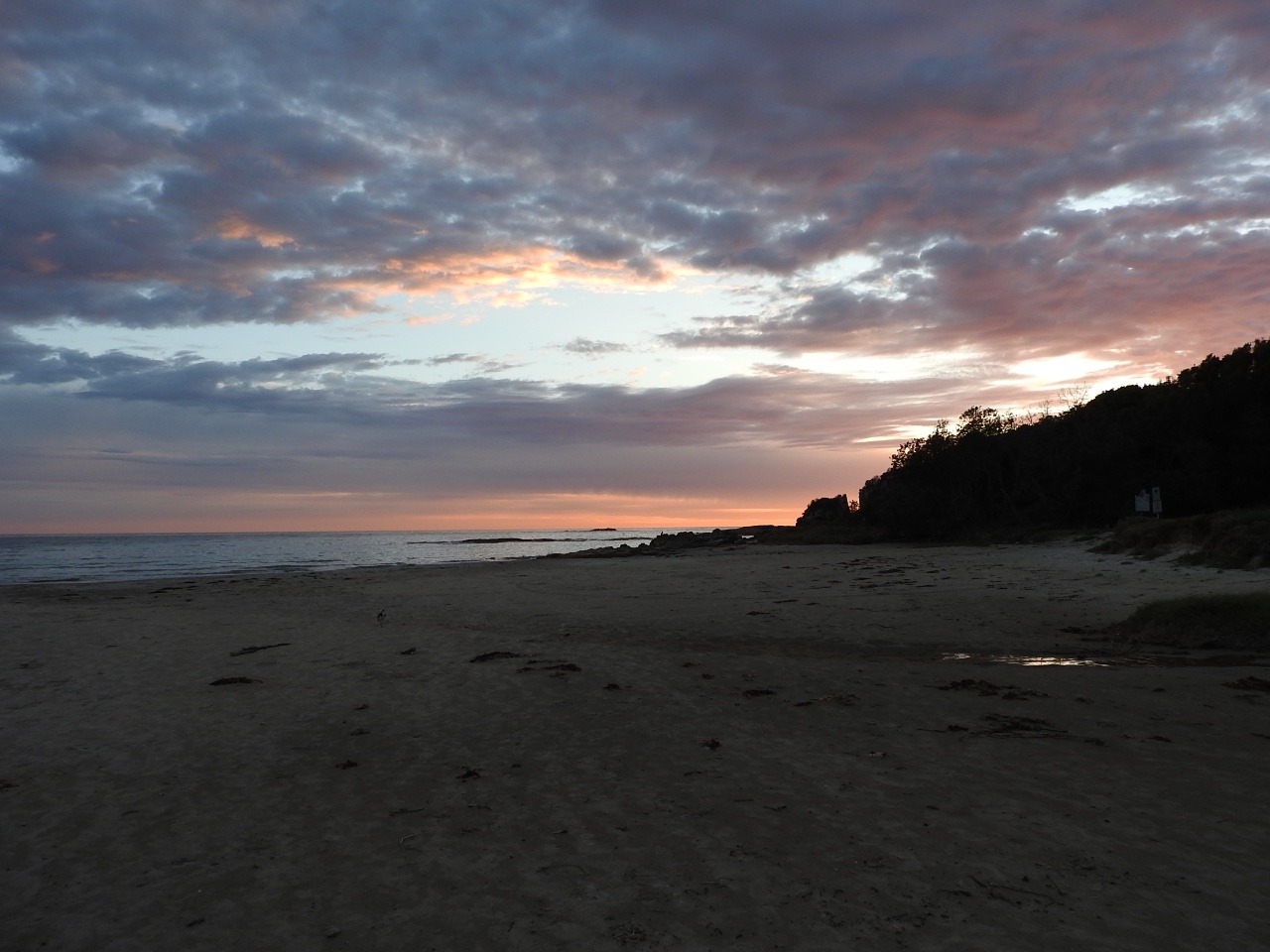
Driving back we found a echidna crossing the track , we did not get photo as we were more interested in making sure it got across safe as cars coming the other way would not stop. We got back to van for late lunch then Larry went bird looking and I went sea swimming/ playing.
It was a calmer sea this day and nice . Got a very cloudy red sunrise before leaving the next day .
We move to Wingham show grounds and the Hunter region of NSW. We are here to build up battery power again before going into next National park as more storms and rain are
forecast. . We stopped in Taree on the way. The showgrounds at Wingham charge $20 for power with clean shower block.
The day is hot and humid and we walk around Wingjam Brush nature reserve. Its part of endangered rain forest with large hundred year old Morton Bay fig trees and very
large stinging trees that do hurt if you brush against them. In here is also one of the largest blush walnut tress at 37metres tall and over a metre around.
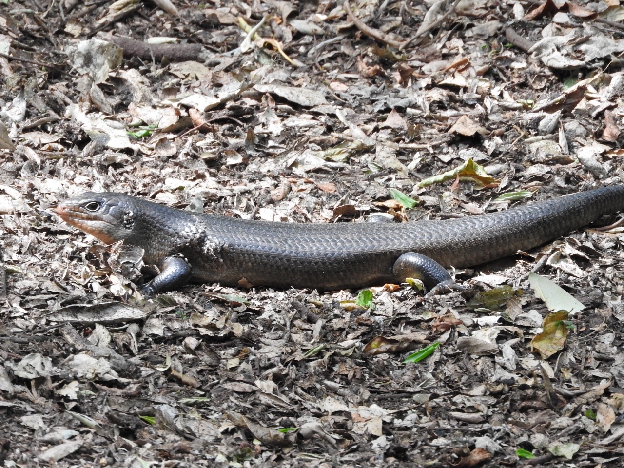
We find 3 Land Mullets Australia’s largest skinks but do not find the Diamond python that lives here.
It is not hard to miss the colony of little red, black and the endangered grey head flying fox.
We hook up the van and head through Forster and Tuncurry which are split by the Wallis lake to get to our next National Park. This is in the Great lakes and is Booti Booti NP stay at The Ruins camp .
From here we visit Cape Hawke lookout which we drive part of the way then lots of steps cut in the track to lookout.
Booti Hill and Wallis lake walk of 8km
Wallingat NP and Whoota Whoota lookout
with veiw of rianforest and wallis lake
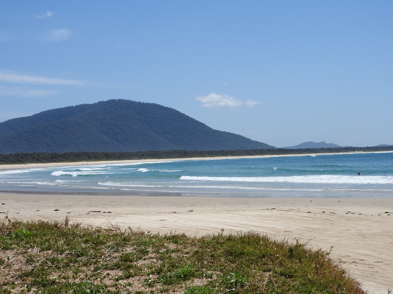
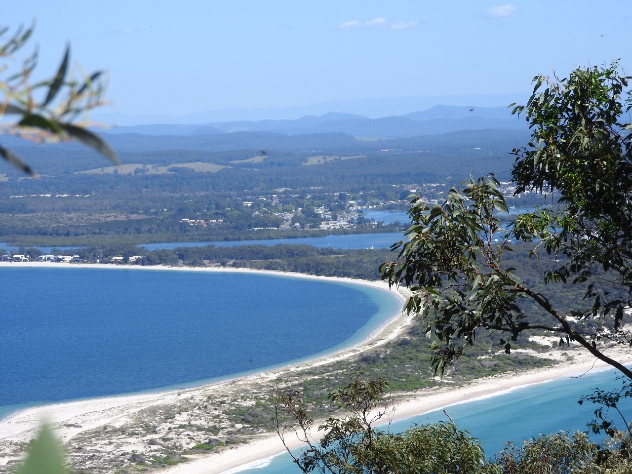
Seal rocks and sugarloaf lighthouse . Smith lake the smallest of the Great lakes and Wallis lake the largest. The beaches are not good for swimming and are mostly surf beaches. We did not sea any more whales. We take the caravan back out of here onto the hwy to get into the south part of the lakes and Myal lakes NP. The beach we stay at for a couple of nights is definitely not a
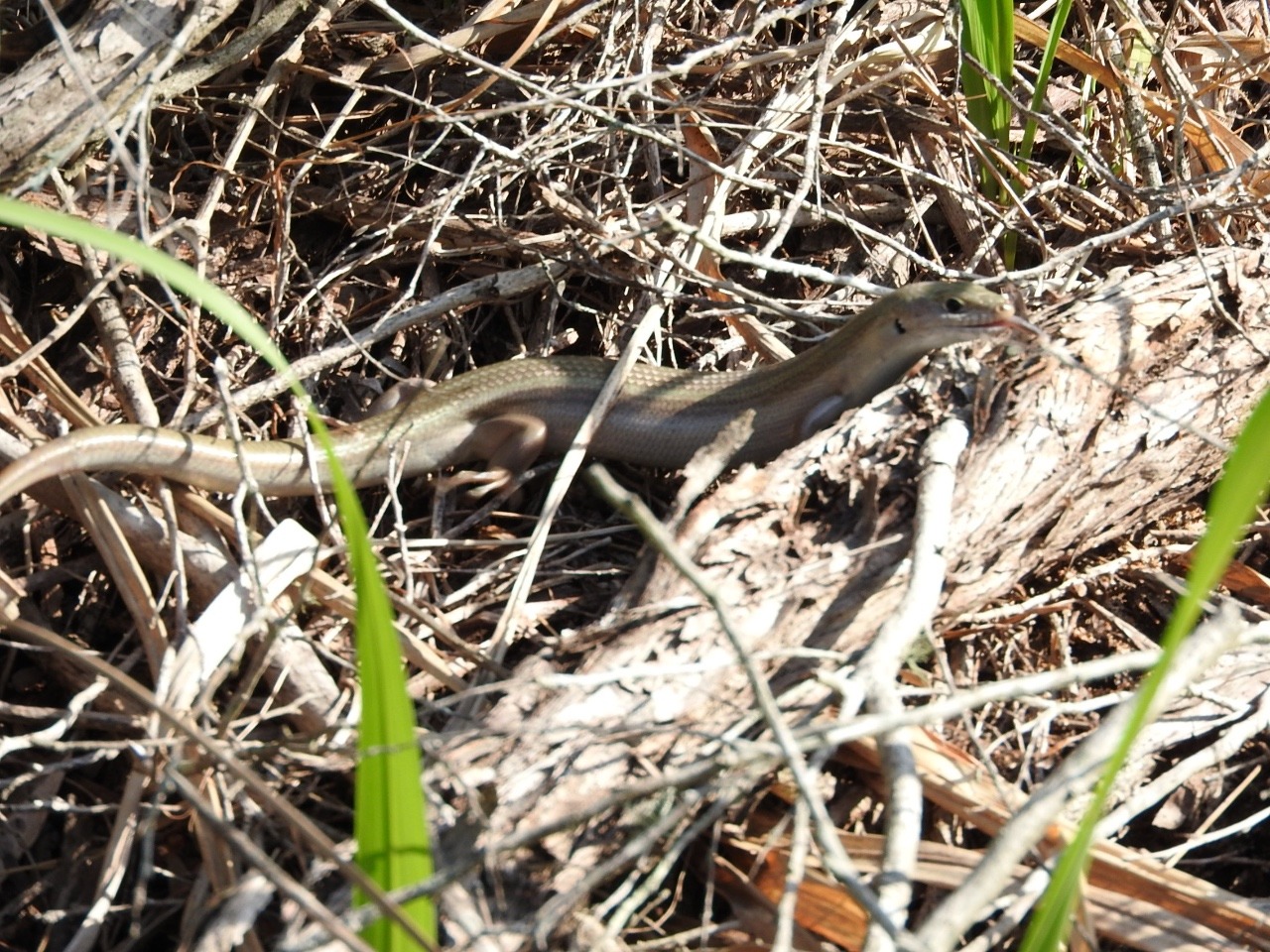
swimming beach but I do fin another different skink on the sand dune climb track to get to beach.
We drive out the way we came in without
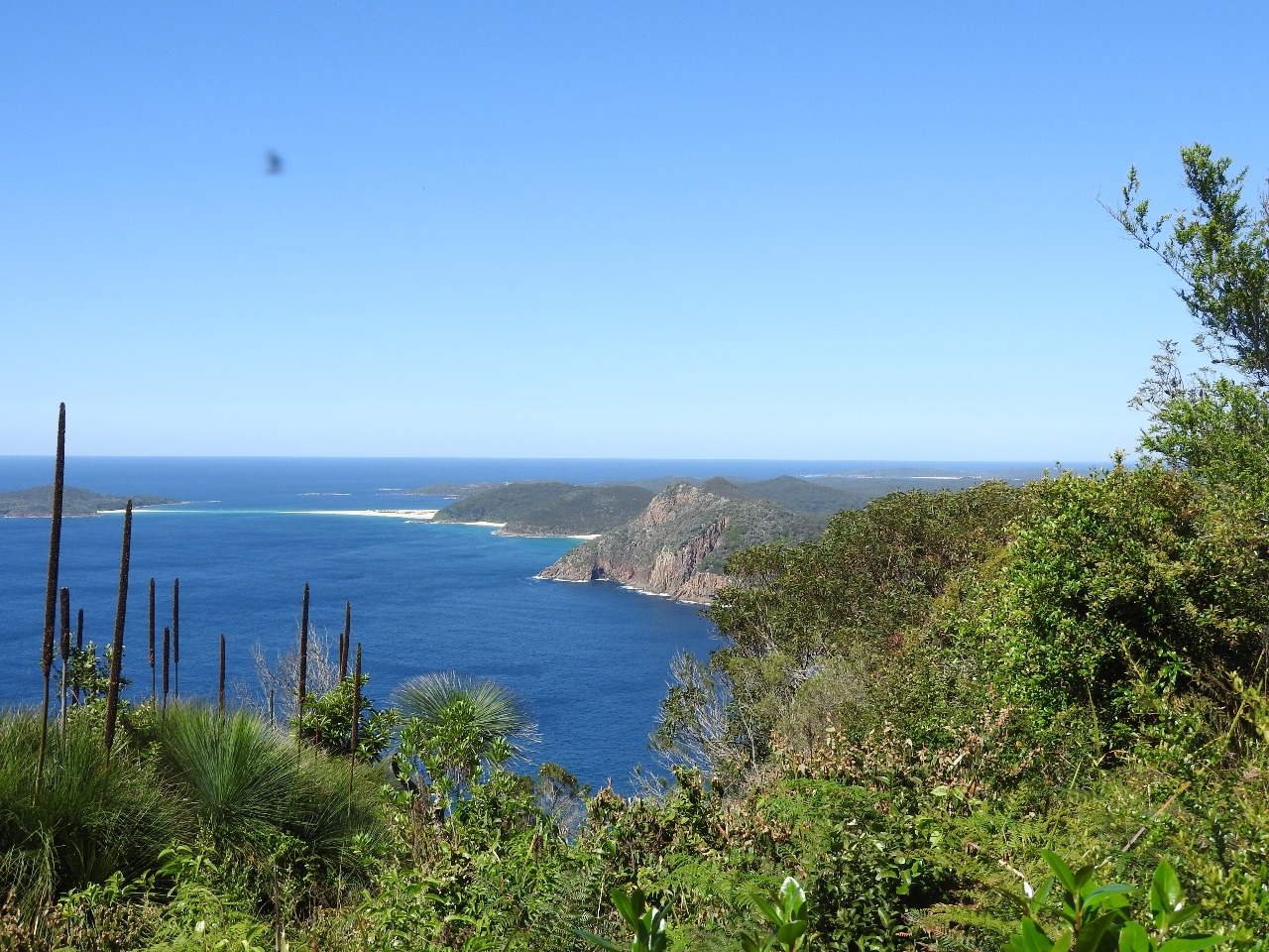
the van to get to Hawkes nest and the Yacaaba headland walking track Its a challenging 1,5km track up to top to look for whales after a good kilometre walk long very soft loose sand beach. No whales , just one stray young dolphin we did not get photos of.
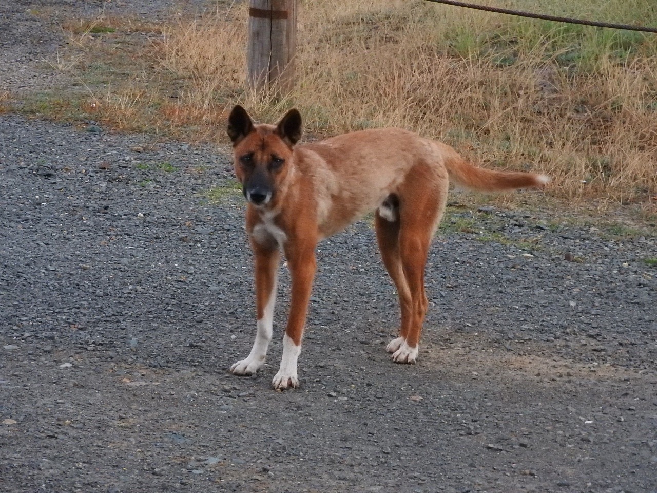
Back in camp Larry gets followed by a Dingo , it probably goes around the camps getting food that people leave out even though plenty of signs not to feed wildlife or leave food or rubbish where they can get to it.
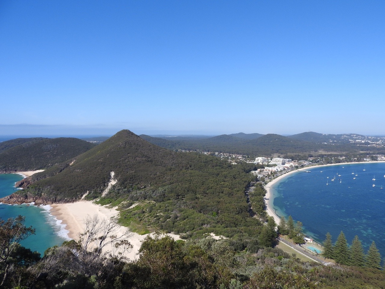
We head into Port Stephens from here
and the only place we can get into was a caravan park in Shoal bay as
they are having a wine and food festival. We got a deal 3 days for
$115. its $36 during the week and $45 or something like that Friday,
Saturday, Sunday normally. Ours would have been $126 so save $9. But
it not worth even $25 a night but we had already paid a couple of
days before.
Every where you go is to take money
from tourists , parking metres evan at the information centre , who
don.t have much information just want to sell you tickets for cruises
for dolphin and whales or guided Koala walks in the wildlife park . I
wanted to go in with the mantra rays and sharks to feed them but they
wanted an entry fee plus money for each encounter in tanks.
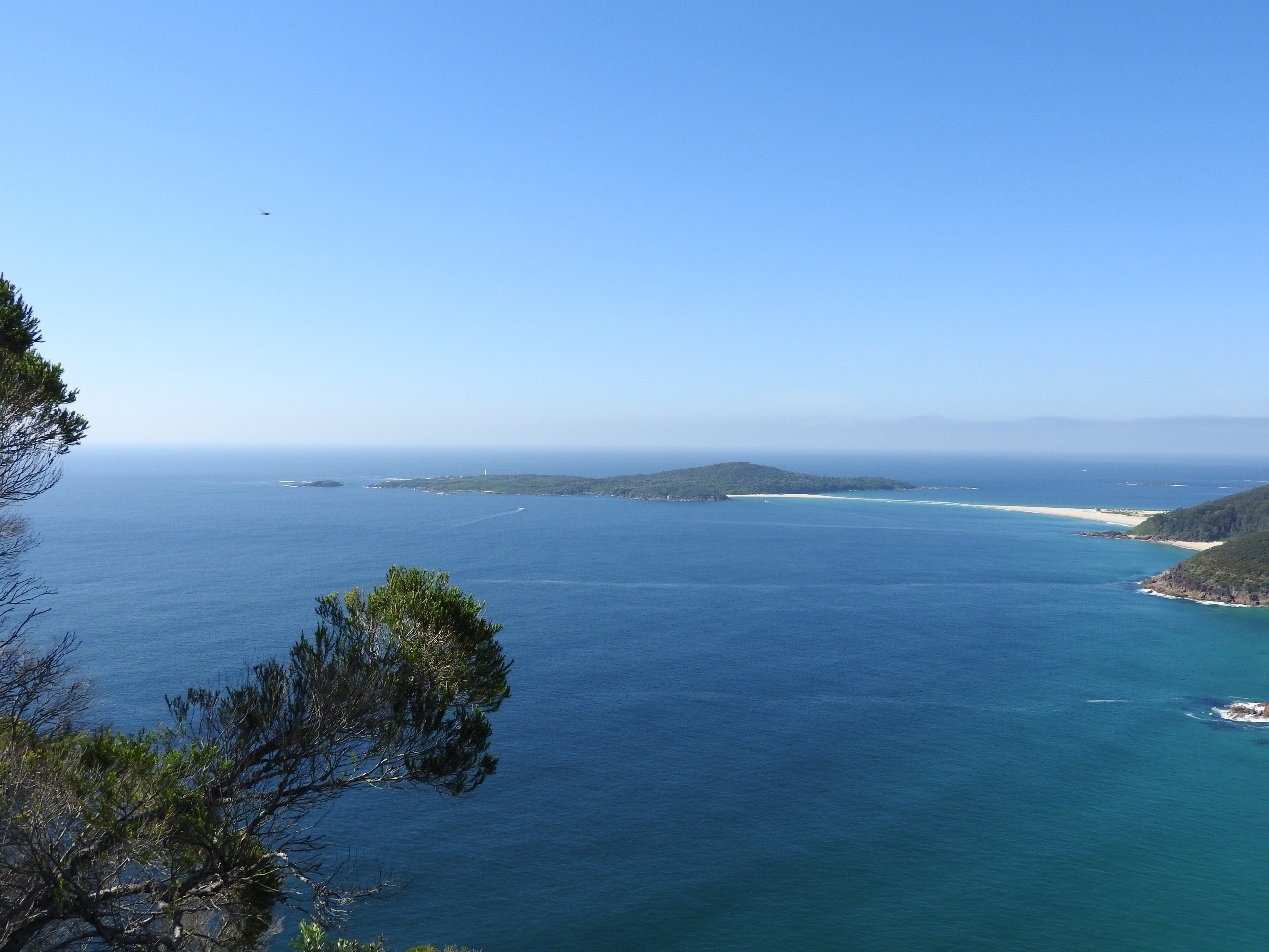
We walked all we could and went to see
different Bays and beaches did some shopping and I swam each day at
the beach across from the van park. Even the woolworths was set up
for more up market travellers. We did get some rest ready to get
through Sydney in the next few days.
Other Entries
-
Sep 1650 days prior Bundaberg, Australia
 -
Oct 1224 days prior
Warwick, Australia -
Nov 05
Port Stephens, Australia -
Nov 3025 days later
Tilba Tilba, Australia -
Jan 3187 days later
Benalla, Australia -
Feb 23110 days later
Ceduna, Australia -
Mar 10125 days later
Drummond Cove, Australia -
Mar 28143 days later
Karratha, Australia -
May 05181 days later
Port Hedland, Australia -
May 28204 days later
Kununurra, Australia -
May 28204 days later
Kununurra, Australia -
Aug 18286 days later
Mareeba, Australia -
Aug 18286 days later
Mareeba, Australia -
Aug 18286 days later
Mount Isa City, Australia -
Aug 18286 days later
Mungindi, Australia -
Nov 08368 days later
Moree, Australia -
Mar 12492 days later
Ceduna, Australia -
Mar 12492 days later
Esperance, Australia -
Apr 30541 days later
Cape Le Grand, Australia -
May 31572 days later
Coomalbidgup, Australia -
Jun 24596 days later
Yealering, Australia

2025-05-22