 Alice Springs, Northern Territory, Australia
After our round trip back to Katherine are first couple of nights are spent in rest areas where 24 hour stopping is allowed.
Then it is a stop at Daly waters at the Hi-way inn to fill up on water and recharge everything on 240 volt, lot quicker than are usual solar power. This place gives us each a free on tap beer or wine for staying here. We were going to stay at the Daly waters pub, it supposed to be the place to stay , people leave things all over the walls. Yes one of those bush pubs but it very dry and dusty in campground and more of a party type place , not for us.
We move on to just outside Elliot to Longreach waterhole. We are camping here while we wait for mail to arrive at Elliot.
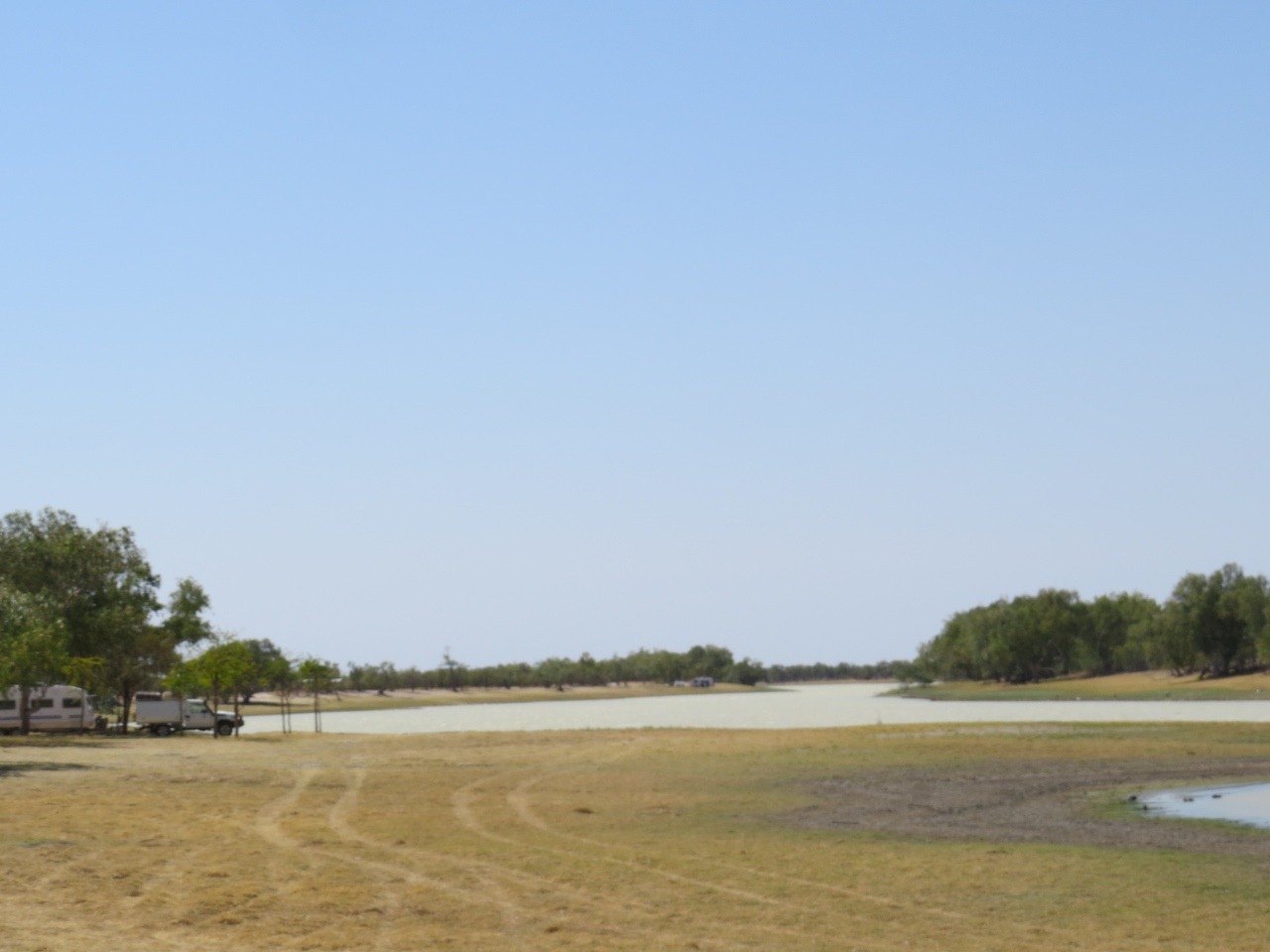
Elliot is just a wayside stop with small shop that sells all sorts as well as being the post office, and campground , a service station and thats about it. We decided as it was friday and we could be here a few days, we would camp 12km out of town at the waterhole. Longreach waterhole has a creek at one end and can be joined to Lake Woods at the other. It is a conservation area that has been set up for campers with dirt roads in and a toilet block with an area for water skying.
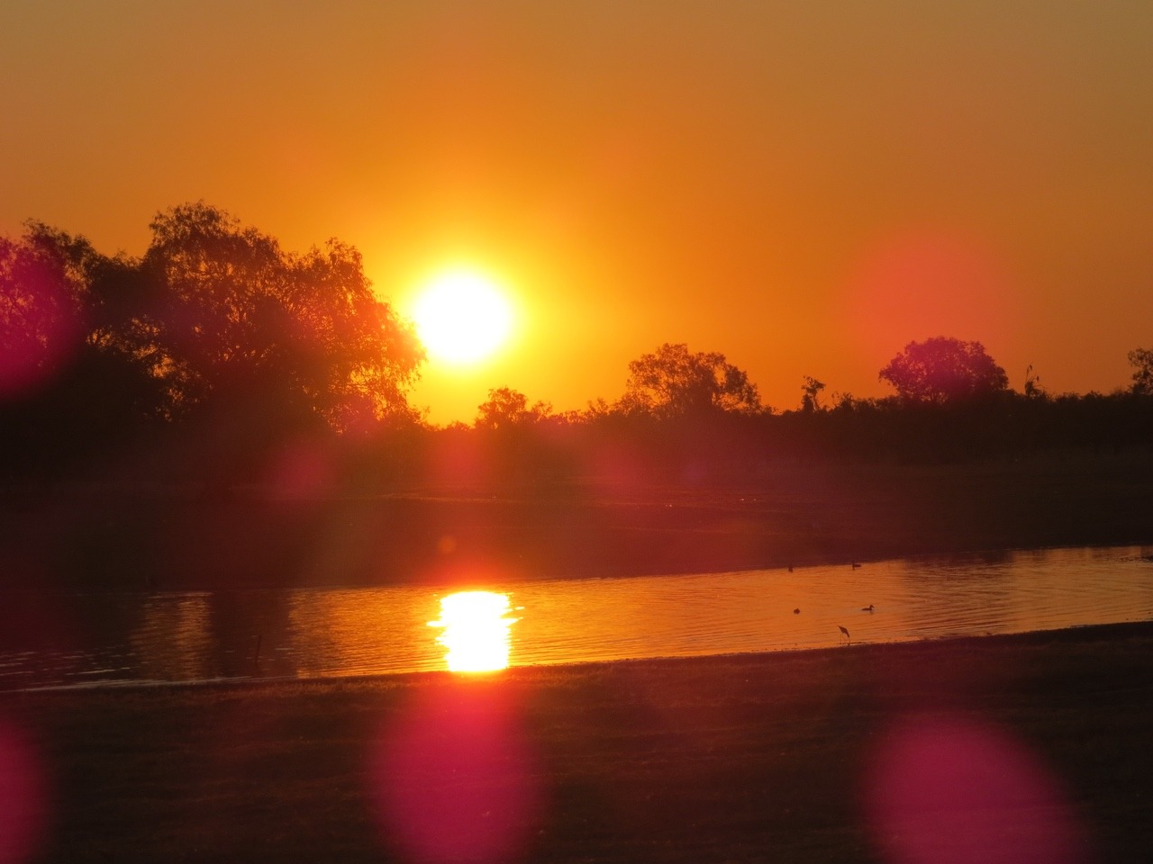
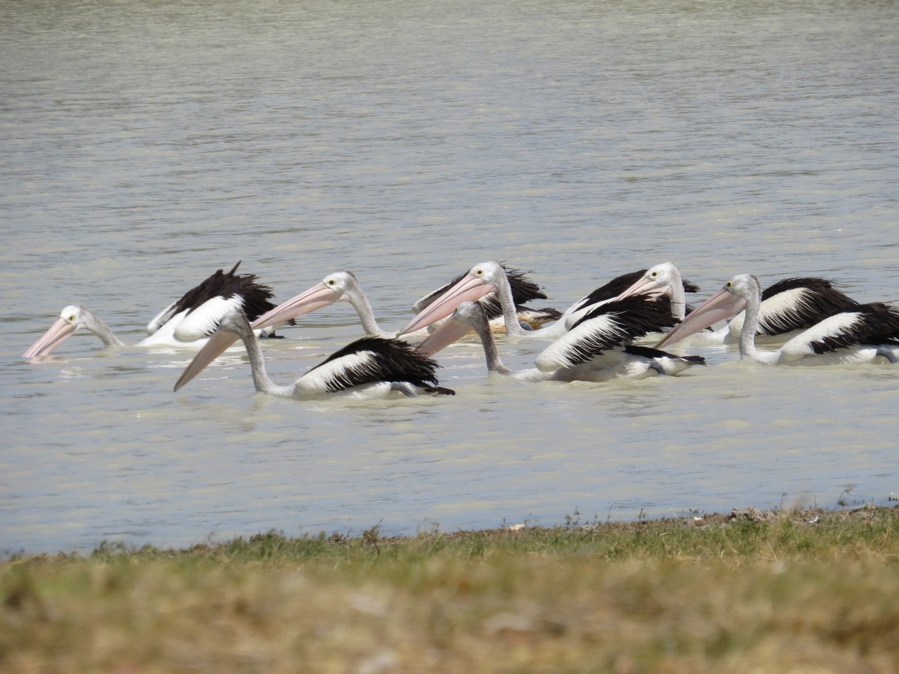
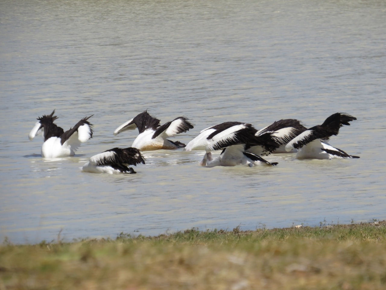
We find a quite spot and set up for a few days right beside the water. We walk around then swim across everyday. Sit and watch the pelicans do synchronised fishing, and I do some more gem and rock polishing ready for me to try wire wrapping.
On the other side of the water is a kite nest high in a tree so that also gives us something to watch as the birds go hunting and return with food for the young.
The post we are waiting for has not arrived after 5 days so the owner of shop/ post office he would forward it to Alice springs or return to sender after another week . We will ring him when we reach Alice Springs.
WE have a couple of stops on the road into Alice the first is to stop just outside Tennant Creek at Attack creek. This place commemorates the explorer John McDoual Stuart turned back from his 1860 expedition to cross Australia after a hostile encounter with the Warumunga Aboriginal people.
The Pebbles {Kunjarra} aboriginal women's dreaming site of Miniature granite boulders similar to The Devils marbles.
Tennant creek Telegraph station . This was first constructed in 1870 as the main telegraph station of the north being maned 24 hours a day. The team here had to be self sufficient as supplies cam by camel train from port Augusta only every 6 months. The men not only maned the Morse code machine 24 hours a day they had to keep the line in good repair both north and south. They had a blacksmith making tools and equipment, supplied medical assistance to the local aboriginals , grew their fruit and vegetables and kept sheep and cattle for food. So one out building is a cellar to keep food cool out here and a smoke house for the meat.
The telegraph line covered 3000 km and had 11 stations and 36,000 poles between Adelaide and Darwin. At a cost of 479,000 pounds and at the time a loaf of bread was less than 6 pence so this is a lot of money. It cost 1 pound that is about $50 todays money,for 10 words to send a message so not many ordinary people used it.
When gold found in the area the Tennant Creek was born and the station was moved there.
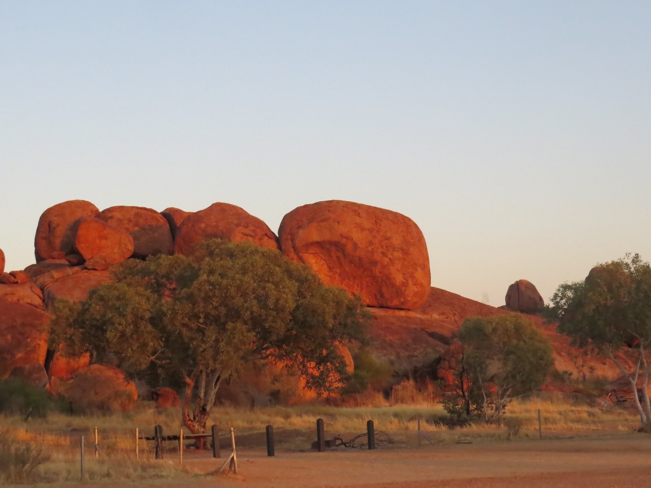
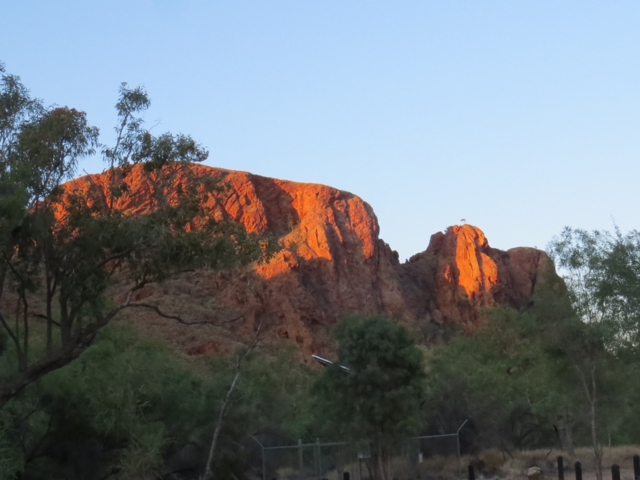
We spend the night at the Devils Marbles .
These are large granite boulders scattered across a shallow valley, many balanced on top of each other.
Formed from an upsurge of molten rock that cooled and became solid beneath a layer of sandstone.
The solidifying granite caused vertical and horizontal fractures creating rectangular blocks. Overtime water passed through the cracks breaking down the sandstone and then the granite, as a result rounded granite boulders remain some on top of others giving shelter to birds , lizards, and plants.
On our way out in the morning we stop at Lake Mary Anne a man built lake in 1981 to have a swim but it very windy and choppy. Plus we had heard the news a couple of days ago about a body being found at the lake , a bit of putting. There was guinea fowl and geese and a rooster walking around the picnic area.
The night is spent at a private station that has the remains of the New Barrow staging camp on it. These are from 1942-1945 and was the first overnight stop for the troops moving North from Alice springs during WW11.
The owner of the property allows people to camp the night if you are self contained, but there is northing much left to see, all the buildings are ruble.
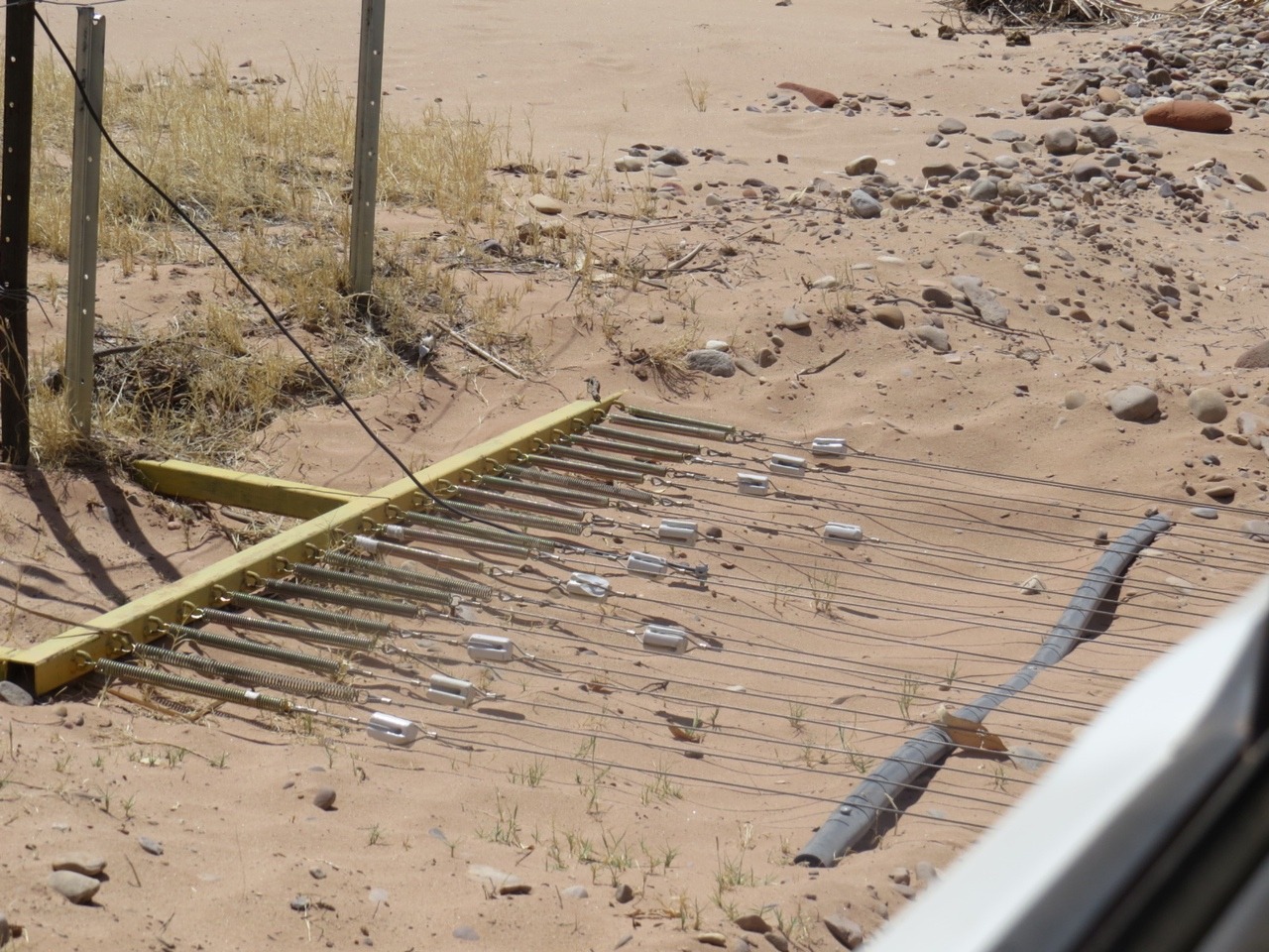
You remember I said the speed limit here is 130km well, we come to a stretch of road 230km long heading south finishing 25km outside Alice Springs that has a free speed limit. Thats right no speed limit , a bit scary as still no better road still has repairs maybe more straight stretches, but also has wondering stock as stations have not got fences. There are slow down to 130, 100 and 80 as you go through TI-Tree and Alleron.
Alleron is 133 km from Alice Springs and has a giant statue of Anmatjere man and other statues around roadhouse.
We stop and walk up the hill to the stutue to stretch our legs.Its a very hot dry place. The next stop was at Ryans well , dug by hand in 1889, following the route of the telgraph line. The wells were sunk to supply water for people and stock in an effort to draw people to new settlements in central Australia.
A stop a bit different for us ,was our stop at the Mango farm and winery. Even though it was only just after 9 am we still had to sample the wines, chutney, jam and dried mango. How else could we find out if we would by presents . Most of their wine is exported or only sold locally so samples had to be bought to share when we get back to Benalla .
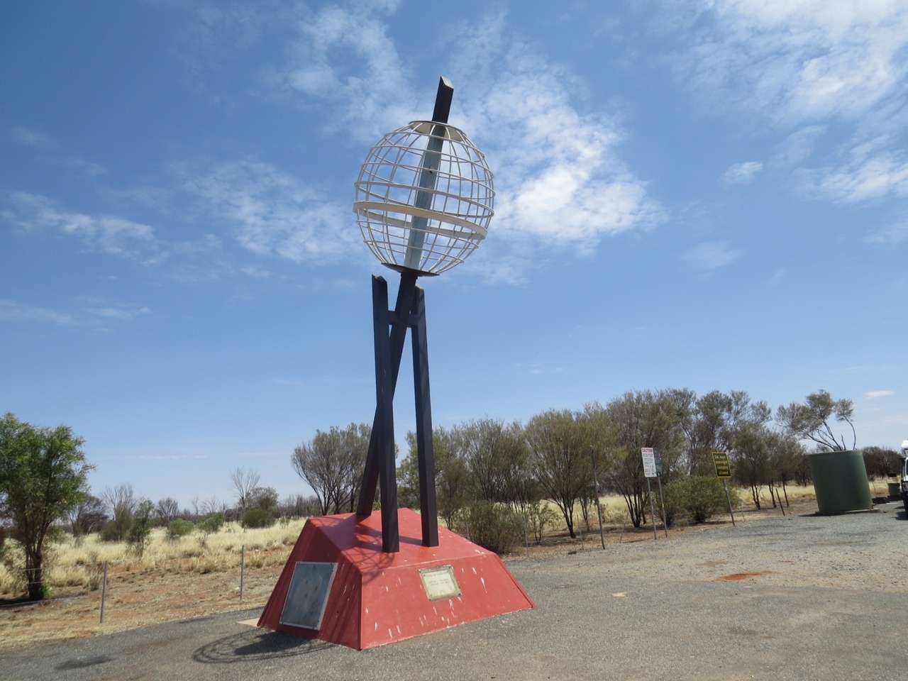
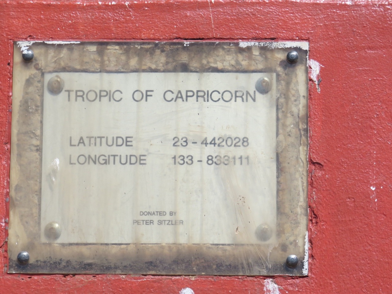
A last night before Alice springs was spent at the Tropic of Capricorn line. We would be leaving the tropics heading south to where the cold weather is.
Alice Springs population 28,000
We stay here for a couple of days , mostly to re-stock food as they have both Coles and Woolworths ,oh joy a bigger range to choose from at a better price than we have had for awhile, we also refill our water tanks and do the washing we can not do easy on the road, sheets, towels and while we have the water the seat covers can be washed. Larry watches Bathurst car racing and I go wandering around Kmart and the market, and all I bought was new runners, mine have holes in the sides.
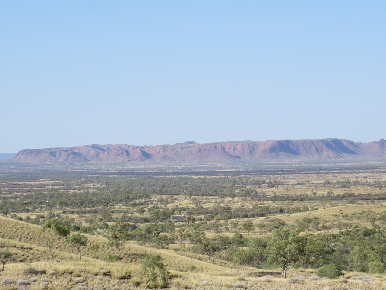
We leave Alice Springs and head to the East MacDonnell ranges. Our base will be Trephina gorge and we will drive to N'Dhale gorge and Arttunga goldfields and on to Ruby gap.
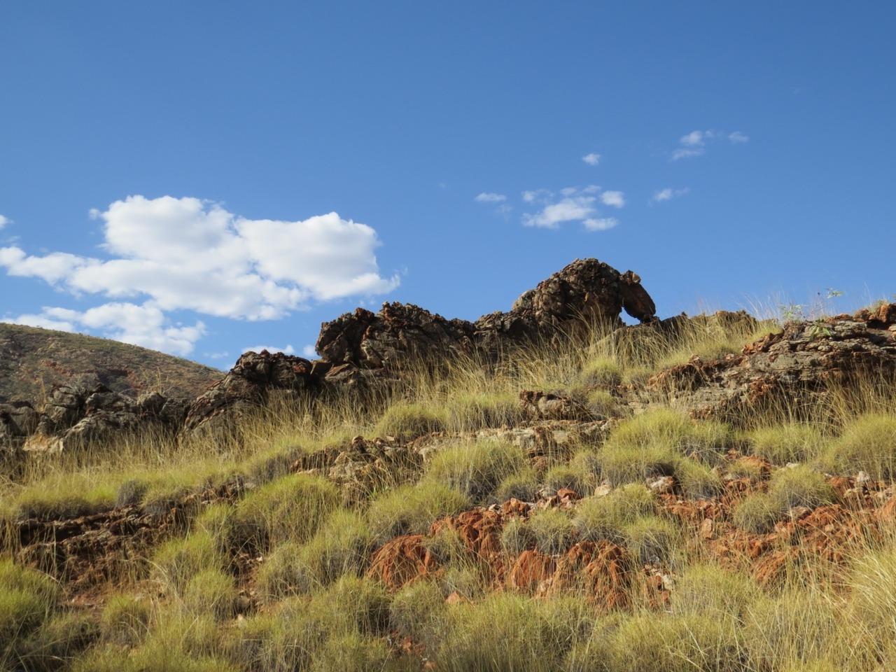
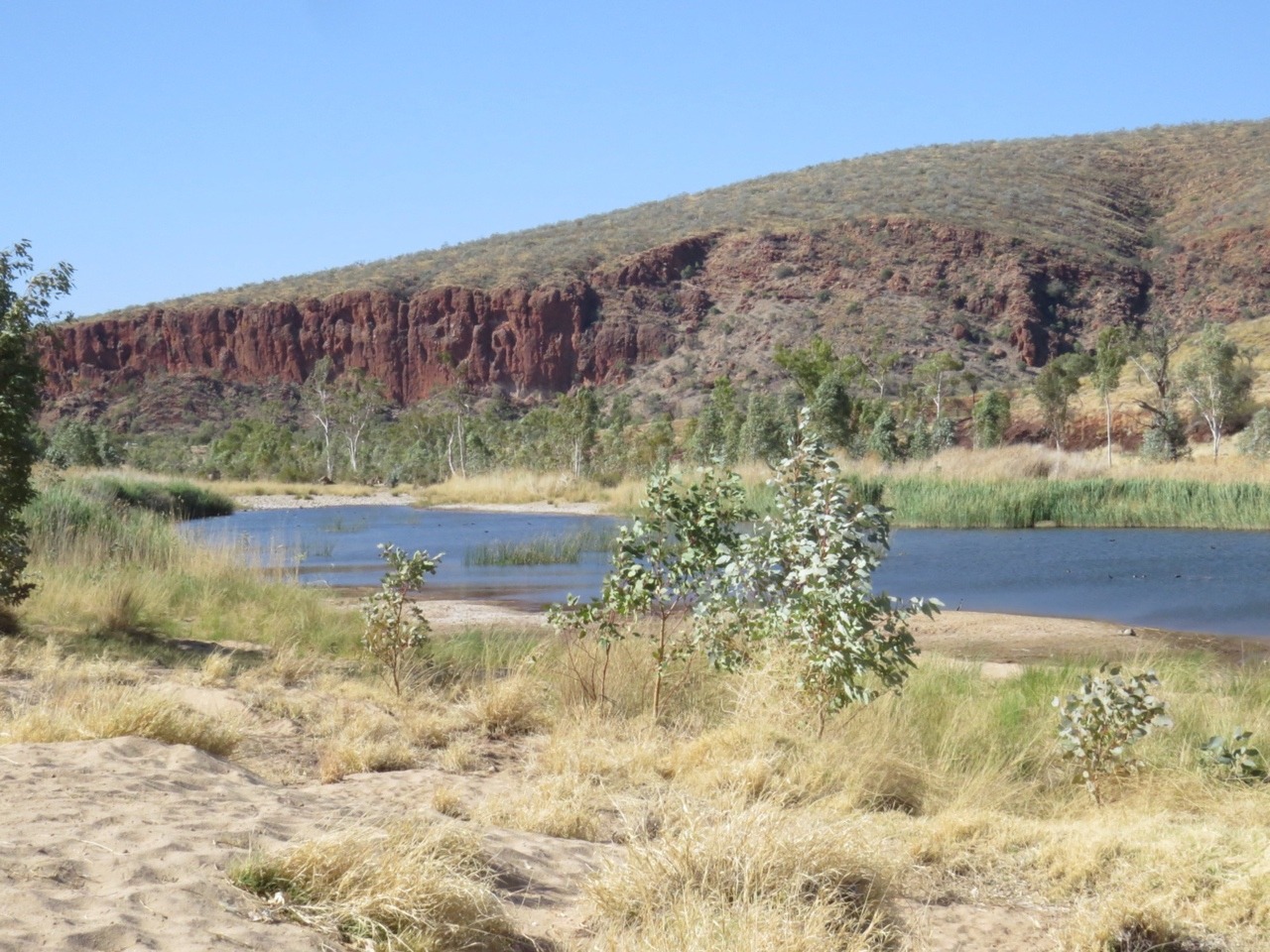
Trephina gorge has sheer quartzite cliffs with sandy creek beds.
There is no water in the creek so we can not swim here but we do walk the gorge from the camp ground . We could have walked along the top of the gorge to a waterhole but it is maybe 15km to drive there from the camp ground and a lot longer walking along the ridges. So you can guess what we did in this heat.
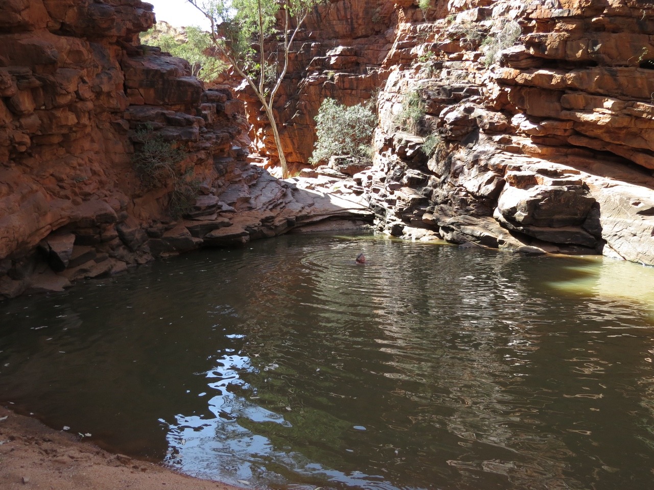
John Hayes Rockhole has still got plenty of water. The road in is a definite 4 wheel drive road and still has a walk from the car park to the water hole the water is warm at the sides but gets quite cold as it gets deeper, like all these water holes. No one is around just us so I go skinny dipping to save carrying wet clothes out, have not done this for awhile.
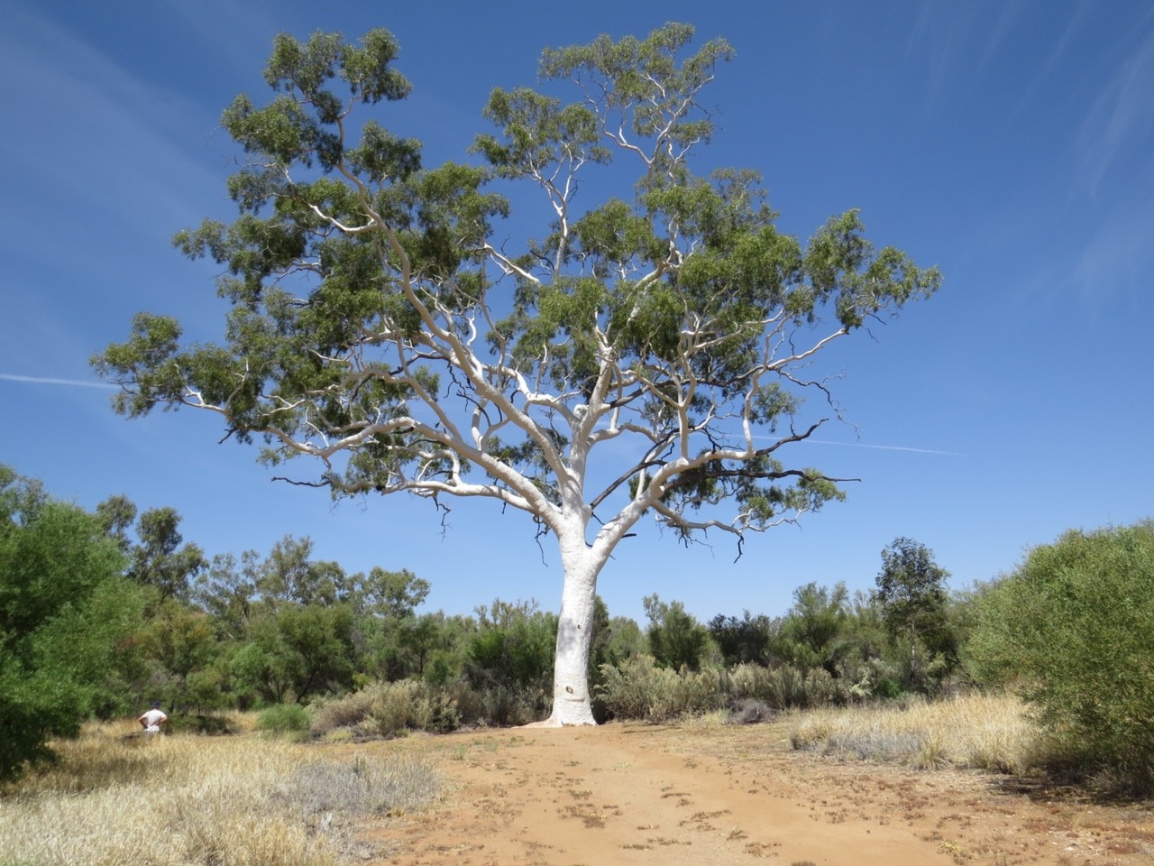
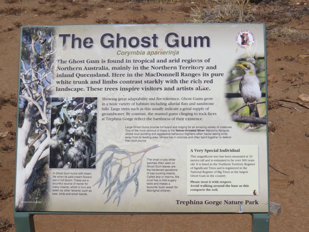
We also stop to look at a 300 year old ghost gum, pretty impressive and still in good condition.
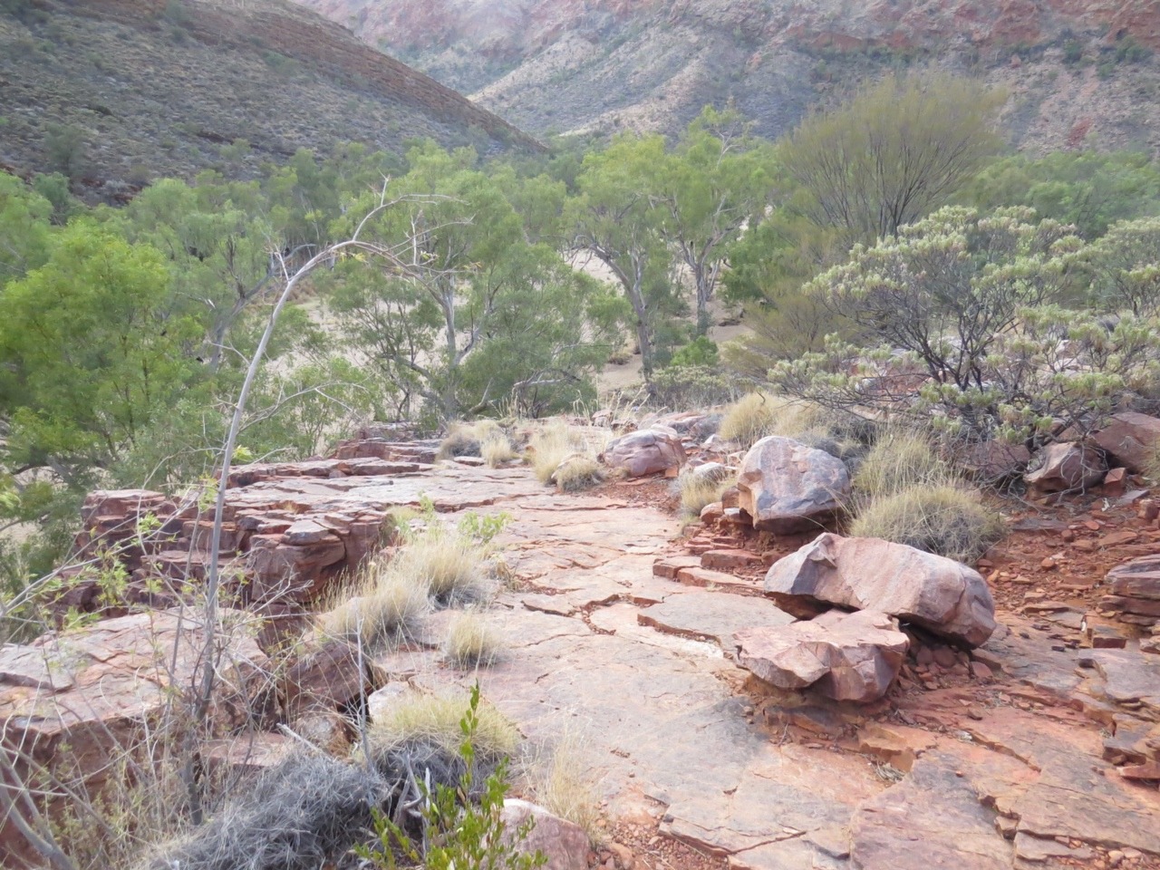
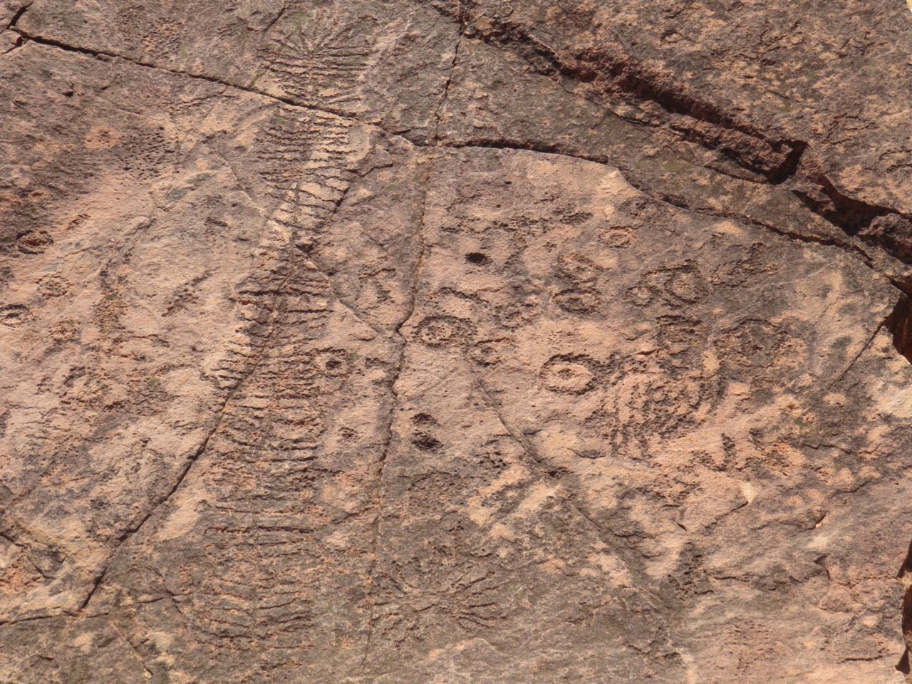
The next day is a trip to N'Dhale gorge nature park. This is an important site for over 5,900 individual petroglyphs/ rock engravings, as well as several art and shelter sites. 2 styles of petroglyphs from 2 time periods are here, some from 10,000 years ago and some just 2,000 years old. These are made by sharp stones which a hit with another rock.
There are also 2 plants found here and no where else, both are frost sensitive. They are Hayes wattle -acacia undoolyana and a white cypress pine -collitris glaucophylla. To get in here you have to drive through Ross river station along the Binns track.
This track crosses the Ross river a few times which is mostly dry at the moment with springs still flowing which the stock drink.
Are trip in here takes nearly all day so the next day is taken up with Arttunga gold fields and old mining town and out to Ruby gap.
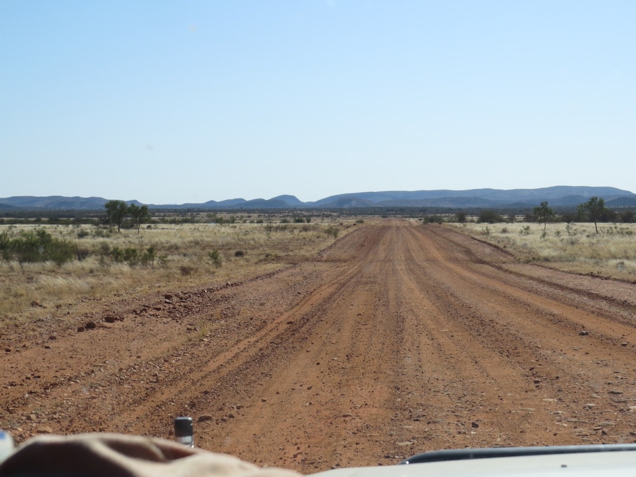
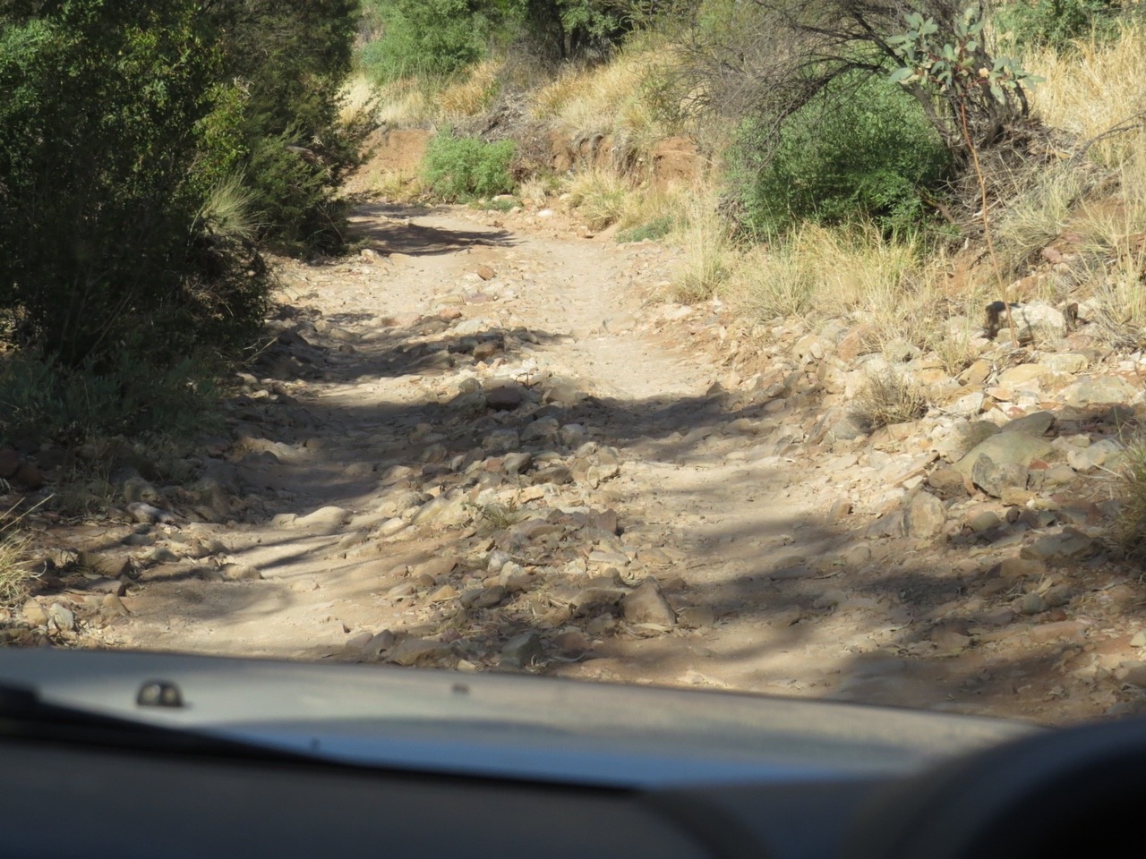
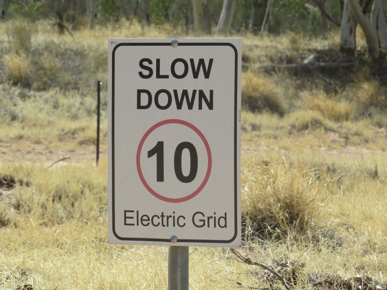
A high clearance vehicle is needed to get in to Ruby gap and 3 hours of very slow going we finnally get to the park. We still have 4km of very sandy river bed driving to get to camp area. You just start driving in very loose deep sand when you have to stop to go through an electric grid and then a gate . Stopping in this sand is not good you get bogged very easy so we decide to go back to start of the river bed and have lunch up on the bank. We are carrying our distress beacon the Epirb
and UHF radio but do not have a satellite phone so because we are in the middle of the mountain range and at the end of this road ,we go no further. The electric fence are to keep feral animals out of the park as it has been made into a nature park to protect the wildlife in it. We did see some animal tracks but not there owners , lizards, snakes dingo , wallaby, and small mammals maybe native rats or mice.
In March 1886 explorer David Lindsay found what he thought were rubies in the Hale river bed, by 1887 there was over 200 people here mining for rubies. Then gold was found in Arttunga 45kms away and the goldfields town was established.
In 1888 the rubies where found to be high grade garnets , not as valuable and the ruby boom collapsed. So we did some river bed searching for a couple of hours and did not find garnets just the rocks they are found with.
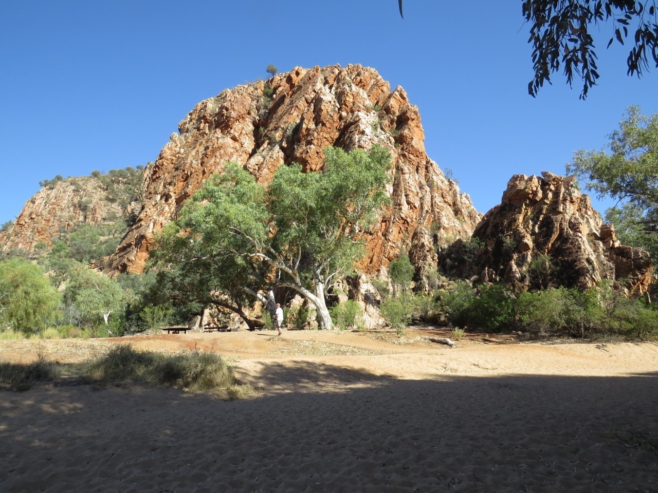
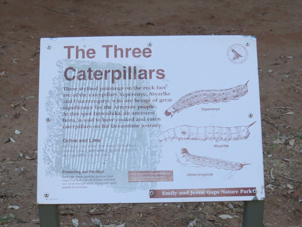
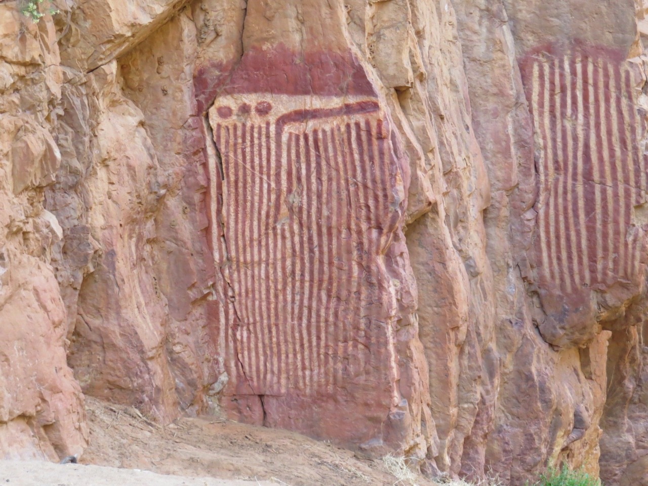
The next day we head towards Alice Springs stopping at Emily and Jesse gaps. These contain Aboriginal paintings of the Dreamtime Caterpillar trail that made these gaps.
We only stop for fuel , milk, bread and some more fruit on our way through Alice to the West MacDonnell ranges.
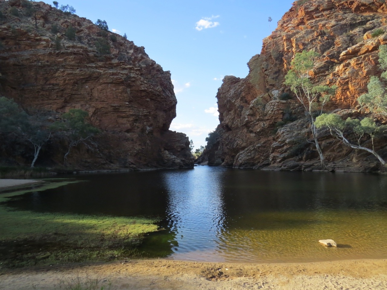
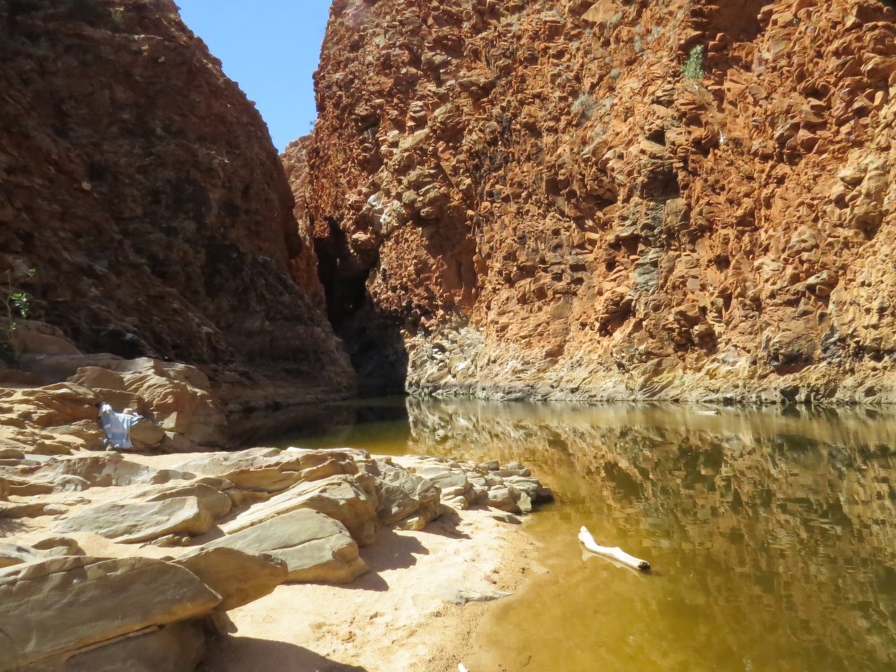
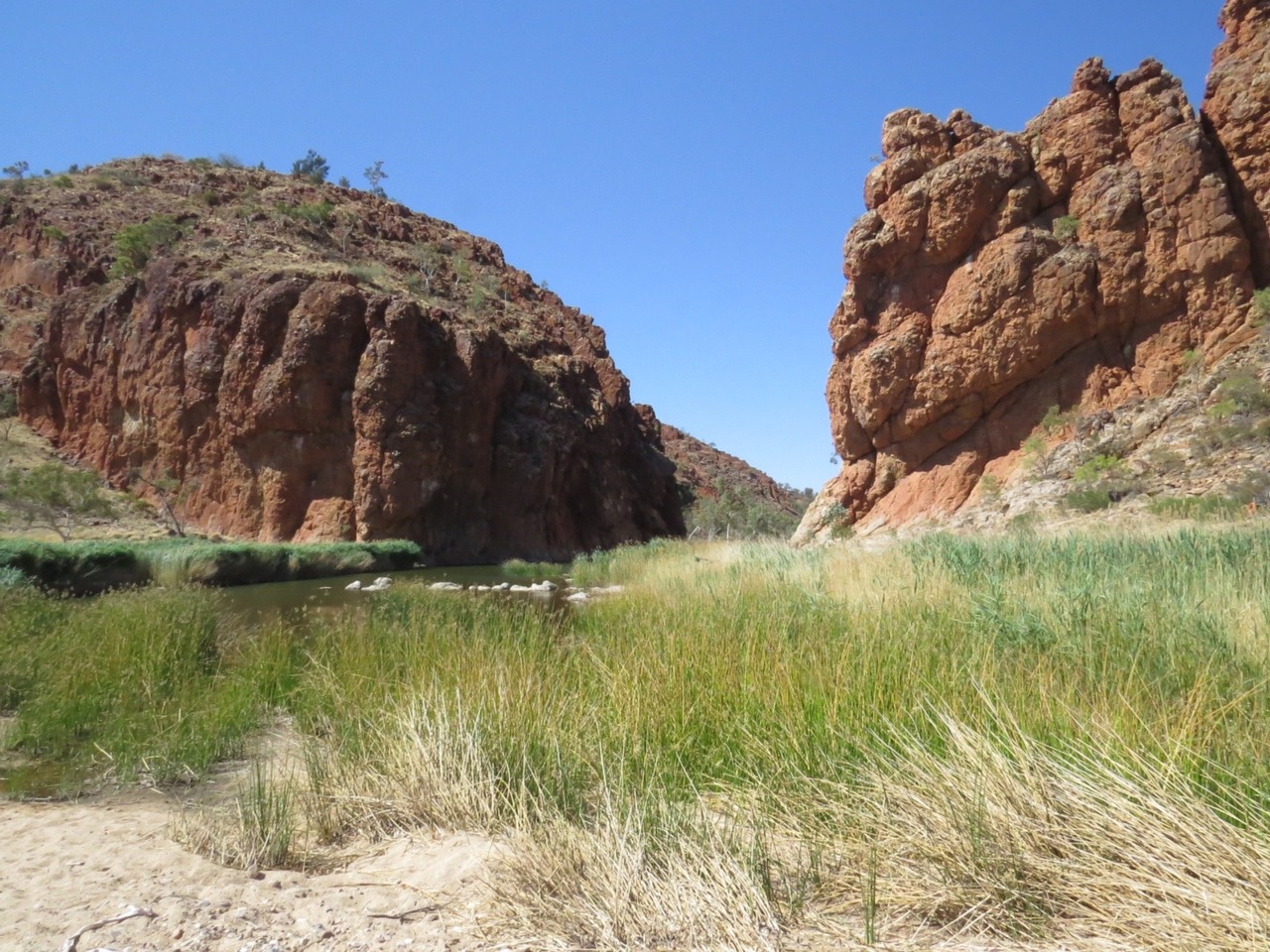
That night we pull up at Ellery creek big hole, a water hole with a camp site part of the National park still., 80km west of Alice springs.
Ellery Creek big hole has 2km dirt road drive in which is not too bad. Ellery creek cuts through the MacDonnell ranges here and when the creek is not running a permanent big waterhole remains. The swimming waterhole is 200mt from the camping area and we cool off in here a few times during the day and evening. We walk along the track around the area and back to the creek and of course go for a swim.
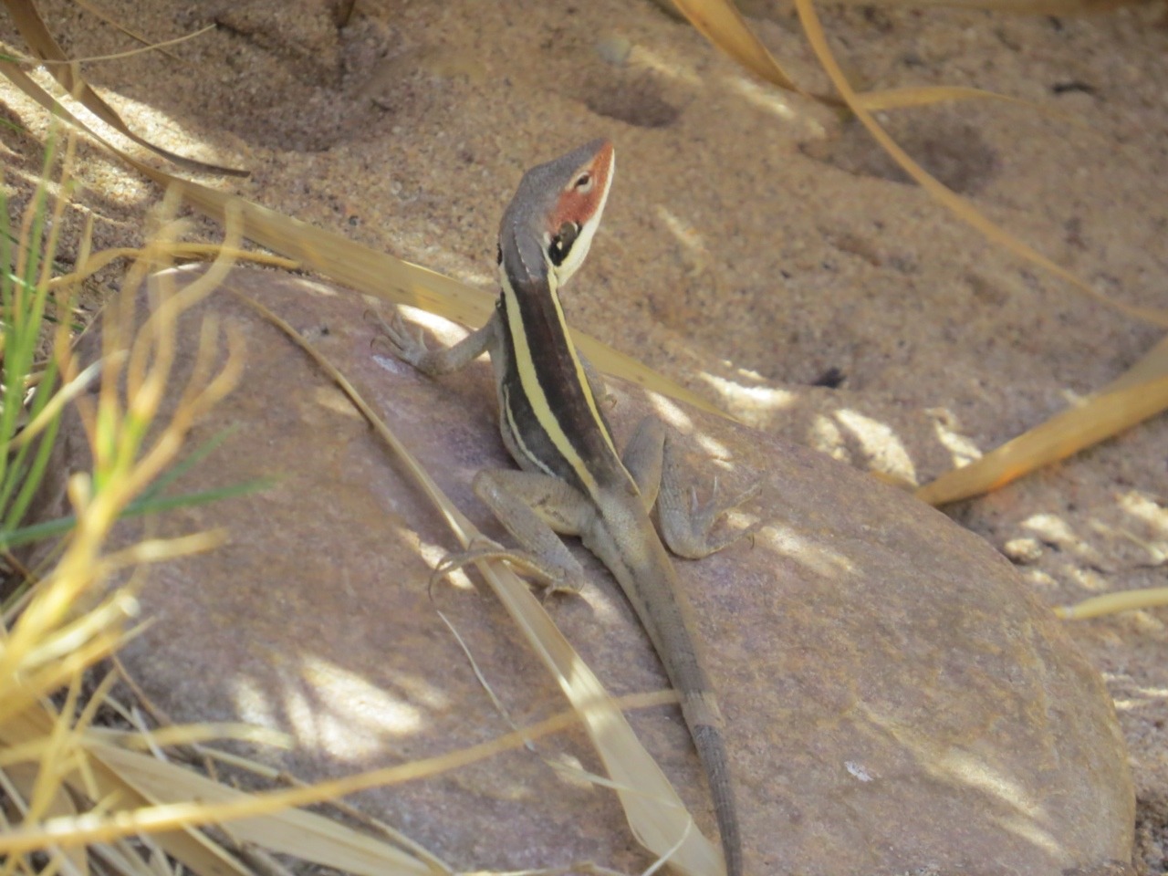
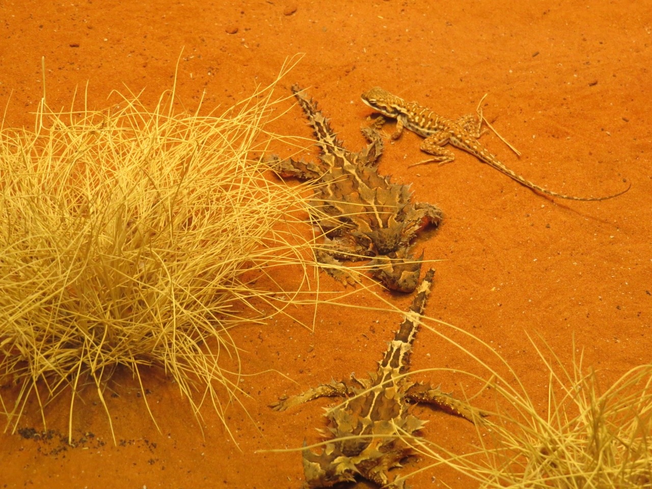
The dingos could be heard during the night but we did not see them , we did find long nosed dragons and a Australian hobby in the tree outside the van before we left.
On our way to Redbank gorge we stop at the Ochre pits. These slate and shale beds where tipped up vertically thousands of years ago. Weathering of the siltstone and shale has caused the rock to change chemically, the iron oxides combining with the water and staining other mineral particles of the rock. It is these rocks the Aboriginals grind up to make dyes for painting. We are only allowed to a lookout not into the pits.
We get to Redbank gorge and find a 5km dirt road in to the first campground which the caravan can make , but not to the next camp ground or to the gorge entrance. We had intended to park here and use as a base to drive to all the other gorges and valleys we wanted to see, so thats ok. The only place big enough for us is in one of the tour bus camping sites and thats ok too as nobody is here.
This is 156km west of Alice Springs and is a narrow gorge and chasm at the base of Mt Sonder with a permanent water hole for swimming and is a refuge for some animals and bats. After setting up we drive the couple of kilometres to the start of the gorge, it is a hard 2km walk into the chasm and swimming from here. Carrying our flippers and noodles as they say this water is really cold and a floatation device is advised because of hypothermia.
We were very hot after the walk in with the last bit over rocks, so the water did feel very cold when we first got in . We wanted to swim through the chasm so we did put on our flippers and use our noodles incase we did get too cold. The water is very deep and to get through the chasm to the next bit of the waterhole you have to climb over some rocks and I just could not get me up the slippery rocks from deep water with no foot or hand holds. When the rain falls you would be able to swim through but it was not to be even with Larry climbing up first and taking my gear from me my knee and hands were cold and not working perfectly.
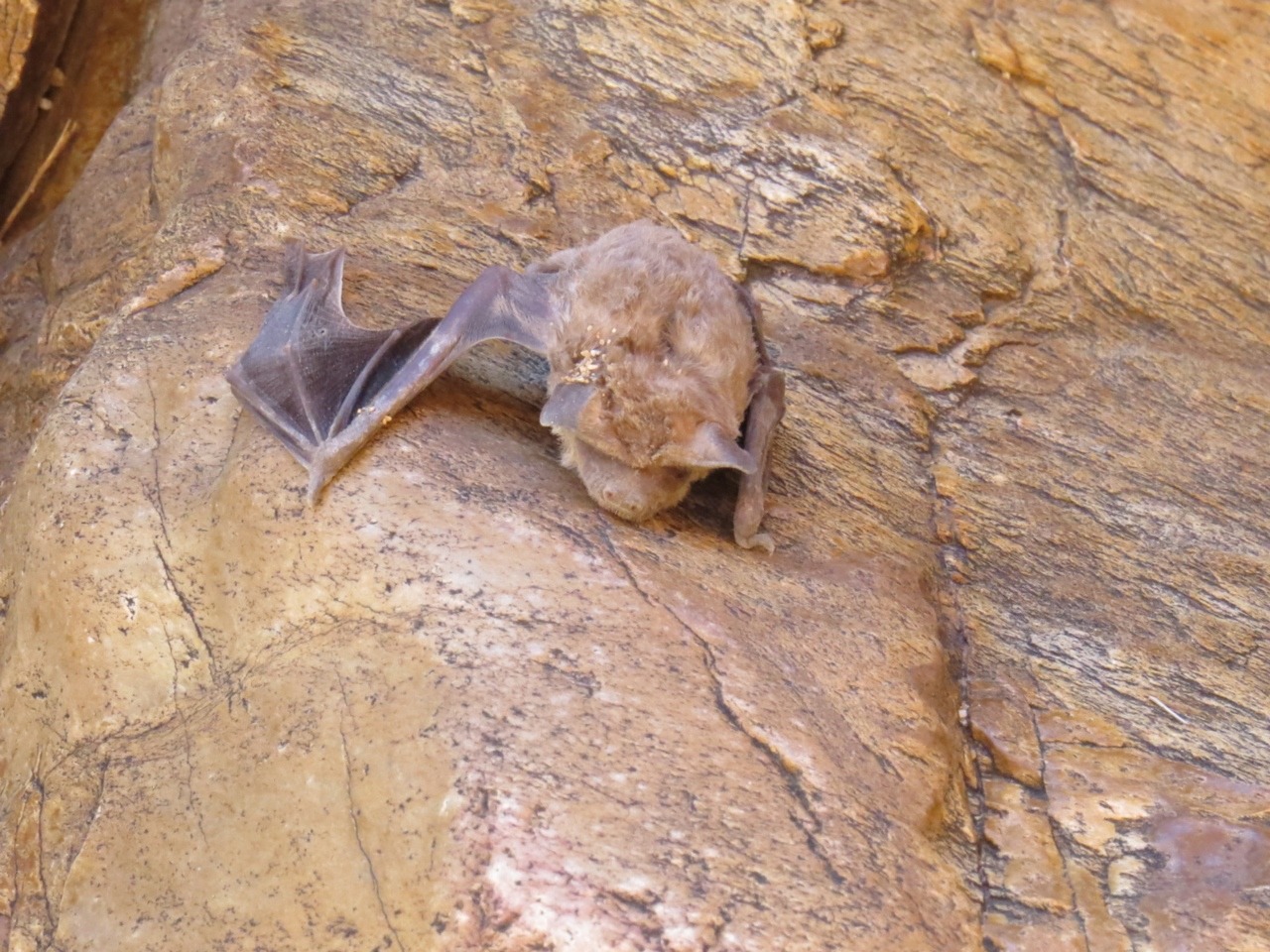
We did have a good swim though and I found a bat that probably died that day trying to catch insects above the water, got too low and was not strong enough to lift out of the water. Found out he was a Hills sheath-tail bat, one of the protected here.
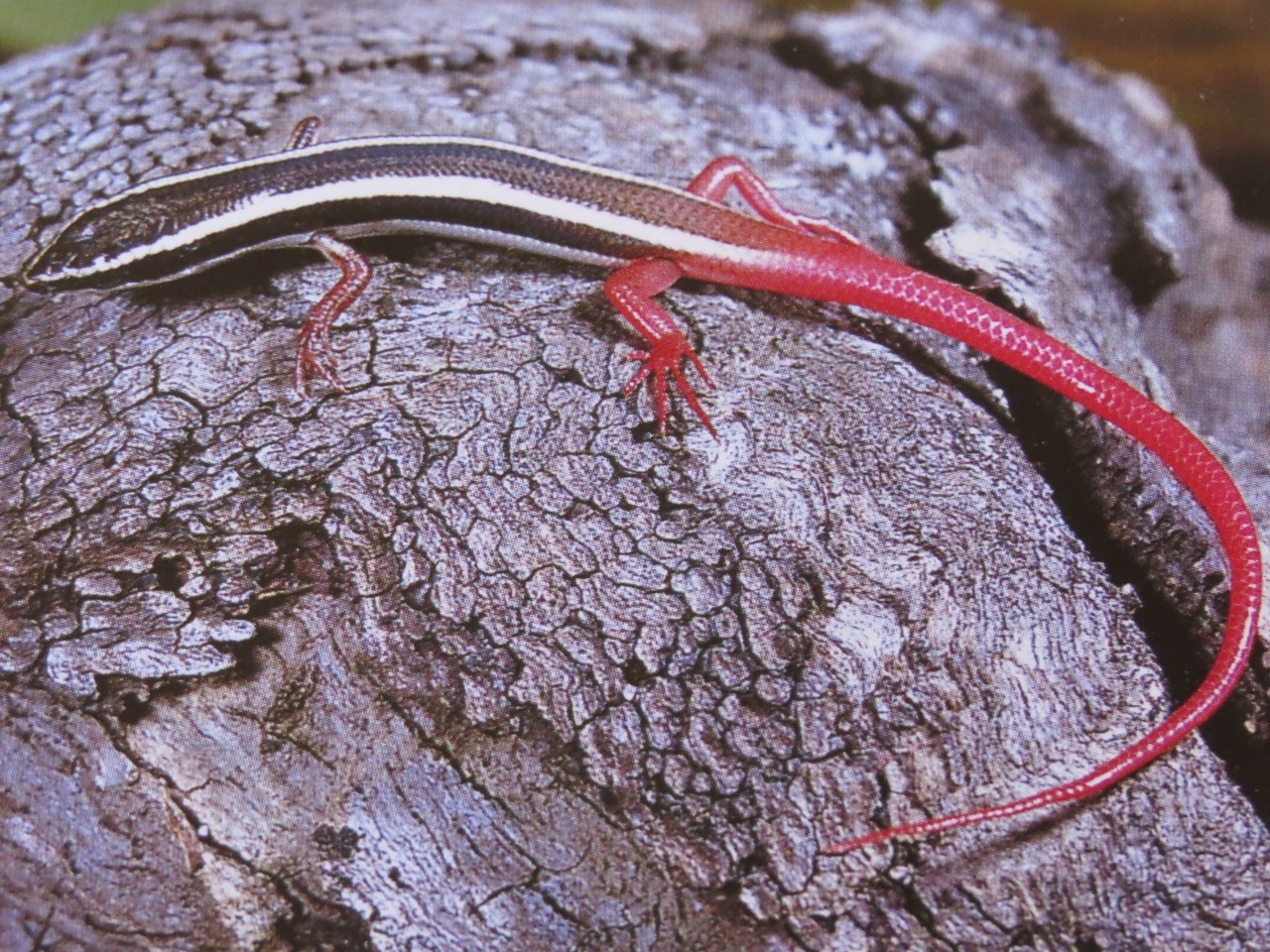
We found a fire tail lizard on the walk back to the car.
We will not be walking back in here again as our days will be taken up with other things and this is not a quick walk.
One of our days was taken up with the first stop at Tylers Pass lookout . We did not have to walk to this one it is a drive up to lookout. It looks out over to Goose Bluff conservation park where we are heading next.
Gosse bluff is the impact site of a frozen ball of carbon dioxide, somewhere between 130 and 142 million years ago from outer space. This is a comet of about 600 metres wide that crashed into the earth and rock from 6km down got blasted to the surface forming a ring of hills. The original crater was about 20km across but over the years erosion has made it look like this. Photo from satellite.
We walk in as far as we are allowed and take photos.
Then its on to the Finke River park some 42 km of dirt road from the crater to the start of the park, thats why this without the caravan and because it gets worse. We see mobs of wild horses on the way. There is a electric grid to stop the wild horses getting through into the park.
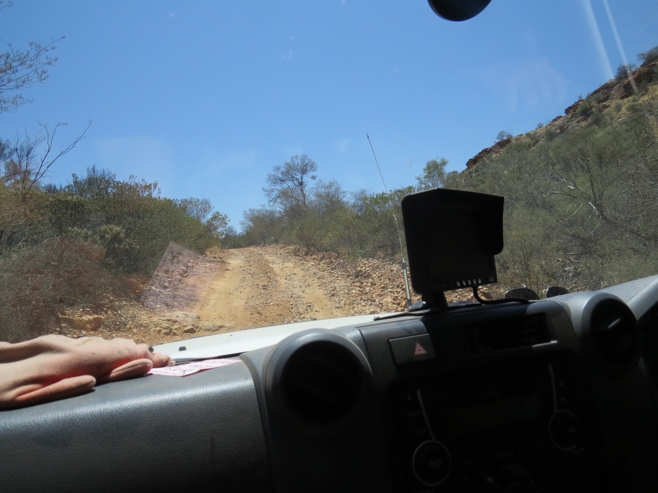
We are heading into Palm Valley which is down even worse roads with the last bit as sever off road driving, with high clearance vehicles only.
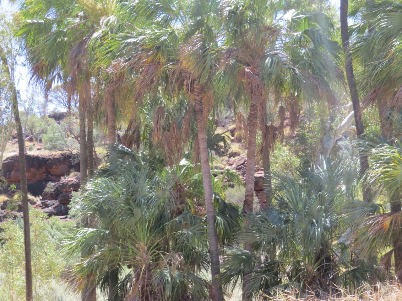
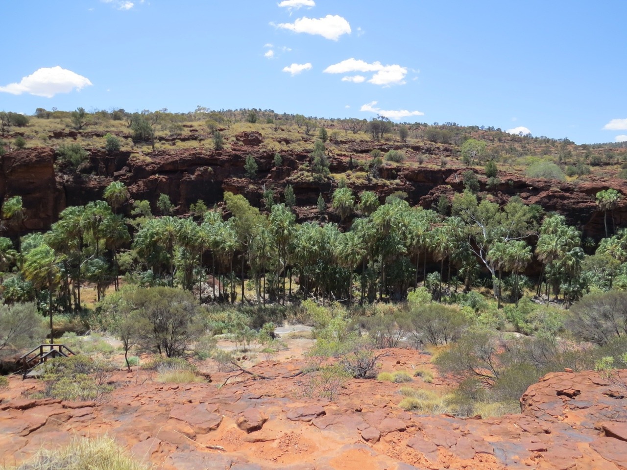
We still want to get in here as Palm valley provides refuge for around 3000 Red cabbage palms, livistona mariae , found no where else in the world. There are also 22 other rare and 12 classified as relict plants. Melaleuca trichostachya and Pimelia interioris are just two of these.
To get in here from start of park is 18km off road dirt road then there is a further 4-6km along the river bed across rocks and boulders, classified as severe off road . We find some cars have gone halfway and the people walking , but even when you get there you still have a 2km walk in Palm valley. We drive in slowly with no hassles we do see some boulders with big gouge marks in them and here some cars scrapping along.
All is good we get there and find the walk and you can see the red cabbage palms but you can not get too close as this would damage the root system and any seeds in the ground.
The layers of rock in the region store water like sponges, this water seeps into the valley floor and creek bed . Not much water is visible but it is all just under the surface and only in this area of palm creek and valley, making a different environment and a safe one from fire and most people for these endangered plants to live.
We are hot and we still have to get out of here and then drive the 2 hours on the other dirt road back
to the caravan at Redbank gorge and no swim .
We slept well and the last day here we visited Mt Sonder lookout and the part of the Finke river it overlooks. There is a good bush camp in there we would have liked next to the water but no caravans can get in.
Across the other side of the road from here is the entrance into Glen Helen gorge so we went in here to the park day use area the rest is part of a station and commercial resort.
We walked along into the gorge and found more lizards and should have gone swimming in here but we had decided to go to Orminston gorge for a swim. We did consider staying at Orminston gorge at one time but it a little bit touristy with a kiosk and cafe. We parked and walked the 200mtres into swimming area –its waterhole left on the dry river bed. It was a bit of a let down with not much of an area left to swim , it would be good a little early in the season. We cooled off and went back to the caravan.
All this area was part of the shallow inland sea millions of years ago and the main river now is the Finke with its permanent waterholes along it. This river is said to be 350 million years old and one of the oldest rivers in the world.
After our trip in the West Macdonnell ranges we headed back to Alice springs but not without our last stay at Ellery Creek big hole. Here we swam as soon as we got there and again late afternoon and again in the morning before leaving. On the afternoon swim we take the underwater camera with us , not to get photos in the water but to get photos from the other side of chasm looking back. The water is still too deep and cloudy for under water photos .
Back in Alice Springs and back to the same van pack so we can shop again and spend one day at the Desert park . We visited here a few years ago but wanted to go to the nocturnal house to see some of the animals we had not been able to find and watch the free flying bird show again. We did think about their night time tour but this is what is out running free in the hills is what you see nothing is for sure , so the glass nocturnal cages would show more variety. It would have been better in the wild but at $44 each against $37 for both of us during the day to see more.
Tomorrow/ Thursday 22 oct we head south again but still have a couple of stops, big stops like Kings Canyon, The Olga’s and what was once called Ayers rock.
East and west McDonnell Ranges and Alice Springs
Thursday, October 22, 2015
 Alice Springs, Northern Territory, Australia

Other Entries
-
Sep 0646 days prior Kakadu National Park, Australia
 -
Sep 2329 days prior
Mataranka, Australia -
Oct 22
Alice Springs, Australia -
Nov 0110 days later
Uluru-Kata Tjuta National Park, Australia -
Nov 2332 days later
Cameron Corner , Australia -
Mar 30160 days later
Moree, Australia -
Apr 17178 days later
Mareeba, Australia -
Apr 22183 days later
Mt. Carbine , Australia -
May 15206 days later
Seisia / loyalty beach, Australia -
Jun 01223 days later
Cooktown, Australia -
Jun 18240 days later
Mareeba, Australia -
Jul 10262 days later
Normanton, Australia -
Aug 01284 days later
Julia Creek, Australia -
Aug 28311 days later
Finch Hatton, Australia -
Sep 16330 days later
Bundaberg, Australia -
Oct 12356 days later
Warwick, Australia -
Nov 05380 days later
Port Stephens, Australia -
Nov 30405 days later
Tilba Tilba, Australia -
Jan 31467 days later
Benalla, Australia -
Feb 23490 days later
Ceduna, Australia -
Mar 10505 days later
Drummond Cove, Australia

2025-05-22