 Miles, Queensland, Australia
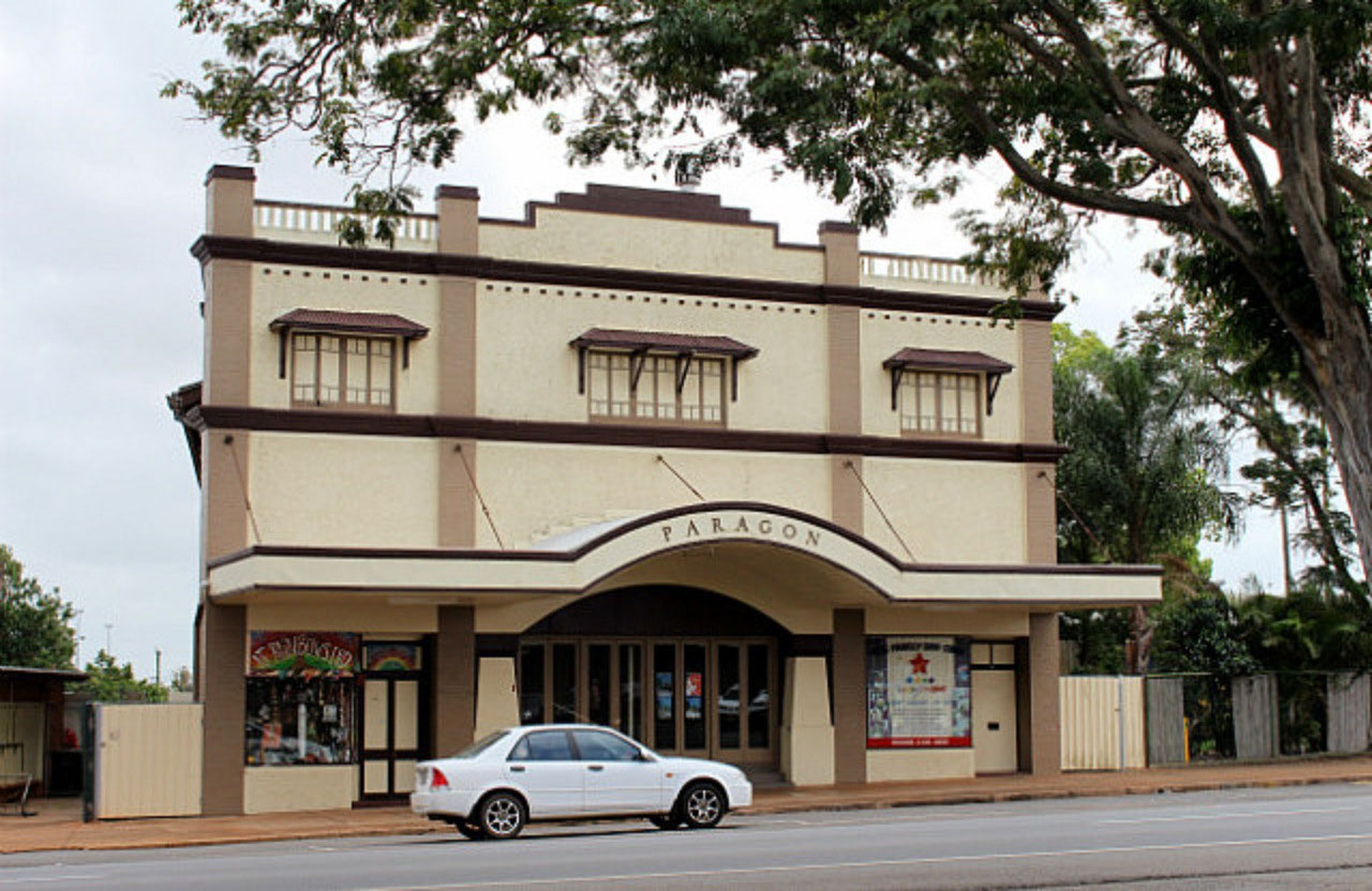
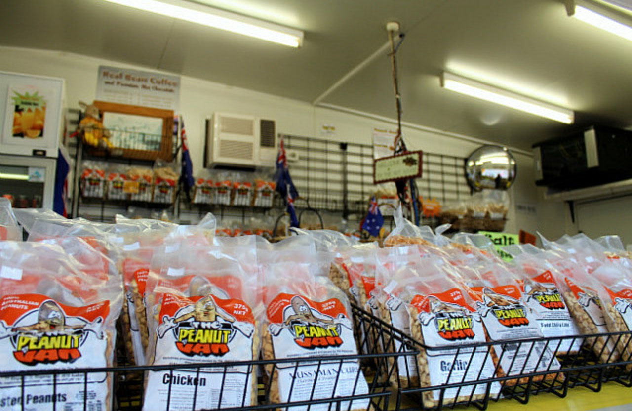
We left Bundaberg by 8.00am despite the fact that we had decided last night that there was no rush! We were awake, so it was 'Get up, organised and on the track'. Our first stop was Childers, only 60kms from Bundaberg, travelling on the 'Isis Highway' and then out onto the Bruce again for 6kms. We were there by 8.40 and as the Information Centre in the Palace Hotel building was not open until 9, we did our own 'Heritage Walk' down the street to the 'Peanut Van'. We are just loving the Queensland peanuts. The ones that Pete has really taken a liking to are not as healthy as others, but they are very nice! The ones we purchased today are processed in Kingaroy, which we will be travelling through later on.
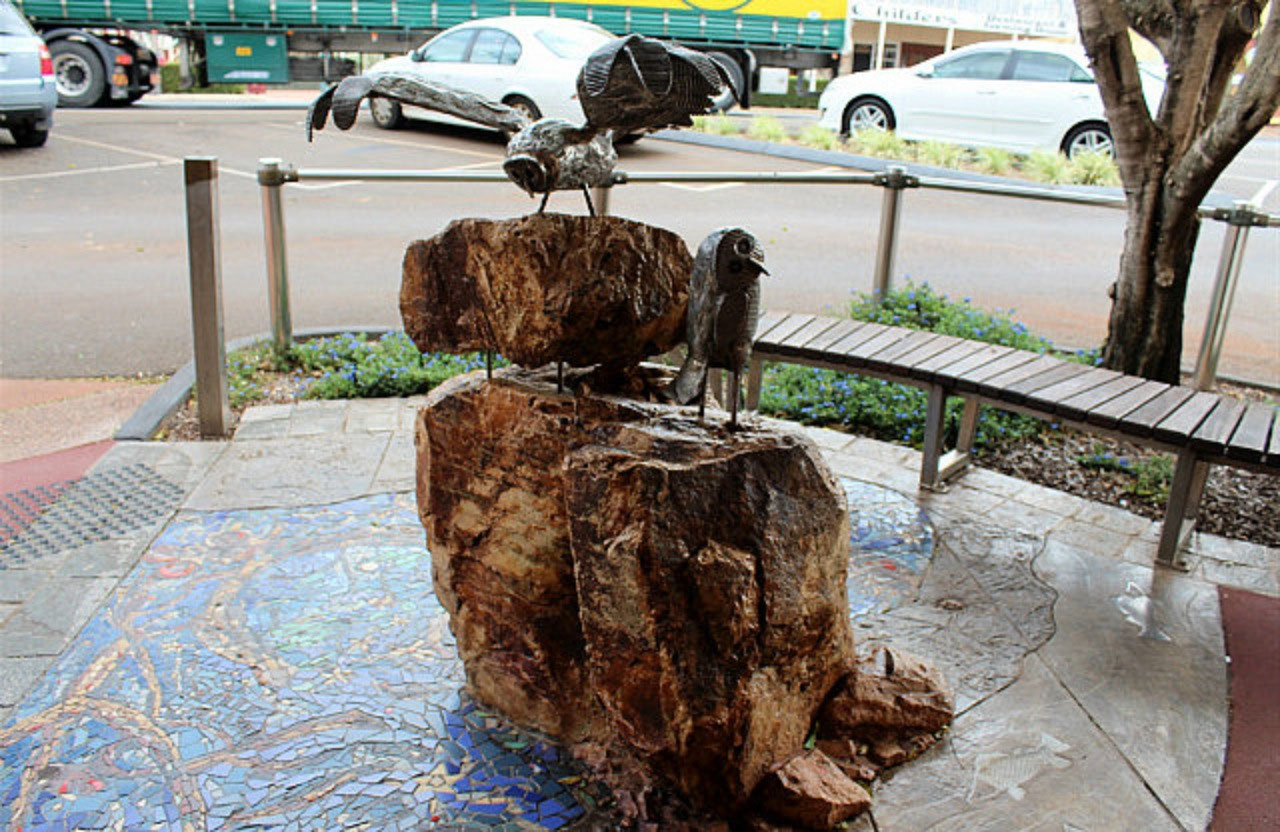
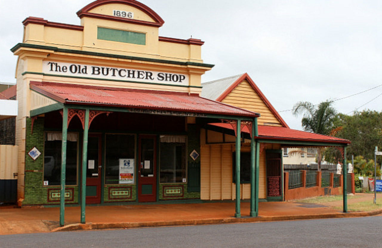
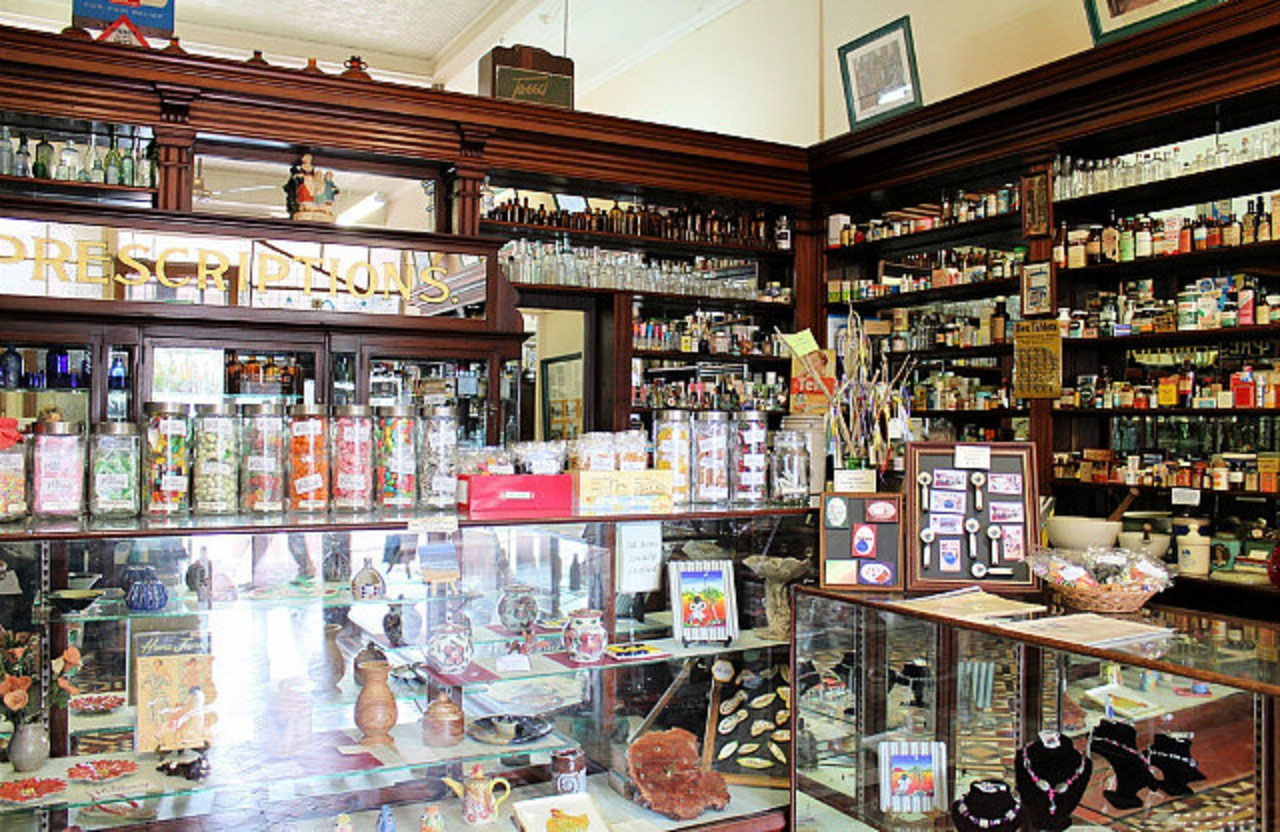
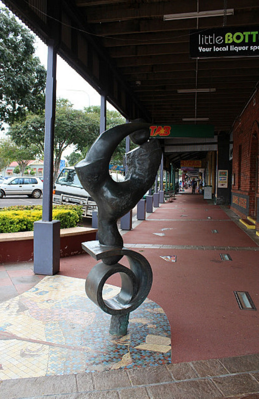
Childers: This is a 'Queensland Heritage Listed Town'. A must see is the Memorial to the 15 backpackers who lost their lives in the hostel fire in June 2000. Only 3 of the 15 were Australians and two were twin sisters from Perth in WA. The 'Memorial Room' has been well done, but one leaves very moved and for us "Somewhat Disturbed'! It wasn't that long ago, and why was a building in the Main Street of the town, in the condition that it was, at that time? One questions whether it should have been available for accommodation. I've looked at a couple of bits on the web and I can remember the controversy when the disaster was constantly on the news. Peter and I have reflected on the times when hard decisions have had to be made, when one is in responsible positions. The brochure that we picked up from the Info Centre only refers to the fella that was charged with lighting the fire. There is nothing about there being no windows in rooms and exit doors being barred up. The man charged, Robert Long age 37, was sentenced to life imprisonment, but will be eligible for parole in 2022. Doesn't seem right! Life sentence and a date that he will be eligible for parole being printed in a brochure. There are lovely heritage buildings in the main street of Childers. The 'Old Pharmacy' is now manned by volunteers and maintained by the 'Bundaberg Regional Council'. I had an interesting conversation with today's volunteer. There was no funding for staffing so the building would have closed a few years ago. Thanks to the help from some passionate volunteers, the building remains open to the public. The 'Old Pharmacy' has pharmaceutical displays and early medicines, including some from the last century. You are able do a self guided tour and there were jars of the old boiled lollies to purchase, tempting the sweetest tooth. Well we are still in sugar cane country.There are over 50 mosaics that have been placed along the Main Street of Childers. It is called 'The Pavement Gallery'. There are also a number of sculptures. The 'Boobook Owl' is the Aboriginal totem of the area. It is said they have spiritual and symbolic significance as do the local rocks on which the owls are perched. Alertness, caring and wisdom can be seen in the owl's expressions. There should have been more 'Boobook Owls' on Council in the late 1990's. Biggenden: Through this town we travelled, still on the Isis Highway. The sign at the Service Station said 'Biggenden was the Shortcut to Everywhere'. We can see mountains, so hopefully the shortcut is a good one!As we travelled the inland country, there were a number of comments from the driver. We passed a very ordinary wheat crop, a very old air-seeder and lots of rocks heaped in the paddocks. "Unbelievable" he reckons. "Look at the bl...stones they have heaped up. One thing about it that don't need much fertiliser with all these volcanic rocks. They must be desperate to crop. Look at those rocks"!
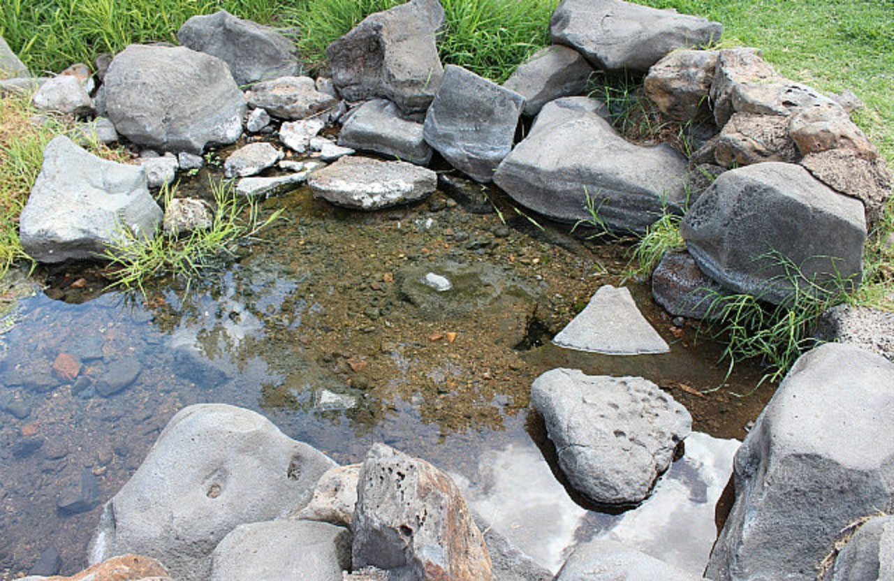
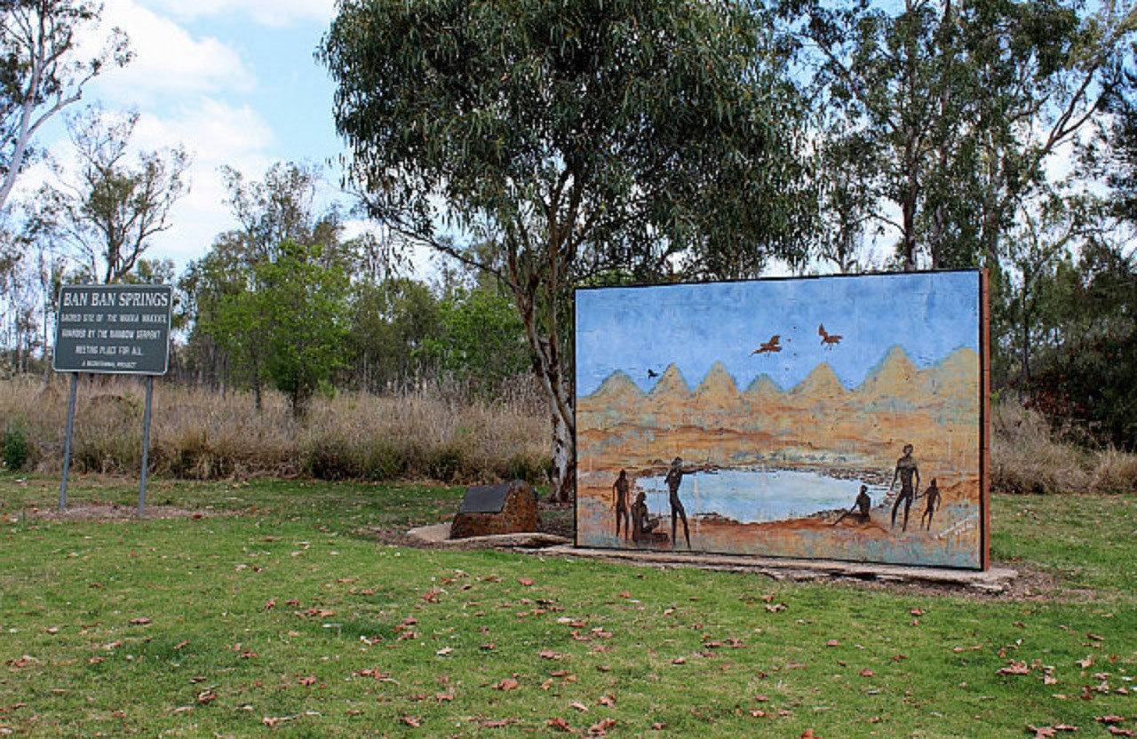
Ban Ban Springs: We turned onto the 'Burnett Highway' here and stopped for a look at the iconic spring and took some photos. There is an environmental project happening in this area between Local Government and Main Roads. Clearing land for farming many years ago has meant that many of the natural tree species of the area have been lost. There are remnant examples of endangered ecosystems and rare and threatened, vulnerable species in the rest area at Ban Ban Springs. The two bodies are working together to re-establish the area with quite a list of species. One could say "That the above is relevant to the drivers comments about farming this area"! ' Ban Ban' is one of the first sacred aboriginal sites to be officially recognised in Australia. The driver can't get over how desolate and dry the majority of the countryside is. He reckons there must have been fires, two years in a row. So many of the trees on the hills are dead. We saw a lot of deer in a paddock, but they were on the wrong side of the car for a photo. Lucerne is being cut for hay. It looks as though it is all grazing country and as we got closer to Goomeri we saw more feed lots on the farms. It would appear they grow the lucerne hay for finishing the cattle.Goomeri: A small town and they have a 'Pumpkin Festival' in the town each year. These country towns are really struggling. Lots of old, empty buildings as you travel through the main street of the town. We turned off the 'Burnett Highway' and onto the 'Bunya Highway' at Goomeri. We've left the mountains behind, so it has been a good choice on roads to get through the Great Dividing Range.
Murgon: Not far from Goomier and a much nicer looking town. We must be in Bjelke-Petersen country because there is a dam named after Joe in this area and a park in Murgon in honour of Flo.
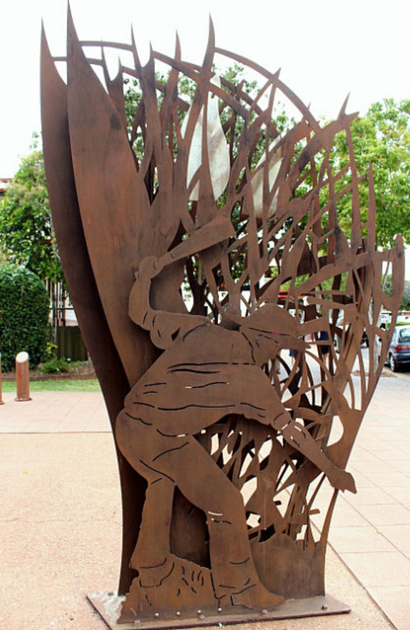
Wondai: Lunch was in the park here. It looks like there is a lovely little Timber Museum in this town. The building and sculptures out the front nearly won us over to stop and visit, but only a snap out the window today. We are heading west! We didn't travel far before another little town popped up. Memerambi had all these relatively new brick homes on the side of the highway and not one of them had inhabitants! Kingaroy: This is the major service town for the 'South Burnett Region of Queensland'. When we came into Kingaroy there was a sign saying it was the 'Peanut and Navy Bean Capital of Australia'. Then on the other side of town was the 'Bean Growers Australia' factory and storage facilities established in 1964. Never heard of 'Navy Beans'! So some more research. The soils look very rich, but can't say we have seen much production. Must be off the highway, which is so often the case.Bean research has found the following: The navy bean got its current popular name because it was a staple food of the United States Navy in the early 20th century. These small white
beans are perfect for making baked beans.
We found the 'Bunya Mountains' 50 kms from Dalby, so we still had some to go through. Jack can't get it that easy Sambo! These ones were more like hills after what we've tackled over the last six weeks and earlier in the year. I think I blogged at that time that Peter said "Coming down the mountain was exhilarating"! He didn't find going up the mountain to Canberra exhilarating!Bell: At 3.00pm the little town of Bell nearly tempted us to stop when the caravan park was called the 'Bells and Whistles CP'.Dalby: Arrived in this town about 3.30pm. The soil in the area is rich black volcanic soil. The region is renowned as a rich agricultural area, growing crops such as cotton, sorghum, wheat,
barley, sunflowers, chickpeas, mung beans and corn, as well as the production of lamb, beef and pork. Diversification into the fish, hemp and native flower markets has occurred in recent times.
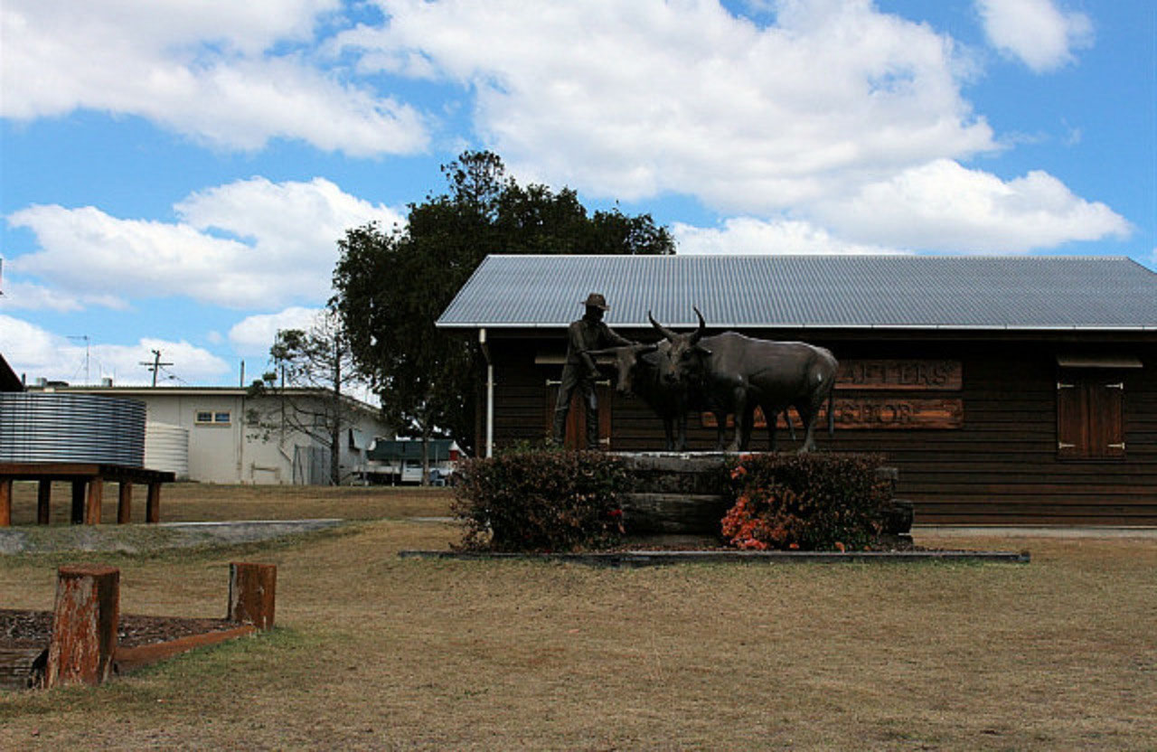
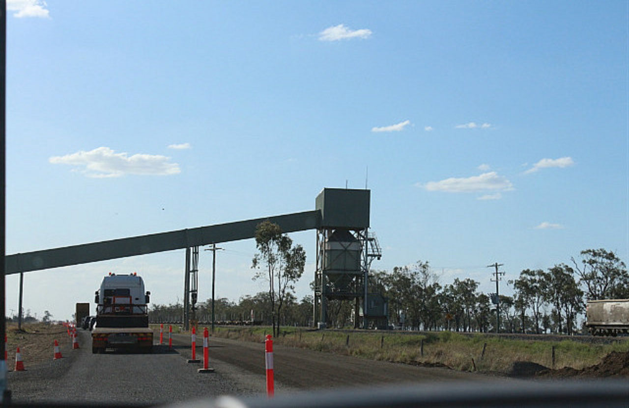
Driver comments "It's unbelievably flat! You could almost eat that soil". On the edge of town there is a 'Big Rural Training Precinct' with lots of small accommodation cottages scattered through the bush land. We fueled up here and were surprised at the size of the town. Big grain receival point too and there were some very, very nice crops. The variety growing is not very tall though. Driver comment "Look at that wheat crop"! And "Beautiful Highway. Look at the traffic and the trucks. It needs to be a good highway too". We are now travelling on the 'Warrego Highway'. Our 5th different highway today. There are huge dams everywhere. Driver is baffled and reckons the dams are only storage, not catchment. More research needed. Now we've got a coal train beside us and a loading facility going over the highway. It is all happening! We did find out later that the dams are actually storage and catchment. They are used to irrigate the paddocks. The paddocks are prepared with just enough slope for the water to be pumped into a large irrigation channel from which the water seeps gently down the smaller channels. When the crops need a drink, they pump the water to them! That's the way to go! No doubt very expensive to set up, so the yields do need to be good!Some paddocks were being prepared for planting. We have seen some irrigation channels on the side of the road. Some paddocks are very green, some nearly ready to be harvested and then we came across a paddock that had been harvested some time ago. The seasons are very different over here. We still haven't been able to establish when their farming season actually is. Maybe we will find out in Roma.Chinchilla: The road didn't take long to deteriorate! Back to a 'Queensland Standard Road'. Quality of land and farming practices is also matching the road, as we got closer to Chinchilla. Chinchilla has a 'World Famous Melon Festival' in February. Well that was what the sign said 'World Famous'! There was a beautiful new Information Centre on the highway as we came out of the town.Columboola: We saw some of the coal seam gas wells at a little settlement called Columboola. Couldn't manage a snap through the trees, but hopefully we will see some more. Suddenly we came across the storage and service site for the construction of the gas pipeline, which is taking the gas from these wells to Gladstone. It is certainly a huge project.Miles: Finally at Miles we called it a day and pulled into the one and only caravan park in the town. We have travelled 513 kilometres today. We are certainly not going to be doing that distance too many days in a row. Especially on roads the condition of the ones we have been travelling today!We phoned Ella for her birthday and Nicole and the girls were on their way to Perth for a few days. Ella told us she is getting a new desk from IKEA. She will love that and the pressure will be on Dad to put it together for her. Ella is our real 'Arty' granddaughter. 14 photos
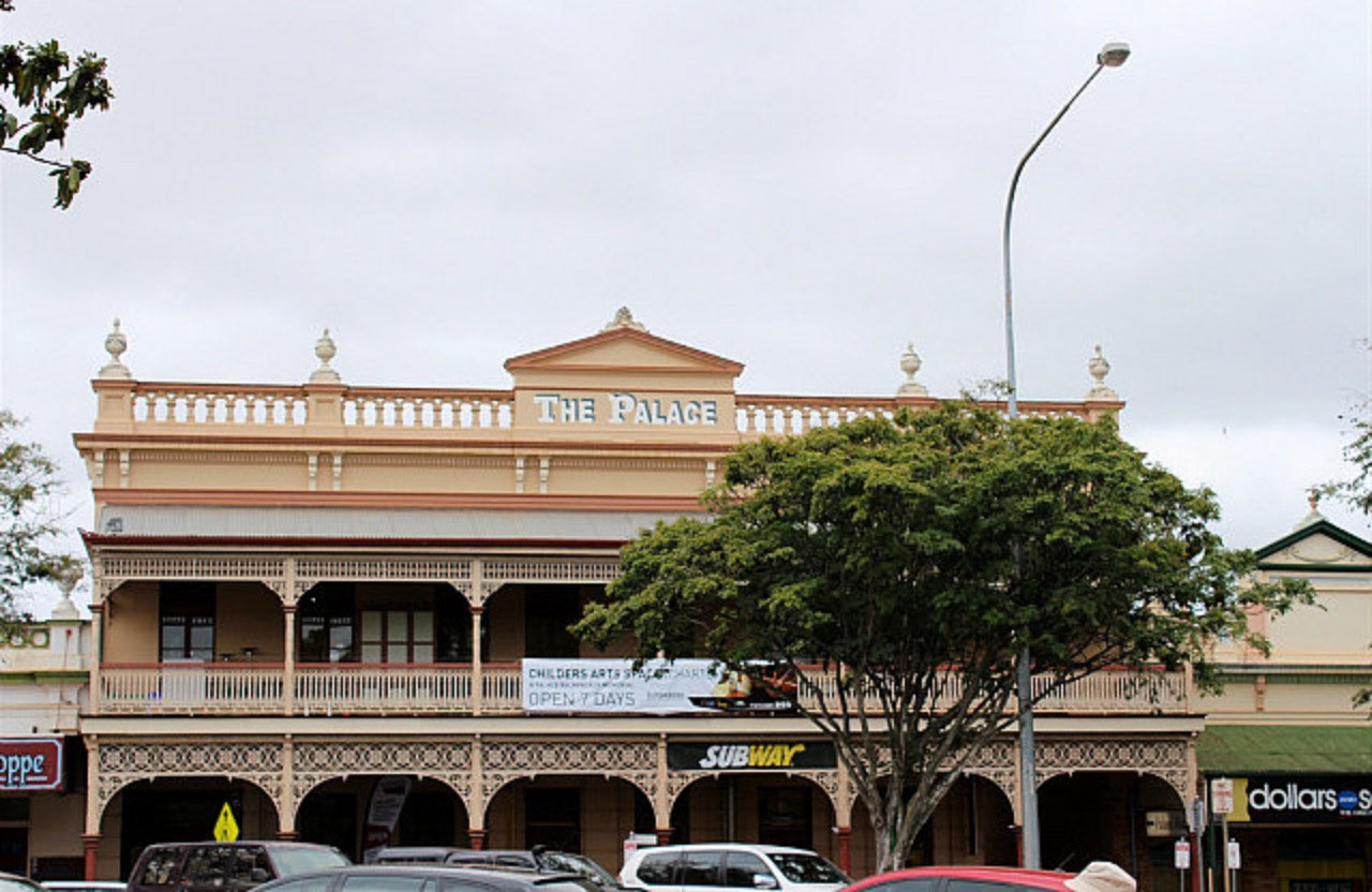
Childers: This is a 'Queensland Heritage Listed Town'. A must see is the Memorial to the 15 backpackers who lost their lives in the hostel fire in June 2000. Only 3 of the 15 were Australians and two were twin sisters from Perth in WA. The 'Memorial Room' has been well done, but one leaves very moved and for us "Somewhat Disturbed'! It wasn't that long ago, and why was a building in the Main Street of the town, in the condition that it was, at that time? One questions whether it should have been available for accommodation. I've looked at a couple of bits on the web and I can remember the controversy when the disaster was constantly on the news. Peter and I have reflected on the times when hard decisions have had to be made, when one is in responsible positions. The brochure that we picked up from the Info Centre only refers to the fella that was charged with lighting the fire. There is nothing about there being no windows in rooms and exit doors being barred up. The man charged, Robert Long age 37, was sentenced to life imprisonment, but will be eligible for parole in 2022. Doesn't seem right! Life sentence and a date that he will be eligible for parole being printed in a brochure. There are lovely heritage buildings in the main street of Childers. The 'Old Pharmacy' is now manned by volunteers and maintained by the 'Bundaberg Regional Council'. I had an interesting conversation with today's volunteer. There was no funding for staffing so the building would have closed a few years ago. Thanks to the help from some passionate volunteers, the building remains open to the public. The 'Old Pharmacy' has pharmaceutical displays and early medicines, including some from the last century. You are able do a self guided tour and there were jars of the old boiled lollies to purchase, tempting the sweetest tooth. Well we are still in sugar cane country.There are over 50 mosaics that have been placed along the Main Street of Childers. It is called 'The Pavement Gallery'. There are also a number of sculptures. The 'Boobook Owl' is the Aboriginal totem of the area. It is said they have spiritual and symbolic significance as do the local rocks on which the owls are perched. Alertness, caring and wisdom can be seen in the owl's expressions. There should have been more 'Boobook Owls' on Council in the late 1990's. Biggenden: Through this town we travelled, still on the Isis Highway. The sign at the Service Station said 'Biggenden was the Shortcut to Everywhere'. We can see mountains, so hopefully the shortcut is a good one!As we travelled the inland country, there were a number of comments from the driver. We passed a very ordinary wheat crop, a very old air-seeder and lots of rocks heaped in the paddocks. "Unbelievable" he reckons. "Look at the bl...stones they have heaped up. One thing about it that don't need much fertiliser with all these volcanic rocks. They must be desperate to crop. Look at those rocks"!
Ban Ban Springs: We turned onto the 'Burnett Highway' here and stopped for a look at the iconic spring and took some photos. There is an environmental project happening in this area between Local Government and Main Roads. Clearing land for farming many years ago has meant that many of the natural tree species of the area have been lost. There are remnant examples of endangered ecosystems and rare and threatened, vulnerable species in the rest area at Ban Ban Springs. The two bodies are working together to re-establish the area with quite a list of species. One could say "That the above is relevant to the drivers comments about farming this area"! ' Ban Ban' is one of the first sacred aboriginal sites to be officially recognised in Australia. The driver can't get over how desolate and dry the majority of the countryside is. He reckons there must have been fires, two years in a row. So many of the trees on the hills are dead. We saw a lot of deer in a paddock, but they were on the wrong side of the car for a photo. Lucerne is being cut for hay. It looks as though it is all grazing country and as we got closer to Goomeri we saw more feed lots on the farms. It would appear they grow the lucerne hay for finishing the cattle.Goomeri: A small town and they have a 'Pumpkin Festival' in the town each year. These country towns are really struggling. Lots of old, empty buildings as you travel through the main street of the town. We turned off the 'Burnett Highway' and onto the 'Bunya Highway' at Goomeri. We've left the mountains behind, so it has been a good choice on roads to get through the Great Dividing Range.
Murgon: Not far from Goomier and a much nicer looking town. We must be in Bjelke-Petersen country because there is a dam named after Joe in this area and a park in Murgon in honour of Flo.
Wondai: Lunch was in the park here. It looks like there is a lovely little Timber Museum in this town. The building and sculptures out the front nearly won us over to stop and visit, but only a snap out the window today. We are heading west! We didn't travel far before another little town popped up. Memerambi had all these relatively new brick homes on the side of the highway and not one of them had inhabitants! Kingaroy: This is the major service town for the 'South Burnett Region of Queensland'. When we came into Kingaroy there was a sign saying it was the 'Peanut and Navy Bean Capital of Australia'. Then on the other side of town was the 'Bean Growers Australia' factory and storage facilities established in 1964. Never heard of 'Navy Beans'! So some more research. The soils look very rich, but can't say we have seen much production. Must be off the highway, which is so often the case.Bean research has found the following: The navy bean got its current popular name because it was a staple food of the United States Navy in the early 20th century. These small white
beans are perfect for making baked beans.
We found the 'Bunya Mountains' 50 kms from Dalby, so we still had some to go through. Jack can't get it that easy Sambo! These ones were more like hills after what we've tackled over the last six weeks and earlier in the year. I think I blogged at that time that Peter said "Coming down the mountain was exhilarating"! He didn't find going up the mountain to Canberra exhilarating!Bell: At 3.00pm the little town of Bell nearly tempted us to stop when the caravan park was called the 'Bells and Whistles CP'.Dalby: Arrived in this town about 3.30pm. The soil in the area is rich black volcanic soil. The region is renowned as a rich agricultural area, growing crops such as cotton, sorghum, wheat,
barley, sunflowers, chickpeas, mung beans and corn, as well as the production of lamb, beef and pork. Diversification into the fish, hemp and native flower markets has occurred in recent times.
Driver comments "It's unbelievably flat! You could almost eat that soil". On the edge of town there is a 'Big Rural Training Precinct' with lots of small accommodation cottages scattered through the bush land. We fueled up here and were surprised at the size of the town. Big grain receival point too and there were some very, very nice crops. The variety growing is not very tall though. Driver comment "Look at that wheat crop"! And "Beautiful Highway. Look at the traffic and the trucks. It needs to be a good highway too". We are now travelling on the 'Warrego Highway'. Our 5th different highway today. There are huge dams everywhere. Driver is baffled and reckons the dams are only storage, not catchment. More research needed. Now we've got a coal train beside us and a loading facility going over the highway. It is all happening! We did find out later that the dams are actually storage and catchment. They are used to irrigate the paddocks. The paddocks are prepared with just enough slope for the water to be pumped into a large irrigation channel from which the water seeps gently down the smaller channels. When the crops need a drink, they pump the water to them! That's the way to go! No doubt very expensive to set up, so the yields do need to be good!Some paddocks were being prepared for planting. We have seen some irrigation channels on the side of the road. Some paddocks are very green, some nearly ready to be harvested and then we came across a paddock that had been harvested some time ago. The seasons are very different over here. We still haven't been able to establish when their farming season actually is. Maybe we will find out in Roma.Chinchilla: The road didn't take long to deteriorate! Back to a 'Queensland Standard Road'. Quality of land and farming practices is also matching the road, as we got closer to Chinchilla. Chinchilla has a 'World Famous Melon Festival' in February. Well that was what the sign said 'World Famous'! There was a beautiful new Information Centre on the highway as we came out of the town.Columboola: We saw some of the coal seam gas wells at a little settlement called Columboola. Couldn't manage a snap through the trees, but hopefully we will see some more. Suddenly we came across the storage and service site for the construction of the gas pipeline, which is taking the gas from these wells to Gladstone. It is certainly a huge project.Miles: Finally at Miles we called it a day and pulled into the one and only caravan park in the town. We have travelled 513 kilometres today. We are certainly not going to be doing that distance too many days in a row. Especially on roads the condition of the ones we have been travelling today!We phoned Ella for her birthday and Nicole and the girls were on their way to Perth for a few days. Ella told us she is getting a new desk from IKEA. She will love that and the pressure will be on Dad to put it together for her. Ella is our real 'Arty' granddaughter. 14 photos

2025-05-22