Today we got an early start on what promised to be an ambitious day. The free breakfast at the hotel was lame today, just muffins and granola bars. We were on the road by 7:30. Most of today was spent on US-101, the Pacific Highway. It begins in Tumwater, WA, and on the first leg, it is called US-101N. This passes by on the eastern side of the Olympic National Park, and runs adjacent to the Hood Canal, the westernmost portion of Peugeot Sound. The road itself is a great motorcycle ride, plenty of twists and turns, ups and downs, as it follows the coastline of Hood Canal. The scenery is beautiful, and Peugeot Sound is a spectacular body of water.
As US-101N hits Gardiner, WA it suddenly turns left and becomes US-101W towards Sequim and Port Angeles
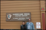
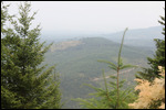
. Since Sequim was the first sign of real civilization since we left Tumwater, we were looking for McDonald's for another cup of coffee. As we followed the signs, we somehow got turned around and ended up in front of a Starbucks. What Luck! Revitalized with coffee and a cinnamon role, we were ready to head for Hurricane Ridge. It's 17 miles from the Visitors Center in Port Angeles to the Visitors Center at the top of Hurricane Ridge, and the elevation changes from basically sea level to 5200 ft in that short distance. It's a fun road to ride, because there are no 180 degree switchbacks to the top. The entire road just heads up the mountain with a series of easy left and easy right turns until you are suddenly near the top. The last 5 miles are on the side of the mountain with spectacular views of the valley below.
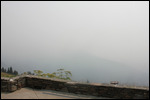
Unfortunately for us, today ended up being a cold, cloudy day, and the visibility at the top was limited. In talking to the ranger, she said that the Washington peninsula is usually cold and cloudy or rainy, and that she only breaks out her shorts a few days out of the year
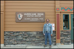
. Definitely too cold for us! Before we headed to the top, we got our passports stamped, and watched the obligatory 20 minute movie. By the time we got to the top, there was an additional passport stamp, and much better t-shirts.
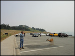
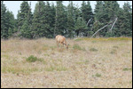
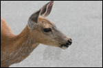
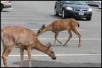
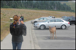
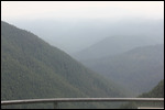
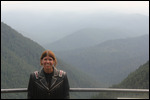
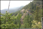
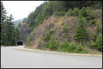
When we reached the parking lot at the top of Hurricane Ridge, there were two deer just grazing next to the cars. One came down to drink some of the water spilled on the ground in the parking lot. They were tame as could be, and not at all skittish about people being around. It gave us an opportunity for some close-up deer pictures. As we were getting ready to leave, two rental RVs pulled out in front of us to head down the mountain. I contemplated being a jerk and racing past them to get out in front, but thought better of it at the last moment. The speed limit was 35 mph, and these guys were doing 15 -25 mph all the way down the hill. About halfway down are three tunnels followed by a scenic overlook that we had spotted on the way up. By the time we reached the tunnels, we were done with these slow pokes and pulled into the overlook to take some pictures
. A parade of about a dozen cars were stuck behind them.
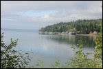
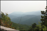
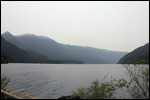
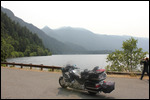
The pictures at the overlook were wonderful. We were below the clod cover, so we could see well into the valley below. By the time we finished with our picture taking at the overlook, the rental RVs were long gone, and the traffic had cleared up. When we arrived back in Port Angeles, we headed west on US-101W until we reached our next stop at Crescent Lake. The lake was huge, and nestled between the mountains, it looked picture perfect. Or it would have, if the temperature wasn't still hovering around 63 degrees. We too a bunch of pictures, and continuesd west until we reached the town of Forks, where US101W suddenly turned south and became US-101S. I've never seen a road change markings like this before, but it was accurately describing the direction of the road.
As we continued south, it was now about 4:00 and the hotel was still a couple of hours away. We had skipped the Sol Duc Hot Springs Resort, but were now trying to decide whether to take the side trip to the Hoh Rain Forest
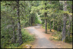
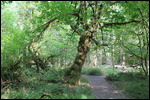
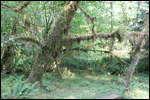
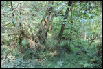
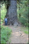
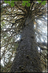
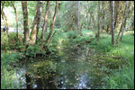
. When we reached the Rain Forest Entrance, it was only 18.5 miles to the Visitors Center, so why not? The road to the Visitors Center was awesome! It twisted and turned, uo and down everywhere. I don't think there was ever a straight stretch the entire 18.5 miles. The road was also surrounded by forest on both sides withe very old growth, extremely tall trees everywhere. This was rain forest, so it was even denser than a normal forest, because of all the hanging moss and ground cover.
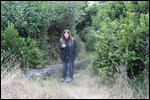
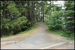
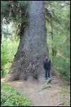
By the time we reached the Visitors Center, there was just enough time to get another passport stamp, before we headed out to look at the hiking trails. There were several that looked really interesting, and with the interesting look of the rain forest, we really wanted to do a few. But it was getting late, and we were getting hungry, so in the end we settled for the quarter mile short loop, and a walk around the parking lot and picnic area to take a few more pictures. We could have used a couple of more hours
.
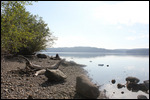
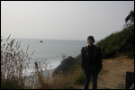
When we left the Rain Forest, we still had a couple of more hours to the hotel, so we only ended up making one more stop. As US-101S moved over to the Pacific Ocean, we had to stop to take our first pictures of real Pacific Ocean, before heading back down US-101S through the Quinalt Indian Reservation. The point at which we decided to stop for the night was a spot where US-101S was not next to the Pacific,, so we had to make a turn to head further west.. the name of the town where we made this turn was called Humptulips, WA. I don't know where they get some of these names, but that was the actual name.
It was a short ride on Wa-109 and WA-115 to Ocean Shores, WA. A typical Washington Beach town if you can call it that. Our hotel was advertised as "beachfront" and I guess it technically was, except there was at least a half mile of sand dune and overgrowth between the hotel and the water. We followed the trail right about unset, and it was quite a hike. In the end we were concerned that as the sun went down, we may not be able to find the path in the dune to the hotel, so we left before the sunset was complete.
We were too tired to do anything special for dinner tonight, so pizza at the pizza shop across the street was all we needed. Tomorrow is just a travel day as we make our way to Portland, OR. We will be staying slightly east of Portland in a place called The Dalles, at the entrance of the Columbia River Gorge National Scenic Area. It should be great!
376.3 miles today'
9146.1 miles total
11.205 gallons today
217.935 gallons total
Day 45 - Our Furthest Distance From Orlando!
Tuesday, July 07, 2015
 Ocean Shores, Washington, United States
Other Entries
-
29Day 28 - Hiking Near The Edge, Riding On Gravel
Jun 2017 days prior Great Falls, United Statesphoto_camera28videocam 0comment 0
 -
30Day 29 - Father's Day, More Gravel, and a Glacier
Jun 2116 days prior Columbia Falls, United Statesphoto_camera24videocam 0comment 0
 -
31Day 30 - Going to the Sun - Best Ride Ever!
Jun 2215 days prior Columbia Falls, United Statesphoto_camera43videocam 0comment 0
 -
32Day 31 - Leaving Glacier and a Lesson in Trust
Jun 2314 days prior Missoula, United Statesphoto_camera24videocam 0comment 0
 -
33Day 32 -Montana's Last Shot ,Scenic Roads in Idaho
Jun 2413 days prior Hailey, United Statesphoto_camera34videocam 0comment 1
 -
34Day 33 - Awesome Start, Boring Finish
Jun 2512 days prior Boise, United Statesphoto_camera26videocam 0comment 1
 -
35Day 34 - Making Lemonade in Boise
Jun 2611 days prior McCall, United Statesphoto_camera22videocam 0comment 1
 -
36Day 35 -We're the Best Kept Secret of the Lower 48
Jun 2710 days prior Spokane Valley, United Statesphoto_camera24videocam 0comment 0
 -
37Day 36 - Who Runs Ironman in 106 Degree Heat?
Jun 289 days prior Spokane Valley, United Statesphoto_camera32videocam 0comment 0
 -
38Day 37 - Boring Start, Awesome Finish!
Jun 298 days prior Winthrop, United Statesphoto_camera44videocam 0comment 2
 -
39Day 38 - Climb the Mountain, Ride the Ferry.
Jun 307 days prior Seattle, United Statesphoto_camera44videocam 0comment 0
 -
40Day 39 - Zero Motorcycle Miles, But 15,000 Steps
Jul 016 days prior Seattle, United Statesphoto_camera83videocam 0comment 0
 -
41Day 40 - Another Mega-Tourist Day!
Jul 025 days prior Seattle, United Statesphoto_camera49videocam 0comment 0
 -
42Day 41 - Quiet Day, ZinZanni Night
Jul 034 days prior Seattle, United Statesphoto_camera9videocam 0comment 0
 -
43Day 42 - Wooden Boats & Fireworks on the 4th
Jul 043 days prior Seattle, United Statesphoto_camera48videocam 0comment 0
 -
44Day 43 - Cars, Glass, & What's an Enumclaw?
Jul 052 days prior Enumclaw, United Statesphoto_camera42videocam 0comment 0
 -
45Day 44 - Another Exciting Day in Paradise!
Jul 061 day prior Tumwater, United Statesphoto_camera29videocam 0comment 0
 -
46Day 45 - Our Furthest Distance From Orlando!
Jul 07 Ocean Shores, United Statesphoto_camera32videocam 0comment 0
 -
47Day 46 - Who Goes To the Beach at 61 Degrees?
Jul 081 day later The Dalles, United Statesphoto_camera24videocam 0comment 0
 -
48Day 47 - Motorcycle Service & Discovery Center
Jul 092 days later The Dalles, United Statesphoto_camera30videocam 0comment 0
 -
49Day 48 - Seven Waterfalls & a Log Jam
Jul 103 days later The Dalles, United Statesphoto_camera72videocam 0comment 0
 -
50Day 49 - Planes, Cars, and a Cold, Rainy Beach
Jul 114 days later Newport, United Statesphoto_camera38videocam 0comment 0
 -
51Day 50 - Lighthouse, Sea Lions, and Sand Dunes
Jul 125 days later Roseburg, United Statesphoto_camera55videocam 0comment 0
 -
52Day 51 - A Cold day at Crater Lake
Jul 136 days later Grants Pass, United Statesphoto_camera26videocam 0comment 2
 -
53Day 52 - Whitewater Surfing - Who New?
Jul 147 days later Grants Pass, United Statesphoto_camera6videocam 0comment 0
 -
54Day 53 - Out of the Vortex & Into Coos Bay
Jul 158 days later Coos Bay, United Statesphoto_camera27videocam 0comment 0
 -
55Day 54 - Final Ride Down The Oregon Coast
Jul 169 days later Crescent City, United Statesphoto_camera46videocam 0comment 0
 -
56Day 55 - Goodbye Caves, Hello Redwoods!
Jul 1710 days later Crescent City, United Statesphoto_camera44videocam 0comment 0
 -
57Day 56 - Those Trees are HUGE!
Jul 1811 days later Eureka, United Statesphoto_camera36videocam 0comment 0
 -
58Day 57 - Avenue of the Giants - Redwoods Day 2
Jul 1912 days later Eureka, United Statesphoto_camera46videocam 0comment 0
 -
59Day 58 - Goodbye US-101, Hello Highway 1!
Jul 2013 days later Willits, United Statesphoto_camera22videocam 0comment 0
 -
60Day 59 - Still Love To Play With Trains!
Jul 2114 days later Fort Bragg, United Statesphoto_camera30videocam 0comment 2
 -
61Day 60 - Highway 1 is Spectacular!
Jul 2215 days later San Francisco, United Statesphoto_camera35videocam 0comment 0
 -
62Day 61 - A Bad Hair Day in San Francisco
Jul 2316 days later San Francisco, United Statesphoto_camera43videocam 0comment 0
 -
63Day 62 - Fisherman's Wharf & Alcatraz
Jul 2417 days later San Francisco, United Statesphoto_camera48videocam 0comment 0
 -
64Day 63-Hippie, Scientist, Artist - In 21,000 Steps
Jul 2518 days later San Francisco, United Statesphoto_camera69videocam 0comment 1

 Ocean Shores, Washington, United States


2025-05-23