Today was just an awesome day! We got up this morning planning to head west on Historic Highway 30 along the Columbia River Gorge. It was a little cold, 65 degrees, when we left at 8:30. While we were loading up the bike this morning we met a couple about our age riding a Harley. They were visiting from Coeur d'Alene, Idaho - we knew where that was, we had been there ourselves only a few weeks ago.
As we headed through town, The Dalles, we noticed it was pretty windy
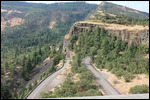
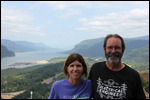
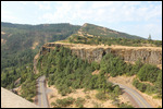
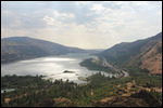
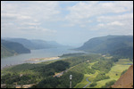
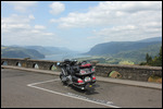
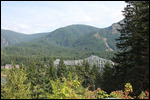
. I guess it is normal around here to get a lot of wind. It just seems to whip up the river, through the gorge all the time. We did have to spend a little time on the Interstate I-84 before it split off to Historic Route 30. First stop was a place called Rowena Crest. It was a steep ride up a bunch of switchbacks to the top of the local mountain. The view of the gorge was beautiful and we took a bunch of pictures. There were also a few bicycle riders pedaling their way to the top. Ive noticed we always see cyclists whenever there is a steep hill to climb.
After riding the equally fun switchbacks down from Rowena Crest, we passed through two towns, Hood River which looked interesting and fun, and Cascade Locks which did not. Each town's biggest claim to fame was that they had a bridge across the Columbia River to Washington. We had to do a couple of brief Interstate runs before we finally broke away completely to Historic Route 30 in Cascade Locks.
We knew there are seven waterfalls along the side of the highway, and we had seen a couple of them on our initial trip to The Dalles
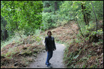
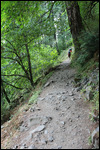
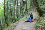
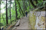
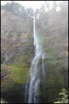
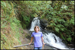
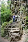
. Today's plan was to visit them all, and hike some of the trails around them. The first waterfall we encountered was called Horsetail Falls. It was really high and beautiful, and we took pictures. But the real claim to fame about Horsetail Falls is the hike up the mountain to Oneonta Falls. The trail is very narrow and steep, and is basically a series if switchbacks up the side of the mountain. It is also VERY rocky, with lots of sharp edges along the path. Luckily it was the first hike of the day, and we still had lots of energy. We made it to the top, though I must admit, my fear of heights kicked in a little near the top.
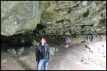
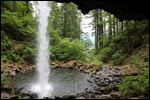
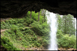
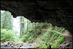
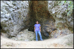
As we came over the top, we could hear another waterfall in the distance. As we came closer, we caught our first glimpse of Oneonta Falls. It wasn't as tall as Horsetail, but this one had a cave underneath the falls that you could climb into, and the falls would pass over the mouth of the cave. It was really awesome! The pictures and videos came out great. The hike back down fro Oneonta Falls was much easier
. Still high, but at least the walking was downhill.
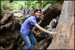
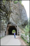
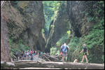
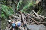
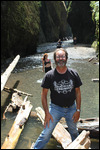
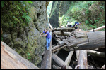
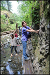
We got back on the bike and headed west. Next stop - Oneonta Gorge. When we got there, it didn't look like much, some steps down to a creek below, and a huge tunnel through the mountain. We checked out the tunnel first, thinking that must be the attraction, and it was cool, but no one was in the tunnel. So we took the walk downstairs to the creek That was when we saw what was so great about Oneonta Gorge. The creek was at the bottom of a fissure in the rock, with steep stone sides on both sides. And in the middle between the stone sides was a huge log jam. To get to the creek on the other side of the log jam, you had to work your way through the log jam like some great obstacle course. The object was to get all the way across without falling in the water and getting wet. At least that was OUR object. Some other people thought getting wet was the best part, and came in bathing suits.
So we joined with everyone else and made our way through the log jam
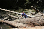
. It was great fun!. We didn't fall in, and we didn't get too wet, just a little dirty from the mud on some of the wetter logs. It was such a blast! Everyone was having such a great time. We did manage to get a few pictures along the way. Jody did really well climbing her way through. By the time we made it back to the bike we were pretty thirsty from the workout and were glad we packed the cooler.
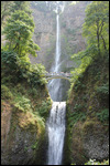
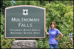
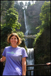
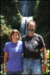
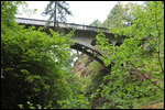
After Oneonta Gorge, we got back on the bike and headed for the major attraction of the highway, Multnomah Falls. This one is really tall, and has a bridge across the creek about a third of the way up for viewing. We took a bunch of pictures from the bottom, but had to do the hike to the bridge to see it a little more close up. This waterfall also had a snack bar and actually a full restaurant on site along with a Visitors Center and gift shop. We bought t-shirts, and sat down for a couple of latte's before beginning our hike to the bridge. We also talked to the lady at the Visitors Center, and she said that since we were staying in The Dalles, on the way back we should take the bridge in Cascade Locks across to the Washington side and take bridge at The Dalles to get back to the Oregon side
. The Oregon side has Route 30, but the Interstate is between Route 30 and the Columbia River. On the Washington side, Rt 14 is a two lane road that follows the river and you can see more from that side. That sounded like a great idea, and we figured that was the way we would take back.
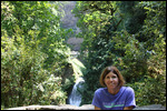
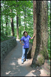
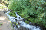
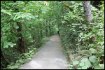
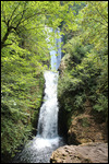
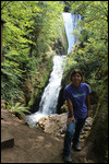
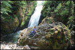
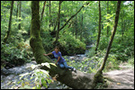
Wahkeena Falls wad right next to Multnomah Falls, and we had stopped quickly to look at them on our first night. This time we did the hike to the midpoint and the view was much better. When we finished Wahkeena, our next stop was Bridal Veil falls. This waterfall is not visible from the road, and you have to hike about half a mile into the woods to find it. This is a lso a downhill hike, where you do the easy downhill walk to get to the waterfall, and then there is the long walk uphill to get back to the bike. Jody was feeling adventurous, so she did some rock climbing and tree climbing to get some good photo-ops. While we were down there, we met a couple from Bradenton, FL who were there with their son from Seattle
. They saw the Florida tags on the bike, and we talked for a while about our trip so far.
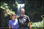
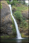
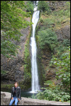
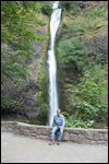
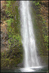
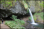
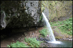
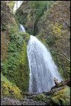
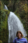
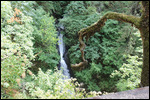
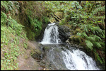
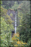
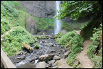
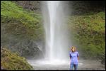
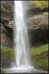
Next was a smaller waterfall at a place called Shepperds Dell. But it was a nice walk down with a lot of moss covered stonework to get there. From Shepperds Dell, the last waterfall was at a place called Latourell Falls. This waterfall also wasn't as tall as some of the others, but the cool part was that instead of ending in a deep pool, it ended on a creek bed with a bunch of small stone. You could actually stand under the falls where it hit if you had a death wish, but more realistically you could get up pretty close and take a good picture. Which we did, and I also got a video of Jody standing there to post on Facebook. It was all great fun, and that was the last of the waterfalls.
We were doing the waterfall tour backwards from most people. Most people come from Portland and travel Historic Route 30 from west to east. Since we came from The Dalles, we were traveling from east to west. So our last stop at the Crown Point - Vista House is usually everyone else's first stop
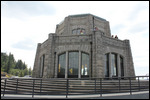
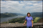
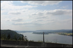
. Much like Rowena Crest, Vista House is at the top of a local mountain, and access is by a series of switchbacks as the road rises up the mountain. The views of the Columbia Gorge from Vista House are spectacular. The pictures look great!
It was about 72 miles we covered in going from The Dalles to Crown Point, and it was going to be about the same back, so we left Vista House and headed back east on Historic Route 30. We were able to travel all the way to Cascade Locks without having to get on the interstate. In Cascade Locks we took the toll bridge across the Columbia to Washington. The bridge was officially called "The Bridge of the Gods", and with a name like that, we had to go across. The toll was 50 cents for motorcycles, and unfortunately this was one of those wire grating road surfaces motorcyclists hate so much. It's one of those - "You know you're not going to tip over, but it's going to feel like that all the way across" - type bridges.
We managed to get across safely, stopped an took a picture of the bridge
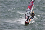
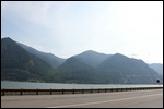
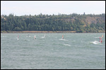
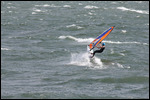
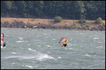
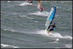
. The road on the Washington side WA-14E was a great road. Two lanes and it just followed the Columbia River. We counted 7 tunnels along the way, mostly with two tunnels in the mountain, one for the roadway, and one for the railroad tracks. It was great fun! Since the Washington side is closer to the water, there are many recreational access points to the river. We saw many wind surfers and kite surfers in the water. Evidently, it is always windy in the Columbia Gorge so that wind and kite surfing are very popular in the area. They looked like they were having a great time, but it looked too cold and scary for me.
It was 5:30 when we finally made it back to The Dalles. We were looking for restaurants on the Washington side with no luck so we decided to give Montira's Thai Cuisine a try. It had great reviews and the parking lot was full. Jody had her favorite Pad Thai, and I had my favorite Chicken Drunken Noodle. Both were good, and after a long hiking day like today, we were hungry.
Tomorrow we leave the Columbia River Gorge and hes west back to the Oregon seacoast and a town called Newport, OR. It should be fun gettin back on US-101S again as we follow it all the way down the Pacific coast.
147.7 miles today
9621.8 miles total
0.0 gallons today
228.742 gallons total
Day 48 - Seven Waterfalls & a Log Jam
Friday, July 10, 2015
 The Dalles, Oregon, United States
Other Entries
-
32Day 31 - Leaving Glacier and a Lesson in Trust
Jun 2317 days prior Missoula, United Statesphoto_camera24videocam 0comment 0
 -
33Day 32 -Montana's Last Shot ,Scenic Roads in Idaho
Jun 2416 days prior Hailey, United Statesphoto_camera34videocam 0comment 1
 -
34Day 33 - Awesome Start, Boring Finish
Jun 2515 days prior Boise, United Statesphoto_camera26videocam 0comment 1
 -
35Day 34 - Making Lemonade in Boise
Jun 2614 days prior McCall, United Statesphoto_camera22videocam 0comment 1
 -
36Day 35 -We're the Best Kept Secret of the Lower 48
Jun 2713 days prior Spokane Valley, United Statesphoto_camera24videocam 0comment 0
 -
37Day 36 - Who Runs Ironman in 106 Degree Heat?
Jun 2812 days prior Spokane Valley, United Statesphoto_camera32videocam 0comment 0
 -
38Day 37 - Boring Start, Awesome Finish!
Jun 2911 days prior Winthrop, United Statesphoto_camera44videocam 0comment 2
 -
39Day 38 - Climb the Mountain, Ride the Ferry.
Jun 3010 days prior Seattle, United Statesphoto_camera44videocam 0comment 0
 -
40Day 39 - Zero Motorcycle Miles, But 15,000 Steps
Jul 019 days prior Seattle, United Statesphoto_camera83videocam 0comment 0
 -
41Day 40 - Another Mega-Tourist Day!
Jul 028 days prior Seattle, United Statesphoto_camera49videocam 0comment 0
 -
42Day 41 - Quiet Day, ZinZanni Night
Jul 037 days prior Seattle, United Statesphoto_camera9videocam 0comment 0
 -
43Day 42 - Wooden Boats & Fireworks on the 4th
Jul 046 days prior Seattle, United Statesphoto_camera48videocam 0comment 0
 -
44Day 43 - Cars, Glass, & What's an Enumclaw?
Jul 055 days prior Enumclaw, United Statesphoto_camera42videocam 0comment 0
 -
45Day 44 - Another Exciting Day in Paradise!
Jul 064 days prior Tumwater, United Statesphoto_camera29videocam 0comment 0
 -
46Day 45 - Our Furthest Distance From Orlando!
Jul 073 days prior Ocean Shores, United Statesphoto_camera32videocam 0comment 0
 -
47Day 46 - Who Goes To the Beach at 61 Degrees?
Jul 082 days prior The Dalles, United Statesphoto_camera24videocam 0comment 0
 -
48Day 47 - Motorcycle Service & Discovery Center
Jul 091 day prior The Dalles, United Statesphoto_camera30videocam 0comment 0
 -
49Day 48 - Seven Waterfalls & a Log Jam
Jul 10 The Dalles, United Statesphoto_camera72videocam 0comment 0
 -
50Day 49 - Planes, Cars, and a Cold, Rainy Beach
Jul 111 day later Newport, United Statesphoto_camera38videocam 0comment 0
 -
51Day 50 - Lighthouse, Sea Lions, and Sand Dunes
Jul 122 days later Roseburg, United Statesphoto_camera55videocam 0comment 0
 -
52Day 51 - A Cold day at Crater Lake
Jul 133 days later Grants Pass, United Statesphoto_camera26videocam 0comment 2
 -
53Day 52 - Whitewater Surfing - Who New?
Jul 144 days later Grants Pass, United Statesphoto_camera6videocam 0comment 0
 -
54Day 53 - Out of the Vortex & Into Coos Bay
Jul 155 days later Coos Bay, United Statesphoto_camera27videocam 0comment 0
 -
55Day 54 - Final Ride Down The Oregon Coast
Jul 166 days later Crescent City, United Statesphoto_camera46videocam 0comment 0
 -
56Day 55 - Goodbye Caves, Hello Redwoods!
Jul 177 days later Crescent City, United Statesphoto_camera44videocam 0comment 0
 -
57Day 56 - Those Trees are HUGE!
Jul 188 days later Eureka, United Statesphoto_camera36videocam 0comment 0
 -
58Day 57 - Avenue of the Giants - Redwoods Day 2
Jul 199 days later Eureka, United Statesphoto_camera46videocam 0comment 0
 -
59Day 58 - Goodbye US-101, Hello Highway 1!
Jul 2010 days later Willits, United Statesphoto_camera22videocam 0comment 0
 -
60Day 59 - Still Love To Play With Trains!
Jul 2111 days later Fort Bragg, United Statesphoto_camera30videocam 0comment 2
 -
61Day 60 - Highway 1 is Spectacular!
Jul 2212 days later San Francisco, United Statesphoto_camera35videocam 0comment 0
 -
62Day 61 - A Bad Hair Day in San Francisco
Jul 2313 days later San Francisco, United Statesphoto_camera43videocam 0comment 0
 -
63Day 62 - Fisherman's Wharf & Alcatraz
Jul 2414 days later San Francisco, United Statesphoto_camera48videocam 0comment 0
 -
64Day 63-Hippie, Scientist, Artist - In 21,000 Steps
Jul 2515 days later San Francisco, United Statesphoto_camera69videocam 0comment 1
 -
65Day 64 - Escaped a Marathon, Found a Mountain
Jul 2616 days later Oakhurst, United Statesphoto_camera25videocam 0comment 0
 -
66Day 65 - Yosemite is an Awesome Park!
Jul 2717 days later Oakhurst, United Statesphoto_camera44videocam 0comment 0
 -
67Day 66 - Two Parks, Big Trees, and a Bigger Rock
Jul 2818 days later Oakhurst, United Statesphoto_camera47videocam 0comment 0

 The Dalles, Oregon, United States




2025-05-23