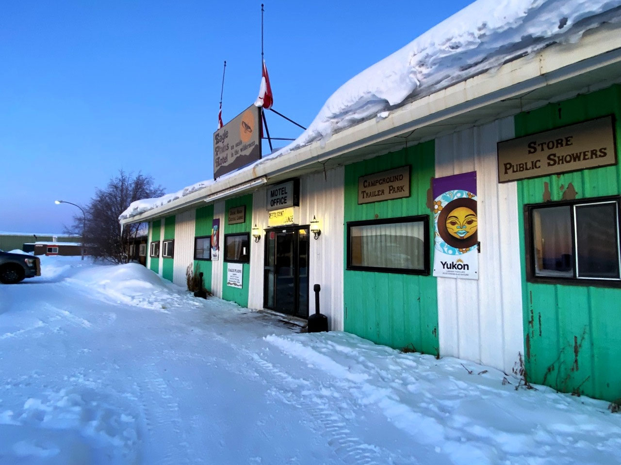
 Eagle Plains Hotel, Yukon, Canada
ON AN ARCTIC MORNING.....
Farewell to Eagle Plains
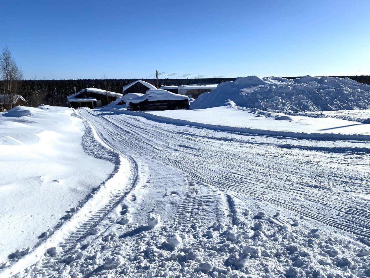
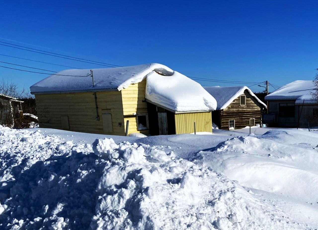
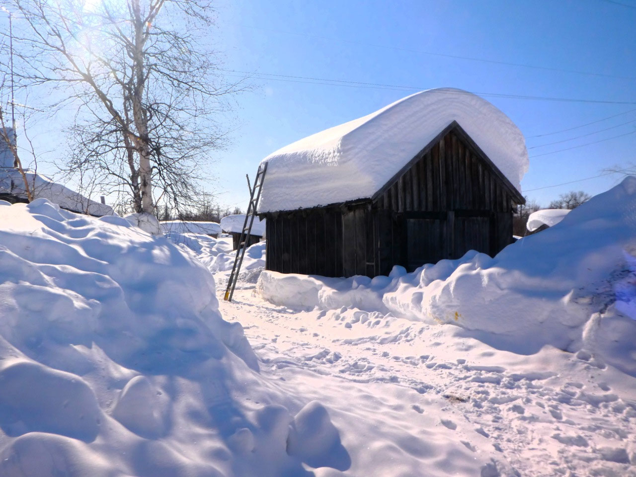
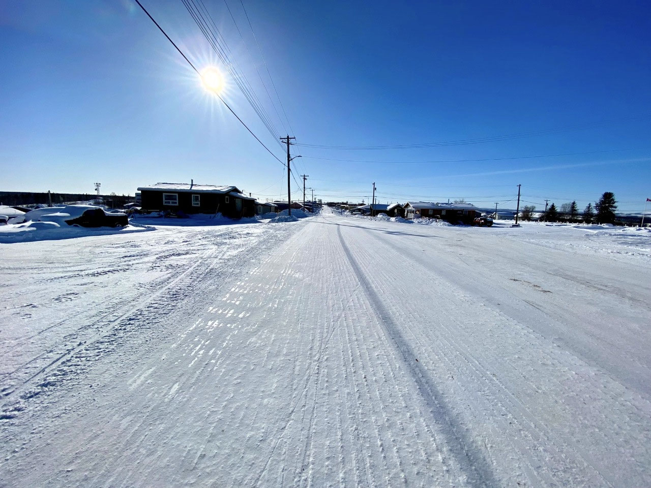
While Eagle Plains may have appeared unassuming, the tiny remote truck stop settlement was fascinating. Nestled in the rugged beauty of the northern Yukon, it was a vital stop for truckers* and a rare opportunity for ordinary travellers like us to witness extraordinary day-to-day life in the unforgiving wilderness of the High Arctic North.
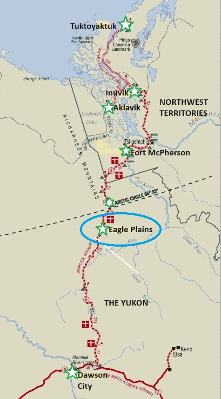
*Eagle Plains is the only truck stop and accommodation, repair service and petrol centre between Dawson City at 410 km south, and Inuvik at 366 km to the north.
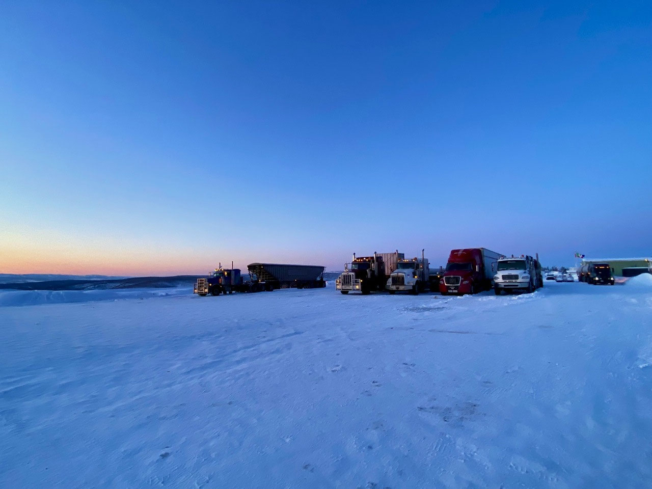
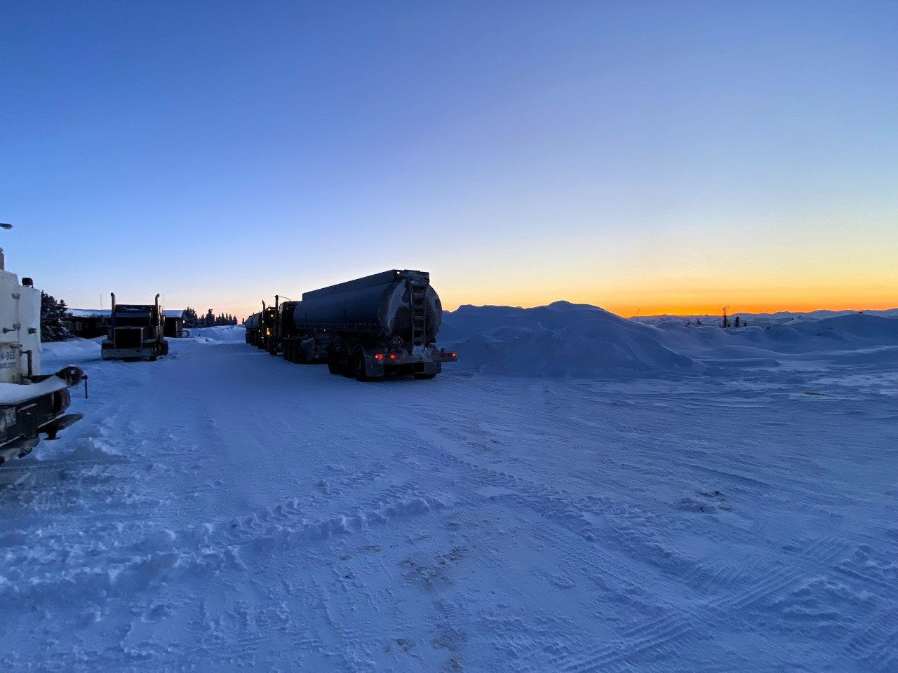
Well before dawn, we heard the truckers start up their engines and check loads for their long trips - north or south. Like all transport hubs in the High Arctic, there was a distinct vibe of anticipation and excitement, intangible yet irresistibly contagious. Etched in our minds, however, was the camaraderie amongst the drivers; their voices and laughter only adding to our enthusiasm for the next leg of our journey north, crossing the Arctic Circle and on to Inuvik. On the way, we would stop at the Inuit township of Fort McPherson. The trip to Inuvik would take us six hours, covering a total distance of 366 km.
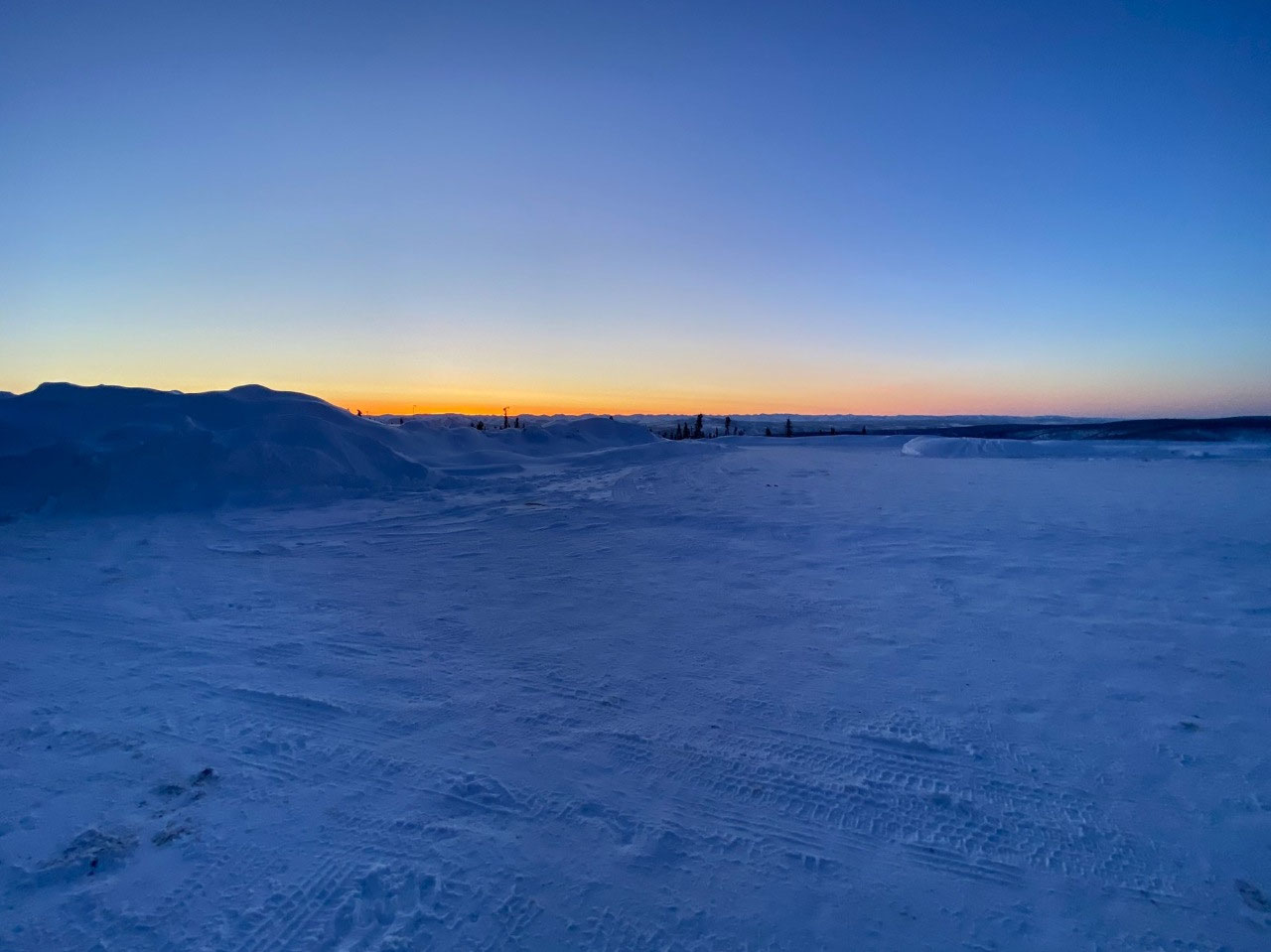
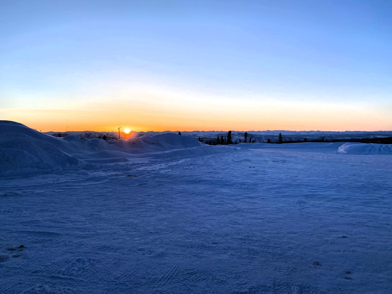
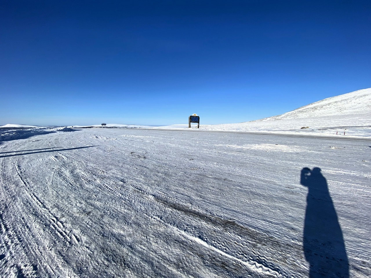
From our hotel room, we could see the long lines of massive articulated vehicles silhouetted against the horizon by a brilliant golden sunrise. The sheer nothingness of the surrounding landscape was breathtaking. Idly, I wondered if we would ever become blasé about the Arctic.
Eagle Plains was painting a stunningly accurate picture of "Why we love the Arctic!" The answer to so many "Why do you go there? What do you do there?" questions asked by friends and acquaintances at home. Explanations that are so difficult to articulate. For us, it is just such a privilege to witness real life in the Arctic. So often, our lives felt like we were part of an impossible reality television series. No, we would never tire of the Arctic...
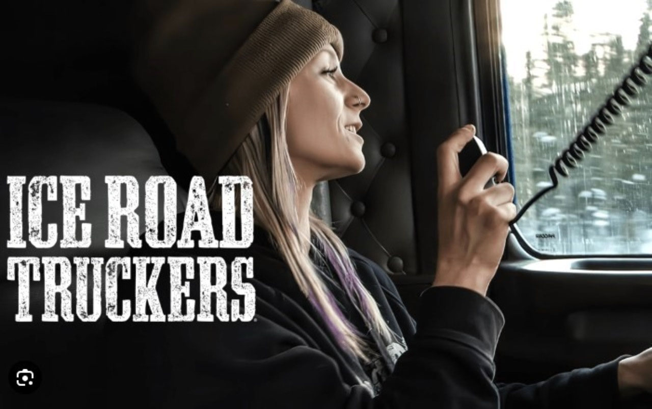
And talking of reality television programs... Looking out at the slow-moving trucks grinding onto the highway from the grounds of the hotel reminded us of the former action-packed television series "Ice Truckers", to which Alan and I were, at the time of the presentation, absolutely addicted. We could have been at the same site where it was filmed - as in the series, the truckers undertook death-defying trips up perilous ice roads to the Arctic Ocean and back.
Chatting about the program, we smiled as we recalled the real-life trucker and darling of Ice Truckers Lisa Kelly who bravely drove huge lorries on ice roads that few would dare.
We initially thought the series was filmed in Alaska. Later in our travels, we learned that although a few episodes were filmed in Alaska, they were mainly taken from around Yellowknife, one of our destinations following our Tuk Tour.
Farewell, Eagle Plains Hotel
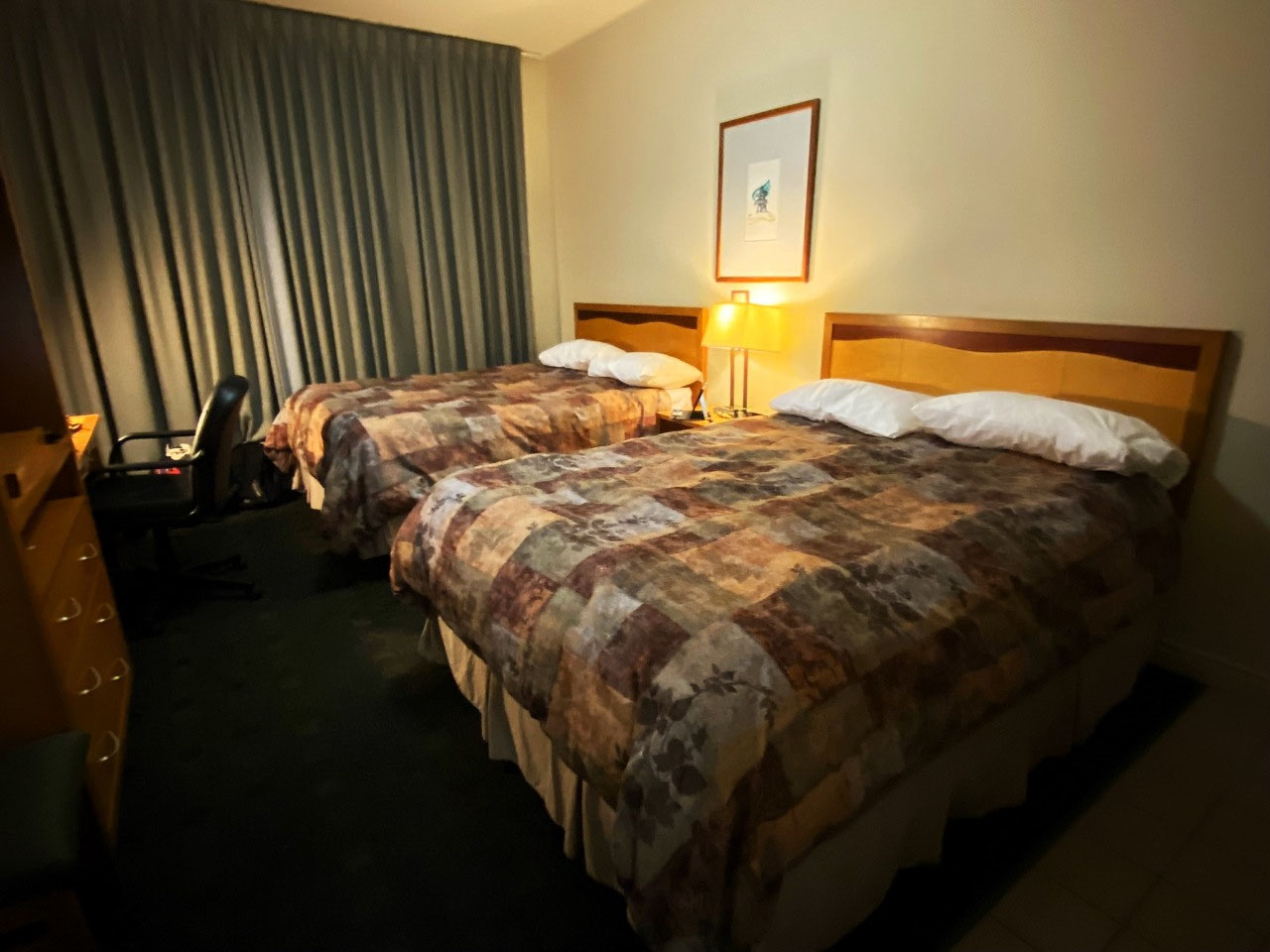
Our hotel was very comfortable. And enormously interesting. Staff and guest truckers alike had been friendly and welcoming. Sadly, we didn't get another chance to chat with them. Conveniently for everyone, the ice truckers were served breakfast in an earlier shift to cater to the restaurant's numbers and give them a chance to leave early.
As we checked out, we found several drivers asleep or resting on benches in the front part of the hotel. Was the little hotel fully booked? In any instance, it was all very relaxed, and the staff was kind and welcoming.
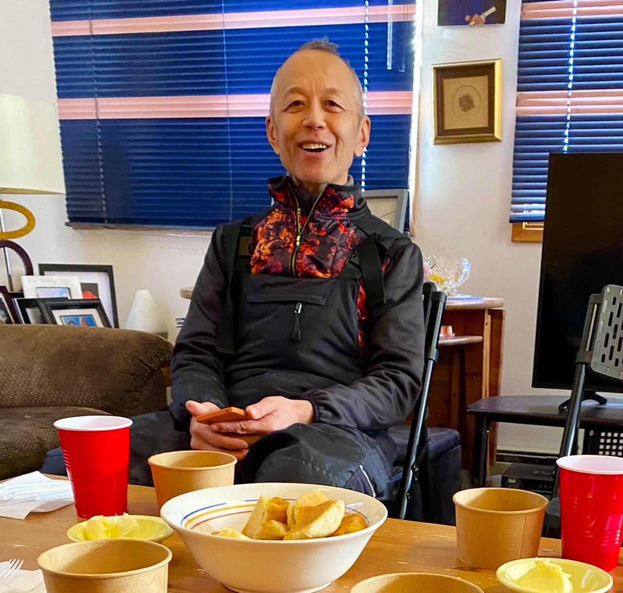
Takashi was, as usual, scraping our minibus windows of thick ice that had formed overnight. At a temperature of minus 26 °C, it was an impossible job. Always cheerful and friendly, Takashi was a favourite amongst our fellow travellers. A great adventurer, he was planning to travel to Mexico to watch the much-anticipated April 2024 total eclipse of the sun, followed immediately by a trip to Venezuela - a country we had wanted to visit for a long time.
Takashi and Kazak friend Nathan were a great asset to our tour, often texting us about possible viewing times for watching the Northern Lights or working out when local museums were open. The only "lone" people on our tour, they formed a firm friendship, with Takashi often being the alarm clock for the very often late-out-of-bed Nathan.
In fact, by then, the entire group was relaxed, friendly and fun. We could not have asked for better people to travel with.
Toward the Arctic Circle
At sunrise, we departed Eagle Plains for our ongoing trip. Mornings were still dark until around 8:30 am, yet evenings were long, with sunsets not until about 10:00 pm. Of course, this meant that Nathan would stay up waiting for sightings of the Northern Lights until the early morning hours.
On alighting our bus, he often looked much worse for wear - having just been awoken by the ever-patient Takashi. Despite his determination, however, he had not seen much of the lights as the nights mainly had been clouded.
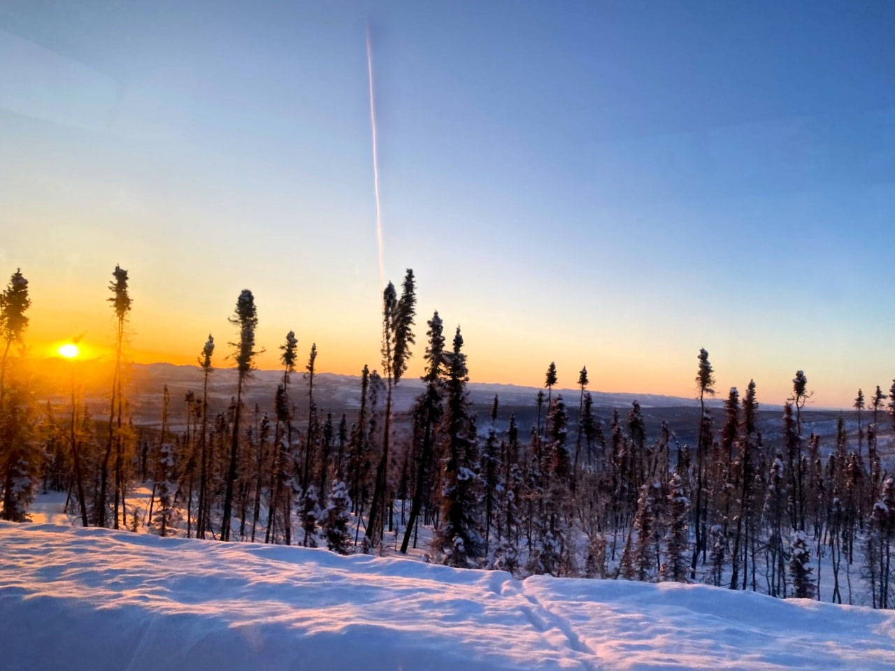
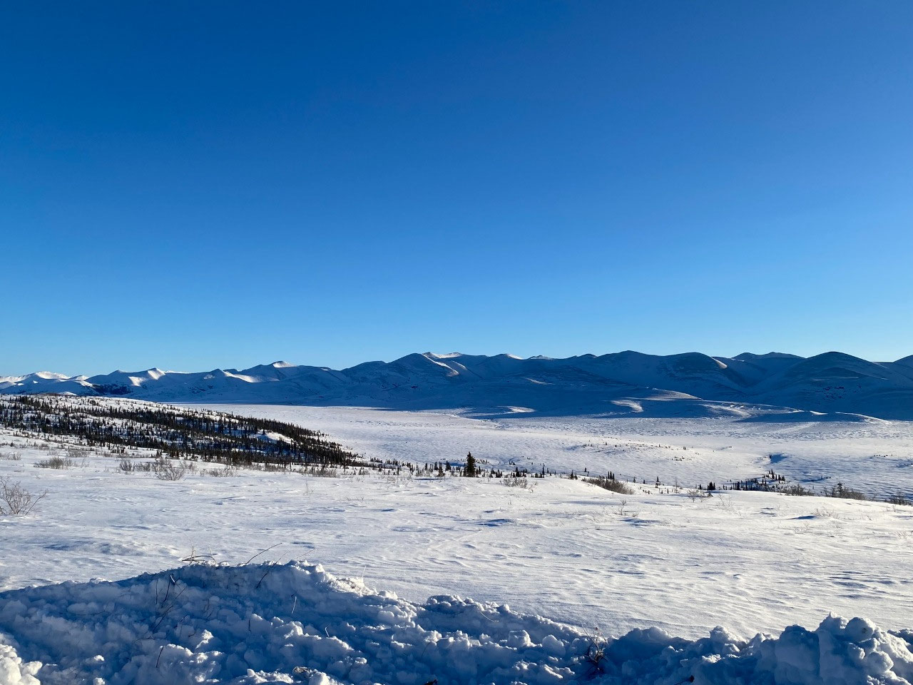
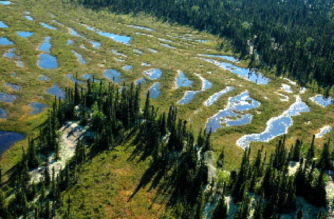
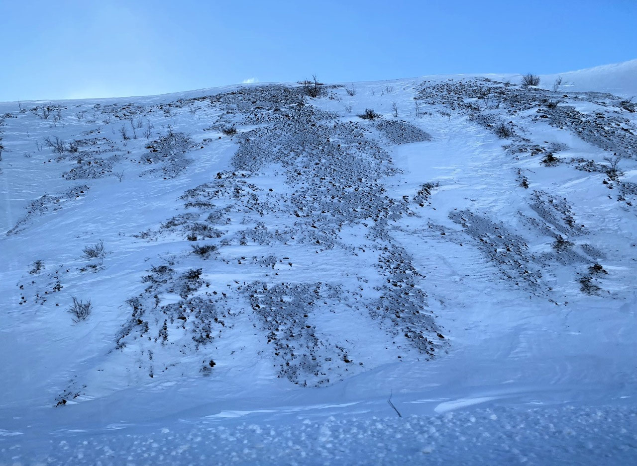
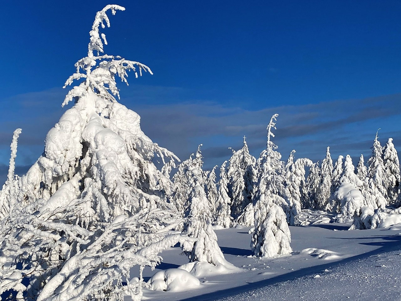
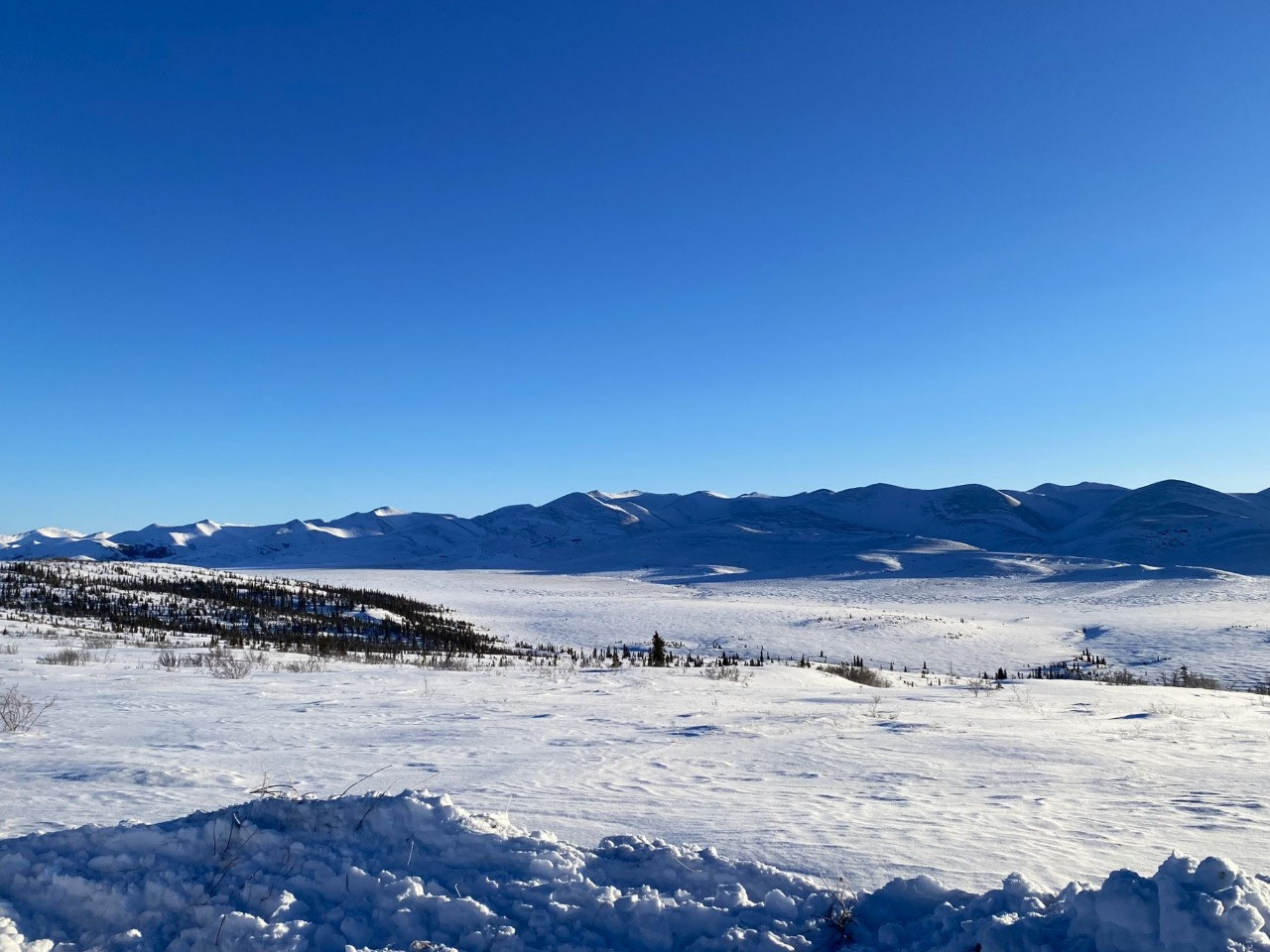
On the very fringes of the tundra, stunted, sparsely growing trees grew reluctantly in the harshness of a near Arctic environment. Mostly devoid of foliage, sickly fragile spruce leant at terrible angles. For all purposes, it appeared that the region surrounding Eagle Plains could be devoid of any tree life in just one wind storm. We felt sorry to see vegetation in such a poor state. After all, as a seed, why would you bother germinating in such a rugged environment? What we were seeing was, of course, the unrelenting transition of forest growth to the real tundra of the north.
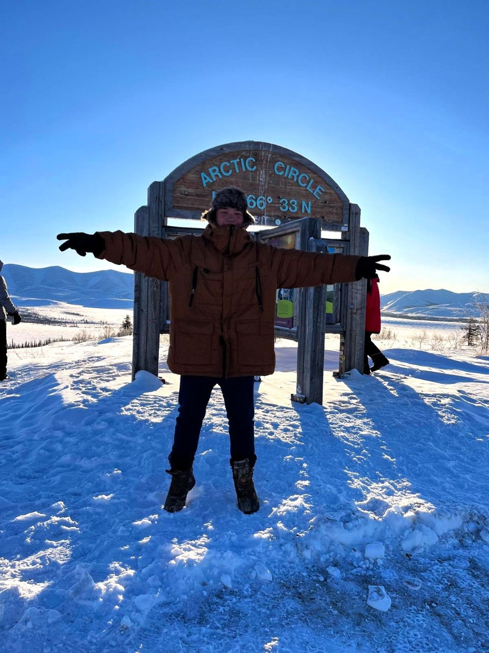
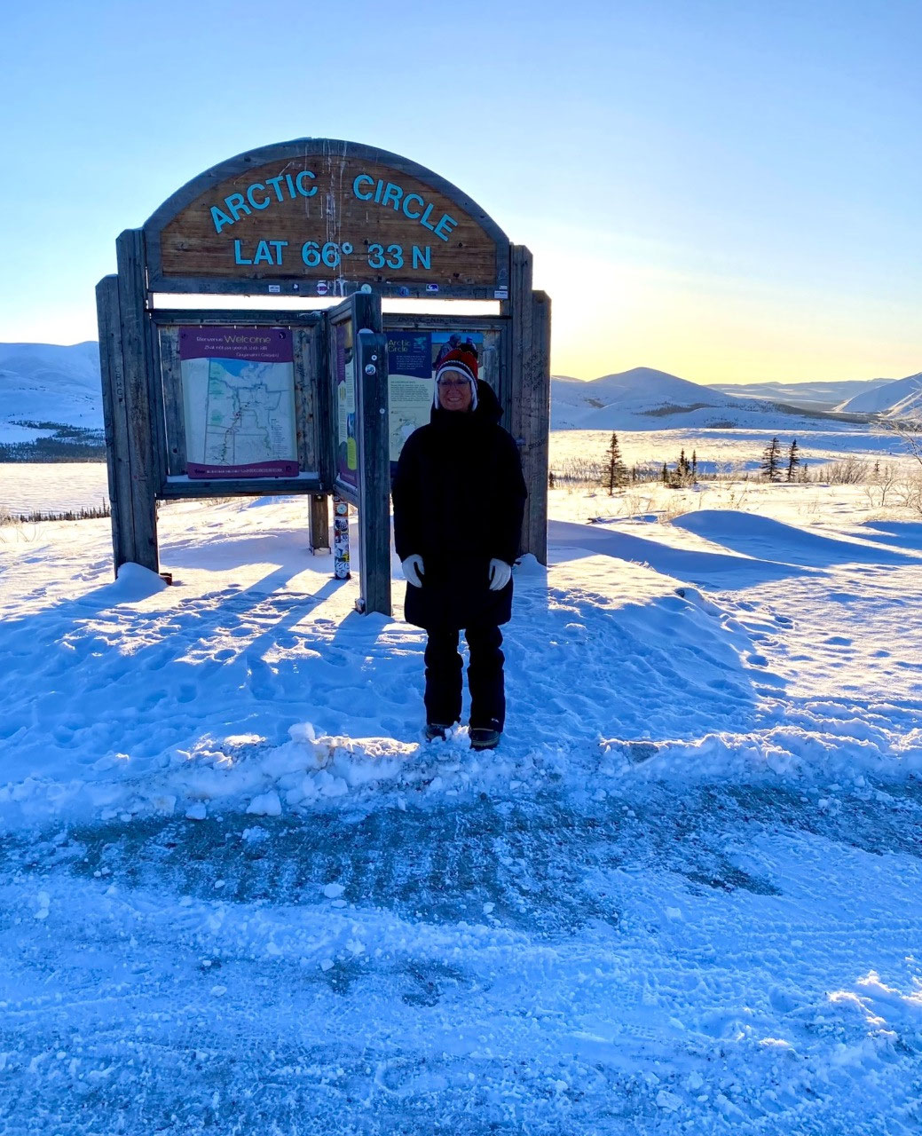
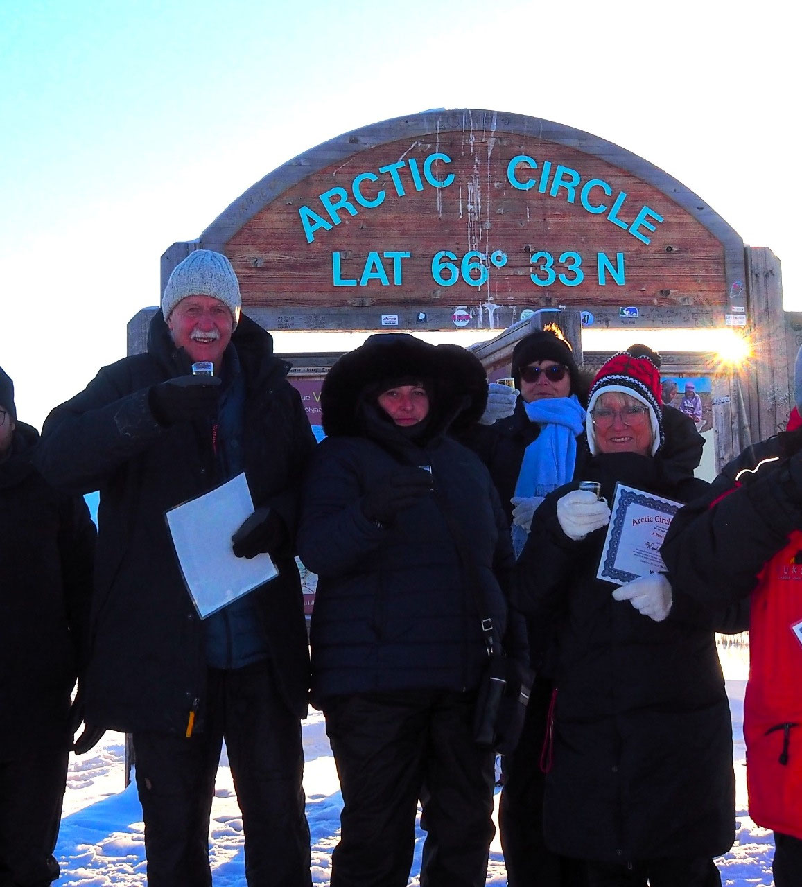
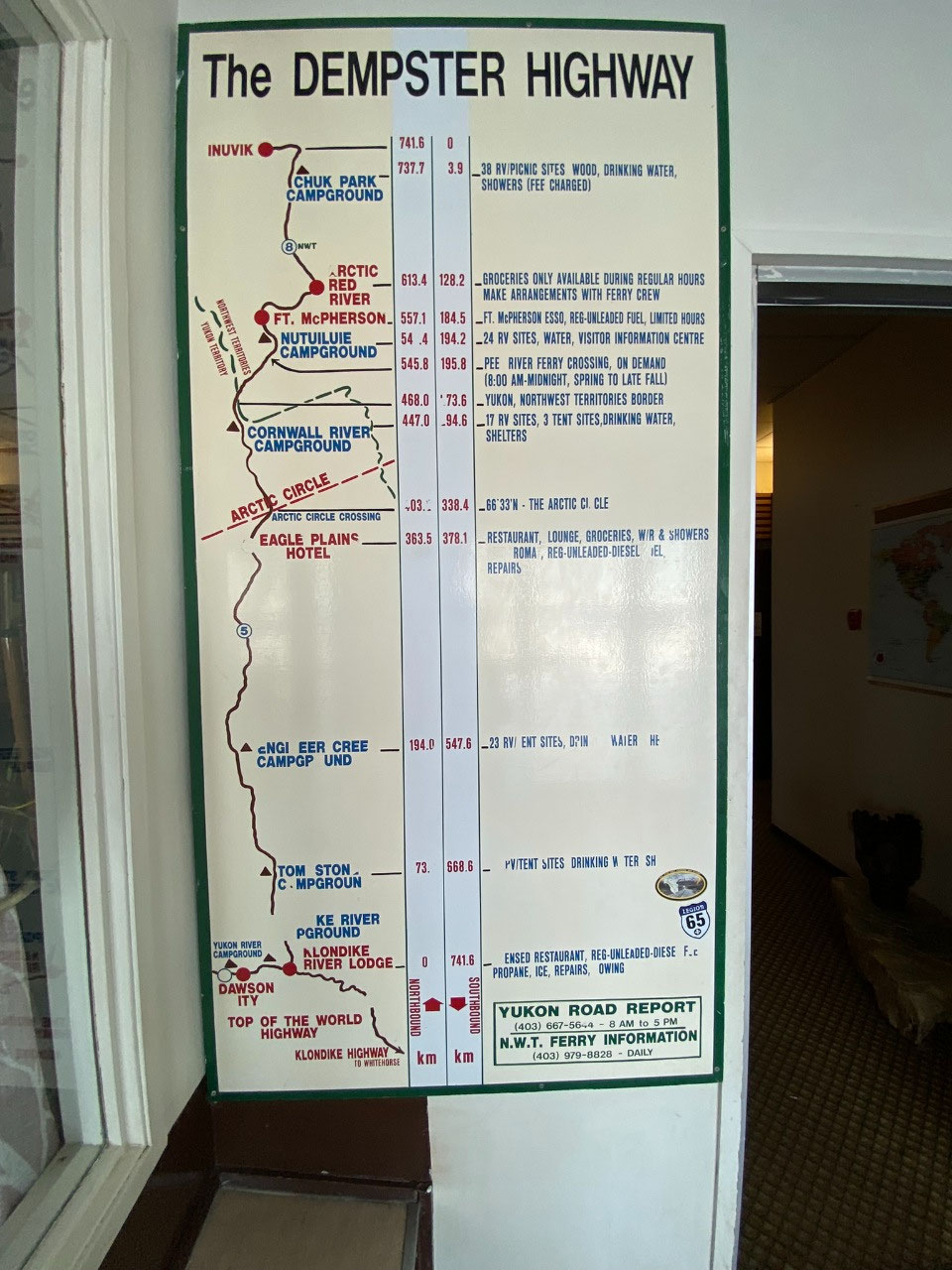
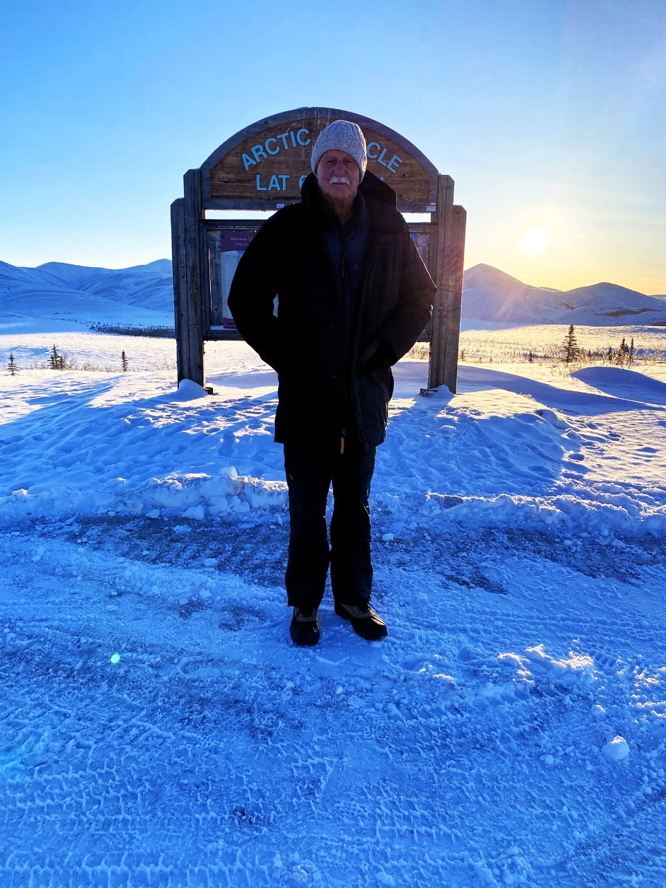
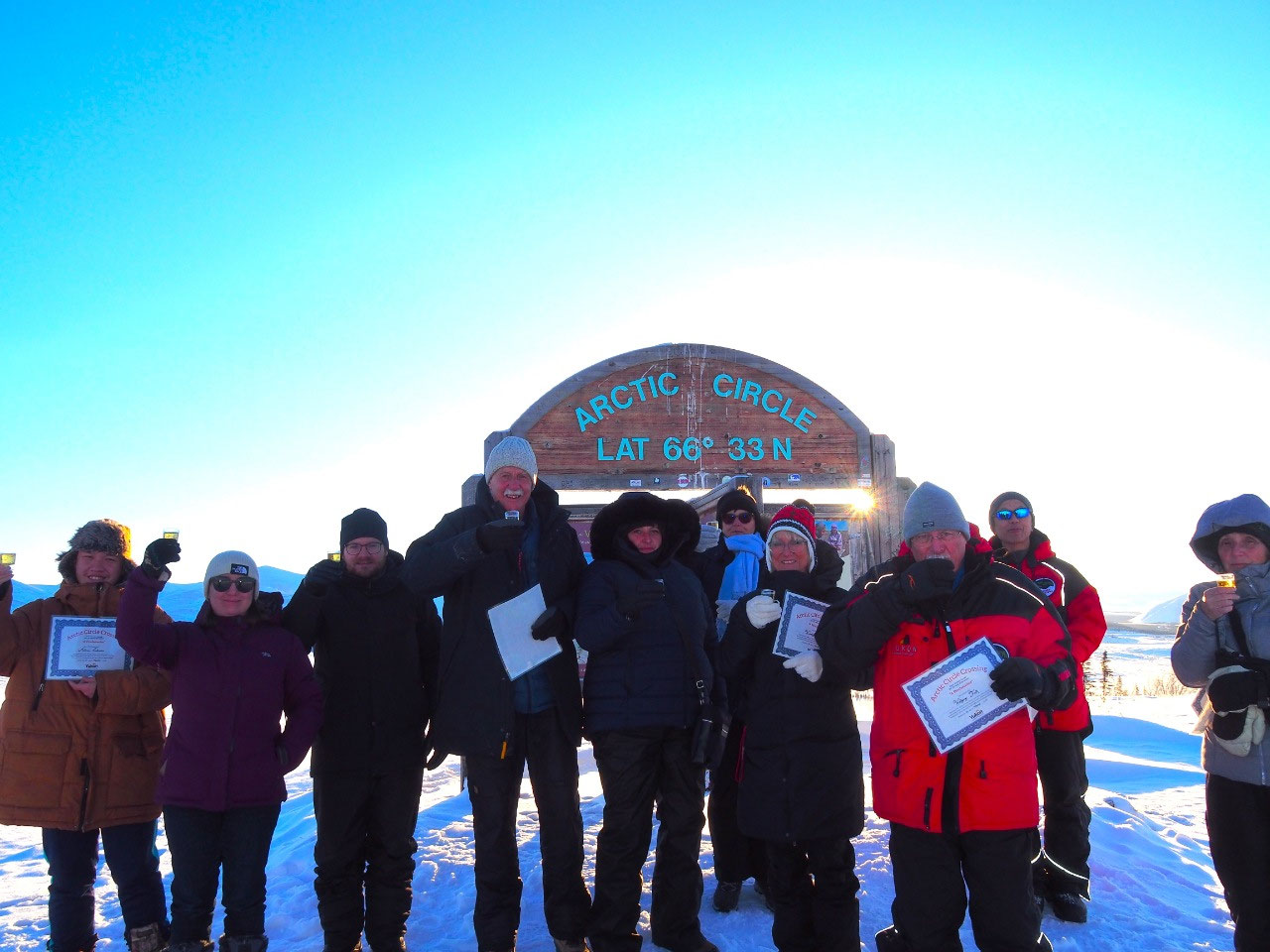
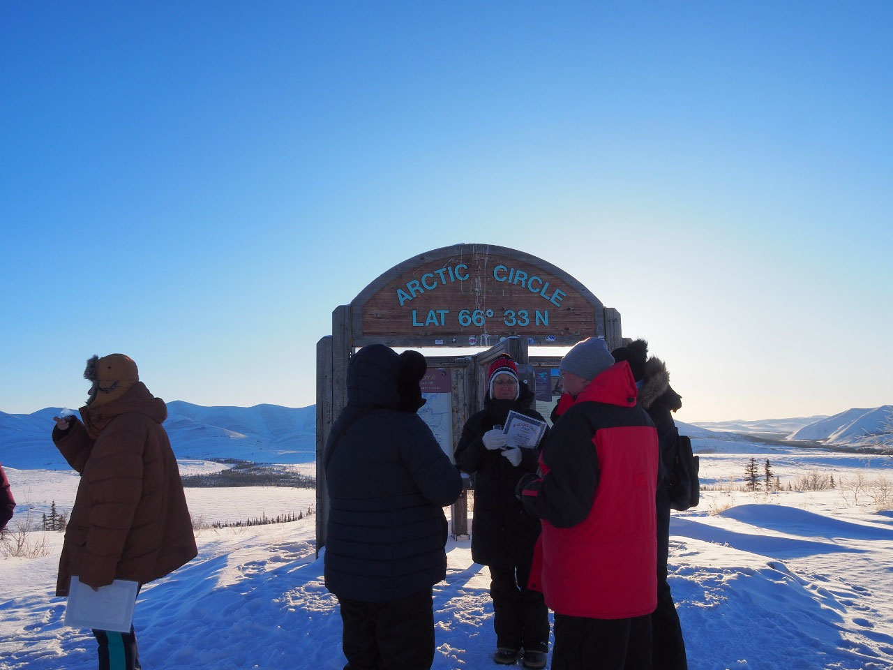
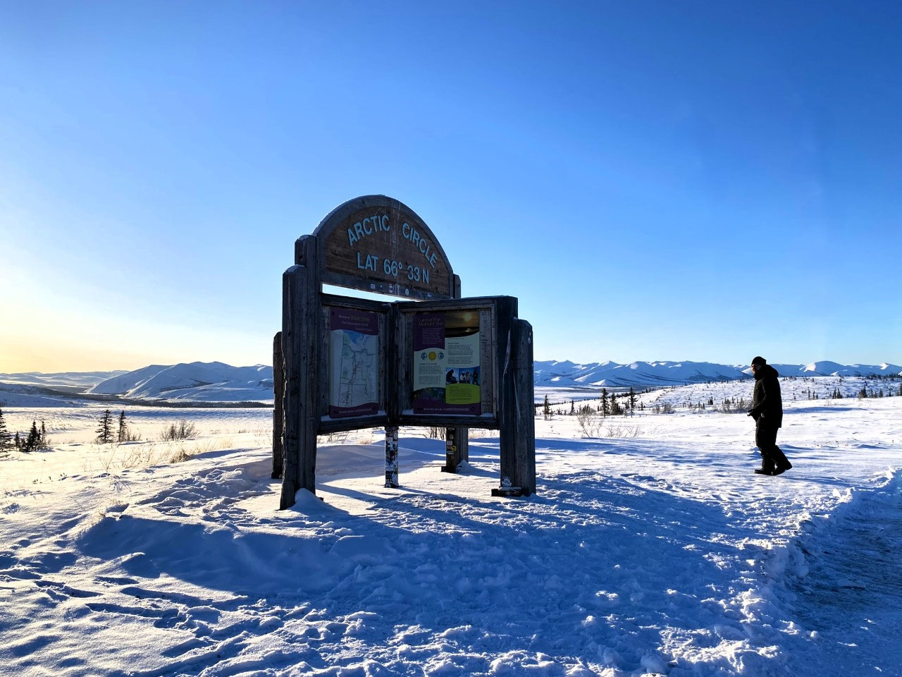
At 66.33°N - We Reach the Arctic Circle
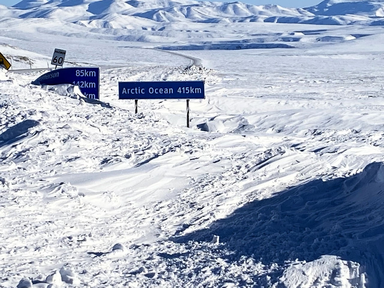
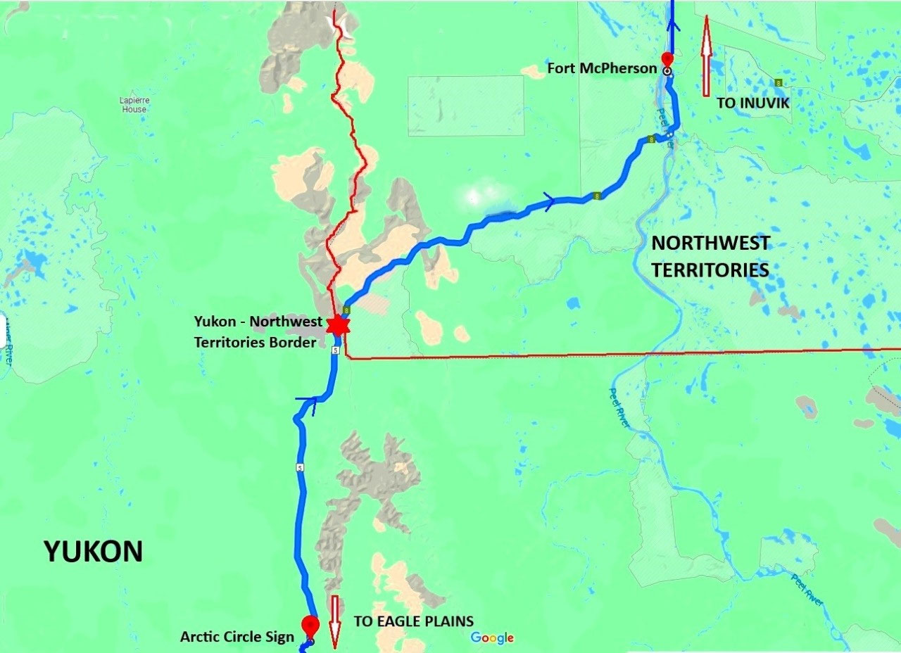
Just 37km north of Eagle Plains, we reached the Arctic Circle. A simple wooden signpost designated the actual site. We were at the very latitude of 66.33°N.
Our tour stated we were to celebrate the event with champagne. And there was no way any of us would let Leo forget... Anyway, at 9:00 am, a toast to the Arctic Circle was perfectly acceptable. And no one complained.
Around the world, we have visited some twenty settlements north of the Arctic Circle, and we have mostly travelled by air to reach our various destinations.
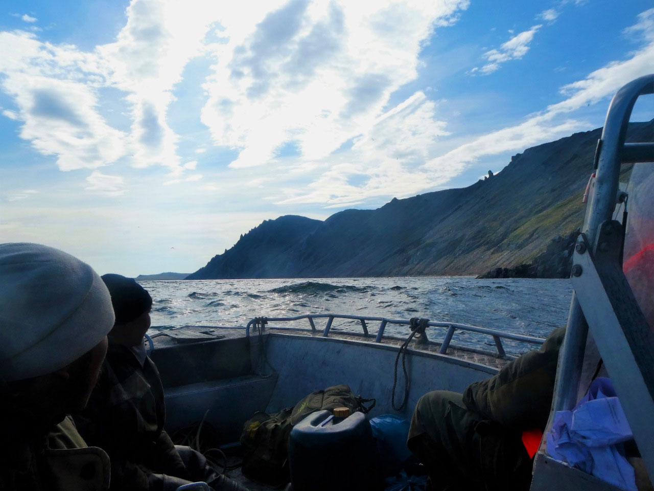
That is with the exception of Russia, where we travelled across the Arctic Circle site near Udachny, Yakutia, by 4WD vehicle, and also our epic travels from the whaling village of Lorino to Cape Dezhnev, Chukotka - the most easterly point in Asia, and where we travelled along the Bering Sea coast in a tiny aluminium whaler's boat.
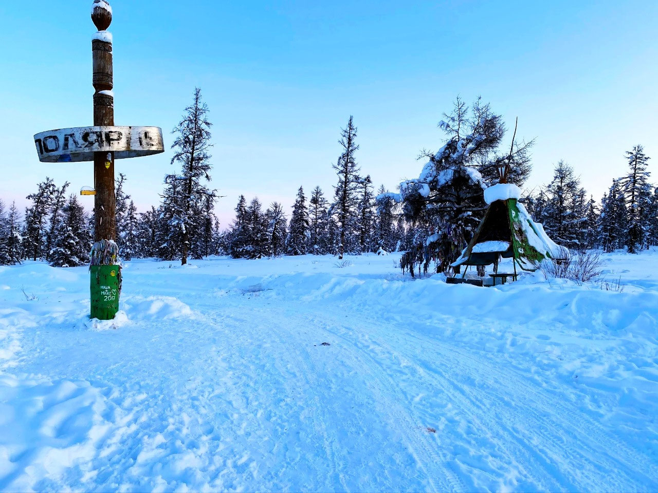
Sadly, we found our crossing of the Arctic Circle at Udachny disappointing. A forlorn corroded sign with a nondescript group of monuments, a wooden totem pole bearing a large crooked metal hoop, and a lonely yaranga marked the very site of the Russian Arctic Circle.
"Somewhat underwhelmed, we were even more disappointed to see that on the pole was painted "Маша л Макс - 2017" (Masha Loves Max - 2017). Next to it was painted a white heart.
Some things in life are indeed universal. Touching graffiti? Perhaps not. I would, however, have to admit that it was almost amusingly bizarre. We were at one of the most extraordinary places on earth. Where during the midnight sun, there is no sunset. And during the polar night, there is no sunrise. How could this be such an insignificant site?" Refer blog Zimnik Yuryung-Khaya, 2020. Link: http://v2.travelark.org/travel-blog-entry/crowdywendy/13/1598165305
And quite frankly, during our travels through the treacherous Bering Sea to Cape Dezhnev by boat, the last thing on our minds was the joy of crossing The Circle. In hindsight, it was such a perilous journey that we had not even thought about it.... Refer blog Chukotka Arktika, 2018. Link: http://v2.travelark.org/travel-blog-entry/crowdywendy/10/1547623723
CROSSING THE BORDER INTO THE NORTHWEST TERRITORIES
Leaving the Yukon: Heading to Fort McPherson
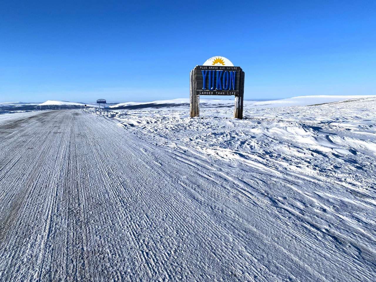
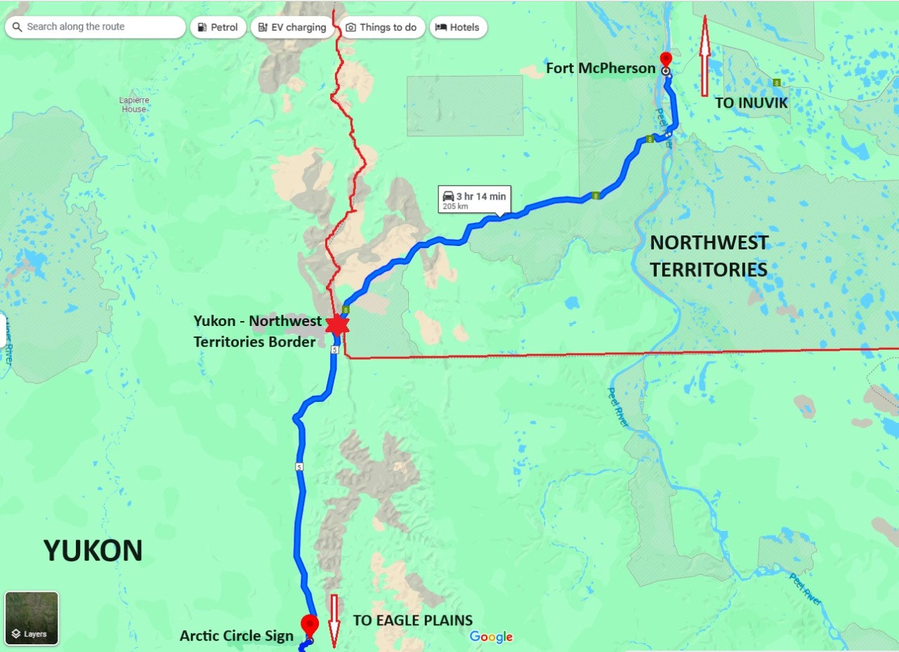
Our travels to Fort McPherson involved crossing the territory border from the Yukon and into the Northwest Territories, some 50 km north of the Arctic Circle.
I felt rather sad leaving the Yukon. It is such an iconic territory, and as mentioned, it had such wonderful lingering childhood memories of sitting glued to the television watching everything American. Except, of course, it was at times Canadian... Well, I guess it was Northern America...
A friend and former work colleague, Linda, eloquently describes these television series' impact: "I too have memories of the Yukon and all those TV shows, with snow and mountains
and lovely men in red uniforms. Funny how those old shows stay in the memory
banks, up there with Daniel Boone and Rin Tin Tin, from my steady diet of
American TV that Australians of my generation were raised on".
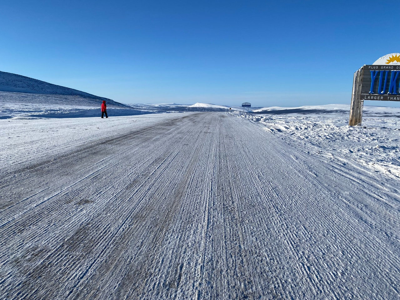
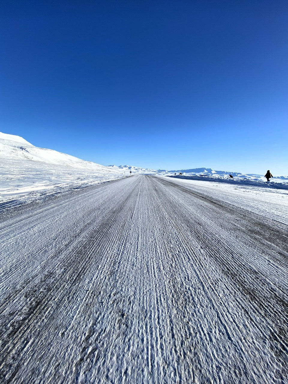
Gazing backward at the sign "Yukon - Larger than Life", it occurred to me just how appropriate the signage was. Set on a vast, snow-covered plain framed by glorious, pristine, undulating mountains, the Yukon was truly magnificent. And it was indeed larger than life. The absolute remoteness was euphoric.
After a short stop to take photographs, we were off once again along the Dempster toward the curious settlement of Fort McPherson.
INTRODUCING THE NORTHWEST TERRITORIES
The Northwest Territories at a Glimpse
The Northwest Territories (NWT) is a federal territory of northern and northwestern Canada. With a land area of 1,183,085 square km, it is the second-largest and most populous of the three territories in Northern Canada (Yukon, Nunavut and the Northwest Territories). To understand the enormity of the territory, its land mass is roughly equal to that of France, Portugal and Spain combined. It is bordered by Nunavut to the east, Yukon to the west and the provinces of British Columbia, Alberta and Saskatchewan to the south.
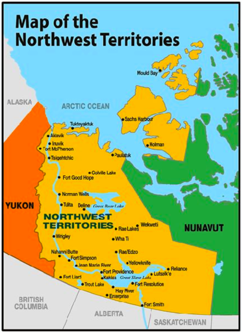
In the north, the territories include the largest northernmost islands of Banks and Prince Patrick. Several islands are also divided between the NWT and Nunavut, notably Melville and Victoria.
The NWT houses a population of some 42,000. Together with Nunavut, it is one of two jurisdictions in Canada where Indigenous people are the majority, constituting 50.4% of the population.
The capital city is Yellowknife.
Geography
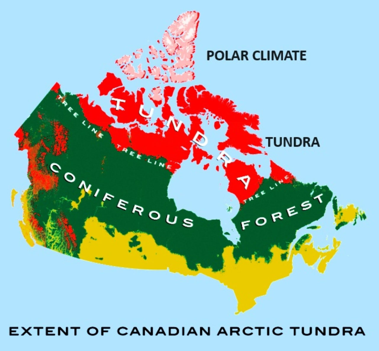
The NWT encompasses a vast area of forest and tundra, the differential being defined mainly by latitude.
There are three main geographic regions: the Arctic Archipelago to the north, the Arctic mainland and the Mackenzie Valley area. The Arctic mainland, sometimes referred to as the Barren Lands, lies northeast of the tree line and the Mackenzie Valley area to the west.
The Mackenzie Mountains to the west and southwest contain the NWT's highest and most rugged relief. The highest elevation is 2,773 meters at an unnamed peak in the southwest near Mount Sir James MacBrien, at 2,762 meters.
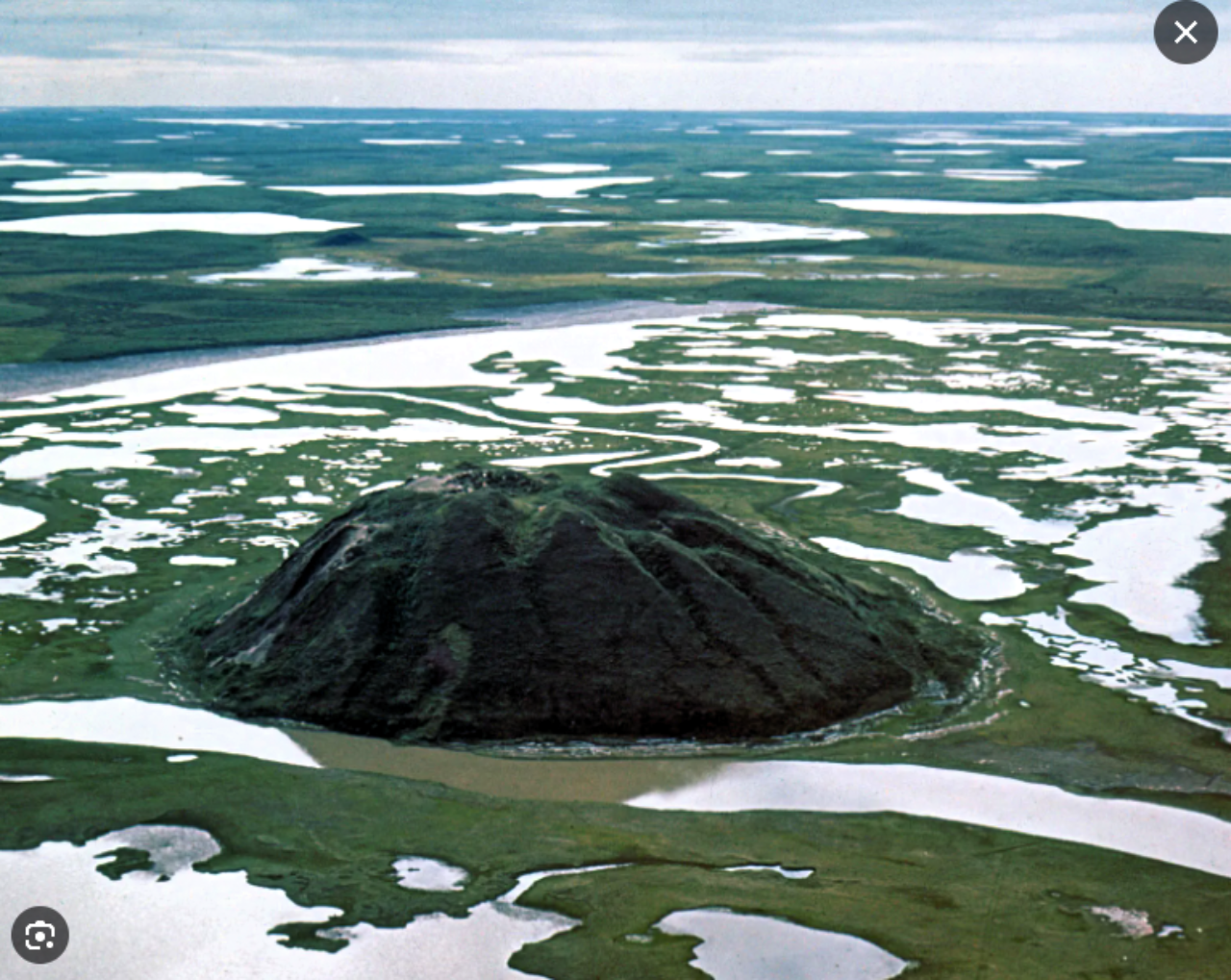
The tundra and the taiga (boreal forest) blend into one another along the tree line zone. Extensive forests are found in the more southern locations. In the north and east of the timberline are the flat and often poorly drained lowlands resulting from permafrost and continental glaciation, with associated string bogs and muskeg**. Permafrost is found throughout the NWT. Around Tuktoyaktuk in the far north, it is hundreds of meters deep. Permafrost creates serious construction problems, especially when the subsoil is an unstable mixture of fine silt and water.
The Mackenzie River runs northwest through the NWT, from Great Slave Lake to the Beaufort Sea. With a total drainage basin of 1.8 million square km, it is Canada's largest river. Great Bear Lake and Great Slave Lake are the two largest lakes in Canada.
**A string bog or string mire consists of slightly elevated ridges and islands with woody plants, alternating with flat, wet sedge mat areas. Muskeg is a peat-forming ecosystem found in several northern climates, most commonly in Arctic and boreal areas. Muskeg is synonymous with bog or peatland.
Climate
Due to its vast area, the NWT has a significant climate variance from south to north. The southern section, most of the mainland, has a Sub Arctic Climate, whereas the islands and far northern coast have a Polar Climate.
Summers in the north are short and cool. Winters are long and harsh. Extremes are common, with summer highs reaching 17 °C and lows typically as low as minus 45 °C. Conversely, summer highs in the south can reach 36 °C and lows to minus 40 °C.
The MacKenzie lowlands offer the most favourable conditions for plant growth, where black and white spruce forests mixed with deciduous species extend north to the MacKenzie delta. With only about 70 frost-free days, however, the growing season for herbaceous plants is short.
Many species of fur-bearing animals are found in the area, notably muskrats and beavers. Moose, wolves and black and grizzly bears are common, as are mountain sheep and goats.
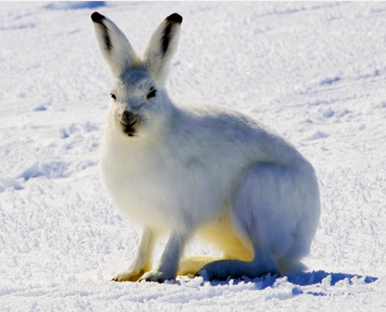
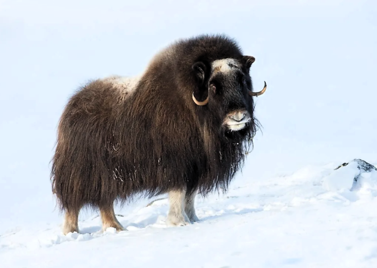
In the north, tree growth becomes sparse and stunted, eventually giving way to the short tough vegetation of the tundra. Here, mosses, lichens and small hardy plants survive, supporting animal life ranging from small burrowing mammals to Arctic hares, foxes, caribou and musk oxen. Seals, walruses and polar bears are prevalent along the coasts. Birdlife is plentiful in summer, with some species, such as the pretty white ptarmigan and the handsome black raven, remaining all winter.
As in Arctic Russia, mosquitoes and midges are plentiful in summer. Yet another reason we travel to the Arctic in the winter season.
Historical Briefing
Before European colonisation, the present-day lands of the NWT were inhabited for millennia by several First Nations groups.
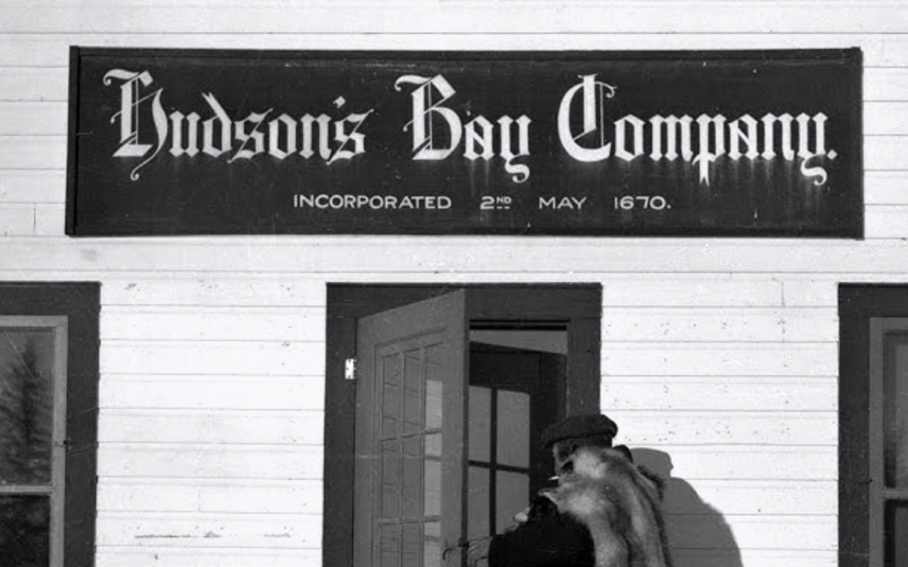
By the late 16th century, European explorers and fur traders began to explore the region. In 1670, the British claimed the North-Western Territory, and a region around Hudson Bay, known as Rupert's Land - to which the British government granted the Hudson's Bay Company a commercial fur trade monopoly***. By the 1700s, European trade in the North-West Territories was dominated by two fur-trading companies: Hudson's Bay Company in London and The North-West Company in Montreal.
As European trade increased, First Nations people became involved as guides and suppliers of furs. In 1821, the North West Company and the Hudson's Bay Company merged under the latter's name.
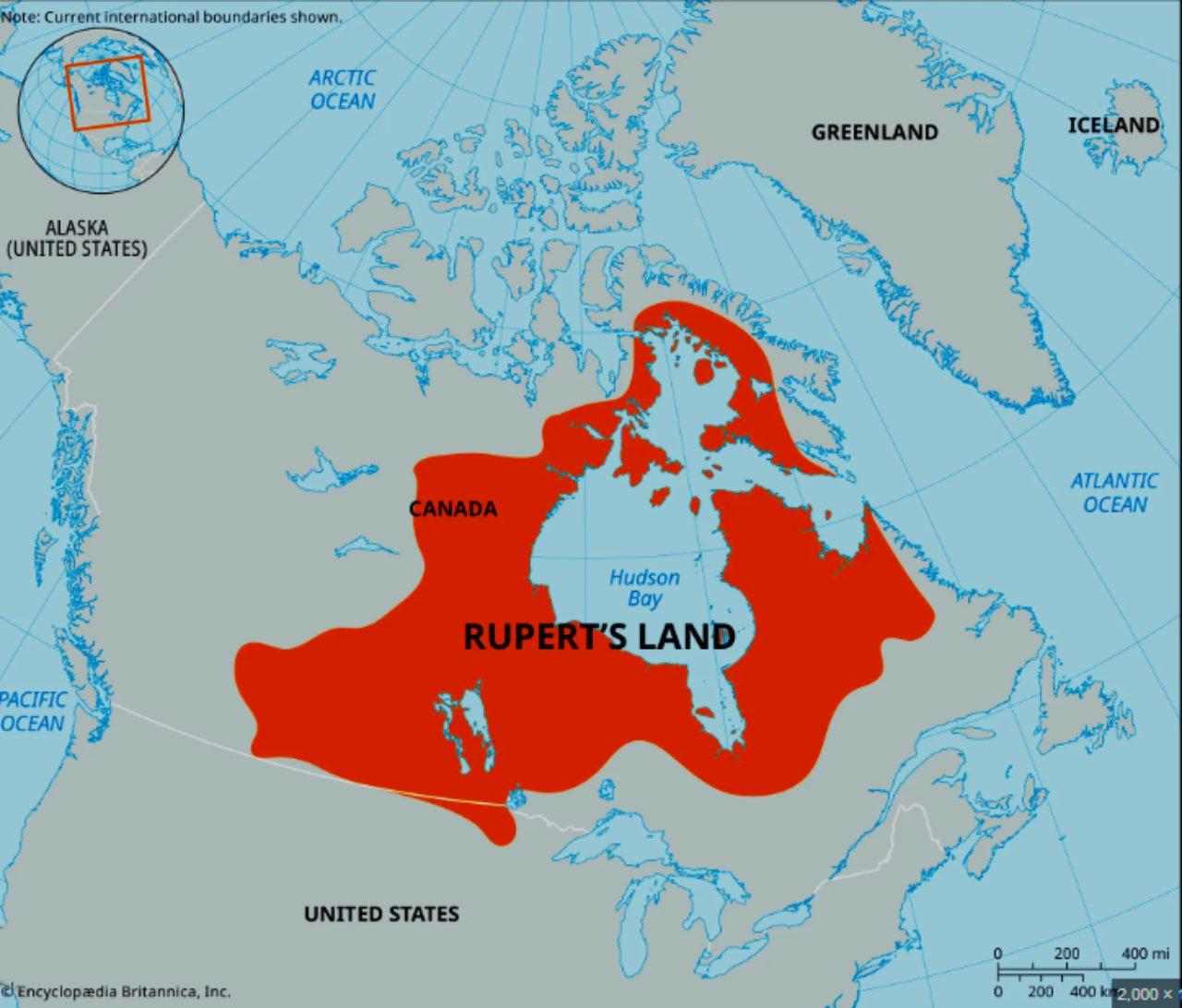
In 1870, the Deed of Surrender was enacted, and the United Kingdom transferred ownership of Rupert's Land and the North-Western Territory from the Hudson's Bay Company to the government of Canada.
In 1880, the British Arctic Territories**** were transferred from the United Kingdom to the government of Canada and then administered by the North-West Territories.
***Rupert's Land or Prince Rupert's Land was a territory in British North America that comprised the Hudson Bay drainage basin.
****The British Arctic Territories was a region of British North America, composed of islands to the north of continental North America. They are now known as the Arctic Archipelago. The British claim to the area was based on the discoveries of Martin Frobisher (1535–1594) in the 16th century. Wikipedia.
During 1898, due to the Gold Rush, the border of Yukon Territory expanded, gaining an area from the North-West Territories. Similarly, Alberta and Saskatchewan were separated from the territories in 1905. In 1906, the official name for the North-West Territories dropped the hyphen to become what is known today as the Northwest Territories.
In 1920, oil was struck in the Mackenzie River Valley. The area became the site of an intense but short-lived oil staking rush during the summer of 1921, from which the indigenous peoples barely benefited. During this time, they were rebelling against the massive mining land claims made by the Canadian government. Several Treaties were signed, but the local indigenous people remained dissatisfied with the resulting implications for the habitation of their lands.
In 1925, Canada became the first nation to extend its maritime boundaries northward to the North Pole. The NWT increased in size to 3.3 million square km.
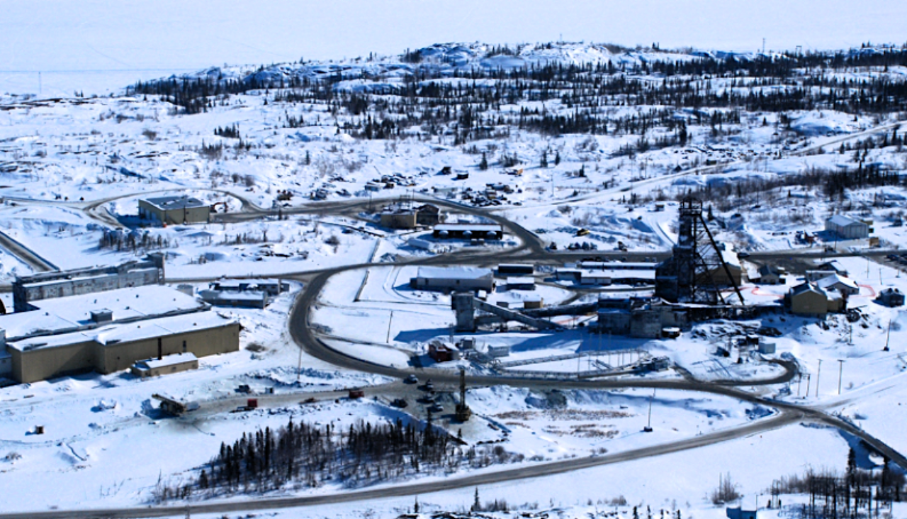
In 1935, gold prospecting country was discovered in the Yellowknife district, resulting in the establishment of the city of Yellowknife. Thirty-two years later, Yellowknife replaced Ottawa as the capital of the NWT.
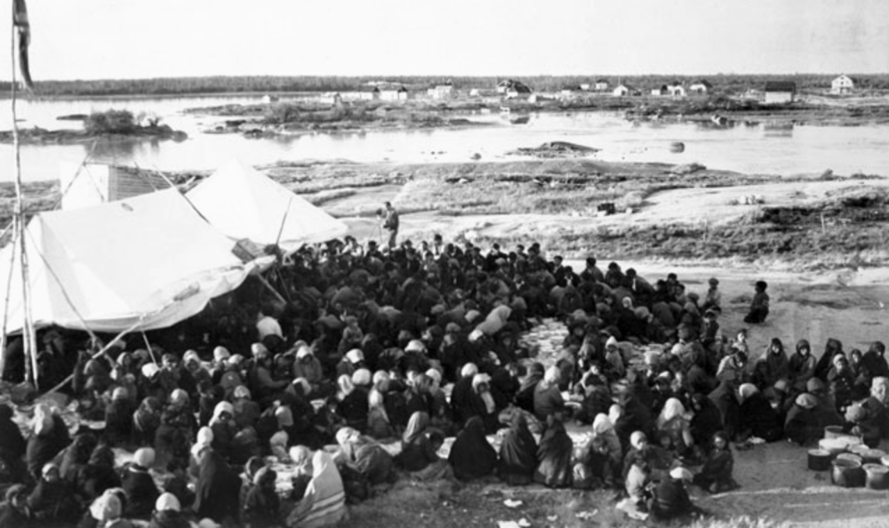
Between 1953 and 1955, during the Cold War, the Canadian government sent Inuit families to the High Arctic North to populate the harsh, barren and militarily sensitive northern territory. A brutal move, the policy resulted in the starvation and deaths of many Inuit families. The history is woeful. The shocking enormity of these moves will be discussed as a separate topic later in this publication.
In 1993, Nunavut was created as a separate new territory. The creation of Nunavut reduced the size of the NWT by more than half.
Modern Economy
The NWT has the highest per capita GDP of all provinces and territories in Canada.
Geological resources include gold, diamonds, natural gas and petroleum. The well-known Eldorado Mines produced uranium for the Manhattan Project***** and radium, silver and copper. High production costs due to the harsh environmental conditions, however, inhibit the development of many of the territories' mineral resources.
*****The Manhattan Project was a research and development program undertaken during World War II to produce the first nuclear weapons. It was led by the United States in collaboration with the United Kingdom and Canada
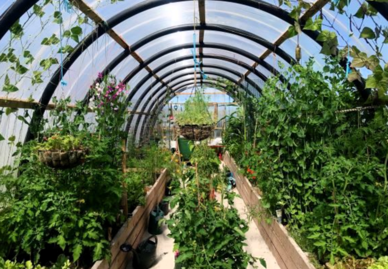
Although there are areas of arable land in the southern parts of the MacKenzie Valley, farming has not been regarded as profitable to date. Small-scale greenhouse farming is undertaken but limited by the harsh weather conditions. Nevertheless, agriculture is considered a small but emerging industry.
Commercial fishing is mainly confined to Great Slave Lake. While the lake's commercial fishery has declined over recent years, the natural wealth of fish remains.
INTO THE REAL TUNDRA
Toward Fort McPherson
After crossing into the NWT, we travelled nearly 100 km north along the Dempster Highway to Fort McPherson, 120 km south of Inuvik, and our final destination for the day.
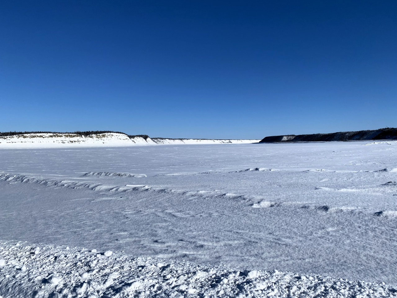
Now we were in the tundra. Rocky hills revealed little plant life, only sparse, short, naked willow and birch. Until we approached Fort McPherson, there were no signs of human habitation.
Fort McPherson is generally accessible by road from Dawson City all year round. Ice roads are made across the frozen Peel and the Mackenzie Rivers in the colder months. Two vehicle ferries operate during warmer months: the Abraham Francis crosses the Peel River near Fort MacPherson, and the Louis Cardinal crosses the Mackenzie River near Tsiigehtchic.
As for our travels through Arctic Siberia, drivers must call ahead to ensure the passageway is open at both crossings. Critical times for ice roads are in the spring thaw and around the autumn freezing.
Brief Visit to the Hamlet of Fort McPherson
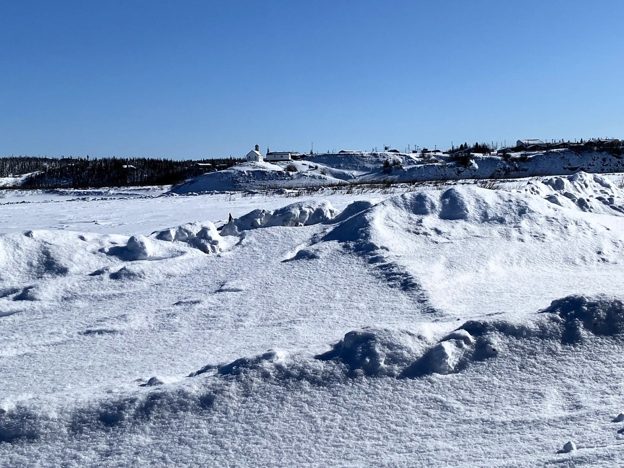
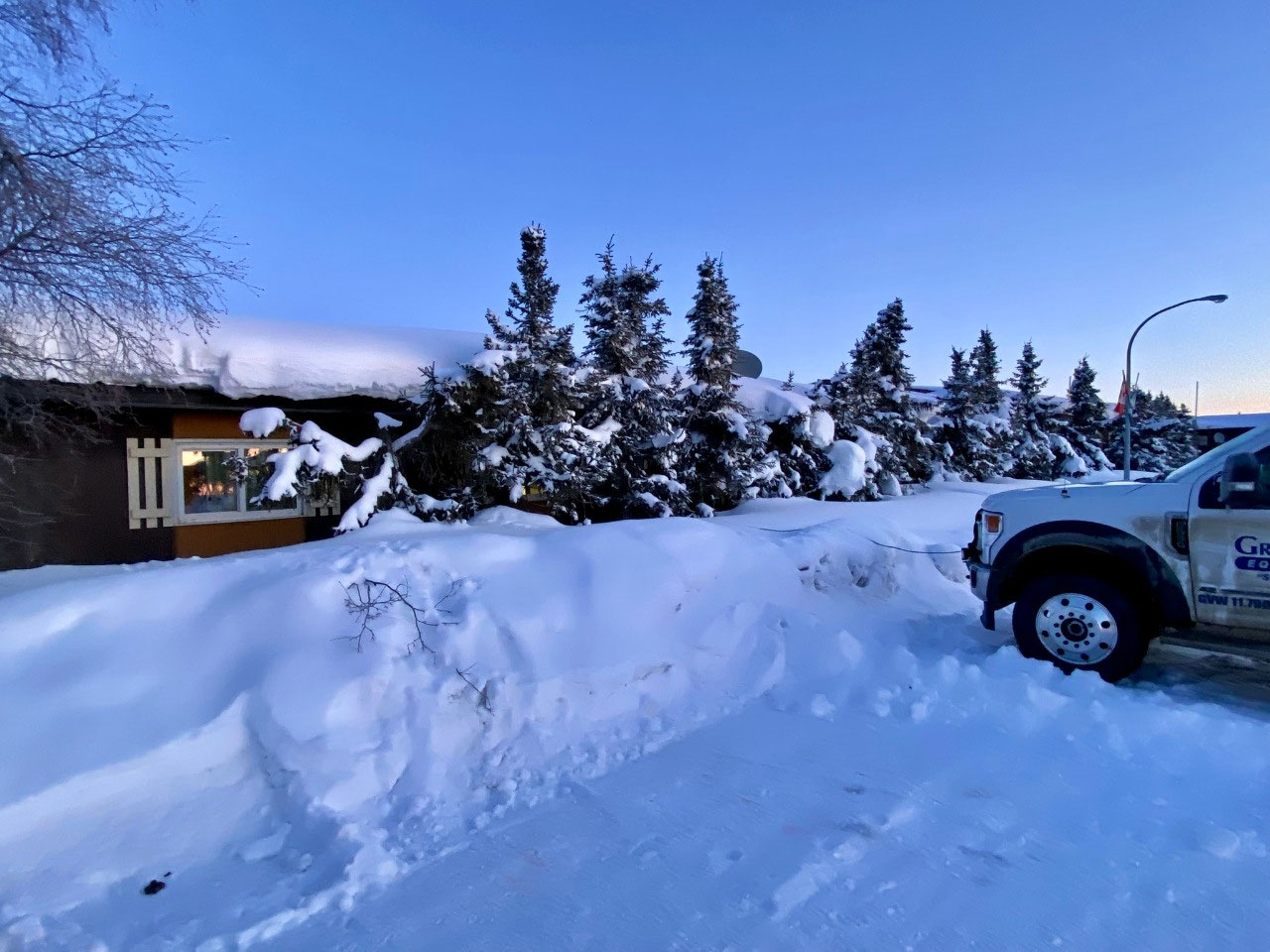
Crossing the Peel River ice road, we could just see the distant outskirts of Fort McPherson. The small Inuit hamlet perched on the east bank of the Peel River reminded us very much of some of the villages we visited in Magadan Oblast, Siberian Russia. Perhaps it was the thickly snow-clad buildings as until then, we had not yet seen anything like the amount of snow nor the spectacular frozen taiga of Arctic Russia.
The village may have been humble, but on a glorious sunny yet icy cold day, Fort McPherson looked magnificent. Barely visible, quaint wooden cottages were piled high with up to a metre or so of marshmallow-fondant layered snow. Clearing doorways and driveways from the thick ice must have been a nightmare. Several cars and snowmobiles were totally encapsulated and would probably not have been accessible until the spring thaw.
As we drove through the pristine snow-clad roads, the little village appeared almost deserted. But then again, it was cold. And as we were to see from other Arctic villages, people only venture outside for essential activities. Sensible people, that is....
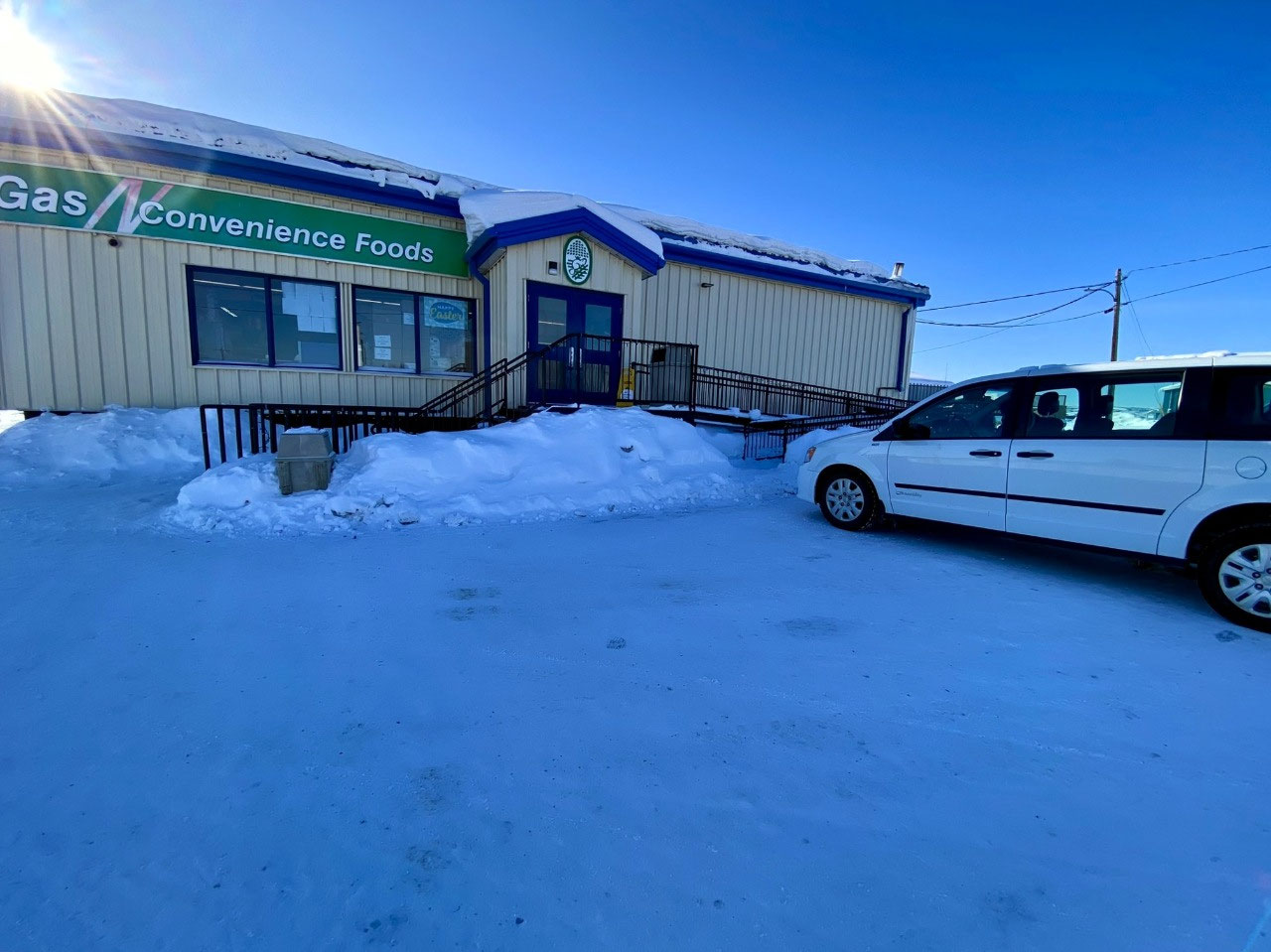
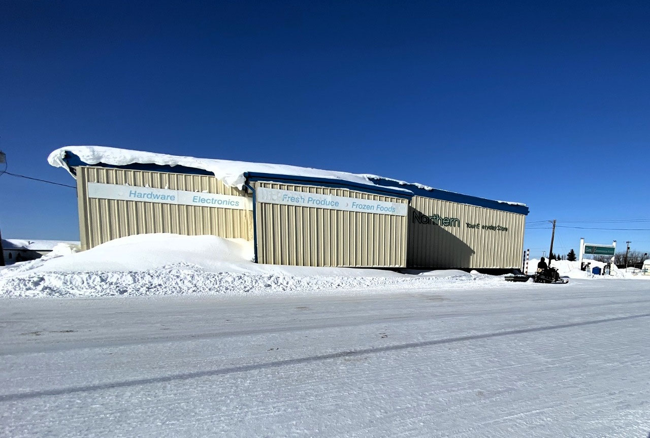
Our first stop was at Northern, a sizeable general store in Fort McPherson that supplied everything from fresh produce and frozen foods to hardware and electrical goods. Northern is one of many store outlets operated by The North West Company. Interestingly, it has a rich, enterprising legacy as one of the longest-continuing retail enterprises in the world. The company traces its history back to 1668, with many of its stores in Northern Canada and Alaska operating for over 200 years. We were to appreciate the homely Northern stores throughout our travels in the NWT and also in Nunavut.
And Northern was an ideal stop. Not only did the management generously allow a bus full of tourists to use their toilet facilities, but the staff was overwhelmingly friendly and helpful.
One thing we could say about our tour was the lack of touristy activities. Stops were for personal relief, food and photographs. We were thankful. The lack of any contrived activities, mandatory stops at souvenir stores or touristy visits certainly suited us. And it pleased the rest of our group.
As we queued, Alan and I chatted with a young fellow stacking shelves at the rear of the store. At just 13, he was surprisingly mature and more than happy to tell us about his life in Fort McPherson. Would he ever consider leaving the village? No, he loved Fort McPherson, his job, and his life there.
Northern was also a great place to buy our food supplies. Shelves were well-stocked, and a surprisingly large variety of fresh fruit, cheeses, bread and biscuits was available.
There was nowhere to eat lunch other than in our minibus. But no one was complaining. After all, it was a chilly minus 26 °C outside....
We spent little time in the hamlet. We had another 120 km further to travel along the icy Dempster Highway across more ice roads before we reached Inuvik. And understandably, Leo was keen to arrive before nightfall.
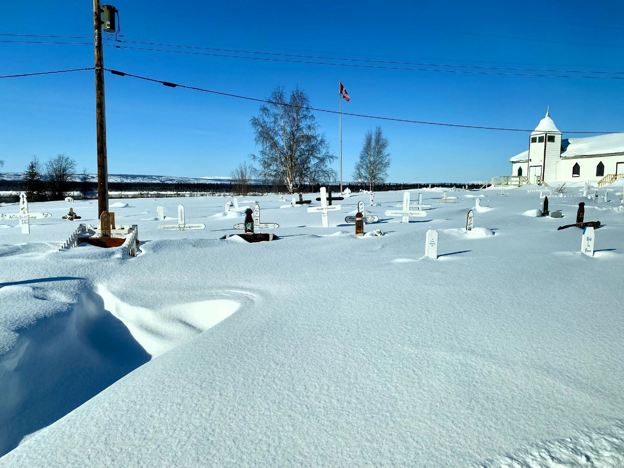
As we left the hamlet, we passed St Mathews Church and its snowy cemetery. A lonely large tomb, cordoned off by four cement posts connected by a chain, is the resting place of the four men who were part of the infamous Royal Canadian Police Lost Patrol (see below). A sad flag pole signifies the location of the site.
An Insight Into the Past - Fort McPherson
Fort McPherson is the first NWT community north of Eagle Plains on the Dempster Highway. Today, it is home to around 800 people; an important and thriving hub for the indigenous Gwich'in people. The Gwich'in call Fort McPherson "Teetliit Zheh" or "head of the waters town". It is one of four indigenous communities in the Gwich'in Settlement Region, an area created by the Gwich'in Comprehensive Land Agreement (1992). The other communities are Aklavik, Tsiigehtchic and Inuvik.
Originally named Peel River Post by early European colonisers, Fort McPherson was founded as a Hudson's Bay Company trading post in 1840. It was the first post established in the lower McKenzie Valley.
In early years, the company traded caribou and moose meat in exchange for European-Canadian trade goods. The meat was critical for the survival of the Peel's River Post and other northern post communities. Following the 1880s, fine fur became an increasingly valuable trade item. For more than 60 years, Fort McPherson was the principal trading post in the McKenzie Delta region.
Missionaries followed the fur traders. In the early 1860s, Roman Catholic and Protestant missionaries arrived to evangelise the Gwich'in.
During the Klondike Gold Rush, Fort McPherson was a significant base from which prospectors reached Yukon's goldfields. In the first year of the Gold Rush, more than 1,500 people passed through Edmonton on their way to the Peel and Porcupine Rivers. Their arrival on Gwich'in lands led to the local indigenous people working as guides, packers and hunters. Their trade network extended to Dawson City, where they traded for modern goods such as canvas tents, stoves, heating equipment and other goods.
In 1903, the first Royal North-West Mounted Police (RNWMP) detachment was established at Fort McPherson. The initiative aimed to assist in asserting Canadian sovereignty in the western Arctic.
Although arduous, most of the RNWMP patrols were uneventful. That is, until the patrol of 1910-1911, which became famously known as The Lost Patrol. On this tour, four RNWMP officers - the tour's whole contingent - died on their way back to Fort McPherson after an unsuccessful attempt to reach Dawson, some 760 km south. With no roads at the time, the team followed various trails before becoming hopelessly lost. One shot himself and the others and perished from hypothermia. They were just 40 km south of Fort McPherson, but it took a year to find the bodies. The four officers are buried at St Mathews Church in Fort McPherson.
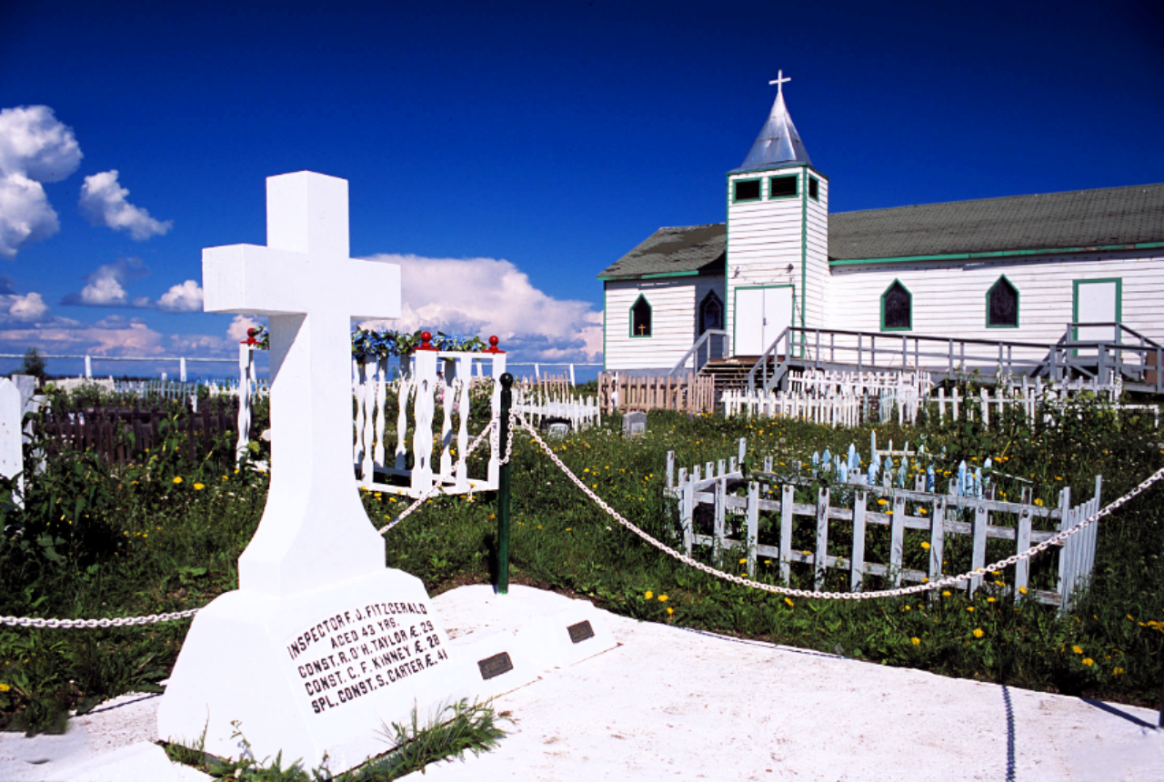
Today's literature often refers to The Lost Patrol as "One of the most tragic episodes in Northern history". I doubt, however, that the Indigenous Inuit people of the northern lands would agree...
To Inuvik
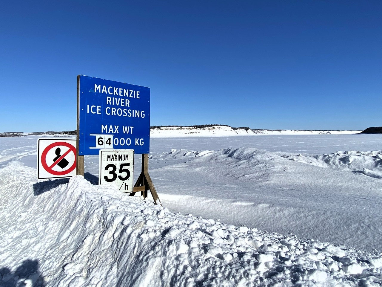
From Fort McPherson, we were travelling through mostly Gwich'in-claimed lands. Our trip north to Inuvik took us over the Mackenzie River ice road, crossing at the nearby settlement of Tsiigehtchic. A graded, beautiful road; it was hard to think we were travelling over the expanse of a major river.

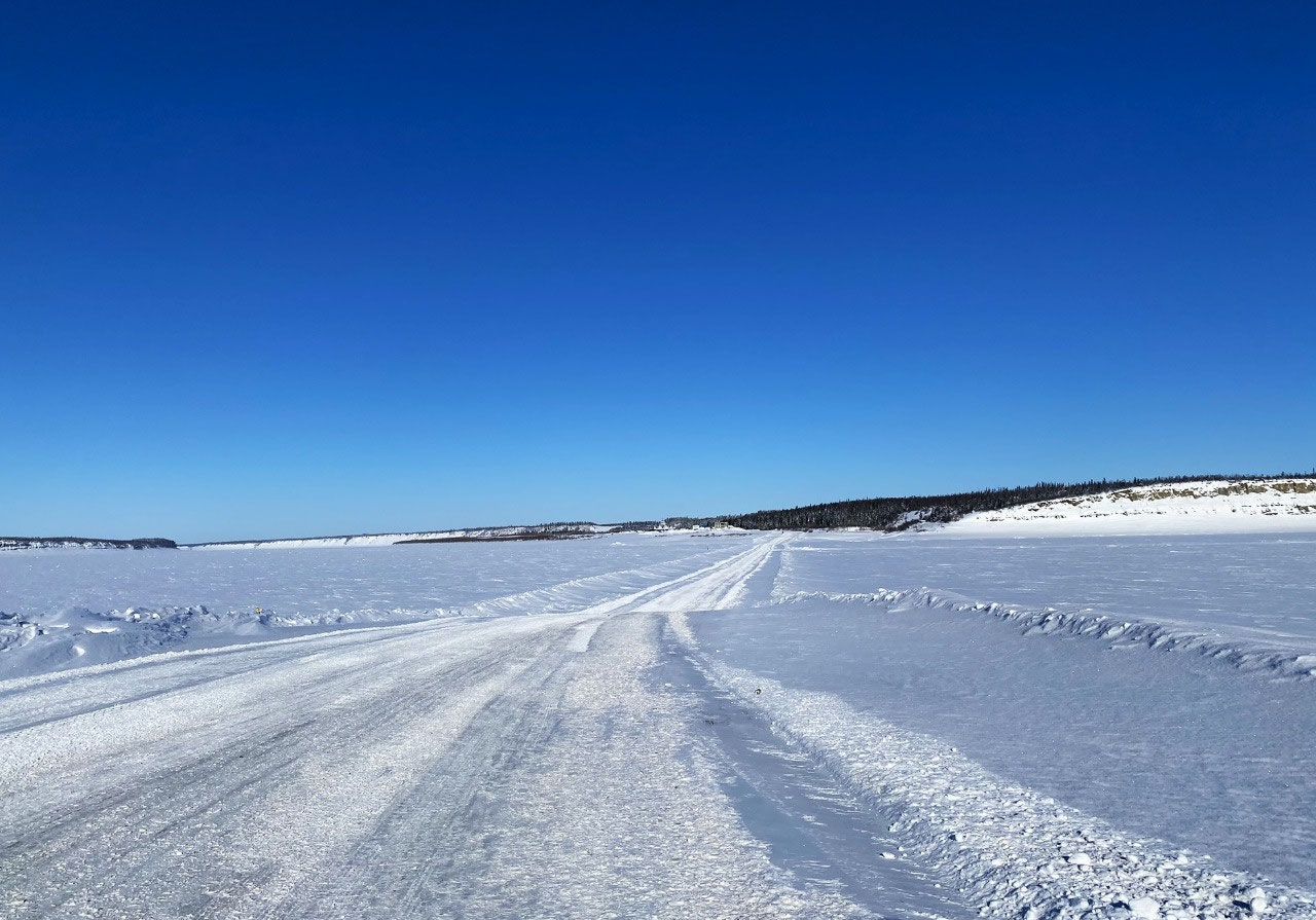
The road, however, was in good shape, with only occasional patches of blue ice. We recalled times in Yakutia when our drivers would alight from our vehicle and jump up and down the ice to test the integrity of the ice roads. Thankfully, it did not ever give way. But we did hear of some pretty horrific stories...
Surrounding us were frozen tundra lakes. Typical of permafrost regions, the landscape was pocked with frozen muskeg and swampland. There was virtually no vegetation in sight.
Earlier in the day, we had tentatively asked Leo what our Inuvik Hotel was like. "Well, if you liked the Sternwheeler Hotel in Whitehorse, then you will love the Mackenzie Hotel", he laughed. It sounded promising.
I must admit that we were somewhat apprehensive as to what the township of Inuvik would hold for us. As mentioned earlier, we had planned to fly back to Whitehorse with our group after our tour concluded. From Whitehorse, we would travel north-east to Yellowknife before embarking on our travels through Nunavut Territory.
Our plans were shredded when Air North cancelled all its flights east for the winter season. We had the option of returning to Whitehorse or staying in Inuvik and catching a Canadian North Airlines flight to Yellowknife. We chose to spend our additional days in Inuvik. Was it a good move? We had not the faintest idea. But Inuvik was a long way north, and we thought it presented more of an adventure than Whitehorse, which quite frankly, we had found disappointing.
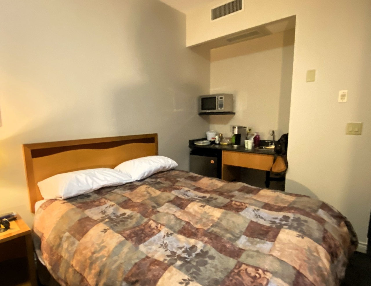
Inuvik however, did not disappoint. Arriving late in the afternoon, the town looked interesting, and we were delighted with our Mackenzie Hotel. Our room was large, pleasant and comfortable, with two double beds and even a small kitchenette with a microwave, refrigerator and tea and coffee-making facilities. Best of all, the hotel had a restaurant and a bar.
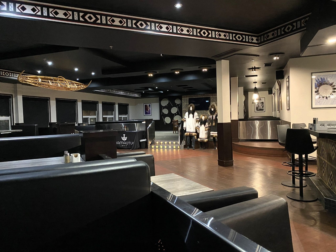
On venturing down to the bar to have a pre-dinner drink however, we were told in no uncertain terms that guests were only allowed to have alcoholic beverages whilst dining. The young woman was pleasant but insisted it was against the rules to drink without eating. It was far too early for dinner, so drinks at the bar were out of the question.
But who were those noisy people sitting at the bar, not dining but obviously enjoying more than one or two drinks?


2025-05-22