The circuit along hwy to Wyndham and back on Gibb river road,
Last day in Derby and Larry's camera stops working , what a time to stop as we are about to leave the van and go bush for 5 weeks. Only place with a camera in Derby is the post office where we have to go to send Larry's camera off to Melbourne and cannon. The only camera they have is a digital Fuji with 36 zoom for $280, well as Larry has laid claim to mine for now for bird photos , I have to have something so this will do. Will have to make him go without beer for awhile.
We drop the van to storage , which is no more than a padlocked paddock with someone staying on the property somewhere supposedly, there are other vans here and the word is nothing has ever happened to anything here.
This is the start of our 4 1/2 to 5 weeks with no van , we will start at the Derby end of the Gibb river road and head down to Windjana Gorge , then Tunnel Creek and the back dirt road into Fitzroy Crossing and on to the Great north highway to Halls Creek. Then dirt and gravel of Duncan's road, back to hwy, to turn off for Purnalulu National Park, -back to hwy to Wyndham . Hwy down to Gibb river road and along to turn off to north and a worse road up to north tip Western Australia to Mitchell falls , back to Gibb road and Manning Gorge, Barrnett Gorge, Bell Gorge, Charnley Station and along to Derby after picking up the van .
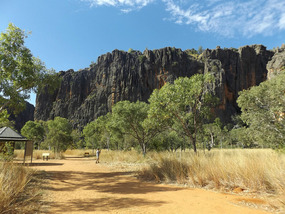
Windjana Gorge National park
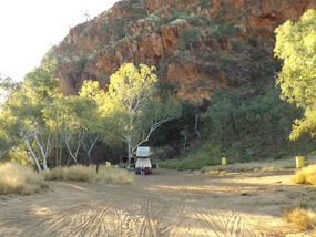
We will stay here a couple of nights and pay our park fees at the gate and decide to stay on the generator allowed side as the other part of the camp is full of loads of people. Less noise on this side even with some generators running and less people.
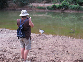
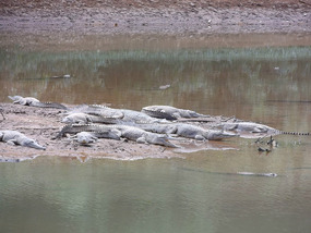
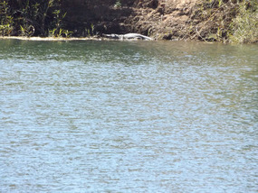
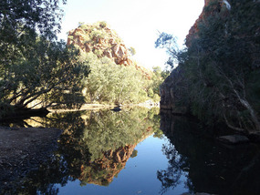
We go and walk the shorter walk into the gorge after setting up camp while the crocodiles are out sunning themselves on the sand bank. There can be up to 150 crocs here in the gorge but they are fresh water crocodiles . They do not grow as big as salt water crocs and their mouth and nose are narrower and can only take smaller bites of you, they are not as aggressive. We have been swimming in places where they are but only a couple of them at a time, not this amount and swimming is not allowed no matter how inviting the water is. You start the walk through a gap in gorge wall and walk alongside the wall and in parts next to what remains of the river. With crocs also laying just under the surface with their noses sticking out.
After watching and taking to them for a while we head back for shower and dinner.
Early morning is time for the long walk as the temperature is still getting to 32 during the day. This is a bit hard after our first night on the hard mattress of the roof top tent but we will get used to it again.
This is a 7km walk in the gorge , start at same place and walk beside water and the dryer parts.
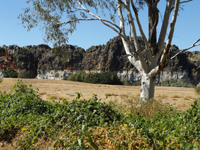
The gorge walls are of different colours and nearly straight up. Some caves for bats to live in and some parts showing fossil of sea creatures from the time this was an inland sea.
We start our walk at 7am and don't get back until 12pm lunchtime hot and hungry. We did take water and apples with us.
After lunch we go to see the crocs again and the little archerfish shooting mouthfuls of water at insects above themselves. They and other fish become croc food. We do see some waterbirds who must feel safe while the crocs are sunning themselves and the wallaby that came down for a drink. Just wait until nightfall when they go hunting, we do not come down here either.
Next morning is only short walk around the cliff base on the outside of the gorge thank havens as we did not sleep too good, noisy owls and a baby crying for over and hour.
Windjana gorge was formed by the Lennard river . 360 million years ago this was part of an inland sea when ancient crocodiles, turtles and diprotodon – a large herbivore like a giant wombat, roamed .Over 50million years the marine plants and algae containing calcium, the lime secreting organisms and dead animals built a barrier reef 2kilometres deep. The earths movements uplifted the Kimberly region and the inland sea retreated, this was the Devonian period.
Then the Lennard river carved out its gorge and its 35km Tunnel.
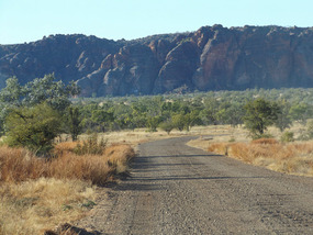
We move on to Tunnel creek down a even worse road than before, you can not camp here.
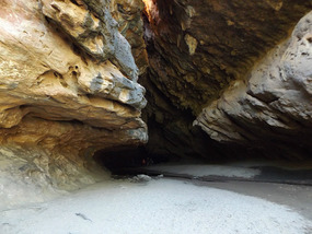
Tunnel creek you have to wade through water that can be waist deep, you need a torch and old clothes, good water walking shoes for the rocks.
Our new camera gets the job of going with us and our underwater camera incase. I have not worked out the camera settings yet so photos not to good.
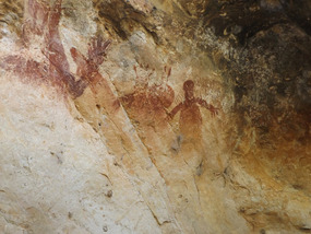
The walk in is over rocks and the deepest water is knee deep to the other end where you can climb out and up to see Aboriginal rock art. We do not see the croc that lives at his end in the river.We have lunch just outside in the carpark and then drive 58km down another dirt road , to stay the night at RAAF Boab Quarry, a disused quarry that was used for the stone for an airstrip at an inland RAAF base during WW11. This is the back road into Fitzroy crossing which we get to the following day.
Fitzroy Crossing was settled in 1890 and got a post office in 1892, police camp in 1894 and was placed on maps in 1903. Located at the crossing on the Fitzroy river as it joins the Leopold and Margaret rivers before they journey to King sound and the ocean. Fitzroy river is one of the longest in Australia with a catchment area of 90,000square kilometres. It starts in the Leopold ranges and empties into King sound south of Derby.
Just outside Fitzroy crossing is Geike Gorge, more about this latter when we come back this way with the van. For now we walk along the gorge for 2 hours and as we sit on the banks of the river for our snack and water looking for birds and anything else of interest I find a fresh water crocodile lazing in the sun on the opposite bank. We will cruise this river latter as we missed the early morning cruise and the midday and afternoon ones where full of tour bus loads. So we will do the 7am one when we return, less people , less noise, more wildlife.
The next night is spent at Ngumbain cliff lookout for the spectacular sunsets and sunrises. Well sky to clear to make either spectacular just good.
Continuing on along the hwy we pull in to Mary pool to check it out for when we return and yes even though not too much water in at moment we will stop here. There is a water crossing to get in but quiet ok for the van.
Halls Creek is next place along the hwy and we pull in for the IGA and bread and a couple of tomatoes. I have been wanting a tomato with pepper sandwich. We can not buy too much fresh because of fridge and there are restrictions for somethings around this part of WA for fruit fly.
Halls creek average daytime temp is 27-28 this time of the year but it has been well above that still and only some nights dropping below 15deg c.
Population of 3993. In 1884 a geologist thought there might be gold in the Elvie river east of here and the following year Hall & Slattery found gold and rode their horses the 550 km to Derby to register their claim. At the time the WA government was offering a reward of 5,000 pounds for anyone who discovered over 10 ounces of gold. With the condition that the gold field went on to yield 10,000 ounces. Well they claim only produced 8,668 ounces so they only got a reward of 500 pounds, but it was the first gold discovery in WA. Now cattle & tourism are the main stay, with Aboriginal art being a big thing here and the Bungle Bungles in Purnalulu National Park.
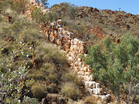
Before we go there though we travel part of the dirt 4 wheel drive Duncan road , it goes all the way into Kununurra near Northern territory border with WA. We go first 5.7km to what is called China wall, which got its name because someone thought it looked like the great wall in China. It is a natural vein of sub-vertical white quartz rising up 6 metres above the surrounding country side, it is kilometres long, formed when the rock surrounding the hard water resistant quartz was weathered away.
Next another 7 km down the bull dust Duncan road is Caroline pool and our camp for the night. It is close to where Halls creek used to be and the families back then used to use this pool and its sandy beach for picnicking and swimming. At the moment it does not hold too much water , we walk along river bed but do not swim but late afternoon a group of cars arrive with young people from Halls creek and they go swimming . We were going until they arrived taking over the water hole and it was too late by the time they left. Never mind it looked a bit green anyway.
We look at what is left of the old pioneer cemetery and town of 1885 and then head on. The gold from this area helped establish the ports of Derby and Wyndham. Town was moved in 1950s.
Palm springs is next and is a permanent freshwater pool on the Black Elvine river. Afghan teamsters planted date palms here ,hence the name. One of which and his Aboriginal wife stayed growing vegetables for sale in Halls creek.These two and another Aborriginal man kept the waterway clear of weeds until Sam Hazlett died in 1980 and no one has lived here since.
We could have stayed here but went just up the road, 3km, to Sawpit gorge instead, as there were a few people in a small area.
Still on the Black Elvine river and we walked and swam here as there were no signs of crocodiles . The water was a bit murky as it has not rained for awhile. The water was deep and cold close up to the rock wall. We are now 52km from Halls creek which we have to travel back down in the morning. We stopped at Palm springs as no one there and thought about a swim as the water is moving a bit more here, but it still murky and slippery on the rocks to get in, so no.
We could have gone down another dirt road for 150km [ the Tanami road] to see Wolf creek crater at the edge of the great sandy desert but decided not to. This is the worlds second largest meteorite crater at 880 metres across and almost circular with the floor 60 metres below the surrounding area.
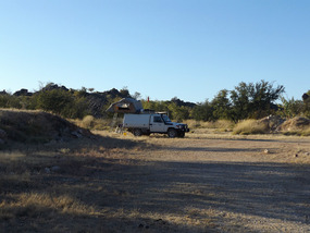
After going back through halls creek we follow the hwy up to the Purnalulu NP turn off and stay at the rest area just there for the night to get a early start in in the morning. A few people leave their vans here if they are only going in the park for the day. We are camping in there and its 4 wheel drive only no vans.
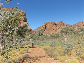
Purnululu national park named by the Aboriginals , known as Bungle Bungles, covers 240,000 hectares and has been a tourist thing since 1983 , world heritage since 2003.
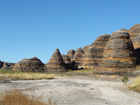
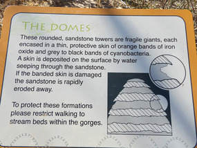
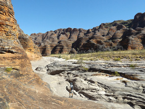
Access only in dry season april to december. 360 million years old , rise over 200 metres and were formed in the Devonian age. Carved over 20 million years through erosion into what you see today. The grey is cyanobacteria, the orange is oxidised iron compounds.
Stripped sandstone beehives, cliffs with evidence of waterfalls that flow in the wet season .
The drive in is 53km of very corrugated 4 wheel drive track with creek crossings through Mable Downs station into the Purnalulu National park . We finally get to the visitor centre after 2 nearly 3 hours and register as we have already booked. Find out where we have to go, but before we set up we drive to our first walk in park that is 20km from the campsite. That is the only draw back with roof top tent you can not move the car unless you pack up the tent, so walk and visit the days places before we set up.
Homestead Valley walk is a class 4 walk of 4 km and return. It goes into the range into a valley the local Aboriginals say was once a homestead. No traces other than the reminants of cattle yards and old equipment have been found. Nice walk into a valley with palm trees and if it was once a homestead it would have been a nice place to be.
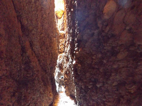
Echidna Chasm is next only a class 3 but a bit challenging walk through the creek bed of different size rocks and pebbles for 2km then climb into the chasm and to get right to the end you climb large boulders into 200metre chasm. Very narrow climb for short while to sit have orange and water looking up to top of chasm
Osmand lookout is a short up hill walk from the car park of Echidna chasm to an elevated ridge with views of neighbouring Osmand range.
Bloodwoods lookout only 500metre walk up to lookout overlooking the woodland.
Then to camp and find our place , set up enough to have a vegemite sandwich and a couple of cups of tea as a very late lunch at after 2 pm . Then finnish setting up tent and go walk part of the savannah walk here in camp to climb up and sit on top of boulders to watch the sunset, look the other way and see the light it casts the mountain range. The sunsets about 5 pm here. Back to camp and dinner and rest.
Up early next day we move to the south end of the park so an early rise in the morning. We need to get there early as the walk out to 'The Window ' is along Piccaninny creek bed along sand and pebbles at the start , getting to larger rocks and boulders. All walks in the south start at the same car park and branching off the creek bed. The longest one of 2 nights we are not about to try dor he 10km one out to whip snake gorge. We go 6km out to The Window which is a hole in the rocks and if you stand in the right place you get to see the early morning light on the Bungle Bungles. We were told at the information office to stand in the window which we did. The sign says don't climb, oh hum, here is photo. Its an uneven walk up here and hot, so we sit and have water and fruit before starting back to the Piccaninny lookout , this is only 500 metres up to it off creek bed. View of creek bed with the surrounding spinifex as it winds its way to the Ord river.
Back to creek bed and heading back to carpark again , the next walk is into Cathedral gorge.
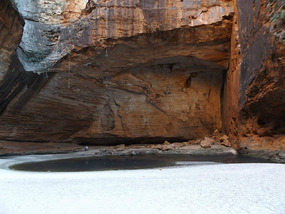
Cathedral Gorge is 2km up with short steep bits and a ladder in one place, narrow ledges with lots of pebbles to slip on. Then between towering cliffs of honeycomb rocks that open out into amphitheatre with a little pool in the base. This is well worth the walk in , but no swimming .
We walk out to the next thing which is to walk around the Domes to the carpark. It is now 12pm and we are hot, tired and hungry. We drive to our new camp in the park , setup have lunch and sit. All this walking dose mean that we are sleeping quiet well on our skimpy mattress in tent.
Our substitute camera takes panorama photos of three photos joined together so have included one.
Before we leave the Bungles we go to a 360 lookout over the western escarpment of Bungle Bungle range to see the colour change as sun rises, then to Stonehenge. A 520mt undulating walk in the bush with signs and explanations of the traditional use of the plants.
Back on the highway after the long slow 53km drive out of the national park we decide to stay the night at Muluks rest area, named after a man who died here in 2008. We are parked as close as possible to the dry creek bed and find a two little eagles then a nest with a young kite being fed . One of the parents flies in with a wood swallow in its claws, but we fail to get a photo.
Next night is at Dunham river, we are not moving much each day as there is too much to pull up and see.On one walk we find a little frog took photos so we can identify latter. We are in cane toad area and if you find one there are places to put them alive and someone comes along each day and disposes of them.
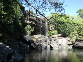
We call in at the Grotto on are way into Wyndham. This has 140 man made steps down into a gorge with a waterfall { in wet season] and a 300foot deep pool at the bottom. Even now in the dry with no flowing waterfall the water is still about 250ft deep but the rocks you have to climb over are getting slippery as the water is not flowing to much. We do not swim as it is early morning and cold down there.
After walking back up the narrow steps it is getting hot and you need a swim but we are heading into Parry creek farm for a couple of days. Hot showers, swimming pool and next to the Parry creek conservation park. It has places to sit and watch for a couple of rare finches and walks.
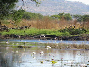
We Visit Marlgu billabong in the conservation area on are way out heading for Wyndham. This billabong has a walk way and a bird hide and as we find out 5 saltwater crocodiles.
Thats why the sign warns not to leave fenced walkway. While we are sitting watching birds and crocs sunbacking a White bellied sea eagle swoops in does a couple of swoops over the birds and then before we can do anything he has a coot in his claws and he is gone. Another great photo chance missed.
Wyndham has a population of 1000, so we get bread and a few things then head to the 5 rivers lookout at the Bastion ranges. The rivers are the Ord, Forrest, King, Pentecost, Duro and they all enter the Cambridge gulf here in Wyndham.
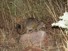
The night is spent back at The Grotto and still we do not swim, instead we head to the eastern start of the Gibb river road. But we do have a night time visitor a small brush tail rock wallaby.
We do not have time to change camera settings so red sorry. We are just glad we have a photo as we have not seen much in the way of wildlife.
The Gibb river road was made as a beef transport road from the surrounding stations to Derby or Wyndham. The road is only 660km long but it is a road.corregated, bull dust and rock
The Gibb river road is bitumen this end into El Questro station . Big station owned by an English man who has now acquired Home valley and Emma gorge. It is now a big tourist resort for all tourist buses and part is way beyond are budget. To go and walk the gorges you have to buy a E L Questro day or longer wilderness pass., then pay camping fees which are more than anywhere else along the gibb.
Once past the gate the road is a rough dirt track still and some of the stops you were allowed on this road at this end are closed.
We drive to Ellenbrae and stay a couple of nights, one hot shower and toilet for 20 or so campers at $30.00 a night is still too much.
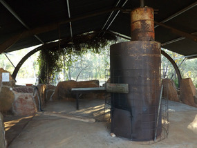
The water heater is an old wood heater ,a donkey you light in the morning and someone stokes during the day. The creek water is pumped in as is and heated , but it is still a shower, and there is a bath that some use.
Yo can also swim in creek close to the pump .
The managers show us a track , on the property, we can drive to and then walk 2km in to a swimming hole with birds and maybe wildlife.This takes us a good few hours and when we get back to report we are back we have scones , jam and cream. The homestead have a little rest area and advertise fresh scones jam and cream for travellers. They are quite nice and yes very fresh, shee makes batches all day until 4pm.
We stop the next night at Russ creek rest stop but just before getting there we find an older couple on the side of the road with a flat tyre on their offroad van. It was not only flat it was a totally ruined wheel, and he was trying to jack it up with this little tiny jack. We stop and Larry ends up changing it with our jack while I make a cuppa. Their spare was also nearly flat so it had to be pumped up. The amount of people that went tearing past in a cloud of dust was unbelievable.
They end up spending the night down a little bit from us I think they a little shaken.
We did find a couple of crocs in the water which did not look to inviting as it was drying up.
Onward along the Gibb to the turn off that will lead us eventually to Mitchell falls.
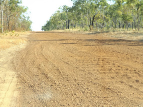
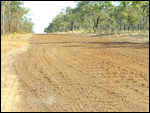
We turn into Kalumbura road and it takes 1 ½ hours to go 59kms. This road would rank up there with the worst corrugated roads we have been on and we still have another 99kms tomorrow .
We stop at Drysdale station at their Miners pool camp, only decomposing toilets but part of the Drysdale creek to swim in. We buy fuel at over $2 a litre diesel, frozen bread.
The 99km the next day took 3 hours with people passing us some with off road trailers going a lot faster. We latter find some of them at our next stop with broken springs , studs broken on wheels and heaps of flat tyres and some axils broken. Got to get there yesterday, now they have to stay do running repairs or limp back.
The night is spent at King Edward river camp on the Mitchell falls track just 3klm from the turn off of the Kalumbura road. This 3km should warn everybody this track is even in a worse state and the sign says no work is done on this track.
Well we start out the next morning down the falls road into the national park its 88km to the campground where we will spend a couple of days. This is the worst corrugated road we have been on ,not one of the worst but the worst and it takes over 3 hours some times not getting over 20km an hour. No wonder there are so many stories of car troubles at the speeds some are travelling at. We value our car and we would rather take longer and arrive intact. At the camp we pay our national park camp fees and find a quiet little spot , well this is a busy place so as quiet as we can.
After lunch we walk our first for here to the lookout and to Little Mertan falls for a swim.
The big walk is tomorrow.
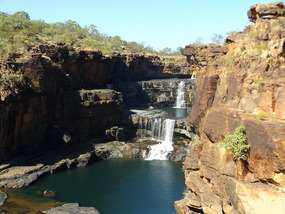
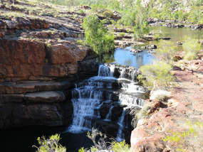
Up early to start walk to Mitchell falls before the heat of the day, 7 am start. The walk is only 2 ½ kms but they say allow 2 hours each way without stops.. We have swimming togs on as we can swim in a few places , water, apples, and vegemite sandwiches. Most of it is ok to walk nothing too bad some places climbing over boulders and the crossing at the top of the falls is not deep. A bit slippery and water is flowing but not too hard. Get across and have a little harder walk across boulders to get to the overhang to be able to take photos from nearly at the front of the falls. The only other way is a helecopter flight of $135 each for either up to falls or back down, but you have to book pay before you come up here. Anyway we get nearly round and I stop on one ledge while Larry makes it across to the overhang. He said photos video a bit shaky as he was a bit shaky out there. I took photo of him on ledge and he took one from there of my ledge.
Very good falls . You are not allowed down anywhere below the falls as its sacred Aboriginal land.
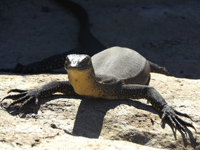
We climb back to where the helicopter lands near the top pools for a swim and we find a water monitor that stays around just sunbathing with us until he hears the helicopter and then he disappears.
The crossing across the river here is not as good as the one we did before it is thigh deep very slippery but the water is not flowing so fast. It takes ½ hour to get back to the track near the first crossing to start our trek back down. We stop and have our lunch on some boulders not far along the track then head down past Big Merten falls to Little Merten falls for a well earned swim.
Beautiful and refreshing once you take the plunge and get wet in cold water. Then finish walk back past a little swimming creek into camp its after 2pm. Nothing much done on our return except have a hot sprinkle shower from our portable hang up solar shower that holds 15litres.
Leave early in morning for the horrible drive back after a short walk around to stretch the legs, back etc.
The distance we were going to travel this day depended on what we felt like as we reached the first stopping camp at King Edward river , close to the road junction with the Kalumbura rd. It took a couple of hours to get here {88km] but it was still not 11 am. So we started out along the Kalumbura road for Drysdale station . [99 km].We stopped on the side of the road pulled over on to the grass to have a cuppa and lunch at 11.50am. I drove the next hour into Drysdale station. That was 187 km 4 hours.
We opt to stay at the station not at their Miners pool camp so we can stand under a very hot full force shower at night and again in the morning. Extra $10 .
Swimming and water bucket or solar bag showers have got nothing on these showers it was bliss to get rid of all the dust and relax. Larry had to tighten some of the nuts/bolts holding the back box to the car chassis, all that shaking , its good thats all that has happened so far..
In the morning we drive the 56km to the Gibb River camp for the night. Driving did not appeal so we sat, walked and washed some dust off the car with river water. While sitting there under a tree we had a great bowerbird visit and a flock of corollas about 200 hundred of the noisy devils.
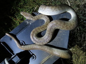
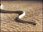
We only move to the Hann river camp next, and on the way come across a lage snake out on the track sunning itself. It is lucky it was us no body else would have stopped to let it across the track. Of course we took photos. At Hann river we walk and swim. As we pulled up a couple of rainbow lorikeets flew in so had to stand and talk to them, also we have another great bower bird hanging around so we leave out some coloured pegs to see if he will take any colour, we can not find his bower. Larry goes off walking and looking for birds again in the afternoon while I try catch up on some of this typing ready for when we have reception.
Call into Barnett river gorge and walk to the top on our way to Manning Gorge.
Mt Barnett roadhouse has fuel, food and you pay your fees to stay at Manning Gorge.
We stay here a couple of days and after setting up we go for a swim in the Barnett river close to the camp ground . The big walk up to the waterfalls will be early in the morning , as they ask you not leave for this walk after 1pm –its too hot, hard decent in the dark if you happen to forget the time .
The walk up starts by taking a little [tiny] boat on a pulley across the river.
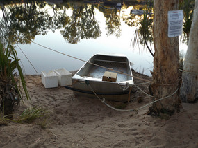
We are up early, make sandwiches, pack water , put on bathers with board shorts and cotton shirt for walk its easier and they dry very quickly while walking. We get down to river crossing to find the boat full of water someone had smashed the boat too hard into the bank and broken the pulley off and spilt end of boat. The camp caretaker came down with a few white polystyrene broccoli boxes. The idea is put top layer clothes, cameras ,lunch in box and swim across pushing box across—fun if a little cold at 7.30 am after a colder night of 15 deg Celsius.. We were first two across and could walk part of the way but rocks in water slippery and deeper parts meant I was swimming most of the way, get across put shorts and top on and start walking . We are wearing shoes for walking in water and over rocks so just left them on to swim.
The walk takes 1 ½ to 2 hours so by the time you reach the top a swim is good. It has some flat areas but a lot of scrambling up or down over rocks & boulders. We reach the falls and I slip crossing the outflow of water from the falls , slipping on an underwater rock ,putting me and camera , backpack in the water. Lucky camera ok ,lunch ok , i'm just wet again and alittle bruised.
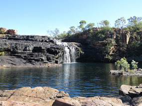
Get across to waterfall pool which is very deep and alittle cold, as usual. I take our underwater camera in and try for waterfall photos again . We swim have lunch swim again , try to get under the falls which is a hard swim. We leave when a couple of men that have been jumping in from the top of the falls allow their kids to try it. Ok the pool is deep but does have submerged rocks around and we can see someone getting hurt.
It takes a couple of hours to get back to camp and the boat is not fixed so I swim across again while Larry takes the option of walking a sort of track through long grass and shrubs further down at a narrow , shallow stretch.
We were just falling asleep and there was a big commotion , apparently a very large black headed python came through camp. Stupid people were trying to chase it away instead of just letting it pass so we stayed out of the way, I might have said the wrong thing to someone. It had probably been disturbed with people trekking through the bush to get around to get out of swimming across.
On the move again and we stop for a look at Galvans Gorge , walk in and the obligatory swim . Very slippery getting in , luckily a group from a tourist bus had just finished their swim, so we were on our own for about 15mins before a lot of family groups arrived.
The next stop was Adcock Gorge, this we did not swim in and it was only a short walk.
We were heading to for the King Leopold ranges and Bell gorge, part of a national park we stay at silent grove campground.
It is to late to go to Bell gorge our first day and on the second day we had to pack up the tent as it is a 10km drive to the car park from the campground. We leave the table, chairs and a few other things out so no body parks in our little piece of ground. Like a few of the national parks here it is first to park gets the place unless it is obviously taken.
The road in is very corrugated and the walk in to the falls starts off going down part of the dry creek bed across different size rocks and then evens out for a while and when you get to the falls you think thats it. Well it would be if all you wanted was to stand at the top of the falls and look down, look at all the different coloured rocks, play around in the shallow top pools. As if , no we have to cross to the other side and climb down to the falls pool. This part is classed a class 6 trail and would be the hardest I have down for awhile, but with a hand getting down or up some of the bigger boulders I got to swim in the pool. It is even hard getting into pool, you slide down boulders on your bum because at this angle and they are slippery you can not stay on you feet. As if thats bad , getting out on your hands, knees, bum or whatever you can is not elegant in any way. The swim is good though as usual tried photos etc. Get a bit dry and then have the scramble out of here, we are having fun, I think.
Just on dark the cry goes up snake so we grab a torch and camera and head off. People don't think and some say kill it . We and another man say no we will move it away from the toilets and water tap as it is a python.
The other man keeps snakes , which is good so between us the snake gets moved off into the bush to catch more mice etc. I did not do the snake training when we all did the wildlife rescue training so was pleased the other man new what it was. Latter when we were talking we found out his 12year old daughter has a Western dwarf bearded dragon as a pet., because it is still young she had it with here in a carry cage, we got to hold it and see the difference to the eastern bearded dragons. This ended the day quite well. Northern Quoll do live here but their numbers are done because of the cane toads have got this far. The quolls eat the toads as they eat frogs and then die from their poison, like other Australian animals that eat things like frogs. They do not have any resistance to the cane toad poison.
That night it rained so had to pack up a bit wet and drive for a while towards Derby , find a campsite and park and try and dry everything out. The road out of silent grove is now mud instead of dust and it sticks to everything , causing moving things to get hot so glad of water crossings to wash some off.
We take precautions at night and put a tarp over the top of the tent, as we do not need to be wet again. Its pick up caravan day and head into Derby for 3 days to wash, shop, and do nothing.
The Gibb river road.
Sunday, July 12, 2015
 Derby, Western Australia, Australia
Other Entries
-
38Coastal National Parks and quite
Jun 11396 days prior Beachport Limestone coast, Australiaphoto_camera11videocam 0comment 0
 -
39Murray Bridge to Whyalla
Jun 20387 days prior Whyalla, Australiaphoto_camera15videocam 0comment 2
 -
40Eyre peninsular
Jun 30377 days prior Port Lincoln To Ceduna, Australiaphoto_camera16videocam 0comment 1
 -
41Across the Nullarbor to WA
Jul 07370 days prior Eucla WA, Australiaphoto_camera20videocam 0comment 1
 -
42The WA side of Nullarbor
Jul 14363 days prior Hyden WA, Australiaphoto_camera20videocam 0comment 1
 -
434 months of surprises
Feb 07155 days prior Benalla, Australiaphoto_camera11videocam 0comment 0
 -
44Are we on the move again
Feb 07155 days prior Benalla, Australiaphoto_camera5videocam 0comment 0
 -
4510 days on Kangaroo island in Rooftop tent
Feb 07155 days prior Kangaroo Island, Australiaphoto_camera12videocam 0comment 0
 -
46Jervis Bay to Ceduna
Feb 14148 days prior Rapid Bay to Ceduna, Australiaphoto_camera13videocam 0comment 1
 -
47Ceduna and on west to Albany WA
Mar 07127 days prior Albany, Australiaphoto_camera28videocam 0comment 0
 -
48To Bunbury and finally past Perth to Bindoon
Mar 21113 days prior Bindoon, Australiaphoto_camera23videocam 0comment 0
 -
49Bindoon to Mullewa
Mar 29105 days prior Mullewa, Australiaphoto_camera26videocam 0comment 0
 -
50Change of direction to get to same place
Apr 0697 days prior Carnarvon, Australiaphoto_camera23videocam 0comment 1
 -
51Cape Range NP and Ningaloo Reef marine park
Apr 2776 days prior Exmouth, Australiaphoto_camera24videocam 0comment 5
 -
52Gorge time
May 1558 days prior Karijini National Park, Australiaphoto_camera31videocam 0comment 0
 -
53Karijini to Port Hedland
May 2350 days prior Port Hedland, Australiaphoto_camera27videocam 0comment 0
 -
54Cape Keraudren. Broome .Derby
Jun 0933 days prior Derby, Australiaphoto_camera24videocam 0comment 1
 -
55The Gibb river road.
Jul 12 Derby, Australiaphoto_camera38videocam 0comment 0
 -
56East Kimberley
Aug 0120 days later Lake Argyle WA, Australiaphoto_camera20videocam 0comment 0
 -
57Crossing the border
Aug 1837 days later Katherine, Australiaphoto_camera36videocam 0comment 0
 -
58Katherine & Kakadu
Sep 0656 days later Kakadu National Park, Australiaphoto_camera31videocam 0comment 0
 -
59From Kakadu to Mataranka
Sep 2373 days later Mataranka, Australiaphoto_camera29videocam 0comment 0
 -
60East and west McDonnell Ranges and Alice Springs
Oct 22102 days later Alice Springs, Australiaphoto_camera35videocam 0comment 0
 -
61Rainbow valley, Kings Canyon, Uluru.
Nov 01112 days later Uluru-Kata Tjuta National Park, Australiaphoto_camera37videocam 0comment 0
 -
62Oodnadatta and Stzelecki tracks
Nov 23134 days later Cameron Corner , Australiaphoto_camera34videocam 0comment 0
 -
63Here we go again
Mar 30262 days later Moree, Australiaphoto_camera26videocam 0comment 1
 -
64Into Queensland again.
Apr 17280 days later Mareeba, Australiaphoto_camera31videocam 0comment 0
 -
65On our way to Cape York
Apr 22285 days later Mt. Carbine , Australiaphoto_camera14videocam 0comment 0
 -
66First half trip up Cape York
May 15308 days later Seisia / loyalty beach, Australiaphoto_camera33videocam 0comment 0
 -
67Second half of Cape York
Jun 01325 days later Cooktown, Australiaphoto_camera32videocam 0comment 0
 -
68Last part of our Cape York trip.
Jun 18342 days later Mareeba, Australiaphoto_camera37videocam 0comment 0
 -
69Atherton tablelands to Normanton
Jul 10364 days later Normanton, Australiaphoto_camera36videocam 0comment 3
 -
70Crocodiles and dirt roads
Aug 01386 days later Julia Creek, Australiaphoto_camera41videocam 0comment 1
 -
71Dinosaur country to east Coast
Aug 28413 days later Finch Hatton, Australiaphoto_camera37videocam 0comment 0
 -
72The end of the Tropics..
Sep 16432 days later Bundaberg, Australiaphoto_camera38videocam 0comment 2
 -
73Peanuts, Lakes, Dams, Waterfalls, Dragons.
Oct 12458 days later Warwick, Australiaphoto_camera37videocam 0comment 0

 Derby, Western Australia, Australia


2025-05-22