Grays & Torreys Peaks - Highest Continental Divide
Thursday, September 02, 2010
 Bakerville, Colorado, United States
I frequently hike with my friend Myra, often around Boulder
near where she lives . This time, though, she was in the mood for something more
challenging and suggested Gray’s and Torrey’s Peaks, both fourteeners within an
hour west of Denver. Gray’s Peak at 14,270 feet is the highest point in North
America that is actually on the Continental Divide, and Torrey’s Peak across
the saddle is only slightly lower. Despite the altitude, the hike to “bag” one
of both peaks is relatively easy as far as fourteeners go because of a
relatively high starting elevation and a long but not particularly steep ascent
for most of the route. I hiked them both early in my fourteener-climbing career
back in the summer of 1992, but was eager to do the hike again since it has
been so long. Eighteen years older and however many pounds heavier than I was
then, it probably won’t be quite so easy this time around. And Myra always
smokes me on the trail anyway, so I won’t get to go at my own slow pace.
Myra and I met around 3:30 A.M. at the parking lots in the
foothills near Golden to ride up together . Do you think 3:30 A.M. is necessary,
Myra? It’s only about an hour and it doesn’t start getting light until well
after 5:00 now that it’s early September.” But I usually give in to what Myra
wants to do, even if that means sitting in the car at the trailhead for 45
minutes until it’s light enough to start without a headlight on. Needless to
say, we were the first car at the trailhead.
Gray’s and Torrey’s Peaks are accessed from the Bakerville
exit on I-70 about five miles east of the Eisenhower Tunnel. It’s then a quite
long bumpy ride up Steven’s Gulch on an unpaved road to the trailhead at 11,280
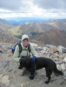
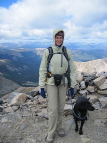
feet. Myra has two canine children, Zion and Prince, but decided to only bring
Zion (the better behaved of the two) on this hike. Being in National Forest
land rather than in a National Park, dogs are allowed on the Gray’s and Torrey’s
Peak Trail.
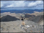
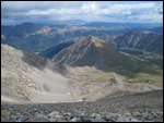
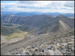
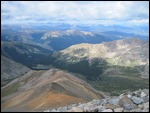
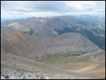
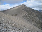
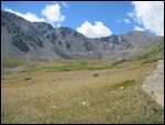
The trail to Gray’s Peak rises about 3,000 feet over about
four miles, not bad by mountain climbing standards, but the first part through
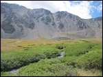
Steven’s Gulch is gradual and pleasant before it begins rising rapidly in
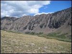
steeper switchbacks through the rock and scree to the peak. Being almost
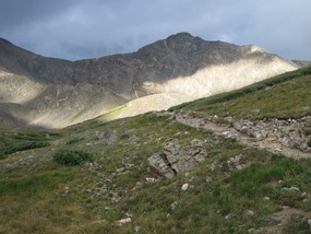
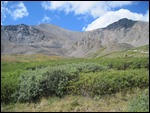
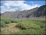
entirely above timberline, the entire trail is very beautiful, especially at
dawn. As usual, Myra and Zion left me back in the dust. She sometimes tries to
walk at my chubby pace, but I can tell she quickly gets frustrated, can’t take
it anymore, and bounds ahead . Being a bit slower than most, there was a small
crowd at the top of Gray’s before I arrived, but not bad by local standards. We
deliberately chose a Thursday before Labor Day weekend for our hike rather than
a weekend day to avoid the bigger crowds.
When Myra set off across the saddle for Torrey’s Peak, I
began my descent. The saddle between the two peaks is only about 550 feet below
Gray’s summit and not much more of a climb than that to the top of Torrey’s so
it definitely would not have been hard for me to do. And I definitely would
have if I had not already added it to my list of mountain conquests, but I
could tell Myra was in a bit of a rush and getting increasingly annoyed at her
slowpoke friend. I tend to enjoy myself more when going at my own pace and
taking lots of pictures than when trying to keep up with someone else anyway.
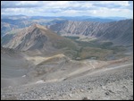
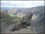
And the light in Steven’s Gulch was getting very beautiful as the high thin
cloud cover we had for much of the morning was dissipating.
Round trip of eight miles with a 3,000 foot ascent, that’s
all in a morning’s work! I even managed to beat Myra and Zion back to her SUV
at the trailhead. We naturally stopped for some highly caloric food (burgers)
and beers at Tommyknockers Brewery in Idaho Springs on the way back. I think we
earned it.
Other Entries
-
12Roxborough State Park - Standing Red Rocks
Aug 03395 days prior Roxborough, United Statesphoto_camera26videocam 0comment 0
 -
13Trinidad & Ludlow - Historic Southern Colorado
Aug 07391 days prior Trinidad, United Statesphoto_camera29videocam 0comment 0
 -
14West Spanish Peak - One Hell of a Steep Climb!
Aug 08390 days prior Cuchara, United Statesphoto_camera36videocam 0comment 0
 -
15Great Sand Dunes National Park - Colorado's Sahara
Aug 09389 days prior Great Sand Dunes National Park and Preserve, United Statesphoto_camera42videocam 0comment 0
 -
16San Luis Valley - The American Altiplano
Aug 10388 days prior Crestone, United Statesphoto_camera21videocam 0comment 0
 -
17El Dorado Canyon Hike
Aug 24374 days prior Eldorado Springs, United Statesphoto_camera35videocam 0comment 0
 -
18Cripple Creek/Victor Mining District - Gold Rush
Aug 27371 days prior Cripple Creek, United Statesphoto_camera43videocam 0comment 0
 -
19Greenhorn Peak Hike - Highest Point in Wet Range
Aug 28370 days prior Farisita, United Statesphoto_camera30videocam 0comment 0
 -
20James Peak Hike - Three County Thirteener
Sep 03364 days prior Saint Marys, United Statesphoto_camera40videocam 0comment 0
 -
21Herman Gulch Hike & Silver Plume
Sep 12355 days prior Silver Plume, United Statesphoto_camera13videocam 0comment 0
 -
22Trans-Gore Range Hike - Summit Autumn Splendor
Sep 27340 days prior Copper Mountain, United Statesphoto_camera41videocam 0comment 0
 -
23Golden & Dinosaur Ridge - Hikes Close to Home
Oct 17320 days prior Golden, United Statesphoto_camera34videocam 0comment 0
 -
24Henry Moore in Denver Botanical Gardens
May 25100 days prior Denver, United Statesphoto_camera57videocam 0comment 0
 -
25Late Spring in Rocky Mountain National Park
Jun 0688 days prior Rocky Mountain National Park, United Statesphoto_camera32videocam 0comment 0
 -
26Greek Festival at Cathedral of the Assumption
Jun 1975 days prior Denver, United Statesphoto_camera27videocam 0comment 0
 -
27Idaho Springs & the Mother Cabrini Shrine
Jul 1450 days prior Idaho Springs, United Statesphoto_camera10videocam 0comment 0
 -
28Saint Vrain Peak Hike - Front Range Prominence
Aug 1914 days prior Allenspark, United Statesphoto_camera37videocam 0comment 0
 -
29Grays & Torreys Peaks - Highest Continental Divide
Sep 02 Bakerville, United Statesphoto_camera20videocam 0comment 0
 -
30French Pass Trail Hike with Jerad
Sep 119 days later Jefferson, United Statesphoto_camera10videocam 0comment 0
 -
31Mohawk Lakes Hike with Jerad and Timby
Sep 1816 days later Blue River, United Statesphoto_camera39videocam 0comment 0
 -
32Mt. Sanitas & South Boulder Peak - Hikes with Myra
Sep 2119 days later Boulder, United Statesphoto_camera14videocam 0comment 0
 -
33Mummy Range Hike in Rocky Mountain Nat Park
Sep 2523 days later Rocky Mountain National Park, United Statesphoto_camera31videocam 0comment 0
 -
34Leadville -Colorado's Ultimate Wild West Mine Town
Sep 2826 days later Leadville, United Statesphoto_camera55videocam 0comment 0
 -
35Aspen - Most Expensive Town in America
Sep 2927 days later Aspen, United Statesphoto_camera57videocam 0comment 0
 -
36Ashcroft - Deep in the Elk Range of the Rockies
Sep 2927 days later Ashcroft, United Statesphoto_camera56videocam 0comment 0
 -
37The Beautiful Roaring Fork River Valley
Sep 3028 days later Snowmass, United Statesphoto_camera36videocam 0comment 0
 -
38Hike Around the Maroon Bells - Earthly Paradise
Sep 3028 days later Crystal, United Statesphoto_camera110videocam 0comment 0
 -
39Marble - Remote Backwoods Colorado
Sep 3028 days later Marble, United Statesphoto_camera36videocam 0comment 0
 -
40From North Fork Valley through West Elk Range
Oct 0129 days later Paonia, United Statesphoto_camera42videocam 0comment 0
 -
41Crested Butte - On The Other Side of the Elk Range
Oct 0129 days later Crested Butte, United Statesphoto_camera55videocam 0comment 0
 -
42From Taylor Park to Saint Elmo - Sawatch Range
Oct 0129 days later Tincup, United Statesphoto_camera37videocam 0comment 0
 -
43Buena Vista & Mt. Princeton Hot Springs
Oct 0230 days later Buena Vista, United Statesphoto_camera16videocam 0comment 0
 -
44Colorado Springs Balloon Festival
Sep 05368 days later Colorado Springs, United Statesphoto_camera44videocam 0comment 0
 -
45Garden of the Gods - Paradise in Red and Green
Sep 06369 days later Colorado Springs, United Statesphoto_camera35videocam 0comment 0
 -
46U.S. Air Force Academy - Where Flyboys are Made
Sep 07370 days later Monument, United Statesphoto_camera18videocam 0comment 0
 -
47University of Denver Campus
Nov 15439 days later Denver, United Statesphoto_camera15videocam 0comment 0

 Bakerville, Colorado, United States


2025-05-22