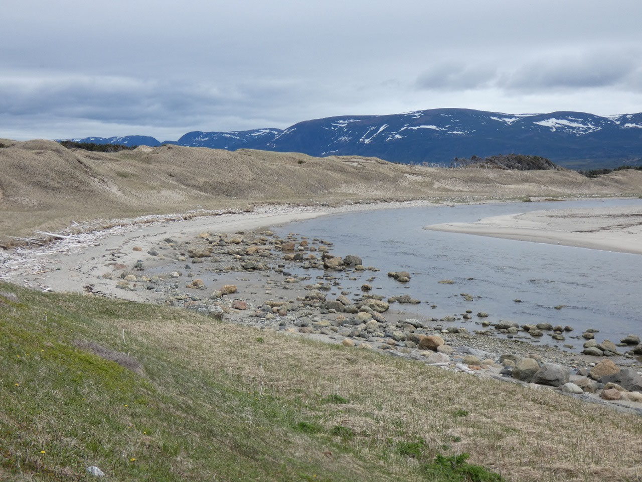
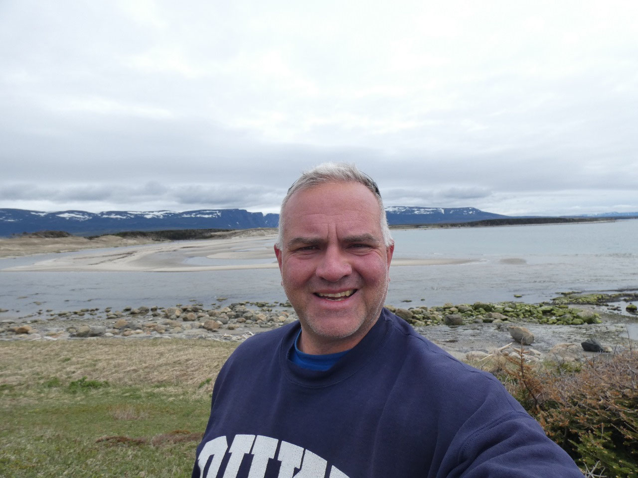
 Cow Head, Newfoundland and Labrador, Canada
Gros Morne National Park in western Newfoundland is now
considered one of the top destinations in the Canadian national park system but
wasn’t established until the mid-1970s. Considered a geological wonderland in
much the same way as Yellowstone or the parks on the Colorado Plateau in the
U.S., it was also one of the early sites to be given UNESCO World Heritage Site
status for its unique features. For me Gros Morne NP has been near the top of my
list of places to go in North America.
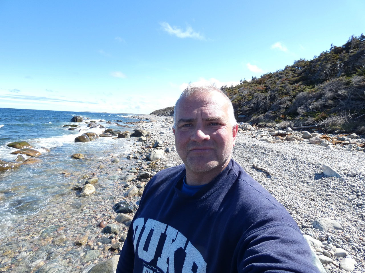
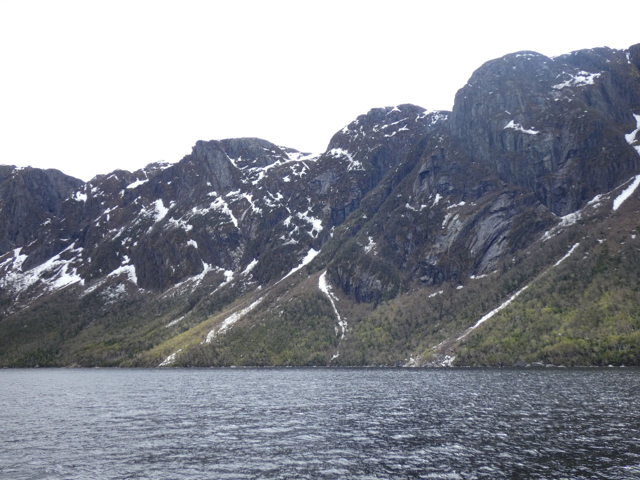
The park consists of a mix of mountains and seashore,
forests and bays. My three top goals for
Gros Morne were to take the boat ride on Western Brook Pond, to Climb Gros
Morne Mountain, and to go to the Tablelands. Gros Morne Mountain is the highest
peak on Newfoundland island, although not the highest point in the province
which is in the Torngat Mountains in northern Labrador. At under 3,000 feet it
seems very doable even if starting out at an elevation not much above sea
level. Although it looked like there were still some snowy stretches on the
peak, it still looked very achievable.
The
ranger at the visitor center informed me when I asked about conditions that it
was closed for climbing because the Ptarmigan were nesting. Oh, well, I guess I
have to nix that one then!
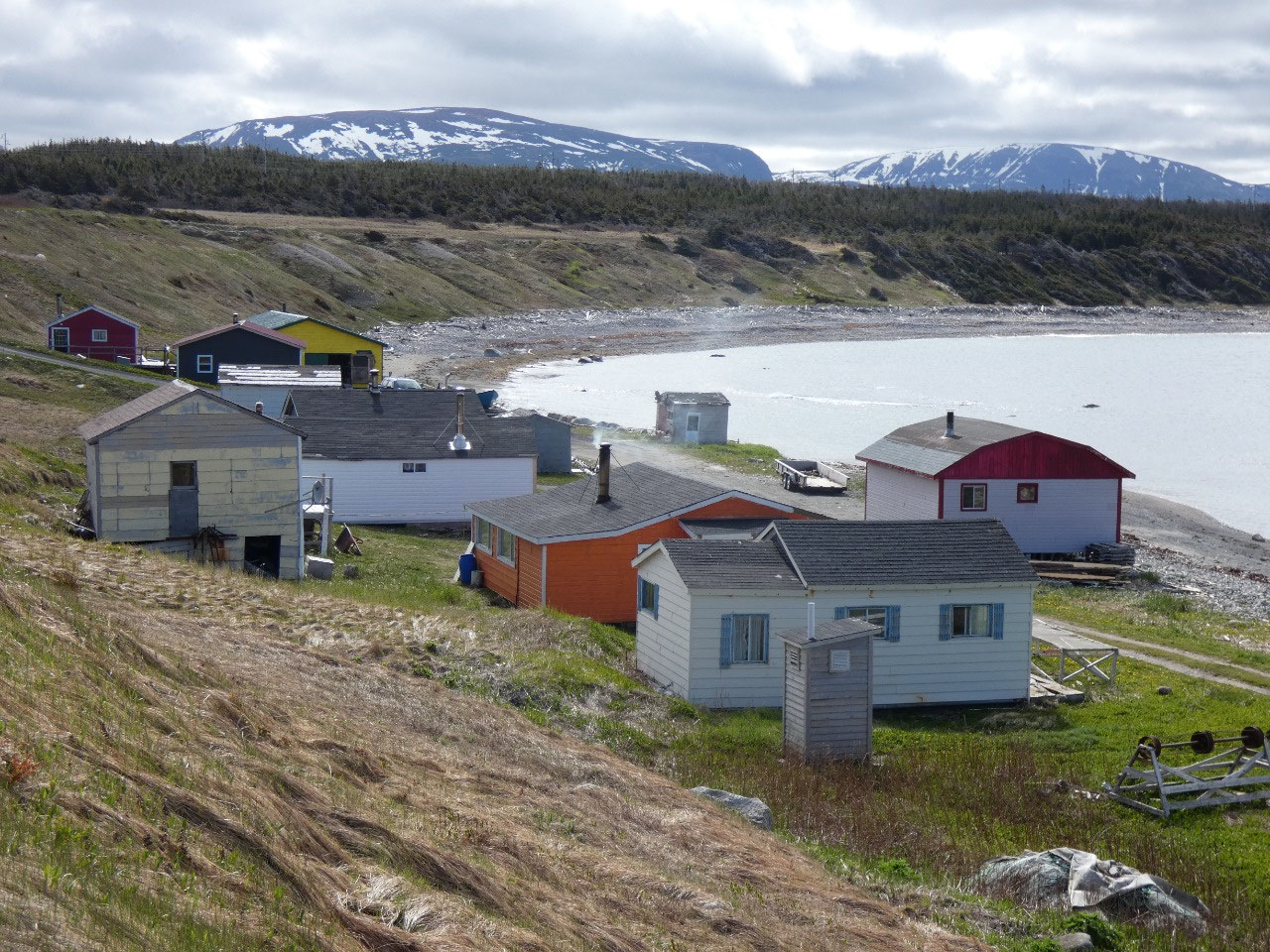
Gros Morne National Park is pretty well split in half
between Bonne Bay, an inlet surrounded by the hills on the shores of which are
several towns which new service the park but aren’t technically within its
boundaries – Woody Point, Rocky Harbour, and Norris Point among others. I spent
two days in the park, effectively one on each side of Bonne Bay, so have broken
Gros Morne into two blog entries on that basis.
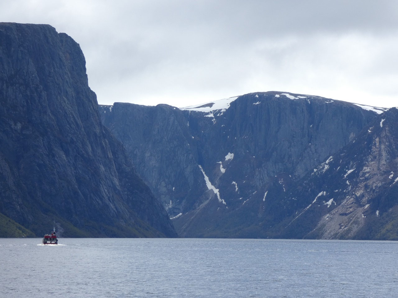
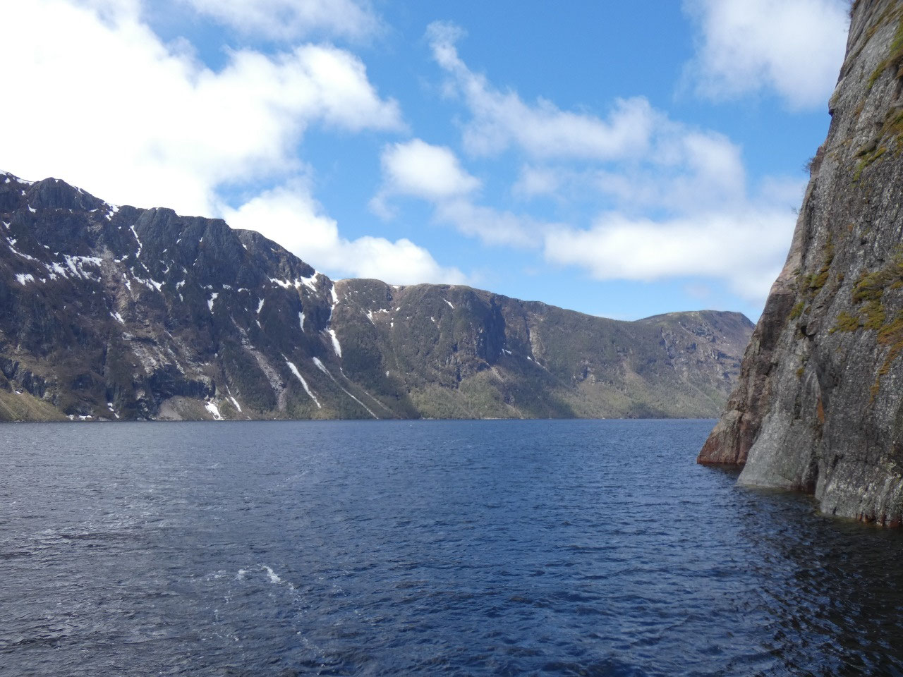
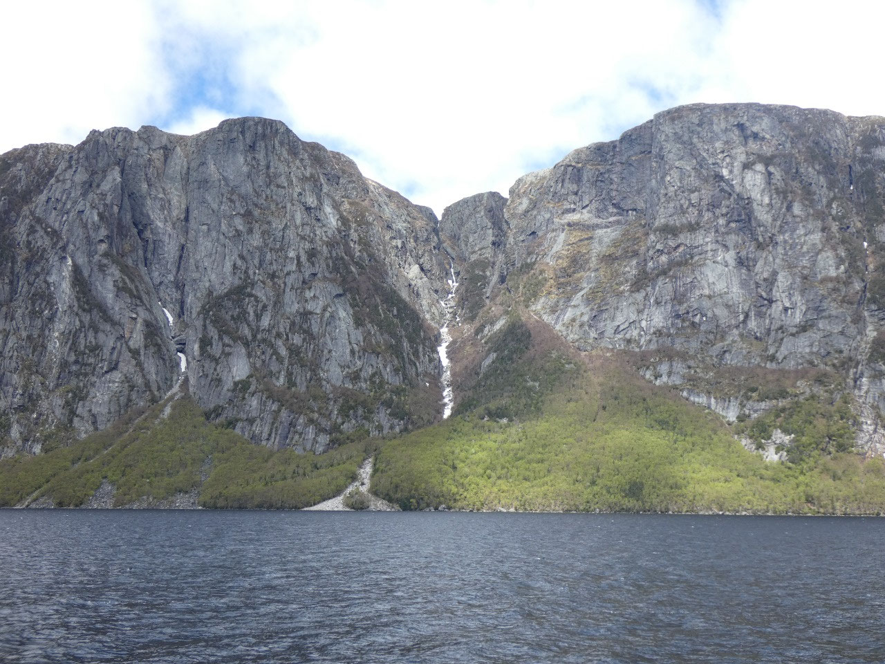
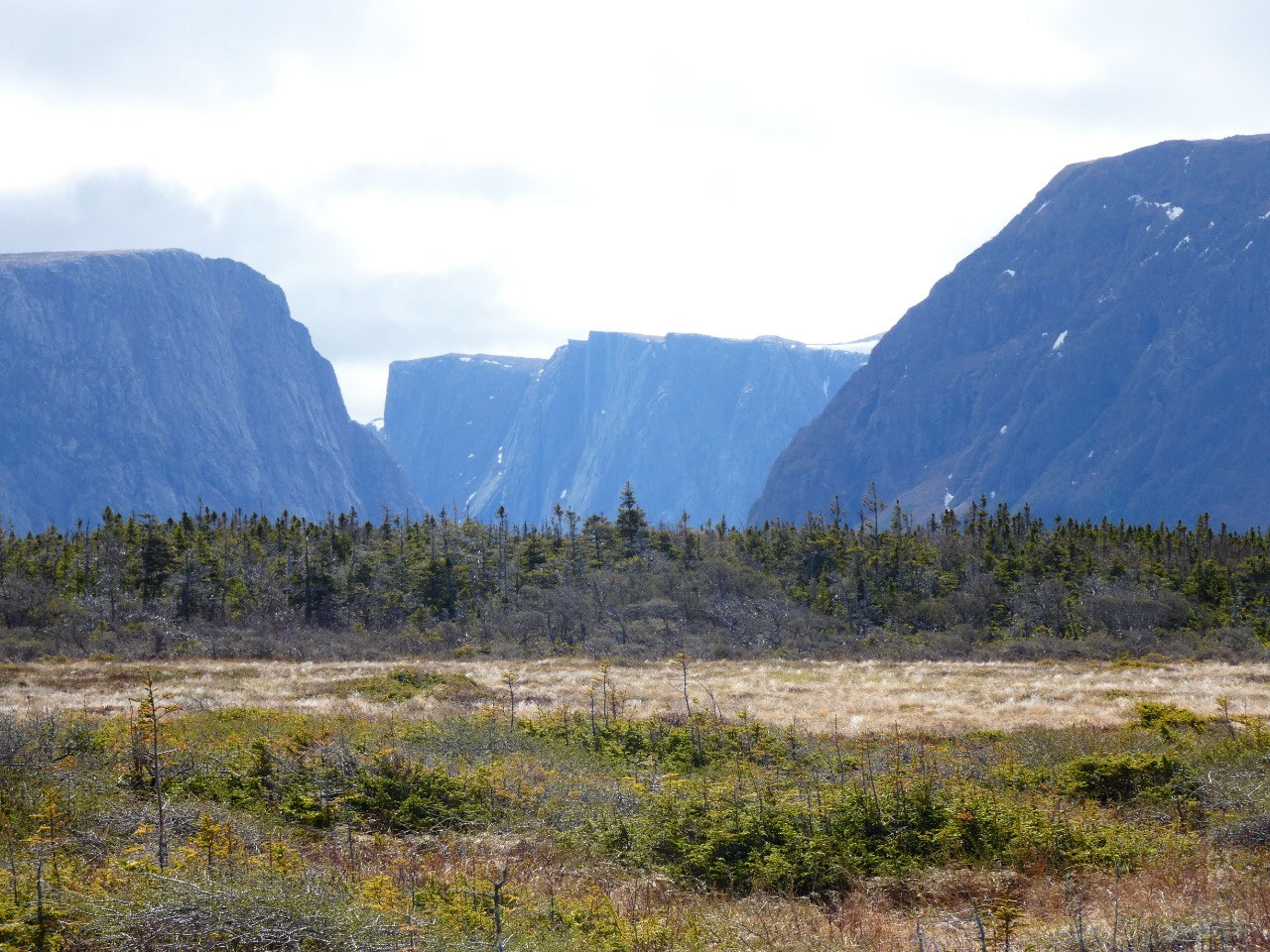
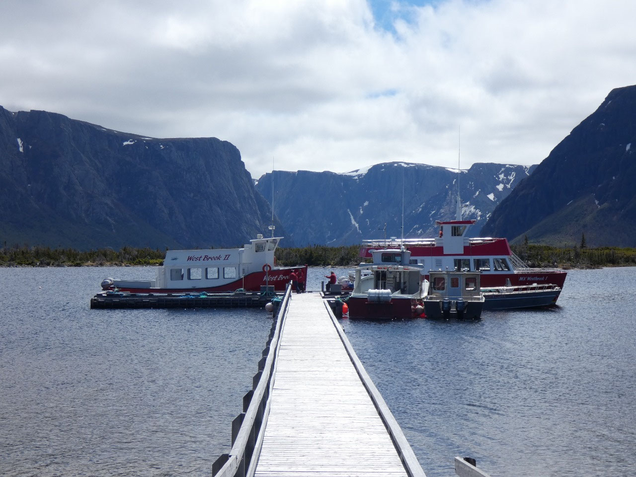
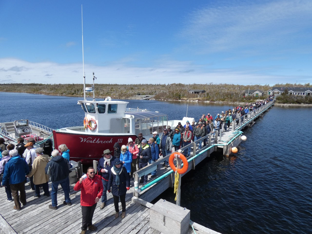
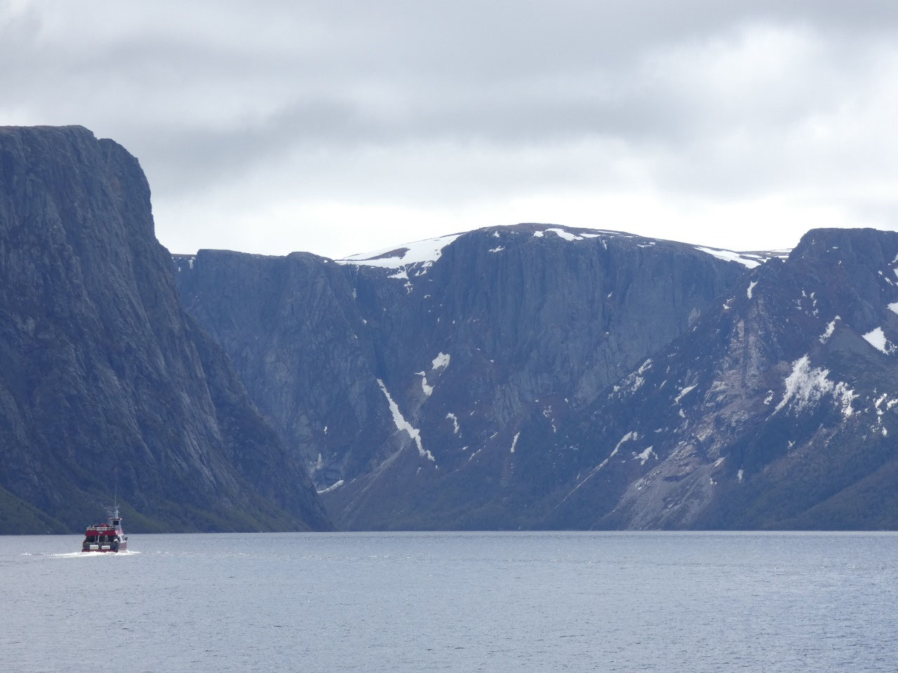
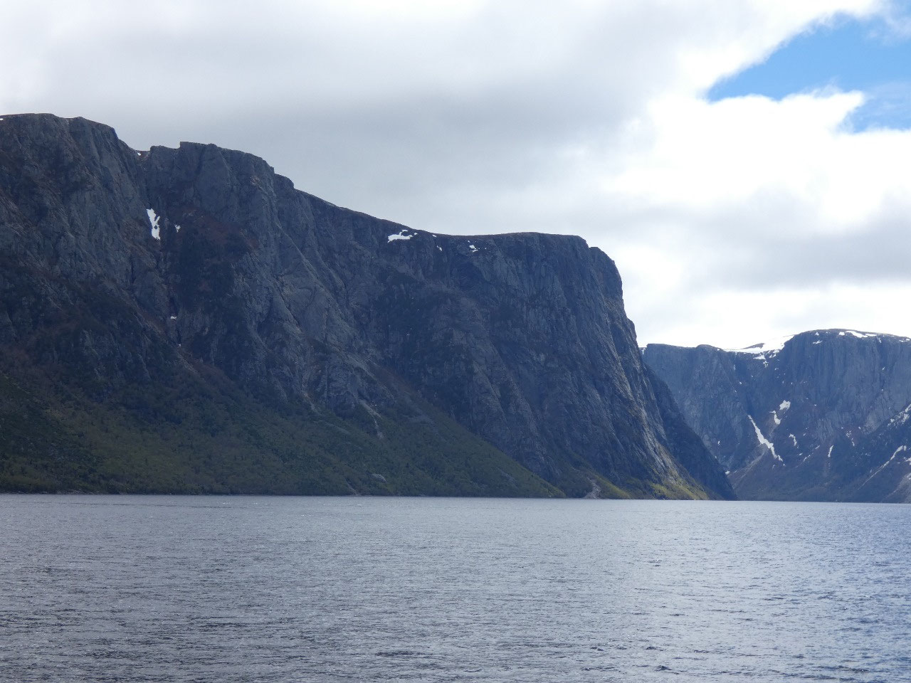
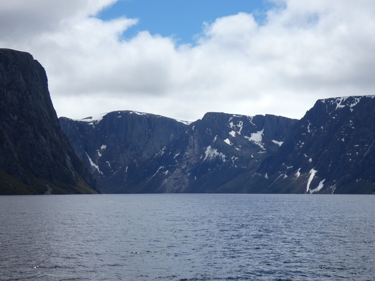
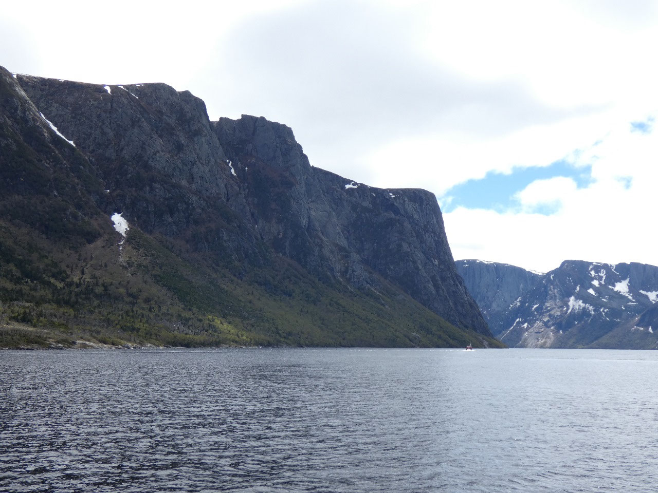
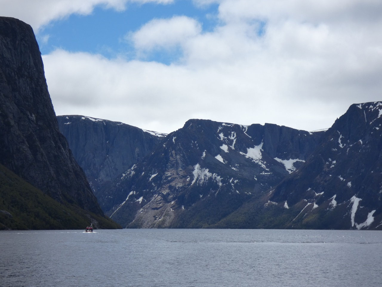
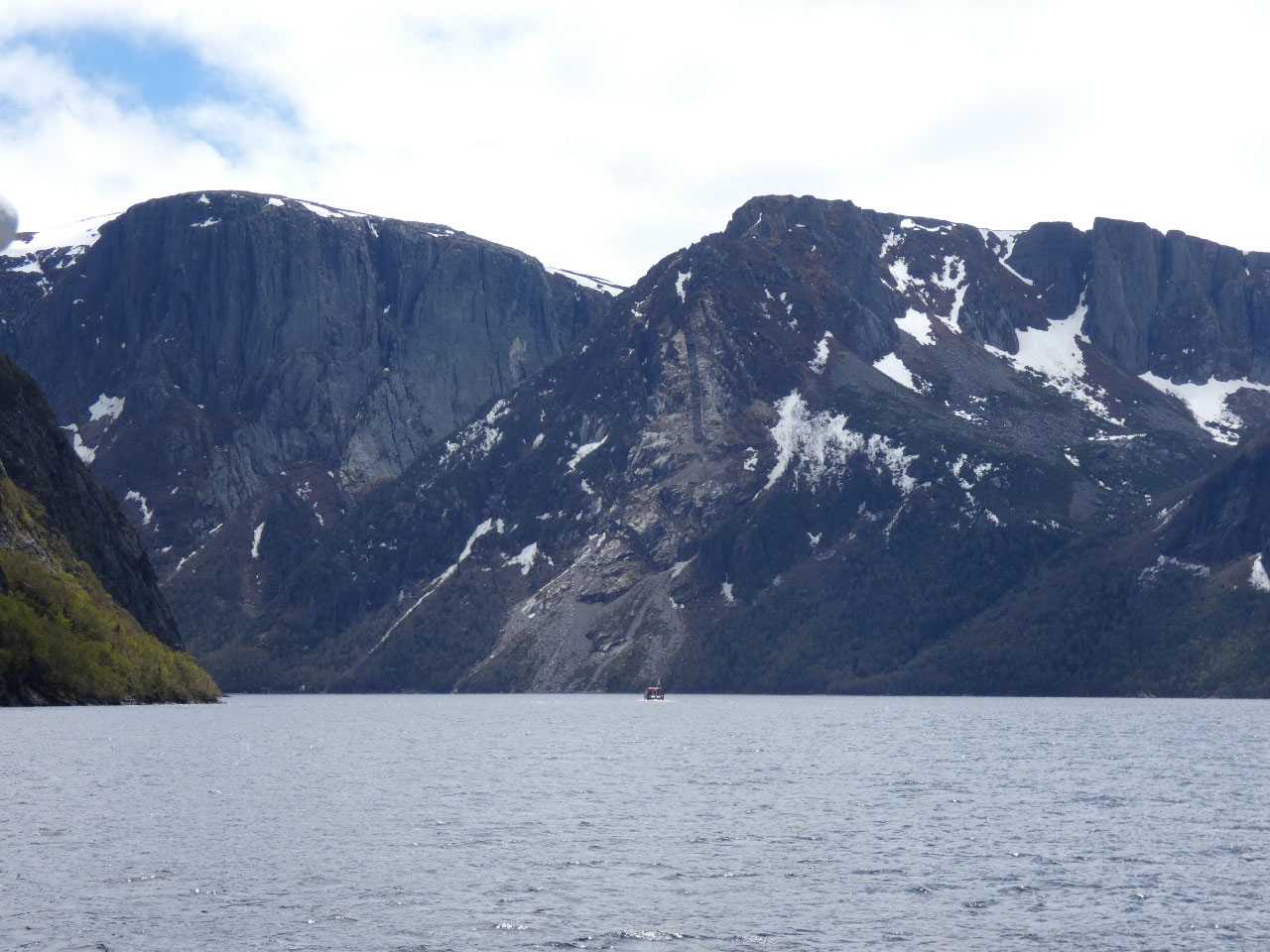
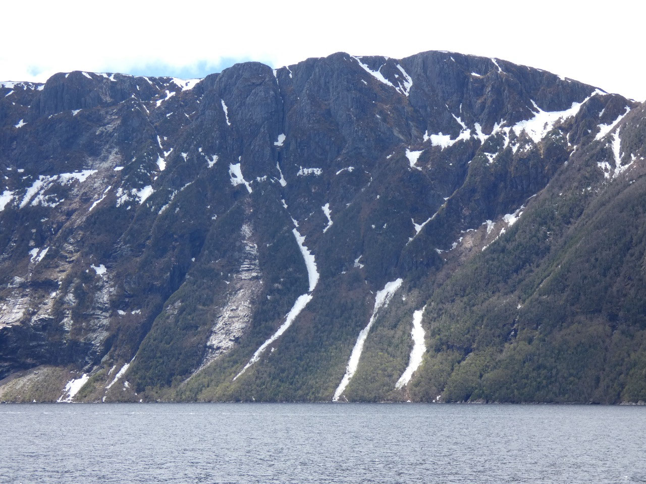
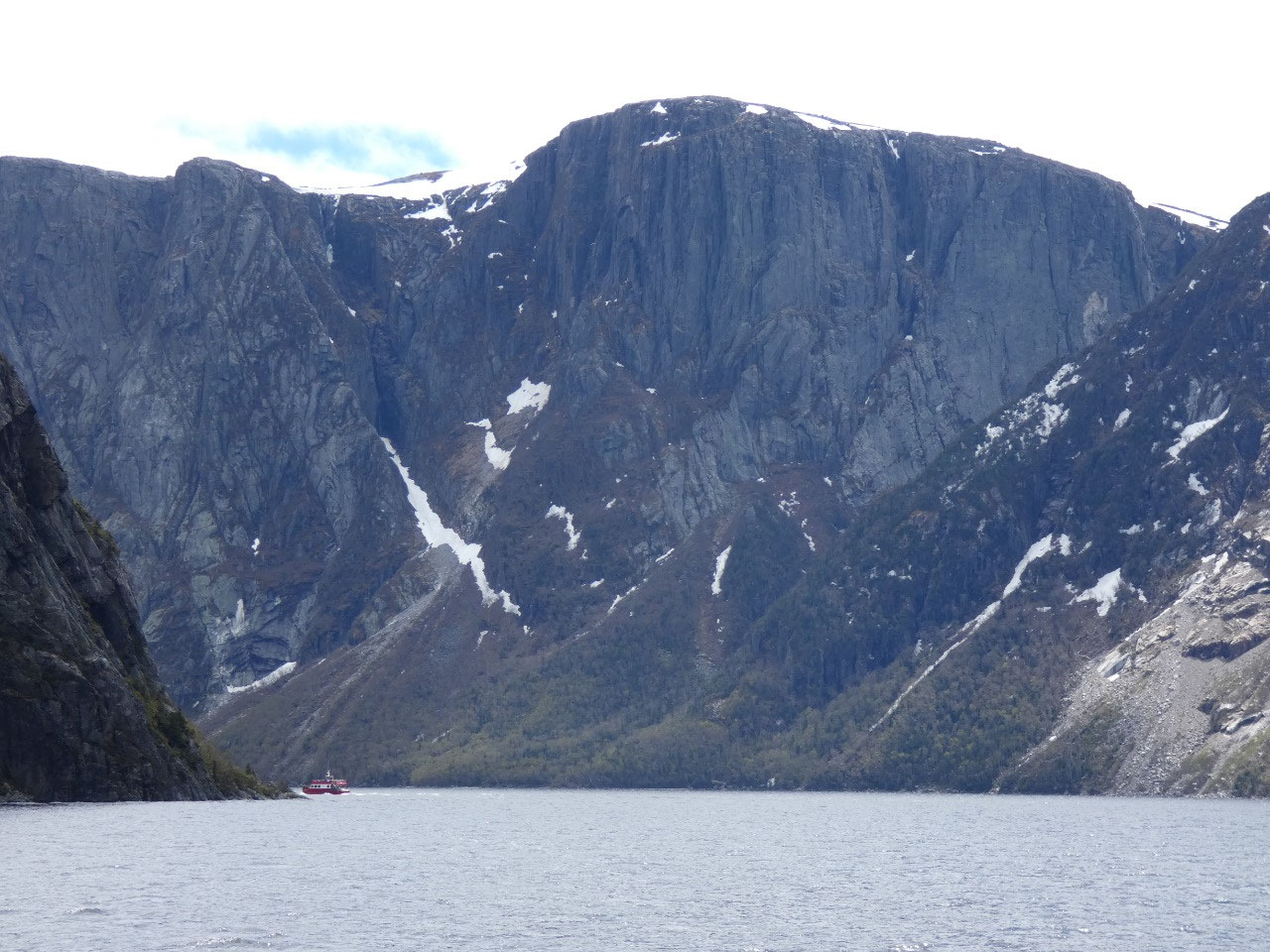
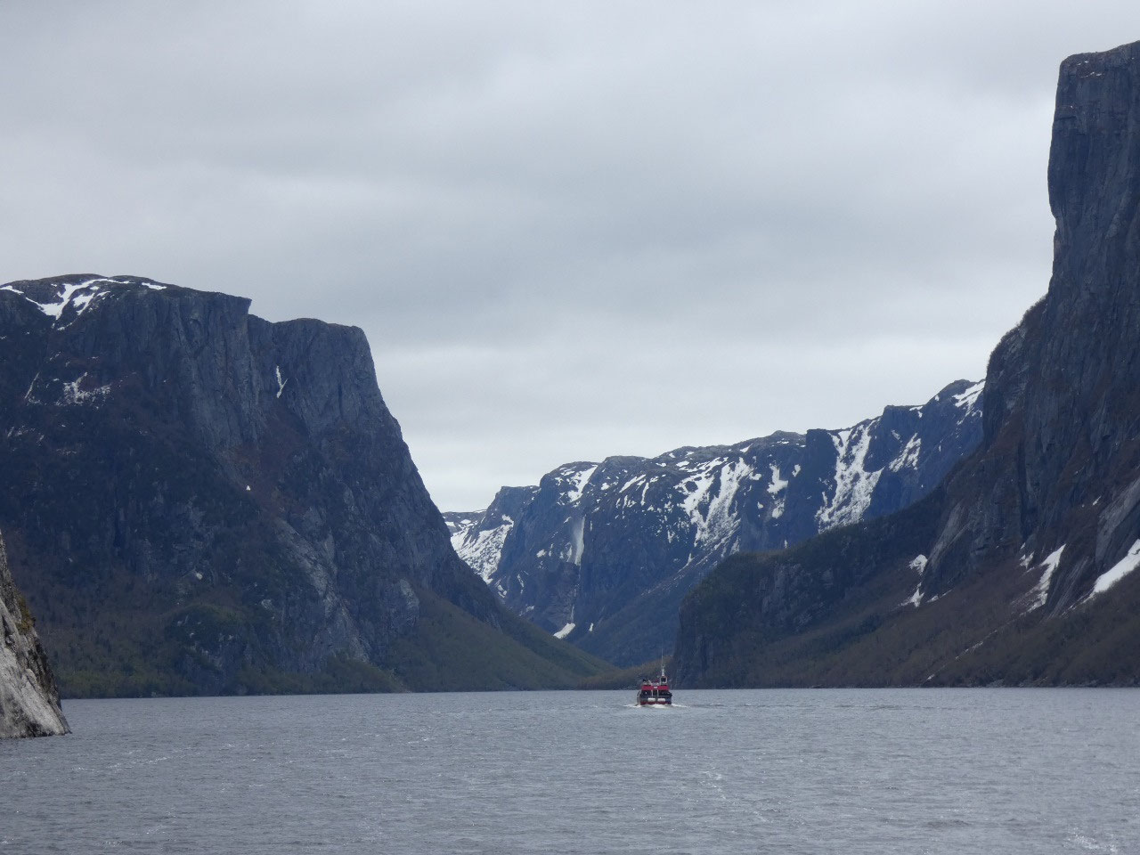
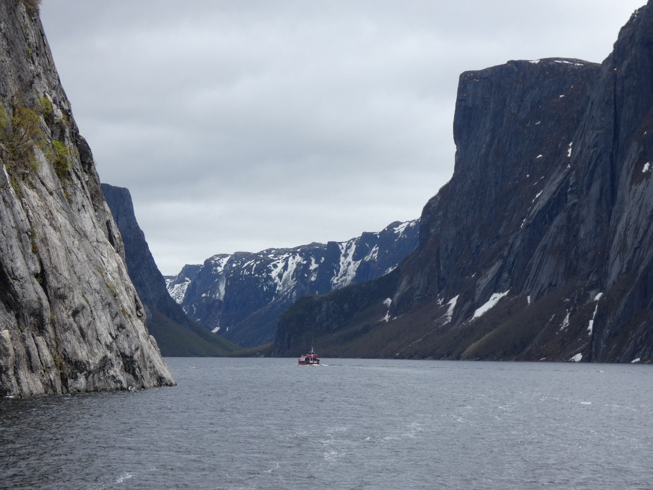
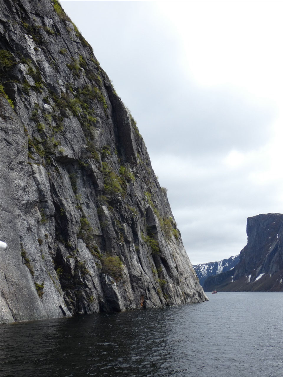
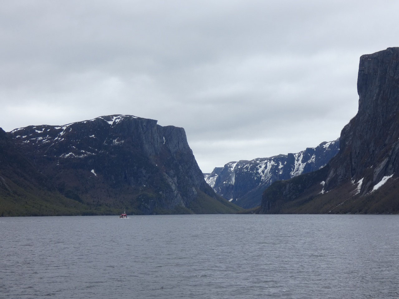
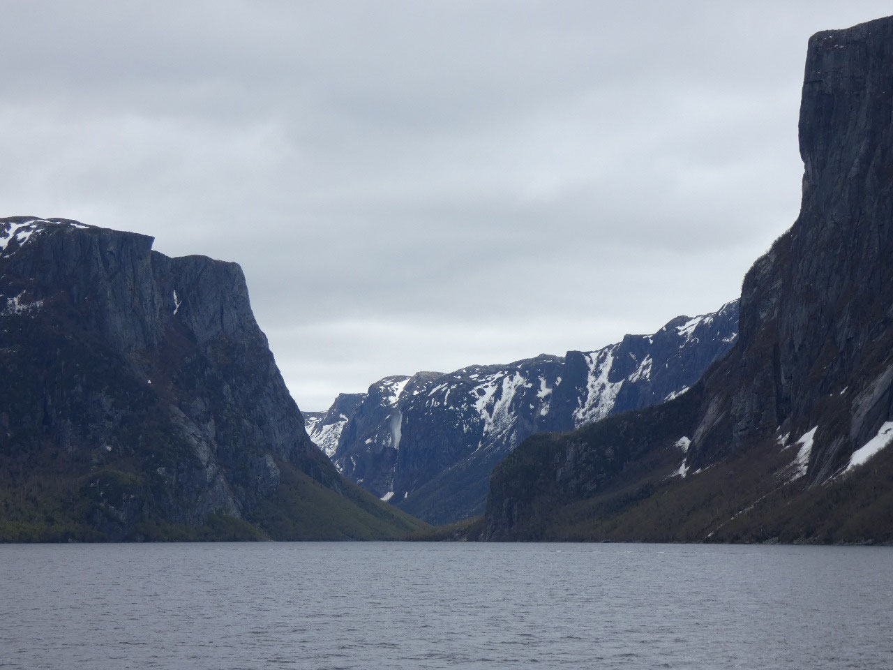
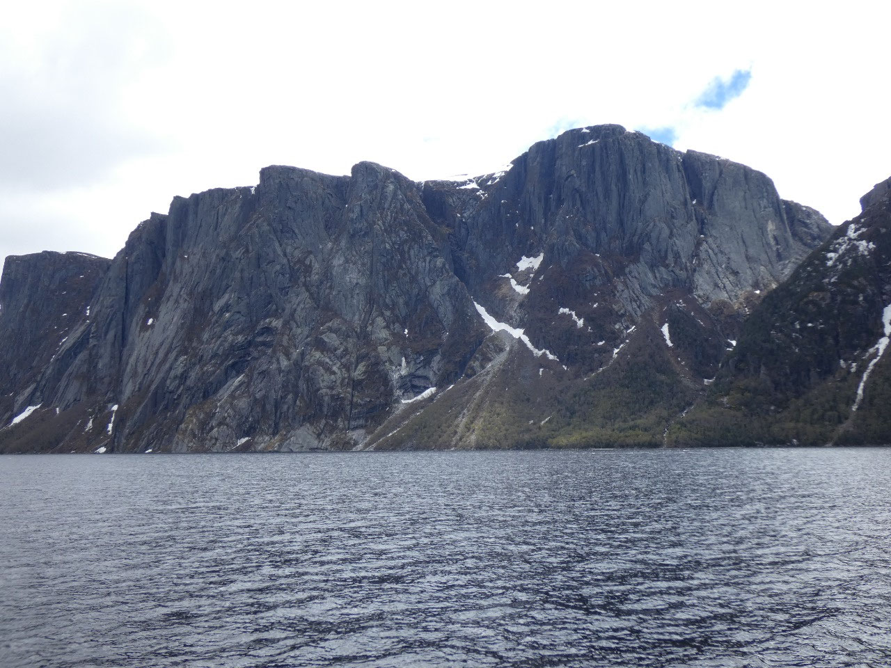
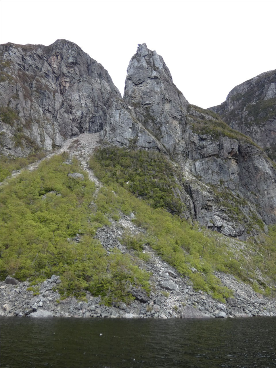
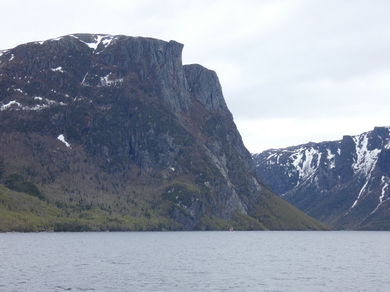
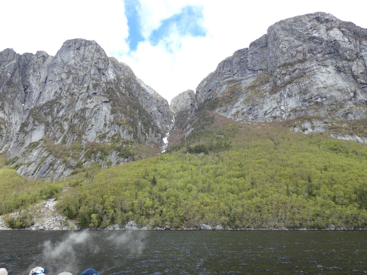
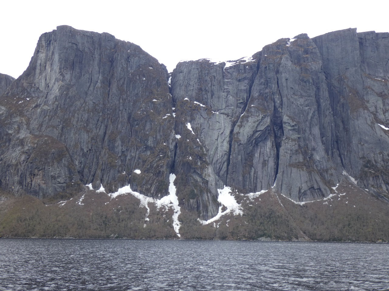
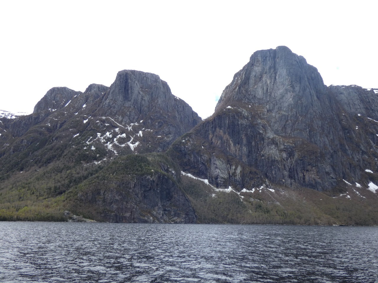
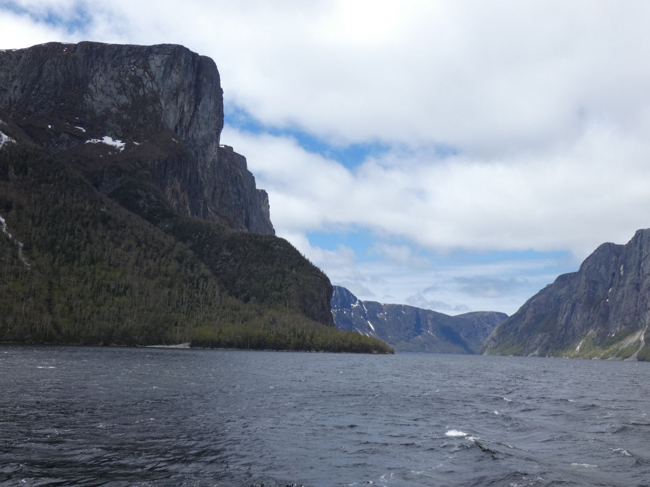
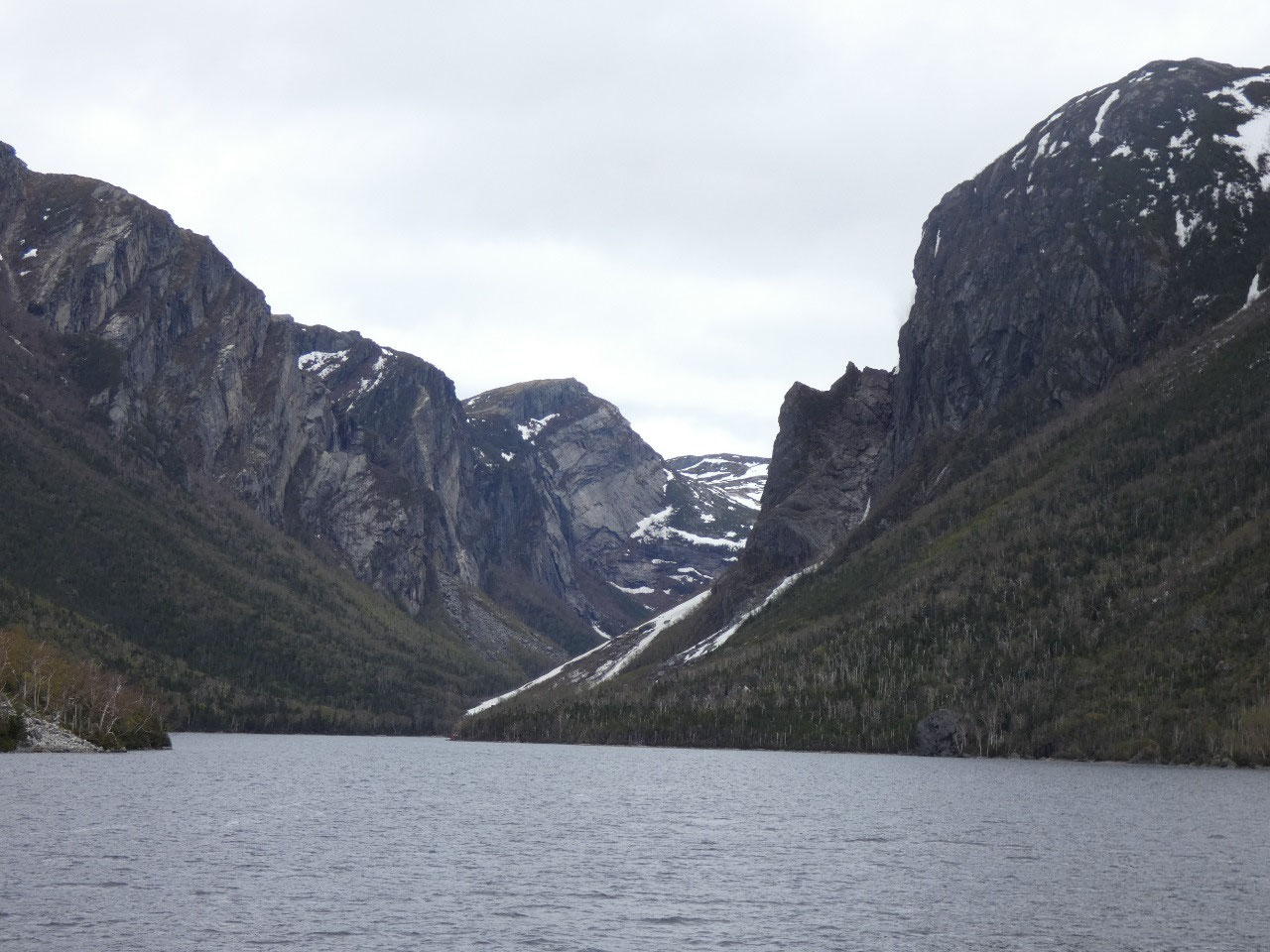
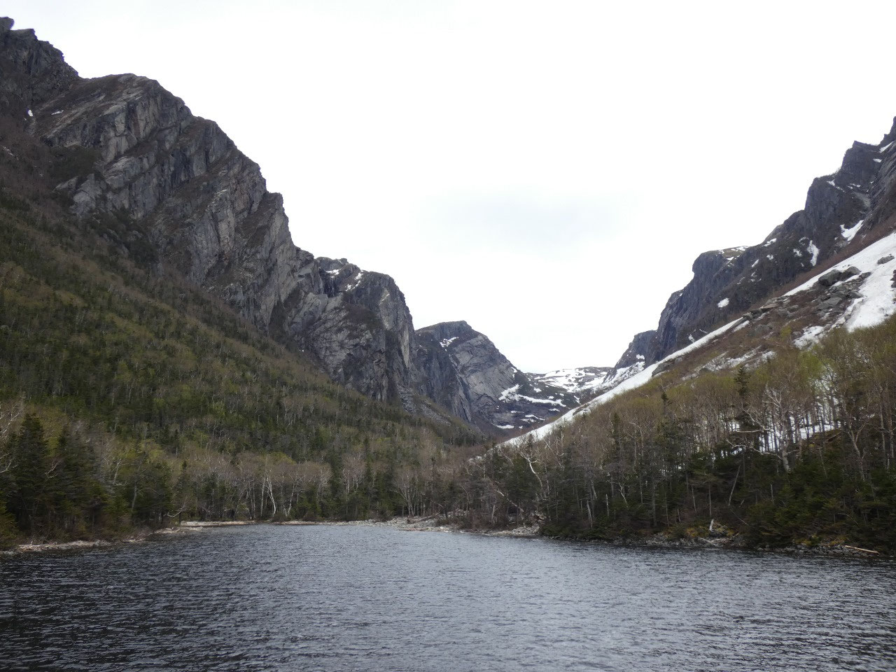
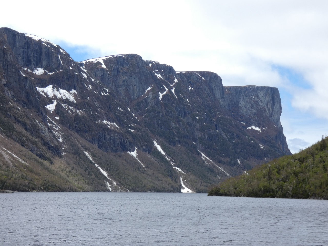
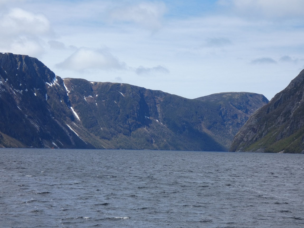
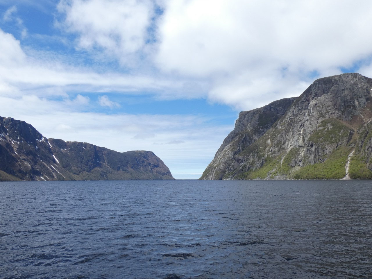
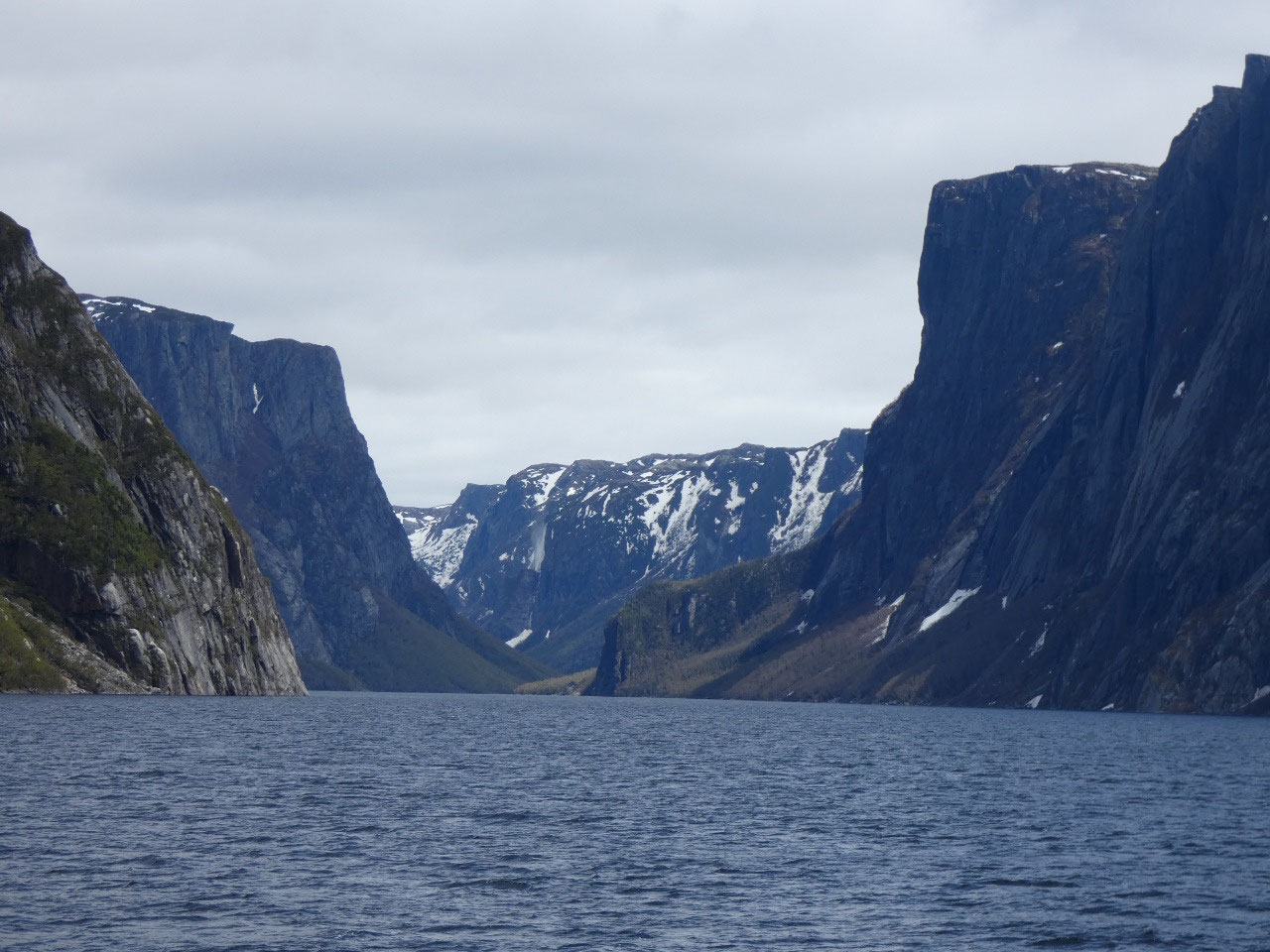
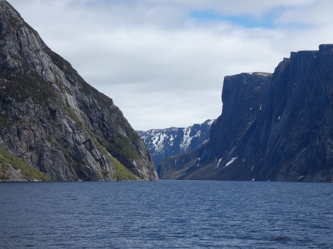
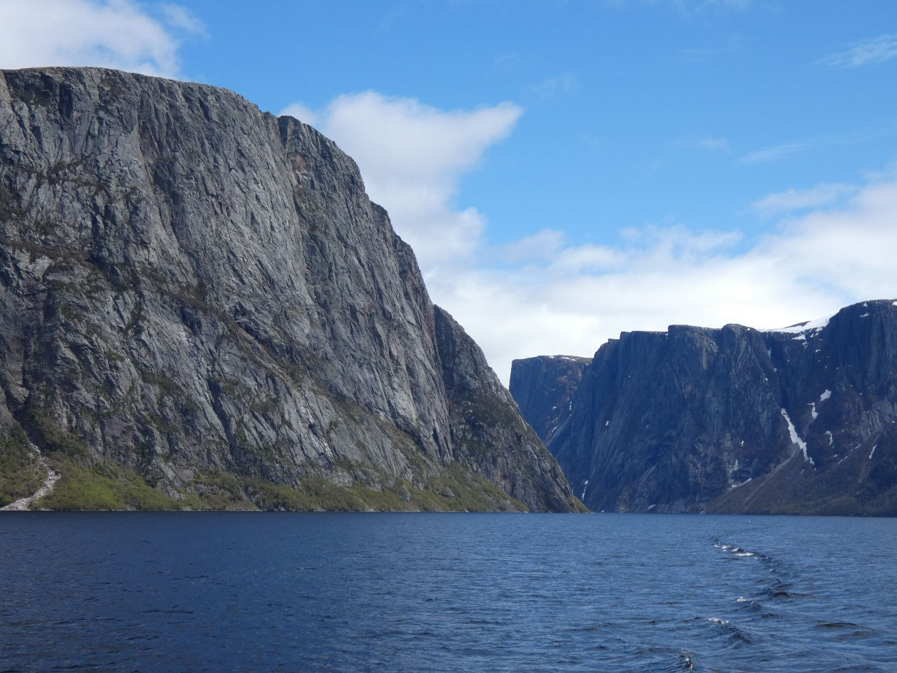
The absolute
highlight of Gros Morne for most people is the two-hour long boat ride on
Western Brook Pond. The adventure starts with a two mile hike in along a dirt
road from the parking lot along the main road through the park to the shore of
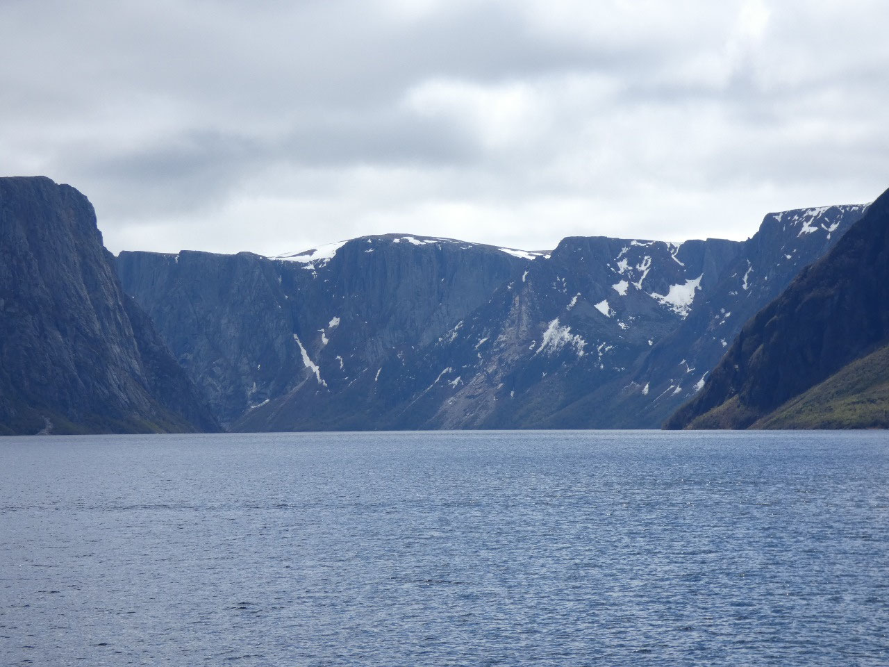
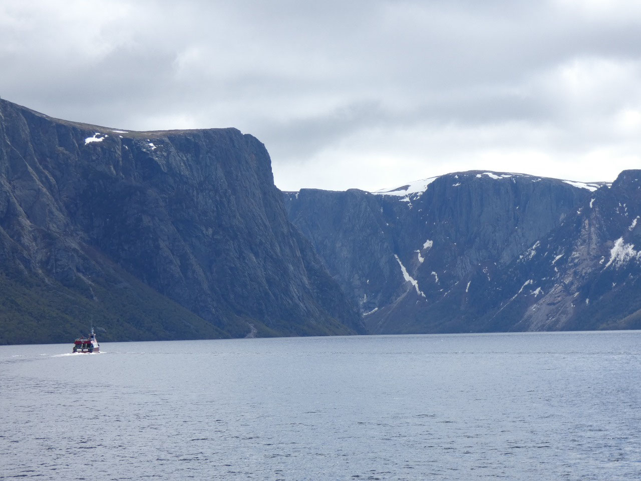
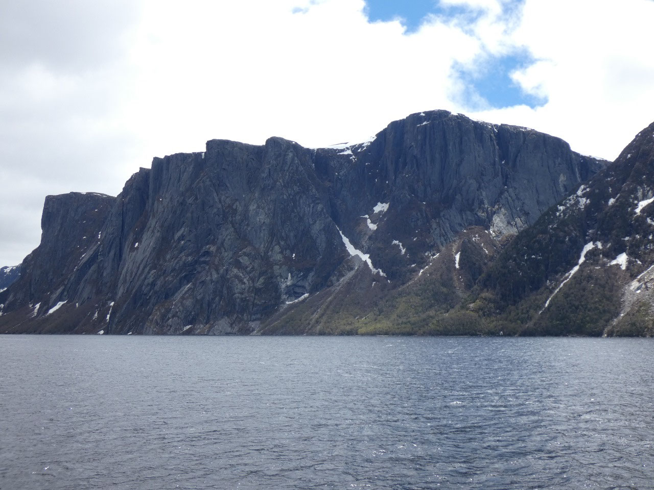
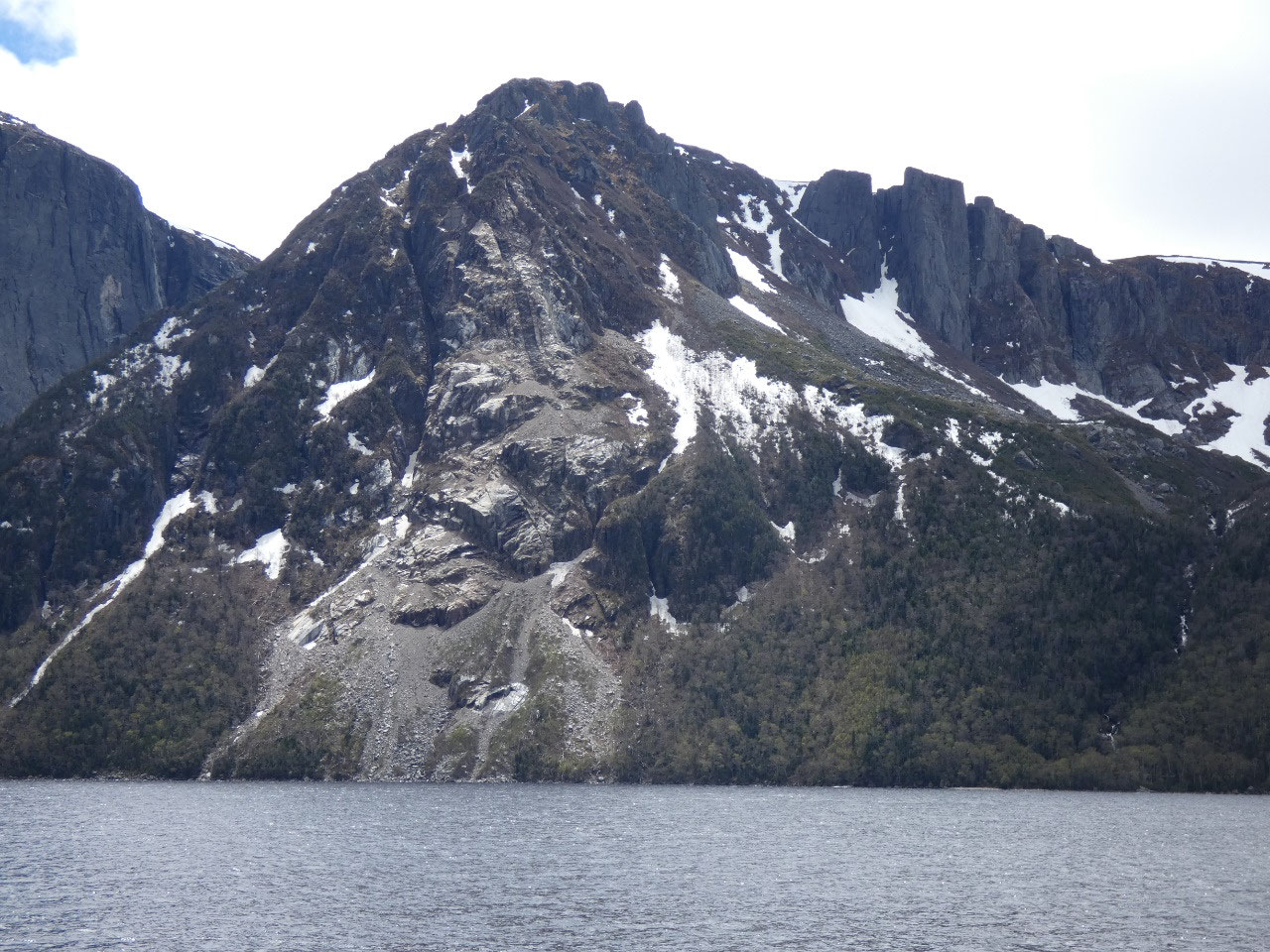
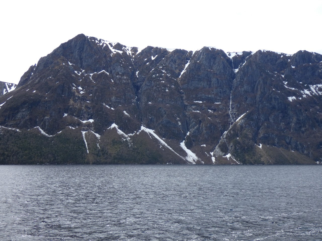
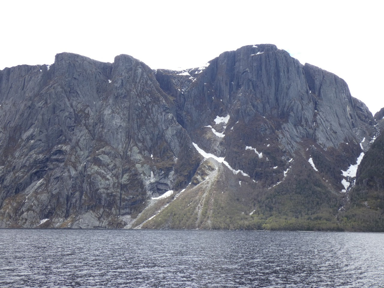
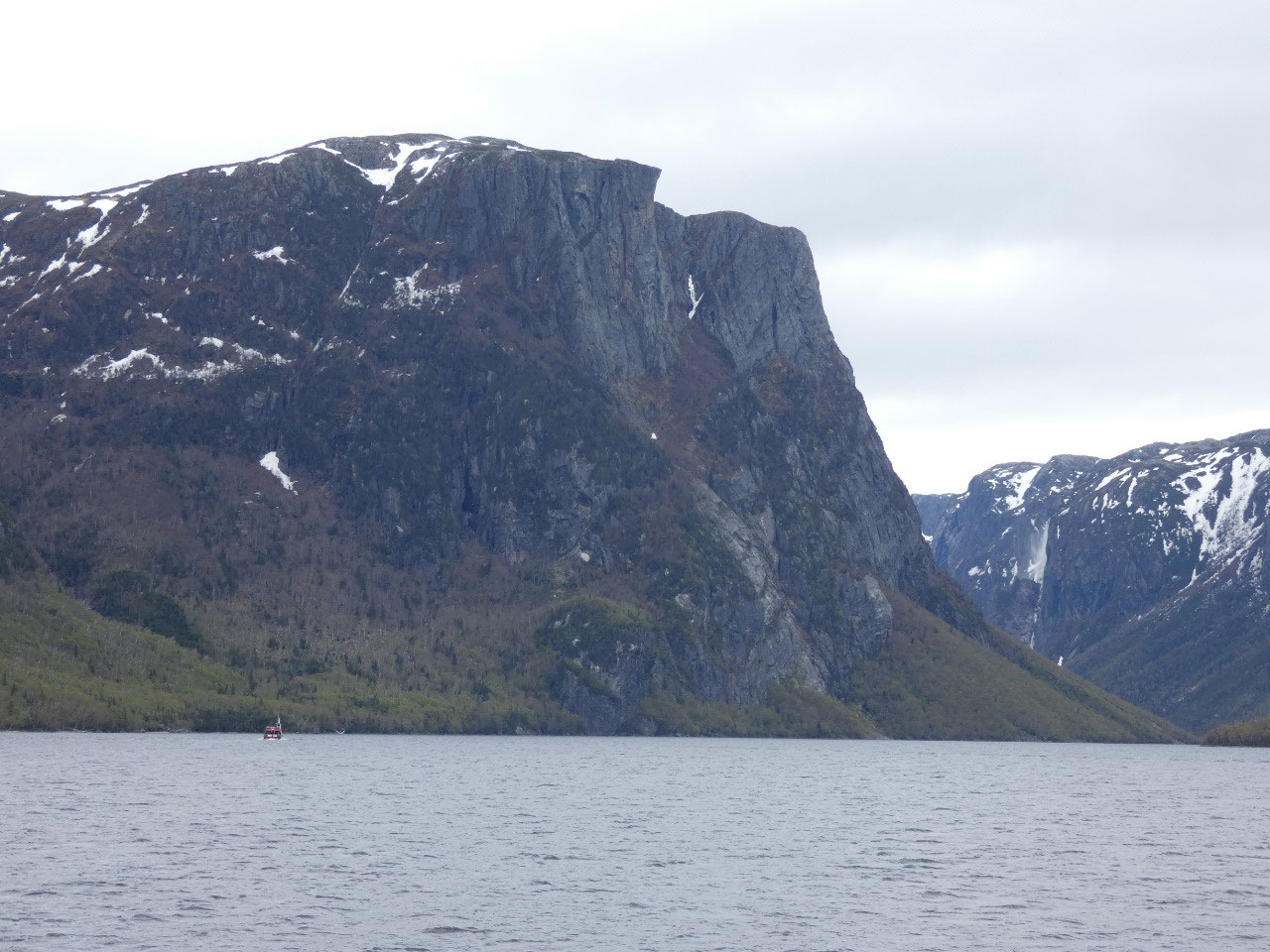
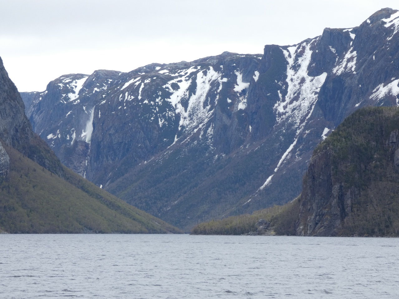
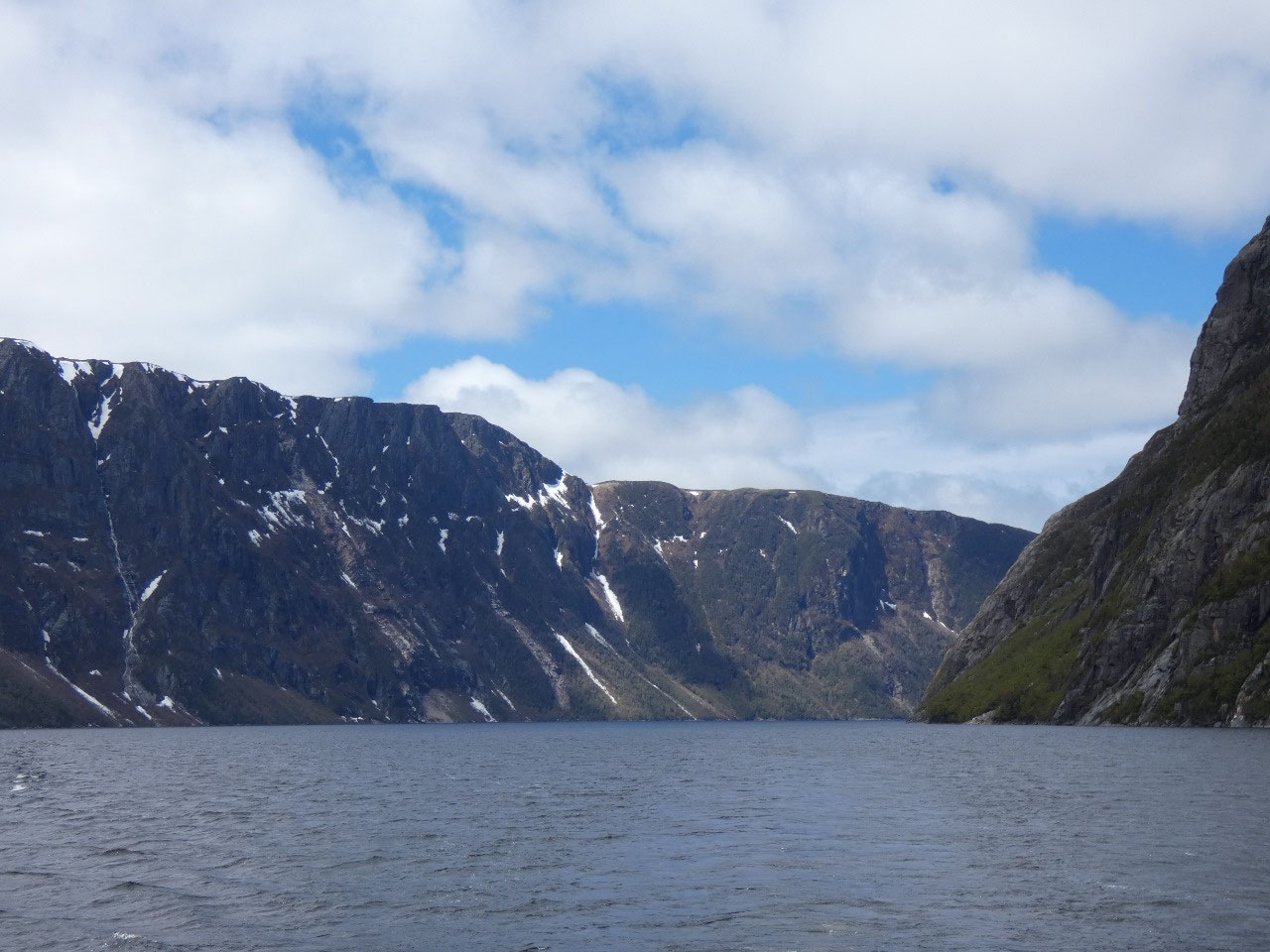
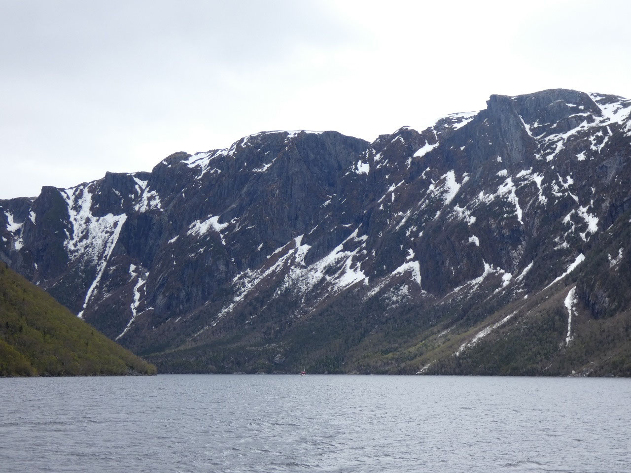
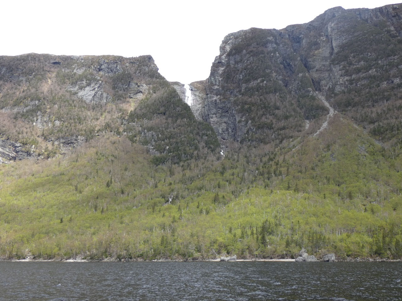
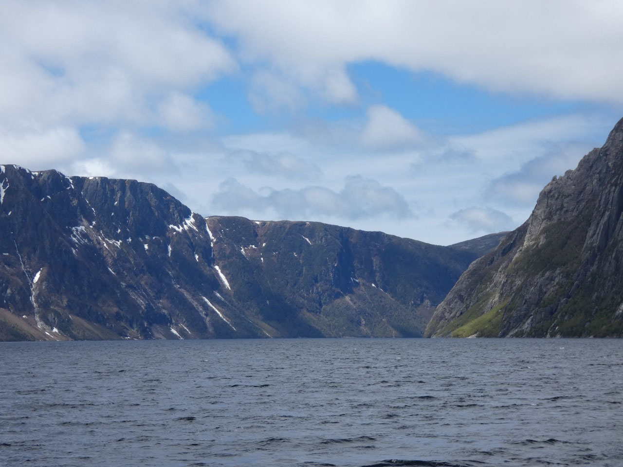
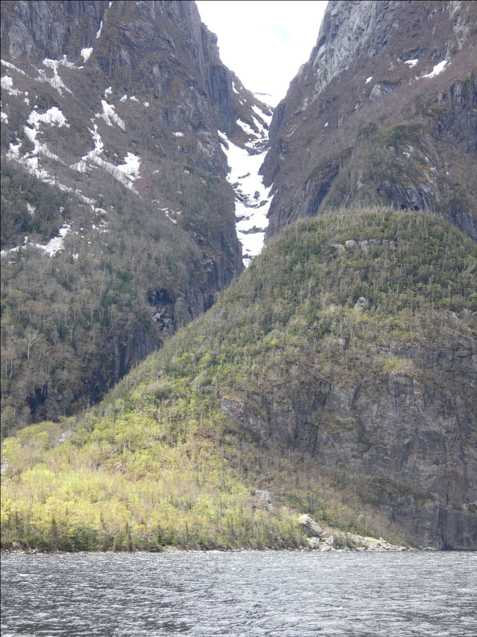
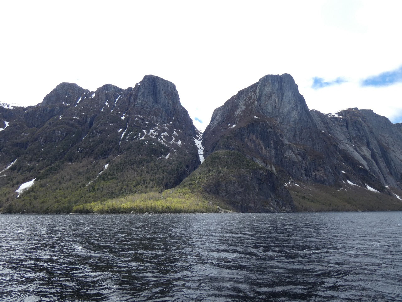
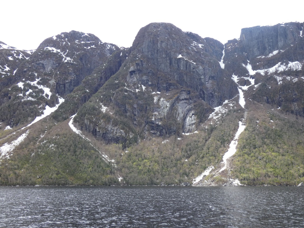
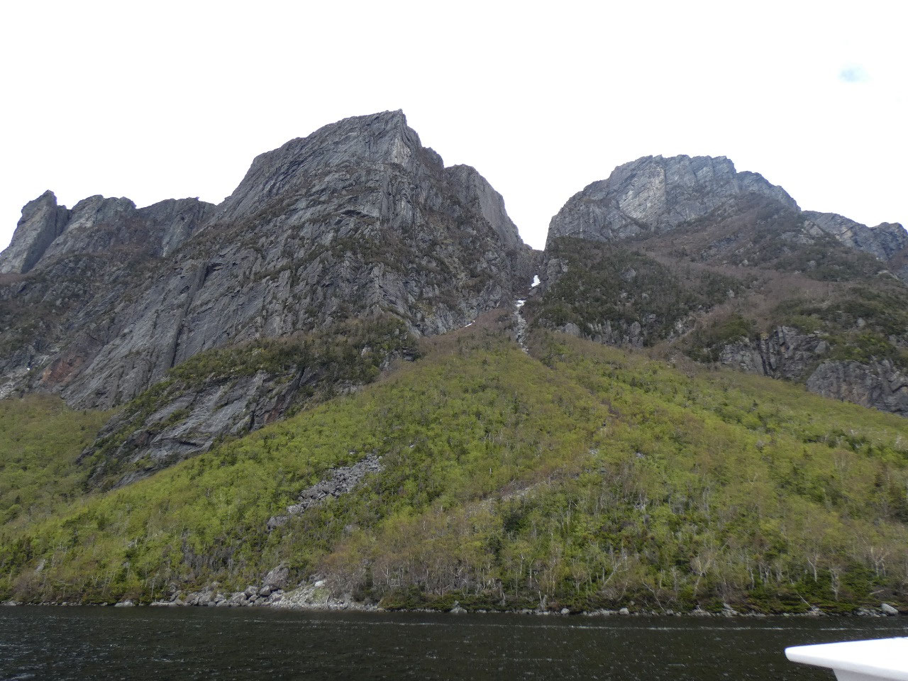
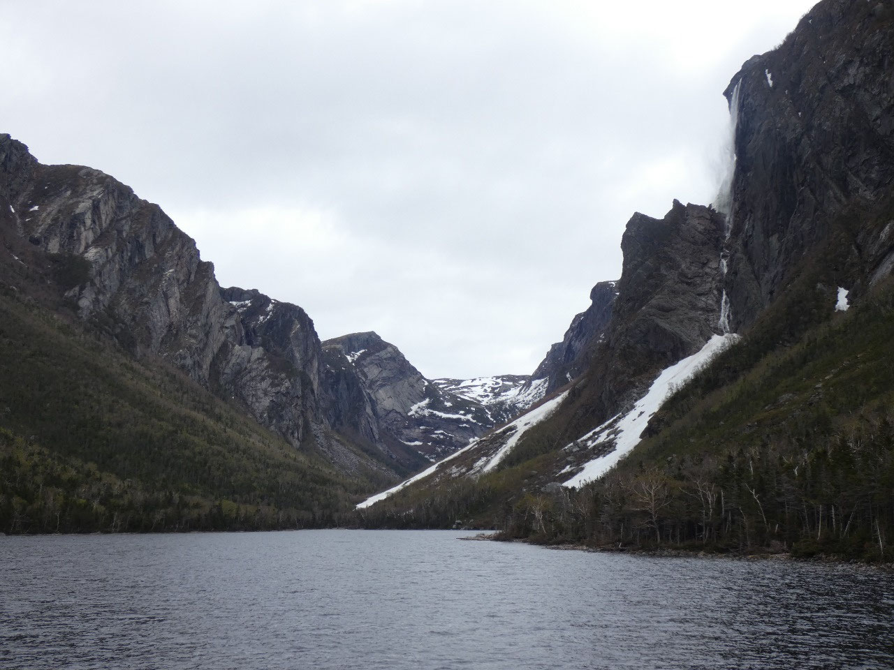
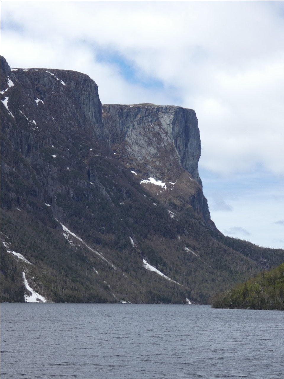
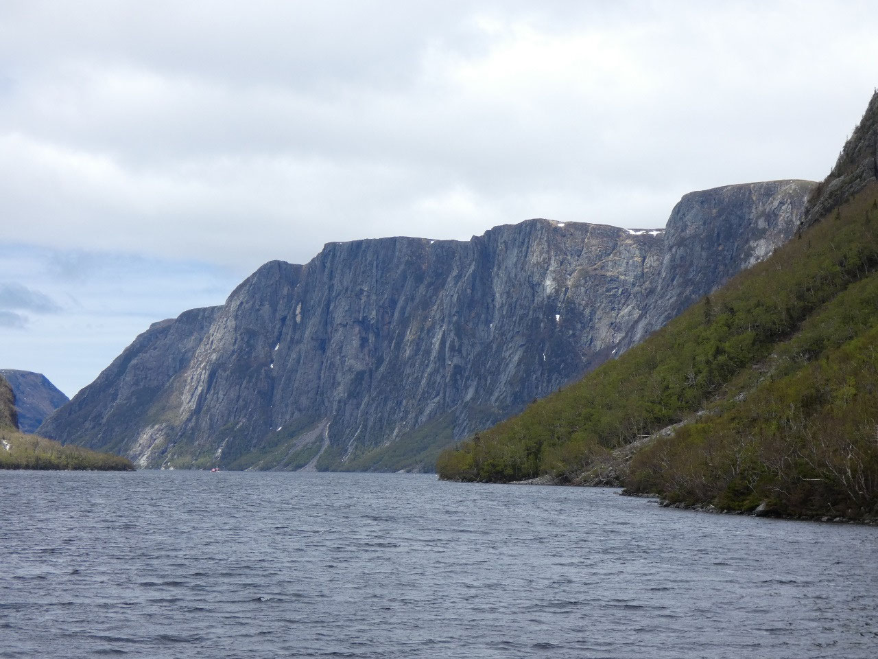
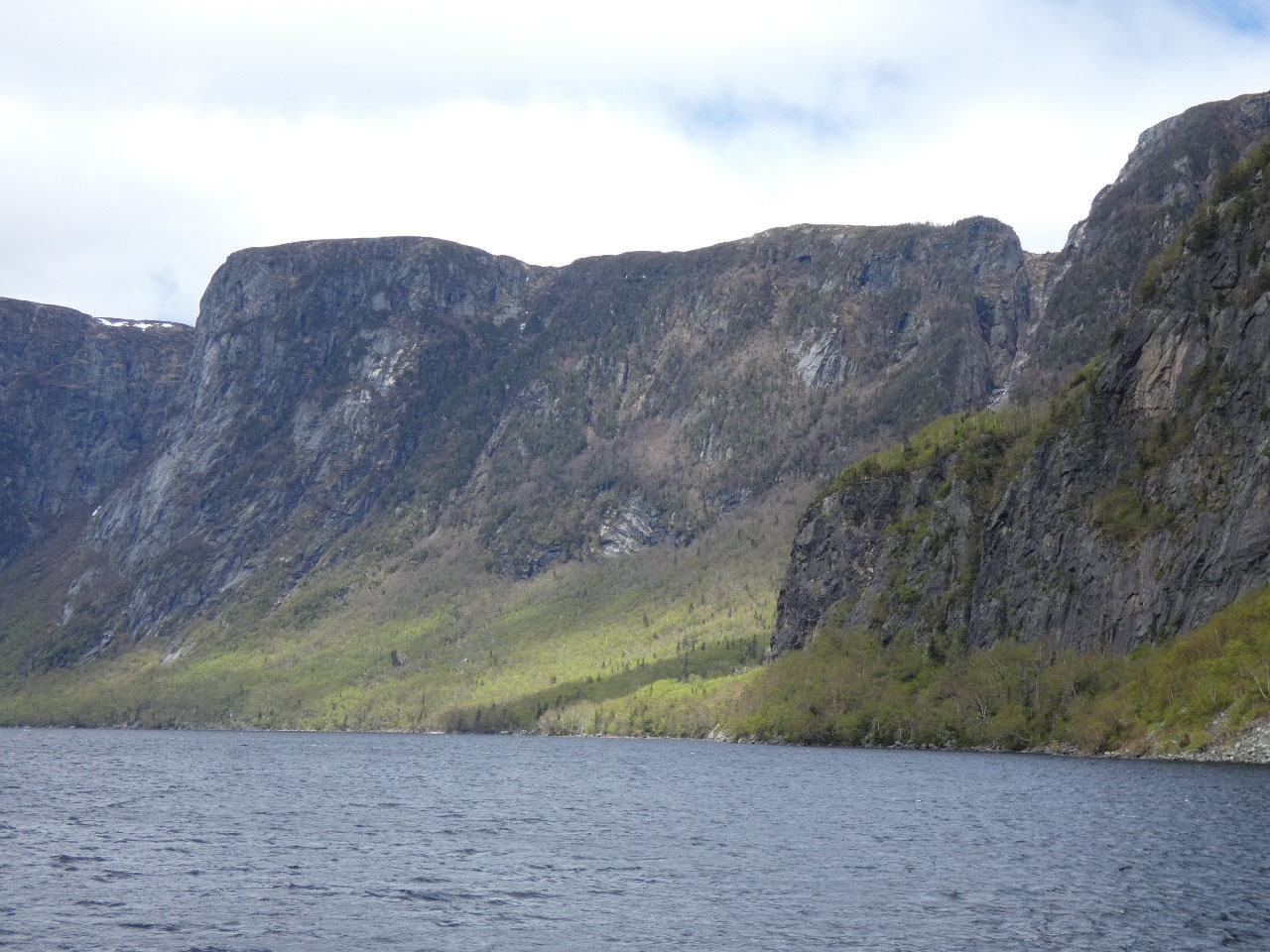
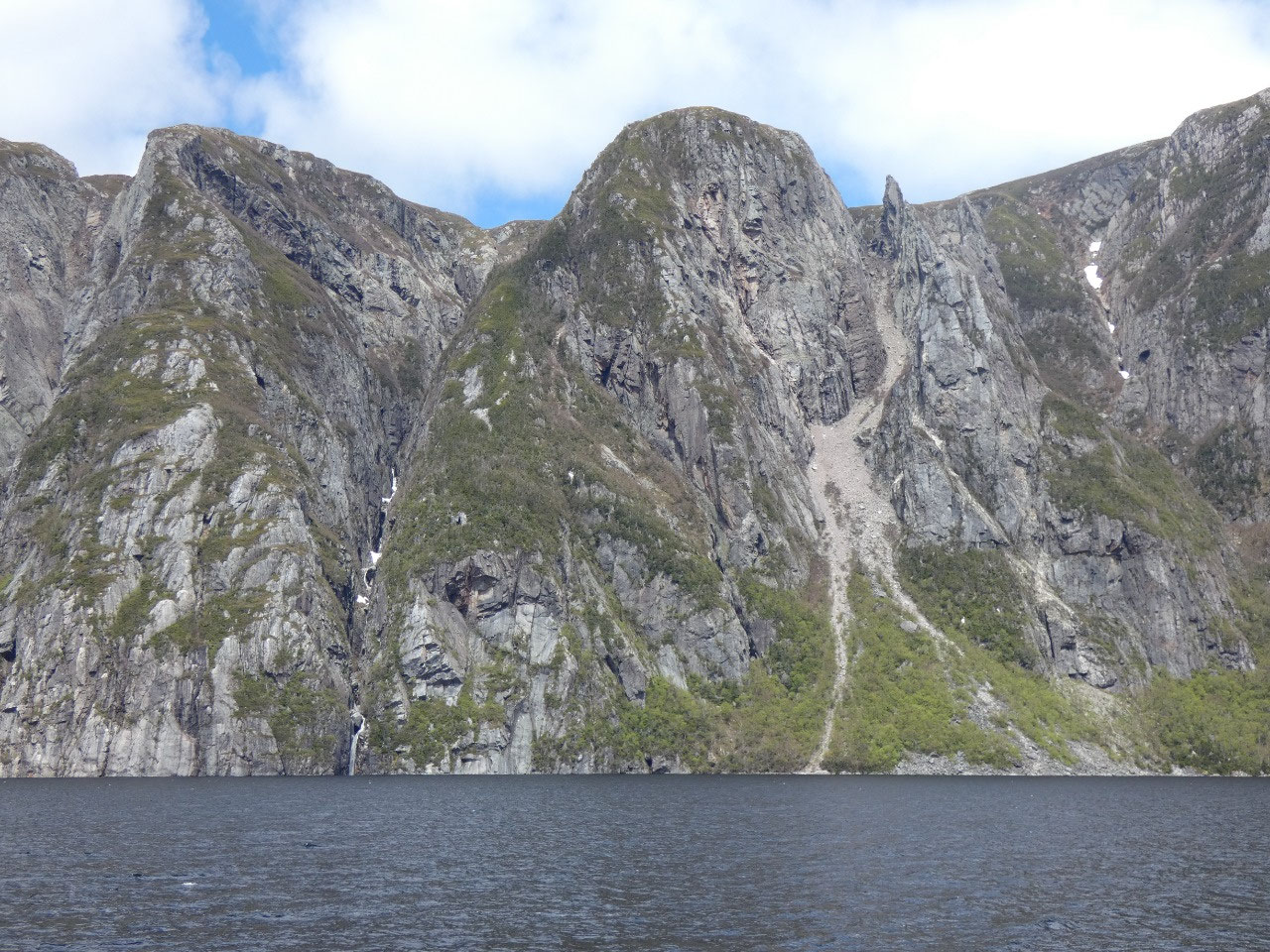
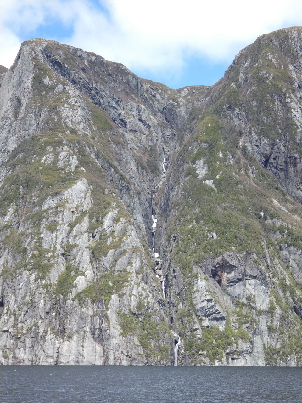
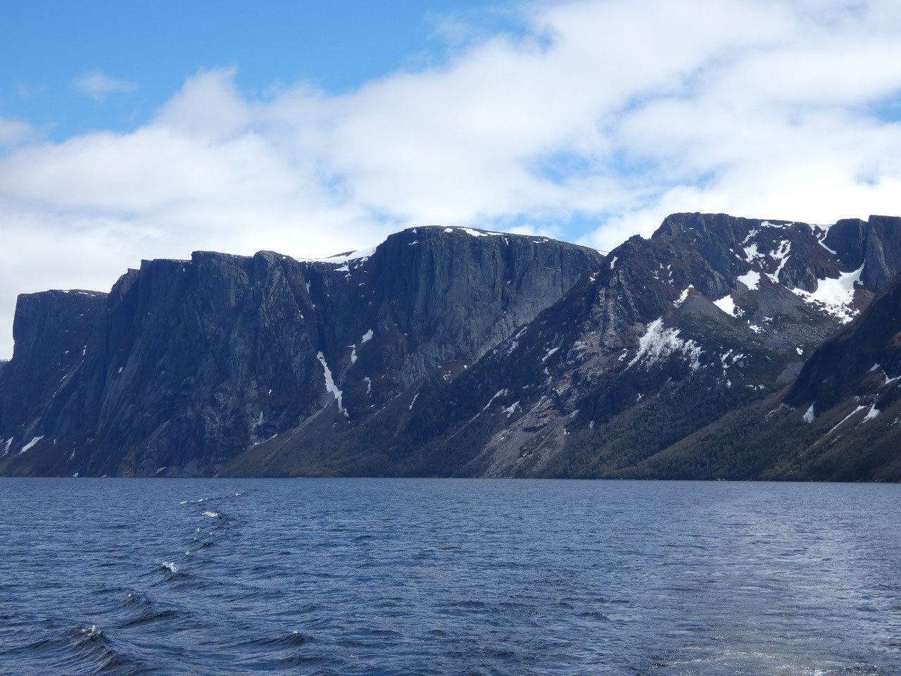
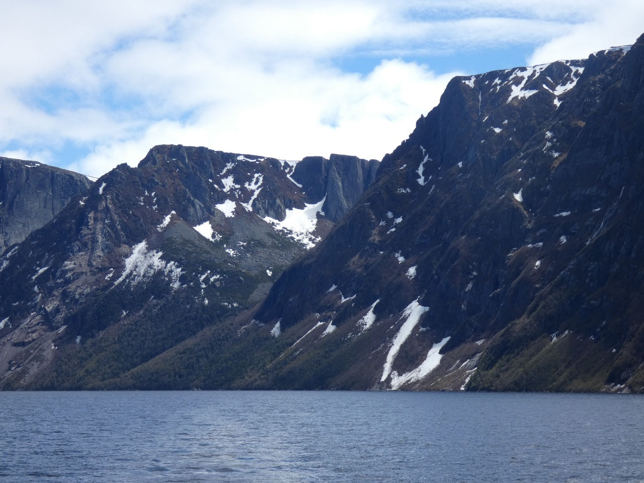
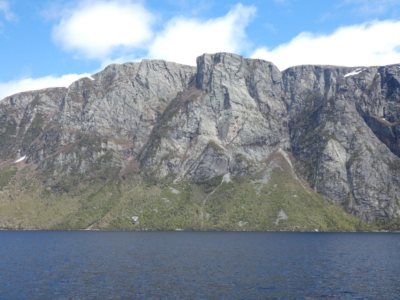
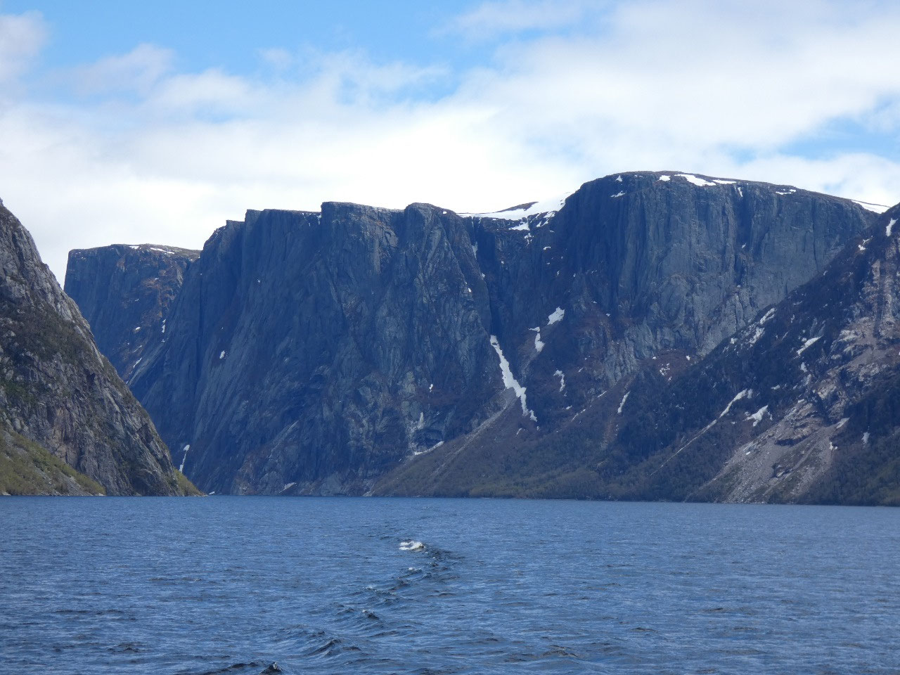
the “pond”. If I were to describe Western Brook Pond I would say to imagine
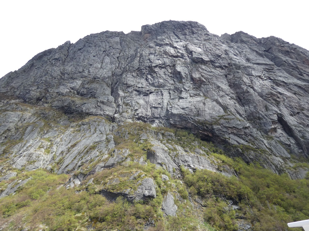
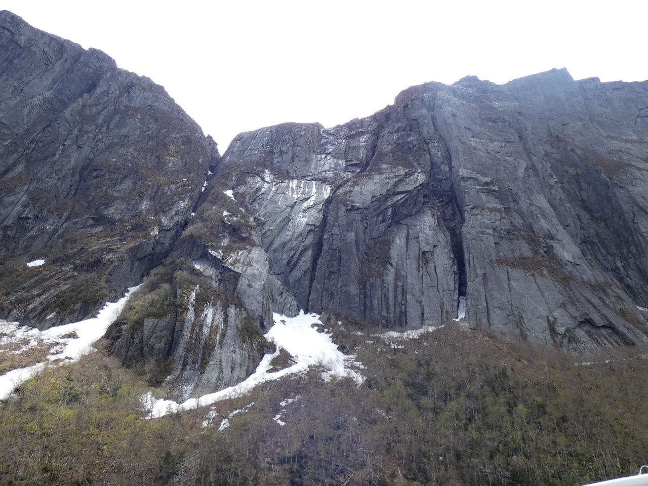
Yosemite Valley filled up with water. Like Yosemite Valley, it was formed by
glacier which gouged out the characteristic U-shaped steep-sided Valley out of
solid granitic rock.
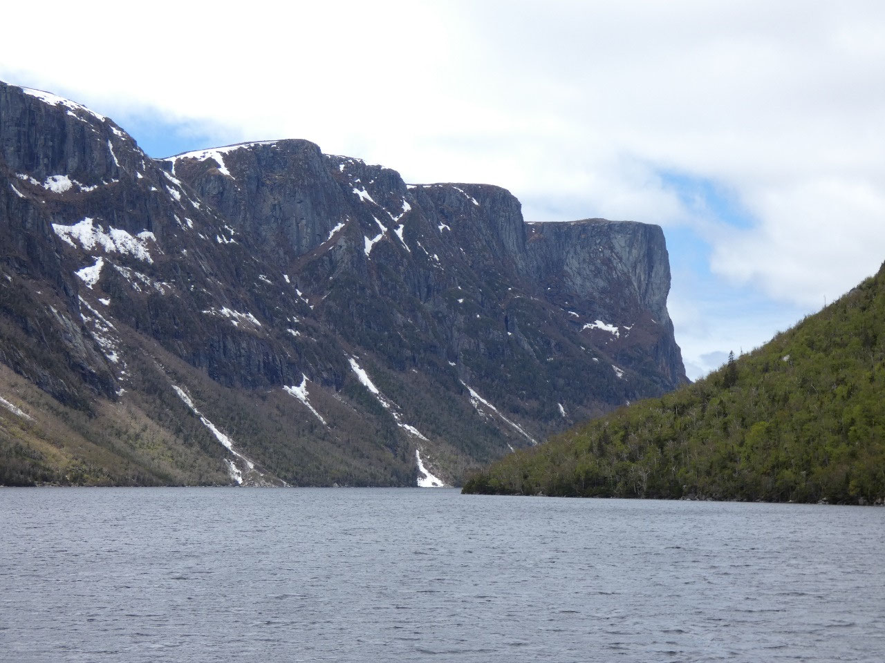
After the glaciers retreated, the valley formed a fjord
open to the ocean. However, as the weight of massive glacier sheet was relieved
after the last Ice Age, the coastal plain rebounded and cut it off from the sea
creating a freshwater lake, albeit a extremely deep one. The tour guides on the
boat recited many superlatives about the purity and uniqueness of the lake due
to several factors such a depth, small drainage basin, slow emptying, and
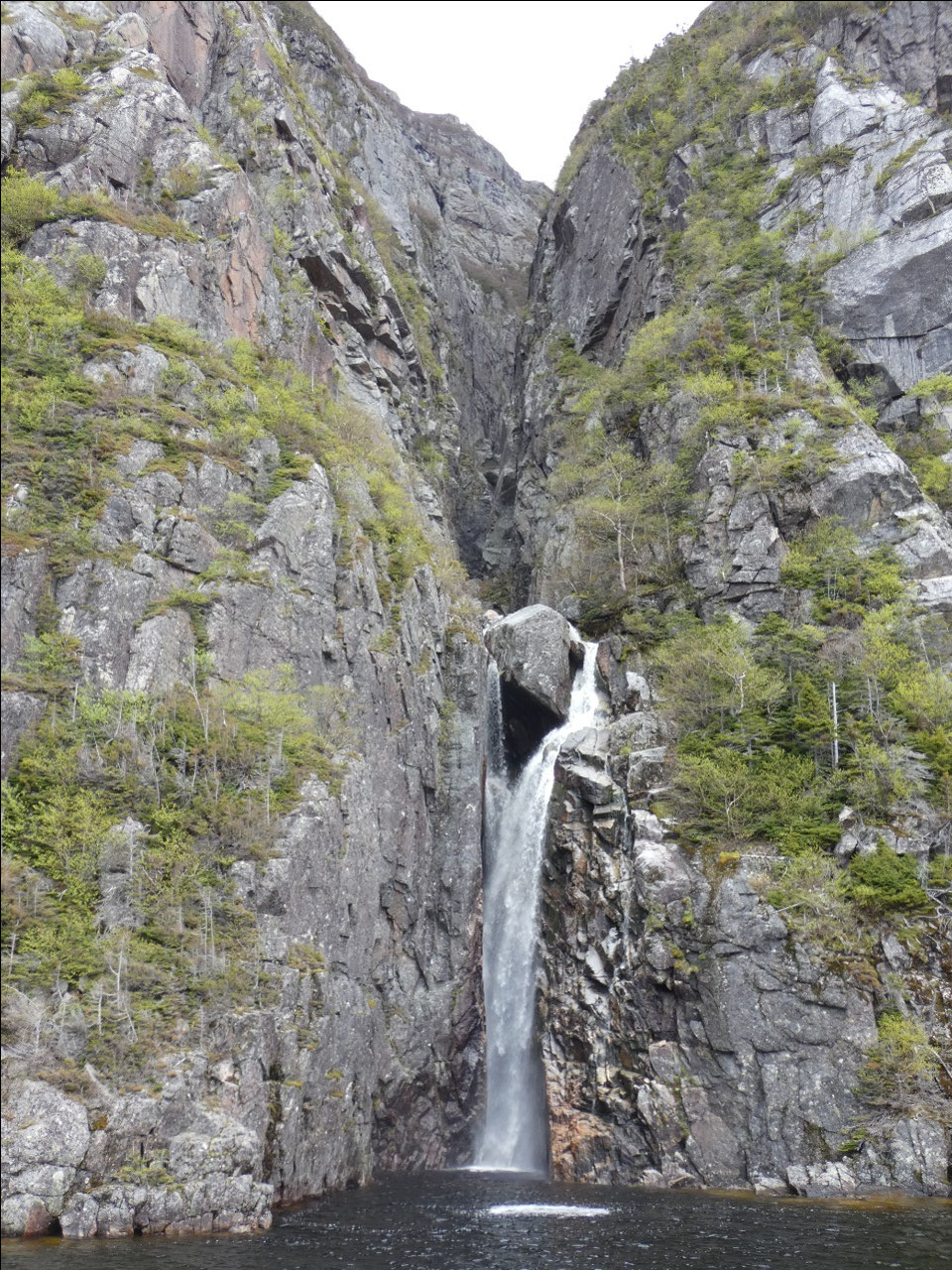
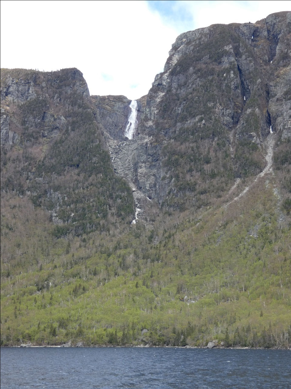
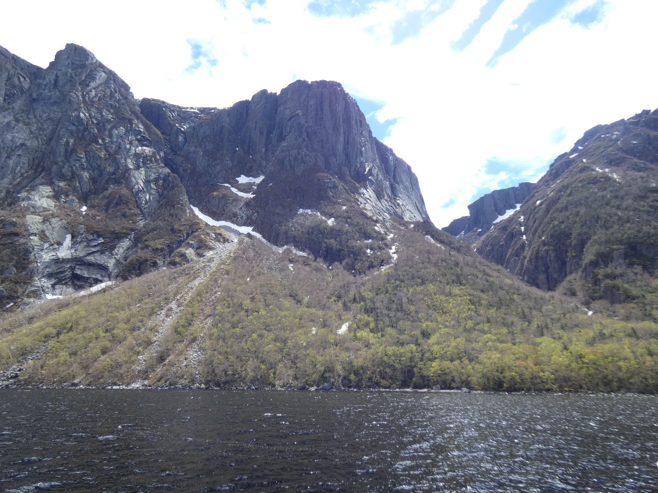
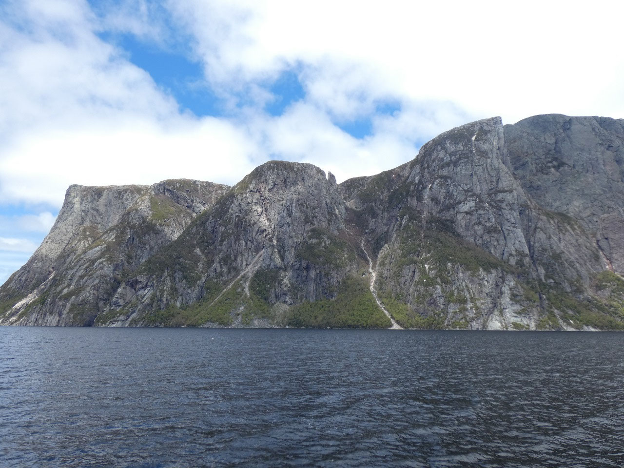
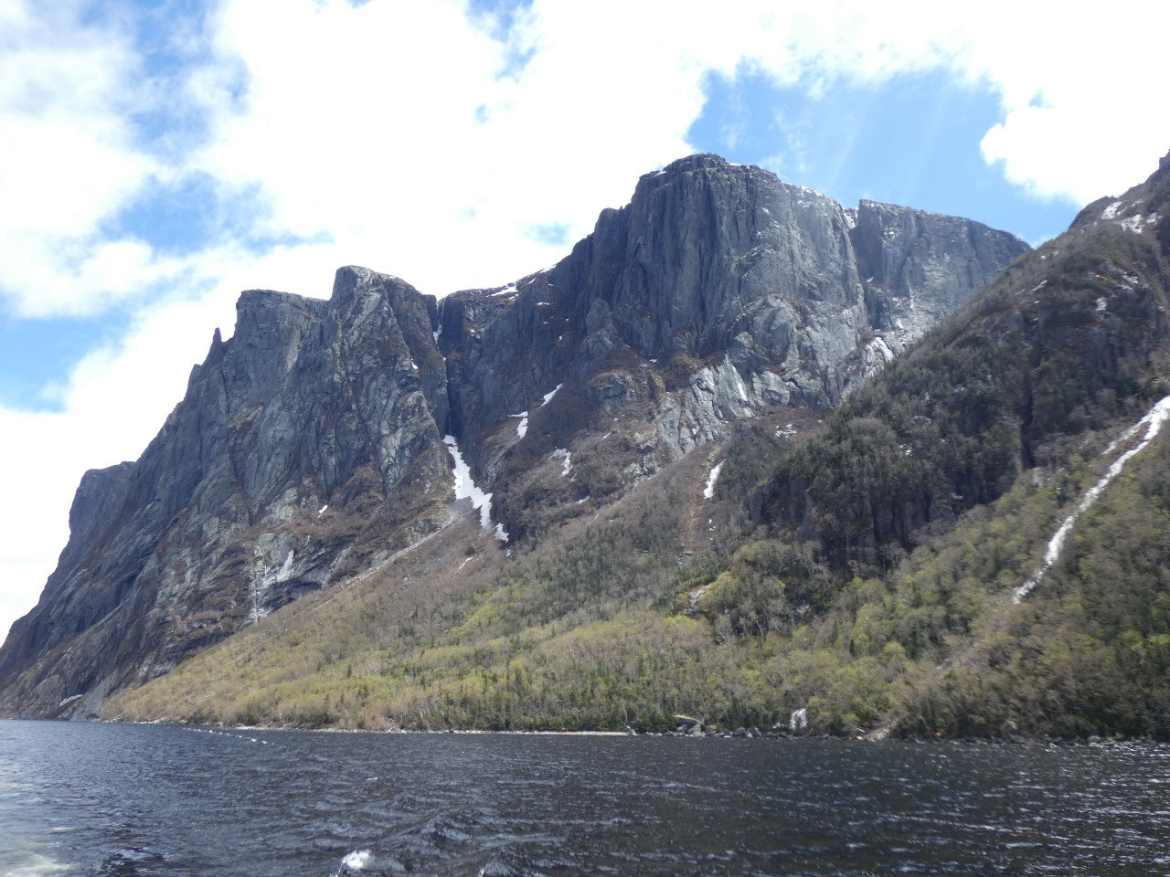
effect of surrounding rock type which create a unique environment. I managed to
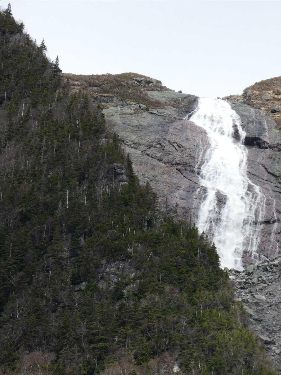
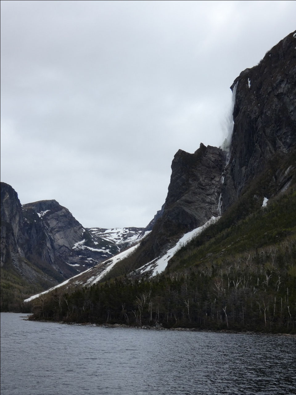
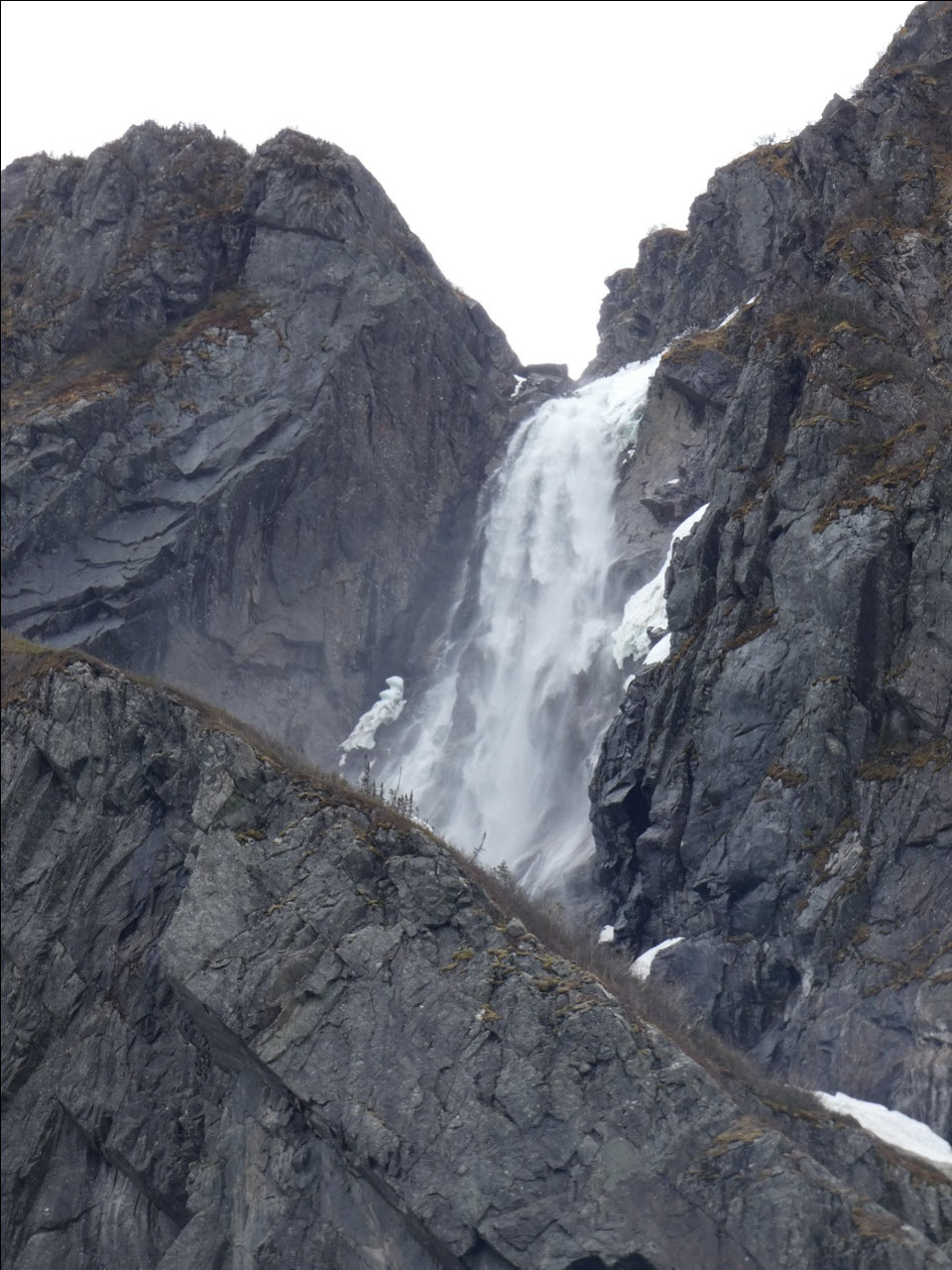
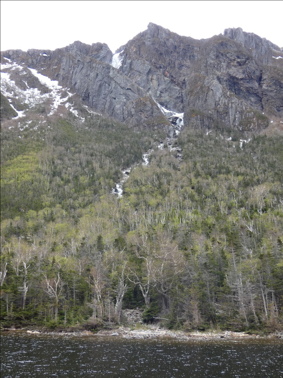
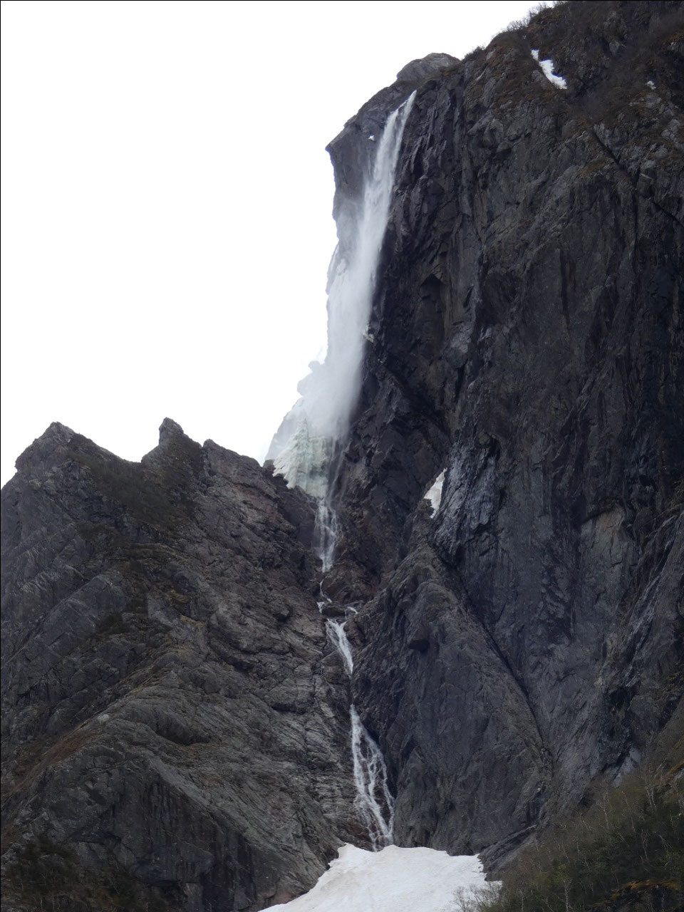
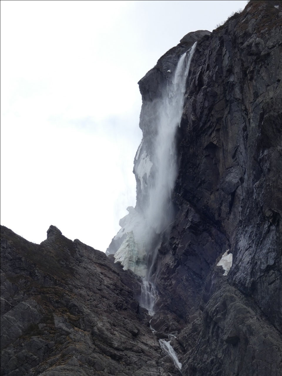
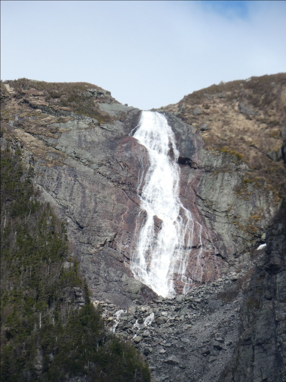
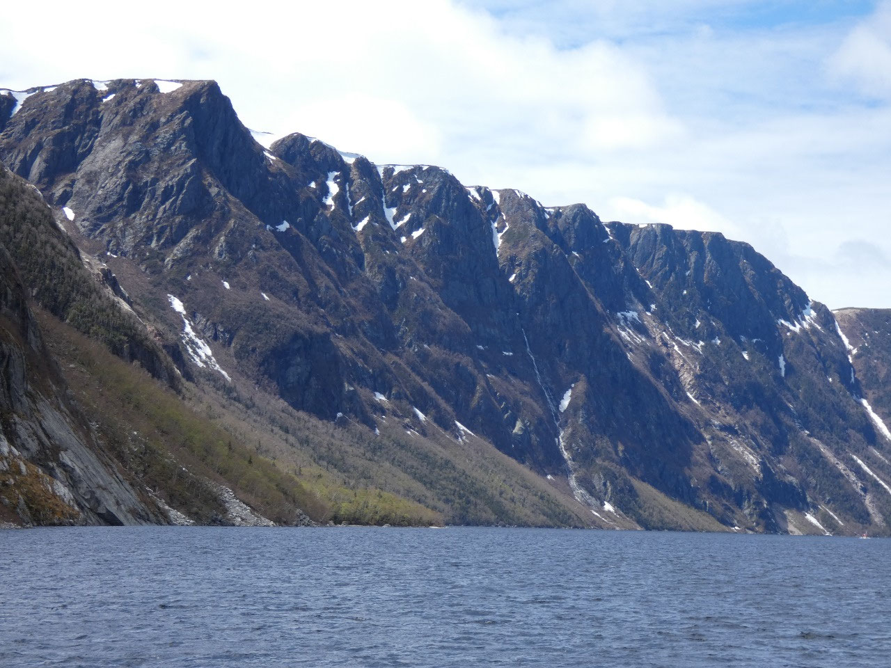
get a good seat on the roof for great views, including many of the waterfalls
tumbling off the cliff faces which reach over 2,000 feet high, also similar to
Yosemite.
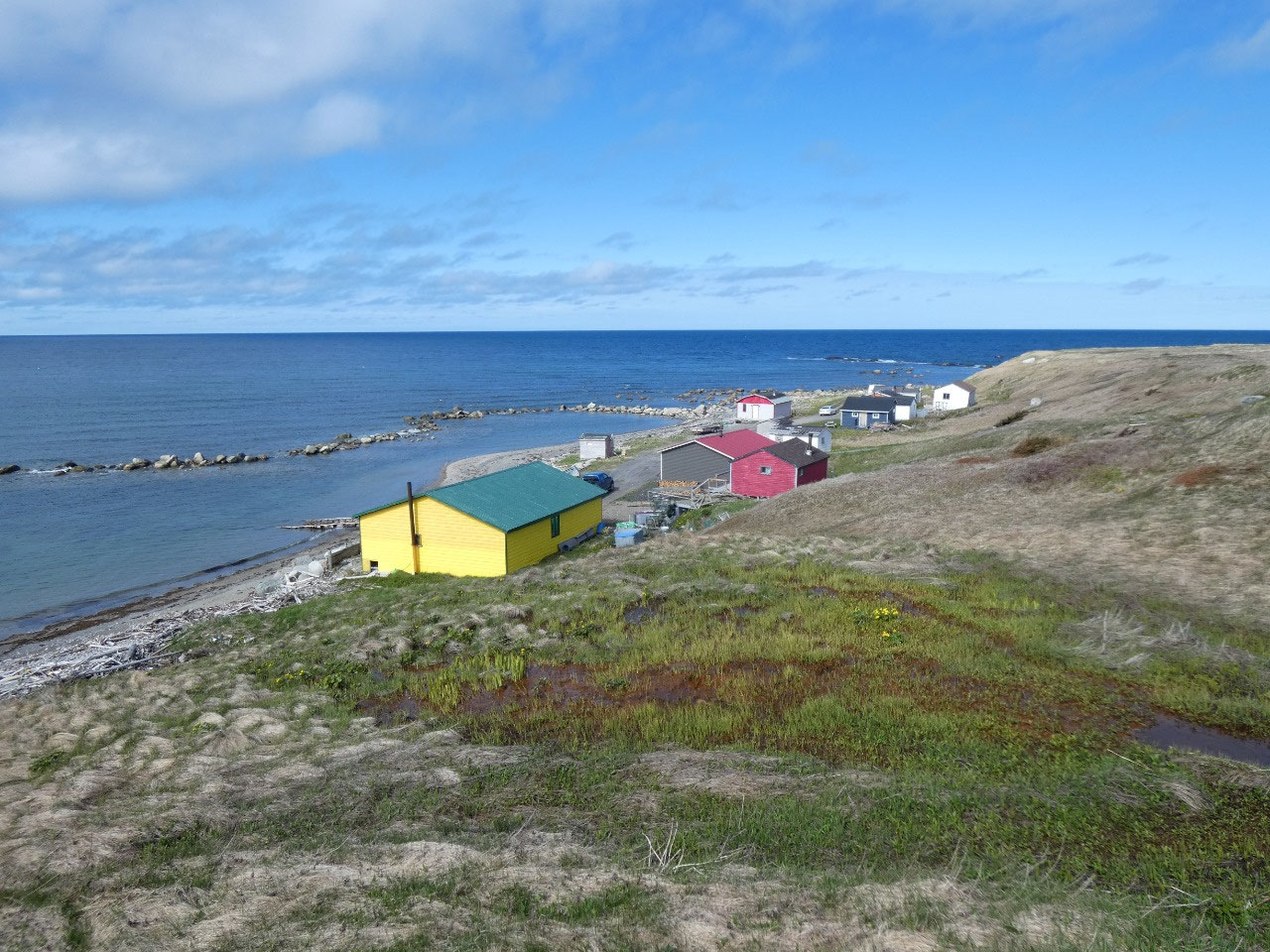
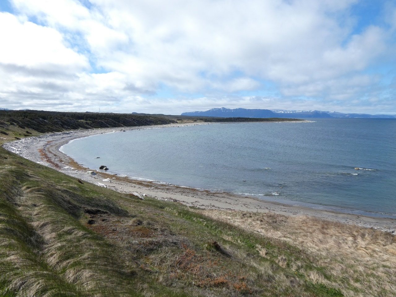
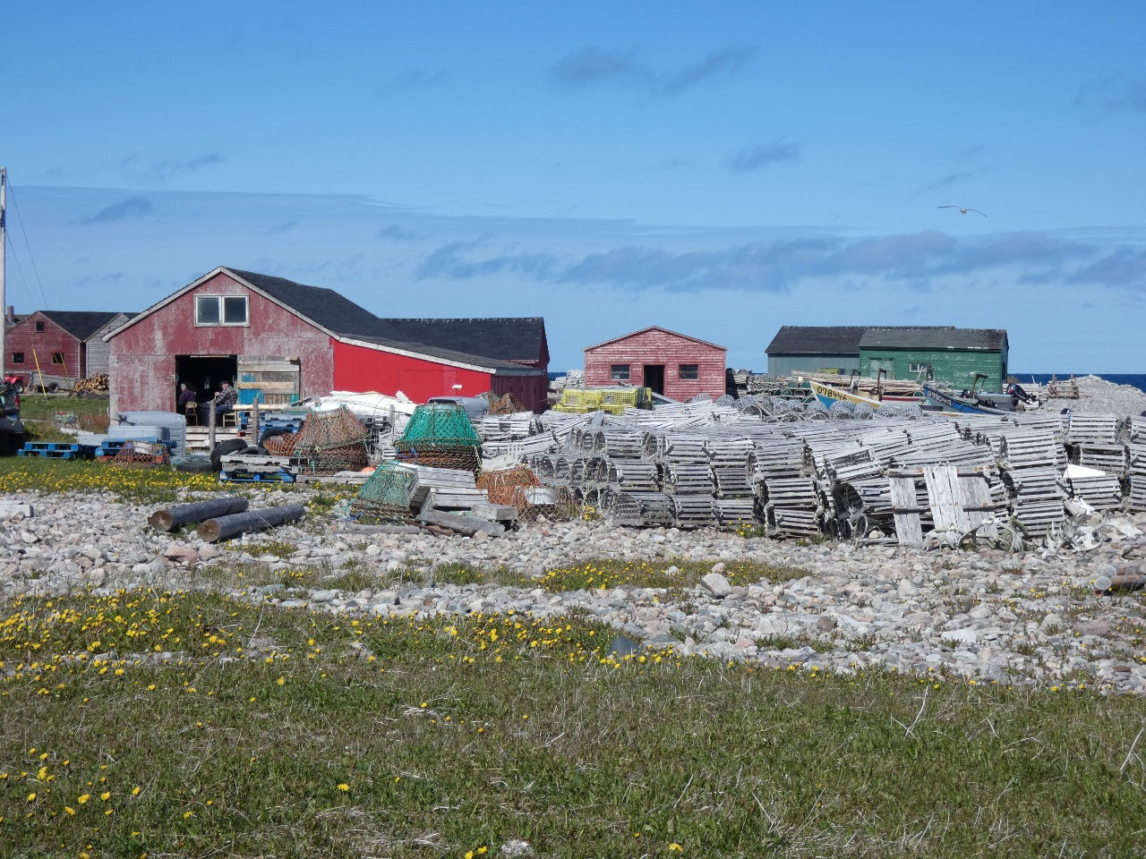
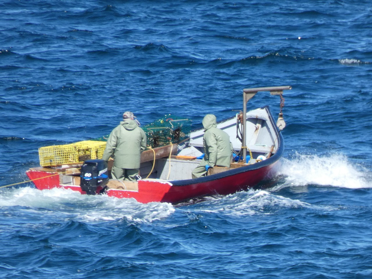
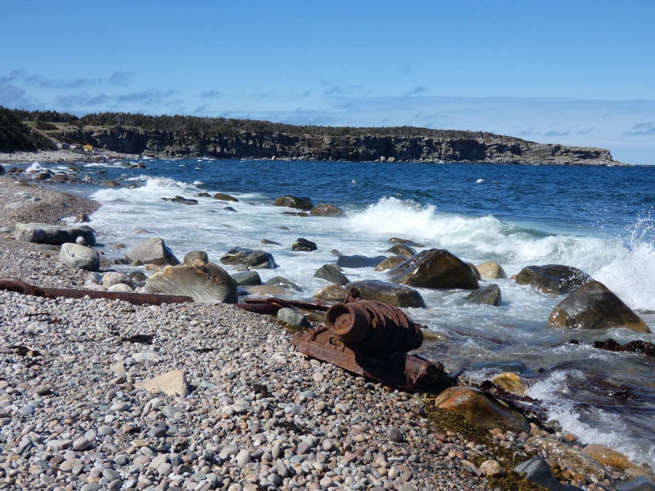
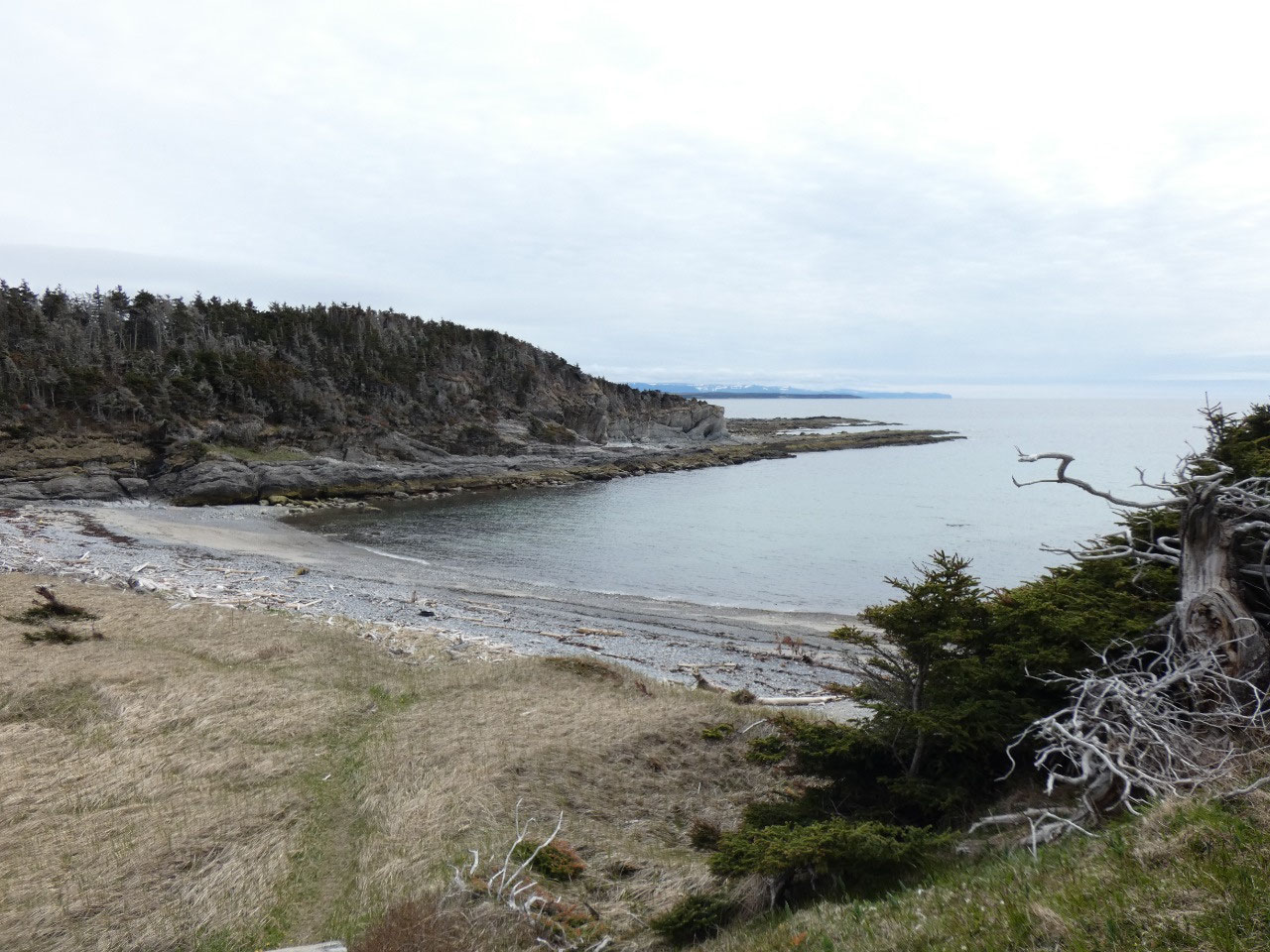
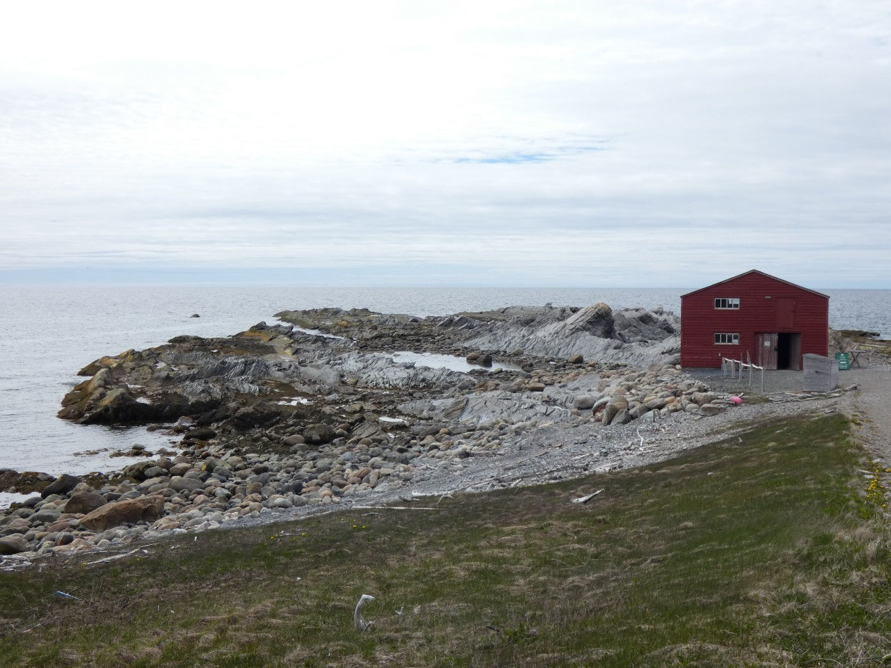
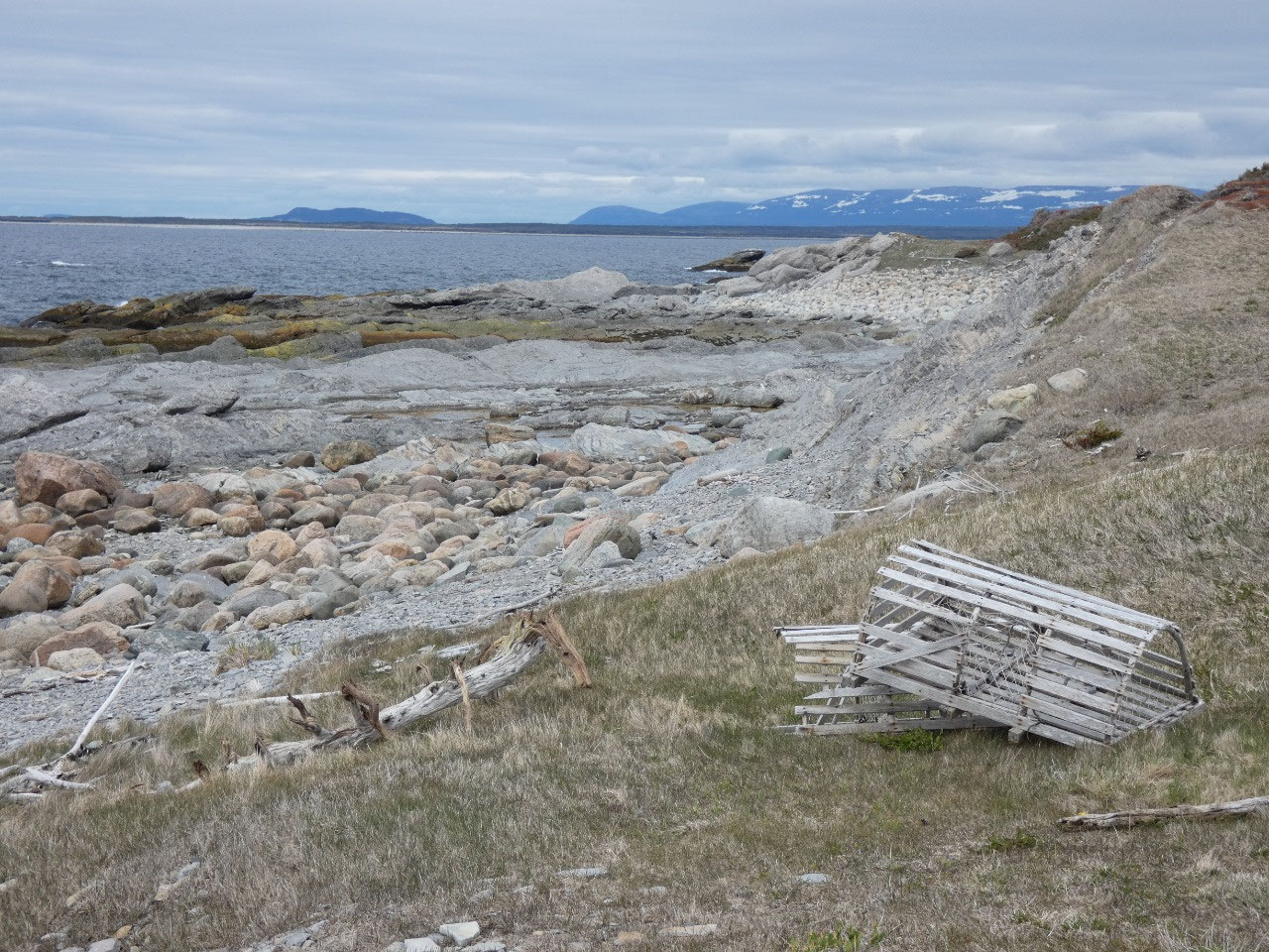
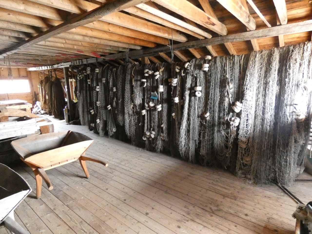
The park shores have many interesting features too including
a shipwreck, displays on traditional fishing communities, and there were even
some bona fide lobstermen setting or collecting traps within site of the shore.


2025-05-23