 Marsh Harbour, Out Islands, Bahamas
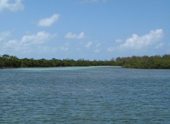
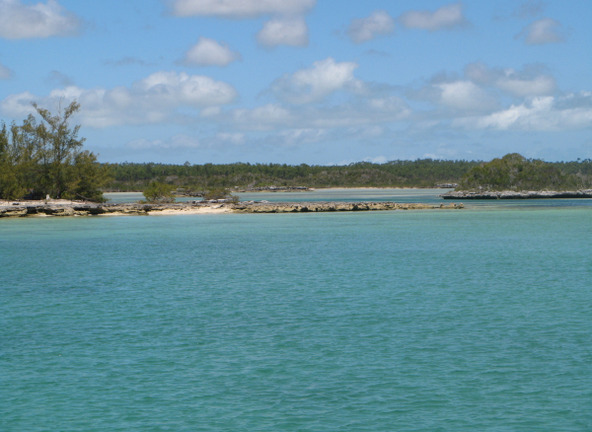
Since we had already visited Grand Cay and the Double Breasted Cays (beautiful!) during our 2013 cruise, both further to the northwest, we departed Stranger's Cay the next morning, April 18, at 0815 for an as yet undetermined destination back to the southeast through the Sea of Abaco. It would be all upwind in east to east-southeast winds of forecast 12 kts. A perfect wind speed for upwind sailing. So, we set full main and genoa and decided to see how far we could get. There were numerous places to stop and we needn’t decide until later – just enjoy the easy upwind sailing in largely calm water. The actual wind speed grew to 15-18 kts, not as easy, and we worked hard, tacking the boat 13 times, but making good progress. It had become clear that the wind today and forecast over the coming several days would be at a strength and from a direction that would not allow us to make desired stops at the extremely exposed Paw Paw Cays, Fish Cays and Moraine Cay found along our way, so our alternative was to stop at Powell Cay for reasonable protection.
However, with sufficient daylight left after reaching Angelfish Point, we decided to go all the way back to Manjack Cay to explore the creeks and mangroves on the southeast end of the island that we didn’t see the week before. To arrive there, it would be a long day - we sailed for 10 hours hard on the wind, covering 67.4 nm zig zagging back and forth across the Sea of Abaco, arriving at the southern anchorage between Manjack and Crab Cays at 1815. Whew!
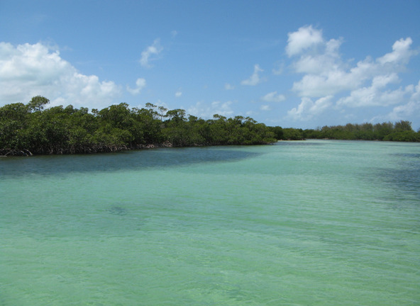
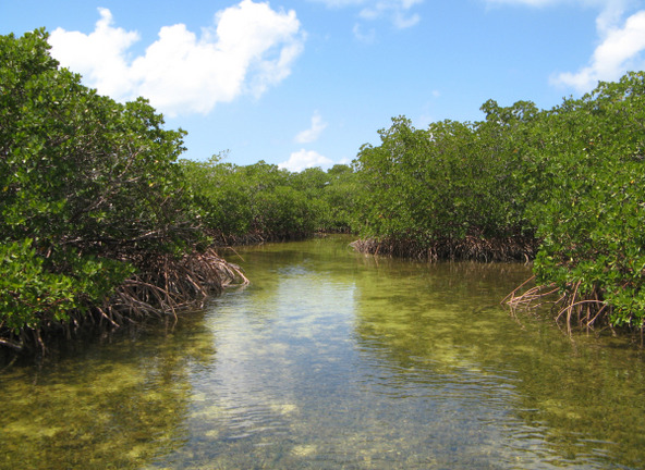
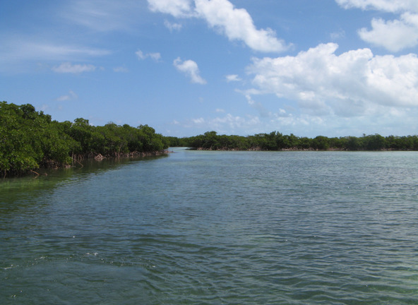
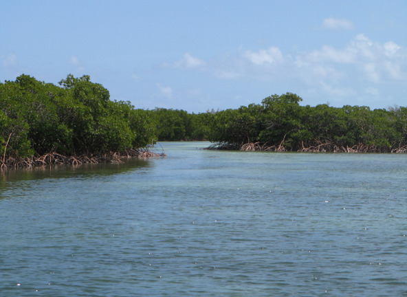
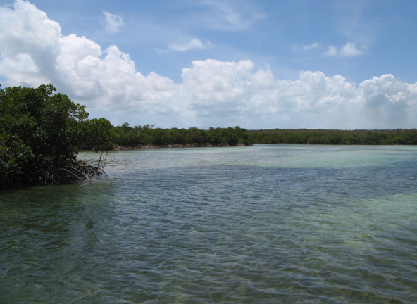
But the hard work was worth it – the next day we explored and fished the wonderful creek system on the east end of the island. Incredibly beautiful. The interconnected creeks winding through the mangroves are wide and deep enough for dinghy or kayak exploring with numerous small branch creeks leading to dead ends. It was a bit too windy this day for carefree fishing, so we stayed along the windward shores for protection, but perhaps the wind was the reason we didn’t suffer any biting insects! Rare for mangroves.
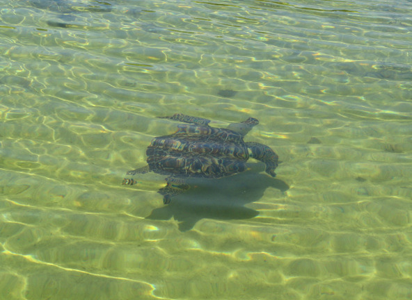
We caught one keeper Mangrove Snapper and returned several small ones and lots of juvenile barracuda to the water. We saw no bonefish. We did see one humungous barracuda that we declared the King of the Creek. A big highlight for Donna was the numerous turtles darting back and forth in the clear water, at times right under the dinghy. We have been in a lot of mangrove creeks over the years and we have to say that this was the greatest concentration of turtles we have seen anywhere. They are gorgeous and simply delightful! We don’t know if this creek system leading off of the charted "Nunjack Harbour" here has a name (none charted) but, if it doesn’t, we sincerely suggest it be called “Turtle Haven Creek”. A real treat to see—don’t miss it!
At 0830 on April 20, we departed Manjack Cay, again for an undetermined destination to the southeast, and again in forecast winds that turned out to be understated. Based on the forecast of moderate 13-15 kts, we still put a reef in the mainsail, learning our lesson from the previous trip to Manjack, which turned out to be a smart decision – the actual wind was more like 12-20 making the single reef appropriate. Our longer-range goal was to get to an anchorage with good east through south to northwest wind protection for a weather event arriving in four days. Once underway, and keeping with our “new places” theme, we decided to head for Great Guana Cay, which we had never visited, and to try out the famous Nipper’s bar and grill located there (advertised on the daily cruiser radio net). From there we would have time to get to a decent anchorage in the southern portion of the Sea of Abaco to bear the significant weather arriving later.
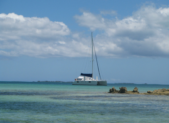
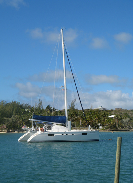
The course to Great Guana Cay would be sailing upwind and we would have to transit the Whale Cay Cut, with the island of Great Guana just beyond it. We flirted with the idea of sailing through the reef cut upwind, but the course would have been very tight on the wind through this narrow span to enter the Atlantic and not on a “down the middle” course. Given the brisk wind of the day, we concluded it was not prudent despite the absence of other traffic to contend with. Instead, we tacked to position ourselves very near the cut, then furled the genoa and motor sailed through the cut on the main, continuing a bit out to sea on starboard tack far enough to gain a good angle to re-set the genoa, after we would alter to port tack, to make it through the east portion of the re-entry channel on a single tack. This worked out well and we needed only one more tack later in the Sea of Abaco to lay the desired anchorage at Great Guana Cay. We arrived at the anchorage at 1215 and got a good anchor set in sand on the first try. Total distance, 24 nm, all upwind, including the slow portion through the cut.
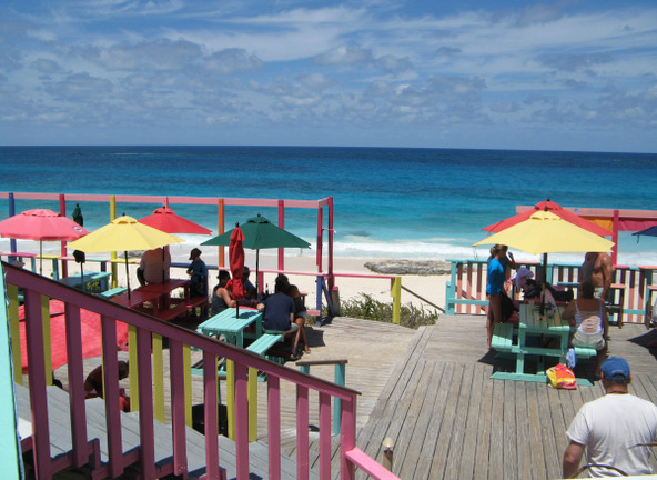
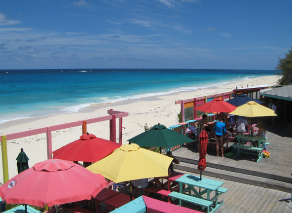
Once securely anchored in Fisher’s Bay, Great Guana, we set out for a late lunch at the famous Nipper’s so that we could evaluate whether it was a spot worth bringing a future guest to. We tied the dinghy to Nipper’s dock in Guana Cay Harbour and easily walked over the hill (signage abounds) to the Atlantic side of the island where the establishment overlooks the Atlantic beachfront. Guana Cay Harbour and the restaurant are also easily accessed from Fisher’s Bay if you beach your dinghy there and walk through the beach resort to the main road. Painted in tropical colors, the restaurant has a lot of tourist appeal. It wasn’t terribly crowded by the time we arrived. While our grouper fish platters were expensive, we found the portions to be very generous compared to similarly priced entrees elsewhere. We were quite pleased overall. If you are visiting you can bring swimwear if you want to visit the beach or swim in the restaurant’s complimentary freshwater pool.
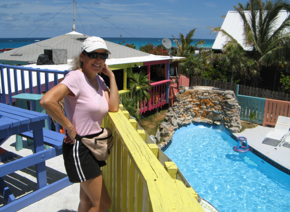
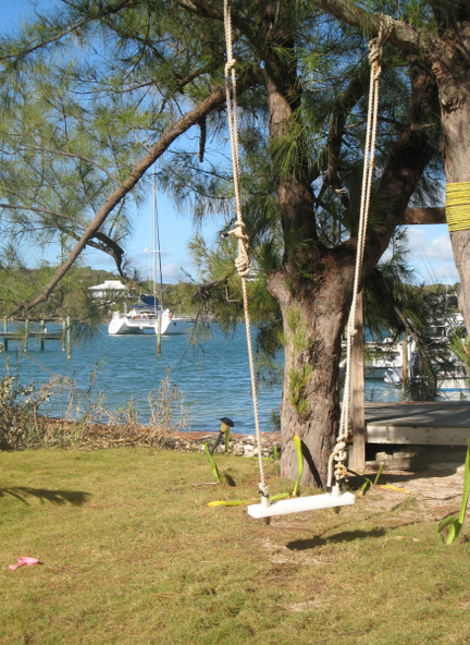
We departed Fisher’s Bay on April 21 at 0825, bound again for some as yet undetermined anchorage to the southeast. And again, it would be another upwind day and the wind was again higher than forecast at 15-20 rather than the cited 10-12. No matter where we ended up, our route would take us close to Marsh Harbour, so we decided to make a pit stop there for a few groceries and to replace the dinghy Jerri can and gas we had given away at Stranger’s Cay. We made the close-hauled sail to Marsh Harbour on one long port tack, arriving at 0940. Once ashore, we split up with Donna going to Maxwell’s for a few groceries, and Dave visiting the well-stocked hardware store for a new Jerri jug, then on to the Shell station to fill it up. All these places are easy walking distance from the dinghy dock. You can pretty much find anything you need in Marsh Harbour. On Donna’s way to Maxwell’s grocery she stopped in to visit the Bahamas National Trust office where she spoke with Mr. Knowles, Chief Park Warden, to learn more about the role that the BNT plays in the protection and development of the Bahamas.
Departing Marsh Harbour, we decided to go all the way east and south in the Sea of Abaco to Little Harbour, where we’d arrive in time on a falling tide to pass through the notoriously shallow entrance. There, we’d pick up a mooring with fabulous shelter needed to bear the previously mentioned strong inclement weather arriving soon. Little Harbour is a perfect shelter, a small, circular harbor, almost completely enclosed within high ground, with just the narrow, shallow opening to the outside waters. It looks like it could have been the crater of an ancient volcano – which it very well may be.
On Sunday, April 23, the bad weather arrived just as forecast with squalls beginning in the late morning and lasting all day and most of the night, drenching the area with over three inches of what was said to be much needed rain. We saw a lot of lightning, mostly in the distance, but heard some thunder from lightning closer by. Winds grew into the 30’s overnight and we were thankful we had sought shelter here. The next day we discovered that one of our two mechanical wind vanes at the top of the mast was gone – certainly blown away during the squalls.
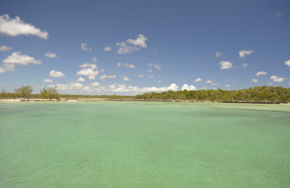
We departed Little Harbour at 0930 the next morning, bound for a west facing anchorage back up the Sea of Abaco a few miles at Cormorant Cay. We would have liked to revisit some of our favorite bonefishing flats in the Bight of Old Robinson just northwest of Little Harbour but the swells persisting in the area from the recent peak winds would be untenable. With winds now shifted to the west and forecast to diminish some, we continued further northward to an area where we could be close to exploring other creeks found along the west shore of the Sea. We had been in the areas of Buckaroon Bay and Snake Cay in years past, so we aimed a bit farther north to Cormorant Cay. For a change, this wasn’t entirely another upwind sail, and we made the short passage winding through the reefs of the south Sea of Abaco on genoa alone in 10-15 kt winds, arriving at the dramatic anchorage at Cormorant Cay at the mouth of a mangrove creek at noon. It was very lovely and peaceful. This anchorage isn’t identified as such on the local charts so, of course, we were the only boat there.
After lunch, we set out in the dinghy for exploring and fishing, entering the mangrove creek just after a low tide – a perfect time to look for bonefish on a rising tide. But we saw few fish of any kind, other than small barracuda, which were anxious to take our jigs. We returned to the boat after a few hours of getting cudas off hooks to relax and enjoy our private, serene anchorage for the evening. But right on time at dusk, they came - No See-Ums. What was now a very slight west wind brought them out to the boat from the mangroves and the nasty buggers drove us inside to refuge behind closed hatches. With biting flies having already boarded from the moment we arrived, we were forced inside until the following morning and deployed our cabin fan for cooling. So, it’s not all rum and mangoes….
The following day, Tuesday April 25, we departed southeastward with a brisk wind that was forecast to abate over the course of the day as a precursor to two days of very mild wind. We hoped such mild (and rare) forecast wind would give us an opportunity to revisit one of the nicest snorkeling reefs in the area near Sandy Cay at the protected Pelican Cays Land and Sea Park. Brisk westerly wind and swells led us to anchor further upwind of where we desired, east of the adjacent Cornish Cay when we arrived at 0940 hours. The wind and ocean swell hadn’t yet abated to make our desired anchorage comfortable. We remained there until calmer seas would allow us to move to an anchorage area defined on the western side of Sandy Cay from which you could access the dinghy moorings on the reef located on that island’s eastern side. This reef area is fully exposed to Atlantic swells from an open area of the barrier reef at this latitude so it is best to snorkel in largely calm conditions…8 kts or less would be ideal. We would have our opportunity the following morning.
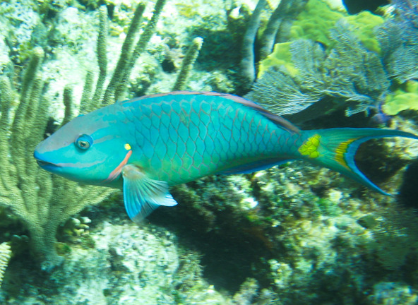
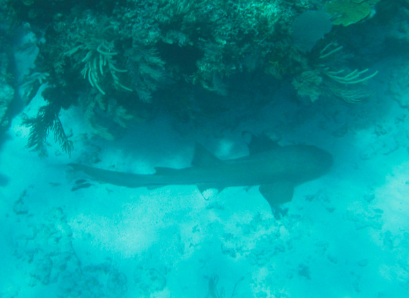
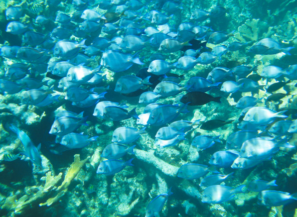
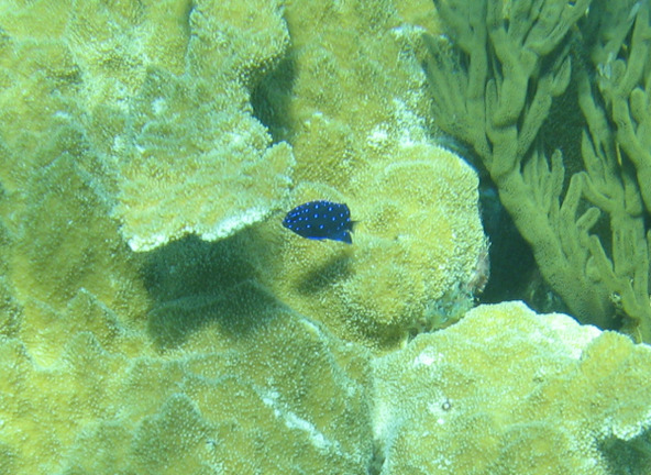
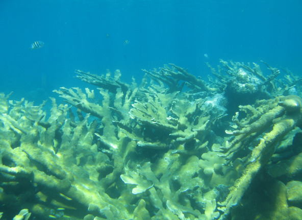
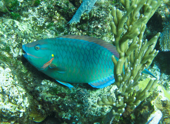
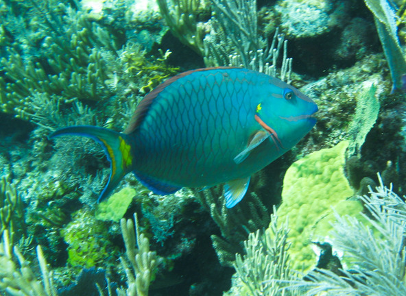
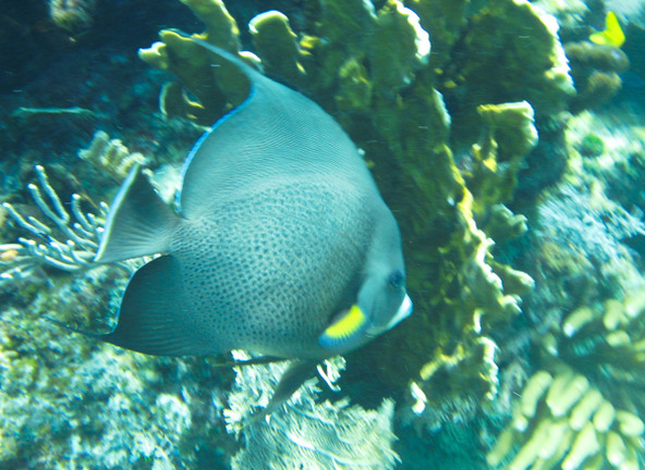
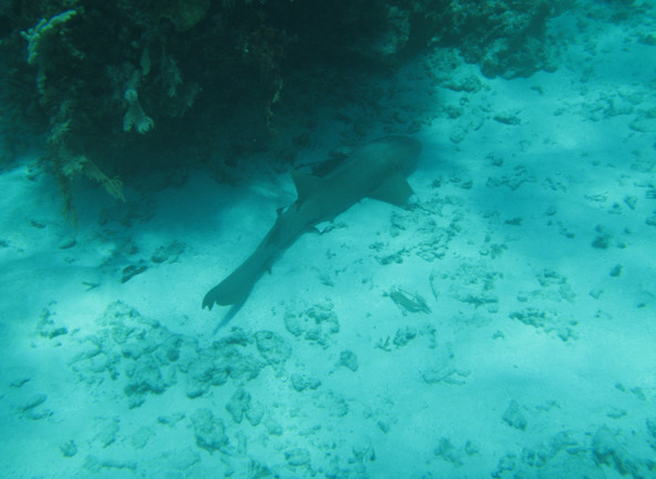
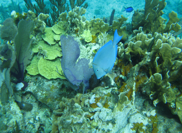
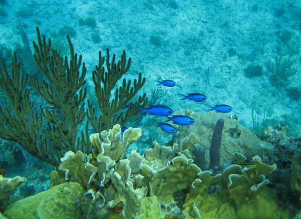
With just a gentle swell rolling in from the Atlantic, very light wind and an almost cloudless sky, we took the dinghy around 1100 to one of the dive moorings available on the reef. We wore our wetsuits so that we could spend a good while in the water without becoming chilled – water temperature was 75 degrees. The reef was lovely as we remembered it. It has probably the largest specimen collections of Elkhorn coral to be found anywhere in the Bahamas. We saw a good deal of healthy growth. While we missed seeing spotted eagle rays or turtles this time around (we know they were out there because fellow cruisers we met that morning had seen rays earlier!), Donna spotted a very large (8 ft length?) nurse shark laying in a bed of sand near a coral overhang and dispatched Dave to take a photograph. Dave captured several other photos of this fabulous area. On our return to the boat, we stopped by S/V Moon River from Pueblo, CO to chat. They had radioed us earlier for some knowledge of this site which they aimed to dive the same morning. They were the lucky ones to have spotted several eagle rays during their dive.
The anchorage area had become crowded by 1 PM with several more boats, many of them chartered catamarans, all taking advantage of this day of special weather ideal for visiting the reef. We picked up anchor for a leisurely sail northward to find a nice spot along north-south oriented barrier island Tilloo Cay where we could be comfortable in the arriving and building southeasterlies.
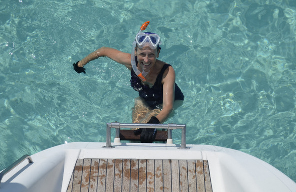
Several other boats had the same idea to anchor in the lee of Tilloo, but there’s about 4 nm of north-south shoreline to pick from and everybody spaced out appropriately. We found a nice sandy spot in the midst of mostly grassy bottom and anchored in 13 feet pretty close to shore. Dave confirmed the anchor set with a swim. This water temperature was up to 77 degrees and Dave was pleased that the water was finally getting warm enough to make a comfy daily dip as a prelude to his transom showers. Simple pleasures! We had a nice quiet evening.
As we prepared to depart Tilloo for someplace downwind (northwest) the next morning, April 27, we discussed deploying one of our big symmetrical spinnakers for a change, once we turned directly downwind north of Lubbers Quarters. We hadn’t used a spi since crossing the Tongue of the Ocean for Andros back on February 12. Wind was forecast to be 8-12 kts, which is a good speed for a spinnaker when we are doublehanded. Setting it and sailing it are easy for us, but getting it down in winds greater than 12-15 kts can be quite difficult for two small people. Donna would steer the boat and release the sheet/guy while Dave hauls down the dousing sock and collar from the trampoline, collapsing the sail into the sock, and relying on his weight for the motive force. Sometimes he is literally lifted right off the trampoline if a wind gust comes and refills the sail before it is fully doused. It’s a lot easier when we have additional crew aboard to help Dave with extra weight, allowing us to use the spi in higher winds.
The forecast wind was within our manageable range for the spi and Donna was advocating that we needed to “put some color on this Sea.” Dave, recalling that some of the best cruising decisions are made right after saying, “What the hell, why not?”, agreed on using the spi. We were soon enjoying our colorful ride! But along the shore of Man O’ War Cay, the wind picked up to 15-20 kts. This was likely due to a nearby squall but it was enough to make Dave anxious about his impending douse. The wind didn’t abate as we approached our intended anchorage at Fisher’s Bay, Great Guana, so we set about dousing the spi using one of our high wind tricks – adding an engine at 2000 rpm to increase our boat speed thereby decreasing the apparent wind speed on the sail, and picking a lull in the wind to do it. Donna is in control of this maneuver at the starboard helm with the engine controls while watching the wind speed readout on the instruments. Dave anxiously waits for Donna’s cue all the way forward on the trampoline with the dousing line in hand, staring up at the huge sail, wondering how many tries it’ll take this time to tame the beast? Lulls in the wind were becoming rarer, so Donna picked one, throttled up the engine and Dave started hauling – getting the sail fully doused with moderate effort on the first try – whew, now he could think about a rum after anchoring and giving Donna a hug! Another Pas de Deux! The lull had not lasted long and Dave managed the feat through gusts that had reached the upper teens—besting his performance years prior off St Barth’s in a similar high-wind douse.
We nixed the anchorage at Fisher’s Bay as we anticipated significant wind chop there with southeasterlies, and instead eyed a few catamarans hiding behind nearby Foots Cay. This spot isn’t identified as an anchorage on the charts nor in our cruising guide, but it appeared to offer spacious sand and some protection from wind and chop from the southeast through southwest. That was enough to convince us to check it out. We motored the short distance into the lee of Foots Cay and found an expansive area of top grade Bahamas clear sand below gin clear water, creating that intoxicating teal water color. Gorgeous! The only down side was the three charter cats already there seemed to have the best protection position and looked like they were set up to party all night, with two of them rafted together.
Dave maneuvered as much behind the island as possible for protection without getting into too shallow water nor too close to the expected party. He was happy with a strong anchor set in the pure sand on the first try in about 8 feet--at low tide it would be about 6 feet. It was only 1220 hrs and not long after we got settled, the charter cats broke up the raft, hauled anchors and moved out to spots further behind us in deeper water! What luck! According to electronic charts they had been sitting over a shoal adjacent to us topped by depth that would have lowered to around 5 feet at this time in the cycle of the moon when low tides were lowest. They may have been getting nervous when they saw how little water they had below their keels while swimming and moved before what was an approaching low tide. The water temperature here was the warmest yet…79 degrees! We both swam to check the anchor – Donna without a wet suit for the first time this cruise – and enjoyed our nearly private shallow water pool. In a while, the charter cats completely left and we had the whole pool to ourselves. Perfect!
But the protection from wind chop was not exactly perfect here for the current wind direction and speed, and the next day we decided to backtrack to the lee of Tilloo Cay near where we had anchored two nights prior to be more comfy in the forecast slightly stronger southeasterlies. So it was back upwind with a 1st reef main and genny and we had a nice sail. It’s a good thing we enjoy sailing upwind! And we were rewarded with a nice flat anchorage, although the wind increased to 15-20 by dusk. The next day, April 29, we motored the short distance north into the lee of Elbow Cay to anchor outside the entrance of White Sound. Located within White Sound is the Sea Spray Marina and resort where we had enjoyed a really good, Bahamian style seafood buffet dinner several years ago. We wanted to visit the resort to see if the buffets were still being offered. We found out that they were and we tucked this info away as an option for where to bring our passage crew for a nice evening if we needed to kill time before departing on our homeward journey – hopefully within the next two weeks.
We sat out too-breezy weather the next day doing boat chores and departed at 0950 on May 1 for a return to the lovely waters at Foots Cay. There was method to our madness – the wind was down a bit and we expected the chop in the Foots Cay anchorage to be tolerable. We were targeting the next day’s anchorage nearby in the gap between Great Guana Cay and Scotland Cay where we would check out what the cruising guide reported as good snorkeling on the Atlantic side of this gap. The wind was forecast to be calm enough check it out, and we could always then move on to the nearby Fowl Cays National Land and Sea Park. Arriving back at Foots Cay (no spinnaker run this time – genoa only) we found deeper water nearer to the Cay and on the morning of May 2 we motored the short distance to anchor near the gap between Great Guana and Scotland Cays. We took the dinghy to snorkel between the islands, but discovered it wasn’t very good. So much for that.
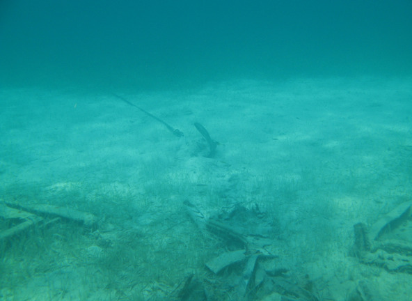
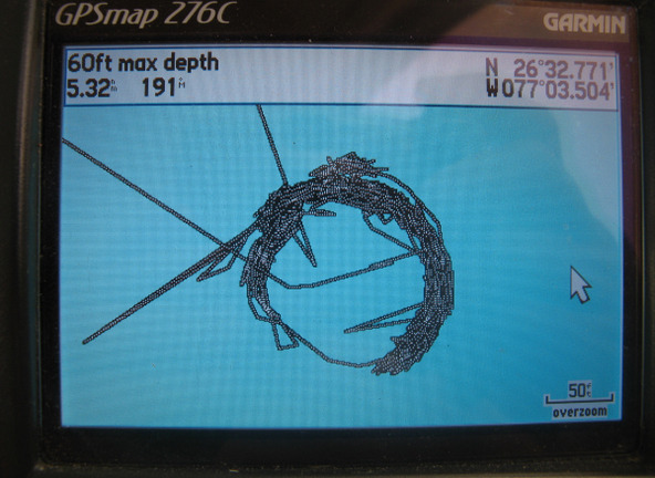
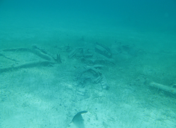
Since we had just taken a look at our anchor and found it on the sea floor littered with remnants of a car and outboard engine, we decided we would rather be elsewhere for that night and moved for another snorkel spot while the wind was light. The Fowl Cays National Land and Sea Park was a sure bet and not far away. It took us only about a half hour to motor to Fowl Cay where we anchored in nice sand in surprisingly deep water close to the Cay around 1430, from which it would be a short dinghy ride around to the Atlantic side. We had snorkeled here before and suspected it to still be wonderful. Established in 2009, this 1,346 acre National Park protects a small but biologically rich stretch of coral reef, seagrass, sandy bottom and rocky shoreline habitat and is frequented by many dive and tourist boats. We had been here in a year past and anchored for the day amidst the reefs—this time we would anchor on the opposite side of the island so that we could stay in place for the overnight.
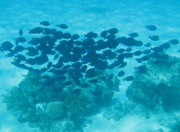
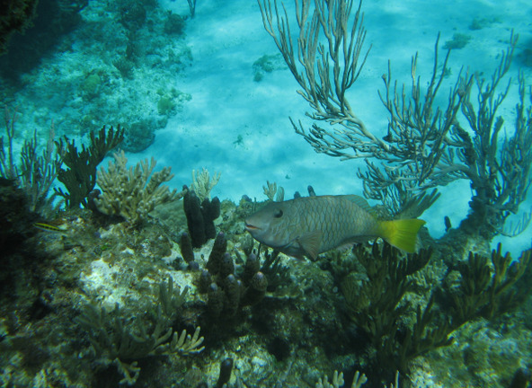
The next day, May 3, we snorkeled the plentiful Fowl Cay reefs all day – making two dinghy trips before and after a lunch break – and it was very good. While out on the reefs we again encountered the crew of Moon River and traded reports on the differing patch reefs to pick from. But the weather was changing and this calm period was soon ending, so the next day we had to retreat to Marsh Harbour for an expected strong cold front arriving in the overnight hours of May 5-6, with high winds for a day afterward. But this pretty much coincided with the expected arrival of our first passage crewmember on May 7 and would give us some time to pick up a few groceries and rum.
Exploring Islands in the Sea of Abaco - Part Two
Wednesday, April 26, 2017
 Marsh Harbour, Out Islands, Bahamas
Other Entries


2025-05-23