 Eleuthera, Out Islands, Bahamas
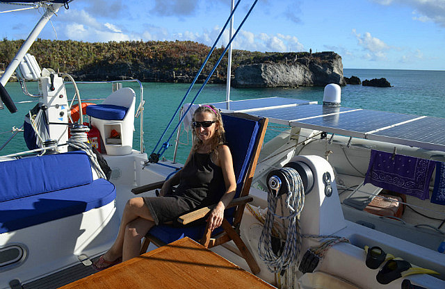
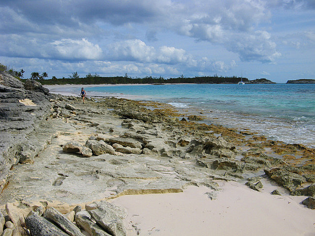
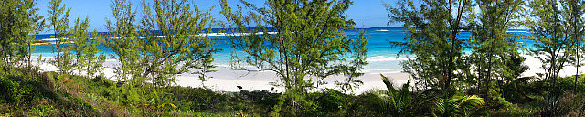
Our first Bahamian destination on our own again was on November 16, 2012 at Annie Bight, just north of Gregory Town, and only 8 nm from Rotten Bay. On first reef mainsail and full genoa in 12-15 kts ENE, this close-hauled sail got us to our anchorage by 1510. Both sails looked really good in this first meaningful opportunity to test them both upwind.
The weather has been cooler than expected since our arrival in the Bahamas, cooler than we recall in 2009. Maybe it's the persistent north component winds--long sleeve tee shirts are still needed in the evenings and morning hours. Regardless, it makes for very comfortable sleeping. The water temperature is in the low 70's.
We spent three nights at Annie Bight over days with frequent rain showers. We visited Gregory Town twice, once to browse the town and check out the laundry opportunities and again to make use of what we found. We also had our first snorkel, donning our wetsuits for the cool water.
On November 19th we departed Annie Bight after doing laundry in Gregory Town in the morning. Our next stop was Alabaster Bay on N to NW winds of 10-15 kts. The north portion of this small bay afforded protection from NW winds which were forecast to increase to 15-20 by evening. This worked out although it was a bit rolly.
On November 20th we tried to depart Alabaster Bay early, but experienced a broken throttle cable on the starboard diesel engine right after starting that engine. We hadn't yet pulled anchor so we stayed put. Fortunately, we carry spare throttle and shifting cables – one for each engine. The throttle/shifters for each engine are located only at the starboard helm, mounted on each side of the pedestal. After several trial and error attempts at removing the cable inside the helm via the access hole available by removing the compass, and staring at it for long periods, Dave finally figured out how to get the old cable out and new one connected by working one-handed through the hole. Part of figuring out how it worked came after sticking a camera down inside for close-up side views of the linkage. An examination of the old cable on this end revealed the failure occurred at the shifter end at the junction of the flex part of the cable with the thicker threaded end, just inside the outer plastic housing. Once he figured it out, the replacement only required partial dis-assembly of the shifter. The work at the other end of the cable on the engine was straightforward as access was unconstrained. We completed the repair in about five hours, but could probably do it again in one, now that we know what we're doing!
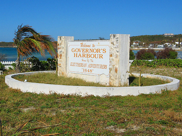
We departed Alabaster Bay around 1215, bound for Governors Harbour, on the still persistent NW winds. We arrived at 1335 and anchored up against Levi Island which afforded decent protection. As has been the case since leaving the Spanish Wells area a week ago, we saw no other cruising boats today.
On November 21st we tried to get ashore in the dinghy - a ride of over a mile - but the on-shore chop from the NW winds made landing the dinghy impossible. Despite what the guide books say, there are no dinghy docks in Governors Harbour. There are only former docks and the very high Government dock on adjacent Cupid's Cay. We cruised the short beach front looking for a place to land, but the combination of choppy water and low tide convinced us to try again in a couple days when the weather was forecast to moderate a bit and we could possibly plan a visit at the right tide. On the way back to the boat, as we bounded off a wave, the wooden dinghy seat (of our brand new dinghy) broke in half under just the weight of Donna's tiny butt.
On Thanksgiving Day we stayed on the boat working on our TravelPod blog and biding our time waiting for the weather to improve. We deferred making a big meal until another time, despite having all the ingredients on hand.
On November 23rd the wind lessened a bit, but it was still from the NW and the chop going to town in the dinghy wasn't much better so we deferred going to town once again. The highlight of the day was the arrival of two other cruising boats! These were the first we'd seen since leaving Spanish Wells. They both anchored with ample distance between us.
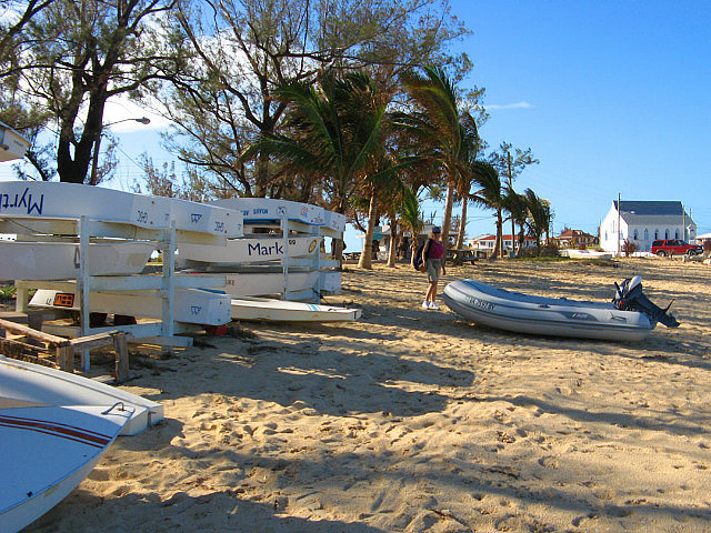
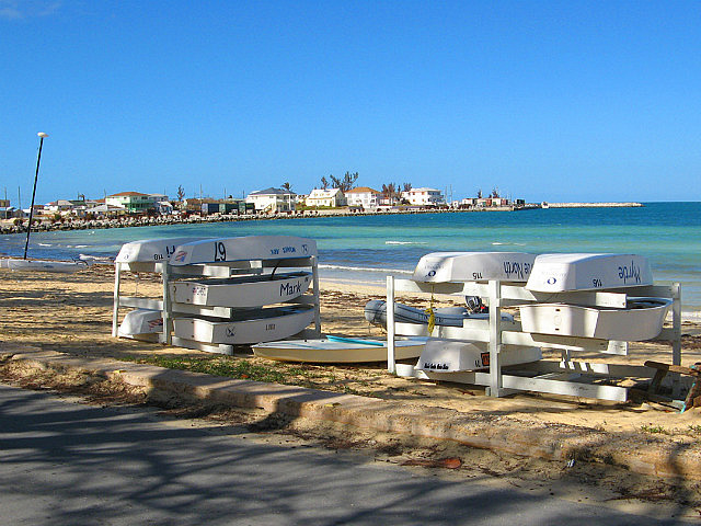
Finally, overnight into November 24th, the wind calmed and the morning forecast predicted a lighter wind day. After breakfast the two other cruising boats left and we headed into town. By the time we reached the beach in front of the library to land, the wind and chop had returned! But the tide was higher and falling so we stormed the beach anyway and landed with less drama than expected. The tide was high enough to clear the rocky shallows and hit clear sand, and we were able to pull the dinghy higher to lock it to a sailing dinghy rack across the street from the library. When requesting permission from the librarian to lock to the dinghy rack we learned that the boats were used by the local kids for regatta racing on a typical Saturday morning but today's weather was too rough for any activity on this day. It would be fine to leave our dinghy and we were also invited to the library's craft bazaar, scheduled to start at 10 am. Our plan was to spend most of the day ashore - through low tide – and relaunch the dinghy after the rocky obstacles were covered again on the next rising tide. This would give us ample opportunity to tour the town, visit the library, and take the short walk to the Atlantic side of the island for a stroll on the beach. Dave hoped to see what was left of the Club Med facility (closed since 1999) on the Atlantic side beach where he had spent a vacation in 1979.
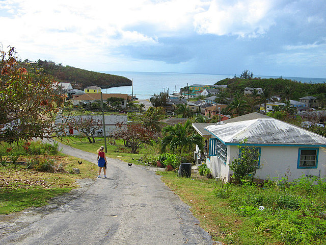
We had a nice day ashore and initially got some good exercise hiking over the steep hill road to the Atlantic side. We found the site of the former Club Med – reduced to only palm trees and foundations – but the beautiful pink sand beach was as Dave remembered it thirty three years ago. Mother Nature wins again. Shore side temperatures were cool enough to make hiking comfortable. There are some very nice homes surrounding the outskirts of town, many with an English cottage look and often showcasing some very well tended gardens.
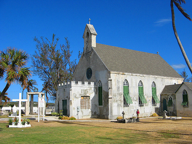
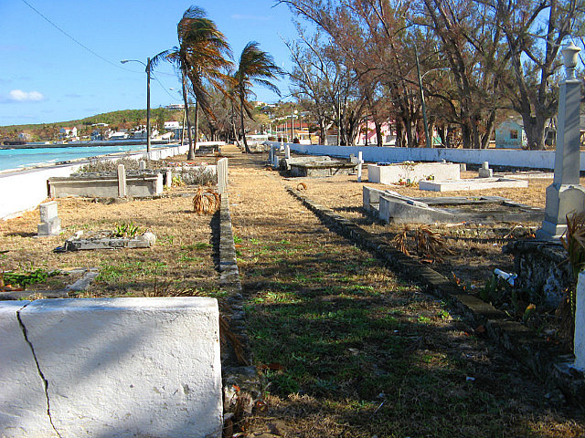
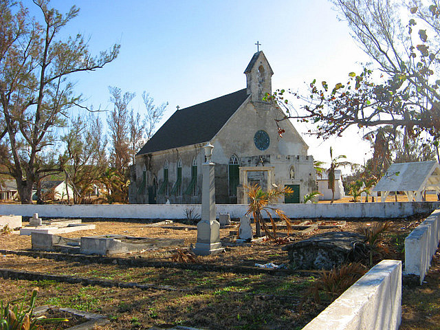
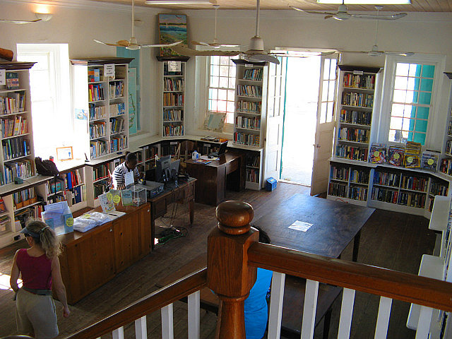
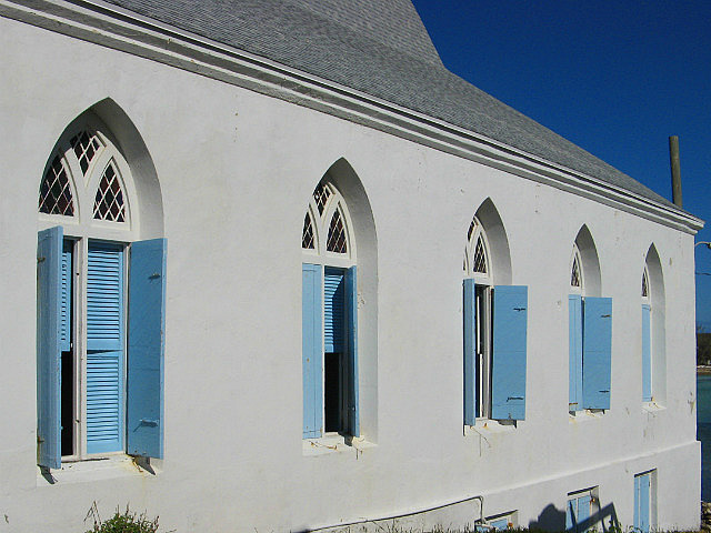
Returning to town we visited the Haynes Library, which was established in 1897, named for the Governor at the time, and restored and refurbished in 1995-1999. With its some 11,000 volumes it serves as the largest library in the Bahamas outside of Nassau, offering computer and Internet access, programs and community outreach. We browsed the Friends-of-the-Library sponsored craft show, and walked around the two substantially constructed churches nearby and a harbor-side cemetery dating from over 160 years. Every settlement has several churches – most very old - and they're always the best built structures around. They have to be to survive in the hurricane belt.
The tide would return to the level at which we landed around 1600, and after a short walk to Cupid's Cay we decided to relaunch the dinghy an hour sooner, moving some small rocks to clear a path to the water. The ride back to the boat was slow and wet but it had been a good day, well worth the visit.
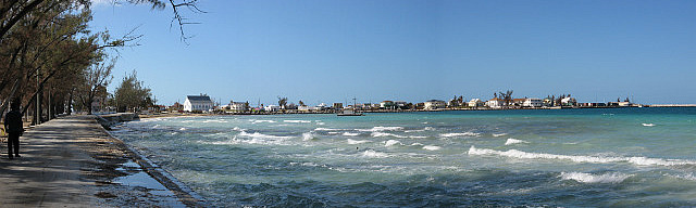
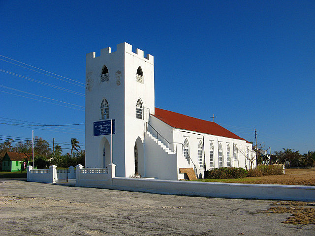
On November 25th we departed Governors Harbor at 0715, bound for Rock Sound, about 20nm south. In feast or famine style, the wind was now too light to sail! We rigged the spinnaker for a laid back downwind ride in the forecast 10 kts, but we never deployed it. It was dead calm, so we had a motor boat ride and made a lot of water with the "free" electricity, arriving in Rock Sound at 1230. Along the way we had plenty of entertainment watching needle fish doing wheelies as they skimmed the top of the flat shallow bank we were motoring. We anchored just off the only town dock and near the conspicuous white church with the red roof, but had to try three times to get a good hold in sand. There are frequent patches of marl between the patches of good sand. Being Sunday, an Anglican mass was still in session and we could hear the congregation singing.
Already in the anchorage was a charter mega motor yacht, anchored far enough away and behind us to not be obnoxious. The weather and calm conditions were perfect for those aboard who could take advantage of a curved water slide from the side deck of the vessel into the water, as well as jet skis and other small water craft. Also at anchor closer to us was one of the cruising boats we had seen in Governors Harbour. After getting settled we headed to shore, stopping to meet and chat a bit with Geoff and Bunkey on S/V Party of Two. We discovered we had been anchored near them in Georgetown during our visit there in 2009. They were waiting for businesses to open the next day (Monday) to pick up what they needed to repair their only head before they ventured on to Georgetown to spend the season there again.
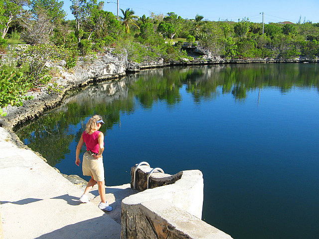
Ashore we visited the Ocean Hole Park, a short walk from the waterfront, and walked down the main road parallel to the waterfront searching for the businesses described in the cruising guides. Because it was Sunday, nothing was open and besides us and Geoff and Bunkey no one was around except for the crowd leaving church. But this was a well kept town and appeared to have ample shopping opportunities for cruisers needing a good grocery or hardware store...just not on Sunday.
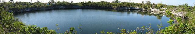
The Ocean Hole Park was interesting and worth the visit. This is described as a deep, semi-fresh, 360- foot diameter water hole that may or may not connect to the ocean. Regardless, there are ocean fish in it who have been conditioned to gather at the surface when someone peers in, expecting to be fed (we had nothing to offer). Apparently it's also regarded as a good swimming hole – complete with a ladder for access – and of course, its water has curative powers.... The story goes that the fish are placed there by local fishermen who donate a few grouper or snappers from their catch. One time, someone added a shark to play a trick on his friends who often went swimming. Being a small town the offender was soon identified and taken to court. In a good example of practical justice he was sentenced to staying by the hole until he caught and removed the shark.
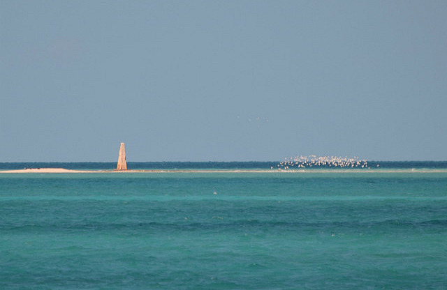
The next day, Monday, November 26th, we departed Rock Sound at 0915, bound for East End Point, the very southern tip of Eleuthera. We were able to consider the anchorage there at Lighthouse Bay because conditions would be reasonably mild with NE wind. This route would first take us directly eastward from Rock Sound toward Powell Point, aka Cape Eleuthera, across approx. 8 nm of The Bight which is strewn with very shallow sand shoals, some of which are exposed at low tide. This is the only real shallow water navigational challenge on the bank side of Eleuthera. We had to wait until after 0900 to leave in order to gain enough direct sunlight on the water to illuminate the shallows, but the high and outgoing tide would be in our favor. Any "deep" water was no more than about fifteen feet. Once rounding Powell Point, we'd turn southeast along the “south coast” of Eleuthera into the deep water of Exuma Sound for a good trolling opportunity along a deep water ledge until we got to East End Point. Very deep water (over 2000 feet) along this coast was less than a mile offshore. The wind had finally veered to the northeast, after being from the northwest for many days and was forecast to be 10-15 kts. This set up the rare opportunity to sail and fish on a fast beam reach in pleasant winds paralleling a coast in flat water. Donna was already counting on a fish dinner....
Prior to departing we set the mainsail at the first reef and sailed deep downwind on the main alone until rounding Powell Point where we'd unfurl the genoa for the beam reach. We traversed the shallows of The Bight without problems, having charted a course that was well described in our companion cruising guide (author Pavlidis—highly recommended) and differed somewhat from the route recommended on the Explorer Charts. The too-shallow-for-us parts were easily seen in the bright sun and the charted depths were accurate. The shallowest depth we saw was about 9 feet. This proved to be a very exotic experience.
Once around Powell Point we unfurled the genoa and put out two baits when we got into deep water. The wind was higher than forecast and once again we were glad we had set a reefed main. We were soon sailing at 8-11 kts, hoping we could slow the boat if we hooked a fish. We didn't have to wait long. Approaching an underwater ridge shown on our charts, where the depth suddenly rose from thousands of feet to less than one hundred, we were planning to bring in the baits upon getting over the ridge to avoid hooking barracuda, then resetting them once back in deep water. But just prior to getting there we got a strike on one bait. As Dave started to tighten the drag on that rod, the other bait got hit. We had two fish on – hopefully not 'cuda. Donna tightened the drag on the second rod, but Dave's fish got off. We switched places and Dave managed to select two 10 degree turns on the autopilot to turn up into the wind some to slow the boat a little. Then the free bait got hit again! This was looking like a tuna feeding frenzy.
Fish dinners can be hard work! This is why when there's just the two of us in windy conditions we only set out two rod baits. Even with just one fish on, there are multiple tasks to perform just to manage the boat. Unlike a power boat, we can't just stop.
Dave was making progress bringing his fish to the boat, and it looked like some sort of tuna. Even with the drag still set from the first fish on Donna's rod, she couldn't slow the second fish down and it just took more and more line. Donna stepped away from the fish to pull out the fish bin from the cockpit locker and Dave got his tuna to the transom, finding it small enough to bring into the cockpit without a gaff so he quickly swung it into the fish bin and ran over to the opposite helm where the third hooked fish got lucky by a line break ahead of the swivel. Whew! By now we were past the ridge and back into deep water. Dave reset our course, unhooked the landed fish, put that bait back in the water, then set another rod with a new bait. Despite the losses, there were at least a few dinners staring back at us from the fish bin—it was a Big Eye Tuna.
The next excitement was getting around the cruise ship anchorage just north of our destination. This is one of the numerous locations in the Bahamas where cruise ships stop for the day at their “private” island paradises for their guests to spend the day frolicking on a beach or enjoying water sports. On this day the Ruby Princess was anchored near shore and from a distance we could easily see the small boats continuously ferrying passengers between the shore and the ship. We would pass the ship on the sea side and down wind of it to avoid conflicts with the ferries. As we approached the anchored ship we also were approaching another undersea ridge and had visions of another tuna opportunity. But this looked problematic as we wouldn't be able to turn the boat into the wind to slow since that would be turning toward the ship. We decided we'd stay on course and hope for the best if we got any strikes.
We passed several hundred yards behind the ship without any strikes, but not without some drama. We were already well beyond the ship when we heard a hail on the VHF for “the sailing catamaran near Princess Cay.” Assuming that was meant for us, Dave responded to the hailer who identified himself as “the police” and was directing us to alter course to avoid the cruise ship. We informed the person that we were southbound and already well past the ship. It was puzzling (we were the only catamaran at the time in the area) that they could not determine our position relative to the ship. We knew the cruise ship had AIS and could see that information about us. So unless there is some unwritten rule about a stand-off distance from cruise ships we were on a safe heading well off the ship's stern. The cruise ship would have itself been in a position to hail us by radio if they felt at all concerned, but never did. In the strong winds of the day, due to our leeway, our bow could have been seen as pointed toward the ship just to maintain our course over ground well astern. Perhaps someone's visual perception caused them needless concern, not understanding that the direction your bow is pointed may be misleading with your actual course over ground. It's still a mystery to us but we did see and shared friendly waves to a police boat that passed us shore side about ten minutes later.
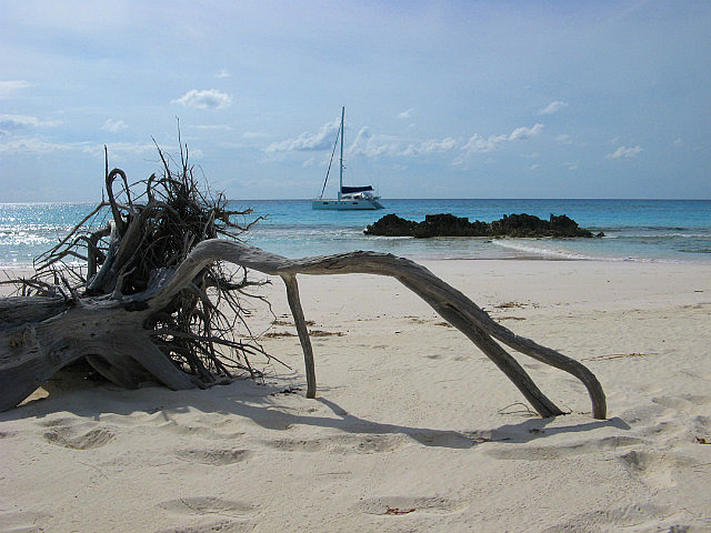
We soon arrived in the vicinity of East End Point, without any more fishing action, and picked our way between shallows into the generally uncharted small bay called Lighthouse Bay. Again, no other cruising boats were around, but there were several day-trip land visitors on the beach who can reach it by car on a dirt road. This bay isn't described as an anchorage in the usually thorough Explorer charts because the authors seem more conservative about suggesting anchorages. The Pavlidis guide spoke well of it however, and with proper caution and the necessary skills we do enjoy exploring these more out-of-the-way places. We found good sand right in the middle of the bay, with good protection from north to east winds. It was a bit rolly, though. This is a beautiful bay with palms and a lovely pink sand beach, apparently named for the only structure ashore, an abandoned small “house” on the hill above it adjacent to an inoperable light beacon. This point would more accurately be named South End, because it's really the southernmost point of the island. From a chart perspective, Donna might have named it Toenail Point.
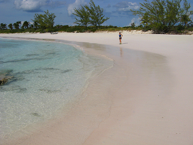
As noted earlier, the water temperatures were cooler than we expected, no more than 73F, along the west shore of Eleuthera. But as we rounded Powell Point and got into the deep water of Exuma Sound, the temperature was immediately up to 78! That's more like it! Perhaps the persistent northerly winds had pushed out all the warm surface water off the shallows on Eleuthera's west side to be replaced by upwelling colder water. We took advantage of the more comfortable swimming conditions and snorkeled off the boat in Lighthouse Bay without wetsuits. Dave also could now better enjoy the transom shower following his saltwater swim....
The swells over our first night in Light House Bay were enough to consider moving on the following morning of November 27th, but things settled down and we decided to stay another day. The weather was changing – light east winds were forecast to back to the NE and increase slightly the following day which would give us a better sailing angle to our next destination, Little San Salvador, just 10 nm to the ESE. But we had to get someplace quite secure by the afternoon of Thursday the 29th when a long period of strong NE wind and squalls was forecast to take over.
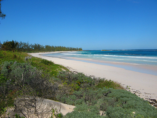
We took advantage of being in this remote location at the small point on the end of the island to dinghy ashore to hike to the Atlantic side, just over the hill. The hike was more up and down than horizontal. On the east facing Atlantic shore we were reminded why so much emphasis is placed on proper disposal of plastics – the shore above the high tide line was littered with plastic bottles and other containers and articles made of plastic that float, even when filled with water. We also saw a young dead sea turtle (known to die from ingesting plastic bags thinking they're jellyfish). This one, however, was headless so it likely died from some other cause. The tortoise shell was absolutely beautiful but we knew it was illegal to be in possession of such.
Notes to cruisers regarding Eleuthera: Although shallow, the bank on the west side of Eleuthera has plenty of depth to permit care free sailing pretty close to shore. There are few obstacles to avoid and all are well charted. The Bight, however, has plenty of shallow challenges.
The anchorage at Annie Bight is small and suitable for only one boat in N to E winds only. But it's a good spot with good holding right in the middle. Two small boats might fit in there if they coordinate their anchor drops to share the room. Easy dinghy access to Gregory Town.
The anchorage at Alabaster Bay is large with good sand holding near the shores and protection from all but WSW to SSW, taking advantage of tucking up in the ends as needed. Best for NW to SE winds.
The anchorage between Levi Island and the mainland just north of Governors Harbour has good sand holding and was good protection from the NW winds we experienced, but it's a long dinghy ride to town. In easterlies you can probably get closer to town. We found intermittent unsecured wifi at our anchorage, probably coming from one of the nice residences on the beach. Anchor closer to the homes to improve your chances for reception.
The only reasonable dinghy landing in Governors Harbour is on the beach in front of the library whose location is shown on the Explorer chart detail of the town, at the base of the causeway leading onto Cupid's Cay. The dinghy landing shown on the chart is misplaced (unless it has more recently been updated). Lock your dinghy to the sailing dinghy rack, if it's still there. The location of the Tourism Office was also misplaced on our Explorer chart. It's actually on the main road leading out of town about three blocks from the waterfront and near the school. It was closed on Saturday when we were there.
The dinghy dock at Rock Sound shown in our Fourth Edition Explorer charts no longer exists. But the “Pier Ruins”, also shown, have apparently been partially rebuilt, enabling docking there. The restored portion is very high, but ladders to the water level were present on both sides. A “seasonal” dinghy dock may exist near the establishments at Little Gully on the north portion of town.
The anchorage in Light House Bay can be considered suitable in N to E winds, but can be rolly if there is a strong swell. There is good sand holding interspersed with easily seen rocky shallows, so best to have good light to enter. Depths were not well charted on any of our charts, but you can pick your way in with the usual visual bottom reading.
On our own again...naturally! Cruising Eleuthera
Friday, November 16, 2012
 Eleuthera, Out Islands, Bahamas
Other Entries
-
Nov 097 days prior Little Creek, United States
 -
Nov 142 days prior Spanish Wells, Bahamas
 -
Nov 16
Eleuthera, Bahamas -
Nov 2812 days later
Little San Salvador Island (Half Moon Cay), Bahamas -
Dec 0317 days later
Cat Island, Bahamas -
Dec 1529 days later
Long Island, Bahamas -
Dec 2842 days later
Acklins Island, Bahamas -
Feb 0682 days later
Samana Cay, Bahamas -
Feb 1288 days later
San Salvador, Bahamas -
Feb 1894 days later
Conception Island, Bahamas -
Feb 25101 days later
Rock Sound, Bahamas -
May 13178 days later
Marsh Harbour, Bahamas -
May 19184 days later
Norfolk, United States -
Dec 24768 days later
Drayden, United States -
Dec 151490 days later
Abraham’s Bay, Bahamas -
Jan 251531 days later
Great Exuma, Bahamas -
Feb 101547 days later
Sampson Cay, Bahamas -
Feb 271564 days later
Andros, Bahamas -
Mar 121577 days later
Marsh Harbour, Bahamas -
Apr 081604 days later
Marsh Harbour, Bahamas -
Apr 261622 days later
Marsh Harbour, Bahamas


2025-05-23