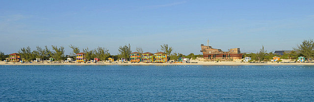
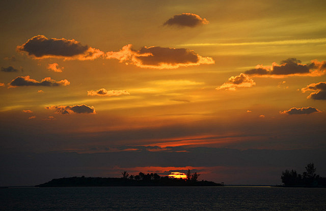
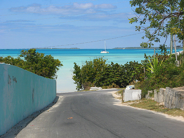
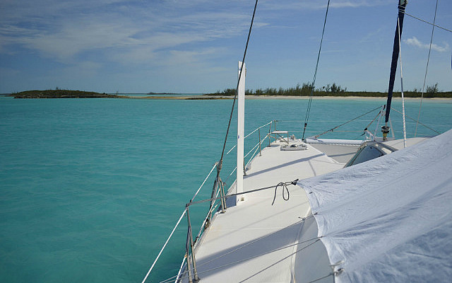
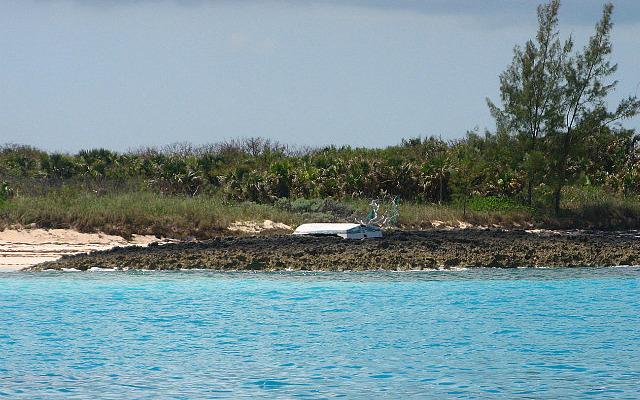
 Rock Sound, South Eleuthera, Bahamas
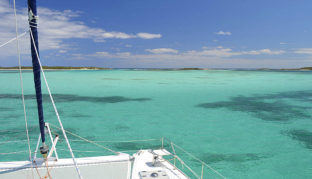
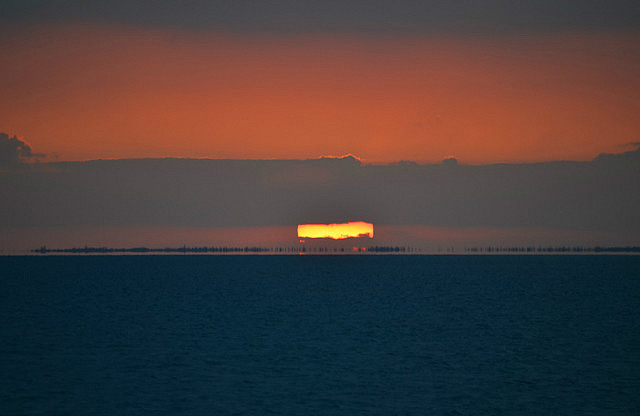
On February 25th, 2013 we departed Conception Island at 0615 bound for Rock Sound, Eleuthera approximately 95nm to the northwest. Winds were forecast to be 10-12 kts from the southeast which created near perfect spinnaker sailing conditions for us. We popped the chute within minutes of pulling up anchor and were off on a two day, daylight only passage. We had several options for an intermediate, overnight stop. First choice was Little San Salvador, 62nm from Conception and more on a direct course, but reaching this destination in daylight was a bit optimistic for the wind speed forecast. Other, closer options existed on Cat Island but all were further off a direct course to Eleuthera. Regardless of the stop we ultimately selected, all routes required us to pass first around Hawk's Nest Point, Cat Island, 30nm from Conception. Our plan was to assess our progress by then before deciding where to stop for the night. We'd visited all our potential stops on our way south last November and December.
The wind was a little stronger, 13-15kts, than the forecast 10-12 early in our passage and by the time we got past Hawk's Nest Point we were confident we could get to Little San Salvador before sunset. We also had a favorable current until passing Hawk's Nest Point. The anchorage at Little San Salvador is an easy anchorage to enter, without coral reefs inside to avoid, and thus does not require high sunlight to see underwater obstacles. But the southeast wind direction, expected to build overnight, would require we anchor for protection in the southeast portion of Half Moon Bay which is off limits during the day when cruise ships are present. (See our earlier Travel Pod entry on Little San Salvador for a fuller description of this situation.) We had taken this into account when planning this portion of the passage – try to arrive after about 1600 when the cruise ship departs, but before about 1800, sunset. This had been the basis for our early daylight departure at 0615. With the wind higher than forecast we were concerned for awhile we might arrive too early and have to wait for the cruise ship to depart. But the wind Gods soon took care of that....
Late in the morning the wind began decreasing and dropped lower than forecast, as if making up for its earlier mistake. By 1215 it was below 8kts and our boat speed was hardly 4kts, so we socked the spinnaker and began motoring, mindful of our desire to arrive before sunset. By this point, our intermediate stop options were only slightly closer than Little San Salvador, and would have similarly required motoring, so we decided to continue on. By 1330 the wind had found its forecast range and we started sailing again, only to see it die for good around 1500. By then we could see the cruise ship at Little San Salvador and adjusted our motoring speed to arrive around 1700. Right on cue the ship departed, we sped up a bit, and arrived at the anchorage at 1645. Despite trolling four lines all day, and varying speeds, we got no strikes. See Google Earth N24*34'33.8" + W075*57'16” for our approximate anchored position.
The next morning, February 26th, we had to get going to Rock Sound before that day's cruise ship would arrive so we departed at 0650, just as the arriving cruise ship came into view from the north side of Little San Salvador. With some communication to the Captain we avoided each others path. The wind was much stronger than the day before – 18-22kts from the SSE – and we set the main at first reef and unfurled the full genoa for the fast broad reach around the southern tip of Eleuthera, only 10nm away. Then we furled the genoa for the deep downwind run to Powell Point. Our plan was to unfurl the genoa again after making the gybe around Powell Point to the east for a close reach the final 9nm into Rock Sound on forecast decreasing wind strength. On the downwind leg the wind decreased to less than 15kts, so we shook out the reef in the main. We regretted this later on....
Rounding Powell Point the wind increased to persistent 23-28kts (the forecast was for 15, gusting 20), and we had much more wind than we wanted. Fortunately the wind angle wasn't so close that we needed the genoa and we left it furled, leaving the main to manage against the wind on this brisk final leg. Of course, the wind slacked as soon as we got into Rock Sound Harbour as a line of clouds departed the vicinity.
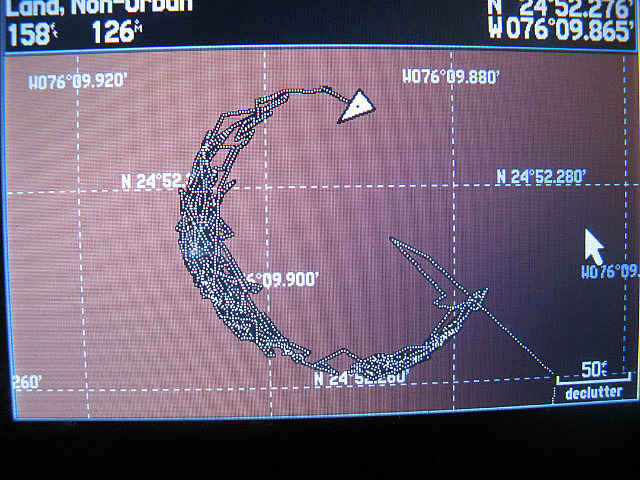
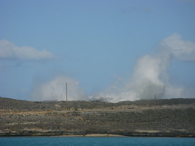
We initially attempted to anchor in the southeast region of this large harbor for temporary protection from the diminishing southern winds. But Rock Sound Harbour got its name for a good reason. Despite its sandy appearance from above, this area included large sections of marl and rocks revealed by our several failed attempts at anchoring. The anchor merely skipped along the solid bottom with its thin coating of sand. We could hear the sound of the anchor scraping along the rock as it radiated up through the chain and was amplified by the structure of the boat. Rock Sound. OK, we got it. Good thing we always have a Plan B.
By the arrival of the next frontal passage due in a few days – and with another front following close behind in the forecast--we had planned for best protection to be anchored on the west side of the bay near the northwest corner. This would provide good shelter from expected strong, pre-frontal west and northwest winds. We could see sandy beachfront in that area about 2.5nm away and sandy beaches usually mean sandy bottoms with good holding. The still southerly winds were diminishing so any exposure from the southerlies across this large bay would be minimal and temporary, so off we were to the opposite corner of the bay. We knew we would be joined soon enough by numerous other cruisers who were currently riding out the south wind in an exposed area on the eastern shore nearest town.
Thus, being "early” we were the first to arrive in the northwest corner and were able to grab the furthest northwest spot, eliminating any possibility that other boats could anchor to be upwind of us when the front arrived. Sure enough, by dusk the next day, ten other boats joined us in the northwest corner. Ultimately, nineteen boats followed our lead. None could get as far northwest as us in this shallow arena. See Google Earth N24*53' + W076*11' for our approximate anchored position.
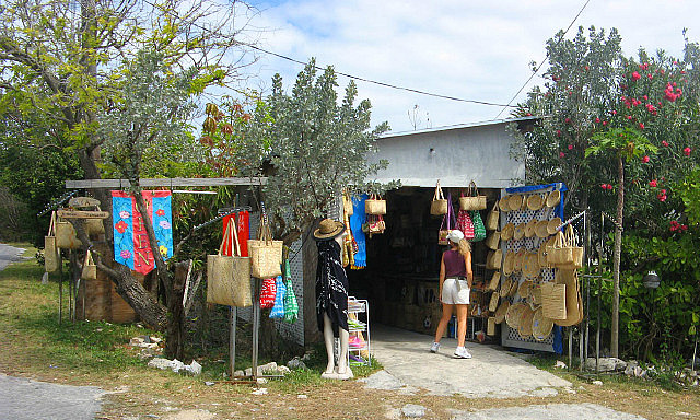
On Friday, March 1 there was a lull that allowed us to dinghy downwind across the harbor to town where we could attempt to upload entries to our blog with internet access available from local sources. We had a delayed start because Pascal's restaurant (which offers free wifi and we found to have a strong signal) was not open in the morning when we arrived. So instead we paid for internet access at Dingle’s, which proved excruciatingly slow (many of the cruisers use that network) and it took Donna all morning just to search for her airline reservation to visit home in April. By mid-day, the restaurant was open and we walked down the road the short distance with the hope that the connection would be better. It was. Donna was able to complete her airline reservation there, and then continued on loading the TravelPod entries. We ate a lunch of grouper fingers and a club sandwich in recognition of the free internet access. We were able to upload only two entries—the process was still rather slow which may have been caused in part by a few children related to the restaurant workers who were off from school and playing video games on their computer. The pipe is only so wide…. They tried to coax Dave into playing video soccer with them and found it hard to believe that Donna was not using Facebook on the computer…these were small grade-school aged children!
We still had to stop at the grocery and liquor store, so after loading our blog entries for our November 2012 visit to Eleuthera and Little San Salvador we packed up and walked the short distance to those shops. Then it was time to head back to the boat. Fortunately, the brisk winds earlier in the day had lessened and the jaunt back to the boat into the wind was not a difficult one.
We spent five nights anchored in the northwestern corner of the harbor for the passage of two separate frontal systems. The temperatures were very cool and we had to unpack some warm clothes. On Monday, March 4 after brisk winds through mid-afternoon, we moved across to the eastern side of the harbor near town. In the meantime, we had done some prep work with our remaining blog entries that would allow us to more speedily handle the process of loading text and photos once we would have internet access again. We could pick up a signal from the boat, but it was a terribly slow connection—no doubt because an abundance of users were probably clogging up a relatively small “pipe”. It simply wouldn't be able to handle our uploads. Donna decided to wake up at midnight to see if we could finally process the uploads with better bandwidth. As it happened, we were able to process the remainder of the text, photos and video clips at what seemed like cable-comparable speed. What a pleasant surprise, even if it meant working through the night! Almost everything was completed by 9AM when the system began to slow down dramatically once again. We finished the task that morning with enough hours left in the day to take our laundry to shore. It had been a long time since we had done a regular laundry and we spent the next few hours ashore at the new local laundromat (only two years old) which was very nice and reasonably close to shore. It had not been listed in our cruising guide but we were happy to learn of its existence from another cruiser.
After arriving on the east side of the bay we had eagerly accepted a Happy Hour invitation aboard S/V First Edition with Peter and Lynn. We had met them at Conception Island and learned they have a home in Virginia on Mill Creek off the Great Wicomico River. Mill Creek is a favorite Chesapeake region anchorage of ours and we recalled seeing First Edition docked there in the past. Small world! We expect we'll see Peter and Lynn again....
On Wednesday, March 6, 2013 we finally departed Rock Sound, Eleuthera continuing northward to an anchorage just south of Current Cut where we could sit out another passing cold front bringing westerly and northerly winds. . We had spent seven days in Rock Sound to allow two frontal systems to pass with their strong clocking winds and we were glad to be moving again.
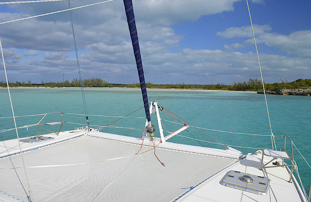
On this day we had southwest winds 10-16 kts in advance of yet another front, but this one was not predicted to be as strong and we chose to take advantage of the pre-frontal south west winds to move northwest along the west side of Eleuthera on a close reach, hoping to get to an anchorage just south of Current Cut, before the winds clocked to northwest and increased. This was a straight line distance of approximately 45nm. If our timing was right, we'd reach our intended anchorage that would afford protection from the northwest and north winds as the front approached and passed. The wind direction held long enough for us to keep a rhumb line course and we arrived at our intended anchorage at 1345. This was an excellent location to ride out a passing front as long as the pre-frontal westerlies are mild to moderate. Once the wind clocked north of west, it was very comfortable with good holding in sand tucked well into the little bay. See Google Earth N25*22'48.4” + W076*47'47.8” for our approximate anchored position.
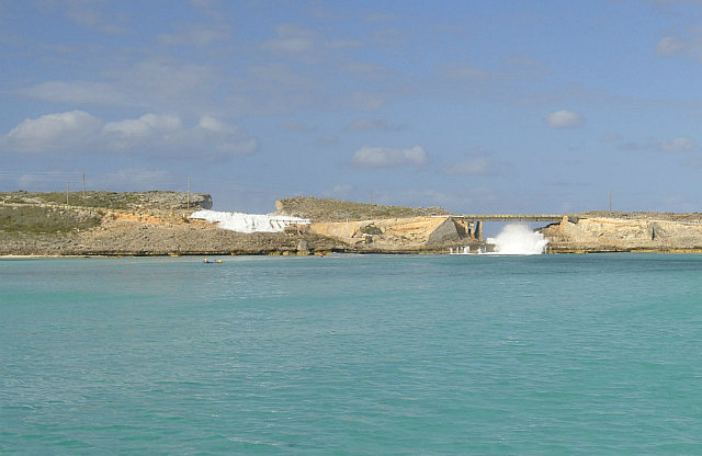
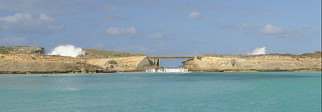
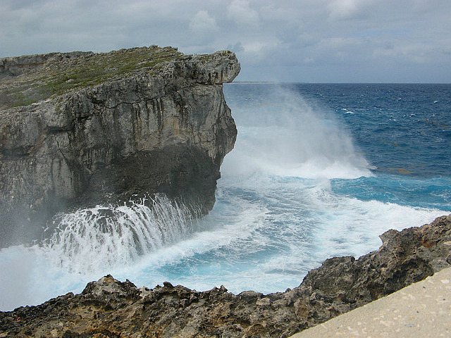
By dawn on March 7, the front had passed and we were left with cool and dry north winds at 10-15. The immediate weather forecast would not be calm enough to make the passage through the Devil's Backbone to our next destination at Harbour Island, with much due to a significantly large north swell emanating from an inordinately large low pressure system creating effects well north in the Atlantic. We knew such a swell could make for a nice show at the Glass Window feature nearby so we decided to sail the short distance back across the bank to that location. There we could await the arrival of calmer seas and easterly winds due in several days to permit our intended visit to Harbour Island transiting the Devil's Backbone. More on that later...
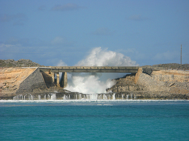
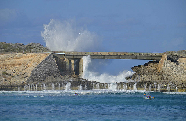
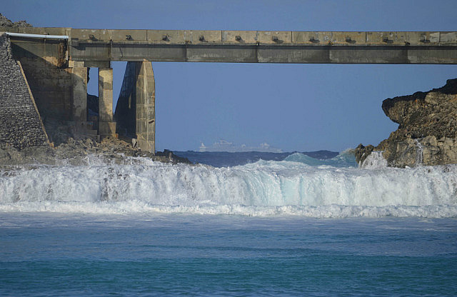
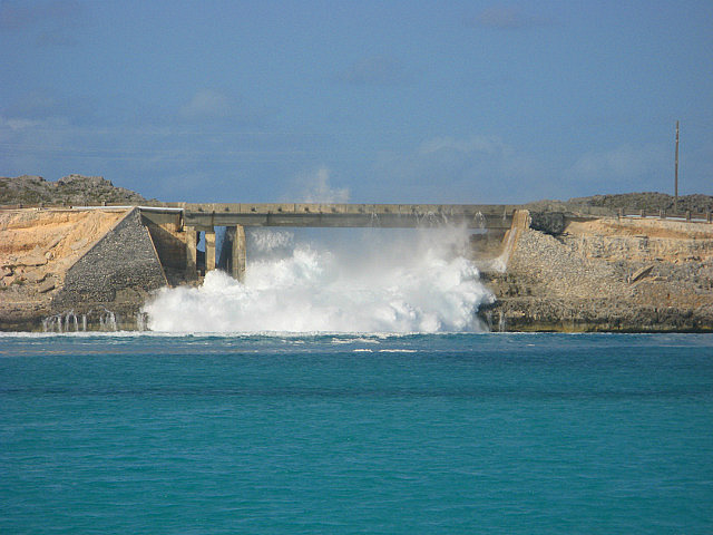
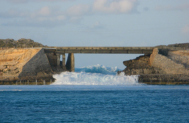
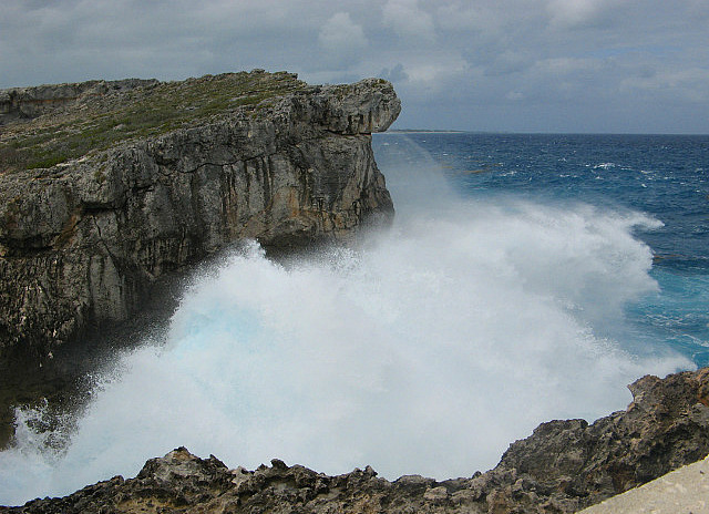
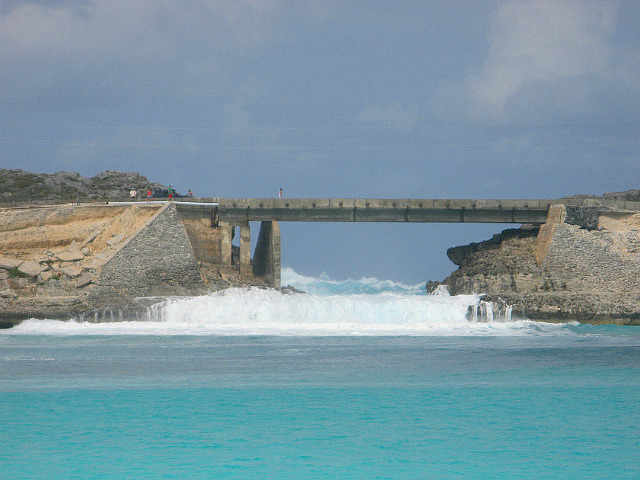
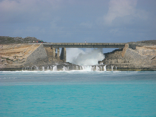
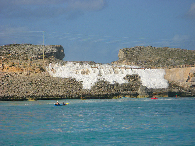
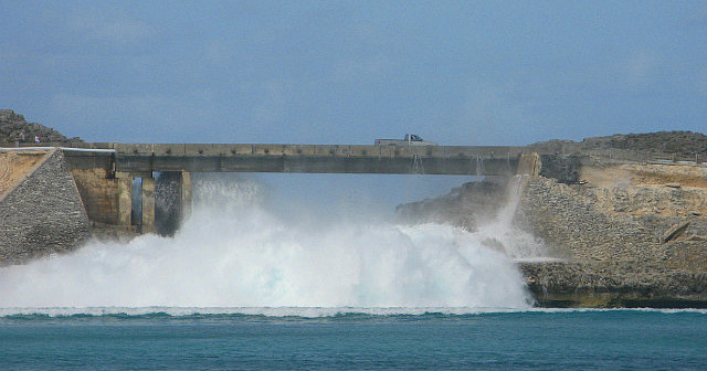
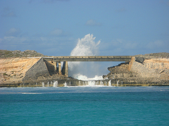
We had visited the Glass Window with Bob and Wally soon after our arrival in the Bahamas last November and, rather than sitting out north winds near Spanish Wells without much to look at, the Glass Window afforded a perfect north-component wind anchorage and a continuous visual display of Mother Nature's powers. Hundreds of miles away in the North Atlantic, a late winter storm was sending large ocean swells southward and upon reaching the northeast facing shore of Eleuthera at the Glass Window, these swells put on a fabulous show of breaking waves and spray through and over the Glass Window.
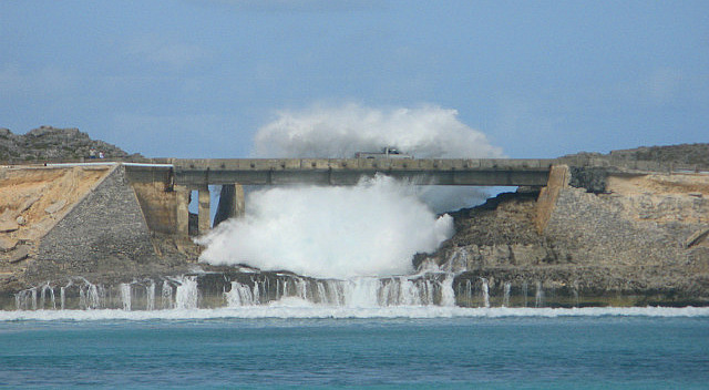
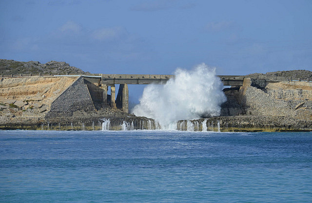
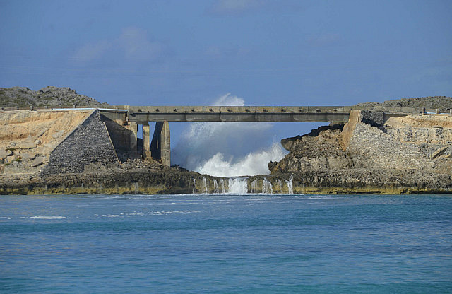
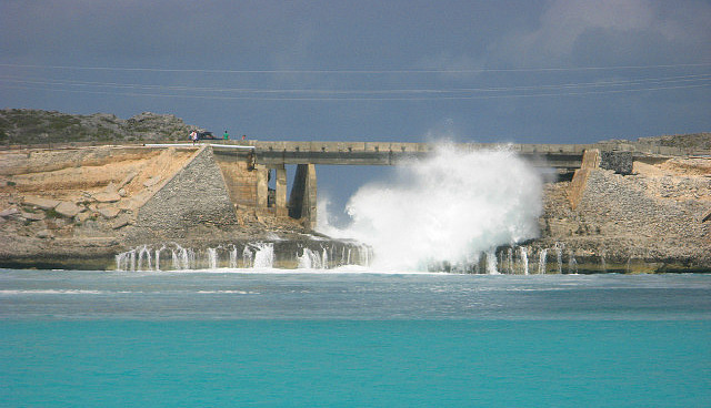
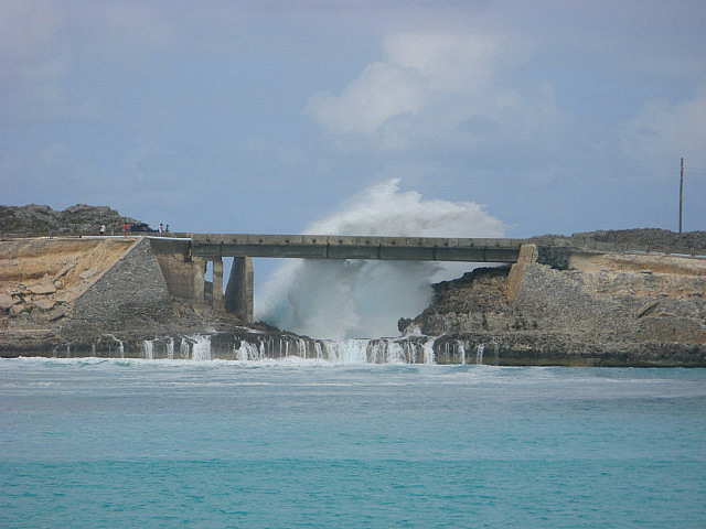
We spent four days anchored about 450 yards from the Window watching the continuous fireworks. It was amazing. Several crashing sets of waves were either strong enough to breach over the island through a cutout in the hilltop, leaving volumes of water over the road, or in several instances reach well higher than the height of the bridge.
We caught a photo of one strong enough to breach over the bridge at the same moment a light truck was passing, totally swamping the truck which made it safely to the other side of the bridge where his horn sounded continuously for several minutes, no doubt having had the water “short out” some portion of his electrical system.
We also caught a striking photo of a large cruise ship passing the Glass Window in heavy seas—we wonder how those passengers were feeling!
On one day kayakers from a nearby resort were actually surfing the waves created by the large volume of water that spilled through the Window and onto Eleuthera's western bank.
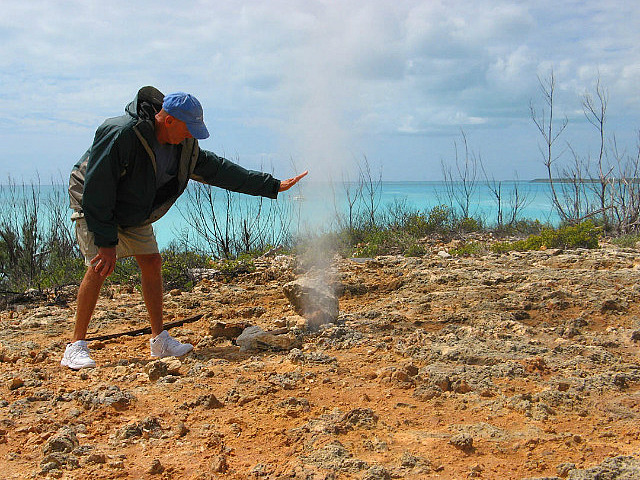
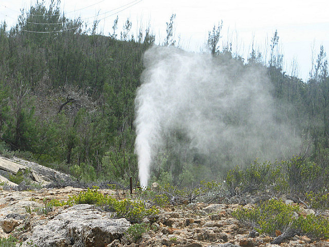
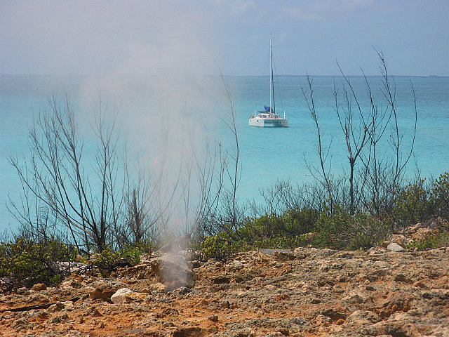
We went ashore on the peak swell day to cautiously take more pictures and visit a blow hole close to the bridge.
Our pictures are the best description. See Google Earth N25*26'03.6” + W076*36'23.5” for our approximate anchored position.
During our stay at the Glass Window the cooler than normal temperatures persisted with the north wind and Dave took the exterior sun shades off the salon windows to gain some solar heating. We departed the Glass Window at 1000 on March 11 and transited Current Cut on an ebb tide to arrive at an anchorage just north of the cut at 1240. Winds were east at 15kts and Dave attempted to sail through the cut with the genoa alone with the current in our favor. Half way through, though, the combination of wind blanketed by the near shore and the speed of the current caused the boat to overtake the wind and the genoa collapsed, so disappointed Dave had to engage what was an idling engine to maintain a little more speed than the current to retain steerage. He'll have to put off bragging rights of sailing through Current Cut at least until our next visit...
The anchorage just north of Current Cut on the Atlantic side near Corrie Sound didn't turn out as well as we hoped, although we set anchor to dinghy in for a quick look at Corrie Sound itself thinking it could be of bonefishing interest. Unfortunately, the timing of the tide was not favorable. A strong outbound and lowering tide against the dinghy made it a struggle to advance up what was an otherwise very interesting channel entry with its water life and resident boobies and cranes in the area. Definitely some fishing potential (bonefish and more) in the right conditions, but today wasn't our day. We returned to the boat and continued on the short distance to the vicinity of Spanish Wells, anchoring in a cove on the east side of the small island of Meeks Patch at 1545.
We spent five nights anchored near Spanish Wells (still waiting for strong weather to depart the area), moving between Meeks Patch and the south side of Russell Island as wind directions changed. Favorable weather was due soon to allow a transit to Harbour Island via Devil's Backbone – the intricate and challenging four mile route along the north shore of Eleuthera that connects Spanish Wells to the harbor of Harbour Island. We missed a chance to visit Harbour Island upon our arrival last November with Bob and Wally as the seas were too rough to attempt entry from the Atlantic at the Harbour Mouth.
While waiting for our Backbone weather we entertained Rob and Pauline from Maine Cat 41 S/V Soligado for Happy Hour one evening and spent another day walking across Russell Island to Spanish Wells. On our walk we met local artist and long time seafarer Chris and his wife Rachel who have a fascinating home they call “Tight Spot” in the Pelican Cay development on Russell Island. It was very pleasant visiting their home.
All cruising guides highly recommend hiring a guide to transit the narrow, treacherous Devil's Backbone, described as “frightful” and “awe-inspiring in the contrast of its beauty and its danger, the golden coral heads set in the glimmering turquoise sea.” The safe route is a winding road - at some points threading through coral heads just below the surface and elsewhere passing very close to the beach inside waves breaking over a reef close on the other side. Guide services are plentiful and currently charge US$60 per one way trip. But we had studied the charts and talked to other cruisers who regretted spending the money for a guide and, indeed, made the return trip without one. Further, the large, high speed ferry that runs between Nassau and Spanish Wells/Harbour Island makes the trip several times a week, weather permitting – and its a LOT wider and deeper than Pas de Deux! And that's the key: waiting for a day with minimal seas, light winds, and plenty of sunlight. We concluded that with the right conditions we could make the trip without a guide inasmuch as the route appeared no worse than many others we had transited before. So we loaded all the recommended waypoints from our cruising guides into our chartplotter, reviewed text guides for other particulars, and then waited for a good weather day, which arrived on March 16.
We departed our anchorage at Russell Island at 1115 on March 16 and headed out for the Backbone. Seas were small to moderate (estimated to be 4-5 feet) and there was plenty of sun despite several clouds overhead. The tide would be in the upper half for our expected two hour transit motoring. The favorable tide would allow us to navigate around the outside of Spanish Wells rather than going through the harbor and followed our well discussed plan.
As we expected, we had no surprises and arrived safely on the Harbour Island side to an anchorage by 1330. In hindsight, we would not have wanted to do that with any bigger seas, but in the right conditions our suspicions were accurate: reasonably experienced cruisers with some advance careful planning can make the trip on their own and spend $60 instead on some good eating at Harbour Island.
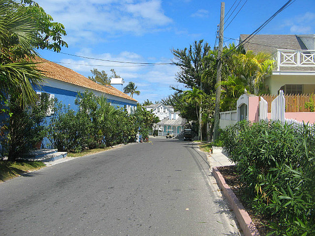
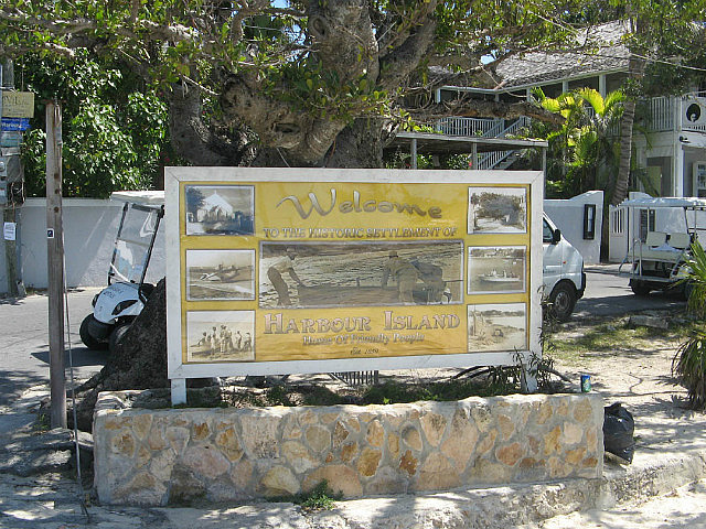
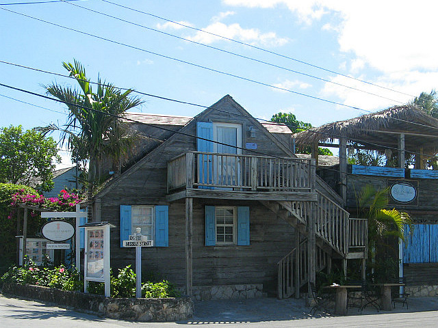
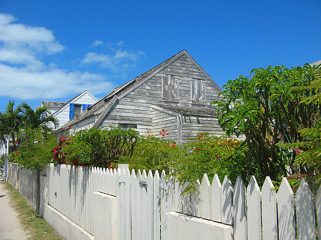
Harbour Island, with its famous Atlantic pink sand beach, is home to several exclusive resorts. Large motor yachts and private jets are constantly coming and going. (All the motor yachts use guides for their trip through the Backbone.) A few high dollar marinas host all the motor yachts, the most notable probably being Valentine's. There were only a couple cruising boats like us at the time of our stay in this entire large northeastern coastal area of Eleuthera. The town of Dunmore Town is New England quaint with numerous shops and restaurants.
We did indulge in lunch one day at the casual, waterside Queen Conch for a conch sandwich wrap, which we enjoyed very much. While there we could watch the girls making fresh conch salad before customers' eyes and vowed to try that if we ever return. Donna had heard some radio traffic citing it as “the best” that person had ever eaten anywhere in his travels.
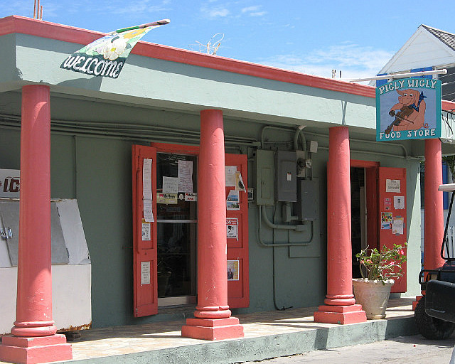
We spent several hours walking throughout this town (instead of renting a golf cart which many people do) so that we could absorb more slowly the variety of homes and establishments along the way.
We walked along about a mile of the three-mile stretch of beach and, while we found it very nice, we felt that we had seen better beaches in our travels so, at the risk of seeming too harsh, to some degree we felt the singular destination of “Harbour Island” was a bit “over-rated”, but certainly a nice hub for people who also have the time to explore and enjoy the balance of cays, reefs and shorelines elsewhere in this northeast corner of Eleuthera and who may not be able to explore destinations further south on Eleuthera and other out-islands.
We spent four nights in the harbor of this area at three different anchorages, the first adjacent to the shallow bank between Man Island and Jacobs Island facing the opening to the Atlantic Ocean,
the second at Little Bay, Harbour Island,
and the third on the west side of the harbor southwest of Pear Rock with Pigeon Island to the north. Here we could wait for good weather for our return through the Backbone. We were adjacent to the creeks and channels leading into the large area of mangroves and shallows that draw bonefishing lodges. We spent a day exploring, hoping for some bonefish action and we saw plenty of fish – but they had no interest in our baits.
Weather for our return trip to Spanish Wells through Devil's Backbone arrived on Wednesday, March 20 and we waited until late morning for high tide and good sun. The weather was even better than the day of our first Backbone transit and the seas were quite calm—calm enough to stop to anchor amongst the coral reefs for snorkeling if time would permit, which on this occasion we wouldn't. As a bonus, we had our chartplotter breadcrumb trail to follow back, so this trip should be easy. But, we knew the high speed ferry made its trip from Spanish Wells to Harbour Island in the late morning so our only obvious challenge was to make sure it was through before we headed out into the narrow-at-spots route with something that big coming from the opposite direction. As soon as we heard the ferry announce its arrival into Spanish Wells, Dave hailed it on VHF to inquire if the ferry was continuing on to Harbour Island, and if so, when would it depart Spanish Wells? “In 10 minutes.” Perfect. By the time the ferry got through we'd be ready to go the other way. We departed at 1138 after seeing the ferry approach Harbour Island, hoping we'd avoided the most significant opposing traffic of the day. That all changed pretty soon....
Even before getting out of the harbor and into the Backbone route, we had opposing traffic inside the harbour – we had to communicate with a large motor yacht and an inter-island freighter to ensure safe passing. At least we got those past us before we got to the narrow sections. But we had heard the guide pilots making their connections on the VHF and we knew other traffic was going through the backbone in both directions that day. We could only hope we made it through before it got busy or would encounter any opposing traffic in other wide sections of the route where ample room exists to get by oncoming vessels.
We were approaching the narrowest section of the route – one way traffic only - where it winds through coral heads for several hundred yards when we saw a line of three large motor yachts coming the other way. We initially thought we could make it through the narrow part first, but soon we heard pilot “Bandit” (Jock Morgan) hailing the “large catamaran”. He asked which way we were going and when Donna replied “west bound” he responded that he was in the first of three motor yachts, two were following him, and the third one, “..is running on only one engine and shouldn't slow to avoid losing steerage.” In other words, please let us through the narrows first. Dave immediately recognized the right answer that we should yield to allow the three motor yachts to pass. We were only one boat and could more reasonably maneuver than trying to coordinate three vessels, one of which was crippled. Fortunately, just outside the preferred route from our current position Dave spotted a wide and deep basin between coral heads on the sea side of the route and Donna informed Bandit that we'd hold station on the side until his vessels passed. With the calm conditions, this was straightforward. As Bandit got his vessels through the narrows, he thanked us profusely for our courtesy. It was easy for us to get back on our route – the only challenge being that we had to wait a bit for the three motor yachts' wakes and bubbles to dissipate so we could see the safe narrow path through the coral heads again. That was the last of our excitement for the day and we arrived back at a Meeks Patch anchorage near Spanish Wells at 1330.
We spent three nights on one side or the other of Meeks Patch as wind directions changed to await good weather for a passage north to Great Abaco Island. This would be an approximate 55nm open ocean passage straight north.
Notes to cruisers:
Do not fear Current Cut. The only challenge to Current Cut is determining the tides and planning your transit to go with the tidal flow. Flood tide current flows from west to east, ebb tide current flows from east to west. Depth in the cut is not an issue. Depth IS an issue just east of the cut for deeper draft vessels. Just mind the depths as shown in the Explorer charts and plan accordingly to use the height of tide you need as you would anywhere else. Explorer Charts will note that the tide here “usually follows Nassau tide by 1 to 2 hours”, but we use the NOAA tide table for the “Eleuthera Island, West Coast” which would imply more like 2-1/4 to 2-1/2 hour lag. Our transit across the bank and through the cut seemed consistent with charted depths based on the NOAA table, but you will ultimately make your own decision on when to transit once you can confirm favorable tide. The “straight through” route on the east side of the cut is the easiest as you don't have to make that hairpin turn to or from the anchorage just south of the cut while trying to accommodate the current flow. We recommend you not try to time slack tide for this transit as that's exactly what others might be trying to do – half coming from the other direction. At popular times, this strategy may result in opposing traffic in the narrow channel (even if you can determine when the very brief slack tide actually occurs). Radio communication will typically prevent tight opposing traffic as courtesy would dictate that one vessel will delay entry until the other has passed through. Bottom line – just go with the flow and maintain enough boat speed to assure steerage.
The anchorage just south of Current Cut on the east side (as shown on the Explorer Charts) is very adequate for west to north winds. Get in close to find the band of clear sand that separates the grassier sand from the shallows. The depths are deeper further in than indicated on the chart.
In the Spanish Wells area we prefer anchoring at Meeks Patch which provides decent protection from most wind directions using both sides of the island as direction changes. South winds will result in some chop on both sides as the island is oriented north-south. North winds can be better taken anchoring up against the south shore of Russell Island. Alternatively, a few moorings are available in the Spanish Wells channel. Many cruisers use the small harbor at Royal Island which seems to suit them well but can be crowded in the spring as many vessels are moving north. There is a resort undergoing construction there and we overheard of the arrival of multiple island freighters arriving after dark that required anchored vessels to move in in the middle of the night in order for them to get to their landing.
As described, the Devil's Backbone can be transited without a guide in mild weather conditions if you have ample experience reading the water. We consider a chartplotter at the helm to be necessary to support you with suggested waypoints, however VPR (Visual Piloting Rules) apply throughout this passage. You cannot expect to navigate through the Devil's Backbone by going from waypoint to waypoint. Collect all the waypoints you can find in guidebooks like Pavlidis and the Explorer charts and load them into your plotter to serve as general targets, but do not use them as “go to” waypoints with your autopilot. We also suggest that you do not consider this passage with a northerly swell in excess of five feet, and only in light to moderate winds (below 15 kts) with favorable sunlight. At the narrowest portion, it may be best to wait for any significant errant cloud to pass so that the thread of passable water is clearly visible through reefs on both port and starboard.
Sailing Northward to Eleuthera, Bahamas
Monday, February 25, 2013
 Rock Sound, South Eleuthera, Bahamas

Other Entries
-
Feb 1213 days prior San Salvador, Bahamas
 -
Feb 187 days prior
Conception Island, Bahamas -
Feb 25
Rock Sound, Bahamas -
May 1377 days later
Marsh Harbour, Bahamas -
May 1983 days later Norfolk, United States
 -
Dec 24667 days later
Drayden, United States -
Dec 151389 days later
Abraham’s Bay, Bahamas -
Jan 251430 days later
Great Exuma, Bahamas -
Feb 101446 days later
Sampson Cay, Bahamas -
Feb 271463 days later
Andros, Bahamas -
Mar 121476 days later
Marsh Harbour, Bahamas -
Apr 081503 days later
Marsh Harbour, Bahamas -
Apr 261521 days later
Marsh Harbour, Bahamas -
Jun 041560 days later
Marsh Harbour, Bahamas


2025-05-23