 San Salvador, San Salvador, Bahamas
Underway from Atwood Harbour, Acklins at 1900 on Tuesday, February 12th, we had rigged our light wind Code 0 for the deep downwind, 95nm passage to San Salvador – the consensus first landfall location of Columbus in 1492. Depending on the wind speed, we'd use the Code 0 or our genoa alone without the mainsail for this passage. We don't use a spinnaker at night and the Code 0 works almost as well especially when we don't expect to have to gybe. But upon exiting the Atwood reef, we found the wind even lighter than expected and we kept motoring instead of rolling out either the Code 0 or genoa.
A few miles out and away from land the wind piped up and we unfurled the Code 0, but after only a short while we resorted to motoring again as our speed was under 4 kts. We had budgeted 6 kts for our desired ETA of mid-day on the 13th at our destination reef-surrounded harbour. Finally around 2100 we got the forecast 15 kts of wind and we unfurled the genoa which we would use for the remainder of the passage. The seas were lumpy – left over from the previous three days of strong wind – and were from the direction of the previous easterly wind. This put the seas more on our beam which made for an uncomfortable ride. The wind was up and down between 8 and 15 kts and it was a long night....
At dawn we were 19nm from the southwest tip of San Salvador and we set out four trolling lines. We had been averaging 5.5 kts and at these slow speeds we could hopefully manage getting four strikes at once. Yeah, right, wishful thinking. Dave spent much of the day cleaning weeds off the baits....
Our excitement of the passage started around 0830. Dave first heard the "whoosh" off the port side of the boat and turned in time to see the back and dorsal fin of a whale as it submerged after breathing. It was only about two boat lengths away and on a parallel course with us. It was much, much bigger than a dolphin, but likely not as long as the boat. Despite both of us anxiously scanning the area for several minutes afterward, we saw nothing else and assumed that was all we'd see....
“Whoosh!” On the starboard side this time. We both saw another whale just as it submerged, again paralleling our course and quite close. After an even longer interval we heard and saw one more. That was the end of it. Neither of us had seen much more than just a back and dorsal fin – black or dark gray – with no other markings or characteristics to help identify the species. Each sighting was too unexpected and brief to get a picture. We had seen either three whales of the same size and species, or the same whale three times swimming along with us. Researching our Audubon Fish, Whale, and Dolphin book later, we concluded our visitor was likely a single individual and could have been a Minke whale, False Killer whale, or Bryde's whale – based on color, dorsal fin shape, habitat (where we are), and the fact that all three species are known to approach and swim with vessels. Very cool!
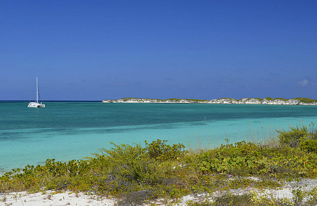
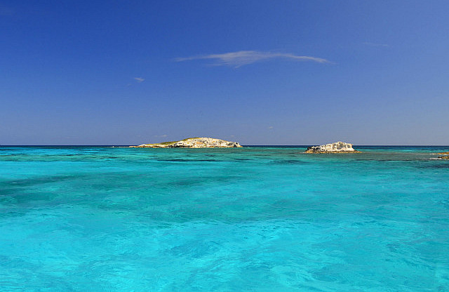
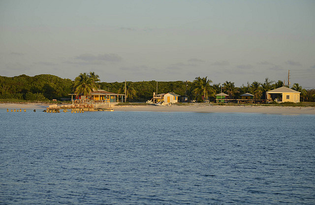
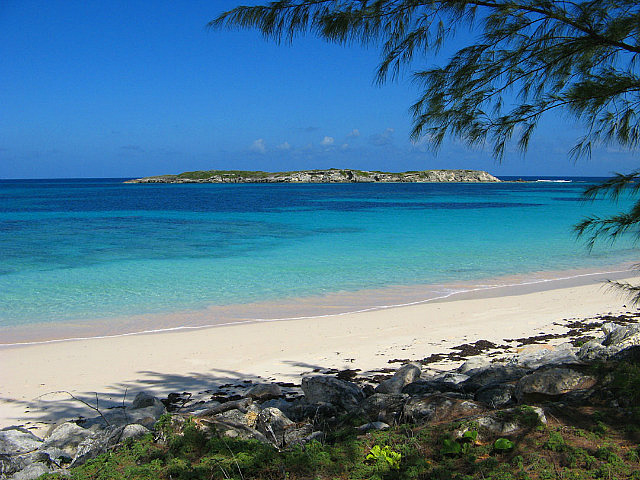
Our destination on San Salvador was Graham's Harbour on the north side of the island – a large shallow harbor surrounded by a reef. Winds were forecast to be southerly for several days and this afforded the opportunity to anchor in this otherwise too unprotected harbor in any other wind direction. See Google Earth N24*08' + W074*29'. Here we hoped to get in some snorkeling in pristine conditions along the surrounding reef, or at interior patch reefs. Ashore we planned to visit a still working, manually operated, 72 foot British lighthouse (circa 1887), a research institute, and maybe even find a grocery store with rum...
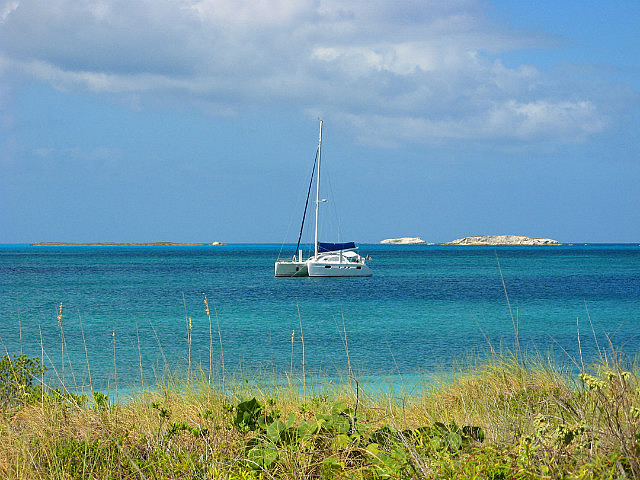
We transited the west side of San Salvador and arrived at the only entrance/exit point across the reef bordering the harbor pretty much as planned, around 1230, and gained entry without difficulty just south of Green Cay as described in our guides. We arrived and anchored near the north coast beach at the SE corner of the harbor at 1315 – it took that long to motor across the harbor. This may have been the harbor that Columbus described upon making first landfall on October 12, 1492 as able to accommodate “...all the ships in Christendom.” More on Columbus' first landfall in a moment...
San Salvador, known as Watling's Island until the early 1900's, lies ESE of Cat Island – itself known as San Salvador until sometime in the 18th Century – and NE of Long Island, Rum Cay, and Conception Island. San Salvador, along with Samana Cay, sits well out into the Atlantic from the rest of the Bahamas and is generally upwind considering the prevailing Bahamian winds. Because of this most cruisers who visit San Salvador are those returning from the Caribbean to the US. We saw only one other cruising boat during our visit here. Contributing to the low number of visiting yachts here is the lack of any all-weather anchorages. The only prevailing wind anchorages are along the west coast, fully exposed to ocean swells from the west. A supervisor at the research center on the shore of the northern anchorage, when asked how frequently he saw a cruising boat anchor there, answered “maybe once a year....”!
We spent three nights at this very comfortable anchorage. Without the southerly winds this would have been much less comfortable if not impossible. A cold front with strong west through NE winds was forecast to arrive late on February 16th and we'd have to relocate before then to the south side of the island.
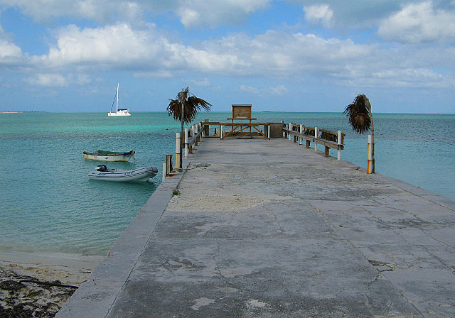
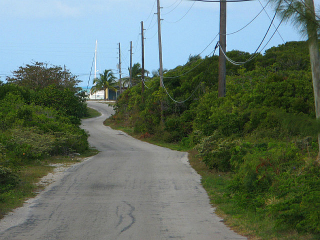
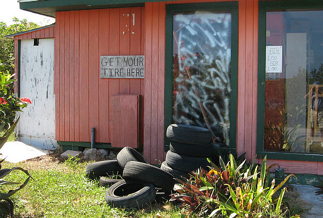
On February 14th we went ashore landing at a quaint community park with a small boat dock for our land exploring. Here we chatted with the very friendly and welcoming local Pastor, “Rick”, who was tending the lawn with a weed whacker. We then ambled on to visit the island's lighthouse and a research center described in the guidebooks—both within walking distance. Along the way Dave was on the lookout for a grocery store that might have rum, but not even passing through the second largest settlement on the island – United Estates – was there any rum to be found. The largest “town”, Cockburn Town, was all the way across the island. Dave would have to wait until yet another island....
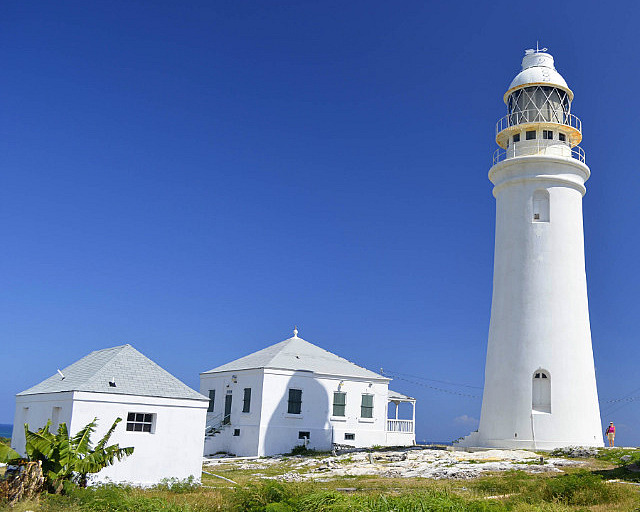
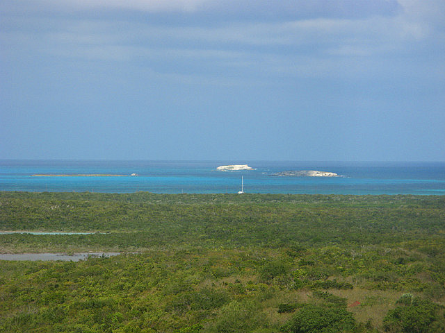
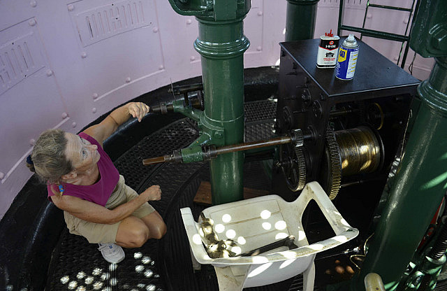
After about an hour walking we approached the historical 72-foot, still manually operated British lighthouse located atop Dixon Hill, elevation approximately 26 meters. The well kept lighthouse, surrounding buildings, and grounds are open to the public and we eagerly climbed the spiral staircase to see the workings of the light and enjoy the view from the top. It was a terrific view; we could see Pas de Deux at her anchorage, about 1 ½ nm to the north.
Being daylight, there was no operator present at the time, so we tried to figure out the workings of the light on our own. We could identify the components of the kerosene fuel supply system for the light itself, and after a few minutes of study, Dave solved the engineering of the gears and shafts and hand cranks of the mechanical system that rotates the lens structure about the light. The light stays still and the lens rotates to create the periodic flash when seen from a distance. The “manual” requirement of the light's mechanical operation seemed to be similar to the manual operation of a grandfather clock. The operator has to hand-crank a weight suspended on a cable up a vertical cylinder from the base of the tower to the level of the rotating mechanism, then gravity pulling the weight back down rotates the lens structure around the light through the “transmission” of shafts and gears. Pretty cool!
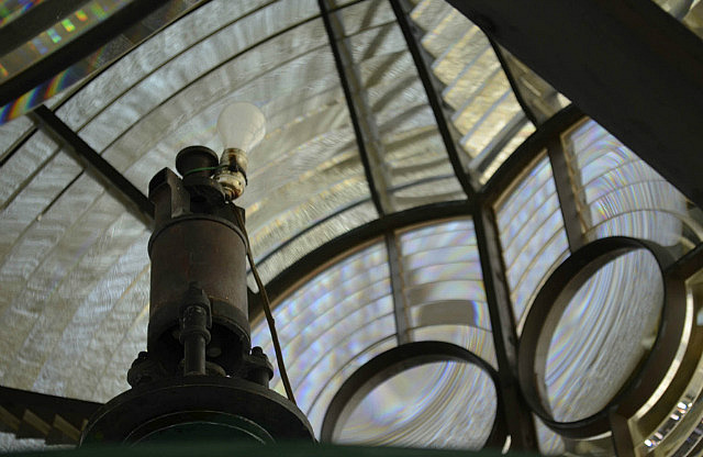
Based on a dial we located, it looked like the lowering weight would rotate the lens for a hour before needing to be cranked up again. Next, following the kerosene fuel lines, Dave climbed the ladder up inside the large lens structure itself to find the actual “light.” He found it, alright. Where the kerosene burner probably used to be was a loosely run cord leading to a lamp socket with a standard household 100 watt light bulb! Our bubble was burst! OK, fair enough, the manual operator still had to figure out when it got dark and turn on the light switch....
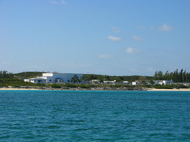
Returning to the anchorage, we walked a short distance further to visit the Bahamian Field Station of the College of the Finger Lakes (yes—upstate New York is represented here!). Here researchers study the island's geological and biological (including marine) features with some archeology thrown in for good measure. According to the gentleman who was kind enough to explain the history and function of the Field Station to us, San Salvador's island limestone is considered quite “young” in geological terms which attracts researchers.
The property the research center sits on was once the site of a US Naval Base. The Navy left in 1969 and the US Coast Guard used the facilities until the late '80s. Once abandoned fully, an academic from New York State purchased the property to turn it into a research center, which he had apparently successfully done elsewhere as well. It welcomes individual researchers now along with some large student groups who might spend periods of 1-4 weeks at this location to complement their college studies. There are dormitory accommodations that have held as many as 200 visitors at one time. There were no groups in attendance at this time, however.
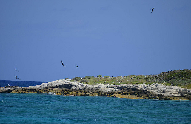
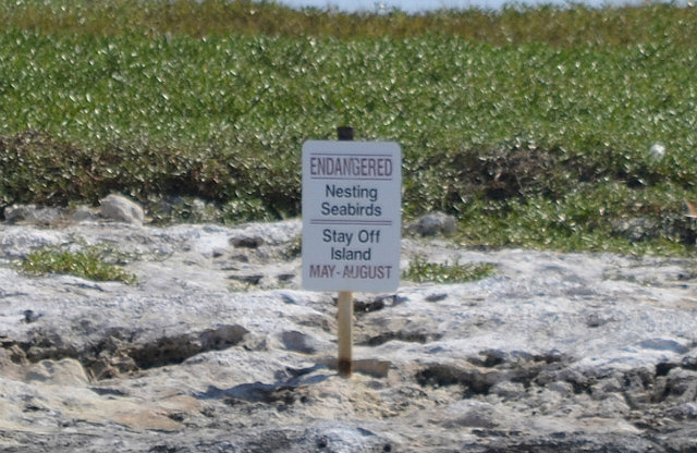
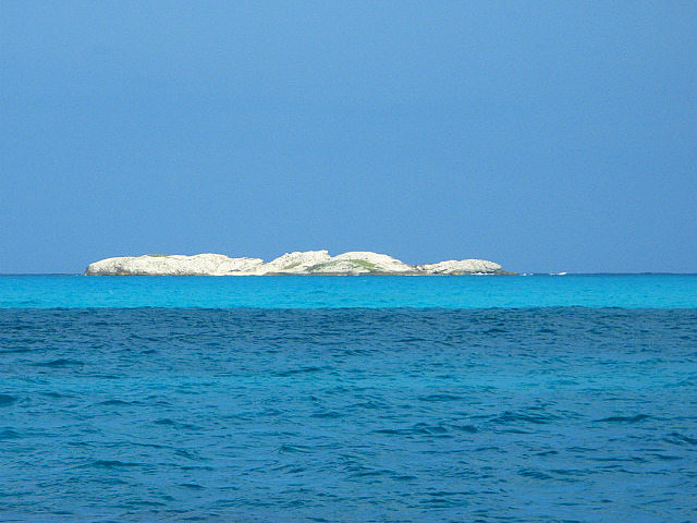
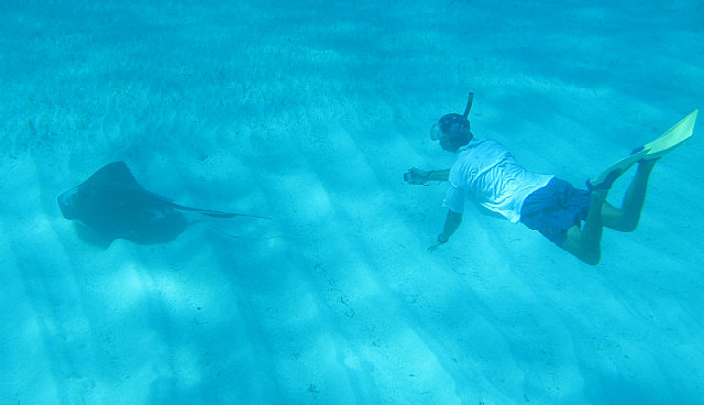
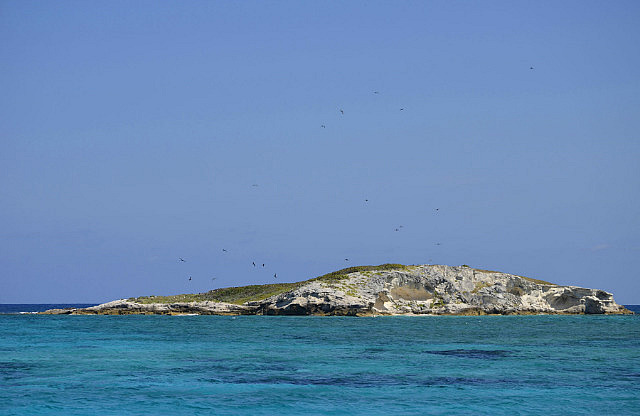
On February 15th we relocated Pas de Deux within the harbor to go snorkeling at a couple of well reputed spots nearby. One of these was near Goulding (aka Hawk's Nest) and Catto Cays. Both these small cays are protected endangered sea bird nesting sites and we could see a large flock of Frigate birds soaring above Catto and actually see the juveniles on the ground through binoculars.
We saw Boobies flying, known to nest on Goulding Cay, but we couldn't identify whether they were brown footed or red footed—both are reputed to nest here with signage that places the island off limits during the nesting months.
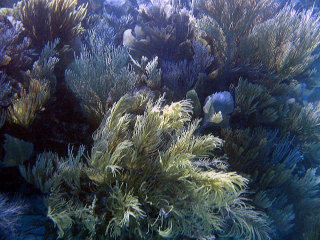
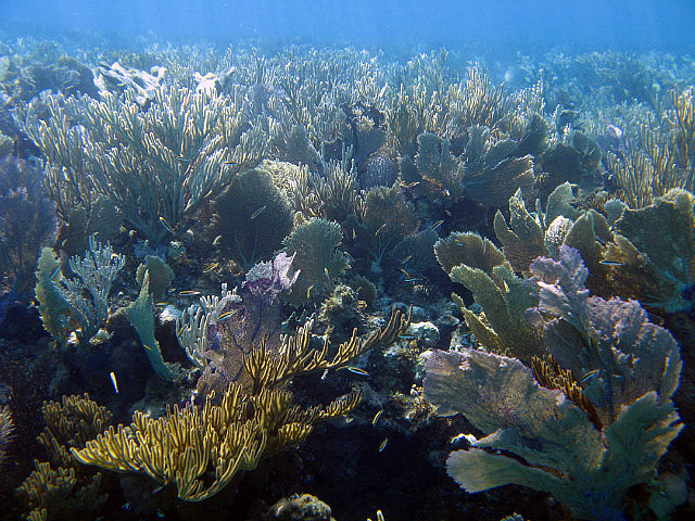
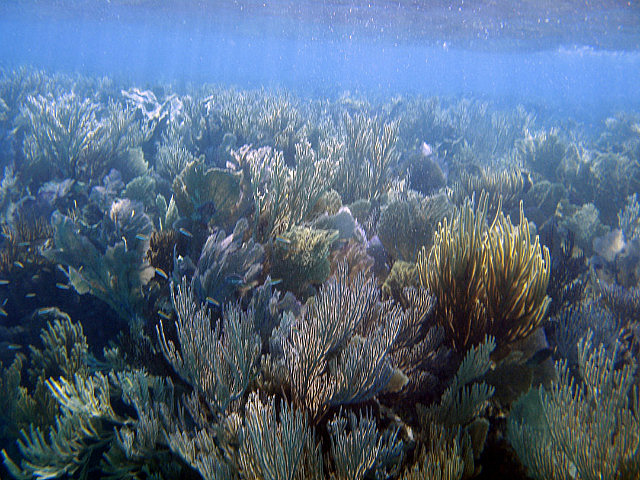
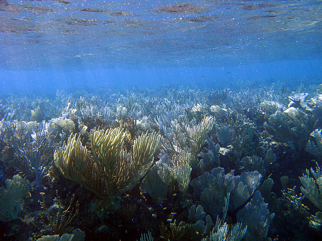
Unfortunately, the wind chop was too rough to go snorkeling at this location and we moved again back closer to the protection of the shore and anchored near several patch reefs where we could swim more easily.
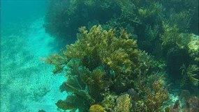
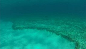
This turned out to be a fabulous spot to see soft corals. These reefs were the largest, most healthy stands of soft corals we had seen anywhere in our island travels to date!
We would become curious to see how Conception Island—our next destination—with its outstanding reputation for diving/snorkeling but exposed to more frequent visitation, would compare in this regard, having now seen how healthy the reefs proved to be at much less-visited Samana Cay and San Salvador.
In anticipation of the cold front due to arrive in the overnight hours of February 16th, that morning at 0910 we exited Graham's Harbour the same way we got in and motored down the west coast of San Salvador into the moderate but building, pre-frontal southerly winds to French Bay. (See Google Earth N23*57'01.5” + W074*32'11.6” for our anchored location.) We didn't know much about this anchorage but it seemed a logical location once the frontal winds had clocked north of west. (In the Bahamas, passing cold fronts from the North American continent cause winds to “clock” from prevailing E or SE, all the way around the compass with the strongest winds being from the NW to N to NE, before finally returning to E or SE. This can take from 24 to 72 hours depending on the strength and speed of the passing front.) French Bay is oriented parallel to the south coast of the island, west-to-east, with a west entrance. A reef about ¼ nm off shore provides the boundary to the open sea to the south and east.
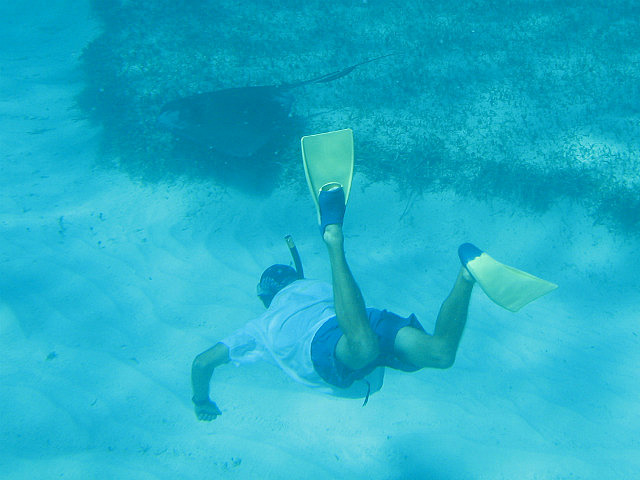
We actually anchored twice here. When we arrived at 1300 the wind was still from the south and we anchored in a position safest for that wind direction, closer to and facing the reef – with ample room to drag towards the beach to the north and behind us if that happened. Dave dove on the anchor to confirm its set and also browsed toward the beach for good sand to relocate to later as the wind direction clocked to the north, as our concern would shift to having ample room to drag to avoid hitting what would then be the reef behind us.
At 1600, with the wind direction beginning to clock to the west, we implemented that plan and relocated closer to the beach with an anchor drop spot Dave had identified during his swim. This was several hundred feet closer to shore than our original position. He dove on the anchor again and confirmed a good set – it was completely buried in good sand and we felt secure. The front arrived overnight with NW winds up to 25 kts and we weathered it well with no problems. There were no significant squalls. By 1300 there was more sun than clouds and by dawn the next day, February 18, the progression of the front was mostly complete with NE winds less than 10kts in this protected spot. Winds, however, were forecast to be stronger and continue clocking to the East, meaning we had to leave French Bay as the protection from the E is not very good. In sum, French Bay was a pretty good place to ride out a strong front. Of significance is the fact that there were no other boats here to worry about.
This had been the first, strong, fully clocking cold front we experienced this cruise. In contrast, during our Bahamas 2009-10 cruise, the strong fronts were much more numerous and came one after another. At one point we endured three fronts in one week that season.
About that first Columbus landfall: San Salvador is the generally accepted location of Columbus' first landfall in the New World on October 12, 1492, with no less than four monuments on the island to remind visitors of this “fact”. But it's not unanimous amongst historians and the evidence for any specific island claim is circumstantial. First landing claims are also made for Cat Island, Samana Cay, and Grand Turk in the Turks and Caicos Islands, all with impressive amounts of research by respected people and even including modern computer modeling of Columbus' fleet's track across the Atlantic. For a number of reasons too lengthy to describe here, there may never be reasonable proof of exactly where Columbus first landed--after all, he had no idea where he was. But reading about the various theories in our guide books was interesting for us, as now we have visited all the islands reasonably considered or claimed to be the first landfalls, so we can say we've been there. Just don't ask us where it is....
See additional photos below!
Notes to cruisers: Absent very settled weather like we had upon arriving in San Salvador, this is often not favorable cruising ground in the winter season. West coast anchorages can be found in prevailing NE to SE wind directions, but all will be open to the west and surgy. But if calm weather or south component winds are in the picture, Graham's Harbour is quite comfortable, easy to enter and transit, and well worth visiting. Use the offshore waypoints from either Explorer Charts or Pavlidis, and eyeball the entry through the reef staying approximately 100-150 yards south of Green Cay. You should see no less than about 8 feet depth. Once in, the depths are better and you will find good holding reasonably close to shore between the pier ruins and the easily seen research center along the eastern end of this northern shore.
As we described, French Bay is a pretty good place to ride out a front and our electronic charts had it very well charted. We went further in than shown as an anchorage on Explorer and much further in than described by Pavlidis and the Yachtsman's Guide (in fact we couldn't imagine anchoring in strong weather where those two latter guides reference). The further in (eastward) the better for west protection, minimized swell, and better sand. In good light, you can easily dodge the very visible patch reefs in and out.
Riding Rock Marina is available on the west coast, as described in both Explorer and Pavlidis, but inasmuch as we don't use marinas we didn't research going in there, not even for the front. Cruising friends described a harrowing visit there to ride out a front, which only underscored our decision to select French Bay on this occasion.
Cruising San Salvador, Bahamas
Tuesday, February 12, 2013
 San Salvador, San Salvador, Bahamas

Other Entries
-
Dec 2846 days prior Acklins Island, Bahamas
 -
Feb 066 days prior
Samana Cay, Bahamas -
Feb 12
San Salvador, Bahamas -
Feb 186 days later
Conception Island, Bahamas -
Feb 2513 days later
Rock Sound, Bahamas -
May 1390 days later
Marsh Harbour, Bahamas -
May 1996 days later Norfolk, United States
 -
Dec 24680 days later
Drayden, United States -
Dec 151402 days later
Abraham’s Bay, Bahamas -
Jan 251443 days later
Great Exuma, Bahamas -
Feb 101459 days later
Sampson Cay, Bahamas -
Feb 271476 days later
Andros, Bahamas -
Mar 121489 days later
Marsh Harbour, Bahamas -
Apr 081516 days later
Marsh Harbour, Bahamas -
Apr 261534 days later
Marsh Harbour, Bahamas -
Jun 041573 days later
Marsh Harbour, Bahamas


2025-05-23