 Cat Island, Out Islands, Bahamas
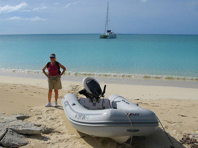
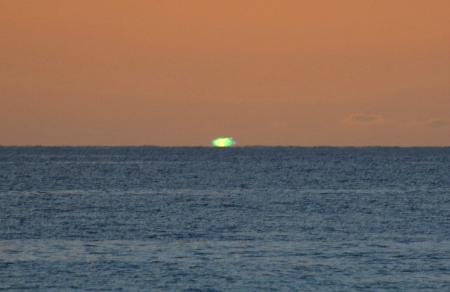
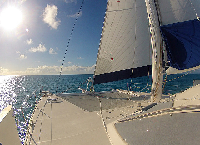
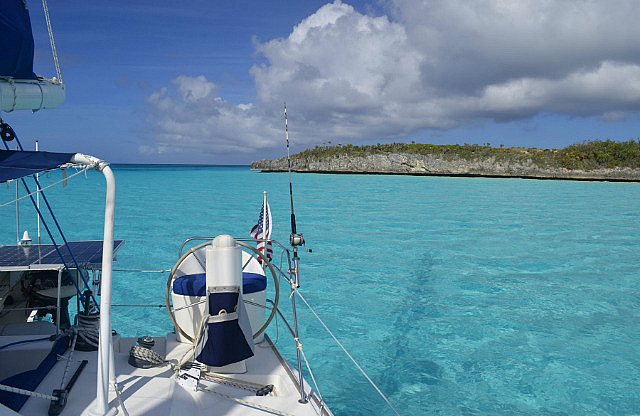
When we saw the same cruise ship come in again to Little San Salvador the morning of December 3rd, we knew it was about time we moved on, having been there long enough. Despite the ENE trade winds still blowing 20-25 kts, we decided to move on to Cat Island. Sailing in the lee of Little San Salvador and Cat Island would shield us from open ocean seas and by shortening sail to double reefed main and reefed genoa would make the 30 nm move to the midsection of Cat reasonable. The route would allow us to troll along the deep water drop-off ledge that parallels the western coast of Cat Island.
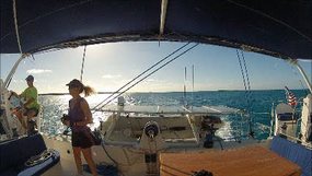
Departing Little San Salvador around 0830, we set the double reefed main, sailing direct downwind to clear the stern of the cruise ship before turning to port to our beam reach towards Cat. Once on course after rounding the ship, and into deep water with two baits set out already, we were moving comfortably at 5.5 to 6.5 kts and chose to not unfurl the genoa to increase our speed. This would make things much easier to manage if we got a fish. A few hours into the trip the wind lessened a bit and veered more to the east, slowing us, so we unfurled about 1/3 of the genoa which brought our speed quickly up to 7 to 9 kts. Approaching the southern third of the island we exited the deep water onto the shallow bank west of Cat and reeled in our baits. To make our planned destination at Fernandez Bay, we had to turn to port a bit, which put us on a close hauled course. We unfurled the rest of the genoa as the wind had lessened some more.
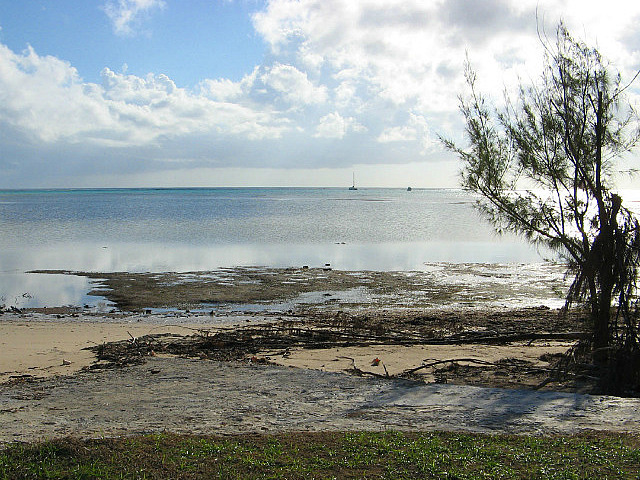
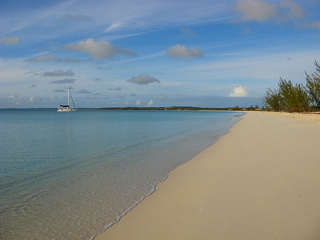
We arrived at Fernandez Bay at 1350 and anchored off the resort located there. The resort facilities were low rise resident-style structures and blended right in with the real residences. Several of the nice homes situated on the beach appeared to have suffered some damage from Sandy. This was a nice calm anchorage with the east winds. Only a few people were at the resort. Two of our cruising guidebooks noted some poor relations in the past between the resort management and impolite cruisers. We were the only cruisers there at this time of the year. We respected their privacy and did not go ashore so we have no idea what kind of welcome we would receive if we had. See Fernandez Bay at Google Earth N24*19' + W075*28'30".
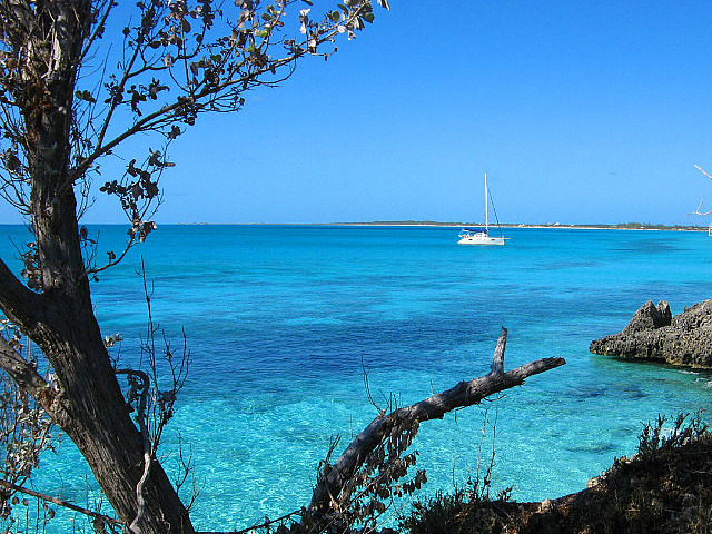
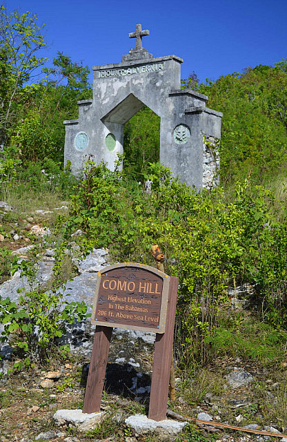
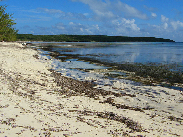
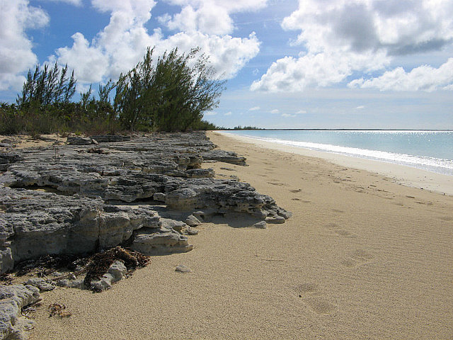
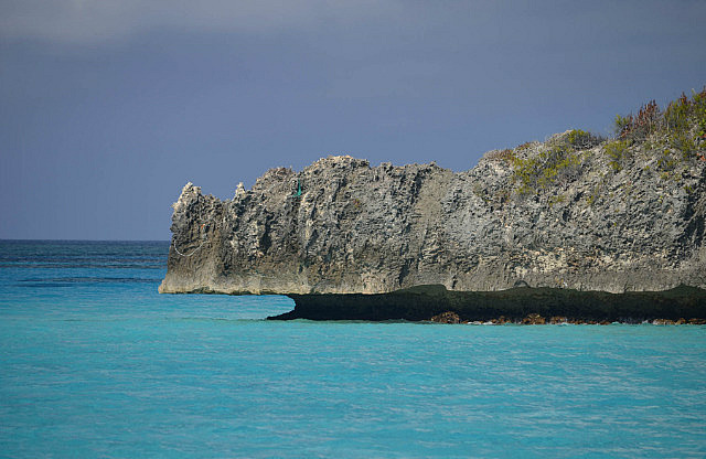
Cat Island is physically similar to Eleuthera – a long, skinny island situated NW to SE with the deep Atlantic on its east coast and a wide shallow bank on the west. At approximately 45 miles "long", it's shorter than Eleuthera's approximately 70 mile length. As seen from a boat, the shorelines of both islands are practically indistinguishable. Cat's west side bank is shallower than Eleuthera's, but generally there is plenty of depth to permit carefree sailing and shallow obstacles are well charted. Cat also has a higher percentage of beaches on its western shore than Eleuthera and also boasts the highest elevation in the Bahamas, 206 feet at Como Hill, renamed Mt. Alvernia by Father Jerome. More on that later....
Our strategy for visiting Cat Island was to ultimately explore the entire western shore, but taking advantage of changes in the forecast wind directions to do so, making our visit appear to be haphazard. For the first several days, winds would be from north of east, favoring movement along the west coast in either direction. Then, winds would veer to south of east, favoring movement toward the northern end of the island. We would end up sailing up and down the coast several times but enjoying some fabulous flat water sailing just off the shoreline. Fortunately, there were no incoming westerlies in the extended forecast. West winds would make being on the west shore uncomfortable to dangerous as there are only a couple places to hide from bad weather coming from the west. Similar to our visit to Eleuthera, we had almost complete solitude – we saw only two other cruising boats our entire visit, which spanned thirteen days.
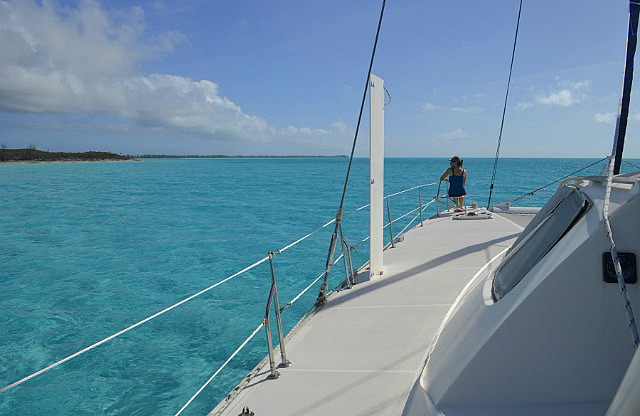
We spent just one night at Fernandez Bay and departed at 0830 on Tuesday, December 4th, for a 12nm sail north to a settlement called The Bluff. This was one of those fabulous sails in shallow flat water about ¼ mile off the coast. We set the 1st reef in the main and full genoa for the beam reach in 15-20 kts. Water depths were 9 to 25 feet and the easily seen rocks and coral heads on the bottom zoomed by!
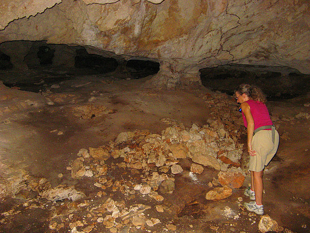
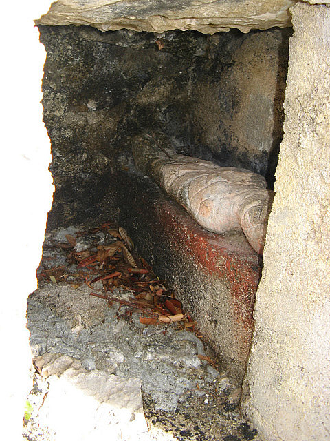
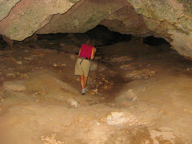
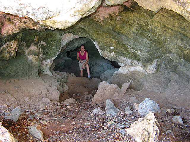
The attraction for us at The Bluff was a cave described in our guide as having a large population of bats. Unfortunately the bats weren't there any longer, but it was interesting nonetheless. As is frequently the case, it was an unexpected attraction that became a highlight: to find the cave we asked a resident we met on the road who informed us there was a "donation” for visiting it. He directed us just across the street to Mrs. Wilson at Wilson's Triple X Restaurant and Bar to pay the “fee”. We found Mrs. Wilson alone in her establishment and learned she is 93 years old. She was a delight to speak to. There were no customers and we saw no clue what “Triple X” referred to in the name of her business. It didn't appear to have anything to do with what you might be thinking....
After visiting the cave, we motored a short distance further north along the coast for an overnight anchorage just south of the Pigeon Bay Club near Alligator Point where a long sandy beach suggested a sandy bottom for more reliable holding.
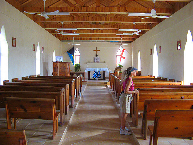
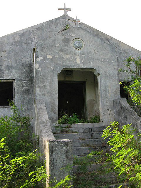
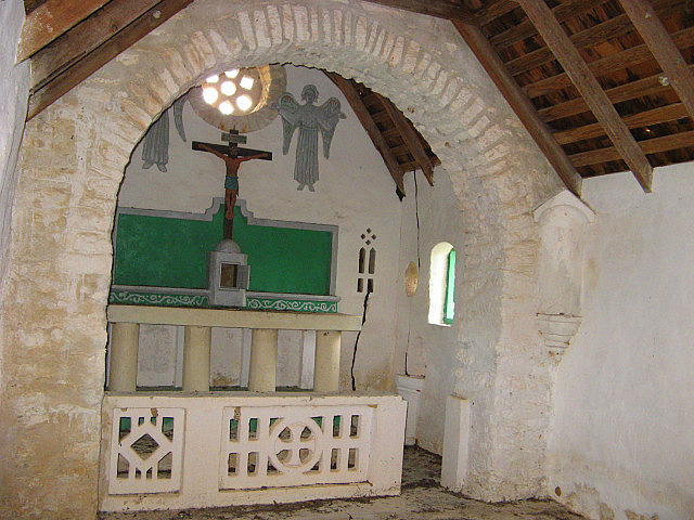
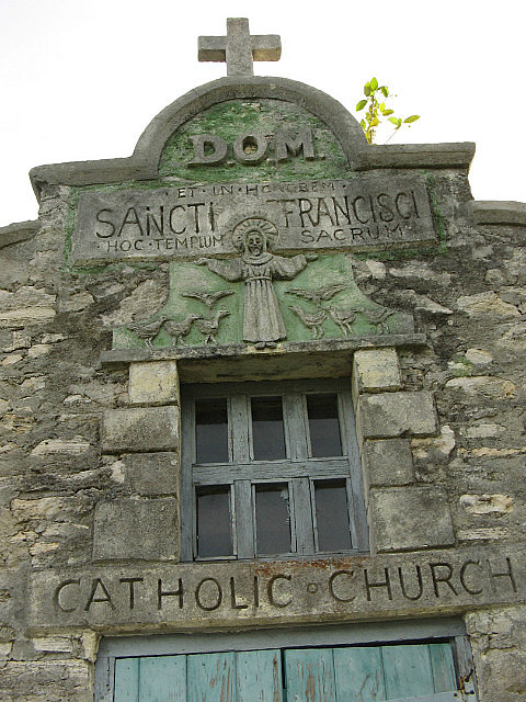
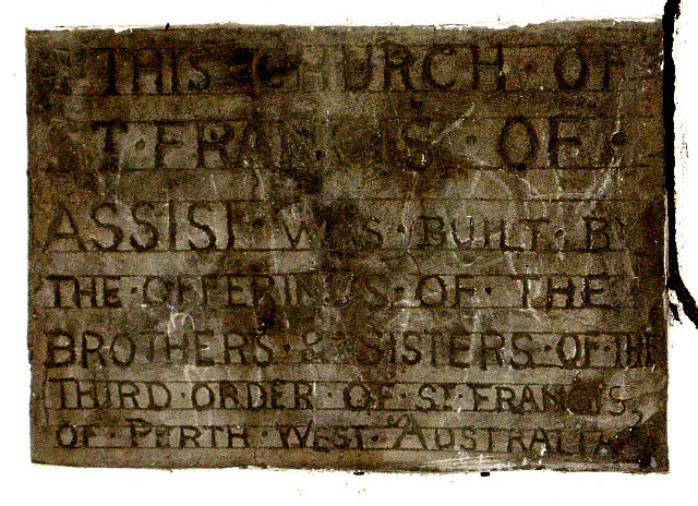
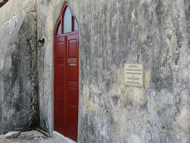
Wednesday, December 5th proved an opportunity for another terrific flat water sail back to the southern part of the island in the still present NE winds. The wind was forecast to veer to the ESE, so we wanted to position ourselves for that expected change. Our destination was the settlement of Old Bight in the large bay at the southern end of Cat called The Bight. The attractions here were two old churches: one Anglican church still in use and on the Bahamas National Register of Historic Resources for its role in the Emancipation Movement; and the ruins of St. Francis of Assisi Catholic church - one of Father Jerome's creations.
A short introduction of Father Jerome is needed here. Father Jerome – John Cecil Hawes – was born in England in 1876 and led a varied life. After completing an architecture education he became an Anglican Minister. A devastating hurricane in 1908 prompted the Anglican Bishop to send him to the Bahamas to restore damaged churches. His hurricane-proof restoration work can be seen in the seven Anglican churches restored on Long Island. Subsequently, he traveled elsewhere and it is written spent time as a wagon train driver, a monk, a missionary, and a horse breeder. In 1911 he traveled to Rome and studied three years to become a Catholic Priest, returning then to the Bahamas to build Catholic Churches and the St. Augustine Monastery in Nassau. Changing roles again he traveled to Australia to become a bush priest. In 1939 he received permission from the Bishop in Nassau to retire as a hermit on Cat Island.
Arriving at Old Bight we anchored in our guide's recommended spot – just off the beach at the Landing – and knew we had about a mile walk to “town.” What our guide didn't mention was that most of this walk was along a causeway that carried the road from town to the beach over a tidal mangrove swamp. Can you say “no-see-ums”?
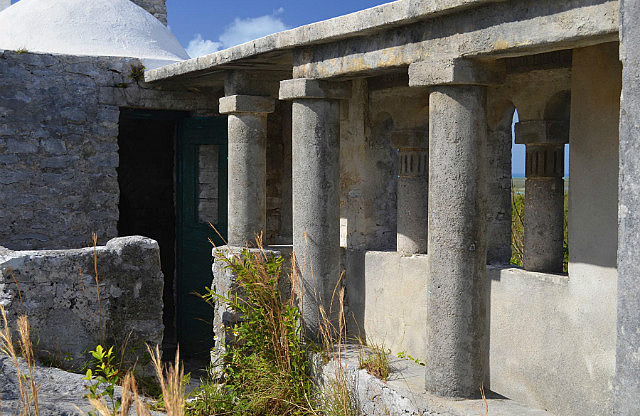
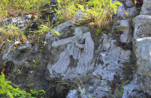
We found both churches and were saddened that Father Jerome's small church has not been preserved. If only for its architectural and historic significance this once impressive structure deserves more attention.
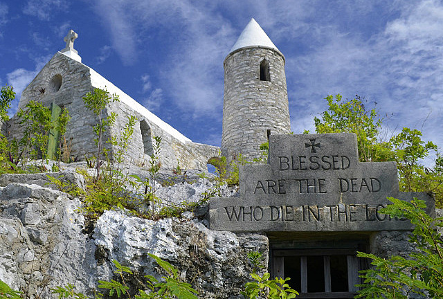
On Thursday, December 6 we motored the short distance from Old Bight to New Bight where we had two significant goals. One was to hike the short distance to the famed Mt. Alvernia, the highest point in the Bahamas, where we would find Father Jerome's final and perhaps most interesting architectural accomplishment, The Hermitage, where he lived out his life in solitude and which became his final resting place. Other than that, we wanted to stop by the local police station where we could ask some questions about extending our immigration visas with officials on the island.
Anchored off New Bight was a rare sight for us recently – another cruising boat. We exchanged waves of hello upon our arrival but otherwise had no contact with the other cruisers who were flying a French flag.
We decided first to take care of business as we would pass through town on the way to The Hermitage. Clearing in to the Bahamas upon arrival at Spanish Wells, we secured a year-long cruising permit, but our visitor visas were limited to 90 days. We had requested 6 month visas, but the immigration officer granted only the more typical 90-day stamp which could be extended when the time came by visiting with an immigration officer wherever we happened to be prior to its expiration. “No problem, mon.” Later, when researching our intended route through the islands, we discovered there were few immigration officers stationed on the out islands we intended to visit who could grant extensions. We needed to know exactly where and by whom an extension could most easily be granted when our first 90 days expired (we expected to be at Mayaguana or Crooked/Acklins islands in that time frame). Ideally, we hoped to get an immediate extension before departing Cat Island that would cover our expected total six month visit. Dave was not confident this would be easily solved and felt like he had grounded on a Bahamian bureaucratic reef.
The friendly police station staff directed us to the customs/immigration offices located both at the airport and Smith Bay Harbour – both within walking distance of Fernandez Bay. We knew these offices existed but hoped the police staff could answer the questions about the capabilities for extending a visa on other islands that could have precluded having to go back to Fernandez Bay. While the conversation implied that we may not be able to obtain an extension on Crooked/Acklins or Mayaguana, the recommendation was that we visit one of the suggested offices. Our plan then became to return to Fernandez Bay after visiting The Hermitage.
We had been looking forward to visiting The Hermitage. Already on our Father Jerome list of sites visited were the two impressive church structures located at Clarence Town, Long Island which we visited in early 2010 (see our TravelPod entries for that time period), as well as the church ruins we had just seen in Old Bight.
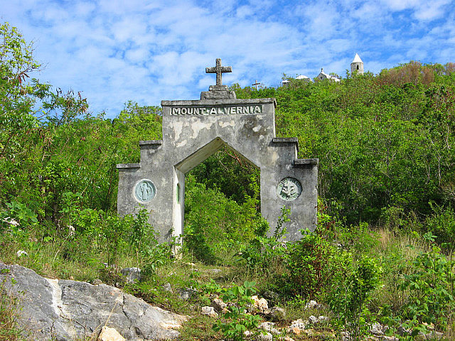
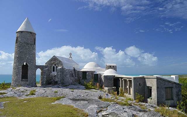
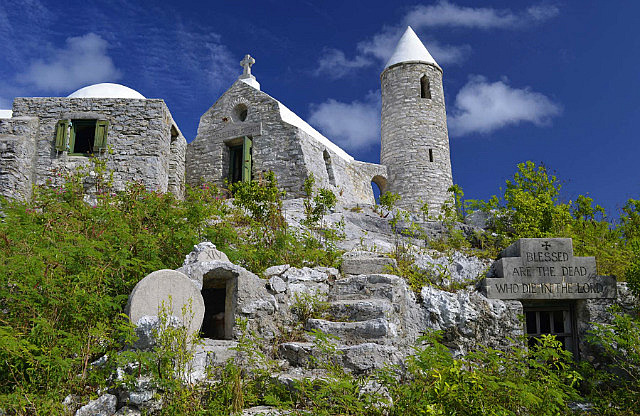
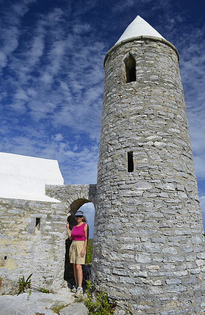
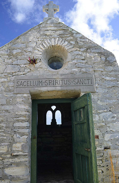
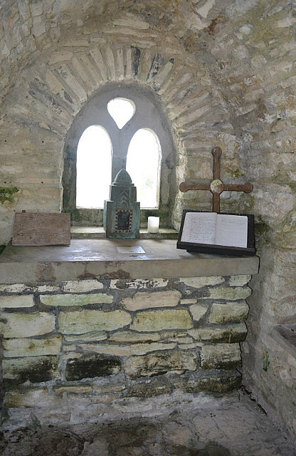
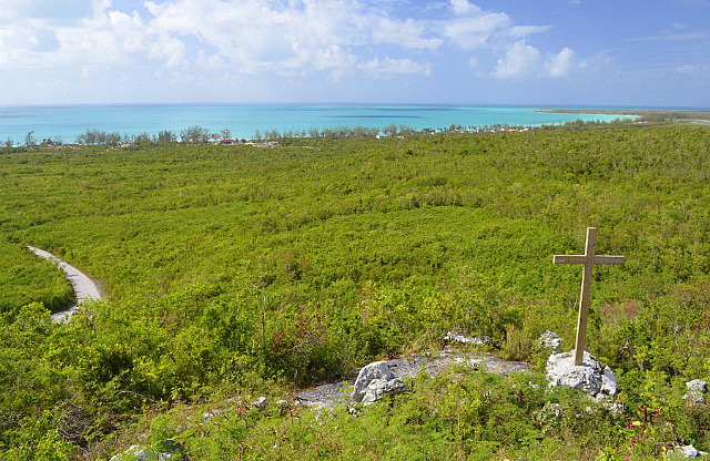
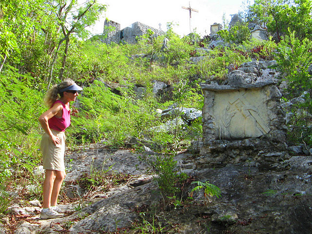
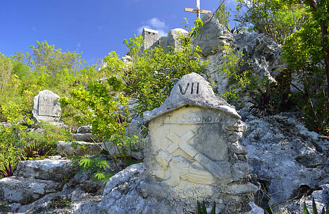
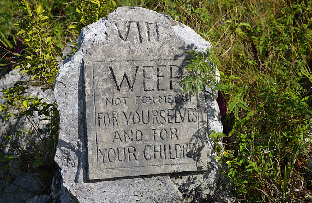
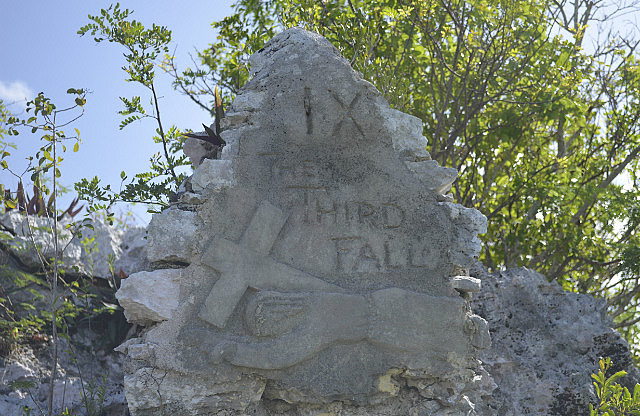
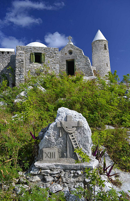
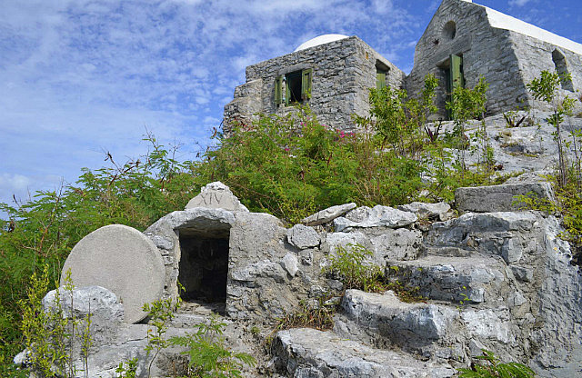
The site chosen by Father Jerome for The Hermitage was Como Hill, elevation 206 feet – the highest elevation in the Bahamas. Here he could see clearly in all directions, including the Atlantic to the east and the shallow bank waters to the west. Father Jerome renamed the peak Mt. Alvernia when he began construction of his “retirement home” in 1940. The structure is a miniature version of a European Franciscan Monastery.
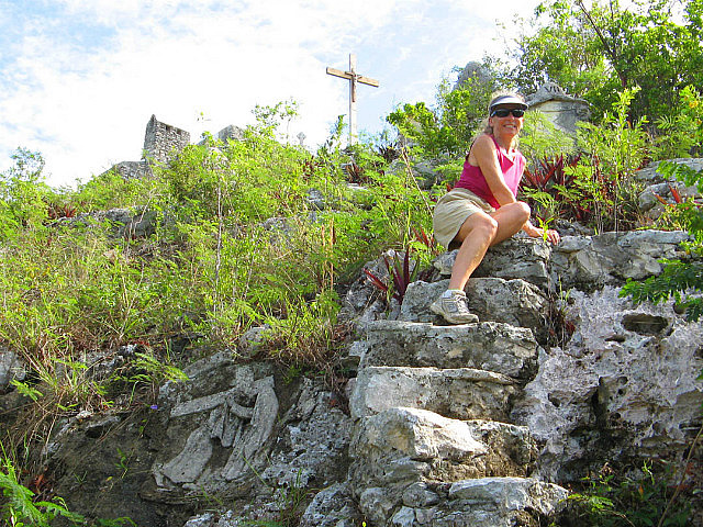
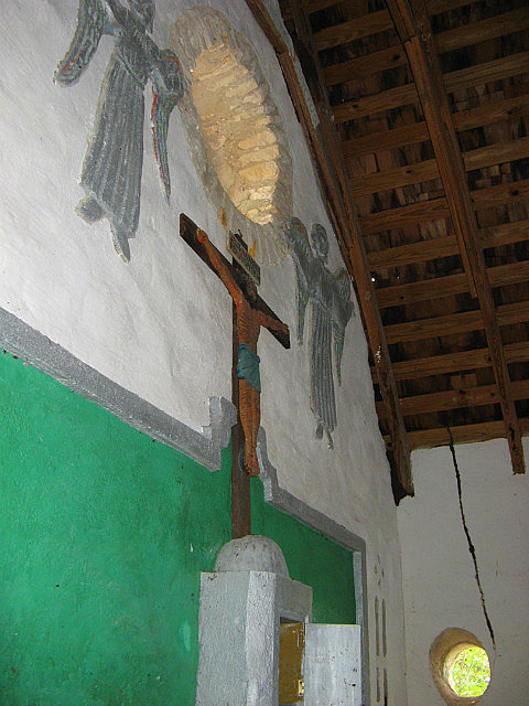
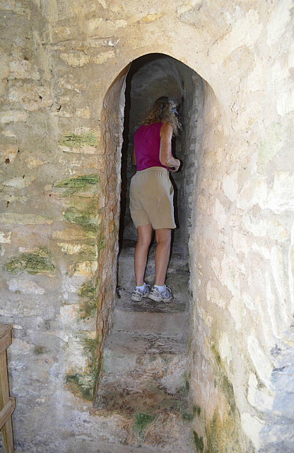
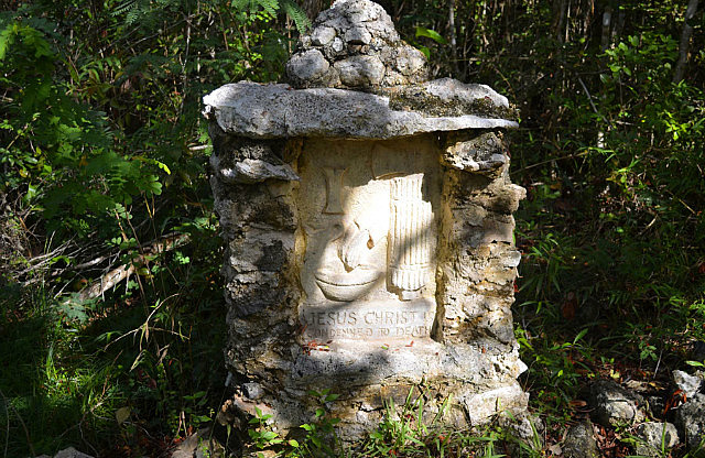
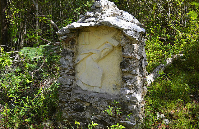
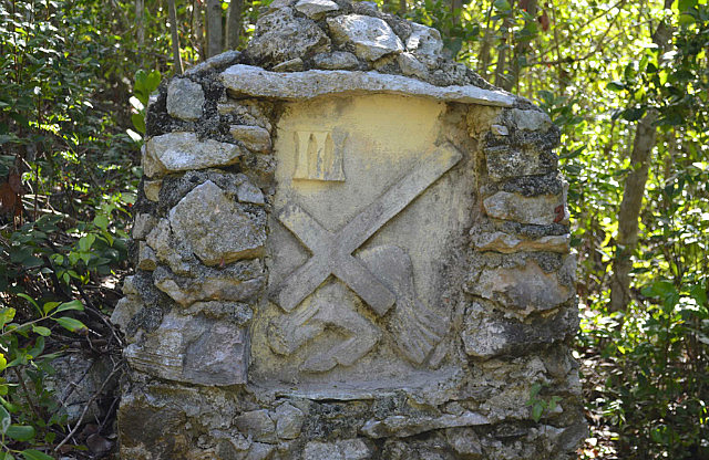
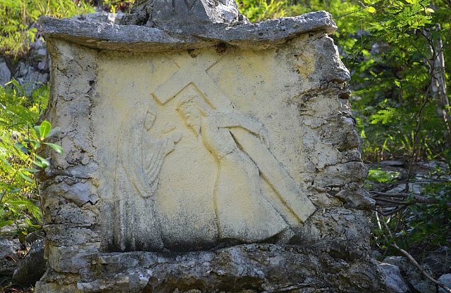
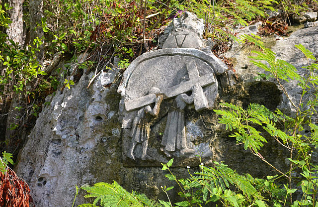
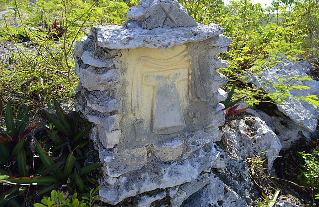
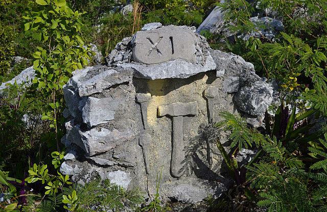
Father Jerome built the entire structure himself out of native stone and it's very fascinating and well worth a visit. The devotion to his faith is well illustrated by the hand built “Stations of the Cross” leading up the final, steep steps to the summit and The Hermitage itself.
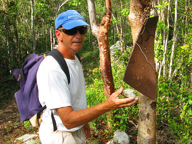
No doubt Father Jerome was a spry man to do that climbing. On our approach, we passed what could be said to be his “doorbell”, a large piece of scrap metal hung from a tree limb that a visitor would strike with a rock.
Father Jerome lived out his life as a hermit and was buried here upon his death at age 80 in 1956. Our pictures provide the best description of the details.
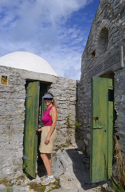
Note the smallish scale of the structure evident in scenes including one of us for perspective. Donna, at under 5 feet, quite firmly bumped her head entering a doorway. Inscriptions along the arcade walkway from his bedroom are his testimony to the wonderment he found in solitude. Fortunately, some care is evident for preserving this fascinating piece of history and exclamation point to the life of an interesting man.
Upon returning to the boat from our visit to The Hermitage we immediately departed New Bight to return to Fernandez Bay, a short distance north, to seek out the customs/immigration officers the next morning, before the arrival of the weekend.
Leap and the net will appear.
On Friday morning, December 7th, we set out for the customs/immigration office at the airport. This was a slightly shorter walk than to the office at Smith Bay Harbour in the opposite direction and we knew from cruising guides that the same staff managed the two locations. We first we had to decide where to land the dinghy along the beach of private resorts and homes, conscious of the poor relations widely reported between cruisers and the resorts in the past. Our guide books recommended we humbly ask for permission to come ashore. Short of making a satellite phone call to reach 100 yards, Donna was comfortable seeking that permission after we landed for a temporary 2-hour stay. At either resort or residences, there was very little activity ashore we could see – in fact, it was impossible to distinguish resort from residences. We landed next to what looked like a resort office and cautiously entered. A very nice woman with a seemingly American accent welcomed us and was surprised we even asked to park our dinghy - as she informed us we had actually entered a private residence. Ooops! But she brushed off our embarrassed apologies and cheerfully provided directions for our walk to the airport from drives leading behind the house. She told us we could also move the dinghy closer to the adjacent resort if we wished, confident that would not be a problem either, but we elected to keep it where we had already pulled it above the tide line. OK, this first part was easier than expected.
It was about a mile walk to the airport and we hoped a plane was due in today that would require the presence of an immigration officer there rather than in Smith Bay Harbour! Upon arriving we learned from the customs officials present at the time, of course, that the immigration officer we really needed to see was currently at the other location. Not to worry! One of the customs officers immediately led us outside to a van and he drove us to Smith Bay Harbour. There, the immigration officer immediately welcomed us into his office, listened intently to our problem, and extended our visas to May 30, 2013 on the spot! What great service! “Is there anything else I can help you with today?”
The courteous officer who drove us to Smith Bay Harbour was waiting patiently to drive us back, dropping us off at the entrance to Fernandez Bay on the route back to the airport. No problem, mon, indeed. What fine representatives of the Bahamas!
Mission accomplished, we were back on the boat and departing Fernandez Bay by noon, just as another cruising boat arrived. This was only the second cruising boat we'd seen at Cat Island. We headed north on SE winds of 15-20 to an anchorage at Bennetts Harbour, just north of Alligator Point. We arrived at our anchorage in a squall at 1545 and celebrated our successful day with cheeseburgers in paradise....
In the near term the weather forecast was for benign conditions to settle in so we set out to position ourselves at Port Royal near the north end of Cat to be able to explore the extensive reefs on the very northern tip of the island. Calm conditions are necessary at this junction of the Atlantic ocean and shallow bank waters. We could do this either by establishing a day anchorage at the north end and swimming from the boat or anchoring within dinghy distance and swimming from the dinghy or the beach.
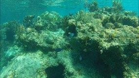
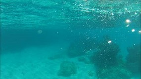
On December 8th, we departed Bennetts Harbour on this quest, anchoring just north of Orange Creek Point. We found conditions mild enough on December 10th to anchor the big boat within a mile of the northern tip, at Man O' War Point, near the mouth of a cave, taking the dinghy over the reefs to snorkel.
It was worth the effort. The water was clear and warm and the fish were plentiful. As has happened to us several times in the past, we were “stalked” by a large barracuda.
They have this unnerving curiosity about swimmers and follow you around. While they have never approached us closely, they can be intimidating!
Flexibility should not be construed as indecision.
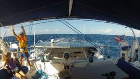
On December 11 and 12 we sailed upwind all the way back to the Bight at the south portion of the island, stopping again at Fernandez Bay for a night before arriving at anchorage off the settlement of McQueens. The sail from Port Royal to Fernandez Bay included seven tacks with first reefed main and full genoa – which we are proud to say we didn't screw up once. Tacking this beast with only two people is definitely a pas de deux.
While at McQueens we decided to next hop all the way to Mayaguana, a 20+ hour, overnight sail to the south east. This was based on forecast benign conditions there for several days, permitting exploration of its reefs. This was a significant change from our previous plan to next go to Long Island, just 32 miles south, and also changed our re-fueling plan. We had originally planned to top off our fuel tanks someplace on Long Island before setting off further out into the remote islands where fuel is hard to find. The solution to the fuel problem was close by at Hawks Nest Marina, within sight of where we were anchored at McQueens. So on Thursday morning, December 13th we motored to Hawks Nest Marina and topped off our diesel tanks. This took only 57.9 gallons, but cost $6.49/gallon. We also got 4.5 gallons of dinghy gasoline at $6.79/gallon. Maneuvering in the strong tidal current of Hawks Nest Creek to the fuel dock was quite a challenge – made more “sinister” by the numerous large sharks we saw swimming near and under the boat. We were too busy to take pictures. After fueling we anchored off Hawks Nest Point for the night in relative calm, planning to depart for Mayaguana the next morning.
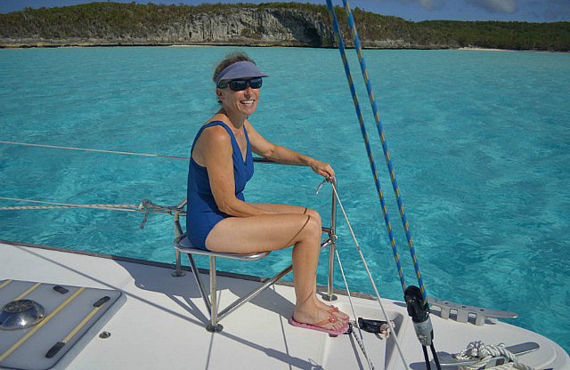
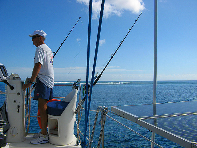
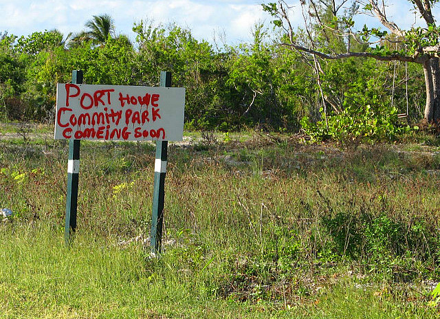
By 0630 on December 14th, Chris Parker's forecast wasn't quite as mild nor long-lived and we resorted back to the original plan to sail to Long Island, departing around 0830. But within 30 minutes the wind had not materialized enough to make that a fun viable option so we spontaneously changed our destination again to the very southeast tip of Cat Island to visit Reef Harbour at Port Howe. This was an uncharted anchorage we had learned of separately from a posting on Noonsite by a resident cruiser there, and we had kept the thought of checking it out in the back of our minds, as nothing was said of it as an anchorage in the cruising guides. The approximate 10nm route there took us along the coastal drop off to deep water and offered a terrific fishing opportunity. Despite trolling four lines and trying numerous different baits, however, we got no strikes.
All we had for entry instructions to Reef Harbour – it has that name for a reason - was a single, unsubstantiated (but likely based on charts) waypoint and directions to “turn right” after crossing the reef. Then proceed about “1/2 mile inside the reef to anchor in clear sand in 6 to 12 feet of water”. But we also had two sets of good reef-reading eyes and mid-day sun to show our way. The entry turned out to be easy – we can now vouch for the waypoint - and we found a good anchorage, but with some surge at high tide when too much ocean swell gets over the reef.
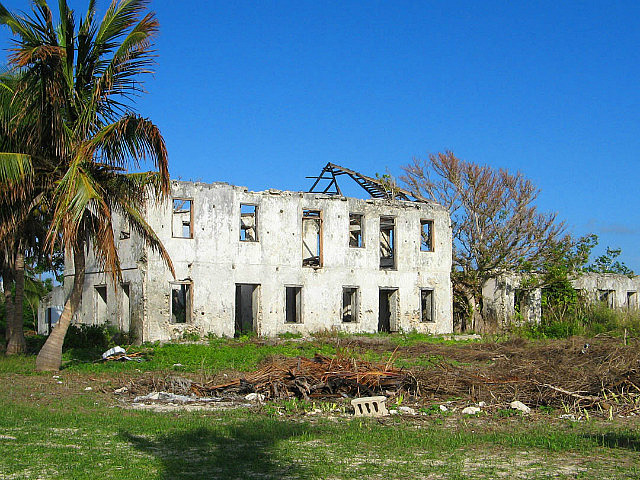
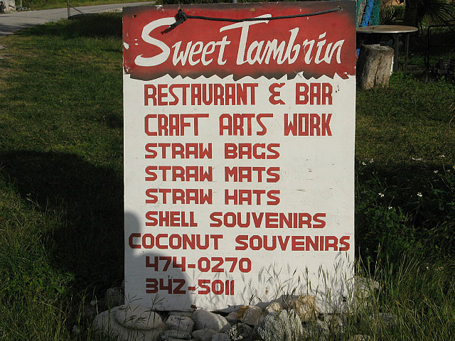
Going ashore in the dinghy was a challenge as we attempted this near low tide and the depths near shore are very shallow (if not dry). It's not often we've had to pick our way through shallows in the dinghy. But this was a pleasant time. We visited the ruins of the Andrew Deveaux Estate at the harbor, the former plantation home of the English Colonel who drove the Spanish from Nassau in 1783, now completely overgrown and (frankly) neglected. We walked through the town and spent a good deal of time chatting with locals associated with the Sweet Tamarin, a restaurant and bar with shelves dedicated to local straw work and home-made jellies for sale. The owner is Daisy Mae Hunter and, although she was away at the time, her sister Ena Babs Hunter showed us around, including to the hair salon, beauty aid and supply next door, Creative Hair Design and Boutique, where cousin and owner Debra Hunter described her services as well. Quite a trio of industrious women! As expected, they were all quite outgoing and friendly. We were also happy to find (after having walked already several miles in multiple directions) that the road precisely behind the Sweet Tamarin led to the very spot on the beach where we had left the dinghy, so we effectively had made a complete circle of the large part of the town.
The following day, December 15th we left the highly enjoyable Cat Island astern, bound for Long Island.
See several additional photos below!
Notes to cruisers: To enter Reef Harbour at Port Howe, set up a virtual range between reef entry waypoint 24*08.773 N /075*21.347 W and the single story house with a red roof on the beach ahead. This will result in a bearing of approximately 10* magnetic. In good light you'll see the reef opening, which is quite wide. Turn east after entering the lagoon, but favor the reef side. Shallows extend far from shore and should be well depicted on your charts. We observed a new moon tidal range of over three feet here. Along this course inward we always had at least 25' MLW. In minutes, however, you will find yourself in an expansive area of good holding sand where the depths will decrease to 12 ft and you will want to be thinking about where to anchor as you continue your approach in good light to avoid an occasional shallow coral head along the way. We anchored in 6 feet MLW on an expansive sand bottom near the private moorings directly off from “town” with the conspicuous ruins of the Deveaux Plantation and a concrete boat ramp nearby. But this places you only about 200 yards inside the outer reef and subject to swells at high tide (we had no wind-driven chop with less than 10 kts true wind during our stay). It might be slightly calmer to anchor a bit further west (not directly in front of town) and closer to the first of two private moorings you will readily see in this harbor. This would place you closer to the only place we would recommend taking a dinghy toward shore where a beachfront remains fairly accessible at low tide and near the road we described above, just to the west of a blue roofed stone house with carport (and probably lots of large fishing floats hanging from nearby trees). Above the crest of the beach, the road will lead to a mustard colored house (it has an adjacent patio with a green thatched roof) just northwest of the beach stone house. Do not expect to anchor very close in. This anchorage should be very good in a norther.
Cruising Cat Island, Bahamas
Monday, December 03, 2012
 Cat Island, Out Islands, Bahamas

Other Entries
-
Nov 1617 days prior Eleuthera, Bahamas
 -
Nov 285 days prior
Little San Salvador Island (Half Moon Cay), Bahamas -
Dec 03
Cat Island, Bahamas -
Dec 1512 days later
Long Island, Bahamas -
Dec 2825 days later
Acklins Island, Bahamas -
Feb 0665 days later
Samana Cay, Bahamas -
Feb 1271 days later
San Salvador, Bahamas -
Feb 1877 days later
Conception Island, Bahamas -
Feb 2584 days later
Rock Sound, Bahamas -
May 13161 days later
Marsh Harbour, Bahamas -
May 19167 days later Norfolk, United States
 -
Dec 24751 days later
Drayden, United States -
Dec 151473 days later
Abraham’s Bay, Bahamas -
Jan 251514 days later
Great Exuma, Bahamas -
Feb 101530 days later
Sampson Cay, Bahamas -
Feb 271547 days later
Andros, Bahamas -
Mar 121560 days later
Marsh Harbour, Bahamas -
Apr 081587 days later
Marsh Harbour, Bahamas -
Apr 261605 days later
Marsh Harbour, Bahamas -
Jun 041644 days later
Marsh Harbour, Bahamas


2025-05-23