We arrived in the Vosges mountains after a long drive from Verdun. After a stop at the Tourist Info to pick up some brochures on the area and a hiking guide, we settled in to a pretty little campsite right on the lake. We had a look through the hiking guide which listed 13 different hikes we could do in the area. There are tons more, but the Vosges hiking club put together instructions with a copy of the IGN hiking map for each one. The trail markings here are incredible – each trail has a colour and symbol associated with it so you know which path to take as you reach a fork. It also helps having the instructions on where to park and where to find the trailhead in the little guide. They also tell you which path you should be taking when you reach a fork and when the symbol you are following changes if you are doing a longer hike. We picked a hike to do the next morning to see how their rating system compares to the one at home and read up on some info from the brochures.
Aug 14
The next day, we drove to the trailhead of our first hike. We set off from a tiny town called Le Valtin, about 10 km from our campsite. The hike we chose was a level 2 (the guide we were using rated hikes from Level 1-3), 6.5 km hike up to a viewpoint and around the valley with a total elevation gain of 350 m. We parked near the mairie (town hall) and set off along the road until we joined up with our trail.
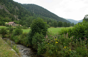
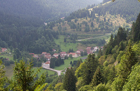
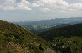
We wandered happily along the road for about 2 km at which point we looked at Anoop's GPS watch and realized we had missed our marker somewhere about 1 km back. So we turned around, as did the French couple who were walking behind us and looked more closely for signs. Sure enough, on the side of a building, somewhat above eye level was our red circle pointing us off the road and onto the trail. We crossed back over the road and began the ascent. It was definitely a steep climb on a very narrow path so you had to be careful where you were walking. The path was covered in rocks of all sizes and lots of tree roots sticking out of the ground so you definitely needed to pay attention. After a while, we arrived at a beautiful view over the valley; we continued climbing and came to an even better view from a huge rock over the town below and the valley to the right.
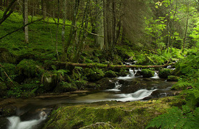
We thought this would be a good place to stop for lunch and enjoyed our egg salad sandwich on a baguette. We continued climbing a bit more and then descended almost back to the town. At this point, we took another path up to see the town from the other side. We climbed up along the path where the cows are brought back to town being careful to avoid stinging nettles which seem to be everywhere. After crossing a stream, we arrived at an info panel explaining how the glacier carved out the valley below. Further along, we met the cows whose pasture we were tromping through and passed back out the other side of the gate. We walked around to a small ski hill with 3 runs and 3 t-bar style lifts which we didn’t think would be much fun on a snowboard. We then wandered along a really pretty little stream through the woods and back to our starting point.
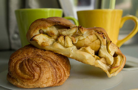
We decided that the rating system corresponded pretty much the same to the one at home and thought perhaps that the level 3 hikes might be a bit beyond us as it was only our first hike of the year. We didn’t feel like heading out again in the afternoon, so we went back to camp to relax, have a cup of tea with our pain au chocolat and check some emails.
Aug 15
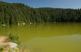
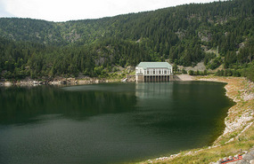
On Wednesday, we decided that we might not be up for the level 3, 14.5 km hike (with a 650 m elevation gain) to the four lakes that we had both picked as a top choice to do. So we decided to drive to the first lake and hike in and then come back and drive to the next one. Once we got to the parking lot, we decided to take some snacks and lunch stuff with us in case we decided to do a slightly longer loop. We started off on the hike down to Lac Vert (green lake) along a small road with lots of rocks and roots. We had decided to wear our hiking shoes rather than runners this time and were quite surprised to see a lady behind us in sandals with not even a heel strap, picking her way among the rocks. It reminded us of all the ill-prepared tourists we often see at home heading up the Grouse Grind! We got down to the bottom for a great view of the lake surrounded by trees.
We decided to continue on the hiking route towards Lac des Truites (Trout Lake) or Lac du Forlet as it seemed to have two names. We climbed up through another cow pasture to an auberge (inn) where we stopped for a brief break. This auberge is maintained by the Vosges hiking club and they provide washrooms, small snacks & picnic tables for you to enjoy your lunch. They only ask that you buy a drink from them if you are using their tables to help maintain the facility. Everything was very reasonably priced, but as we’d only been walking for about 30 minutes, decided we weren’t quite ready to stop yet. We continued on a fairly wide, not too difficult path towards the next lake.
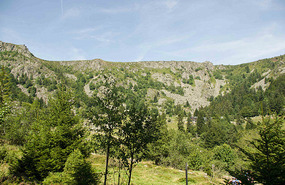
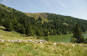
The view when you came out of the forest into the little valley was just stunning. In front was the lake were lots of people enjoying their lunch on the banks and having a swim. There was another auberge where we refilled our water and you could have lunch and drinks if you wanted to. Up to the left were amazing cliffs with people way up top looking down. To the right was a beautiful hill with pine trees, heather and other assorted wildflowers.
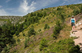
As we admired the view, we noticed the path snaking its way up the hillside and decided it was a good thing there were a few pockets of trees as it was at least 26 degrees out and we were starting to get quite hot! As we started to climb, the grazing cows came into view with their enormous bells that sound like wind-chimes when they are all moving. We decided it was better to be on the path which was not as steep as the cow pasture, although they seemed to be moving up it without too much difficulty! About 40 minutes later with stops for shade and pictures the whole way up (every turn seemed to have another beautiful view!) we finally made it to the top. The path itself wasn’t as steep or narrow as the path the day before, but it was quite long and hot, especially once the trees disappeared!
We met tons of hikers out enjoying the day, many carrying babies or helping smaller kids down the slope. There are a lot more kids out hiking here than at home.
Once we got to the top we had to decide if we wanted to continue along the plateau back to the car or continue on to the next two lakes. Taking the Bennie method (at least Mom & Braed’s method as I can’t speak for Rob & Janet) of cycle tour training to heart and applying it to hiking, we decided to keep going. We had lots of daylight left and decided we could just go slowly if it got really tough. The Bennie method is to not actually train at all before leaving on your trip, but just leap into it wholeheartedly and go slower or not as far until you are in better shape. Our guide book said that the next section would be a long and difficult descent until the next lake. We descended among rocks and roots for about 45 minutes not including our short stop for lunch. It was not as difficult as we had imagined, but my knees were starting to feel it by the time we got to the bottom and we were glad that it hadn’t been a steep descent! The Lac Noir (black lake) was not as fabulous as the two previous lakes, but we enjoyed the view nonetheless.
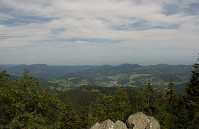
We then headed back up hill for an hour until we reached the observation point near the top. Again, the climbing was on a wide path, but the patches without shade were really hot – we climbed from shade patch to shade patch and made sure not to take breaks in the sun! As we were heading up in silence (saving conversation for shady breaks) and thanking our backpacks for having hip buckles to take the weight off our shoulders, a group came up behind us with a man in the lead. He was chatting away quite contentedly with his backpack slung over one shoulder and camera in hand. We decided he must be a local and / or avid hiker, definitely not on his second hike of the year! The observation point had a great view towards Alsace which Anoop was in charge of capturing as I am not a fan of getting too close to the edge when we are up high!
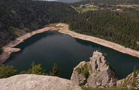
A short while later we arrived at the viewpoint over Lac Blanc (white lake). We were up quite high above the lake and had a great view looking down from the rocks above.
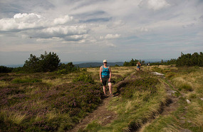
We then continued up to the plateau walking among blueberry bushes, lots of heather and other assorted wildflowers.
There were very few trees so we were glad that it was later in the evening and not so hot out. After a short while we reached the edge of the plateau where we had seen people looking down earlier in the day from when we passed by Lac des Truites! We had a magnificent view and were able to see the path snaking up the hillside where we had climbed earlier along with the cows that were now making their way back down the hill. Amazingly, you could still hear their bells even though we were so far away!
We continued on along the ridge for a few more kms before reaching our van. I really loved the plateau part of the walk; it was nice to end with an easy walk, the scenery is so different from at home and the views were unbelievable!
Aug 16
We had decided to relax in camp in the morning, have a proper cup of tea and later have a swim at the lake since we had missed out both previous days. However, after the downpour in the night it was quite cool and still very cloudy – not at all inviting for a swim. Anoop decided to use the morning to get in a ride up the Col de la Schlucht in preparation for when Dad and Tan arrive while I enjoyed not one, but two cups of tea while relaxing in camp. The climb was 8 km at about 4% grade (total elevation gain of about 420 m with the peak at 1132m), with about a 5km ride to the base of the hill. Before leaving, we decided that I would meet him at the top in about 2 hours since he wasn’t sure how long it would take him. Anoop made it to the top in about 40 minutes and felt good, so instead of waiting for a pickup, he rode back down and into camp. He said that the ride up in the morning was quite neat because as he gained elevation, he was riding in and out of the fog and to his right, he could look back down on the lake and campsite. When he made it to the Roche du Diable, he realized that it was only 2 km more to the top and so he picked up the pace.
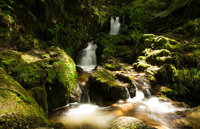
He was quite pleased that he’d made it to the top and now he feels he at least has some hope of making it up Alpe d’Huez which is about twice as steep and longer. Once he got back to camp, we did dishes and laundry and then decided to ride over to Lac Retournemer, a few kms down the road. We went for a walk around the lake and up to a small cascading waterfall that was very pretty.
Then we cycled back to camp for lunch. Afterwards, we drove into Gérardmer to have a look around.
We stopped off to pick up groceries and since it was so hot out we decided to treat ourselves to a magnum. If you’ve never had a magnum, it is like a haagen daaz ice cream bar, but with better chocolate and ice cream, at least in my opinion. The tourist shops sell them for about €2.30 each; at the supermarket, you can get a box of 4 for €2.95. So there isn’t really any point in getting them from the little stores – and being as we are thinking about the budget after all, the box of 4 was the way to go. Now this is definitely not something you can do on a regular basis, but as a treat on a particularly hot day after a long hike the day before, it is not too difficult to justify it to yourself! We had indulged in this treat on our previous trip as well when they came in boxes of 3 so we were pleased to see that they now come in boxes of 4 – much easier to divide in two!
Gérardmer is a big centre for household linens and every major name in linens here seemed to have an outlet store. We popped into the Jacquard outlet to poke around, but soon left as it was way too crowded for my liking. Every store had piles of linens in front of them, some with touristy embroidery, some decorative and some plain. We continued window shopping for a while and then decided to head back to camp to cool down. It is amazing how as soon as we headed away from town, the temperature dropped by several degrees. By then time we got back to camp, about 10 minutes later, we had cooled down enough to be able to function again. As it was our last night in the campsite, we took advantage of their internet and power plugs to get a bit more caught up on computer stuff and then headed to their take out area to grab a crêpe (courtesy of the campsite) and some fries to snack on before dinner.
Next, we are heading off along the Route des Crêtes which follows the crater tops through the mountains with stops at the various viewpoints along the way!
Hiking in the Vosges
Thursday, August 16, 2012
 Xonrupt-Longemer, Lorraine, France
Other Entries
-
1House on Wheels - here we come Europa!
Jul 0938 days prior Vancouver, Canadaphoto_camera8videocam 0comment 5
 -
2The journey begins in London
Aug 0313 days prior London, United Kingdomphoto_camera7videocam 0comment 4
 -
3Olympics fun
Aug 0412 days prior London, United Kingdomphoto_camera15videocam 0comment 12
 -
4Olympics Fun Day 2
Aug 0511 days prior London, United Kingdomphoto_camera15videocam 0comment 7
 -
5Picking up the van and off to Dover
Aug 079 days prior Dover, United Kingdomphoto_camera15videocam 0comment 9
 -
6Rough Itinerary
Aug 079 days prior Arques, Francephoto_camera0videocam 0comment 6
 -
7Arques Glass Factory
Aug 097 days prior Arques, Francephoto_camera7videocam 0comment 4
 -
8Champagne!
Aug 115 days prior Épernay, Francephoto_camera61videocam 0comment 9
 -
9Verdun
Aug 133 days prior Verdun, Francephoto_camera35videocam 0comment 4
 -
10Hiking in the Vosges
Aug 16 Xonrupt-Longemer, Francephoto_camera41videocam 1comment 9
 -
11Grand vues from the Route des Crêtes
Aug 193 days later Ramonchamp, Francephoto_camera63videocam 1comment 7
 -
12Stork sighting at the écomusée
Aug 204 days later Ungersheim, Francephoto_camera43videocam 0comment 7
 -
13Colmar
Aug 215 days later Colmar, Francephoto_camera48videocam 0comment 2
 -
14Cute towns and Villages Fleuris
Aug 226 days later Eguisheim, Francephoto_camera30videocam 0comment 1
 -
15Wine & Grape tasting in Riquewihr
Aug 237 days later Riquewihr, Francephoto_camera30videocam 0comment 2
 -
16Haut Koenigsbourg
Aug 248 days later Chateau Du Haut Koenigsbourg, Francephoto_camera36videocam 0comment 7
 -
17Fountains and Lights in Strasbourg
Aug 2610 days later Strasbourg, Francephoto_camera71videocam 2comment 3
 -
18Clocks and Cakes
Aug 2812 days later Furtwangen, Germanyphoto_camera14videocam 0comment 4
 -
19Off to Switzerland
Aug 2812 days later Schaffhausen, Switzerlandphoto_camera9videocam 0comment 1
 -
20Barfussweg
Aug 2913 days later Appenzell, Switzerlandphoto_camera29videocam 0comment 5
 -
21When the cows come marching in...Alpabfahrt!
Aug 3014 days later Appenzell, Switzerlandphoto_camera25videocam 1comment 5
 -
22A crash course in Appenzeller history and culture
Aug 3115 days later Appenzell, Switzerlandphoto_camera43videocam 5comment 1
 -
23Stamp Stop in Liechtenstein
Sep 0116 days later Vaduz, Liechtensteinphoto_camera22videocam 1comment 4
 -
24Lucerne
Sep 0217 days later Lucerne, Switzerlandphoto_camera55videocam 0comment 3
 -
25Bears in Bern
Sep 0318 days later Bern, Switzerlandphoto_camera36videocam 0comment 0
 -
26Murten
Sep 0419 days later Murten, Switzerlandphoto_camera16videocam 0comment 1
 -
27Cailler Chocolate Factory
Sep 0419 days later Broc, Switzerlandphoto_camera30videocam 3comment 2
 -
28Gruyère production
Sep 0520 days later Gruyères, Switzerlandphoto_camera54videocam 6comment 3
Comments
2025-05-22
Comment code: Ask author if the code is blank

 Xonrupt-Longemer, Lorraine, France


mom
2012-08-26
Glad to see the Bennie Training Regime is working beautifully. It had a few glitches for Braed and I, due to faulty map reading on his part, I am sure. Love the Vosges. Not sure I would be sitting so close to the boule game with open toed sandals, though.
Wendy
2012-08-26
There are some really nice pictures in this entry.
megs-anoop
2012-08-31
Hey Rob! I concur completely with your comment. In fact, I plan on employing the" Bennie Training Method" (TM), patent pending - or BTM for short before the Alpe d'Huez (maybe sans Magnum bars though until I get to the top ;)
megs-anoop
2012-08-31
@Sheahan, I like BTM (Bennie Training Regime) better than Bennie Training Method. Regime sounds so much more rigorous and disciplined - it'll sell better on the late-night shopping channel, of course, in partnership with Magnum.
Those boules players have no concern for safety - it's all about the game ;) !
Priya
2012-10-09
The pictures are beautiful and your trip is amazing !!
Minh-yen
2012-12-07
I love this entry! Wes and I met a Hungarian couple, while we were in Burma, who were honeymooning around the world....on their bikes!!! Your comment about budgeting and ice cream made me think of this Hungarian couple. At that time, they were almost 2 years into their biking adventure. Budgeting their meals was a VERY big thing. They were trying to average $5 a day per person for all meals while in Burma....AND here you both are contemplating buying the almost 3 euro ice cream bars. lol, what a contrast. Ahh the life of travelers!