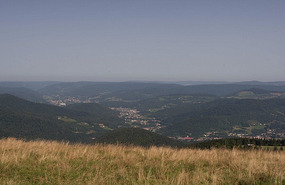
On the drive up to the Grand Ballon, we stopped at 2-star Michelin site (according to our Michelin road atlas) called "Le Hohneck". It is on the site of the old Franco-German border and the summit stands at 1362m. It's another fabulous (I'm running out of adjectives to describe all the sites!) viewpoint and hiking area on the Route des Crêtes.
We saw lots of cyclists making their way up the mountain but more interesting was a group of cross country skiers on what I guess one could call their "summer skis" (see photo below). We parked on the road and walked about 20 minutes to the viewpoint - which was hardly anything compared to some of the previous hikes where we’ve had to work hard for our views. It took us quite a while to walk around and take in the panorama surrounding us. Once we were done there, we hopped back in the van and continued driving along the Route des Crêtes to the Grand Ballon. This route is a twisty, narrow road along the Vosges mountains that offers sweeping views the whole way along of lush valleys and hillsides often dotted with grazing cows. We pulled over for lunch at Le Markheim (a popular hand gliding and parasailing launch point). We sat down at a bench with our cheeses and baguette and watched them gliding above us. We tried a new cheese that day (mild, soft cheese made from cow’s milk) that we both really liked called “Tomme des Vosges”.
The Grand Ballon is the highest point in the Vosges at 1424 m. I had originally thought the Grand Ballon was just a viewpoint that you pull over at and take a few photos of (I should have known better because almost none of the sites in France have been like this). I had imagined that it would have an orientation table and that we’d be spending about half an hour at it. Turns out it’s a national park with walking trails all around it and we ended up being there for nearly three hours! We did the longer panaromic route (there was a short one but we decided since we didn’t have anywhere to be right after, might as well see as much as we can).
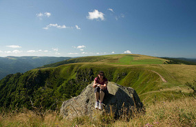
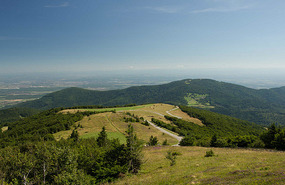
I’m glad we did the long route because we got some stunning views and there was lots of fireweed and wildflowers (with butterflies flying amongst them) to add color to the foreground – not to mention that there were hardly any people on some of the trails so sometimes it felt like you were all alone there. It wasn’t a tough hike to the top but it was definitely warm out in the sun. We didn’t notice it though since the views at every turn were so amazing - it was hazy out but we could still see as far out as Mont Blanc!
Once we reached the top, there was a monument in memory of the alpine hunters who fought and died in World War I. There is also a radar station at the top which is in the shape of big beach ball – I thought this was why the site had gotten its name but it turns out that was only constructed in the late 1990’s. Perhaps the name characterizes the rounded shape of the Vosges mountain peaks. Wrong on both counts - it turns out, the name Ballon is derived from Bel or Baal, the sun god of the Celts (we learned this piece of trivia in out handy little brochure that explained the fauna/flora and history of the Grand Ballon). We climbed up to the viewing platform that is integrated into the radar station. We got a 360-degree view of the surroundings as you walked around the platform.
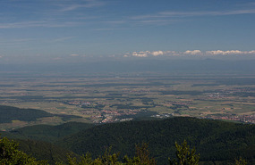
On each of the four sides, there is a large orientation table and it was just clear enough to be able to see all the way to the Jungfrau in Switzerland and Mont Blanc. As we took in the views from the different sides, the one constant was the pleasant ringing of cow-bells emanating from the surrounding hills.
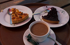
Once we’d made our way around the radar station and checked out all the vantage points (I had to make sure we’d got the best views and photo opportunities), we made our way back down the mountain to the info centre and parking lot where we’d left the van. This is also where the Club Vosgien runs a hotel and restaurant. Before we had walked up to the Ballon, we had seen a sign out saying “Tarte Myrtille – only 2.50 Euro”. We thought that was a very reasonable price and I had been wanting to try something regional (given that Myrtille, or wild blueberry, was in season, I thought this would be very fitting). So having done our several hour exploration of the area, we sat down at the outside tables of the Grand Hotel. The hotel, which is at the parking area of the Grand Ballon, still has impressive viewpoints. I found a table that looked away from the parking lot and over the surrounding mountains. It also happened to be right by the mini bob sled run which many kids were enjoying. Megs went in to order while I held the table. She soon came back out with a tray of goodies- a tarte myrtille, a café au lait (first one of the trip!), and an apricot pie.
We sat down in the shade of the table umbrella, looking out over the green mountain slopes and enjoyed our pies as we sipped our coffee. I quite enjoyed the blueberry tart and it was definitely something I’d get again. The sit down at the hotel was very relaxing and was a very fitting and satisfactory end to a great day of hiking and stunning views.
We then continued along the route des crêtes with more views of the valleys below, picturesque “ferme auberges” with cows grazing lazily on the lush green grass. We thought we were done for the day but along the way, came across Vieil Armand. The French gave this name to the sites of one of the bloodiest battles on the Alsace front. We hadn’t planned on seeing it but thought that since we were already there, we might as well check it out. What we thought would be a short stop turned out to be a two hour pit stop. It was a really interesting site from WWI that is teeming with trenches, underground passages, shelters and barbed wire – reminding us of the fighting and giving visitors a glimpse of what it would have been like during 1914-1918. We walked through the cemetery and up to the memorial – the whole time walking alongside all the trenches.
The forested area all around us was filled with craters, similar to what we had seen at Verdun. At one point along our war, there was a sign that showed the German line and the French line – they were barely 30 meters apart! The final viewpoint at the end of the walking path shows you one of the reasons why it was such a strategic and important hill to have command of – you would have had an obstructed view in all directions of approaching armies.
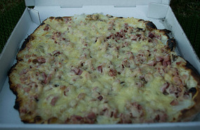
We finally made it into our campsite in Ramonchamp around 8pm. The campsite was a small one and nearly all the campers (which seemed like they were permanent fixtures) were all chatting and having drinks at one of the sites. On the way into camp, my keen food-spotting eyes had seen a roadside pizza stand just a little ways from the campsite. We were too tired to cook so I went on bike and ordered the pizza “forestière”.
Turns out it was a wood fired oven and there were at least fifteen different pizza choices on the menu! Many had cheeses that I was unsure of (or had a goat cheese) which ruled it out as an option. Megs was not there to translate so I had to guess at some of the ingredients (e.g. anchois = anchovies and origan = oregano; turns out I was correct on both counts). The guy took out his fresh homemade dough, put on a generous amount of toppings and then fired the pizza (about 12”) into the oven. I paid the Euro 8.70 for the pizza which I thought was quite reasonable compared to Vancouver for a wood fired pizza (even frozen pizza can run upwards of $10). The pizza was absolutely delicious and hit the spot after a long day of hiking and driving.
Aug 18
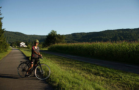
Today will be a short day to write about – I can sum it up in two words: “We perspired”. It was 35 degrees in the shade and we were pretty much too overheated to move far. We attempted a bike ride into Thillot since it was only 2 km away and even that was too much in the heat. We picked up some brochures at the Tourist Info (I asked if there were any swimming spots nearby and unfortunately there weren’t!), picked up some bread and headed back to camp. We just lay outside on towels, moving from shady spot to shady spot, waiting for even the slightest breeze. For lunch, I tried a new type of cheese which we had picked up a few days earlier in the Vosges. Munster is a creamy cheese, similar in texture to Brie, but way stinkier. The rind has a very strong flavour but the cheese itself was quite mild. By around 6pm, we figured it had cooled down enough (it was still about 25 degrees out) to attempt a longer bike ride. I was determined to go for a ride since one of the reasons we had camped at this particular location was because it was along the riding path, “Voie Verte”.
The voie verte is a designated paved lane away from the main road for cycling, rollerblading, running and in winter, skiing. There is a large network throughout France with more being built all the time. We rode along the designated path for about an hour and a half, enjoying the scenery and trying not to swallow too many bugs. The path wound its way between the small towns, going through mostly corn fields. It was a nice flat cycling path but I was having issues with the gear shifting on my bike and it was still fairly hot out so we decided to turn back towards camp after about a 45 minute ride out.
Aug 19
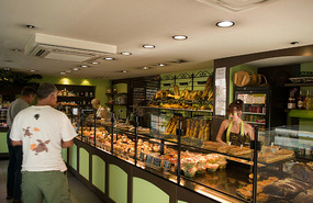
We left camp around 9:30 am and we were at the Ballon d’Alsace by 10ish (it was a short drive from camp). It turns out that yesterday’s bike ride at mid-day, even though it was short-lived, had not been unfruitful. Megs had dashed into a bakery just before noon (almost all the small stores – and even some large chains – close from noon to 2pm in France) to pick up a baguette. She had thought the bakery was definitely one that I would appreciate and so before we passed through Le Thillot on the way to the Ballon, we stopped at the boulangerie/patisserie that Megs had said I was sure to like. I was excited to finally go into a “real” boulange (real by my definition being one with that has that French finesse for making even their bakeries an exciting place to visit by treating their pastry and bread as works of art).
Take a look at the photos and hopefully you’ll agree with me. Needless to say, I couldn’t restrain myself and came out with three treats! Oh well, we were going hiking that morning and I hadn’t had a very filling breakfast.
It was a steep climb to the parking lot and we saw lots of riders along the way – this would’ve been a good warm up for the alpe d’huez ride but oh well, I was going to the top the easy way this time (and plus my bike was still making all sorts of funny noises that needed to be fixed first). We stopped by the TI (as we almost always do) to see what was of interest in the surrounding area. We picked up a really informative, full color hiking guide for the hike we wanted to do (“La Balade des Points de Vue” – Walk of viewpoints) around the Ballon for a whopping 1 Euro (they really do encourage tourism here in France!). We liked viewpoints and it was only 2 hours long so we decided to go for it. Turns out that all the viewpoints were within the first 40 mins and the remaining 80 minutes we spent descending down to tiny lake that was cute, but definitely not worth the 425 m elevation gain that awaited us in the sweltering heat. It actually would’ve been a decent hike overall if it wasn’t for the heat.
Anyhow, I’ll only describe the first part of the hike as it had worthwhile viewpoints. It started with a short climb from the parking lot to the summit of the Ballon d’Alsace itself. It culminates at an altitude of 1247 meters at the point where the three regions of the France-Comté, Alsace and Lorraine meet. As I mentioned earlier, the term Ballon is derived from the name of Celtic sun god. From the Ballon d’Alsace, you can see the sun rise directly above three mountain peaks at various equinoxes (as far as the Black Forest in Germany, the Swiss Jura mountains, and the Petit Ballon). It is thus believed that the Celts used the summit as a solar observatory. The path to the summit follows the old Franco-German border of 1871.
At the top is a statue of Joan of Arc. When it was inaugurated in 1909, it looked out towards Lorraine, but was turned to face east when Alsace became French once again at the end of WWI. Having taken in the magnificent views from the top of the Vosges valleys and mountains, we made our way back down, descending all the way down to a tiny little lake and then all the way back up to parking lot. There is a monument at the parking dedicated to all the 3200 volunteers and 30,000 prisoners of war that helped in disarming mines that littered the Vosges region. The cleanup began in 1945 and ended in 1947. More than 12,000 mines were destroyed/disarmed and 600 volunteers/POWs died during the cleanup. Once again, it was hard to imagine such a serene place littered with such destructive machinery.
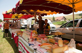
By the time we got back, it was mid-day and a fête was in full swing at the grassy park next to where we had parked. There were lots of people milling about now and we strolled around from stall to stall and sampled various goodies from local producers.
We ended up buying a pretzel and a new cheese from a local farmer, called Tomme Fermière d’Ortie (a soft, farm-made, cheese with a consistency similar to German Butter cheese. It has herbs and it tastes great by itself or with bread).
Having explored the Ballon d’Alsace, we made our way to our next campsite. Since it was still in the mid-thirties, we decide to find a campsite with access to a swimming area. We found a great little campsite in Masevaux that was right next to the community pool. The pool was packed with people of all ages who had the same idea as we did but we didn’t care. We spent the next few hours between cooling off in the pool and lying out on the grass reading our books. As we enjoyed our downtime from sightseeing, we both agreed that we needed to take the time to just “do nothing” a bit more often.
Grand vues from the Route des Crêtes
Sunday, August 19, 2012
 Ramonchamp, Lorraine, France
Other Entries
-
1House on Wheels - here we come Europa!
Jul 0941 days prior Vancouver, Canadaphoto_camera8videocam 0comment 5
 -
2The journey begins in London
Aug 0316 days prior London, United Kingdomphoto_camera7videocam 0comment 4
 -
3Olympics fun
Aug 0415 days prior London, United Kingdomphoto_camera15videocam 0comment 12
 -
4Olympics Fun Day 2
Aug 0514 days prior London, United Kingdomphoto_camera15videocam 0comment 7
 -
5Picking up the van and off to Dover
Aug 0712 days prior Dover, United Kingdomphoto_camera15videocam 0comment 9
 -
6Rough Itinerary
Aug 0712 days prior Arques, Francephoto_camera0videocam 0comment 6
 -
7Arques Glass Factory
Aug 0910 days prior Arques, Francephoto_camera7videocam 0comment 4
 -
8Champagne!
Aug 118 days prior Épernay, Francephoto_camera61videocam 0comment 9
 -
9Verdun
Aug 136 days prior Verdun, Francephoto_camera35videocam 0comment 4
 -
10Hiking in the Vosges
Aug 163 days prior Xonrupt-Longemer, Francephoto_camera41videocam 1comment 9
 -
11Grand vues from the Route des Crêtes
Aug 19 Ramonchamp, Francephoto_camera63videocam 1comment 7
 -
12Stork sighting at the écomusée
Aug 201 day later Ungersheim, Francephoto_camera43videocam 0comment 7
 -
13Colmar
Aug 212 days later Colmar, Francephoto_camera48videocam 0comment 2
 -
14Cute towns and Villages Fleuris
Aug 223 days later Eguisheim, Francephoto_camera30videocam 0comment 1
 -
15Wine & Grape tasting in Riquewihr
Aug 234 days later Riquewihr, Francephoto_camera30videocam 0comment 2
 -
16Haut Koenigsbourg
Aug 245 days later Chateau Du Haut Koenigsbourg, Francephoto_camera36videocam 0comment 7
 -
17Fountains and Lights in Strasbourg
Aug 267 days later Strasbourg, Francephoto_camera71videocam 2comment 3
 -
18Clocks and Cakes
Aug 289 days later Furtwangen, Germanyphoto_camera14videocam 0comment 4
 -
19Off to Switzerland
Aug 289 days later Schaffhausen, Switzerlandphoto_camera9videocam 0comment 1
 -
20Barfussweg
Aug 2910 days later Appenzell, Switzerlandphoto_camera29videocam 0comment 5
 -
21When the cows come marching in...Alpabfahrt!
Aug 3011 days later Appenzell, Switzerlandphoto_camera25videocam 1comment 5
 -
22A crash course in Appenzeller history and culture
Aug 3112 days later Appenzell, Switzerlandphoto_camera43videocam 5comment 1
 -
23Stamp Stop in Liechtenstein
Sep 0113 days later Vaduz, Liechtensteinphoto_camera22videocam 1comment 4
 -
24Lucerne
Sep 0214 days later Lucerne, Switzerlandphoto_camera55videocam 0comment 3
 -
25Bears in Bern
Sep 0315 days later Bern, Switzerlandphoto_camera36videocam 0comment 0
 -
26Murten
Sep 0416 days later Murten, Switzerlandphoto_camera16videocam 0comment 1
 -
27Cailler Chocolate Factory
Sep 0416 days later Broc, Switzerlandphoto_camera30videocam 3comment 2
 -
28Gruyère production
Sep 0517 days later Gruyères, Switzerlandphoto_camera54videocam 6comment 3
 -
29Château de Chillon
Sep 0618 days later Montreux, Switzerlandphoto_camera29videocam 0comment 2
Comments
2025-05-22
Comment code: Ask author if the code is blank

 Ramonchamp, Lorraine, France


mom
2012-09-07
Love the pictures, especially the wooden goats. Do you think that big one would fit in my backpack? The patisseries are mouth-watering. Yumm!
Minh-Yen
2012-12-07
You guys should grade the cheese you have tried....scale of 1-3 for taste, texture, smell. After looking at the photos, I'm craving a plate of cheese for appies, wood fire pizza for the entree...and tarte for dessert!! YUM!