 Black Elk Peak Trailhead, South Dakota, United States
To summit the highest peak in all 50 states is a goal for a
very select few people with mountaineering abilities. I even have a book on all the hikes written
by two dudes who did hike them all. I,
however, am not one of those people because I recognize there are some of the
50 state high points that will always be beyond my ability level. Most notable
among those is Denali peak in Alaska, the hardest of all and one of the
supposedly more difficult of the world’s seven continental highpoints because
of its latitude. Mount Rainier in Washington is probably second on the list of
impossibilities for me. Just about all the others seem potentially doable, some
like Mount Whitney (CA), Mount Hood (OR), and Granite Peak (MT) I could still
probably do on a guided group trip. The others I believe may all still be
doable.
The states where I have summited the high points through
actual hikes of significant length and difficulty include CO, NM, TX, MN, NY,
NH, ME. States whose high points I have made it to via a drive all the way to
the top or almost all the way followed by a short walk include OK, AR, TN, NC,
SC, WV, PA, NJ, and MA.
I once drove to the top of Mount Washington in New
Hampshire but can legitimately claim it as one I climbed because I crossed its
summit on the Presidential Range Traverse hike in 2017. Of the remaining 30 or
so states, three have been high on my list for some years as both interesting
an achievable as dak hikes – Humphrey’s Peak in Arizona, Mount Mansfield in
Vermont, and Harney/Black Elk Peak in South Dakota. One of my main goals for
this road trip with Rodrigo was to cross off the last one.
At 7,244 feet “Black Elk Peak” is the highest point in the
Black Hills, in South Dakota, in the Midwestern region of states, and any point
in North America east of the Rockies. Heading further east the claims local become
spurious. “Highest Point Between Rockies and Alps”. Well, maybe is you draw a
straight line, but the Pico volcano in the Azores (which I climbed in 2016) is
higher, as are peaks in Greeland (yeah, different direction), the Pyrenees, and
the Picos de Europa in Spain.
I put Black Elk Peak, its current official name since 2016
and the very politically correct last year of the Obama administration, in
quotes since its one I prefer not to recognize. Until then it was known as
Harney Peak, named after William S. Harney, a U.S. Army general stationed on
the frontier and involved in the Indian Wars between 1855 and the mid-1870s.
Can’t allow something to be named after an Injun-fighting white dude
anymore! Black Elk isn’t even a Native
American name for the peak.
Rather, he was a Lakota Sioux medicine man for whom
the surrounding national forest wilderness area was already named. It was still Harney Peak the previous time I
was in the Black Hills in 2013.
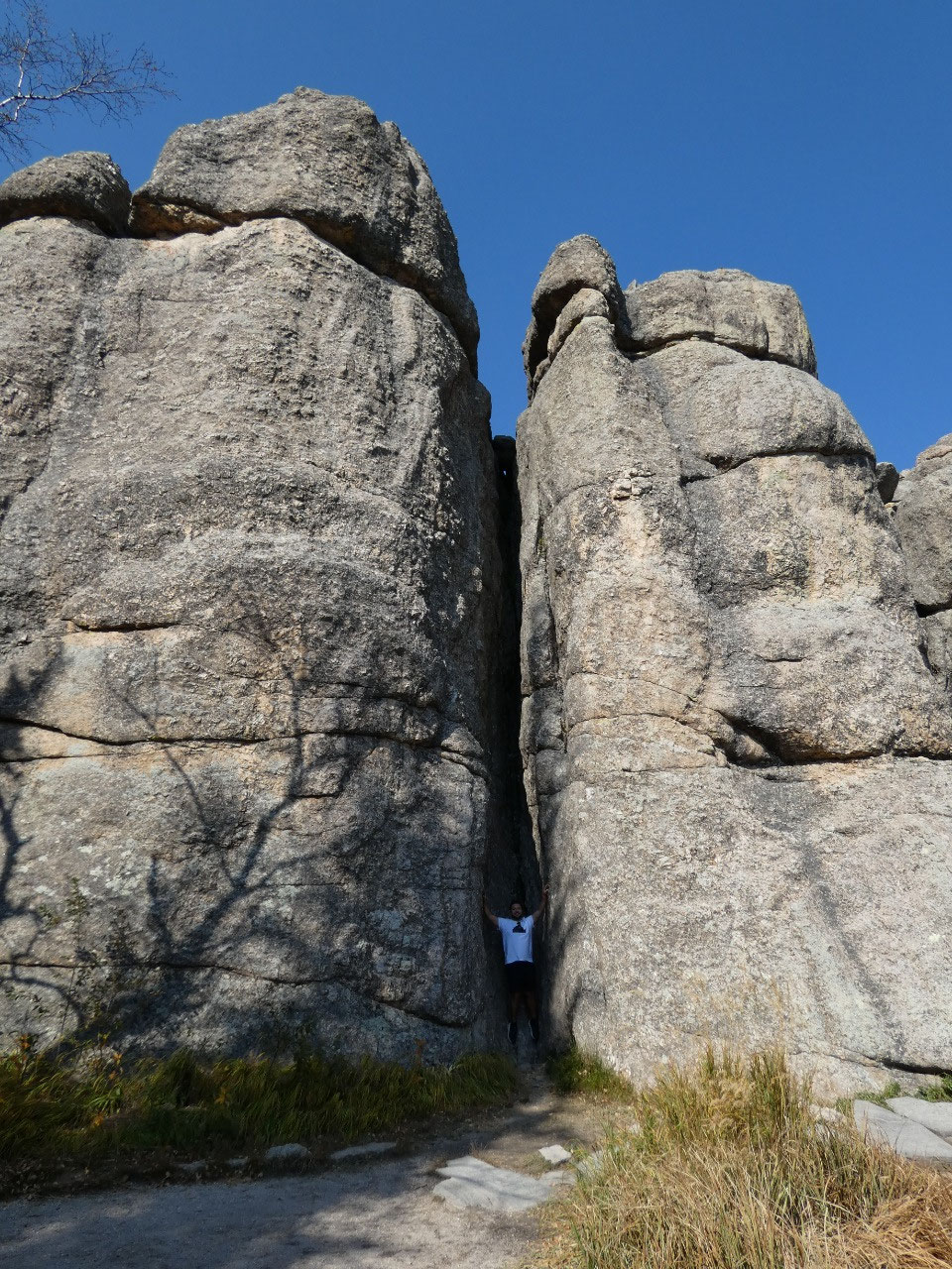
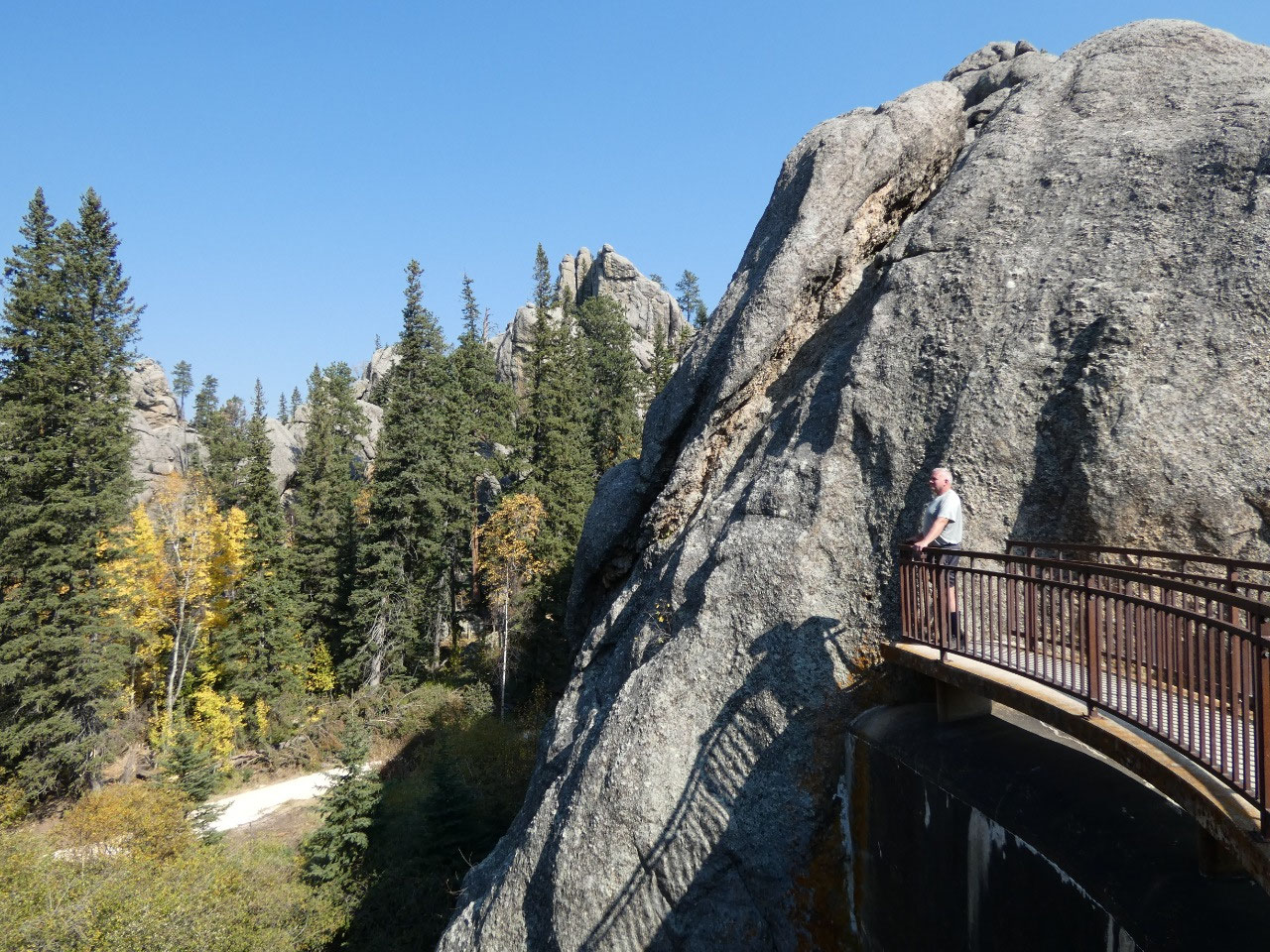
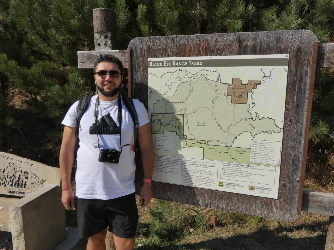
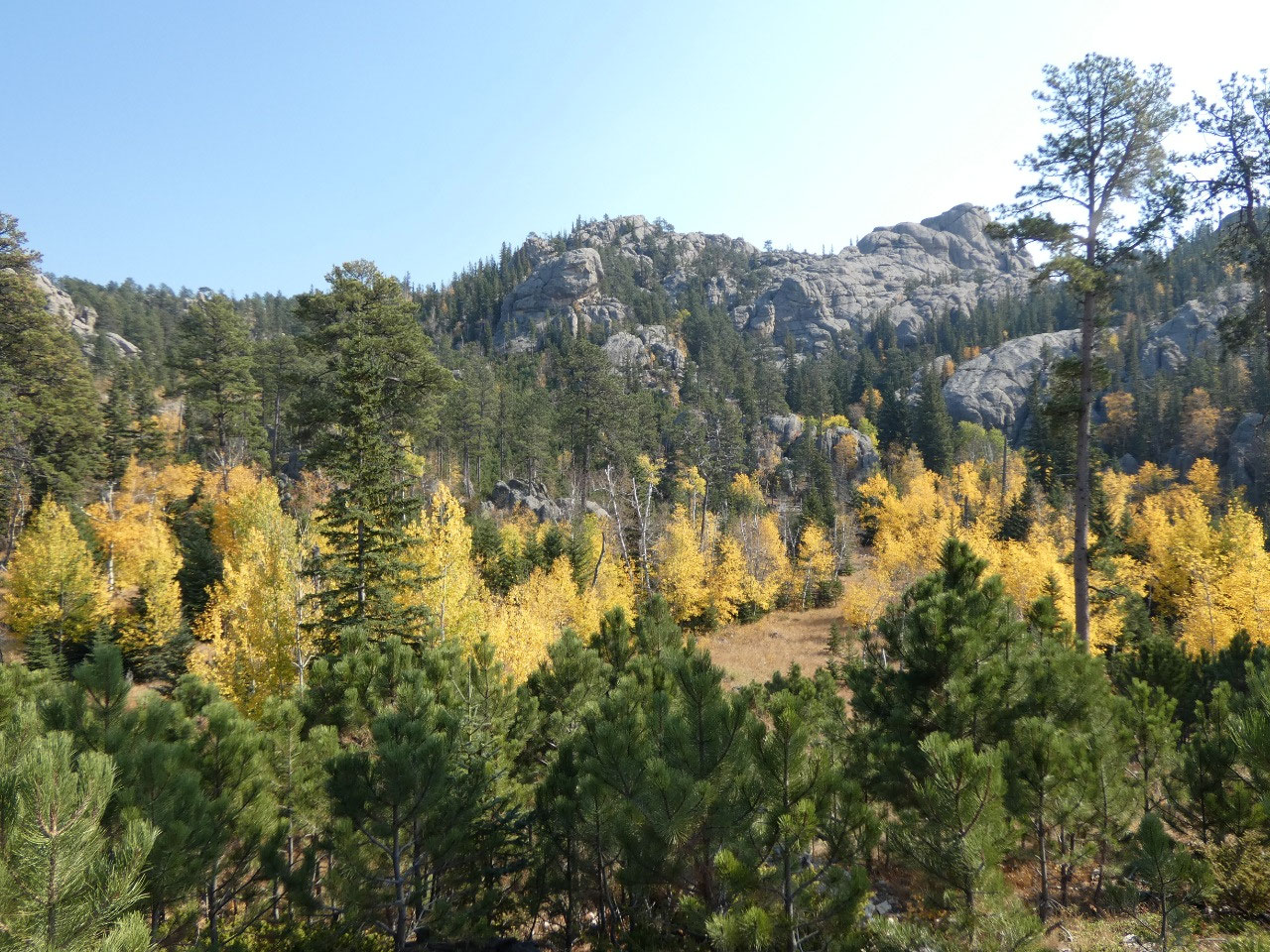
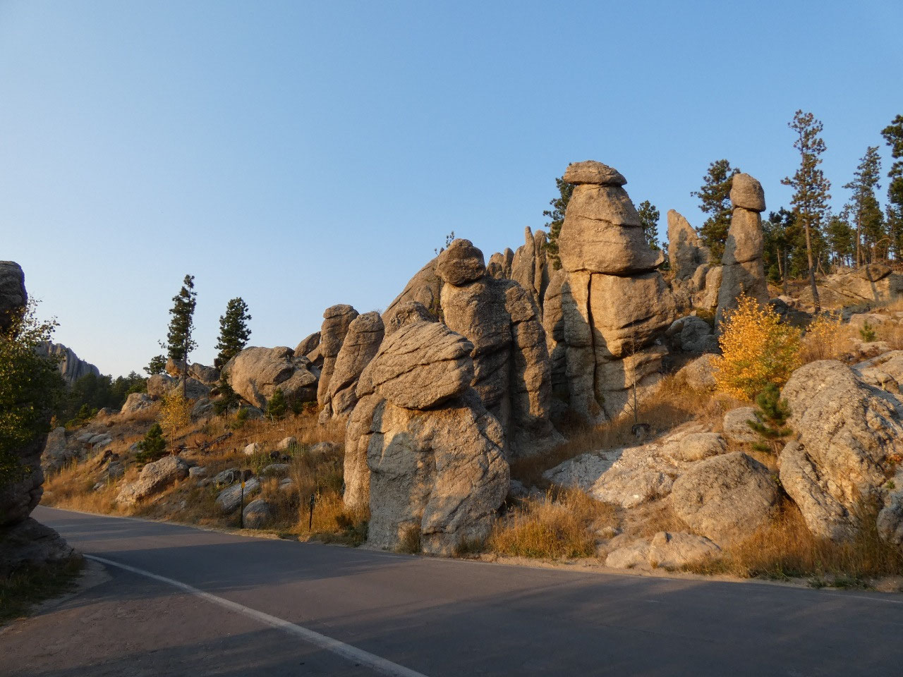
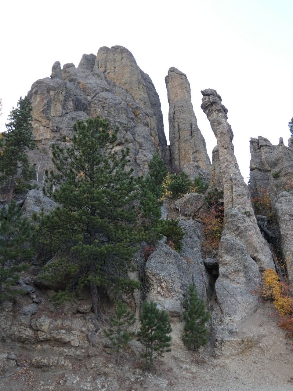
There are numerous routes up Black Elk Peak, but the primary
one is a straightforward 7.5-mile round-trip hike on a good trail starting from
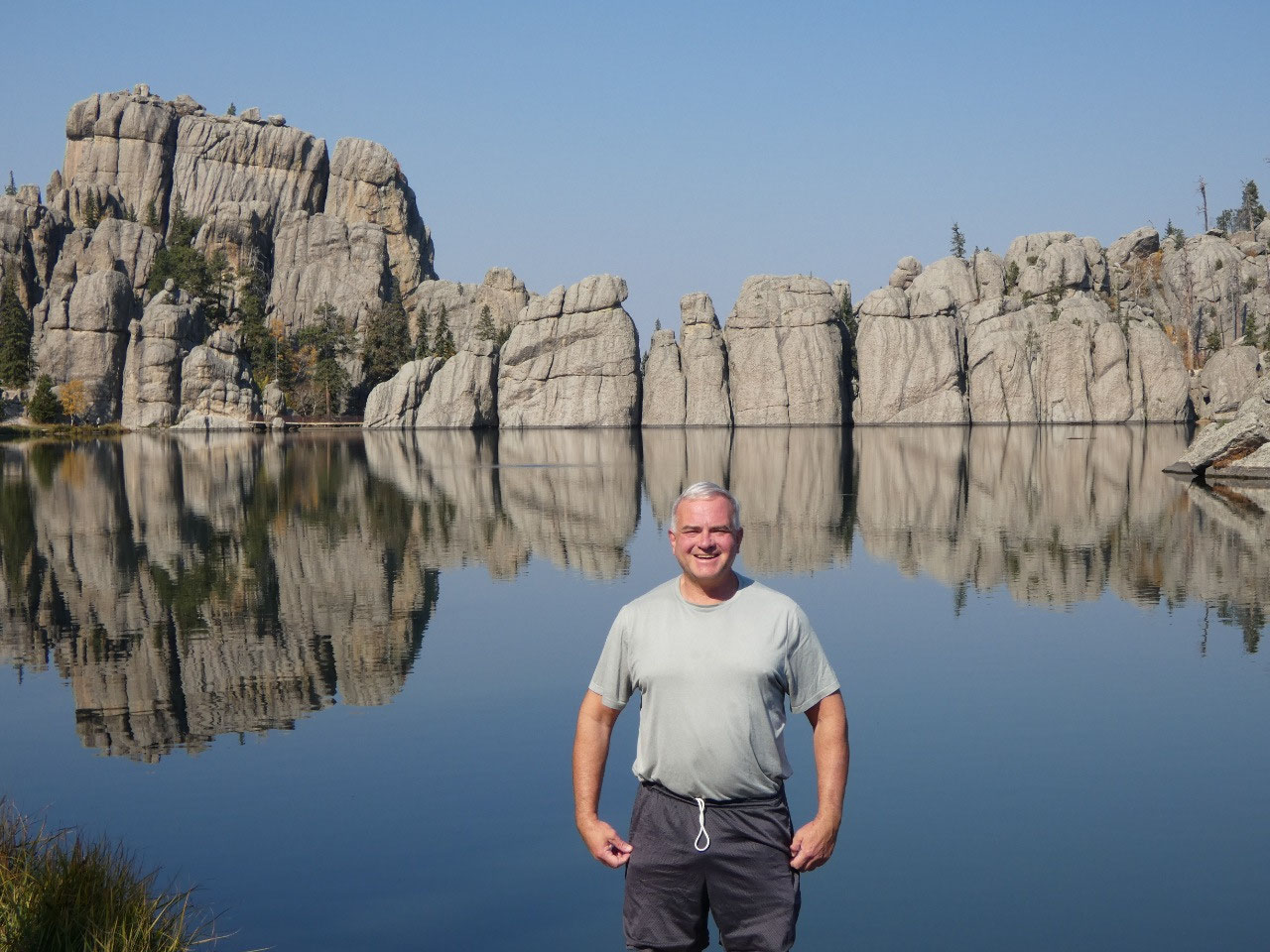
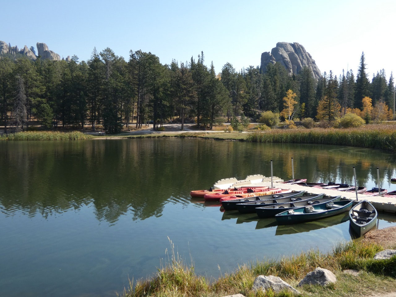
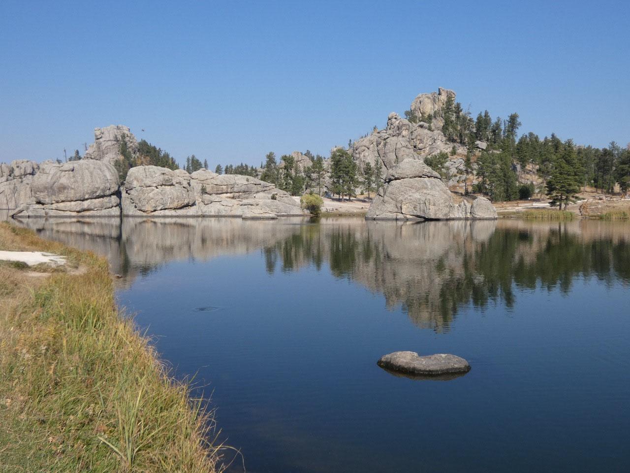
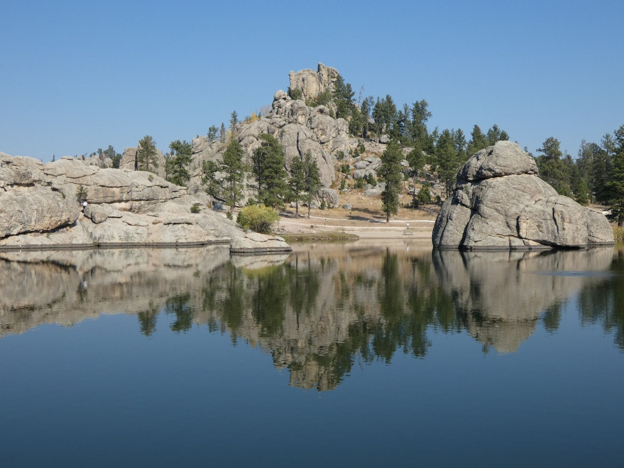
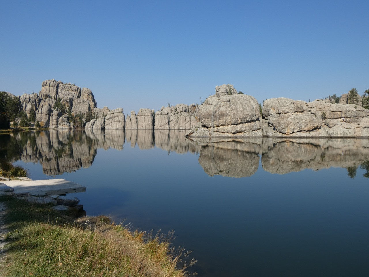
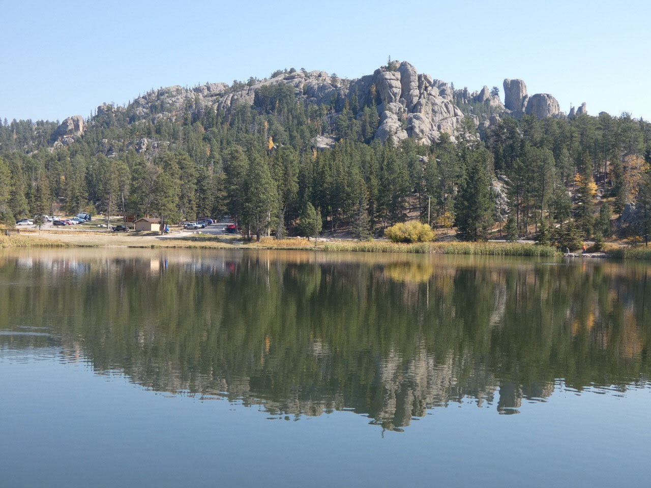
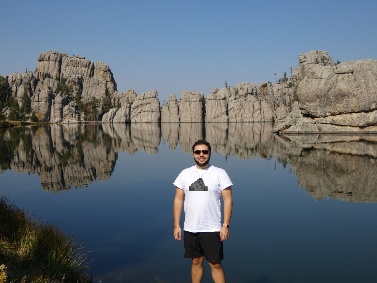
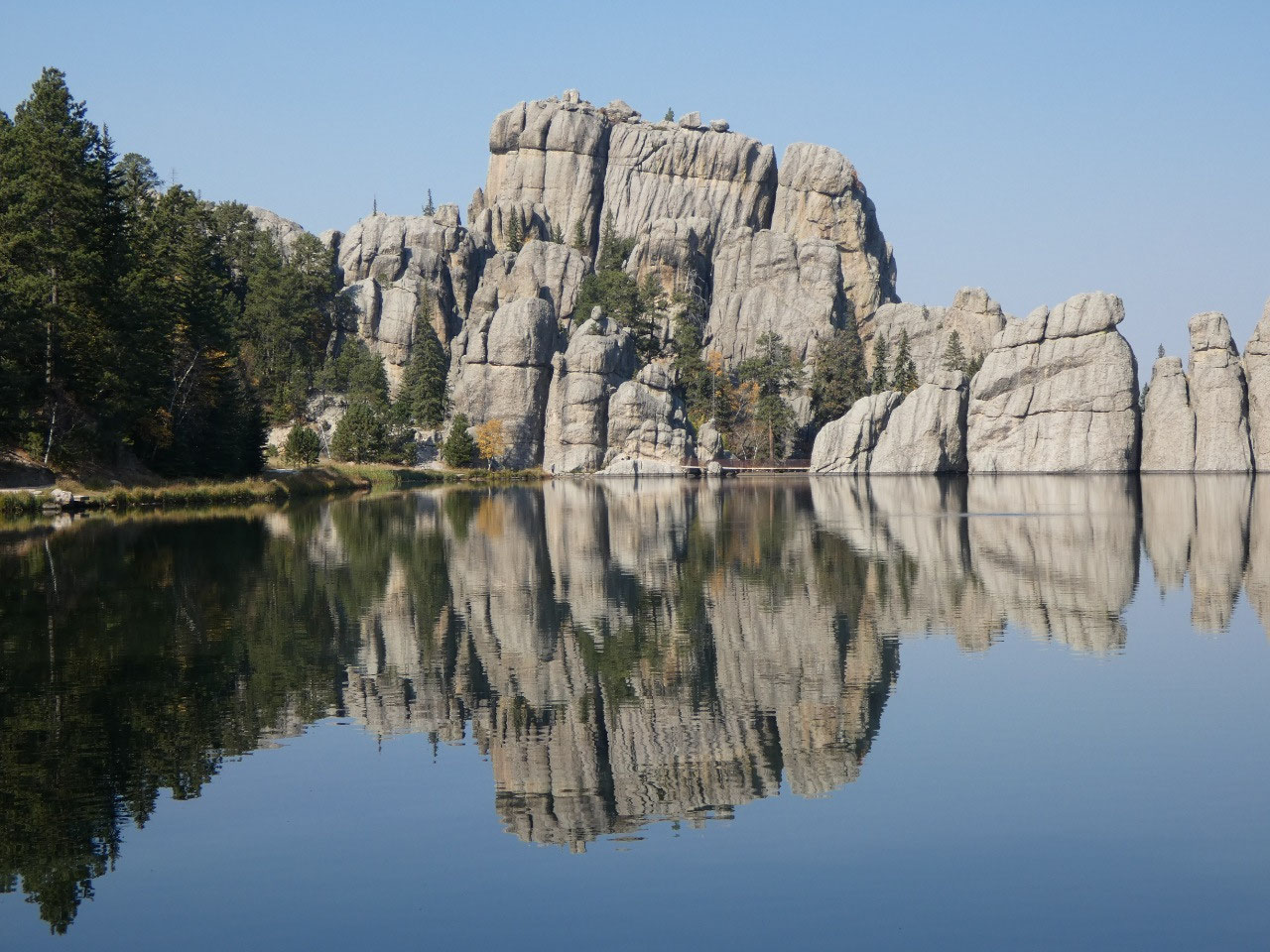
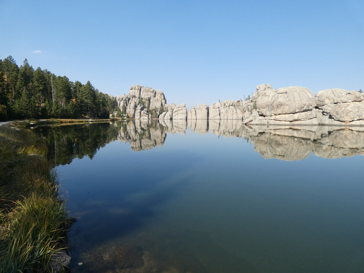
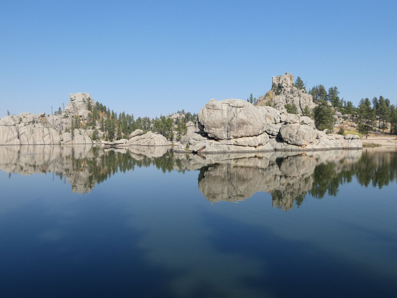
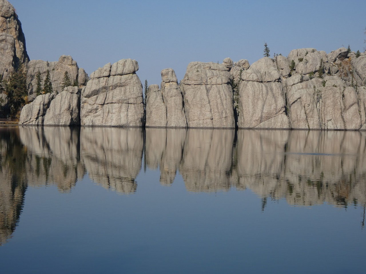
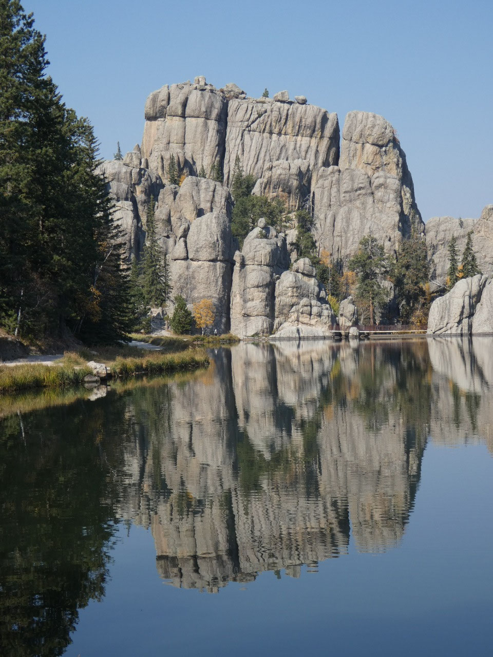
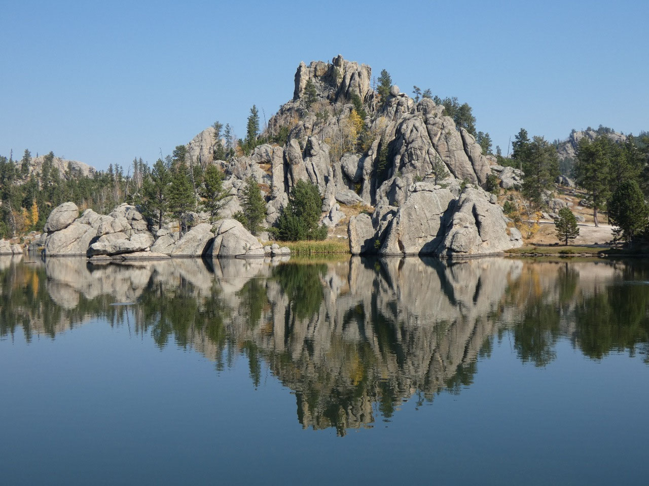
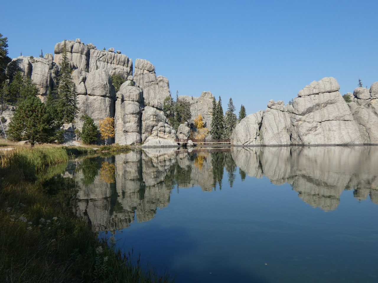
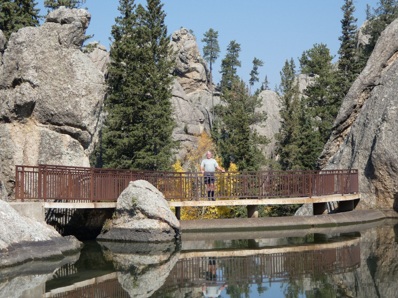
a big parking lot at Sylvan Lake. Sylvan
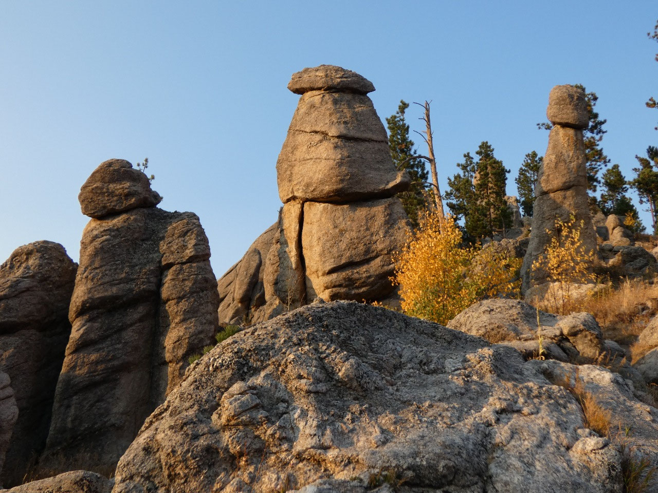
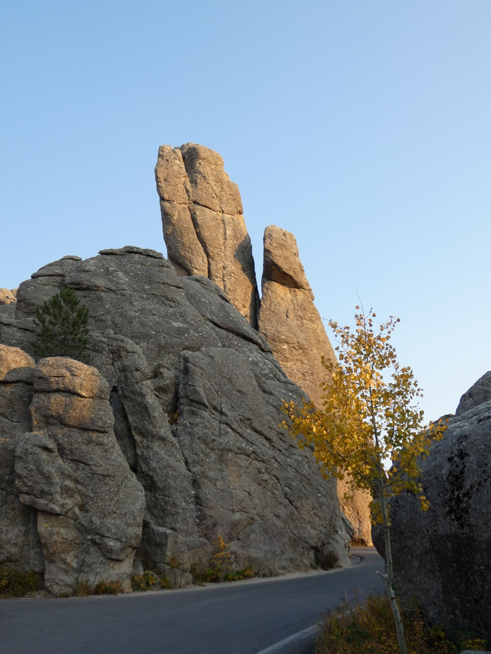
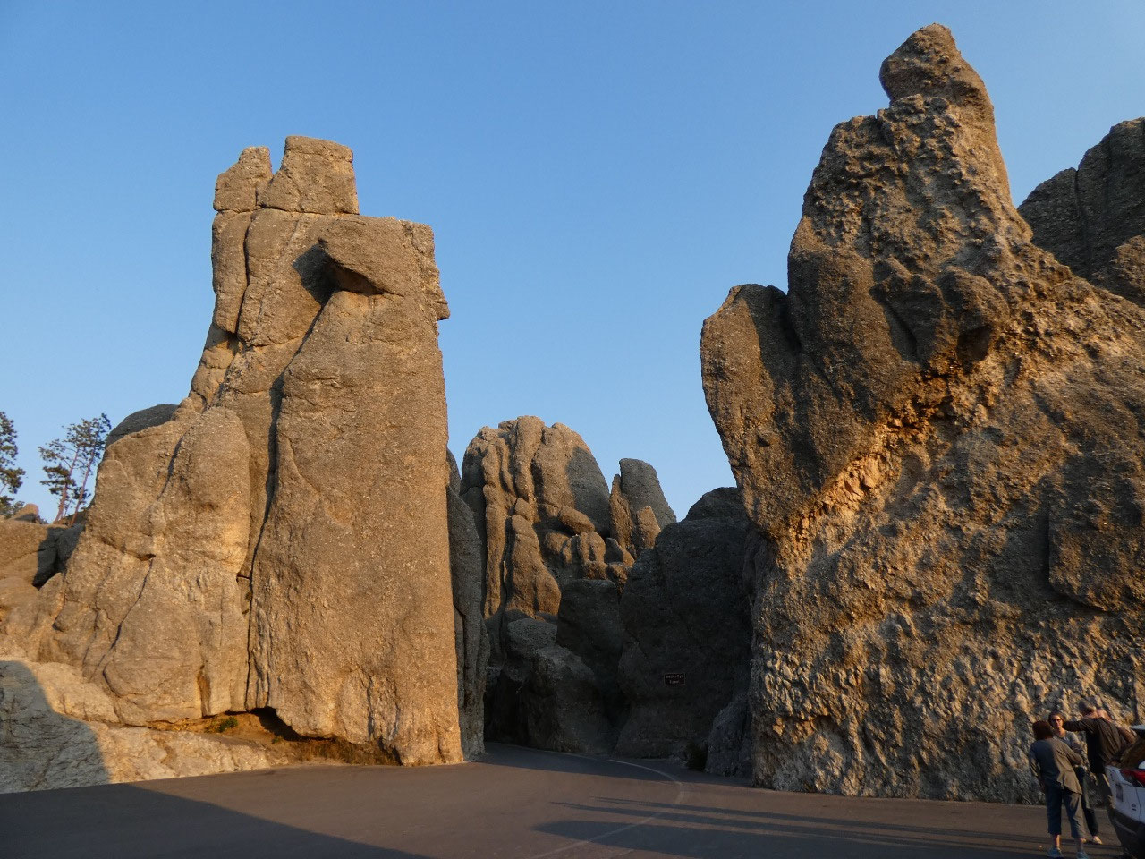
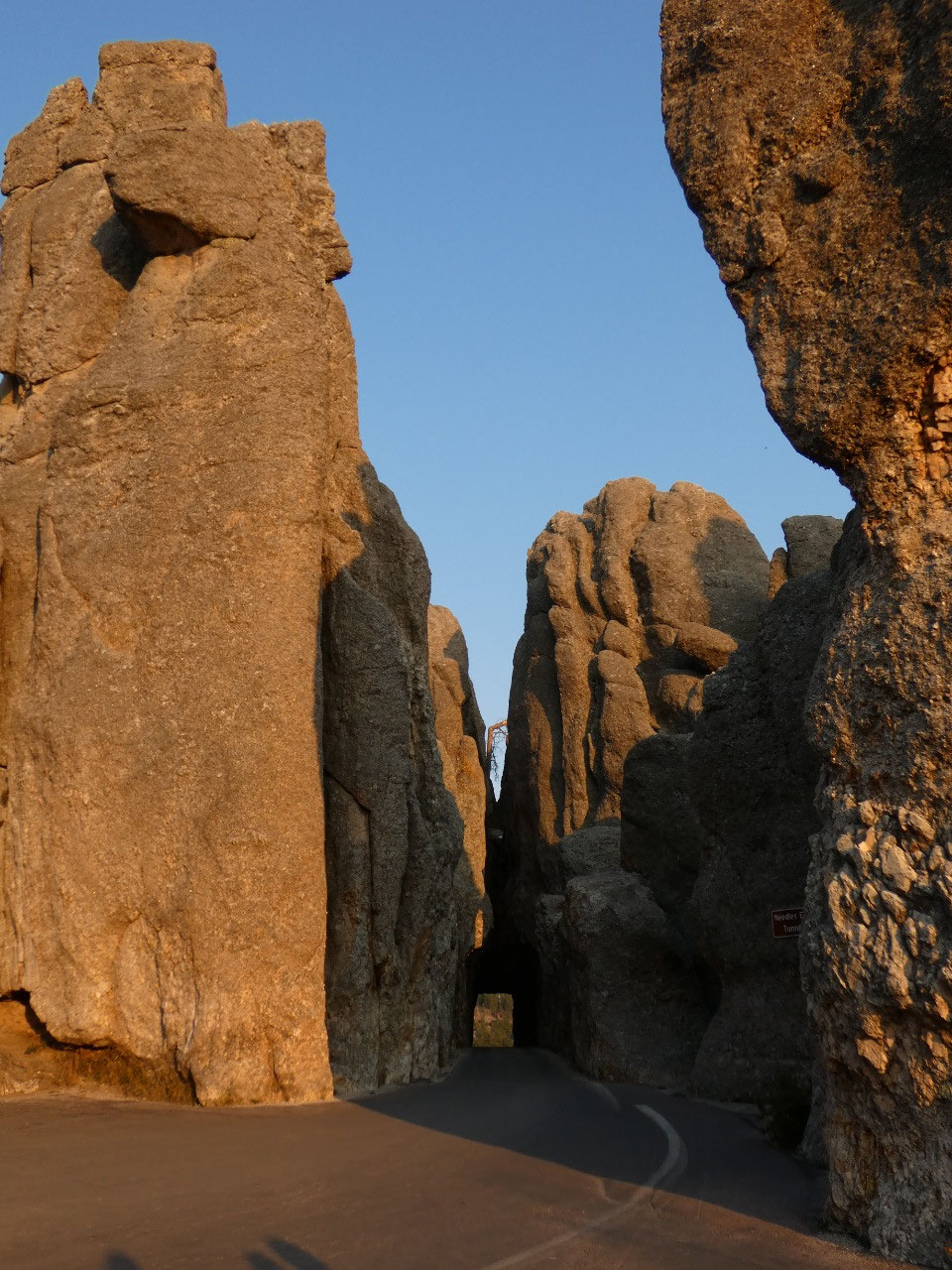
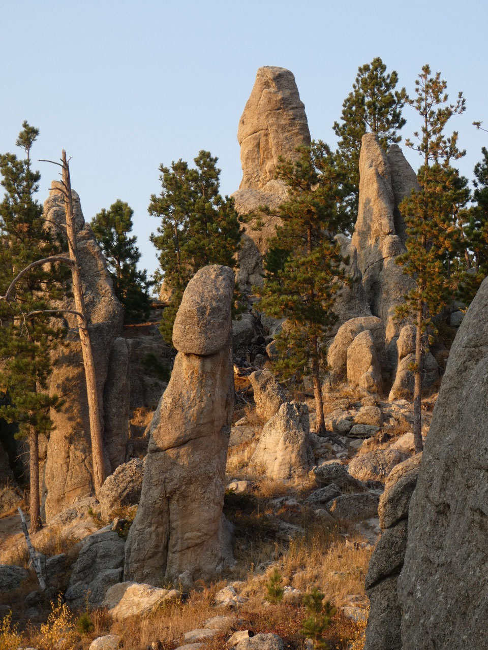
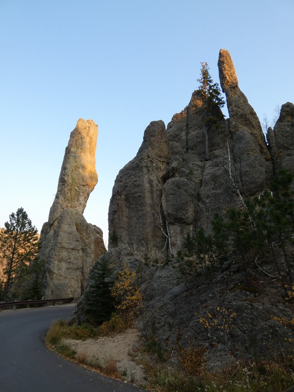
Lake is along the Needles Highway, a short but incredibly scenic stretch across
the highest part of the central Black Hills through standing granite formations
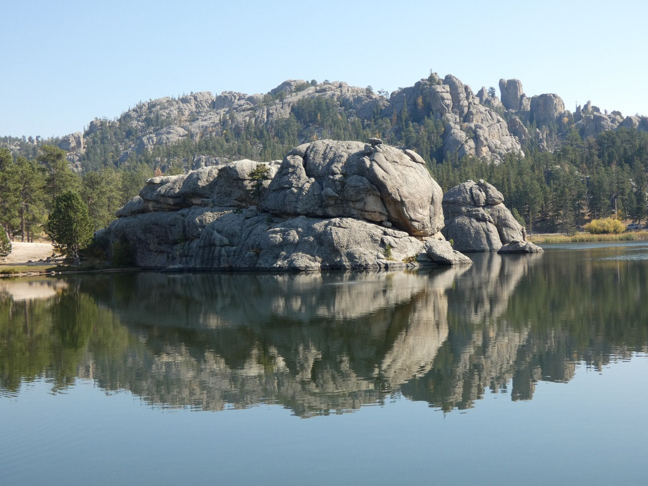
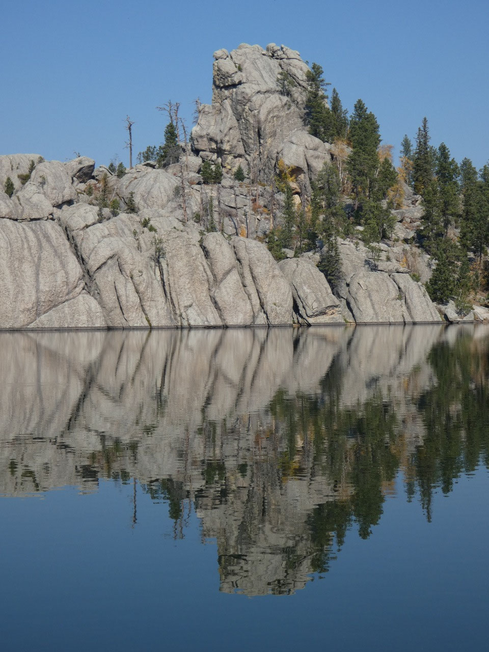
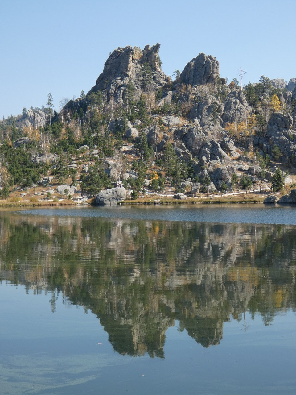
called The Needles. Created by a small dam, Sylvan Lake is incredibly picturesque
on a nice day, its surrounding granite outcrops mirrored in the lake almost
surreally. It was worth the short walk around before starting our bigger hike.
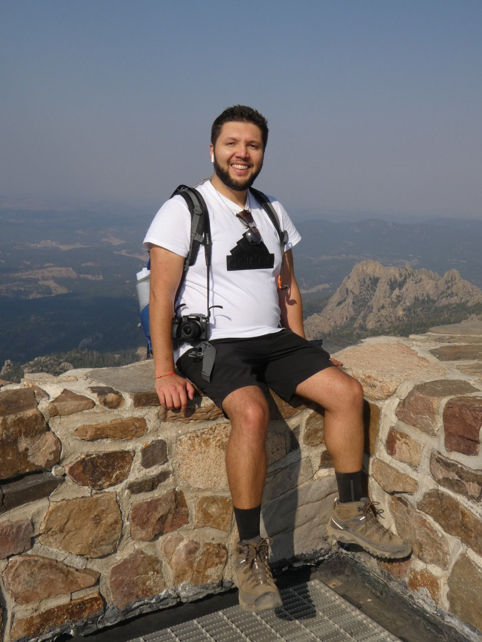
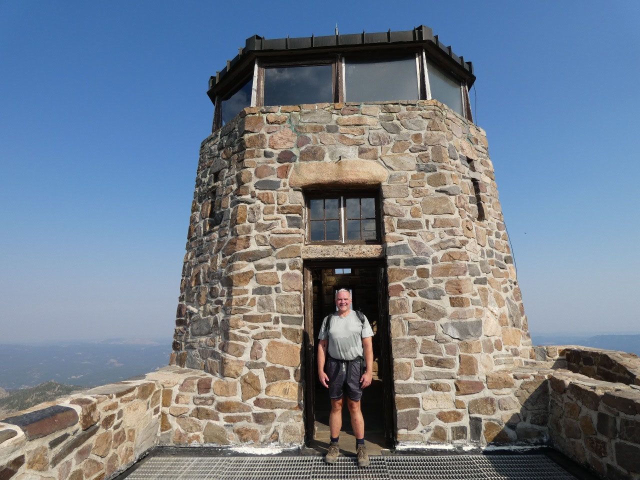
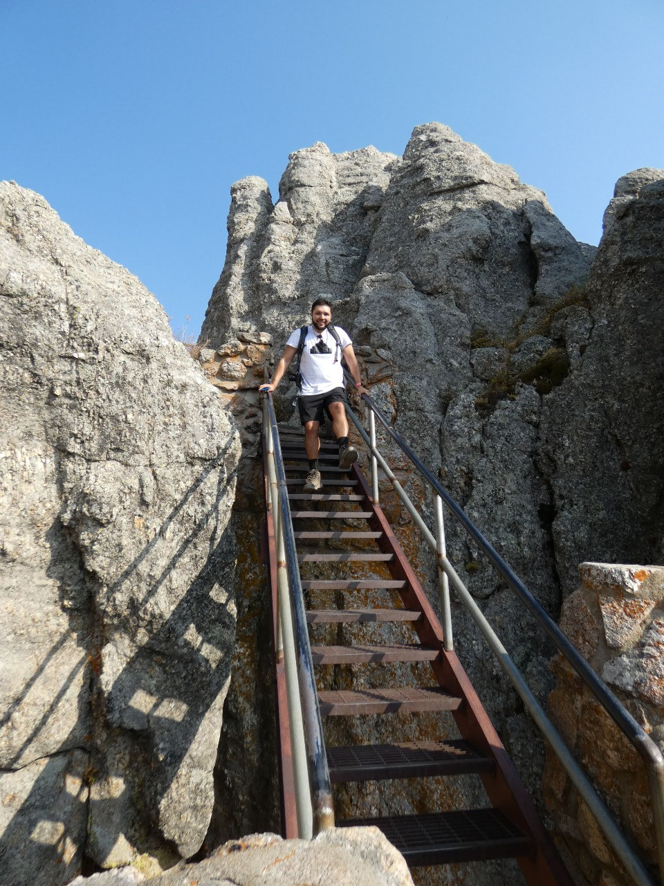
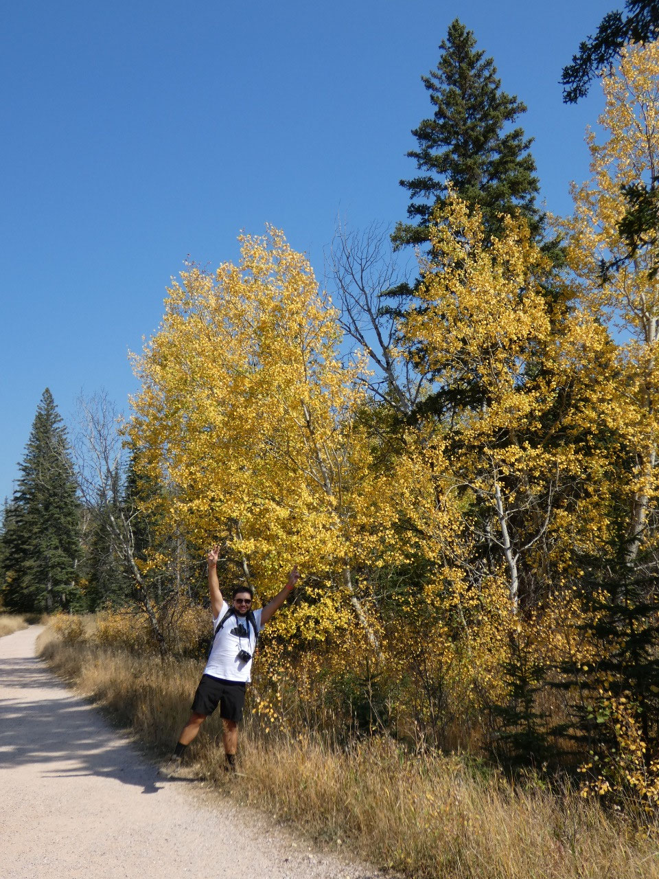
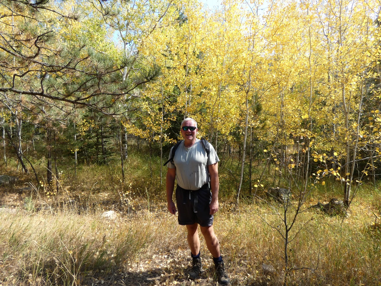
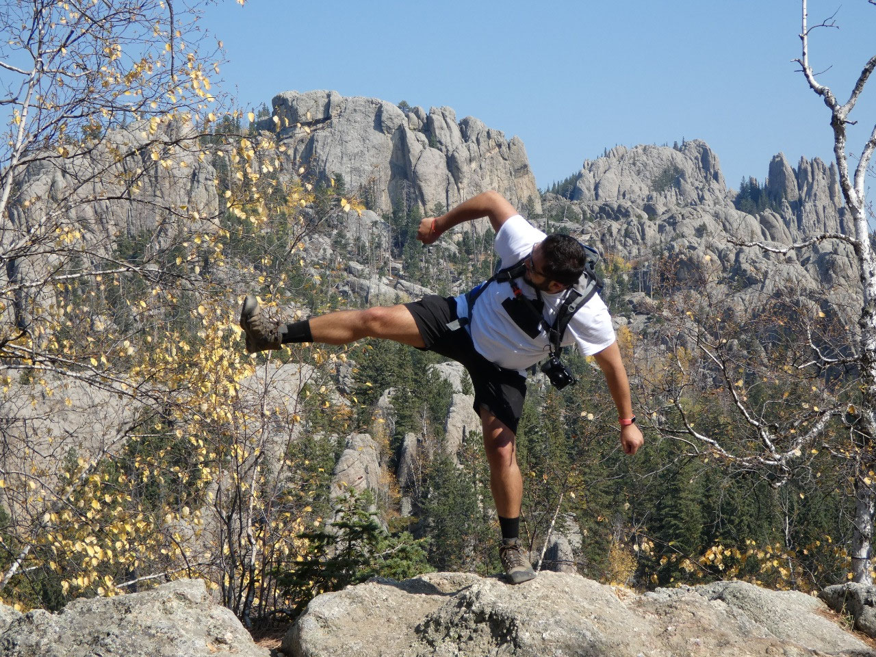
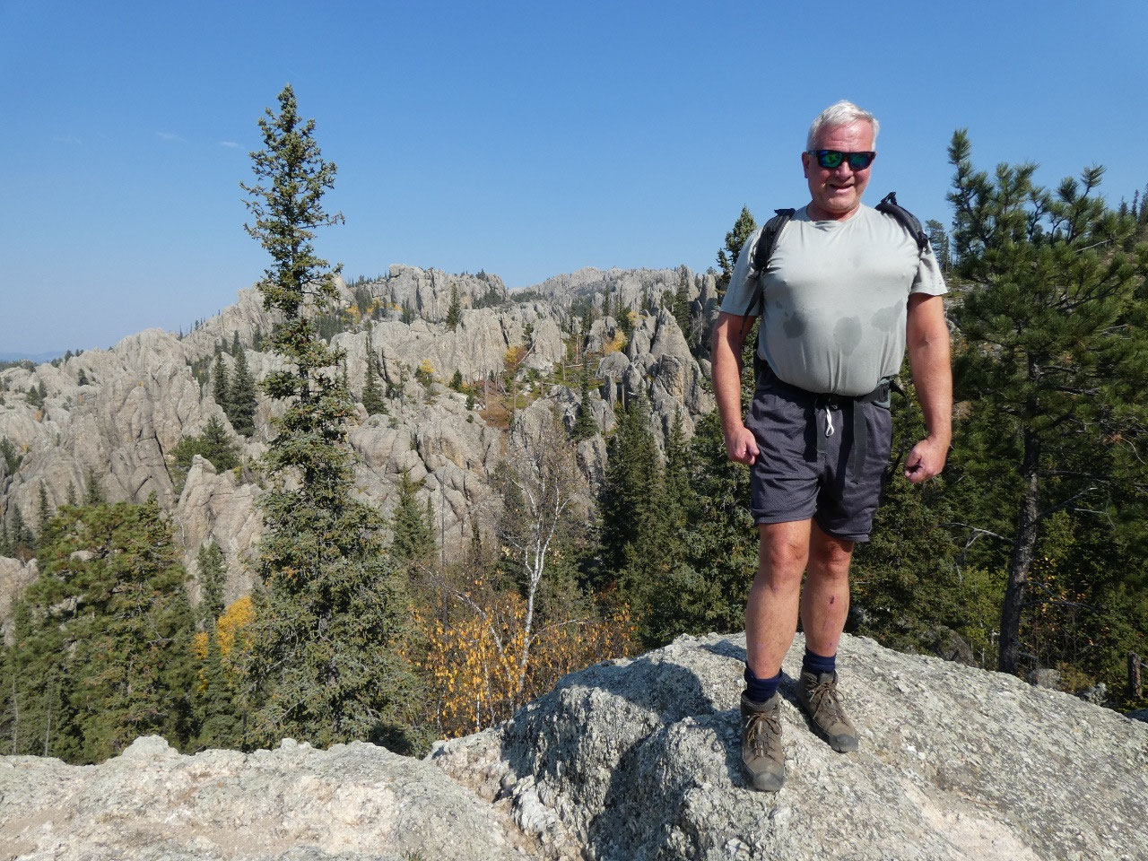
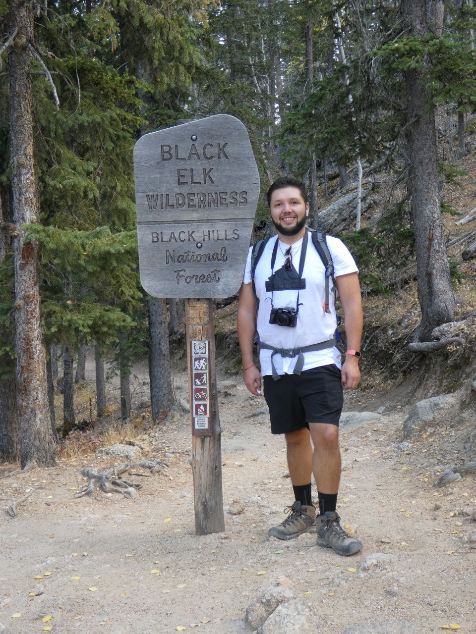
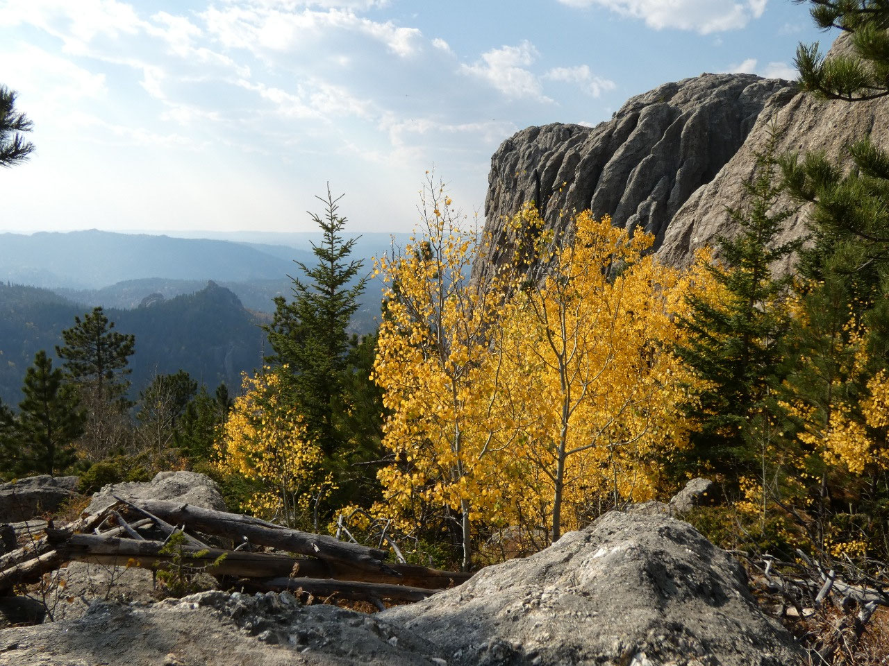
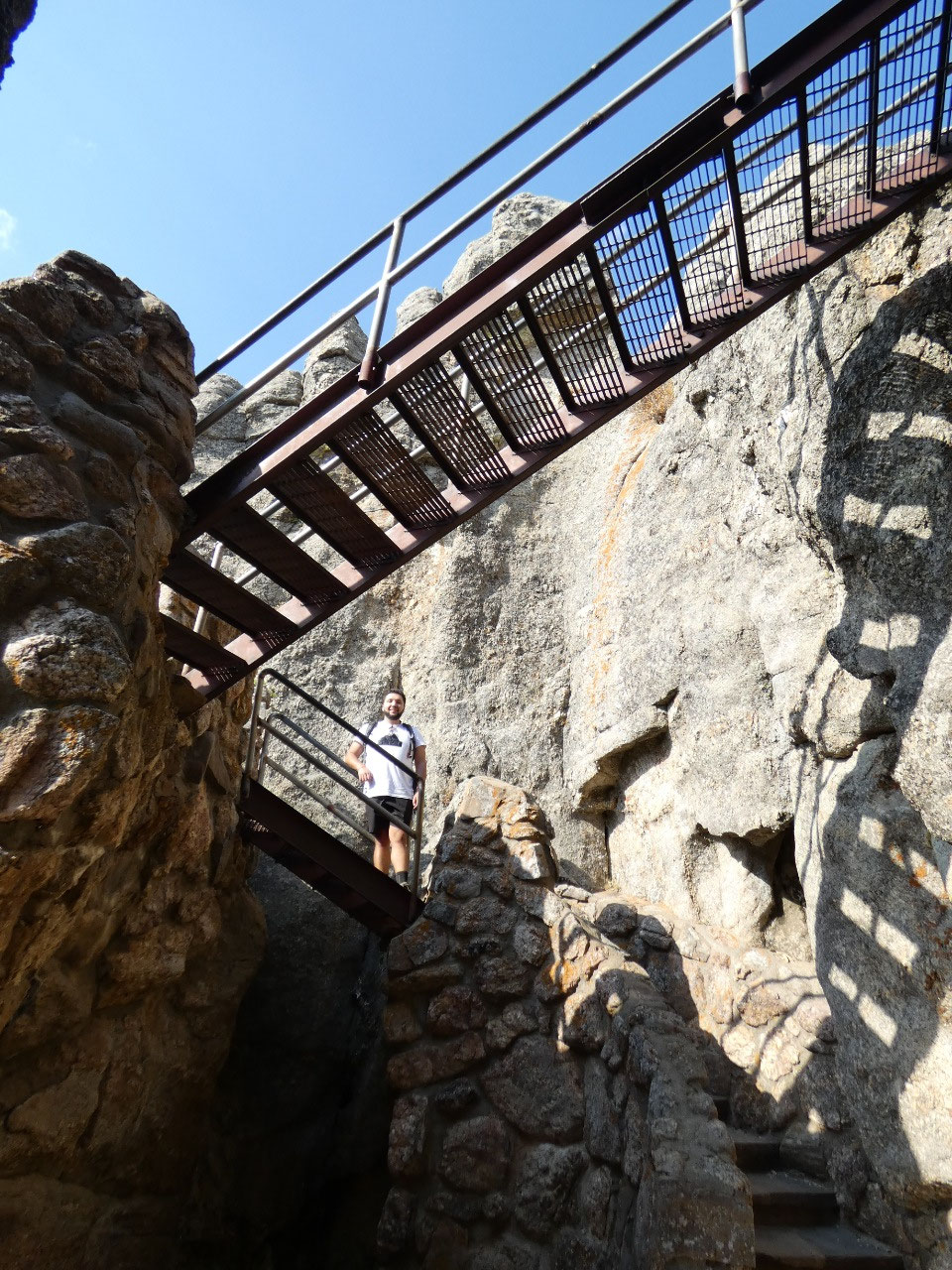
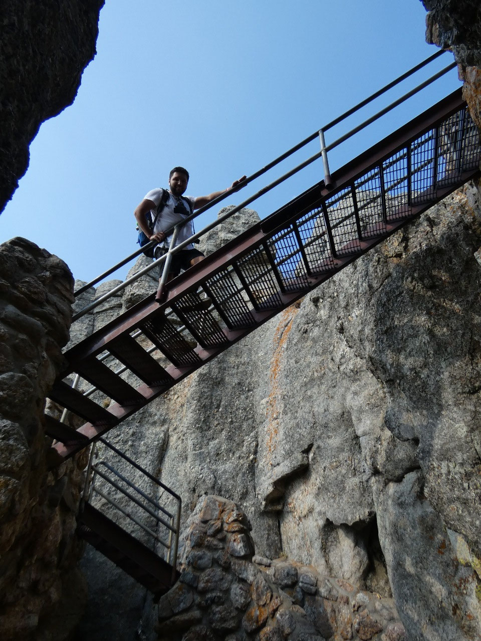
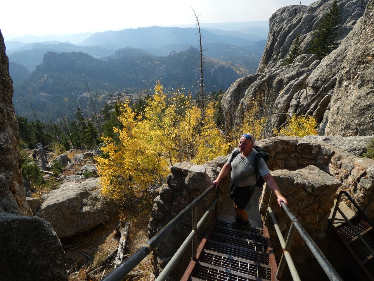
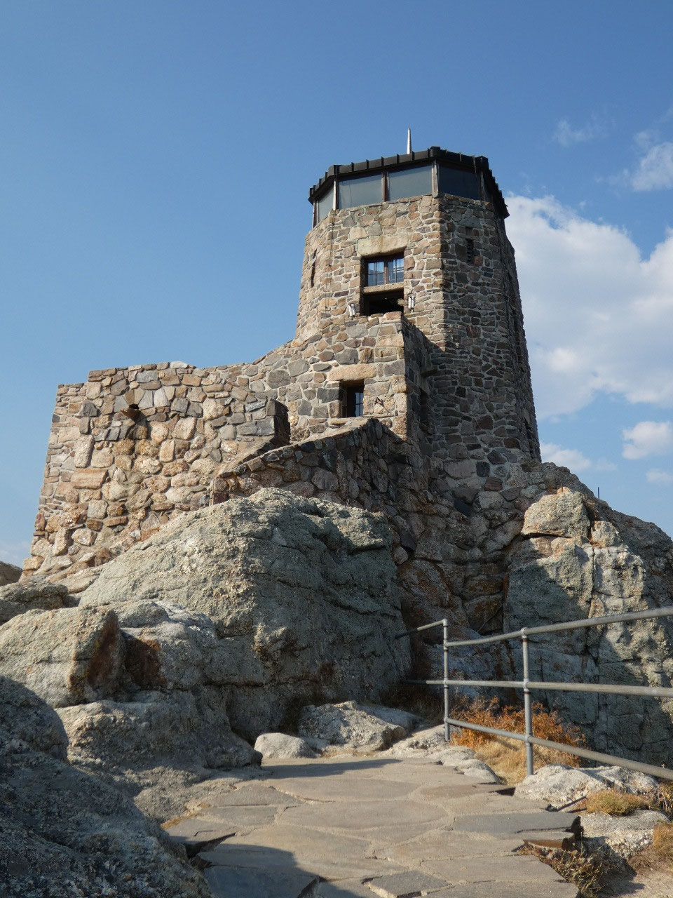
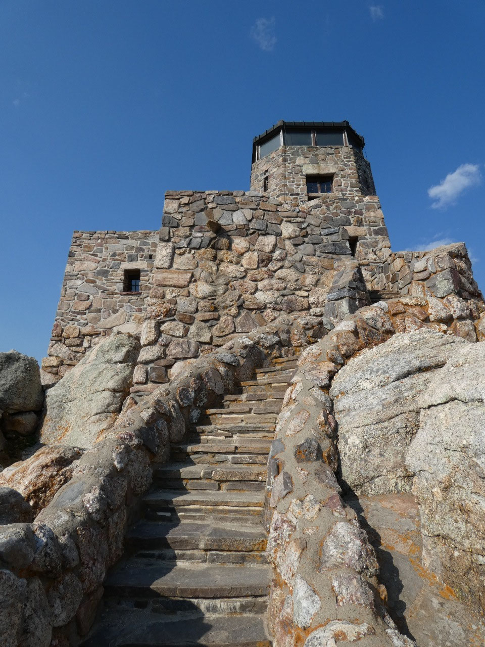
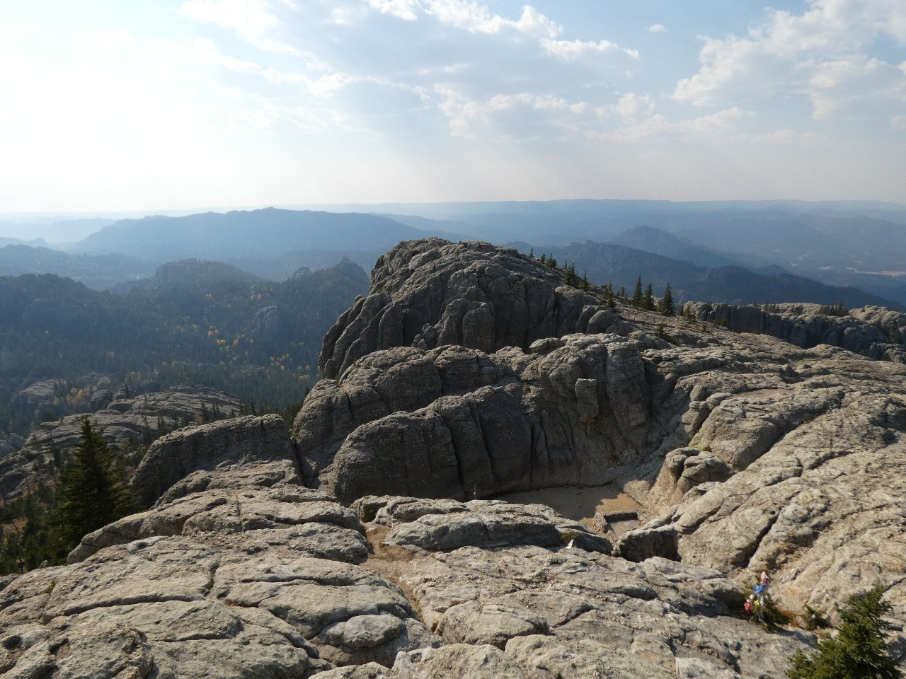
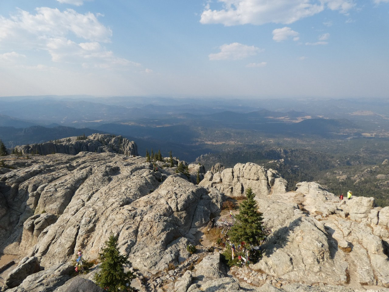
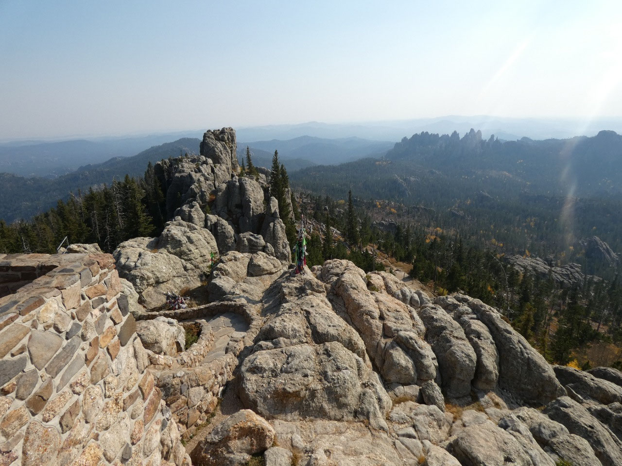
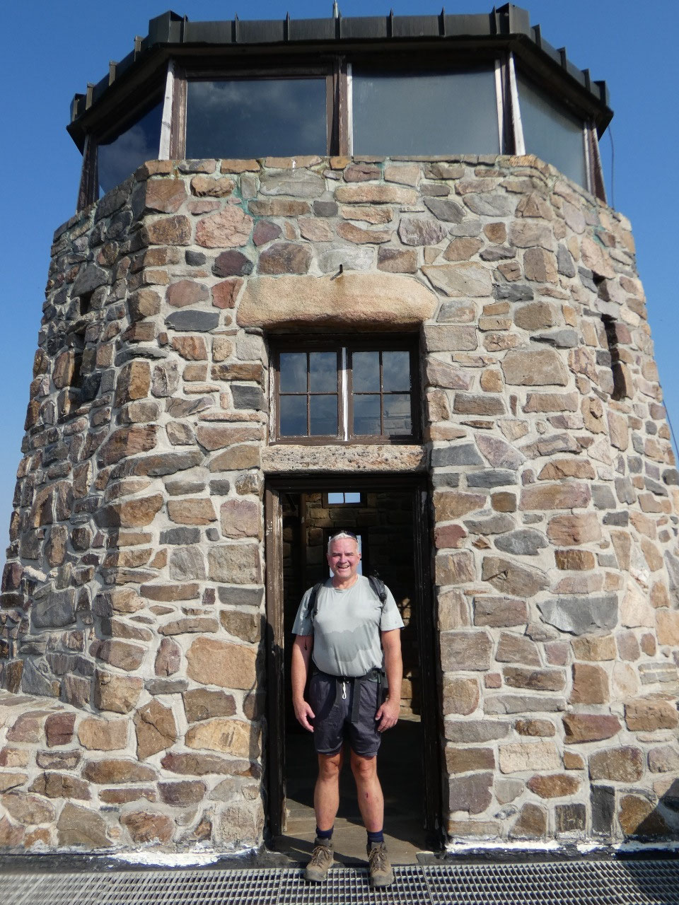
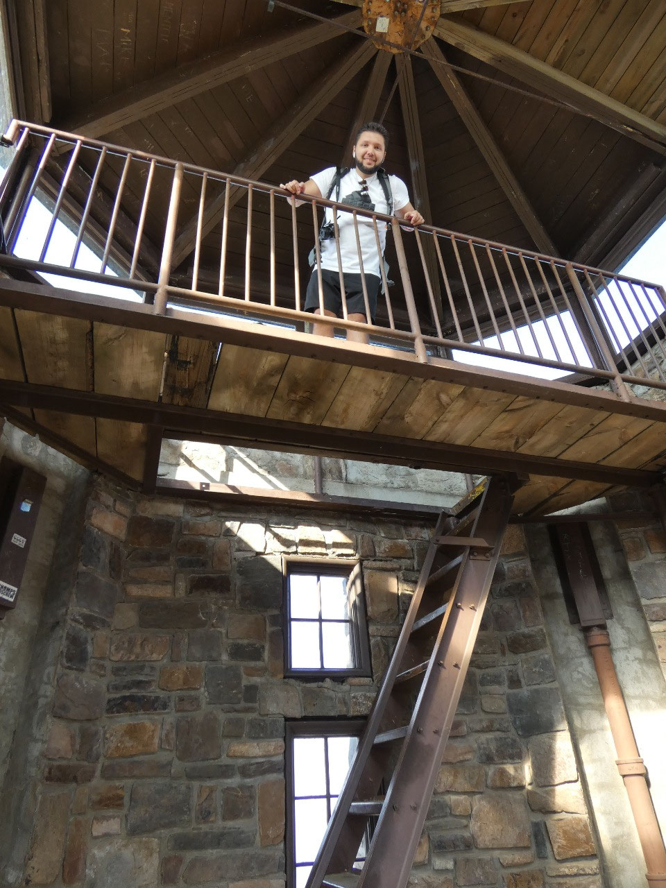
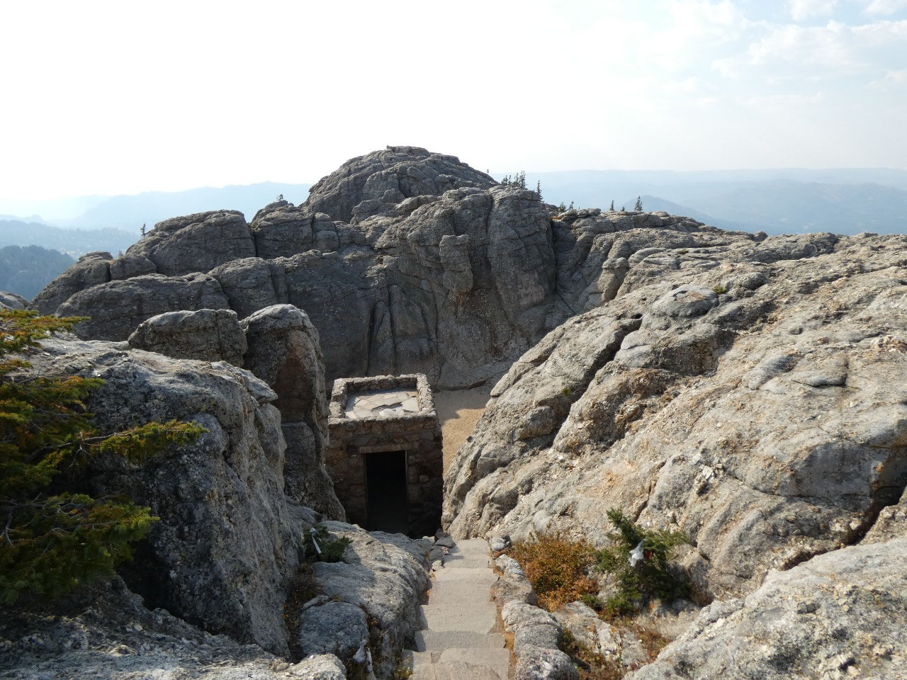
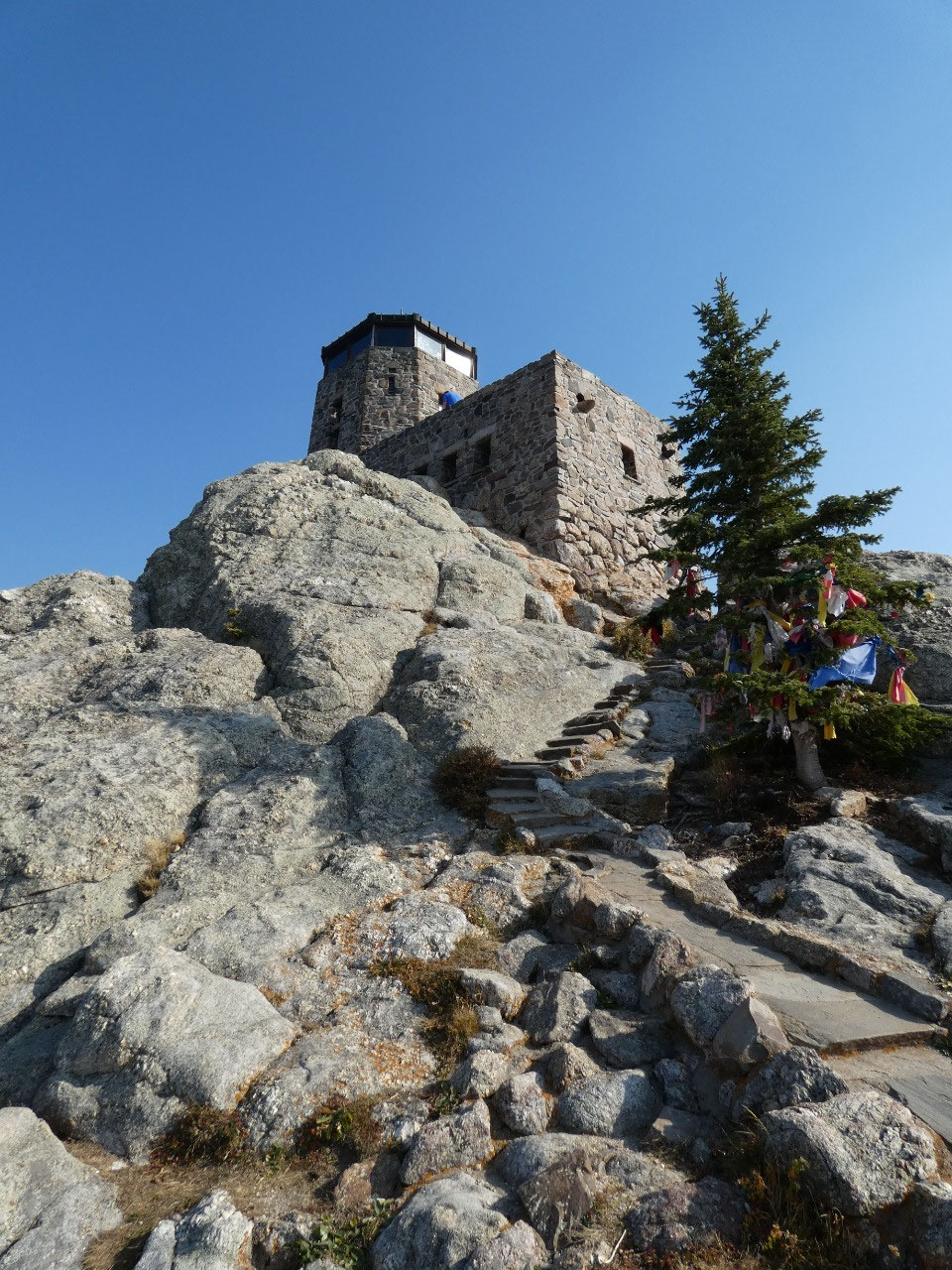
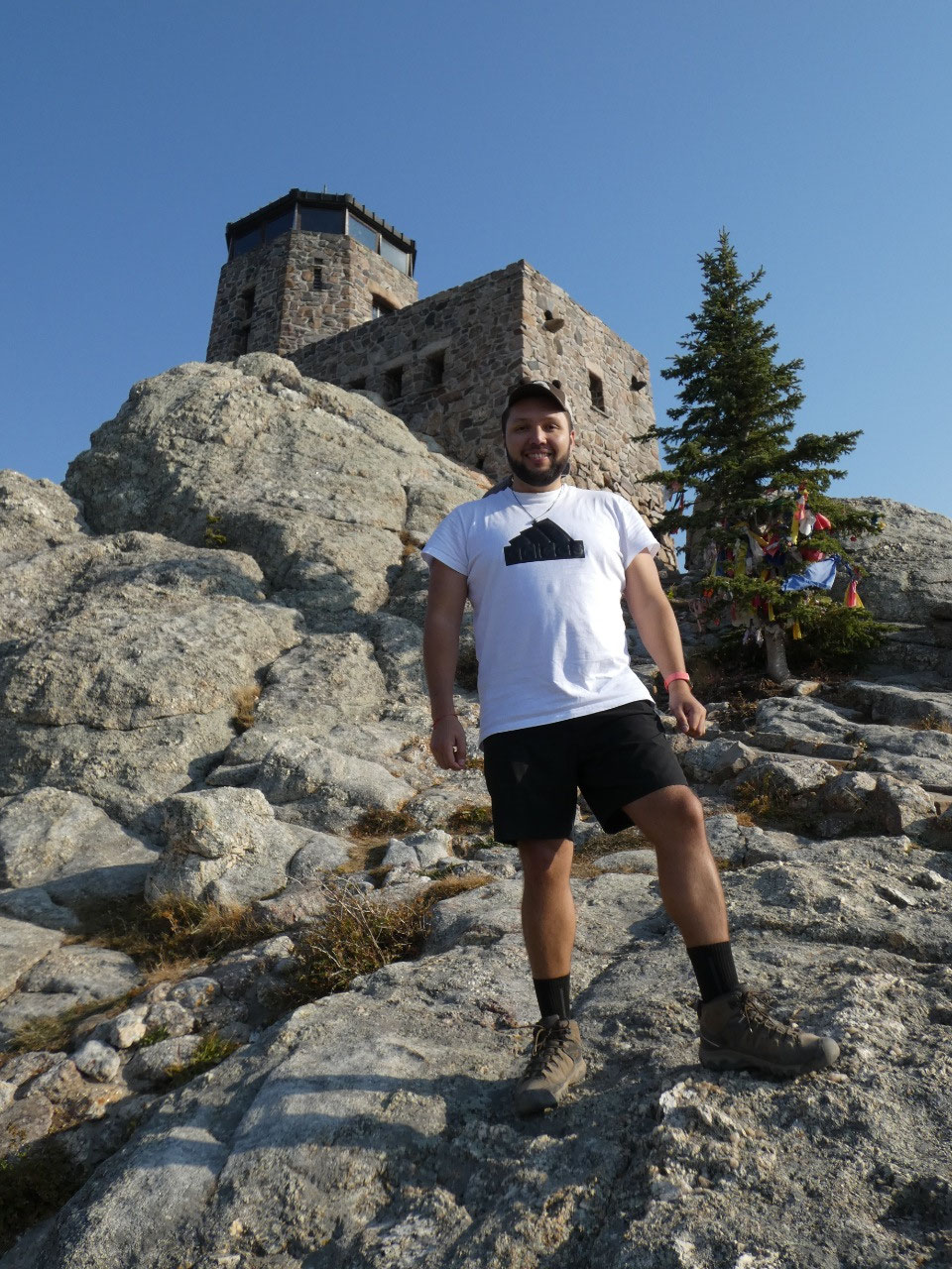
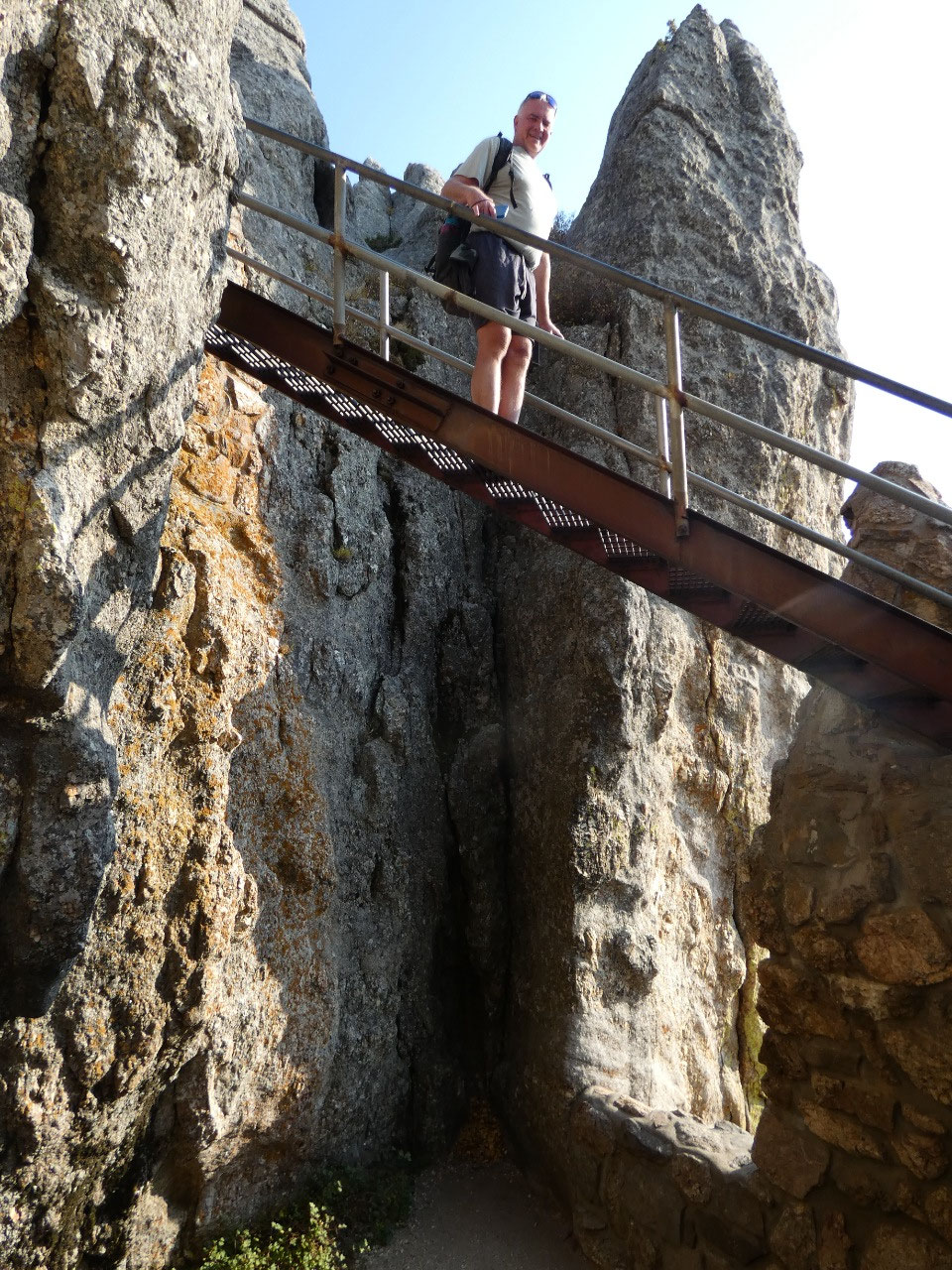
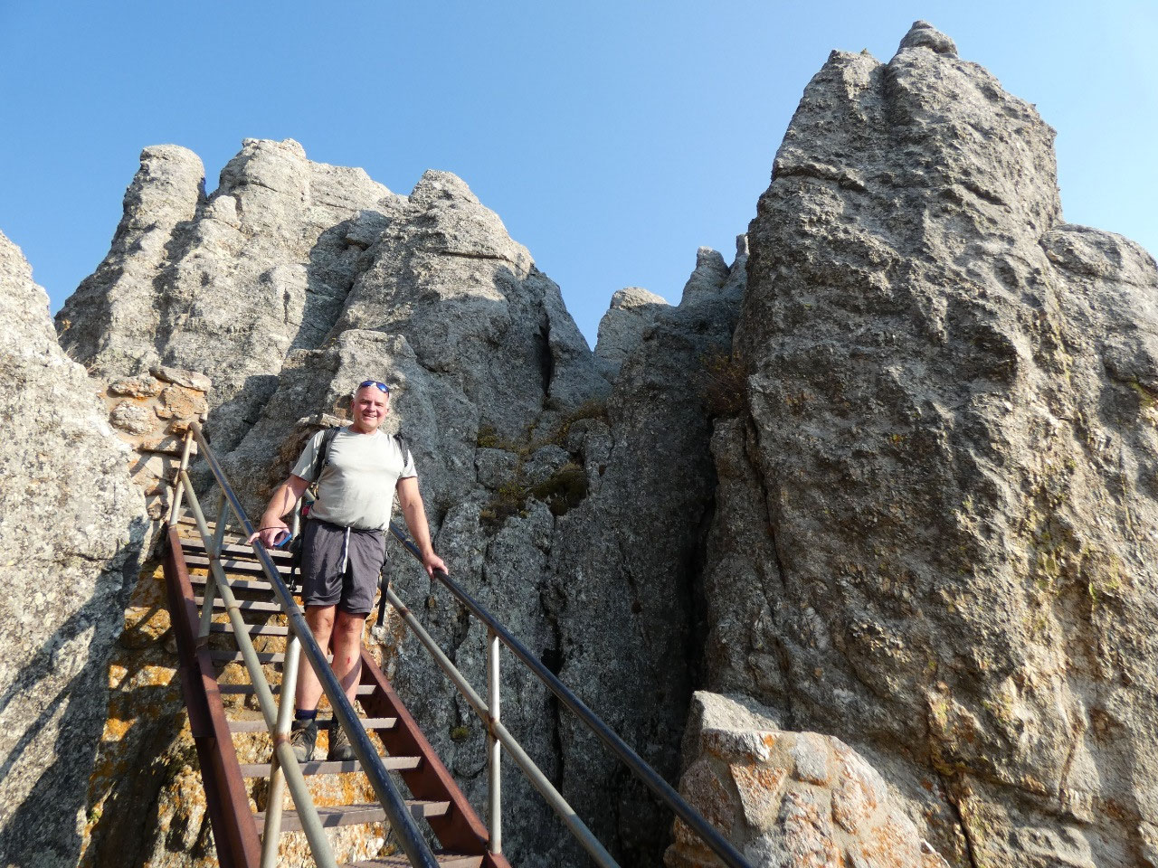
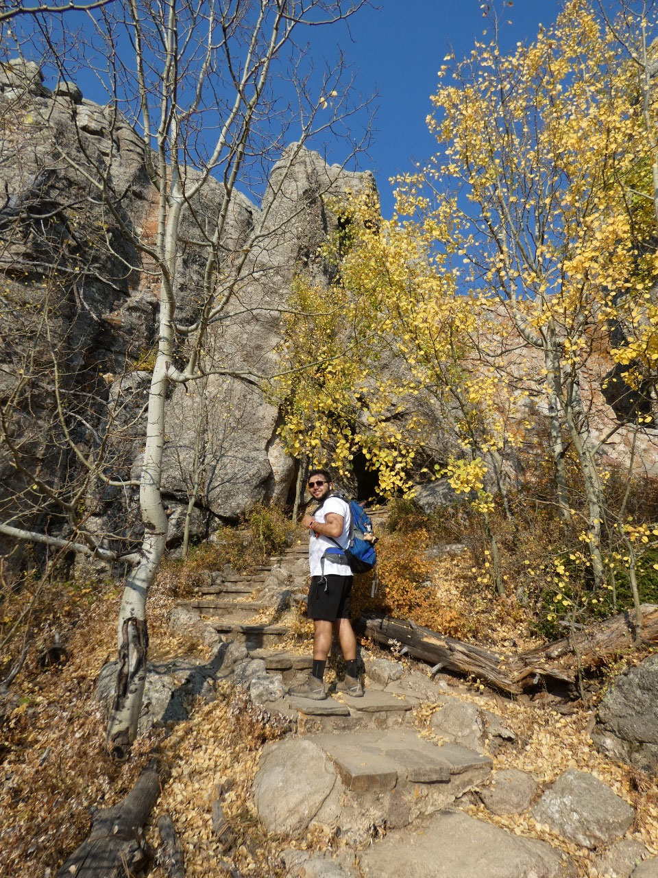
I suppose for some flatlanders the Harney Peak hike might be quite challenging but not for a Rocky Mountain man like me. The trailhead is located in Custer State Park, but the peak itself and much of the route are through the Black Elk Wilderness of Black Hills National Forest. The first mile or so heads upwards gradually through aspen groves near peak color in early October. After cresting a hill with good views toward the ultimate destination, the trail drops down into a valley to cross a stream, and then rises again. At a fork in the trail bearing left takes you on the trail than ascends the peak. The last part of the hike is in the open, not technically above timberline at this latitude but along the sparsely vegetated rocks toward the summit. There’s some more fun as you head through a short tunnel and then climb some metal staircases to emerge within a few feet of the top. On the tippy top of the mountain there’s a stone fire lookout tower built in the 1930s by the Civilian Conservation Corps. Someone I know who hiked the peak more than 40 years ago insists the tower was not there when she climbed it, but it’s been there well before she was born.
I suppose for some flatlanders the Harney Peak hike might be quite challenging but not for a Rocky Mountain man like me. The trailhead is located in Custer State Park, but the peak itself and much of the route are through the Black Elk Wilderness of Black Hills National Forest. The first mile or so heads upwards gradually through aspen groves near peak color in early October. After cresting a hill with good views toward the ultimate destination, the trail drops down into a valley to cross a stream, and then rises again. At a fork in the trail bearing left takes you on the trail than ascends the peak. The last part of the hike is in the open, not technically above timberline at this latitude but along the sparsely vegetated rocks toward the summit. There’s some more fun as you head through a short tunnel and then climb some metal staircases to emerge within a few feet of the top. On the tippy top of the mountain there’s a stone fire lookout tower built in the 1930s by the Civilian Conservation Corps. Someone I know who hiked the peak more than 40 years ago insists the tower was not there when she climbed it, but it’s been there well before she was born.
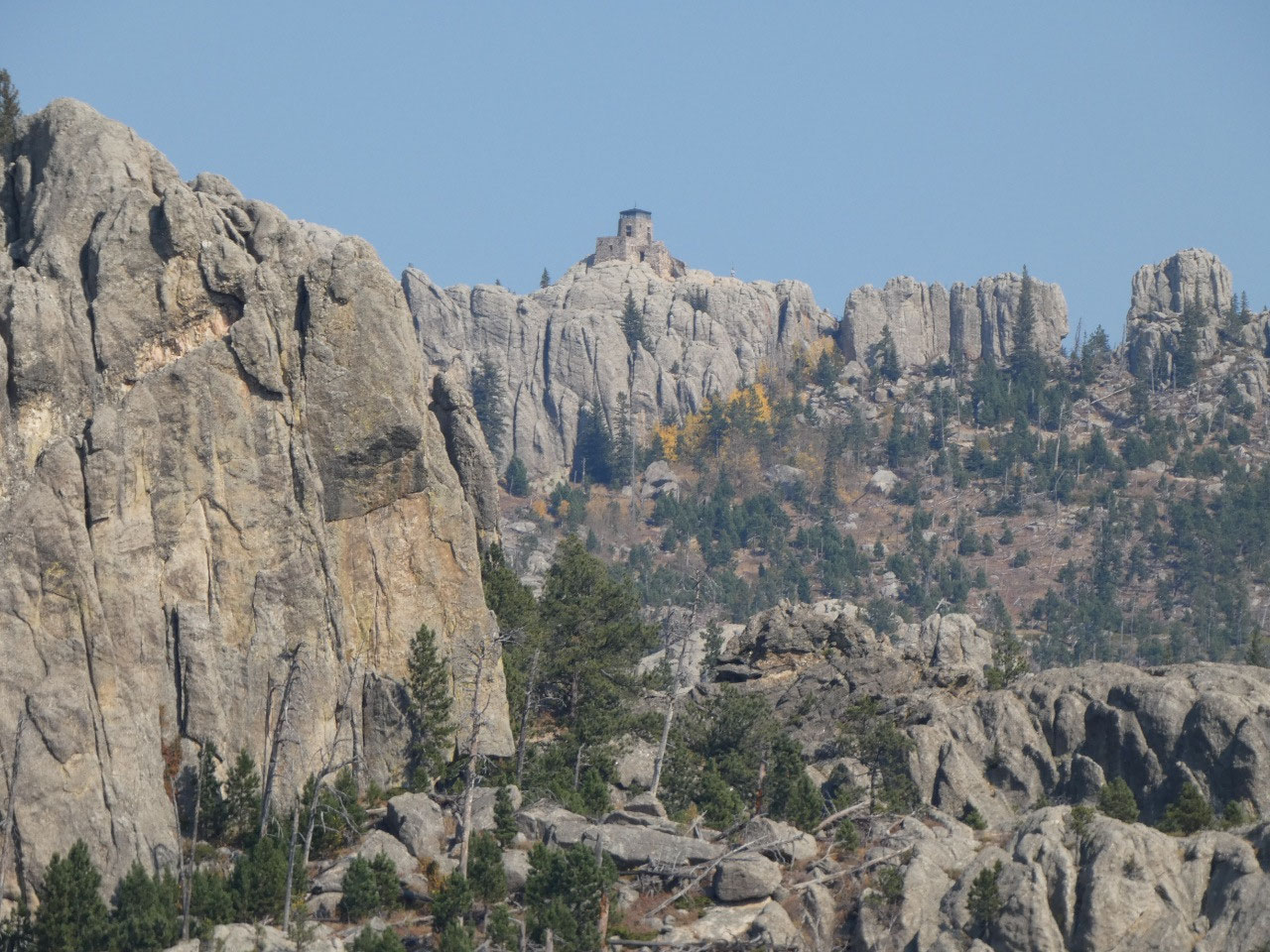
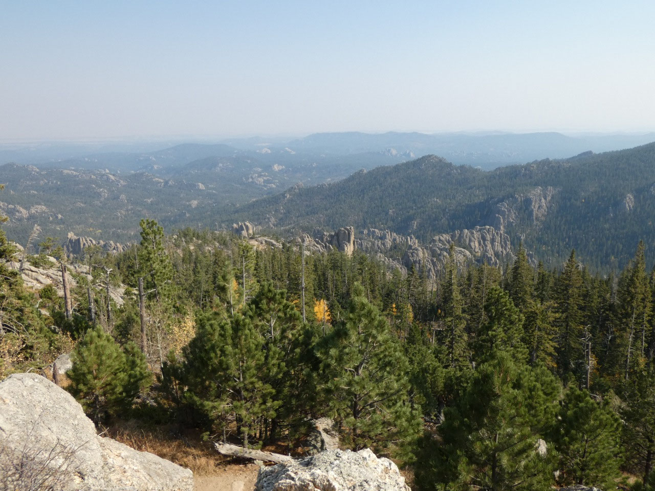
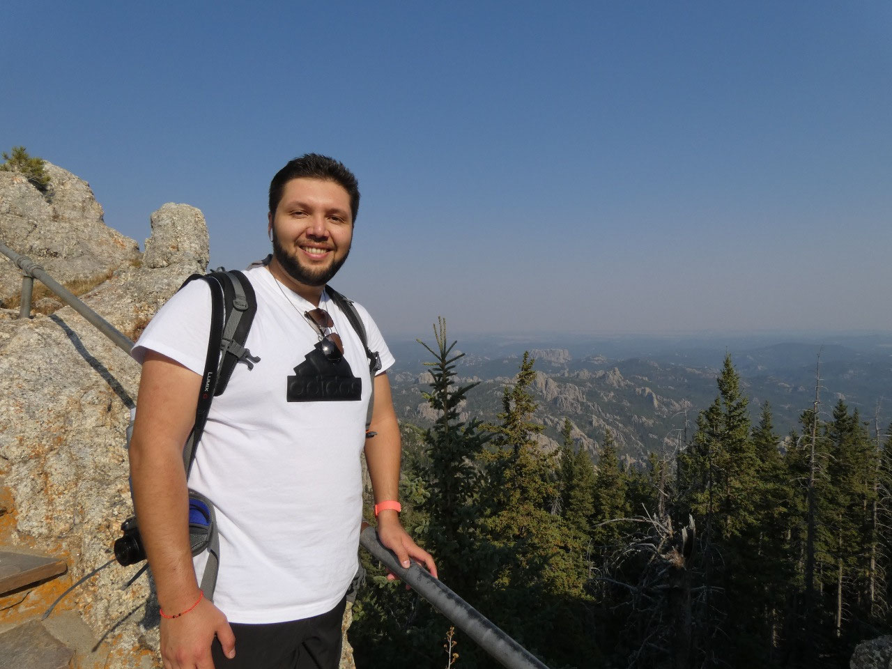
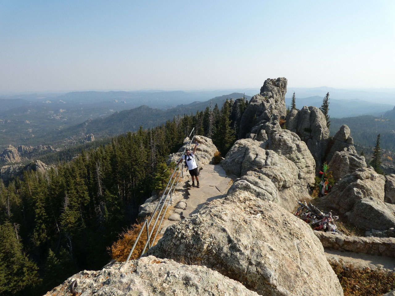
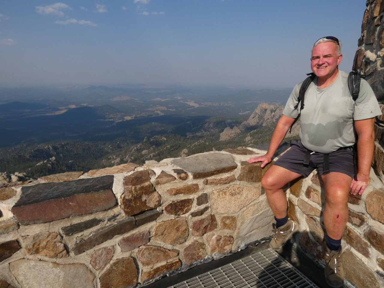
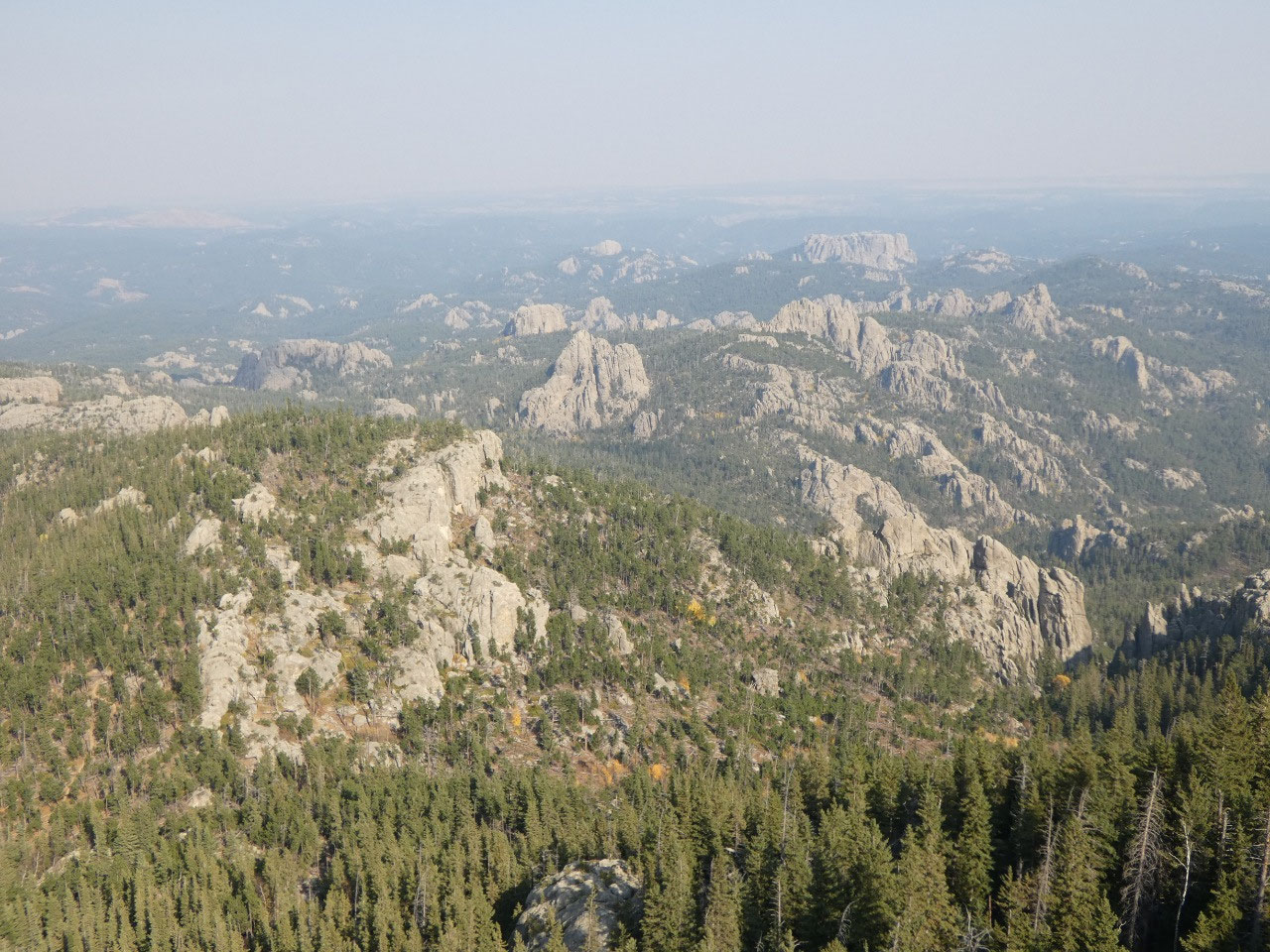
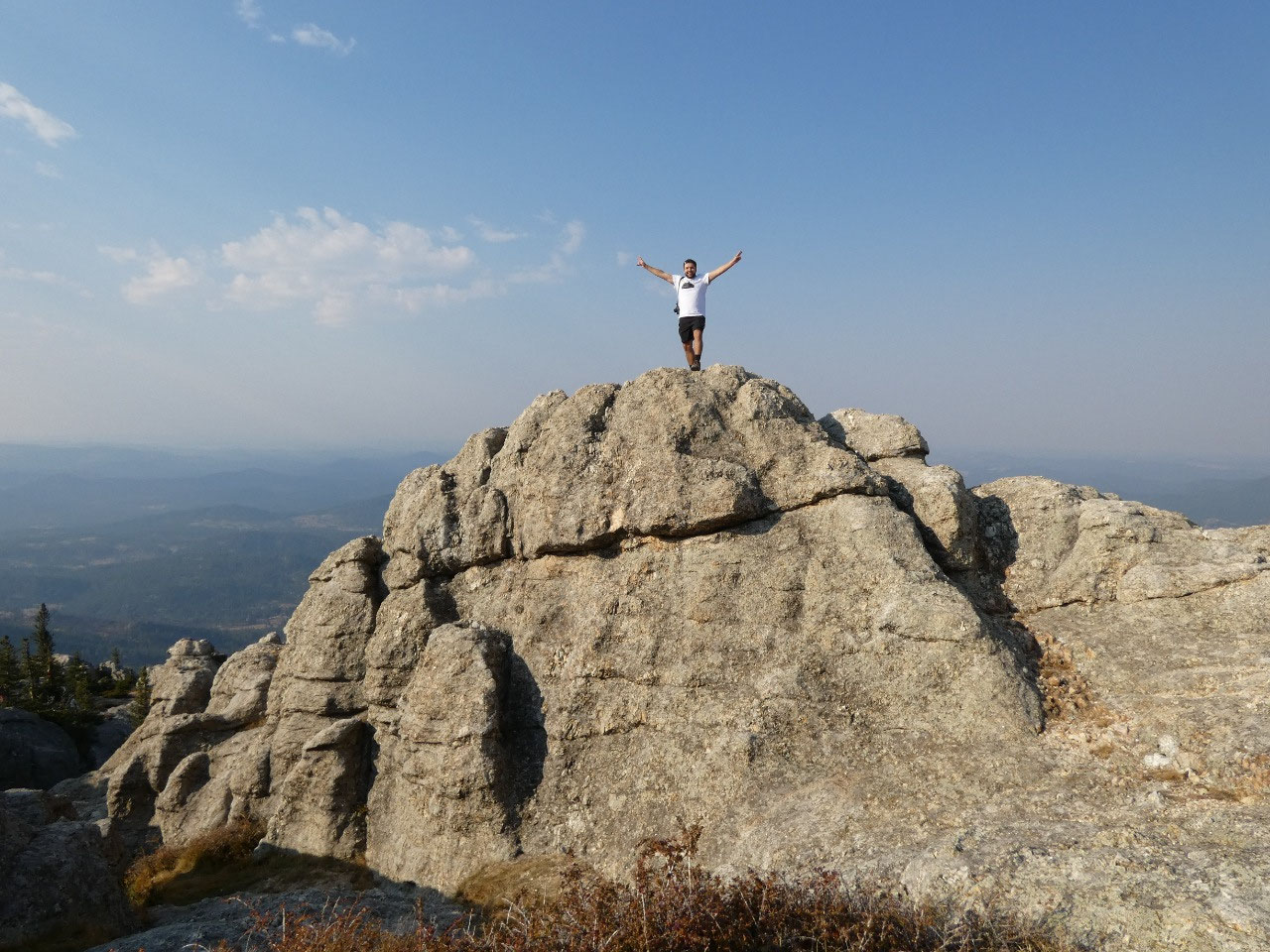
The views in all directions are impressive, and we lucked
out with a warm clear day. Mount Rushmore is only 4.5 miles to the northeast as
the crow flies, but the sculpture faces in the opposite direction so is not
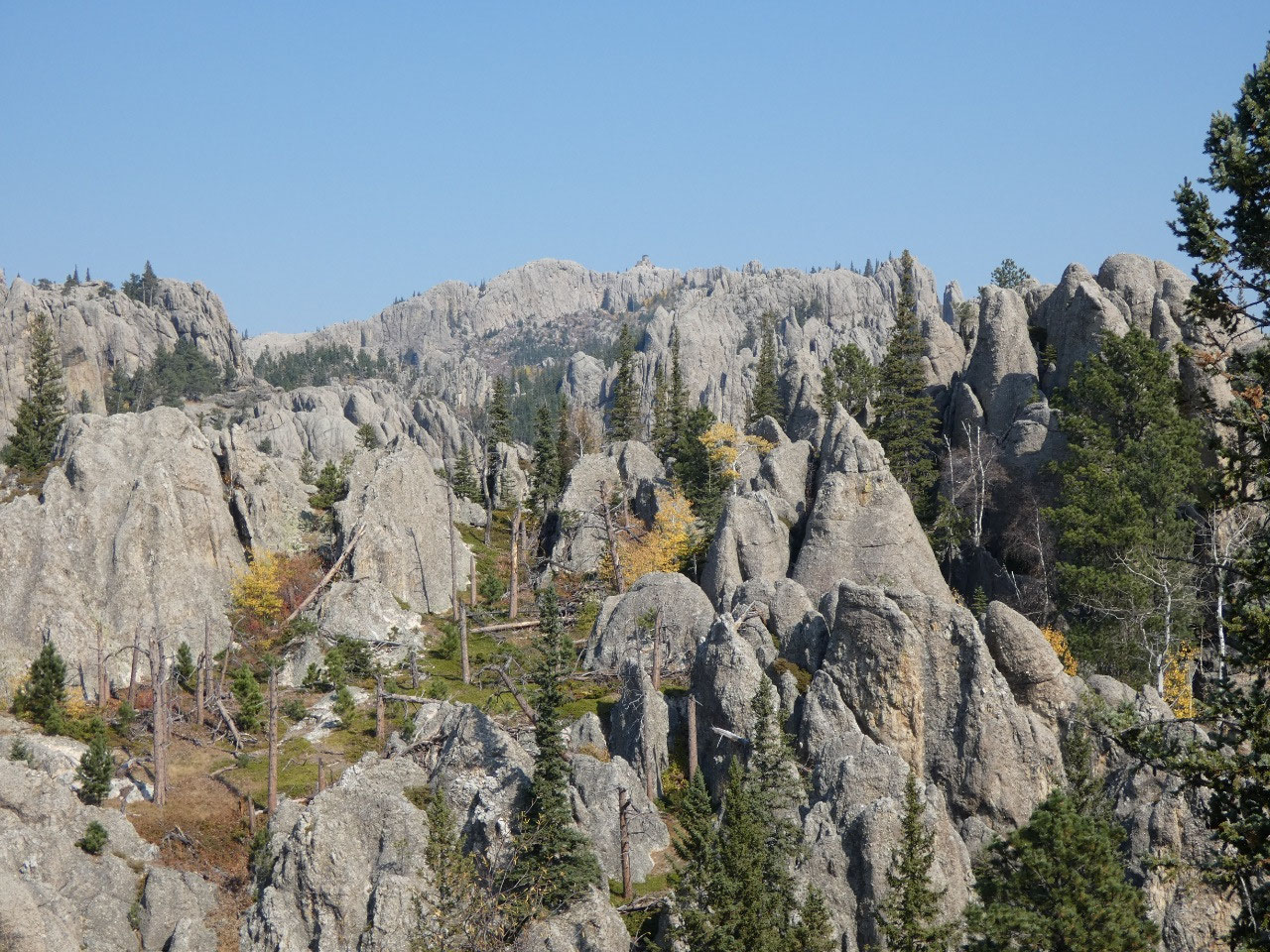
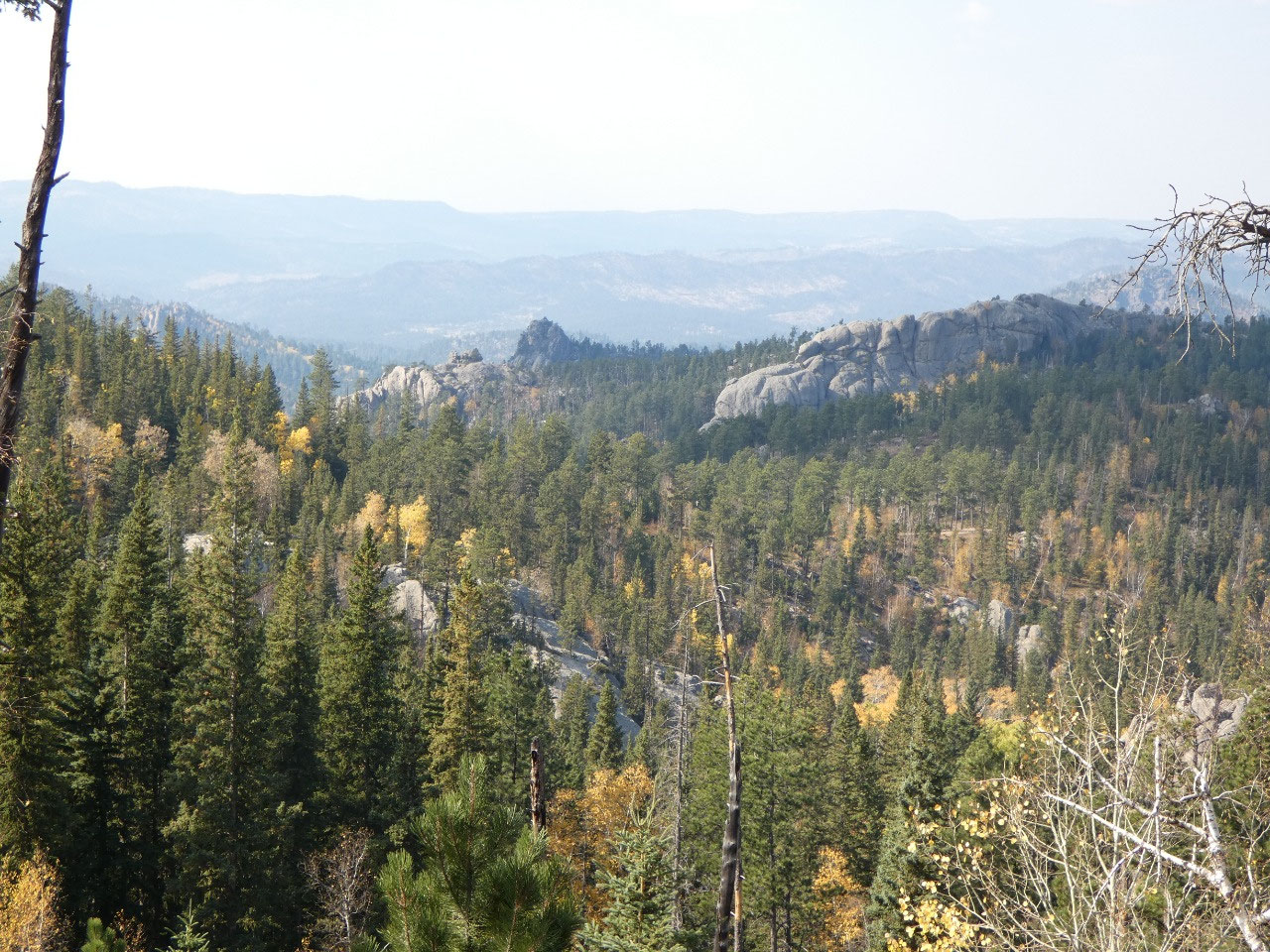
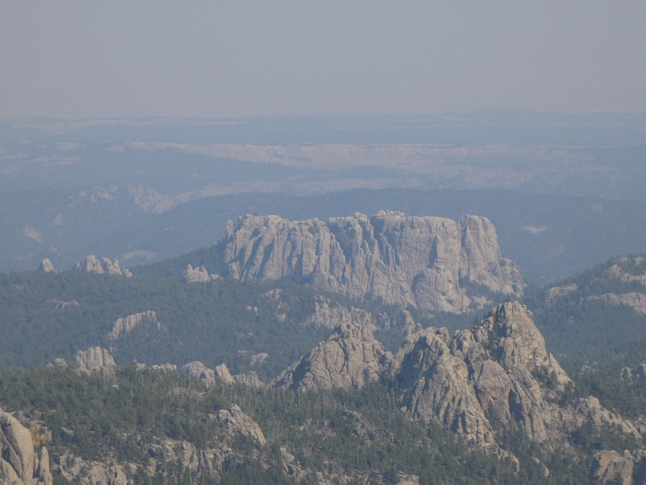
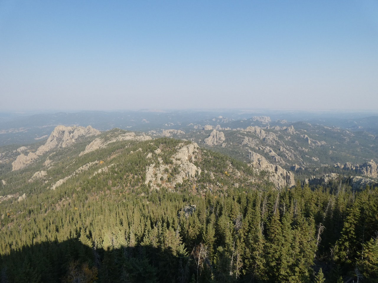
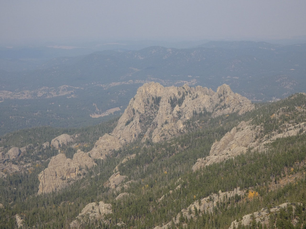
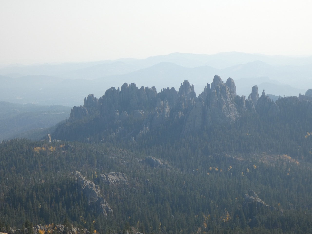
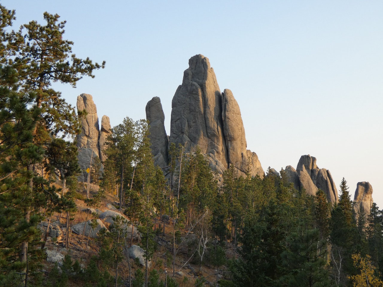
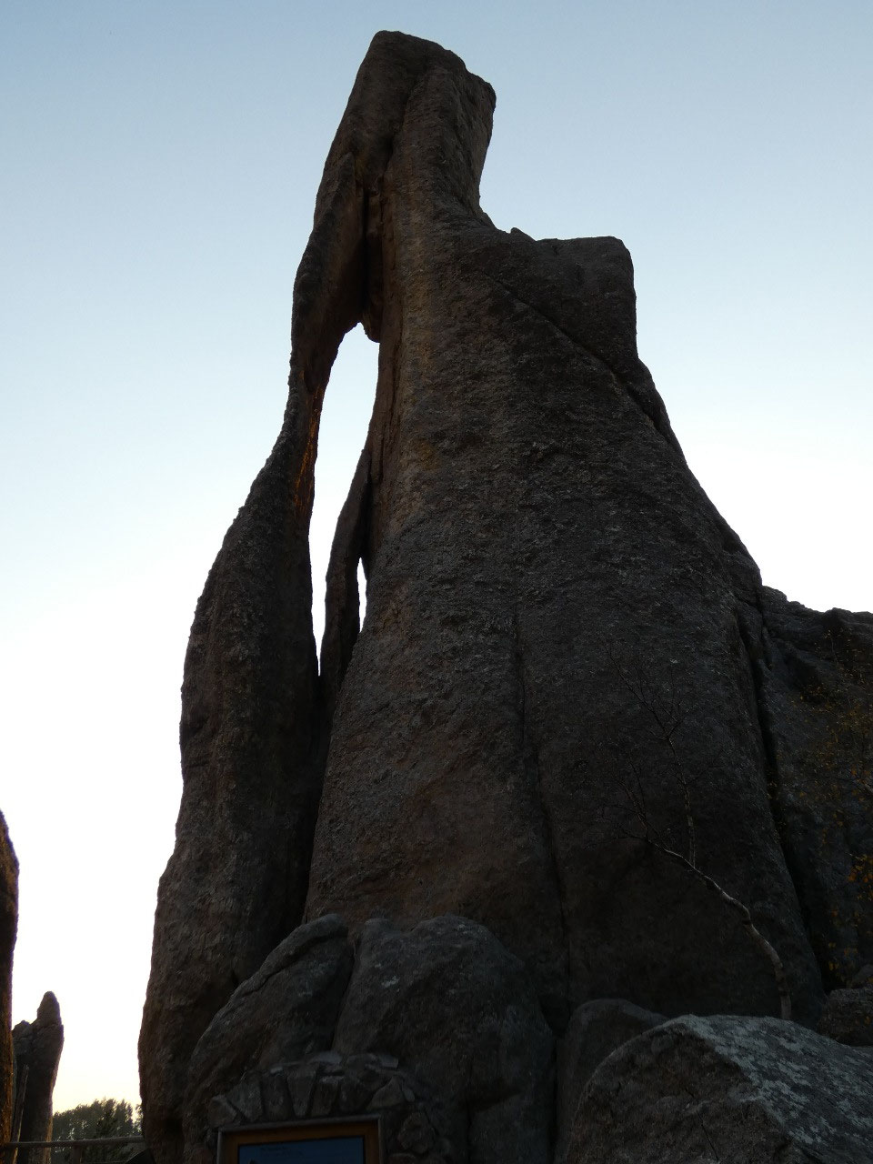
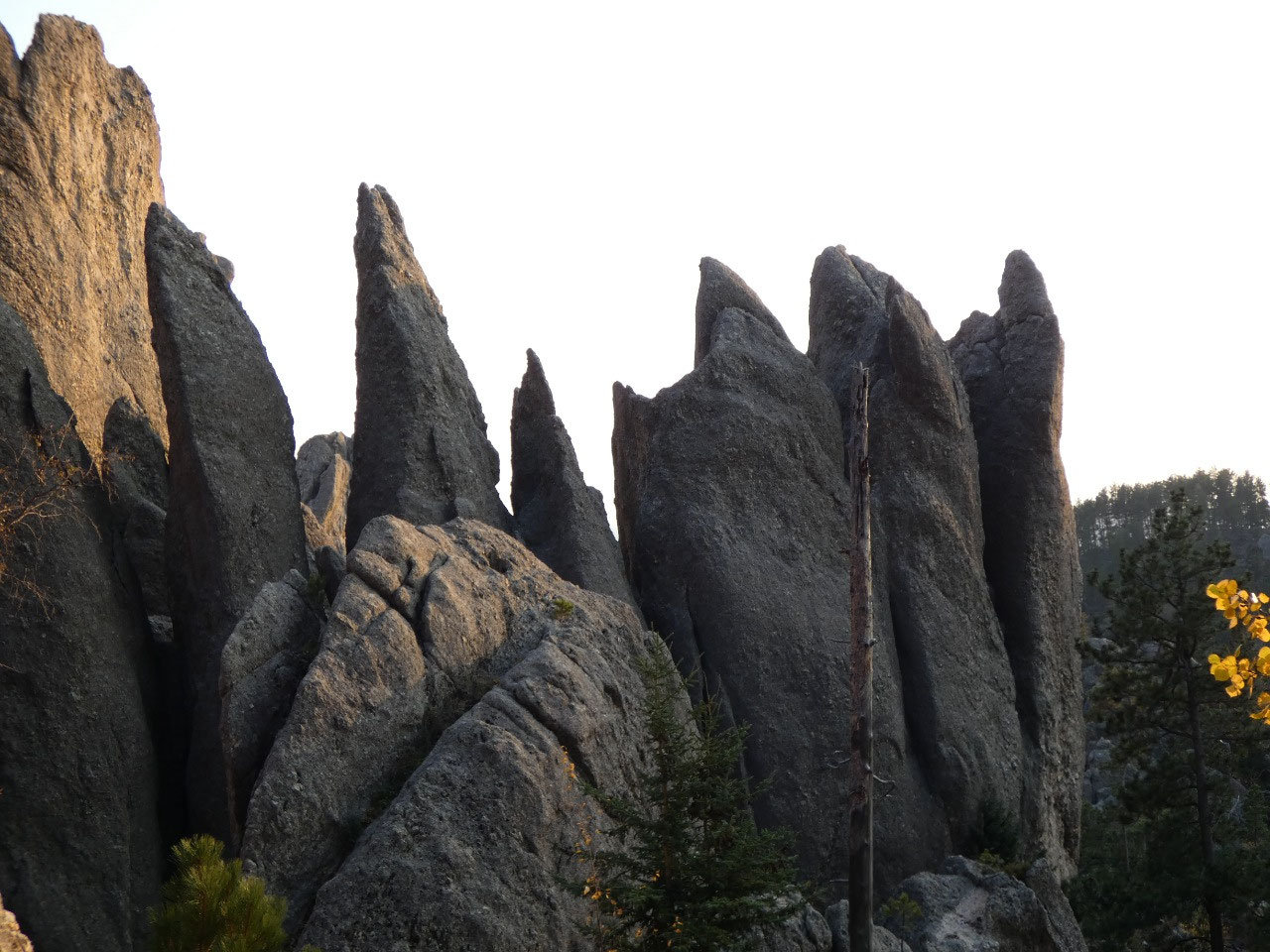
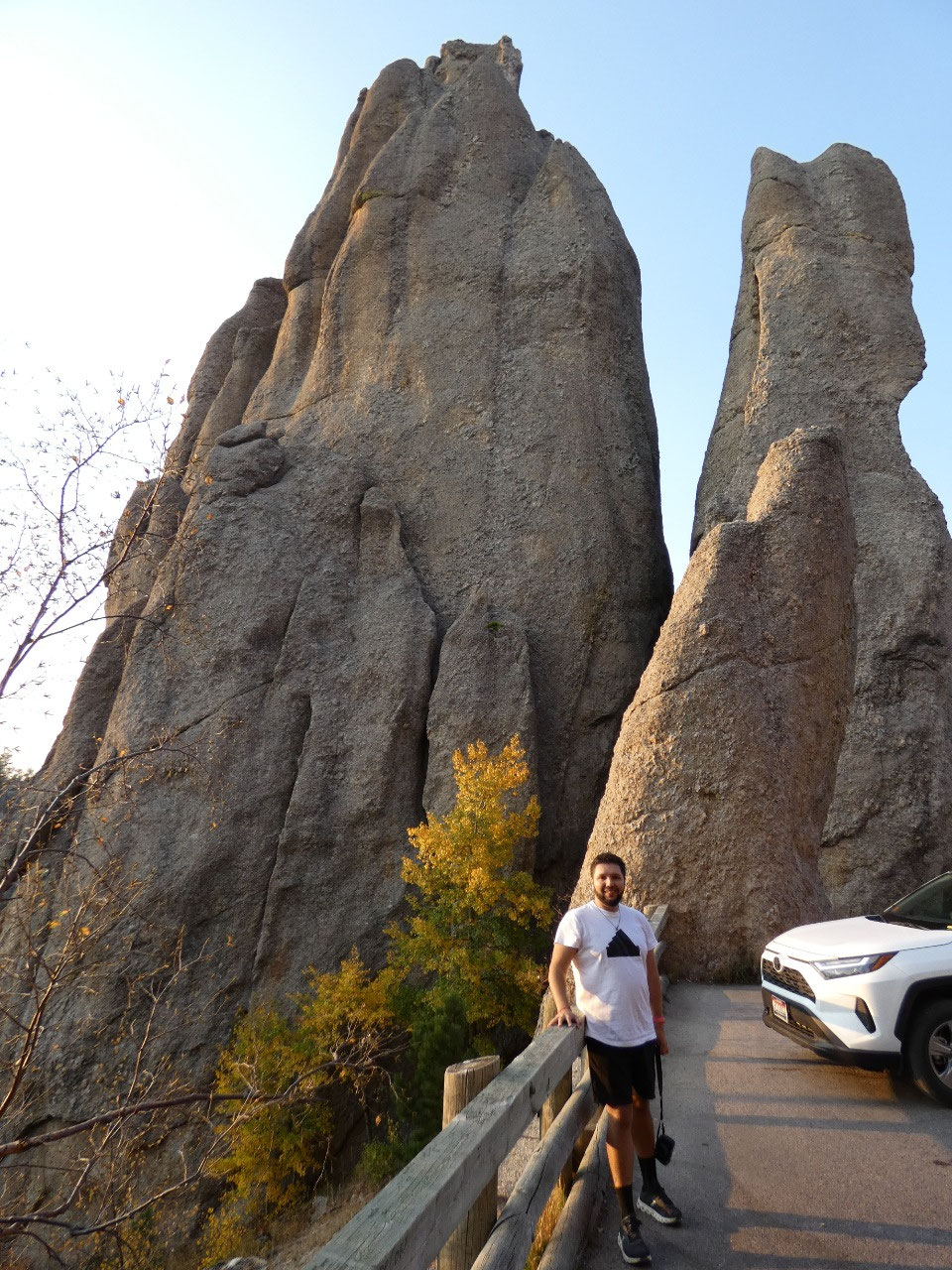
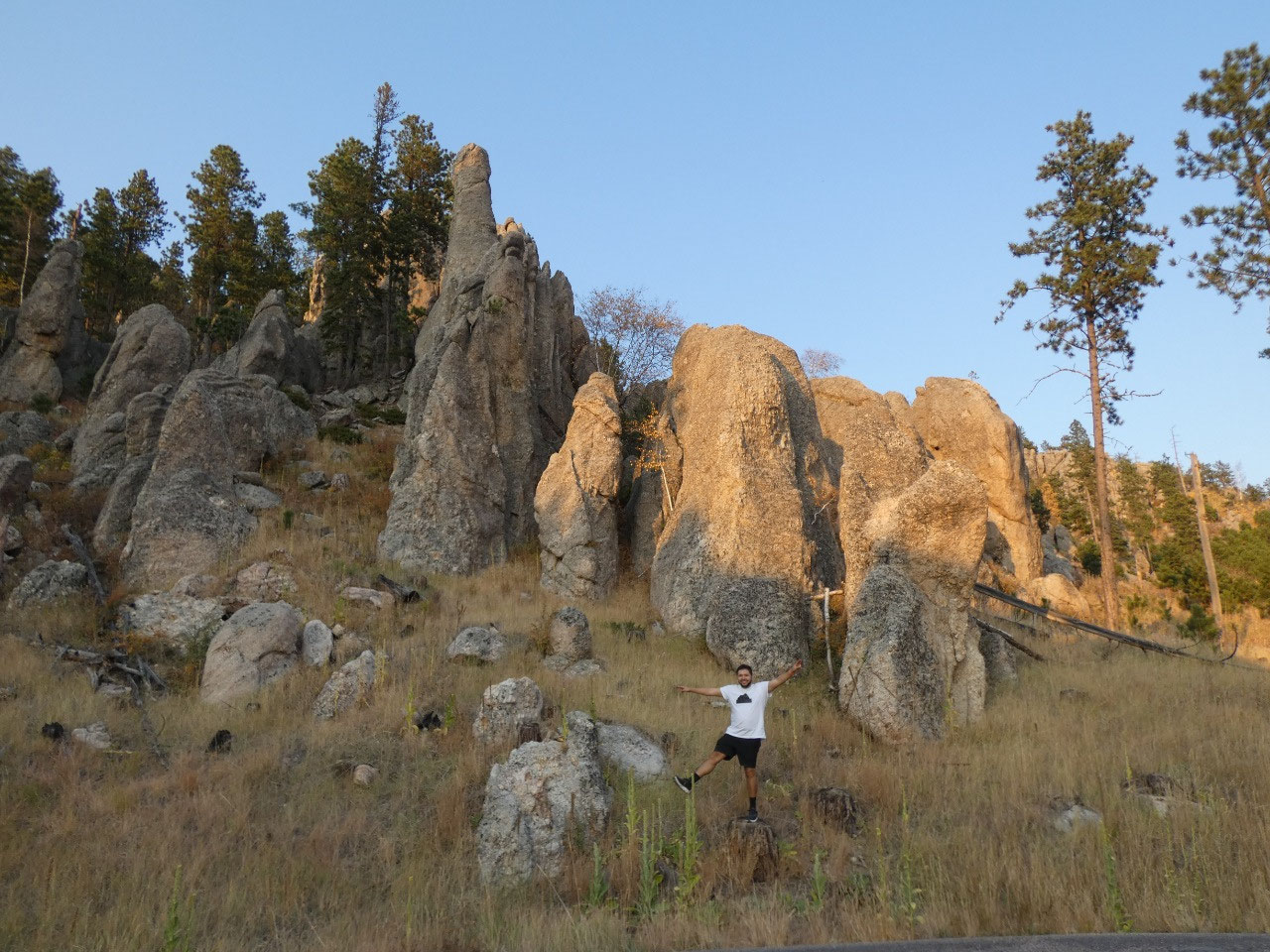
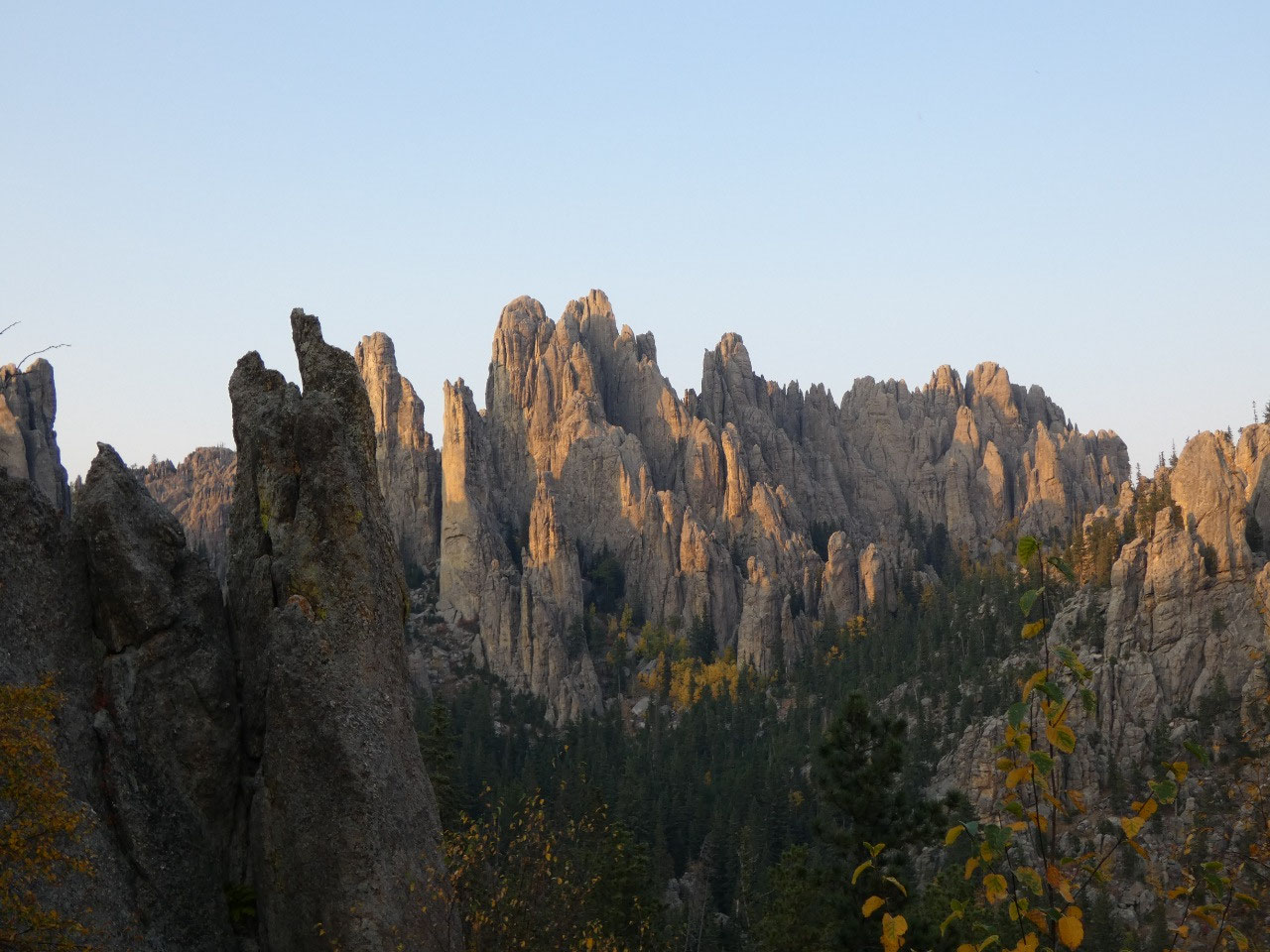
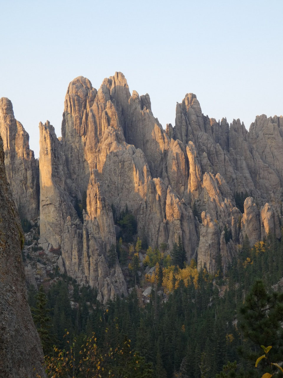
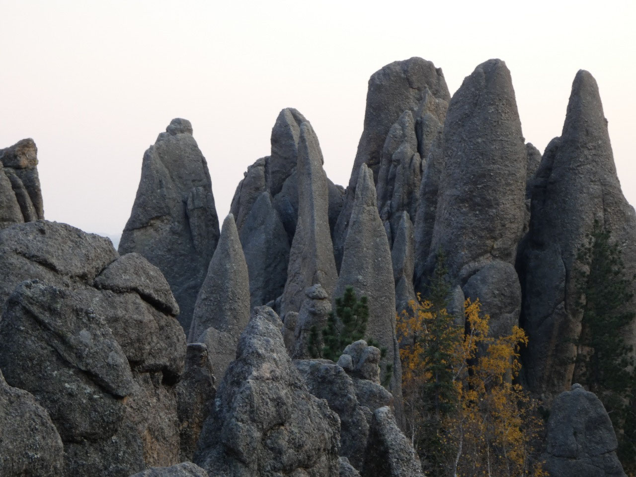
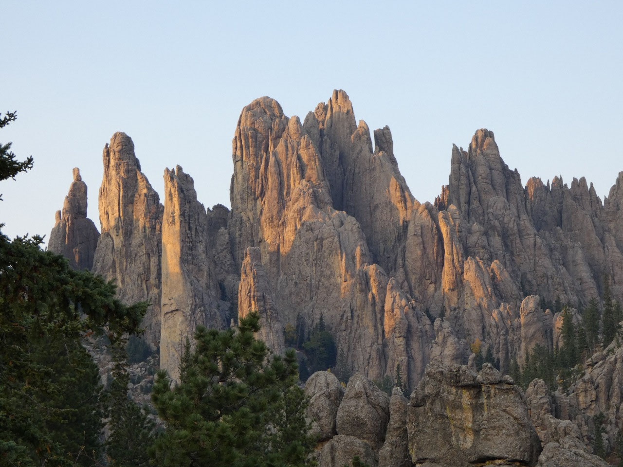
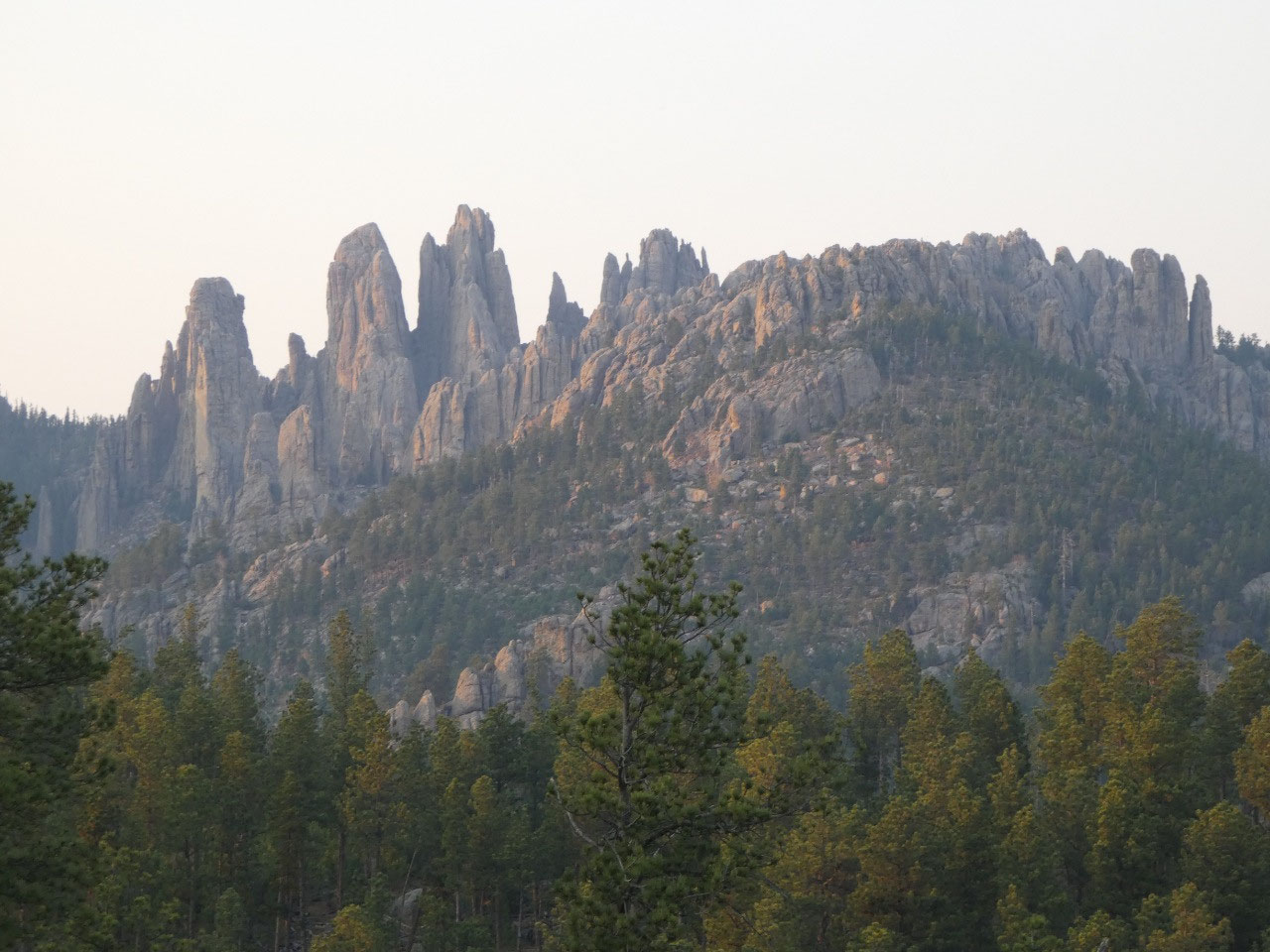
visible from Harney. The other impressive rock formations are to the southeast where
in the heart of the Needles are, the spectacular rock formation known as
Cathedral Spires rises high above the rest.
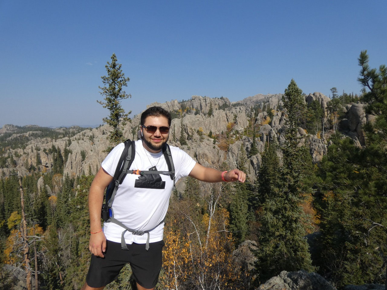
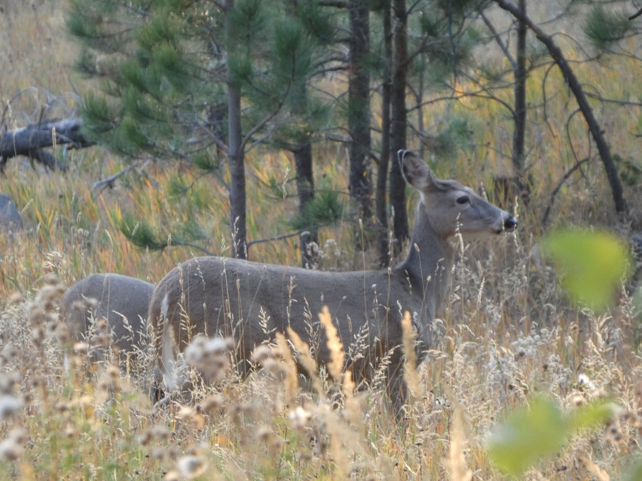
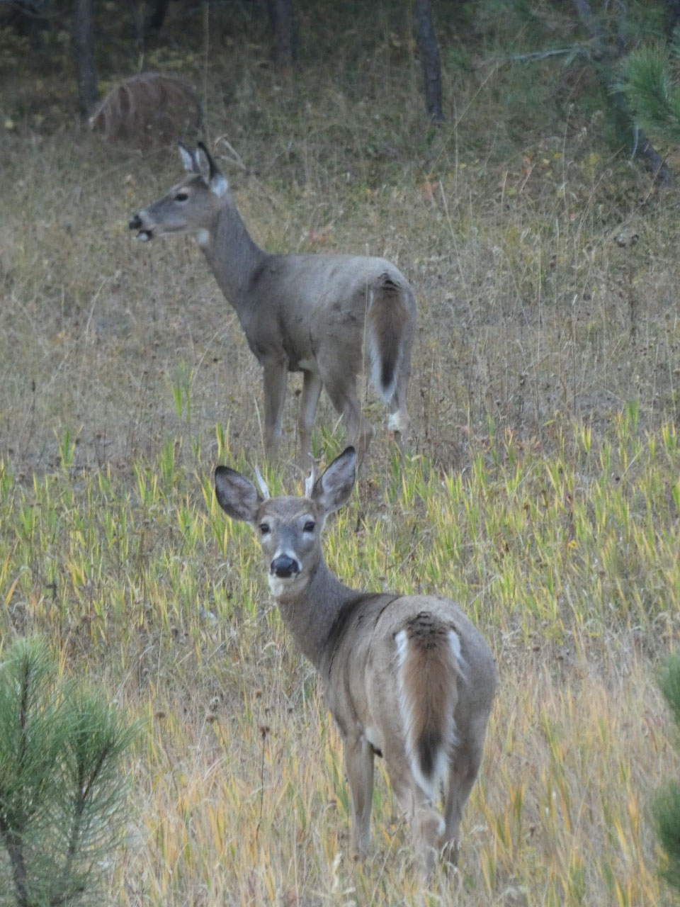
By the time we finished our picnic lunch on the summit, we realized we
were the last people on the mountain. It was nearing dusk by the time we
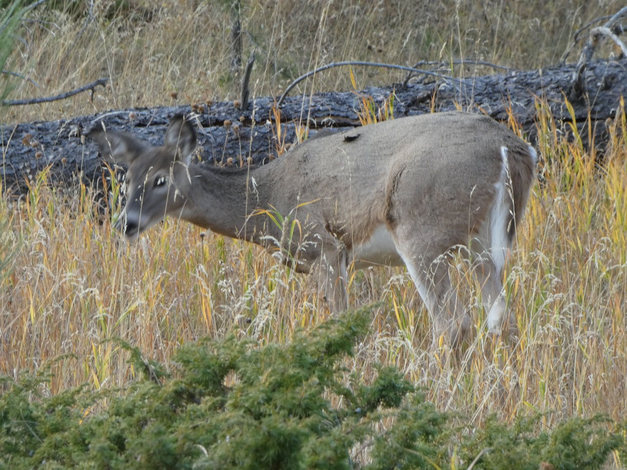
arrived back at the car and felt like the local white tail deer were having a
convention around the last half mile of trail.
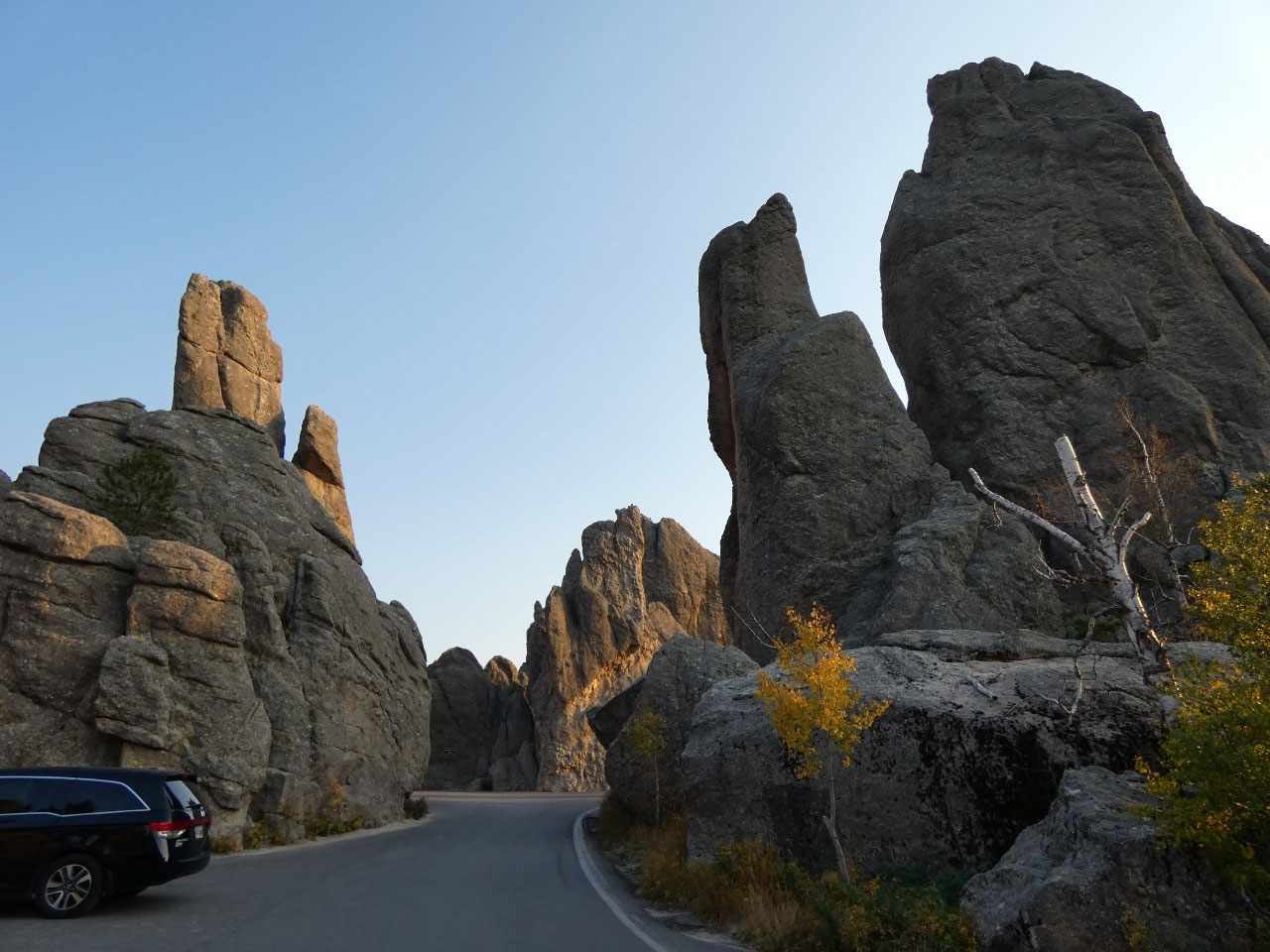
We drove the best part of the Needles Highway as
dusk approached, including through several narrow tunnels and past the Needles
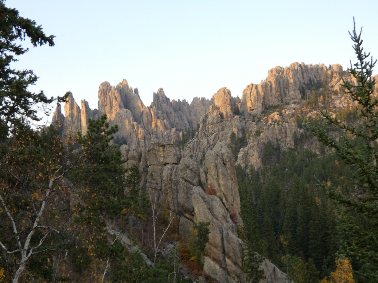
Eye formation. The Cathedral Spires look even more spectacular from below and
to the south. The relatively short trail to the heart of the spires was a
somewhat lesser goal for this trip but not one we were able to achieve. The
days are just too short in October!


2025-05-22