 Canouan, Grenadines, Grenadines/St Vincent
On New Year's Day we awoke early and departed Admiralty Bay at 0700 hours in between rain showers for Canouan, a sail of only about 20 nm, arriving on the south coast before lunch. The area we traveled was "littered" with squalls and soon into the passage Dave was glad he was only using the genoa in the 15-20 knot NE winds. Dark squalls appeared in the east and just ahead of us – on a collision course. The Grenadine islands plainly visible in front of us a few moments ago disappeared. We furled the genoa down to just a hankie to slow the boat, hoping the worst squalls would pass by in front of us. Dave set the radar to “see” the extent of the squalls and confirmed the worst were going to pass in front of us. But we got plenty of the “least worst” nonetheless. The highest winds we saw were in the low 30s but they didn’t last long.
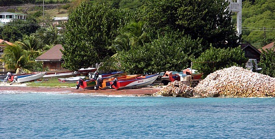
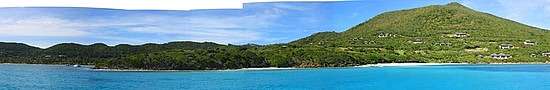
By the time we got to the SE coast of Canouan the sun was back out and we anchored all alone in Friendship Bay
. The popular spot on Canouan is on the leeward (west) side of the island at Charlestown Bay and we suspected the still heavy north swells would make that side uncomfortable. In fact, we soon heard over the radio the charter company “Moorings” based in Charlestown Bay warning that no vessels could approach their dock due to dangerous swells.
Our most current guide book had described Friendship Bay as untenable – unless north swells were running, in which case it was a better option than Charlestown Bay. Why no one else was there with us we cannot imagine! The book was right and it was certainly more comfortable than Bequia’s Admiralty Bay had been with the notorious swells of the prior couple of nights. From our anchorage we could see the forest of masts in the very popular Tobago Cays, less than 4 nm away. Our plan was to wait a few more days before venturing into the Cays, hoping that by then the weather would have calmed to some degree and the holiday charter crowd would thin out
.
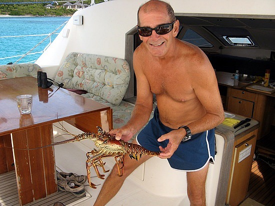
A local fisherman swam by our boat the next morning. “cap-pee-taan, cap-pee-taan, aalloe!”. Dave sprung from the salon to the cockpit to what sounded like a beckoning from a (hornless) Dominican bus driver. The fisherman was treading water and pleaded (in a rehearsed way) for Dave’s “help” so that he could purchase a new rubber band for his fishing spear. In exchange for the money we would give him, he would “give” us a lobster. We guess that is his creative way of selling lobsters. Dave was kind enough to “take the bait” although he responded with less money than the fisherman initially requested, but a fair price for a lobster (which Dave insisted on seeing first). Dave asked “How do I cook this thing?” Answer: “Jus trow it on da grill, mon.” Dave’s response (understandably since our grill was half the length of the lobster) “The whole thing?” Fisherman’s response: “Jus trow da hole ting on da grill”. The exchange was made and Dave was left trying to figure out how he was going to grill the lobster while Donna scurried off to read every cookbook she had on board to see which one would save the day
.
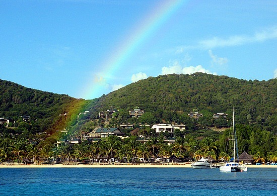
Speaking of books, we have several guidebooks covering different areas of the islands, including a couple of older guides by Don Street, probably the most famous Caribbean cruiser ever (he has spent at least 3 decades in the area). Our copies are even autographed by Street as Dave purchased them from Street personally at the Annapolis Boat Show one year. Because shore facilities and other island information changes so frequently, the most popular guide books are updated every couple of years and Street’s are considered outdated. His answer to Dave for lack of updating is “rocks don’t move”, but his guides are not big sellers anymore. His guides are known to recommend off-the-beaten-track anchorages and one of these was just around the corner from us on the east side of Canouan. On that windward coast of the island lies a barrier reef less than a mile offshore. Inside the reef is a narrow, shallow passage along the island coast that leads to a pretty good size Bay on the northeast side of the island, where an exclusive resort and Jim Fazio-designed 18-hole golf course can now be found
. Street described this as a superb anchorage for shoal draft boats, which includes us, and described how a “seasoned sailor” with a “good deal of skill” in a shoal draft boat could navigate through the shallows and coral heads to find this isolated anchorage. The more current guidebooks did not describe this area at all.
We never pass up an opportunity for a secluded anchorage (and Dave was intrigued by Street’s “challenge”) and this one was too close not to try out (with reef snorkeling to boot), so we departed Friendship Bay the next morning (January 2) and cautiously stuck our nose around the point into the passage behind the windward side reef as soon as the sun was high enough to help us see the bottom. And see it we clearly did. As we motored the short distance from Friendship Bay it quickly became apparent that this wasn’t too difficult a move – we navigated this way throughout last winter in the Bahamas – and the shallowest water we encountered was still seven feet deep
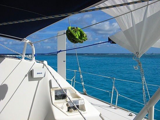
. We had been in shallower spots in the Bahamas. Heck, we had anchored in less than that in Bequia! Pas de Deux draws 4 feet 3 inches under the rudders. We passed a couple beautiful sandy spots we could have easily anchored at but Dave’s eagle eyes saw that there could be even better ahead and was encouraged by the ample depth soundings thus far. We continued on and before long a big white sandy bottom appeared in front of us beside a gorgeous resort that had been hidden from afar behind a point of land. There were no other boats and the anchorage was well protected from the wind and swell by the north shore and barrier reef. Just to seaward the barrier reef was breaking up the waves and providing a constant and soothing surf sound. The anchor set immediately in the soft sugar sand and Dave decided he didn’t need to dive on it as he could clearly see that it set well some 75 feet from the boat – the water was that clear and the sand that white. Beyond the reef, nothing lay windward of Pas de Deux but Africa. Simply lovely.
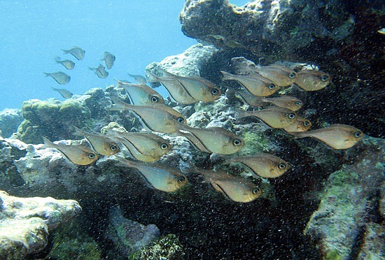
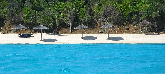
We took the dinghy out to sample the reef in calmer areas but found mostly shallow moss-covered rocks and tiny fish with just a couple of fan corals. It would have been too rough to venture further out in the ocean to the opposite side of the reef in this season. We were quite disappointed but were happy to be in such clean, clear water, if only for swimming. The water temperature read 82.6 degrees. We saw a couple of stingrays nestling in the sand below the boat during our stay. Donna was convinced they were seeking some shade in the shadow of our hulls.
Adding to the appeal of the anchorage, we were able to pick up a strong wifi signal – apparently from the resort – that has permitted this update of our blog. Now it's time to go swimming!
Southbound to Canouan
Tuesday, January 04, 2011
 Canouan, Grenadines, Grenadines/St Vincent

Other Entries
-
Dec 287 days prior Soufrière, Saint Lucia
 -
Jan 013 days prior Bequia, Grenadines/St Vincent
 -
Jan 04
Canouan, Grenadines/St Vincent -
Jan 073 days later
Tobago Cay, Grenadines/St Vincent -
Jan 128 days later St. George's, Grenada
 -
Jan 1814 days later
St. George's, Grenada -
Jan 2420 days later
Mustique, Grenadines/St Vincent -
Jan 2521 days later
Mustique, Grenadines/St Vincent -
Jan 2622 days later
Mustique, Grenadines/St Vincent -
Jan 2723 days later
Bequia, Grenadines/St Vincent -
Jan 2925 days later
Marigot Bay, Saint Lucia -
Jan 3026 days later Portsmouth, Dominica
 -
Feb 0128 days later
Portsmouth, Dominica -
Feb 0431 days later English Harbour, Antigua and Barbuda
 -
Feb 1138 days later
Codrington, Antigua and Barbuda -
Feb 1340 days laterGustavia -
Feb 1542 days later Simpson Bay, Saint Martin
 -
Feb 2249 days later
Simpson Bay, Saint Martin -
Feb 2754 days later
Simpson Bay, Saint Martin -
Feb 2855 days later North Sound, Virgin Islands British
 -
Mar 0358 days later
Anegada, Virgin Islands British


2025-05-23