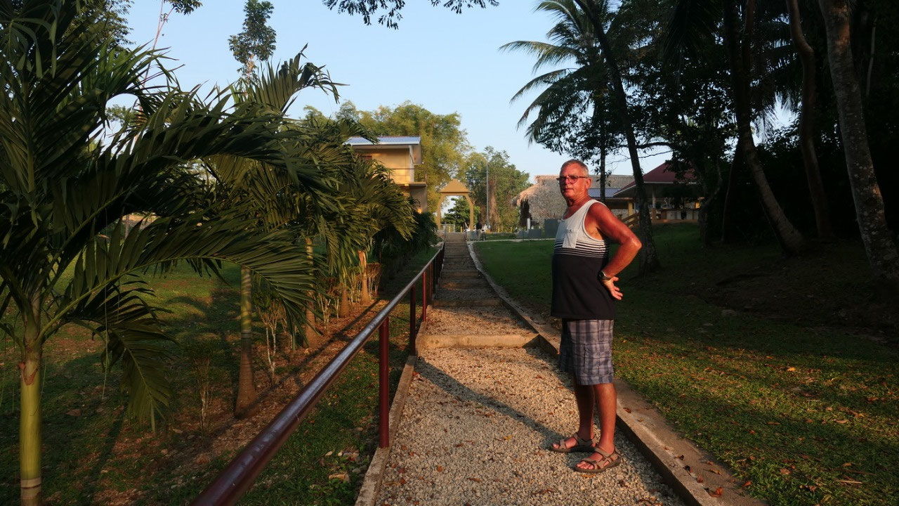
 The Chaos Oasis, Toledo District, Belize
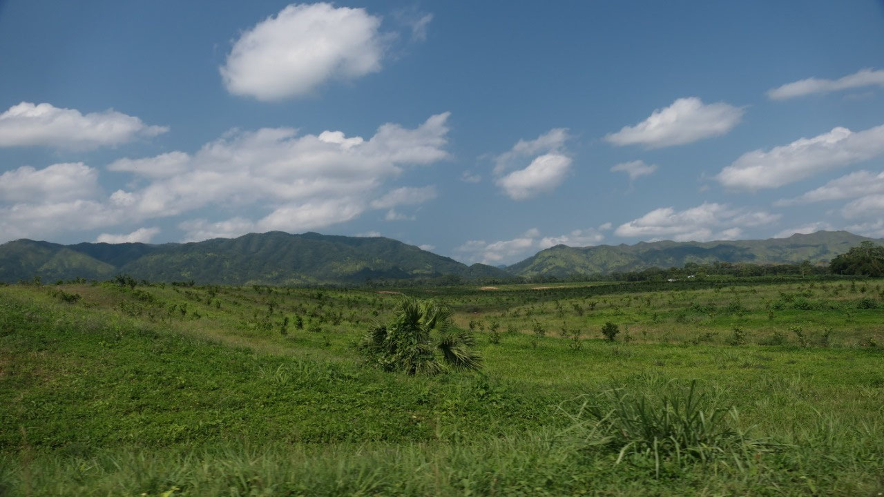
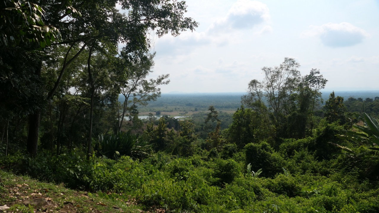
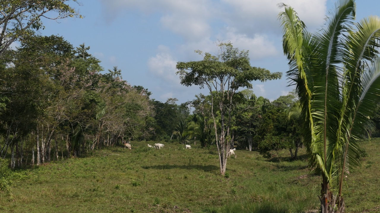
Maya Mountains
Dangriga
Shopping
already
coming in we could see that our car is still there and yes all was in
it – it was only a bit more dusty. No-one around. We quick walked
over to the Scotia bank who knows when there is another one: and we
needed 3 tries but finally the ATM accepted our debit card!! - Right
near it was a supermarket and we couldn’t believe it they had
lactose free milk, so we got enough for the rest of the vacation. The
supermarket across the road had nothing we needed, so we ventured
through back roads to the big Family shopping center and found there
the rest of the staff we wanted like baby oil against sand flies!!
and 2 bags of ice for our cooler. The lady at the cash was super nice
and told us to “never pick up a hitch hiker, there are good and bad
people everywhere and it is always better to be careful.”
on
the way South
in
the next 2 days we will go to the furtherst south point of Belize: we
had some beautiful glimpses on the mountains and another thing which
we saw a lot today are the pine trees – sometimes it nearly felt
like beingat home, with the main difference here it’s way more
humid and warmer.
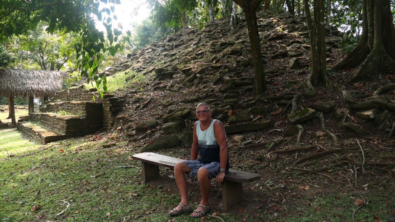
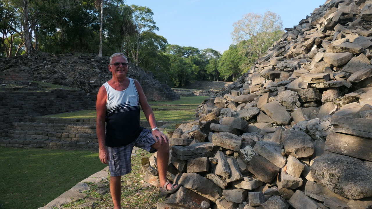
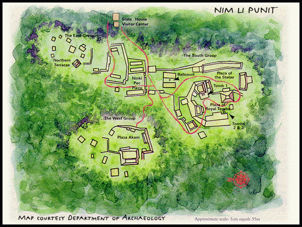
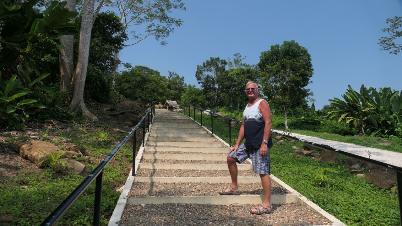
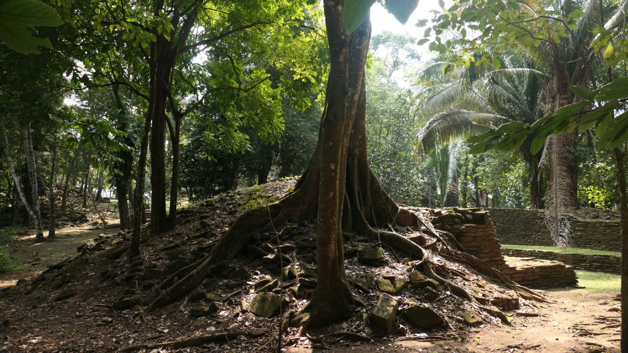
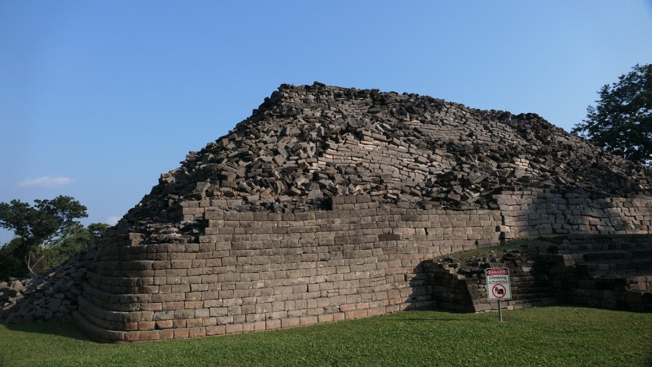
Nim
Li Punit Ruins
and
then the turn off comes to the Nim Li Punit ruins and Gine says to
Paul, so here in the Deep South we should be nearly alone and no
cruise ships – wrong!! there were 3 buses from the Oceania
Cruiseline, good thing they were all leaving.
What
are the Nim Li Punit Ruins famous for?
- it’s atop of a hill surrounded by forest and mountains
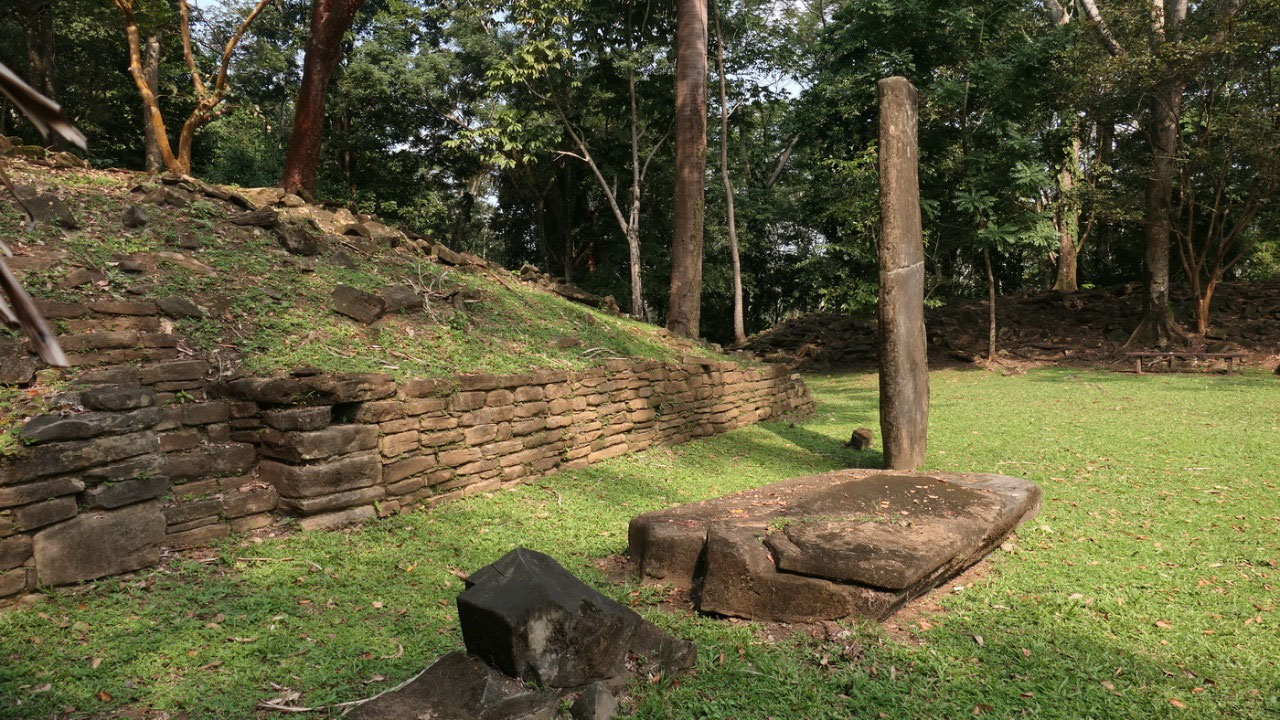
- it's famous for it's stelae: they found over 25 stelae, with the best preseved and the 2nd tallest stelae (30ft) in the Mayan world
- the name means “big hat” in Kekchi – because the ruler on the longest stelae wears a hat and is called Nim Li Punit - which you can see on one of the stela
- it was inhabitat from 400- 850 AD and they assume that probably 5000 – 7000 people lived here
Finding Nim Li Punit ruins:
- it got rediscovered in 1976 by oil prospectors
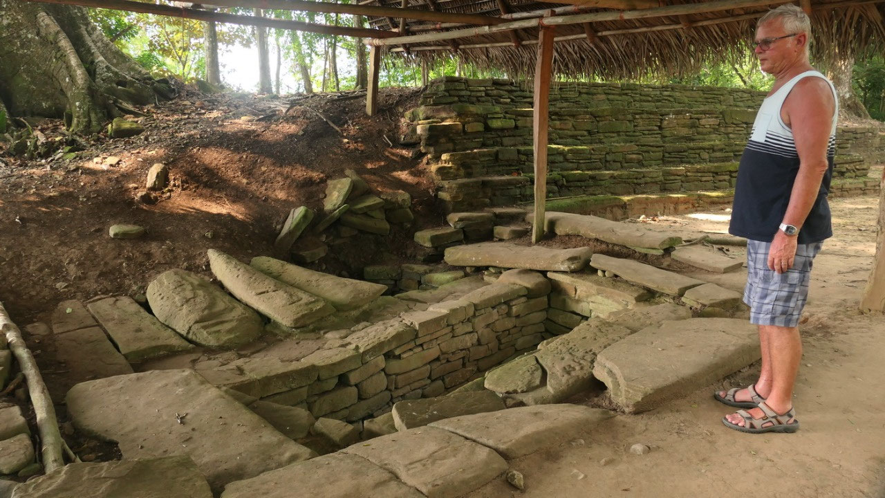
- in 1983 the surrounding areas were surveyed and in 1986 a royal tomb 1 was discovered: and we looked down it it
- 1998: restorationwas carried out, financed by the EU: they focused on consolidations of the structures with the greatest risk of destruction and the overall development of the site for tourism – they put in the trail system and the tourist information - and they found 2 more tombs
- 2012: a research was done to find out the relations with neighbouring sites like Lubaaantun, finding similarities and differences
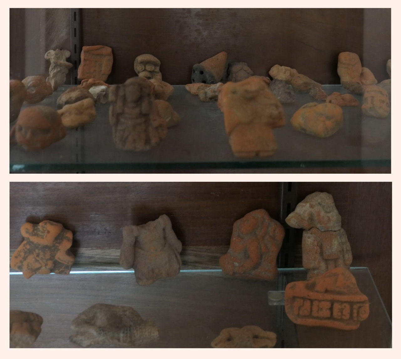
- 2015 they did some more excavations to better understand the history , they discovered tomb 5 with a lot of ceramic shreds, obsidian pieces, human remains, obsidian blades used for blood letting, over 25 vessels and they found a pendant: the wind jewel
We
started out in the little Museum:
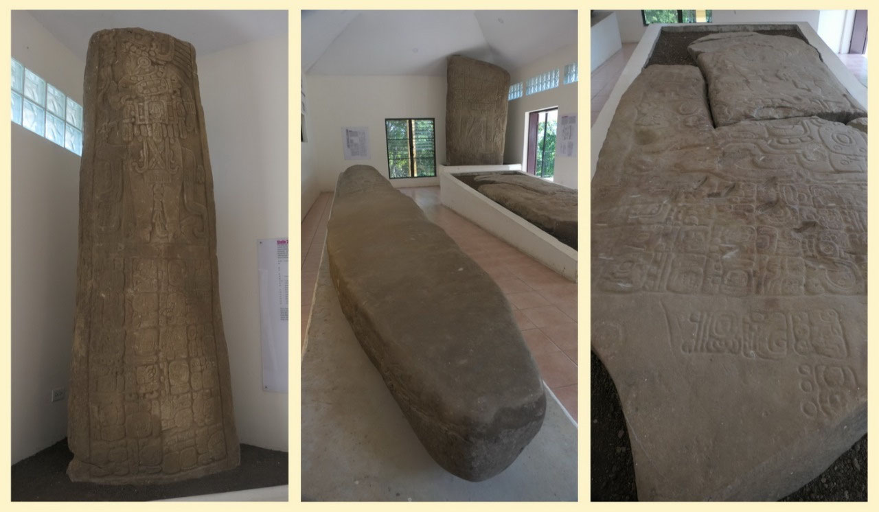
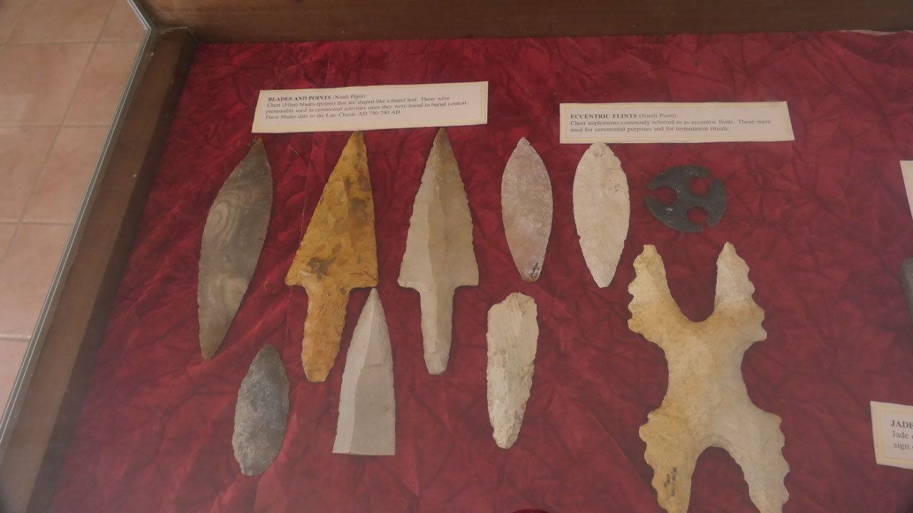
The
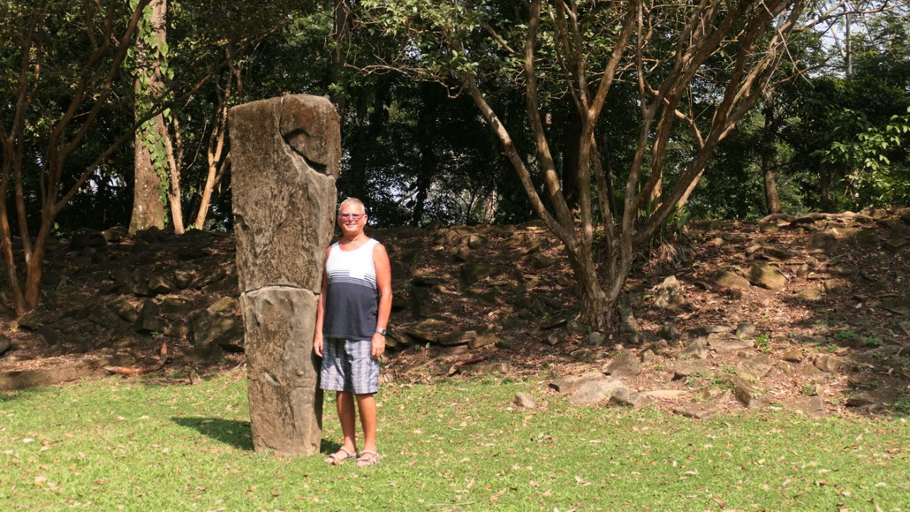
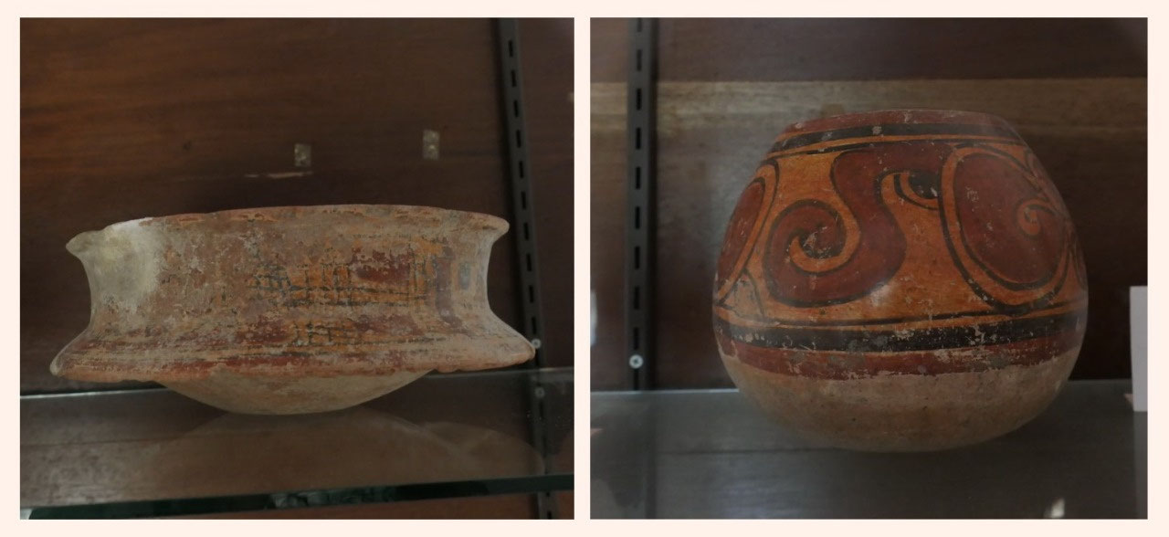
Stelea: where they had 3 amazing stalae with a lot of the
hieroglyphs still on them as well as figures I think it is super
fascinating – even better they have near them explanations what all
means. One of them was the 2nd largest Stalae found in the
Mayan world: also when you look at the details wow: and yes we
discovere the big hat. The other stelae you can see how a ruler drops
offerings on a monster... no imagination – all facts.
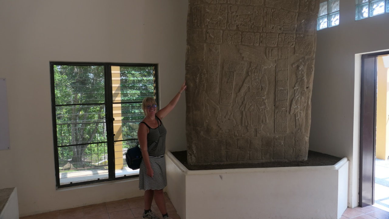
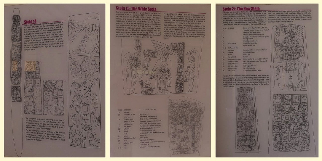
- Stelae: are monuments that recorded important events: important alliances, wars, battle victories, family trees of leaders, visits from other sites
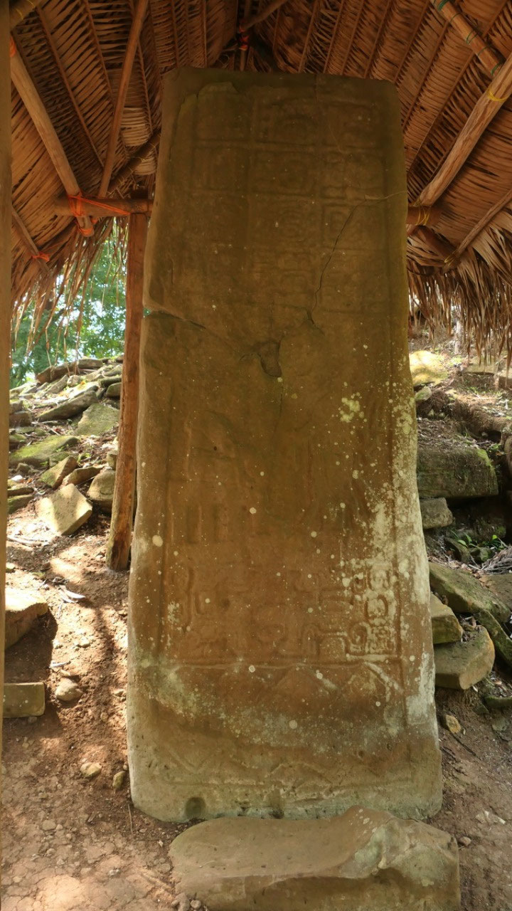
- in Nim Li Punit: 7 stelae were carved between 734 – 741: telling us the story of the ancient Maya, most of the stelae were originally at the plaza of Stelae and relocated into the museum to protect the delicate sandstone and limestone carvings
- Stela 1: The Mat Stela is still at the Plaza: it shows a woman sitting and a man standing likely blood letting – below the figures is the mountain spirit
- Stela 2: the Jaguar Stela
- Stela 15: the Wide Stela: the enourmous head dress of the ruler on this stela gave the site the name – it looks like this scene is after the blood letting, this stela has the longest hieroglyphic inscription and it the earliesst carved monumnet from this site: from Oct 9, 721 AD – there is a date from 524 AD (200 years before the stela was erected)
- Stela 14: is the tallest Stela in Belize 9.5 m long and the 2ns tallest ever built by the ancient Mayans (the longest is in Quirigia / Guatemala) – because it was found unbroken, it is suspected that it was never raised/planted – it’s about a offering or sacrifice in the company of several gods/spirits
- Stela 21: the New Stela – because it only got discovered in 1998, since it was found lying face down it was very well preserved: it describes the blood letting: what is really cool near the stela was an exact description about each of the hieroglyphs – so we know the stela is from 790 AD
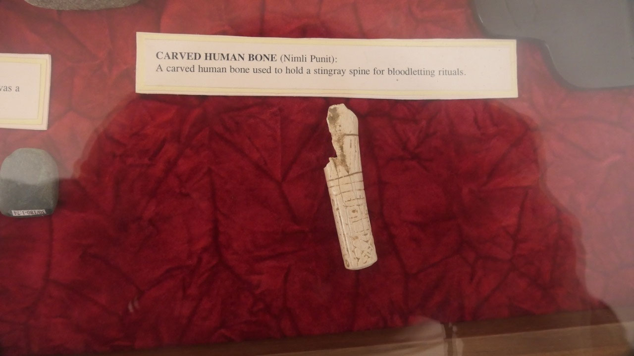
Another
interesting Artefact here was the carving of a human bone which could
hold a stingray spine for blood letting.
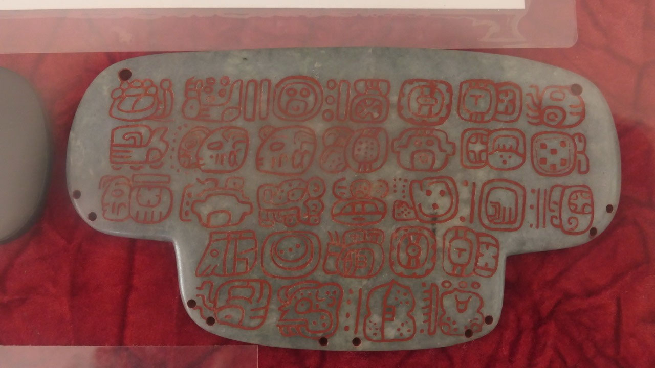
the
wind Jewel: it’s a jade artefact in a t-shape. They say it was
worn by the kings during ceremonial incense burning (as it could be
seen on the 2 stelae) on one side it has a carved in T = the Mayan
glyph ik = wind: it represents the breath of life and the winds that
bring the rain – and more interesting as per Gine is the back with
some historical writing – that is how we know that it is from 672
AD. On one of the Stela you can actually see the ruler wearing this
pectoral - they found it in tomb 5.
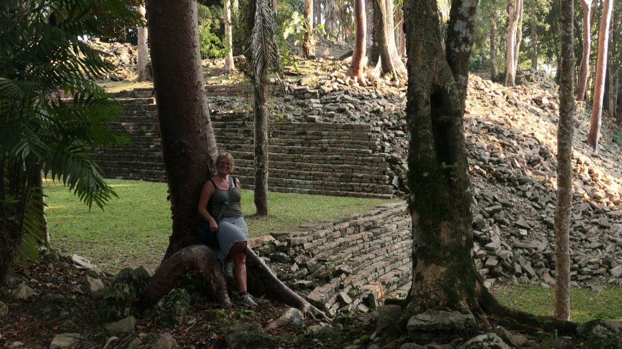
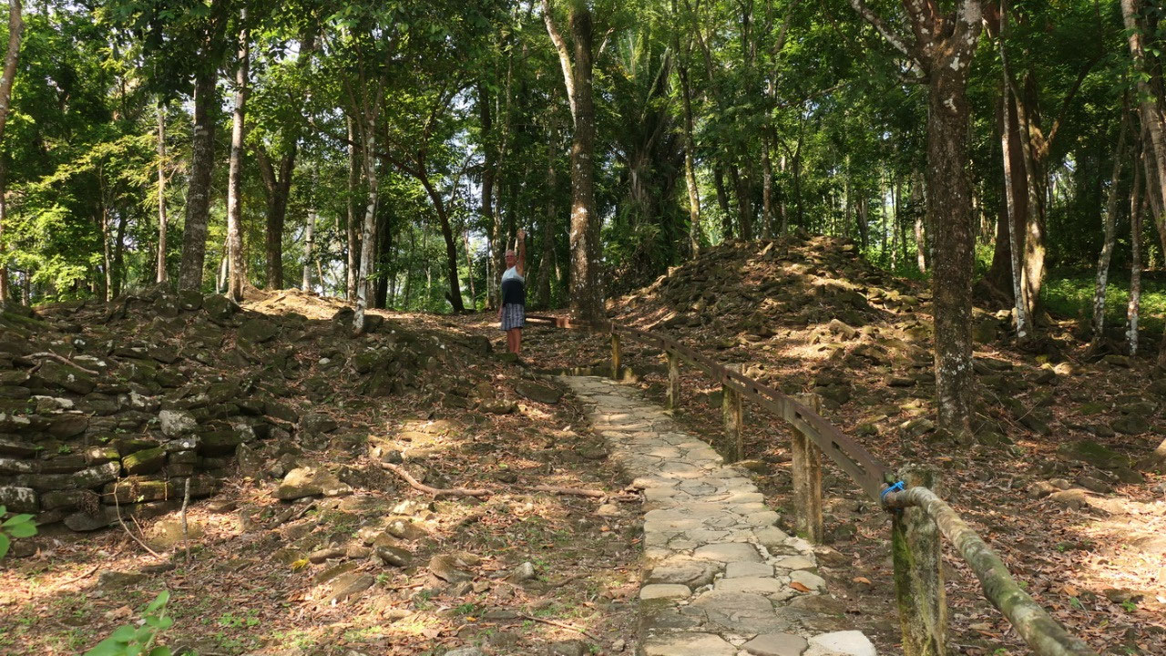
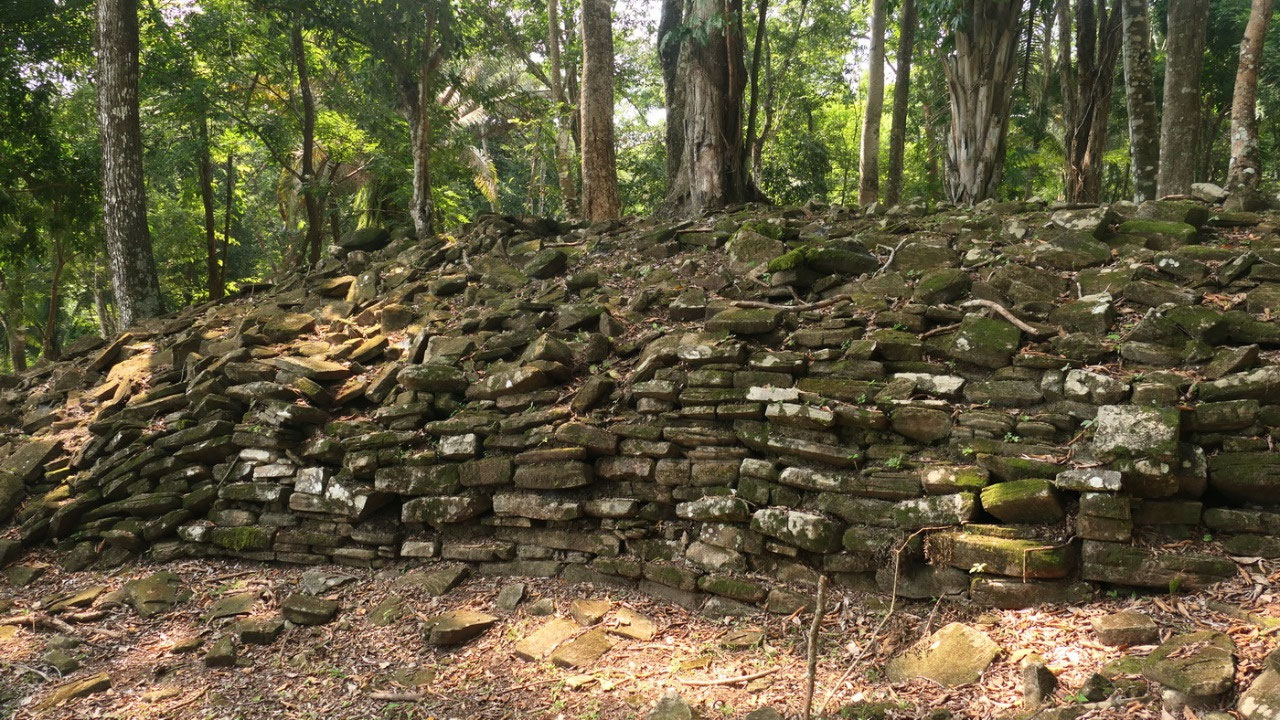
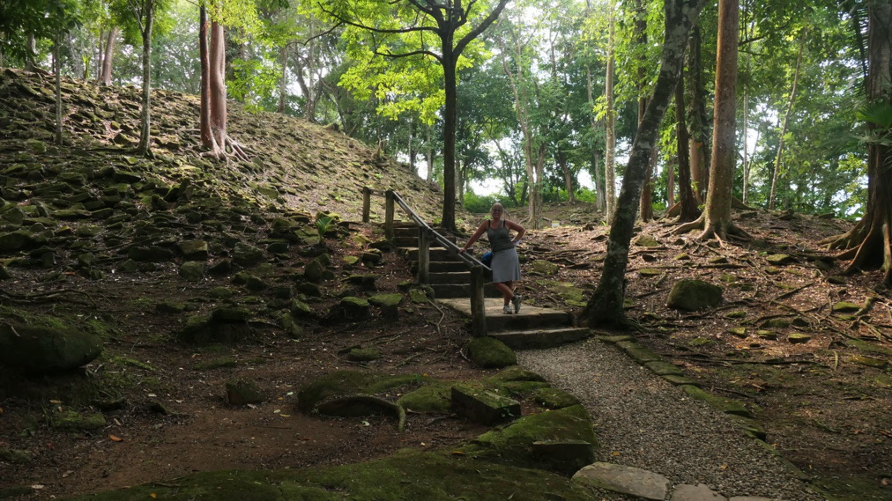
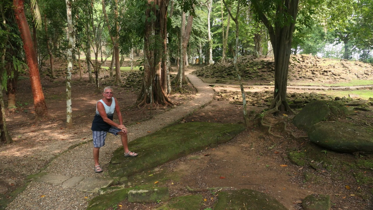
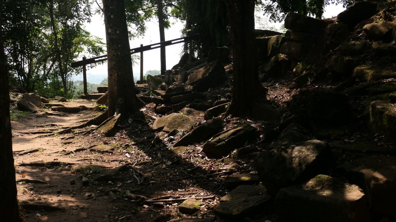
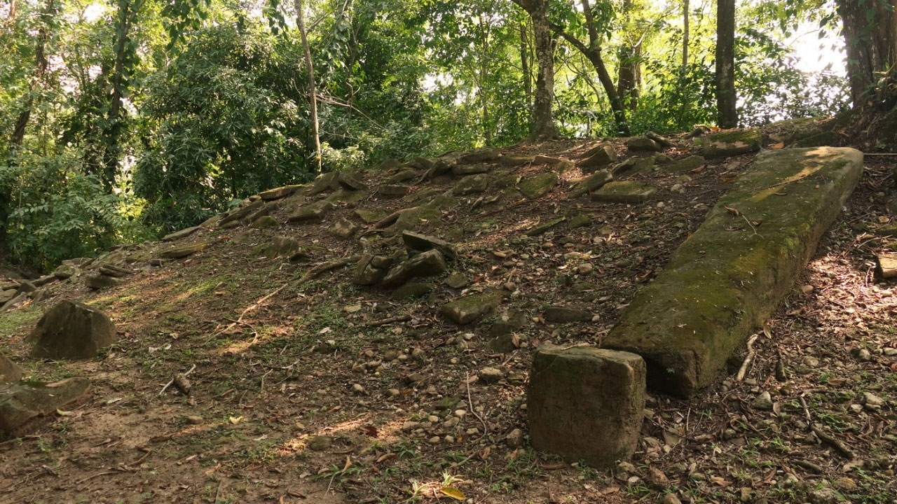
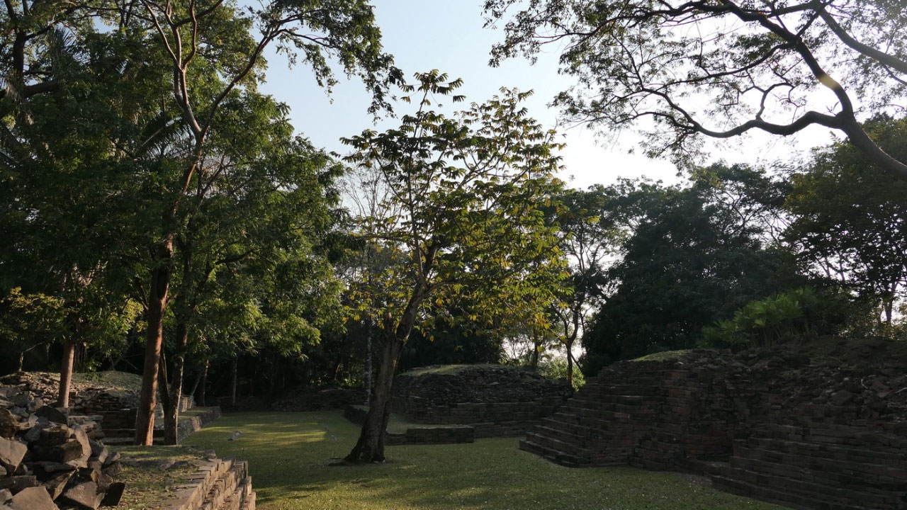
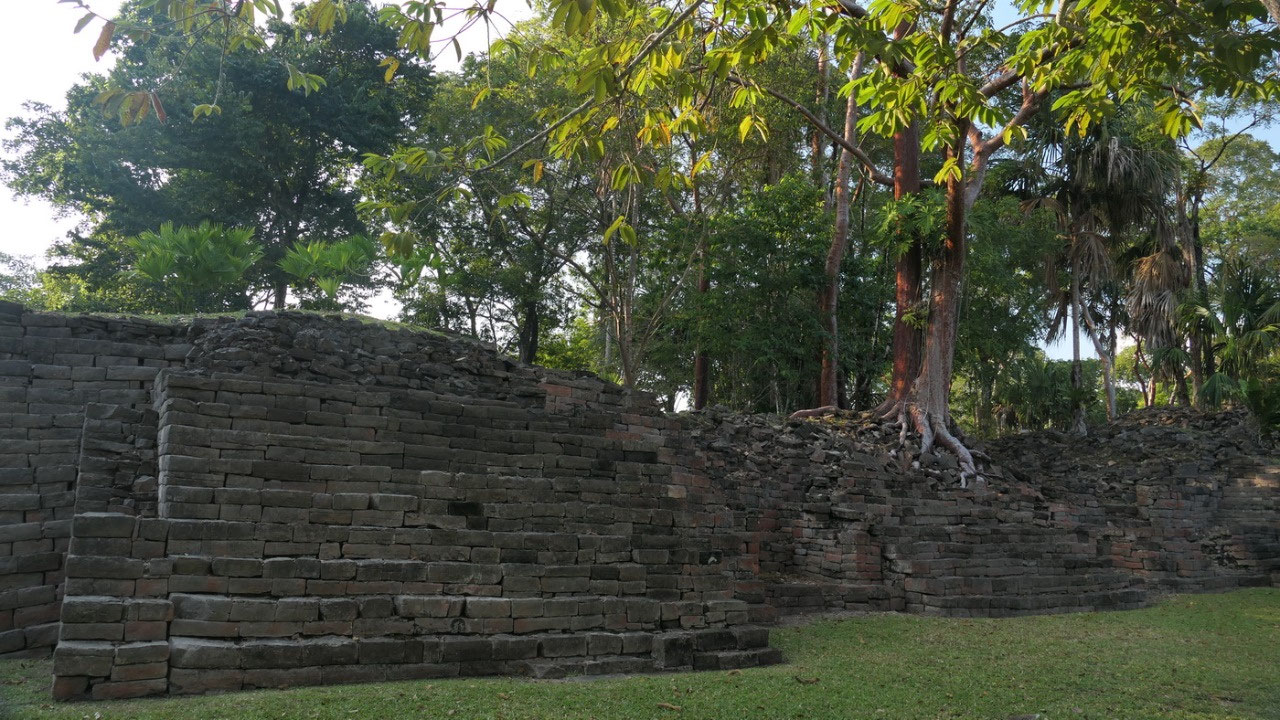
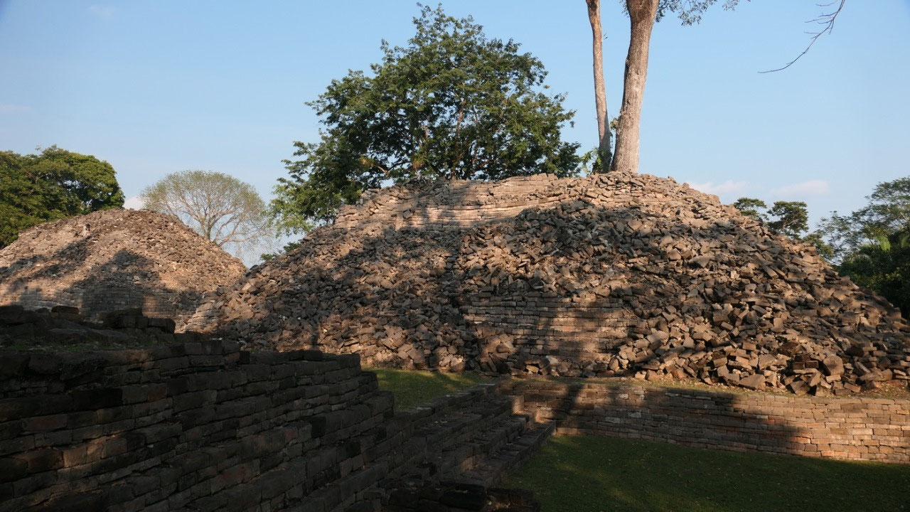
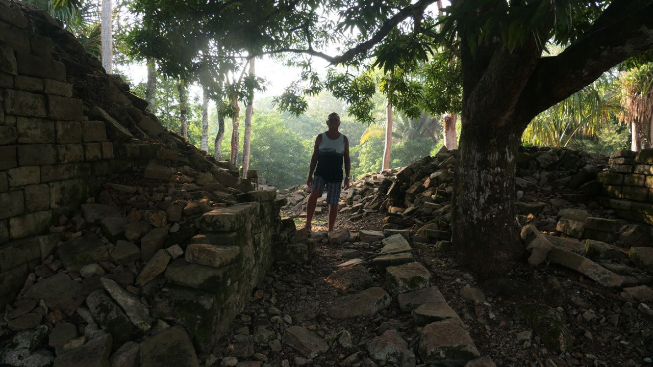
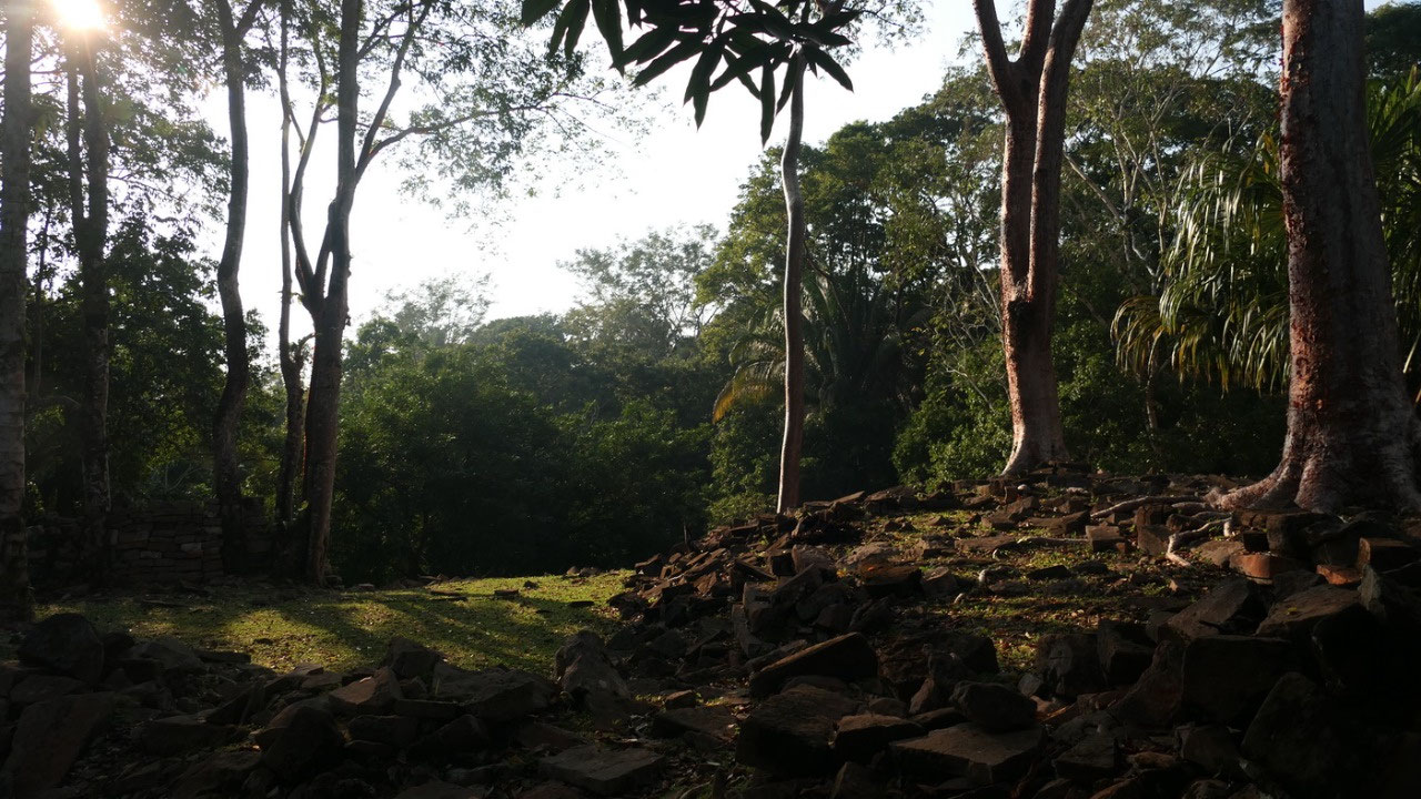
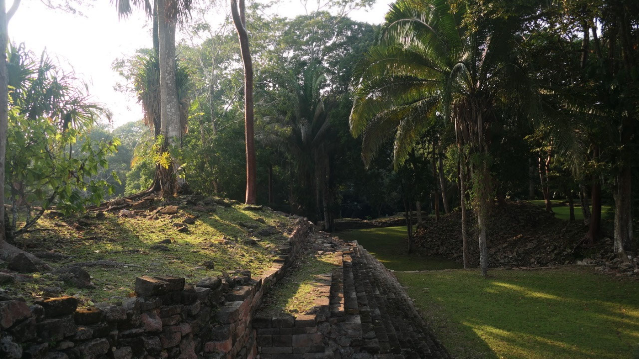
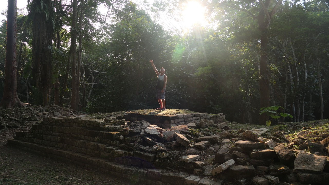
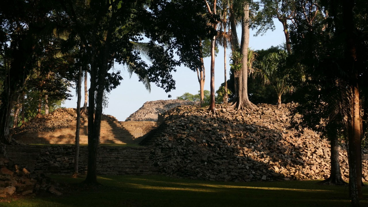
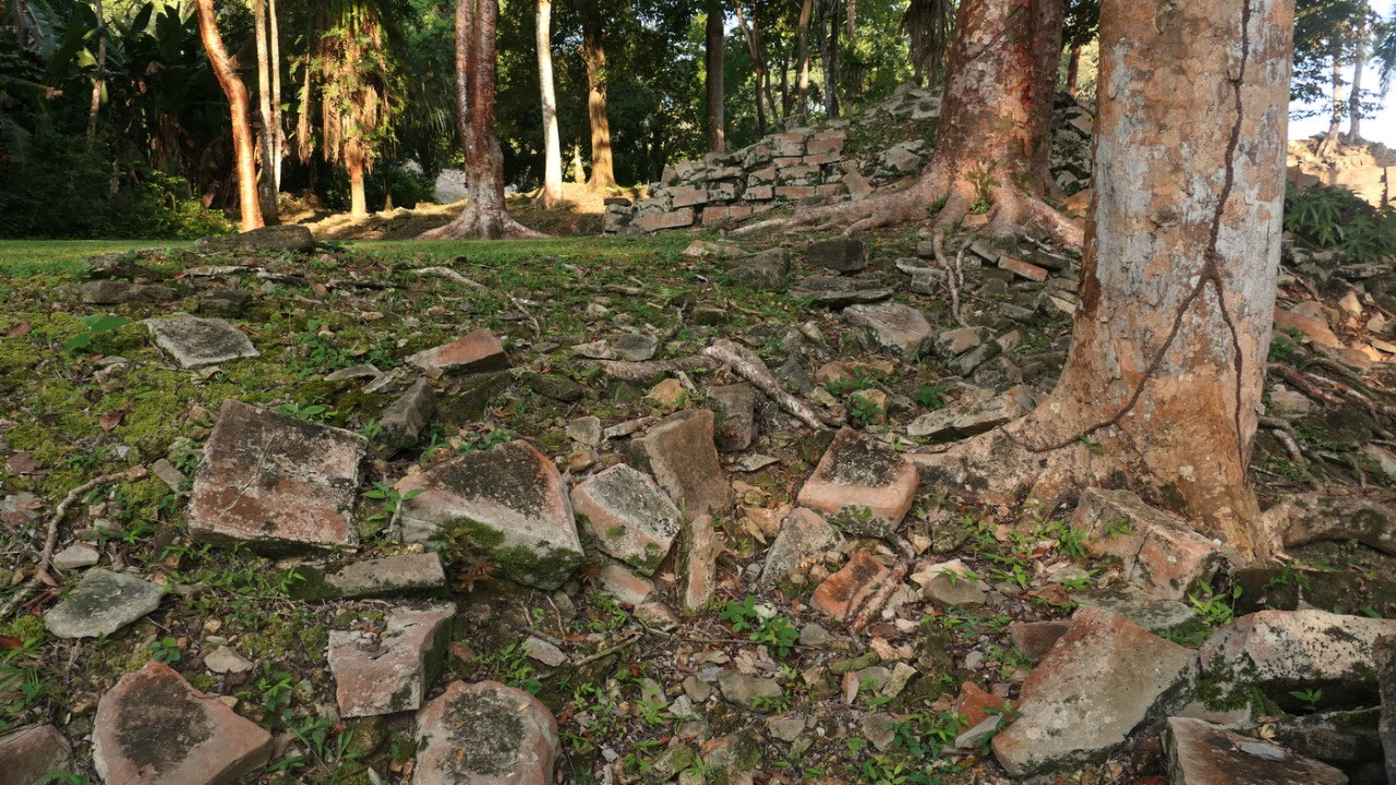
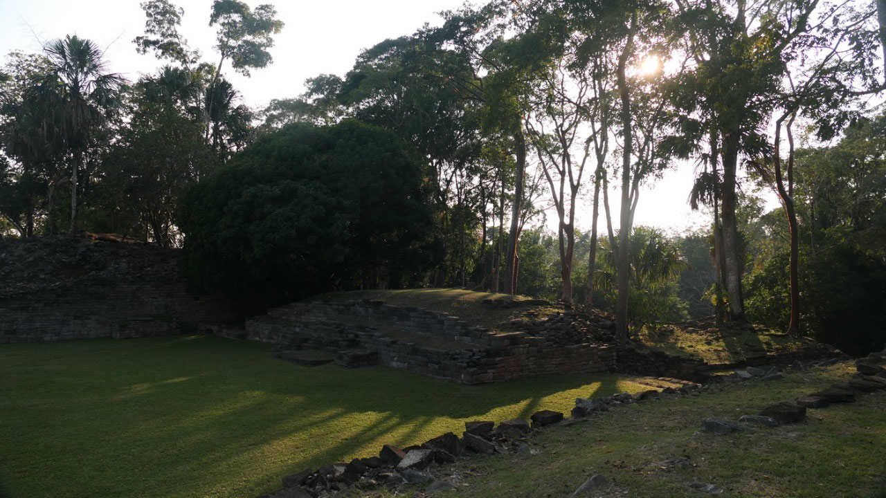
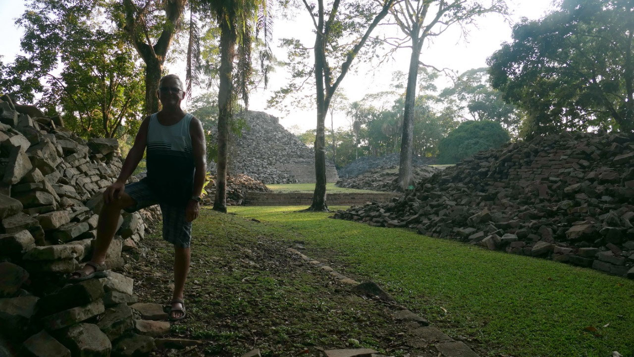
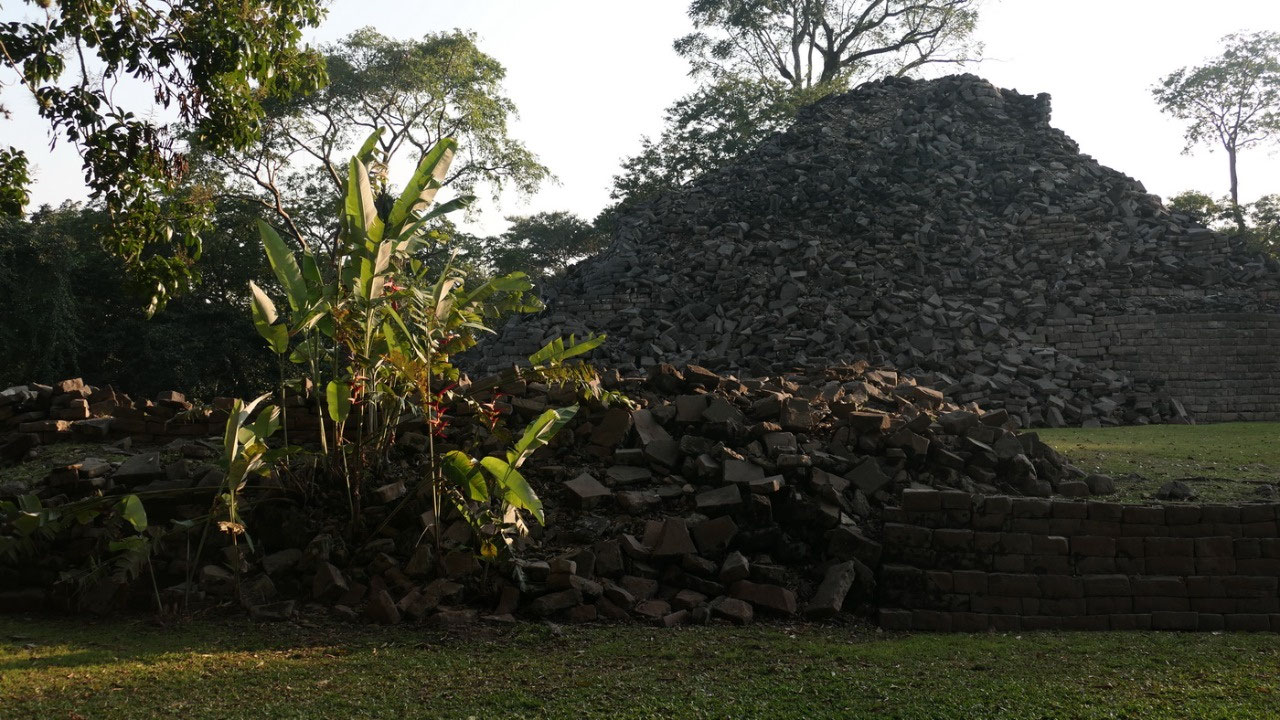
And
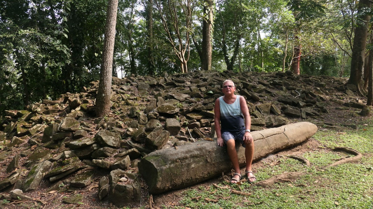
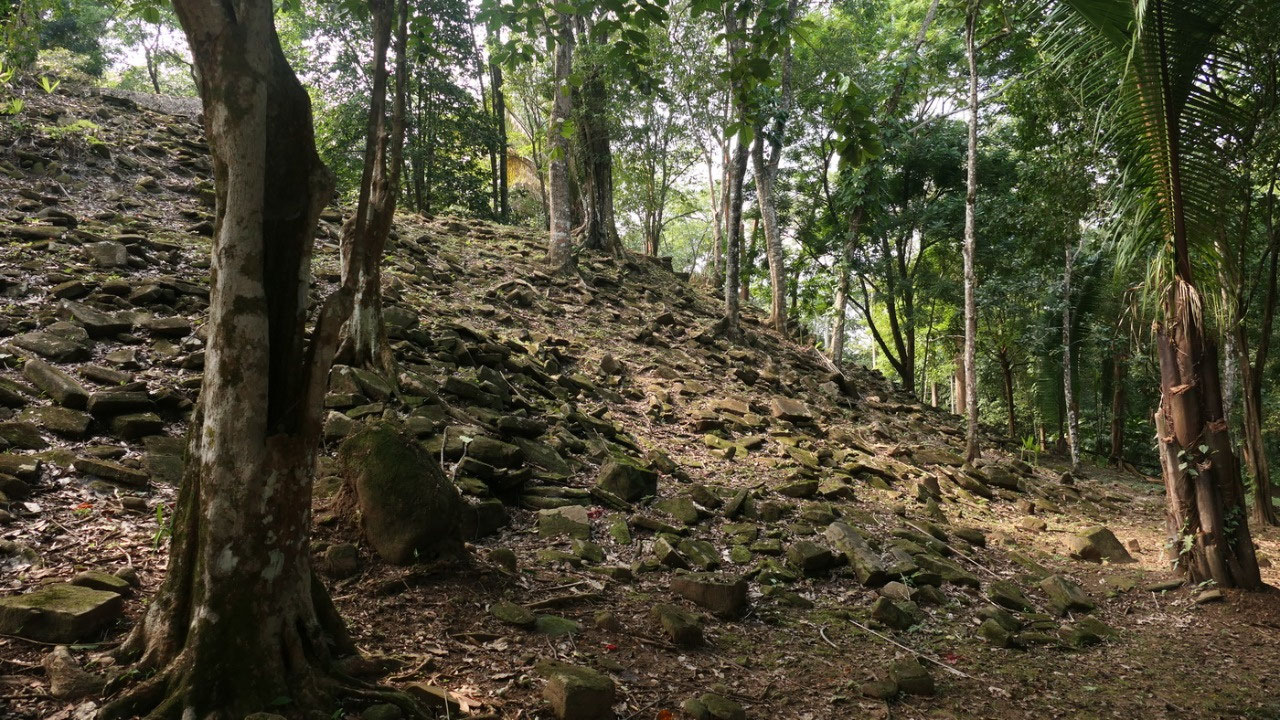
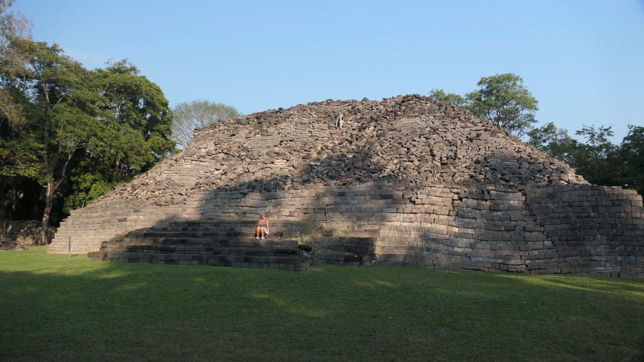
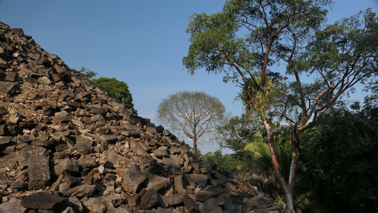
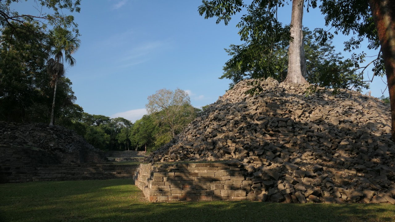
then we enter the site, we know that only a few of the buildings are
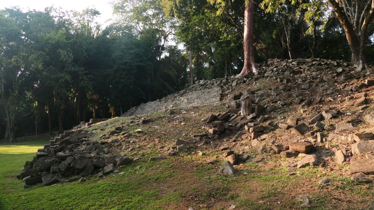
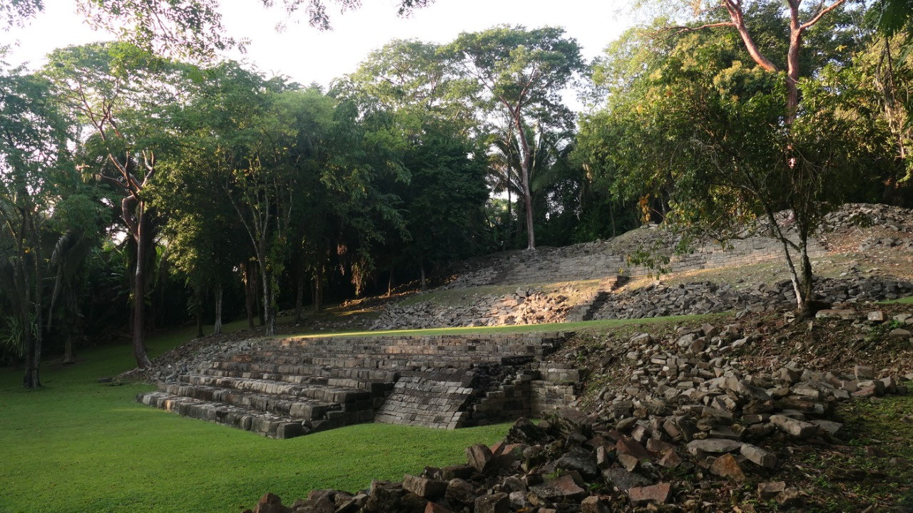
excavated and as we are already experts in ruins we discover all the
rubble mountains which were once buildings. And right away we are in
a Plaza with some small pyramids with stairs near us. And we see the
first Stelae (only those once you can’t read anymore) – Gine
found online a map so we had a route on how to best walk around but
overall we did not had too much information about the site. But then
we saw a guide with a few people they were so fast through the ruins,
I don’t think that they had a lot of information about this
specific site either.
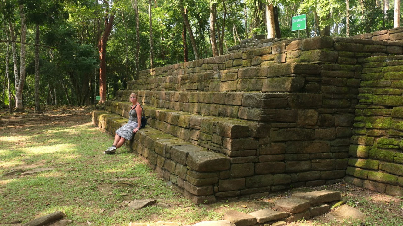
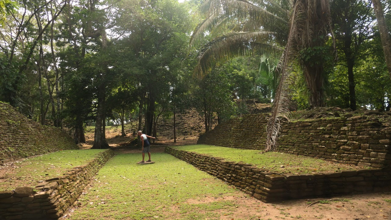
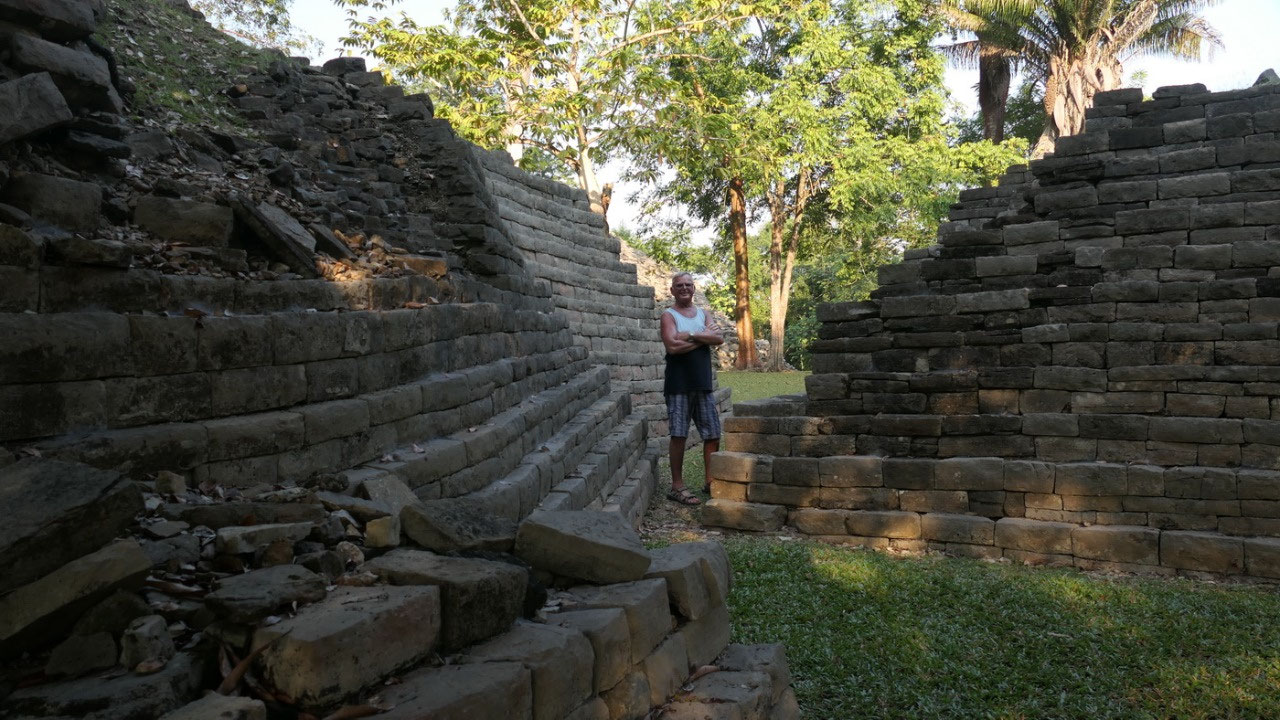
- Ball court: we saw this structure and right away knew that this is a ball court with a marker in the middle: and yes we know that it is a ritual associated with the creation of the universe, the earth and all that lies between it. They say the movement of the ball represent the cycles of the sun and the moon. And we know that sometimes the winner was so lucky that he got sacrificed (you are lucky because yuo can skip the underworld) or that the looser gets killer – so regardless you will be dead!! I'm not sure I want to be a ball player!!
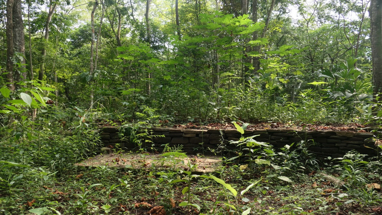
- the unrestored buildings: then we walk a nice path between some rubble- I’m sure more historical old buildings.
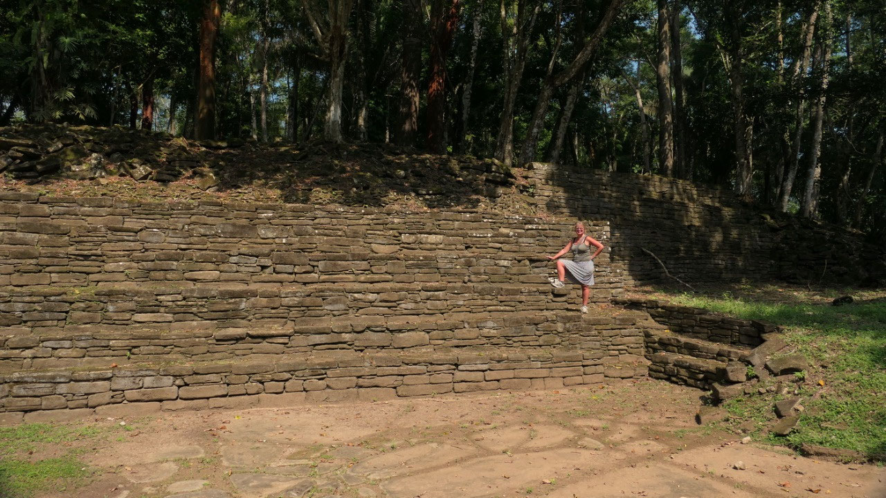
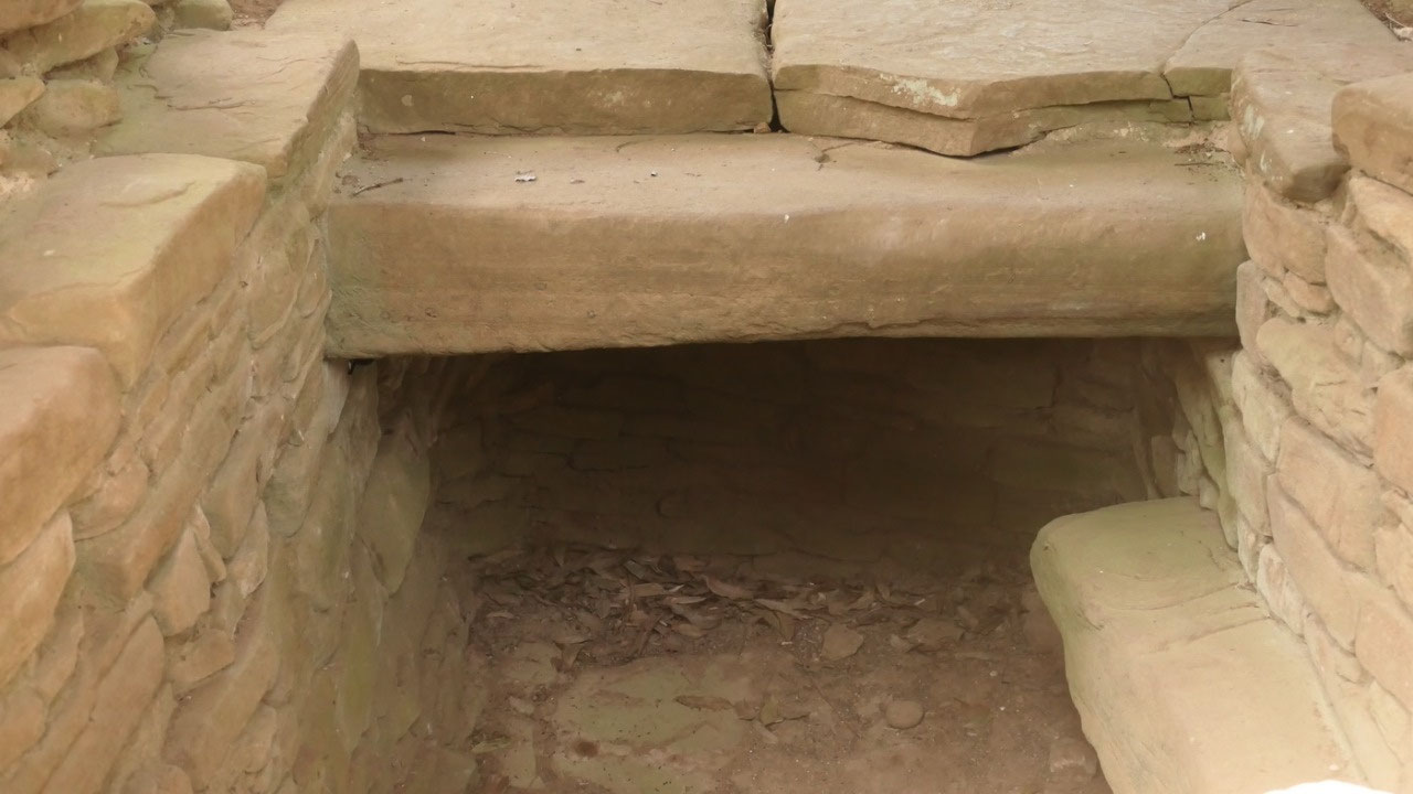
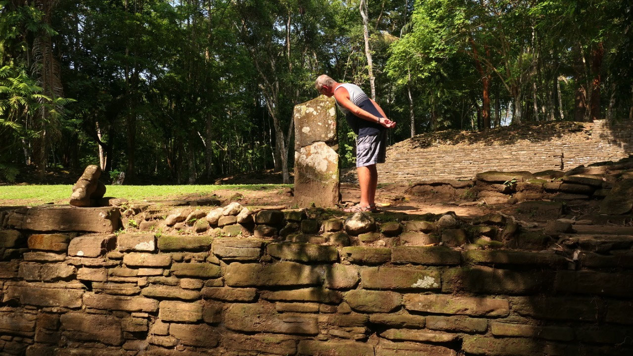
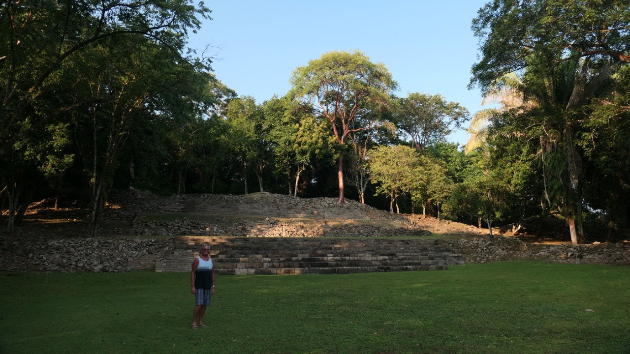
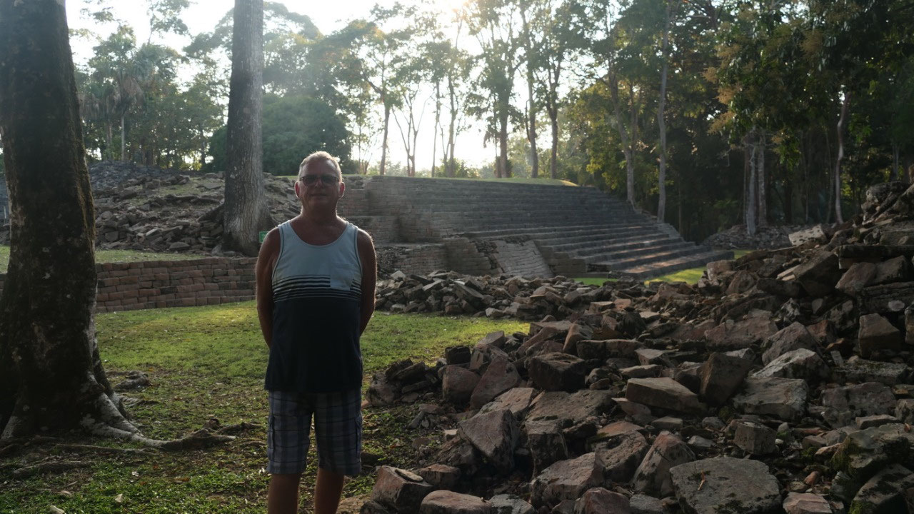
- Plaza of the royal tombs: yes we know that a lot of the big pyramids are tombs for kings etc – interestlingly here they opened 3 tombs and you can actually look down in the square chamber which was once the tomb. Inside them they found some of the artefacts. By the way one of the tombs was only discovered in 2015 - now they call it the plaza of the royal tomb. One of the tomb contained actually 5 bodies – likely all part of the royal family and this tomb was found in 1986. 2 tombs were found in 1998 – tomb 3 had 6 bodies in it: it got observed that in the Southern Belize region previous occupants of a tomb were moved aside to make room for the newly deceased one.
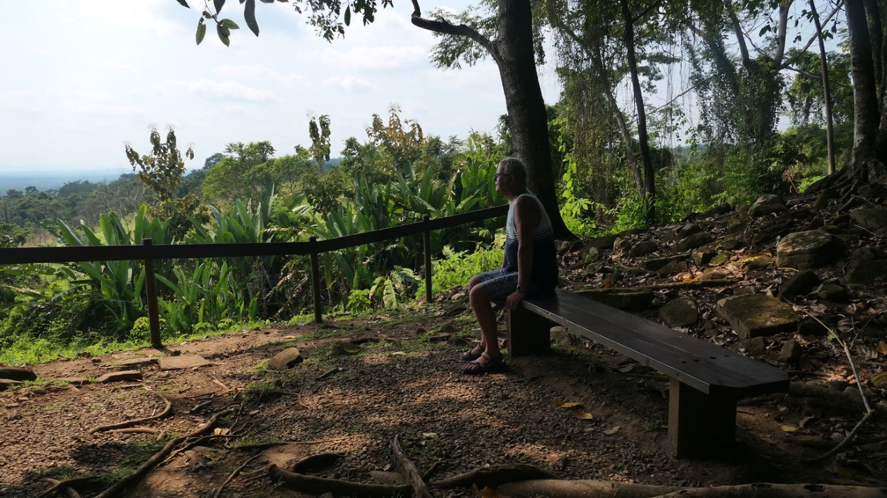
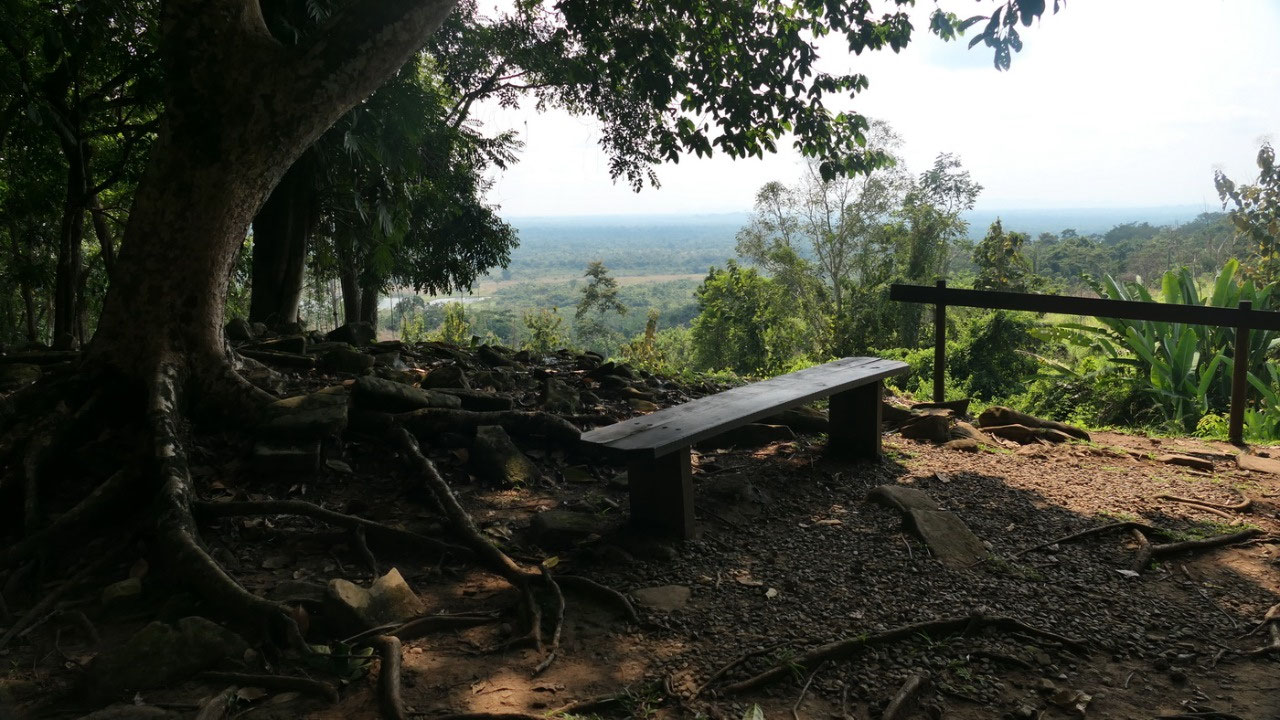
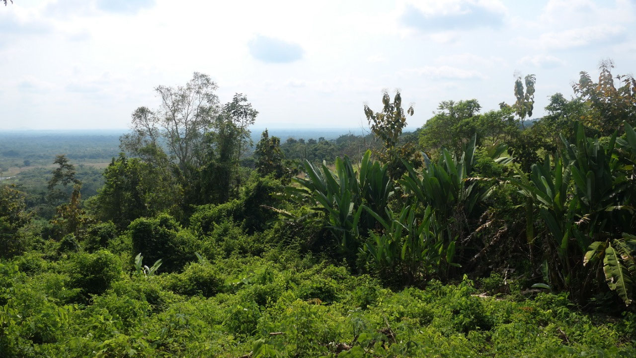
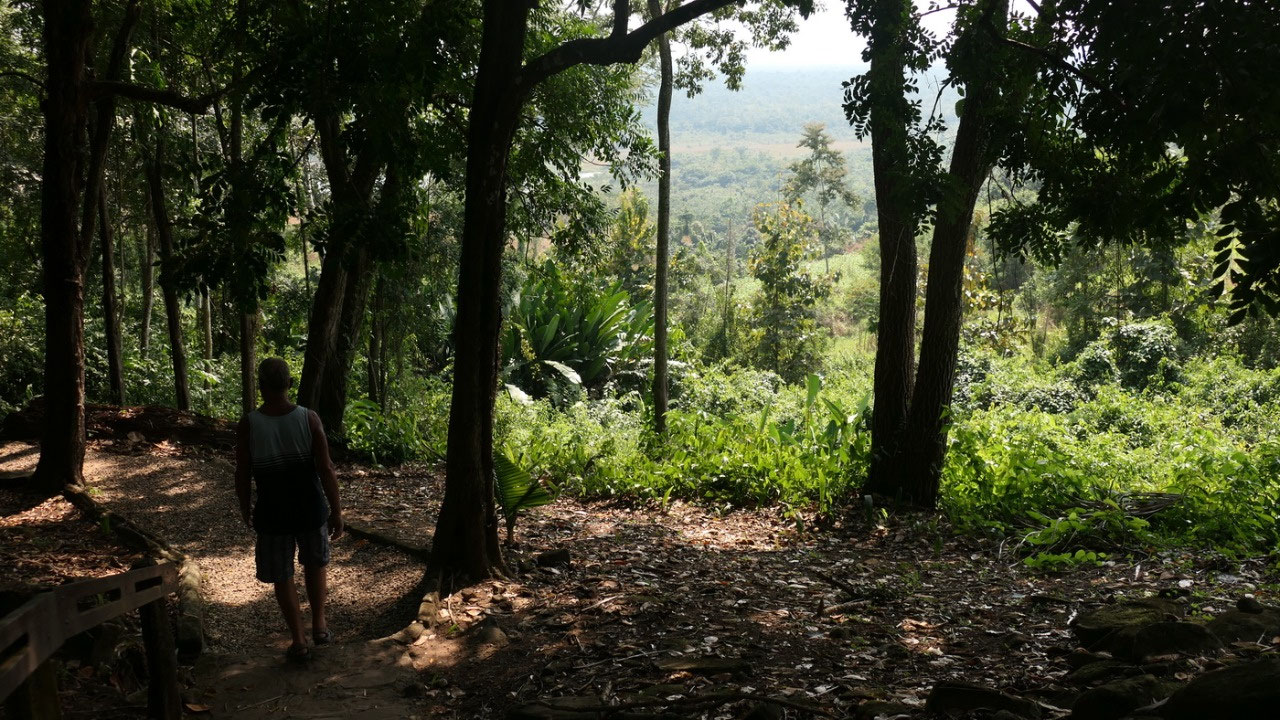
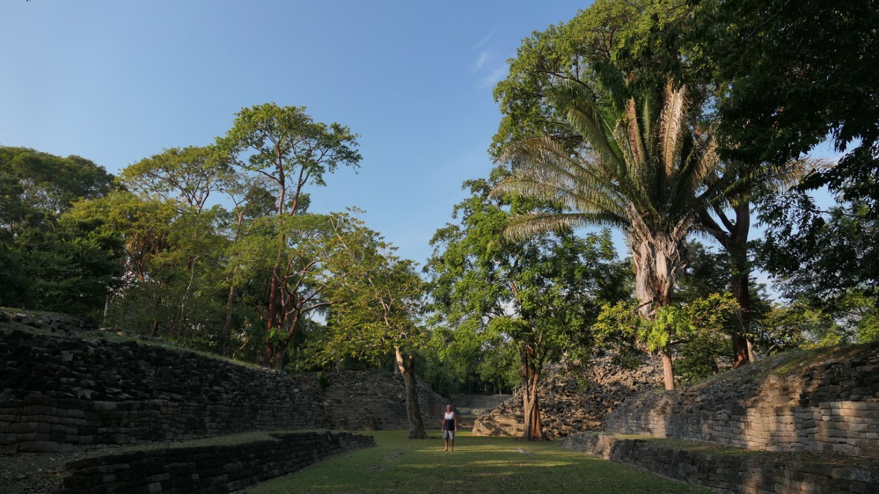
- View point: Did I mention that it is extremly hot and humid!!! and that we are nearly dying of heat – so up here are two benches with a gorgeous view over the mountains and it is a bit hazy but they say we can see all the way to the Caribbean sea – so is that the Caribbean sea or the haze? And up here we can even feel a light breeze.
- Plaza of the Stelae: here are actually a lot of stelae – even since you can’t read anything anymore it looks more like gravestones. On one we could actually still see some hieroglyphs. This is also where the E-group is: where they observed the sun, moon and stars: the 3 stone markers are for the equinoxes and solstices: when the sun rises the rays hit the marker
- West
group: Gine wanted to go to the West group Paul said that is not
a real path and he doesn’t want to go there – so Gine went on
that tiny path and there are more mosquitos and finds a few walls...
later Gine reads that the west group is separated by a creek and yes
you walk over a tiny stone bridge, and it says that nearly all is
overgrown – also true: so yes Gine felt that she did explore the
jungle with the mosquitos.
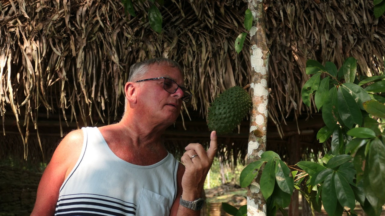
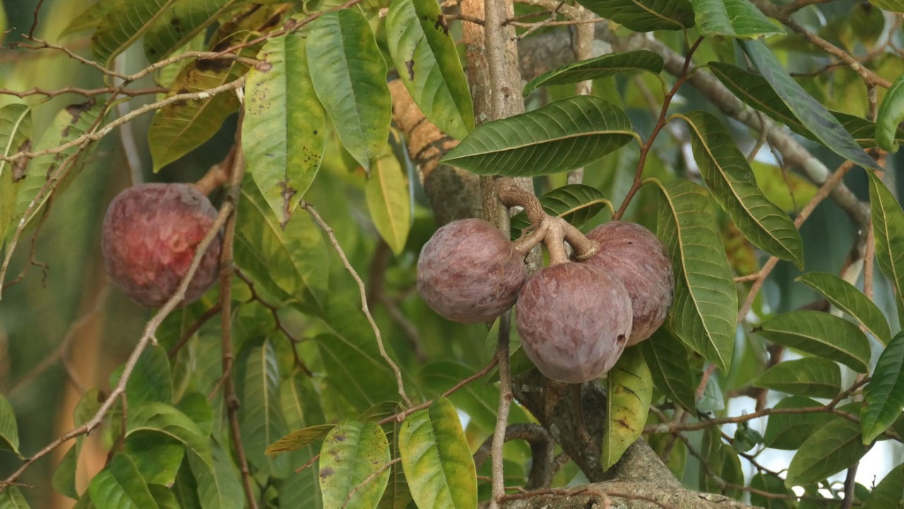
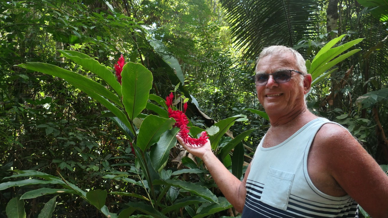
the
Sour sop tree: and then we see this green prickly fruit again –
and we wonder what it is – Paul said take a picture so we can
research later and see there only a few meters away is a tree with a
sign on it saying sour sop tree. And then we remember that the ice
cream place had a sour sop flavour.
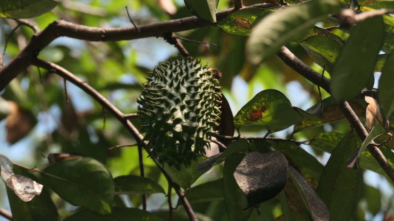
- the sour sop is an evergreen
- the prickly fruit is as they say a combination of the taste of straw berry, apple and citrus flavour with the creamy texture of the banana
- some say you can use it for cancer treatment (but there is no evidence)
What
made this ruin unique is seeing the cool stelea and looking down into the tombs but also
the cool trees and then we drive down the road again with amazing
view on the Maya Mountains.
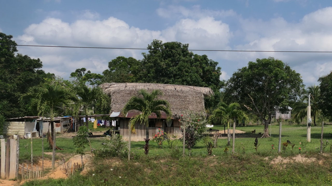
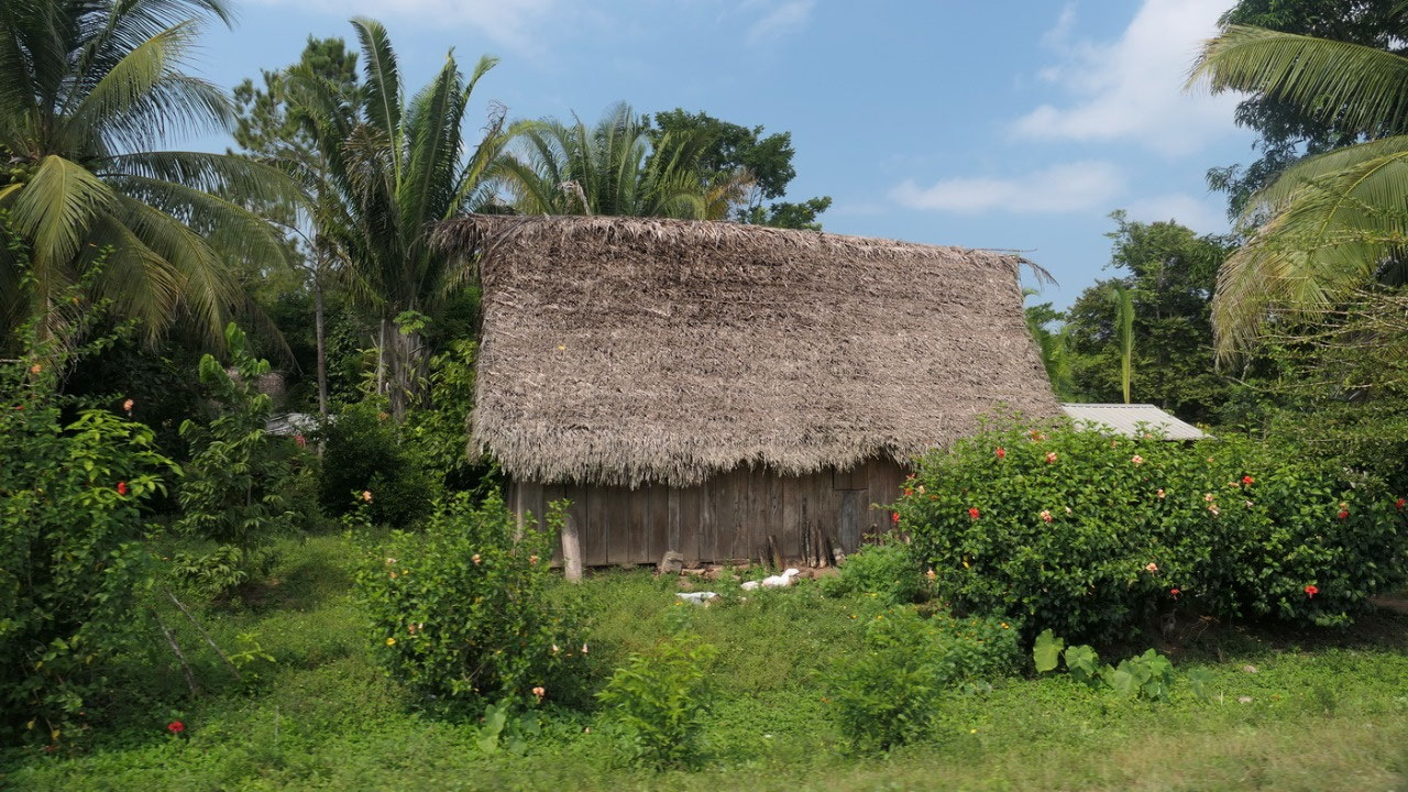
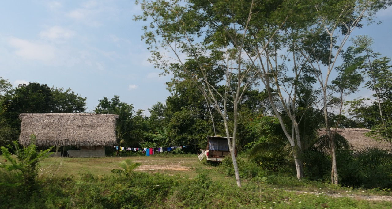
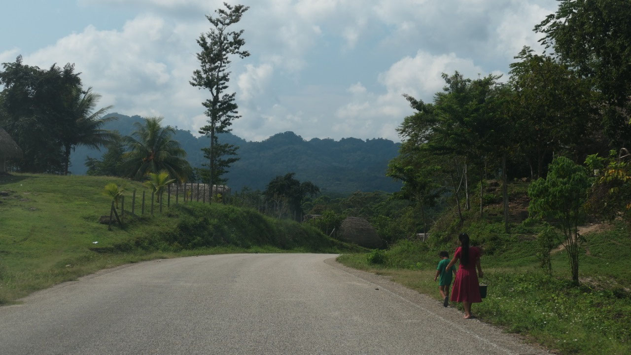
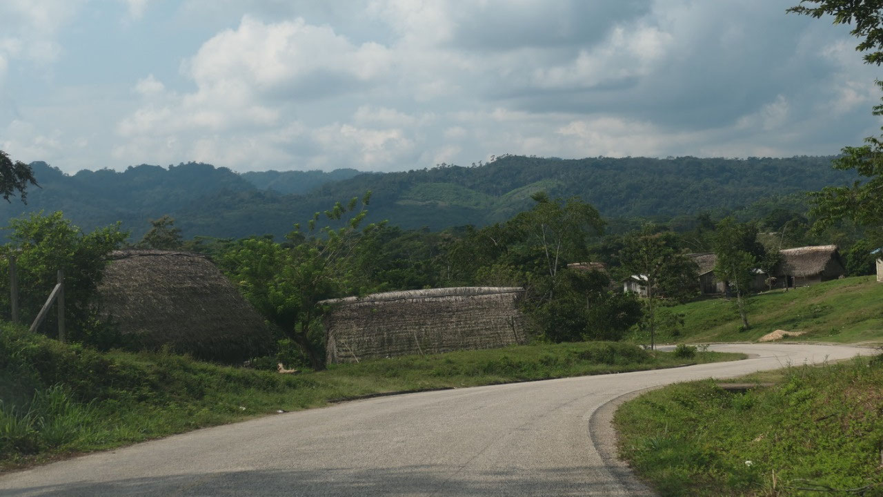
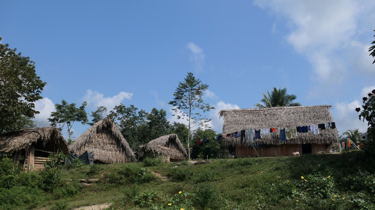
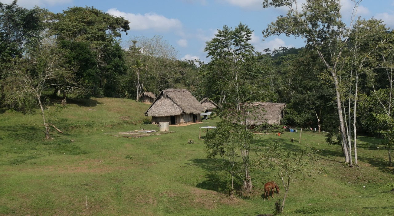
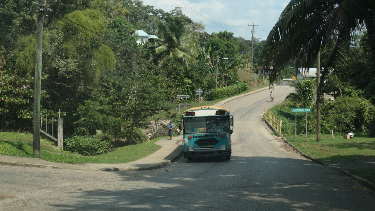
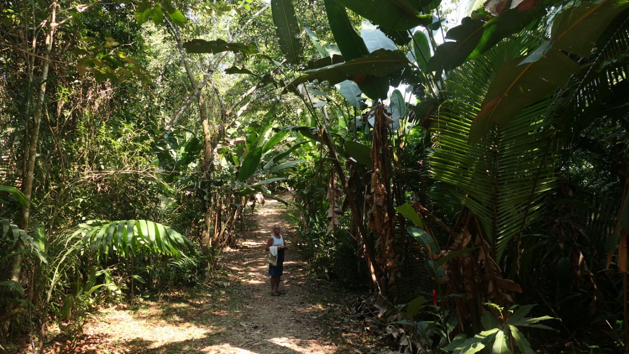
Driving
through Mayan Villages
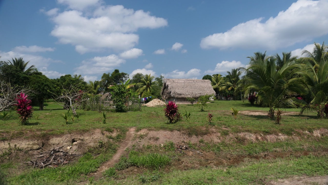
and
we are now in Maya land - most of Belize's Mayans live here in the south that means we are now in Maya
country.
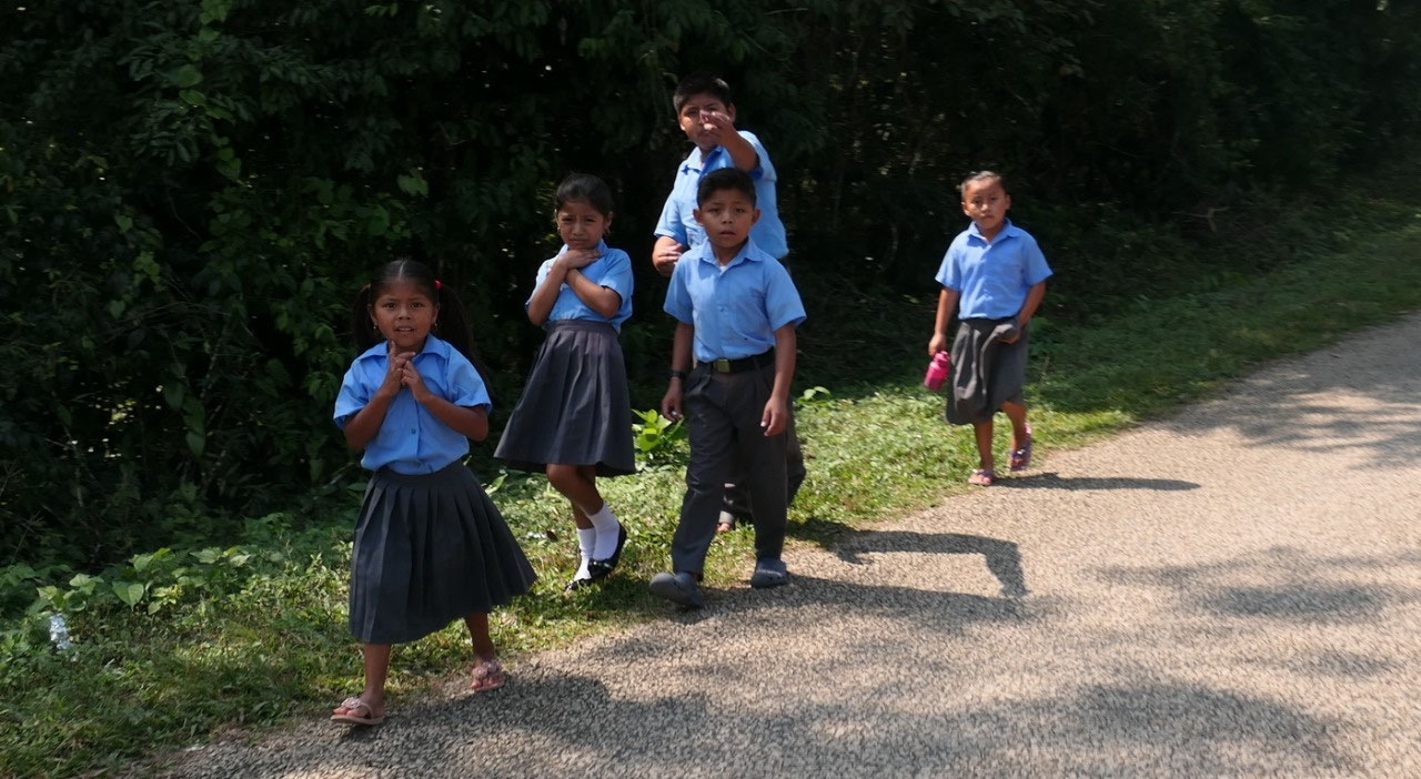
- in this area are over 30 Mayan villages and half of the population of the Toledo district is Mayan - once upon a time in the classic period over 2 Mill Mayans lived in todays' Belize (compared to nowadays 10 % or 35.000)
- most Mayans here are either Mopan or Ketchi – and they speak different languages (did you know Belmopan got it's name from the Mopan Mayans)
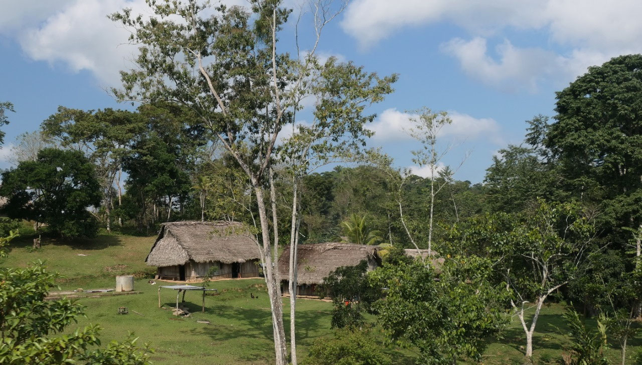
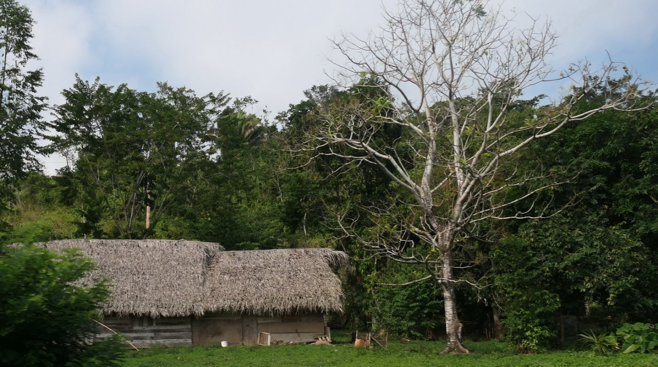
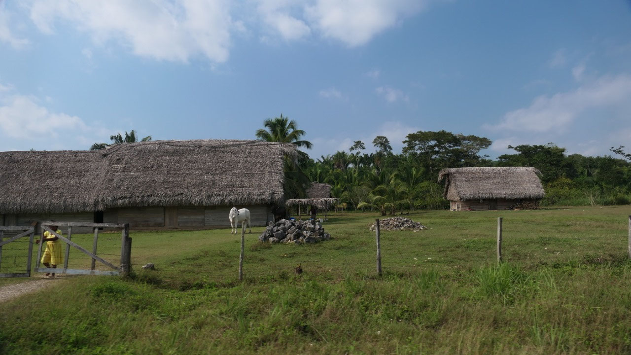
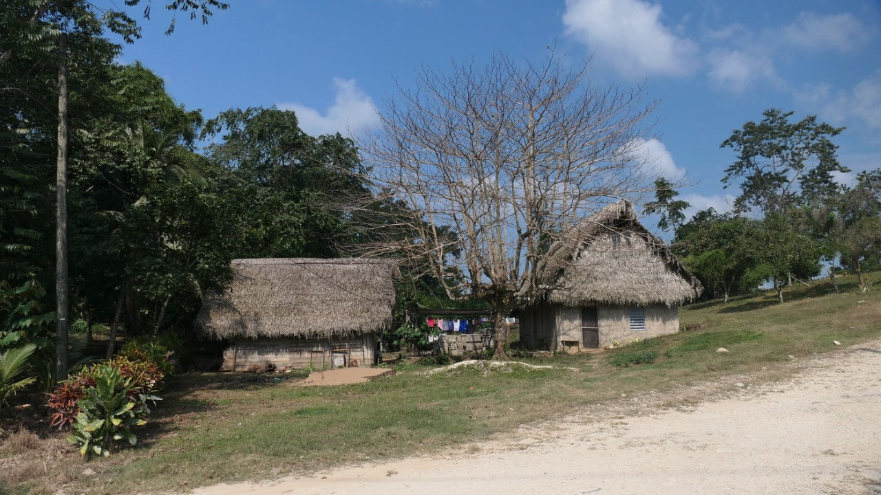
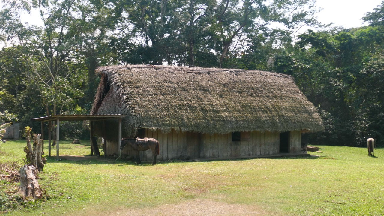
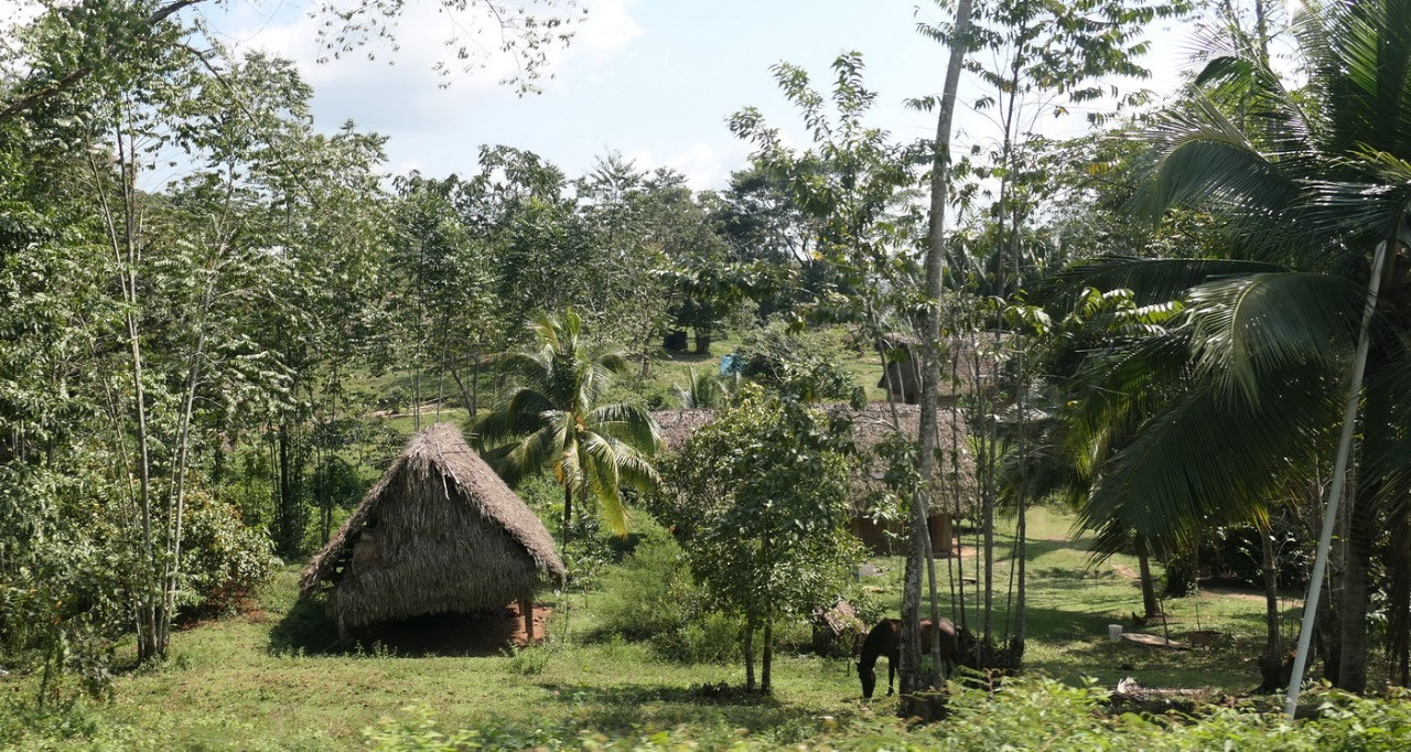
- a lot of the houses have thatched roofs on the huts: Gine thinks they are looking super nice
- the lifestyle is very basic and some of the villages only got recently electricity
- once the Mayan occupied the area from South Mexico through Guatemala, Belize, Honduras and into El Salvador (By the way the Aztec came later and lived more around the Valley of Mexico from the 12th century on)
- it’s a Meso-American Civilization (Meso means middle – it is the link between South and North Americas)
- the Mayan’s were the largest ancient civilization in Central America
Indian
Creek was the Mayan Village next to the Nim Li Punit ruins, we drove
through San Pedro Columbia (which is quite big) – it was founded in
1905 when the Mayan’s looked for new farm land. It is super
interesting to drive through this area and always see those very nice
Mayan houses.
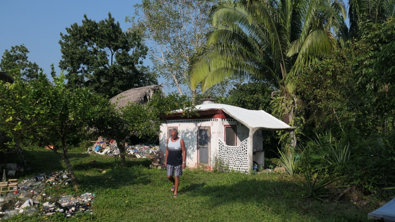
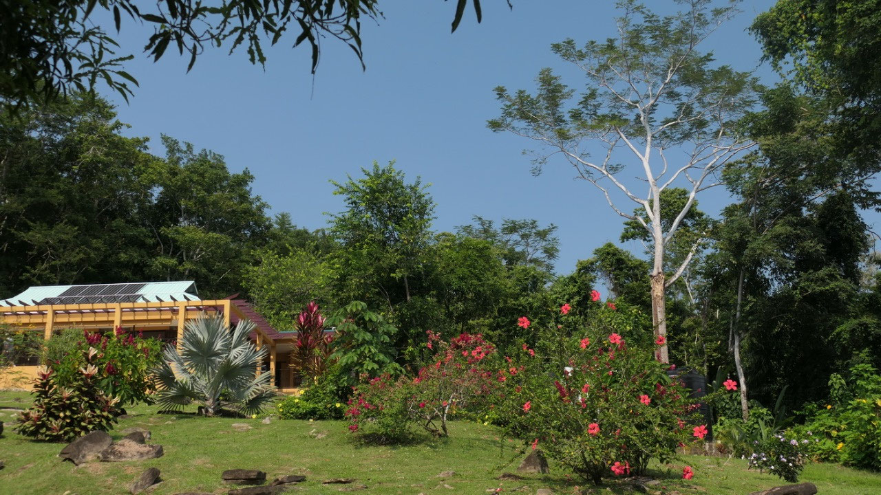
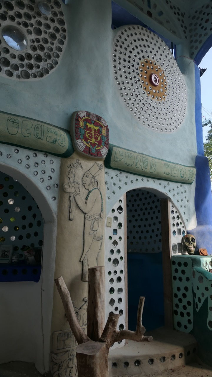
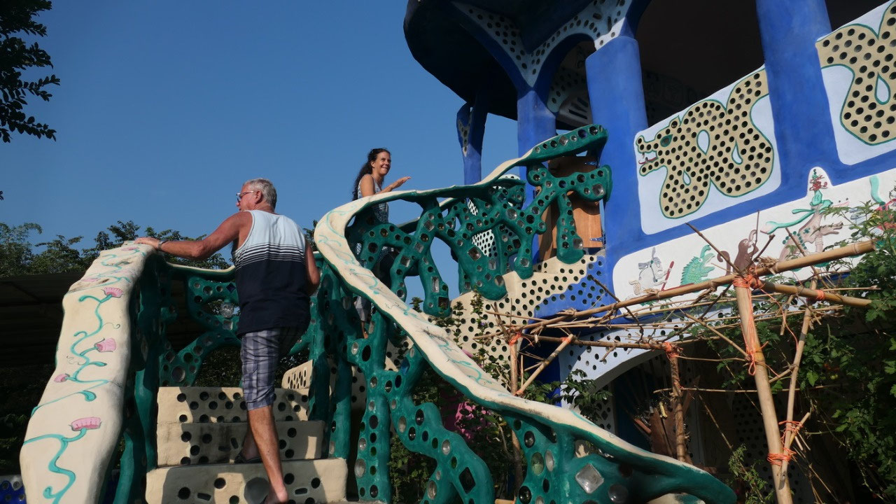
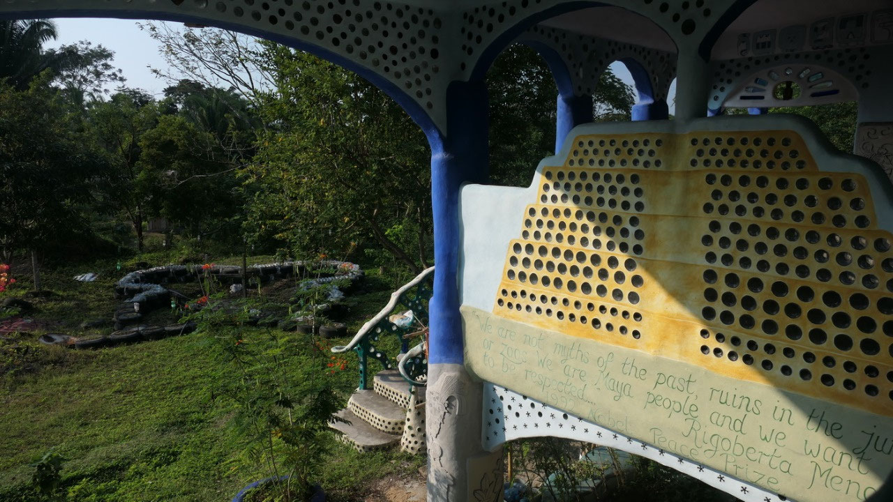
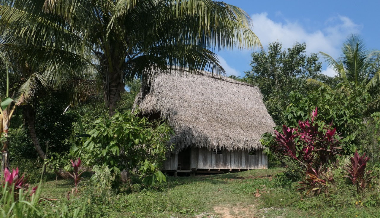
The
Chaos Oasis
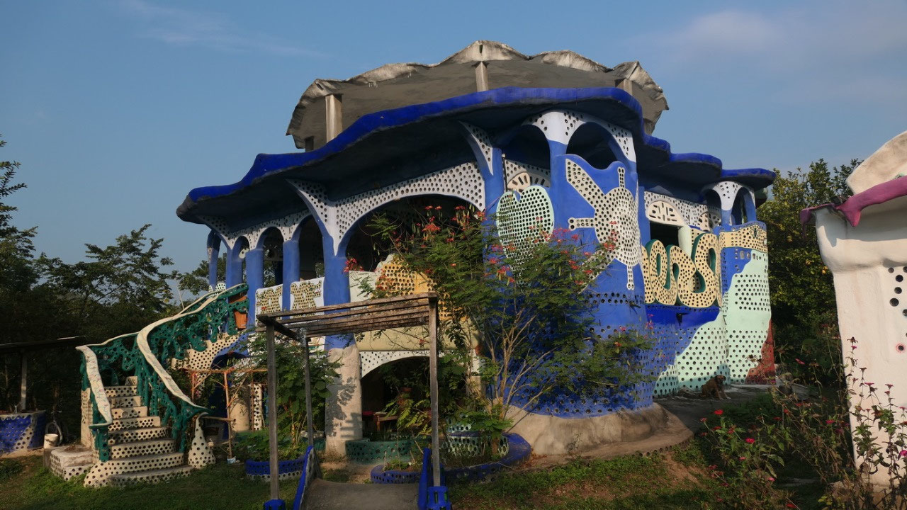
ok
so that is an adventure by itself: the description on how to drive
there is: in the town of Dump (where there is one gas station turn
right towards San Antonio, then turn the next one right towards San
Pedro Columbia (and that is where the dust and the gravel starts) –
drive through town (ok at one time we were not sure if the Y means
left or right so we choose the tiny bit bigger right) – then a
sharpened turn left up on a hill (so that makes us wonder when is the
end of the town and what that means – but once there we knew where
it was) and at the top is a church (seen it) then turn right and go
downhill over river (no problem and we discovered this is also where
you go swimming): and then the next turn left with the sign Lubatuun
and look for the blue house: and we found it.
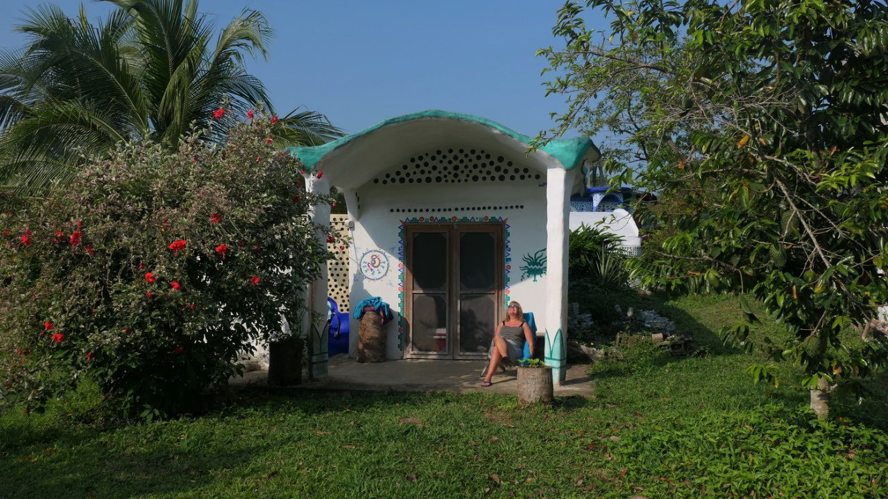
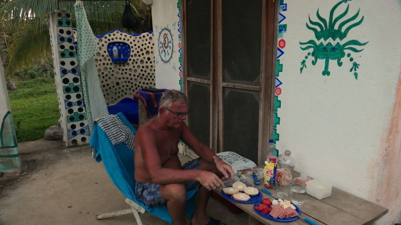
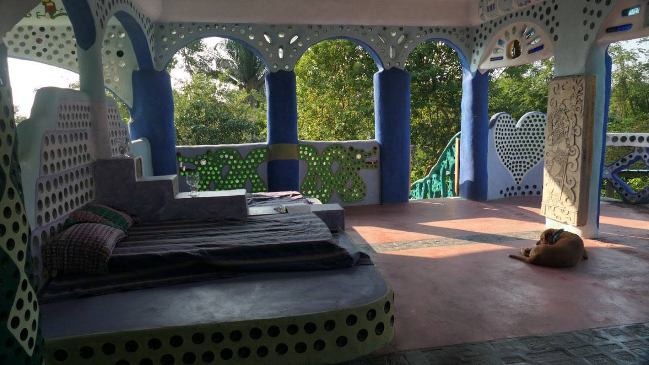
we
met Alisha, she is super nice and welcomed us with a cold drink with
ice and lemon ice cubes. Our little hut is also made of recycled
bottles – they built it for their son. It has an outdoor shower and
she even put water for us into a solar heating bag – otherwise you
fill a bucket with water and dump it over yourself.
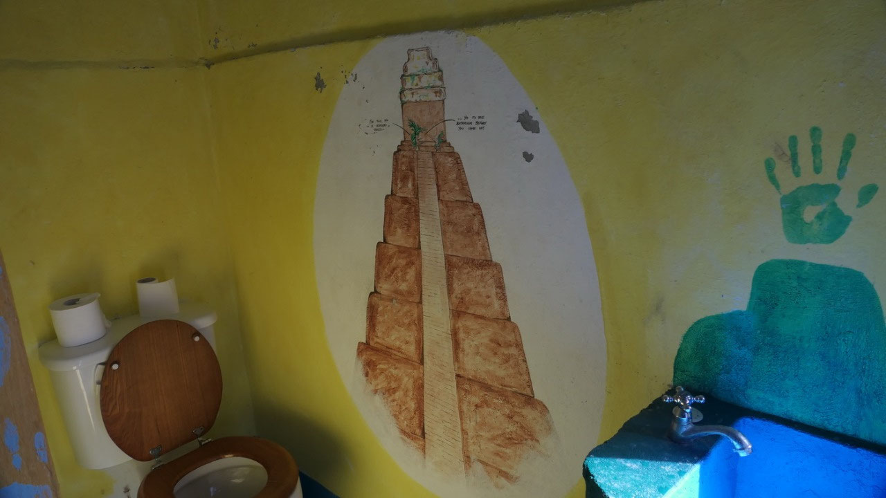
The
toilet is a bit away: and yes you have to dump water in for flushing.
So tonight I need Paul to go with me before we go to bed. Inside
there are some cute shelves – we have some outdoor sitting – and
it is quite cool inside too.
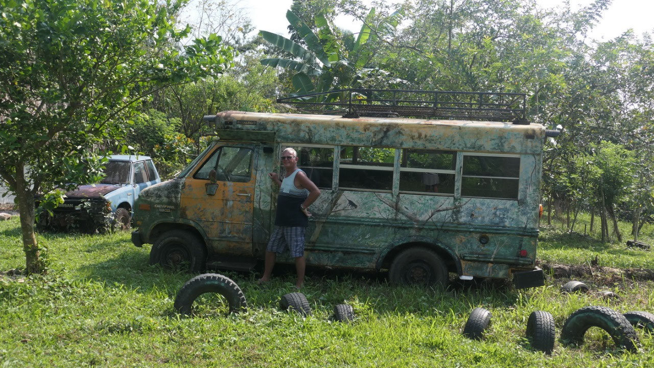
On
the grounds you can see an old RV – this place is so unique and
cool – it is one special experience to be here.
Lubaantun
Ruins
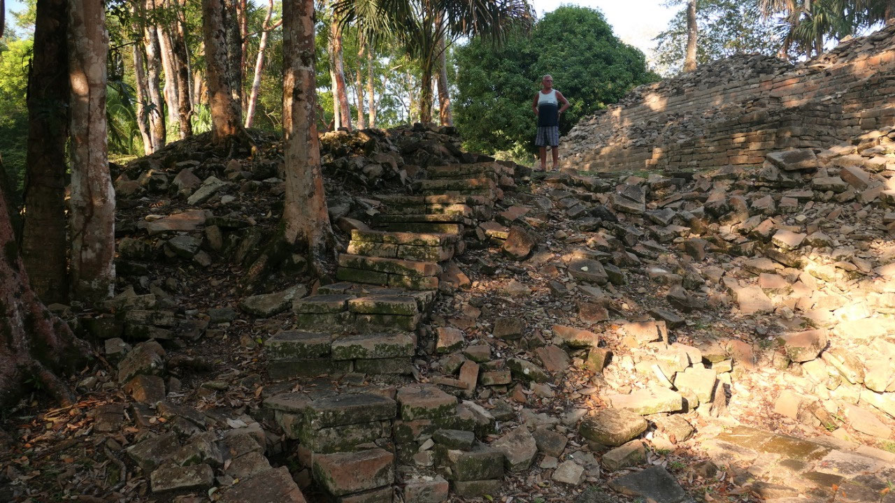
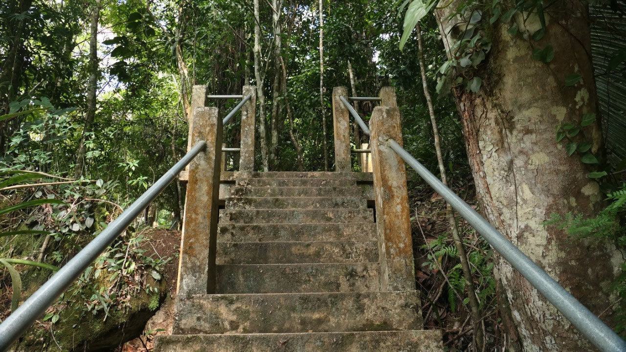
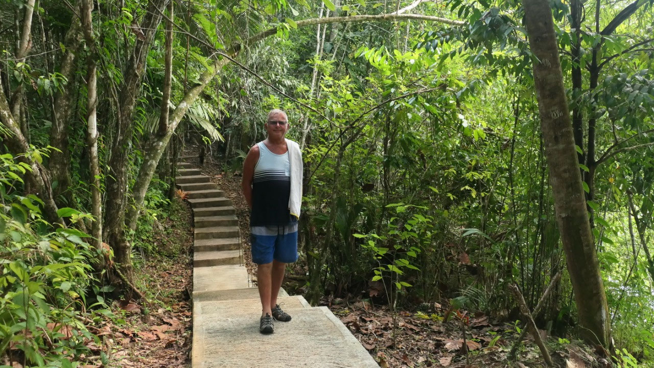
the
parking lot is only 200 m from our little cabin – so we walk over
and I think we were the last visitors of the day – because as soon
as we left at 16.50 the guy jumped on the bike and left (even the
site is open until 5!!). The dogs followed us along towards the
ruins: and there is this impressive beautiful paved parking lot
(after a few km of really bad gravel road) near it, is a new modern
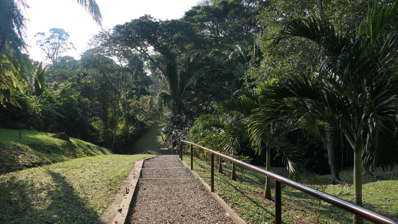
entrance building which is not in use. Down the hill and up the hill
and we are at the little museum – but we decide to check out first
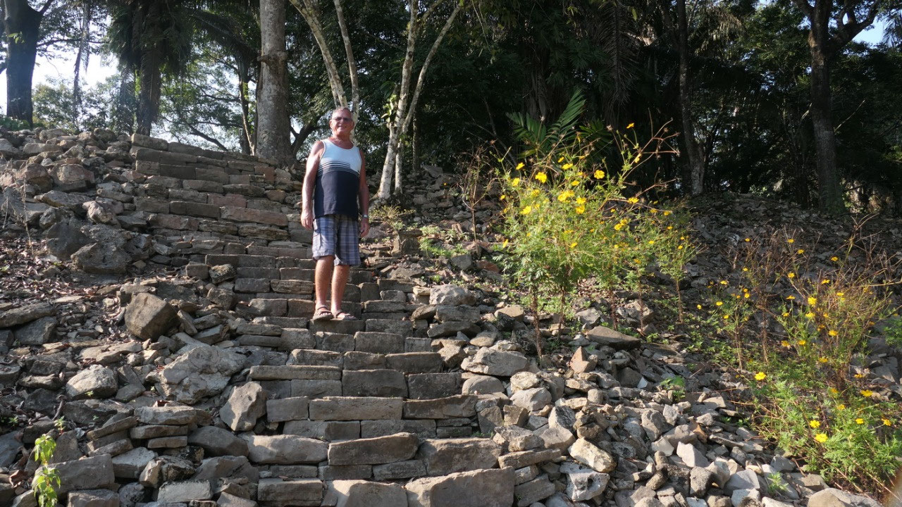
the ruins and up some big steps towards the Main Plaza – and again
here are a lot of rubble hills.
The
story about the crystal skull:
- it means place of the fallen stones – it has 5 layers of
construction
- Lubaantun is known for it’s ceramic figurenes they found here: often they are ball players with protective headgear (like helmets)
- it was a ceremonial center of the Mayans – and yes when you stand between the pyramids you can easily imagine it
- It is the largest Mayan site in Southern Belize: it’s believed that around 20.000 people lived here from 730 – 890 AD
- It’s also known for it’s unusual construction: they did not use Mortar here – it is strong because of the hand cut stones which were carefully measured (amazing when you think how old it is)
- the structures do not have doorways, as well some have rounded corners
- also they were choosing natural hills on which they built the settlement
- the soil of the Toledo Bed is very good to grow cacao, which is still planted today in those mountains (and yes we were eating later some of this organic grown chocolate)
And who found the mysterious site and the skull?
- it was first described in 1875 by American Civil War refugees
- the first one excavating was Thomas Gann: a medical officer who had an interest in archaeology – by today’s standards his excavations are horrific: he often blasted the top of temples with dynamite – he came here in 1903 and he was the one making the first plans (maybe we would see more today without his excavations)
- in 1915 when Mervin came he discovered a ball court marker and this ball court was the first one identified to be from the Classic Period (up until then they thought all ball courts were post classic)
- 1926: here they found the crystal skull: it is said that 16-year old Anna Mitchell-Hedges, the daughter of the Archaeologist found this perfect shaped human skull carved from an 8 in rock crystal on her birthday. Anna later living in Canada still owned it. But no-one know if the story is true.. The first time this skull was mentioned in 1954 in a diary of her father, published after his death. The Smithonean examined it in 2007 after Anna died and said that is was probably made in the 1930s So what should we believe. But regardless if it is a fact or fantasy the world knows that the Crystal Skull belongs to Lubaantun
- in 1970 more excavation were done, that is when they found out that the town was founded shortly after 700 AD and only occupied for 130 – 180 years before it got abandoned
- in 1998 they started out to restore some of the structures and they showed some before and after pictures
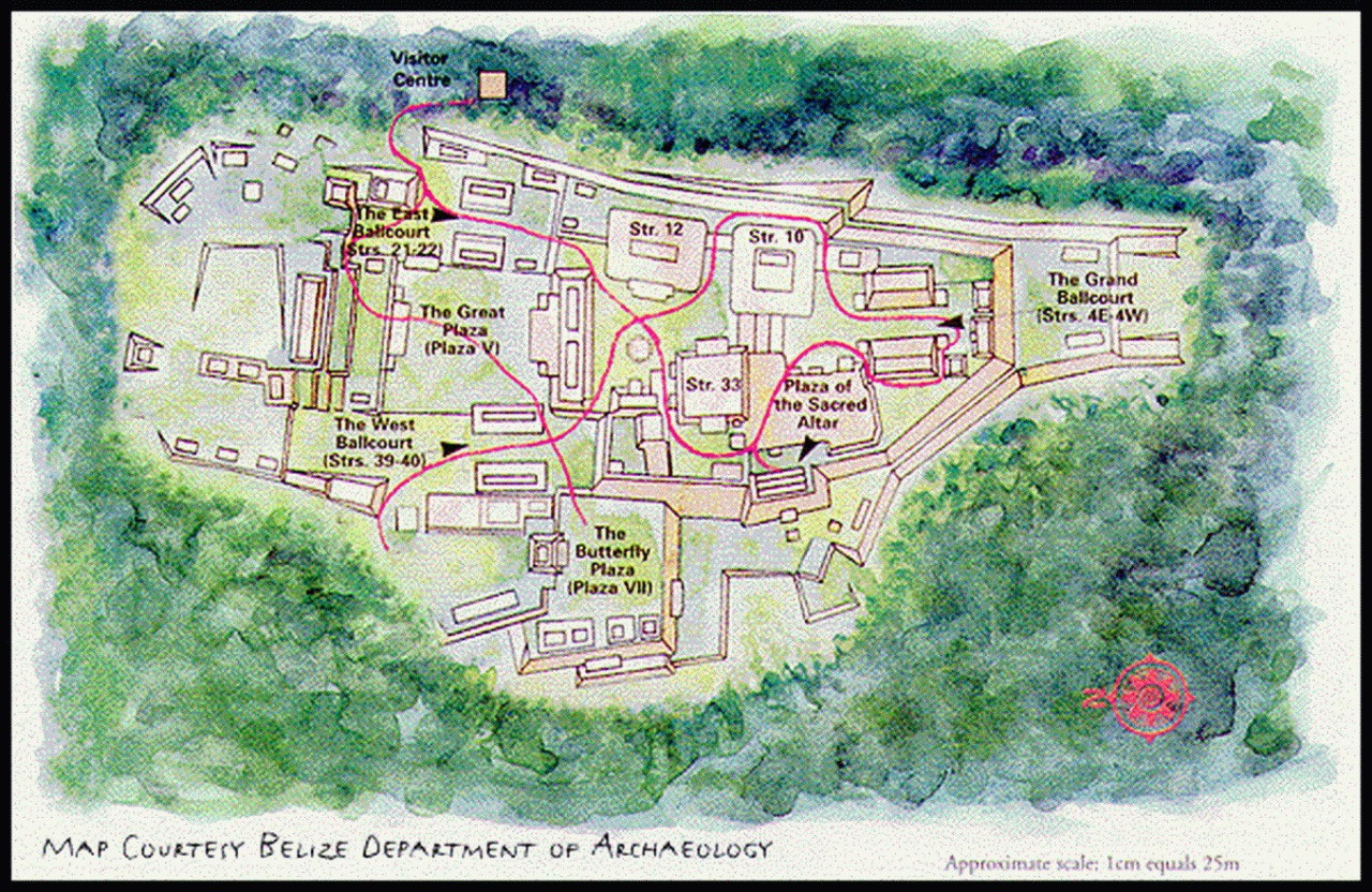
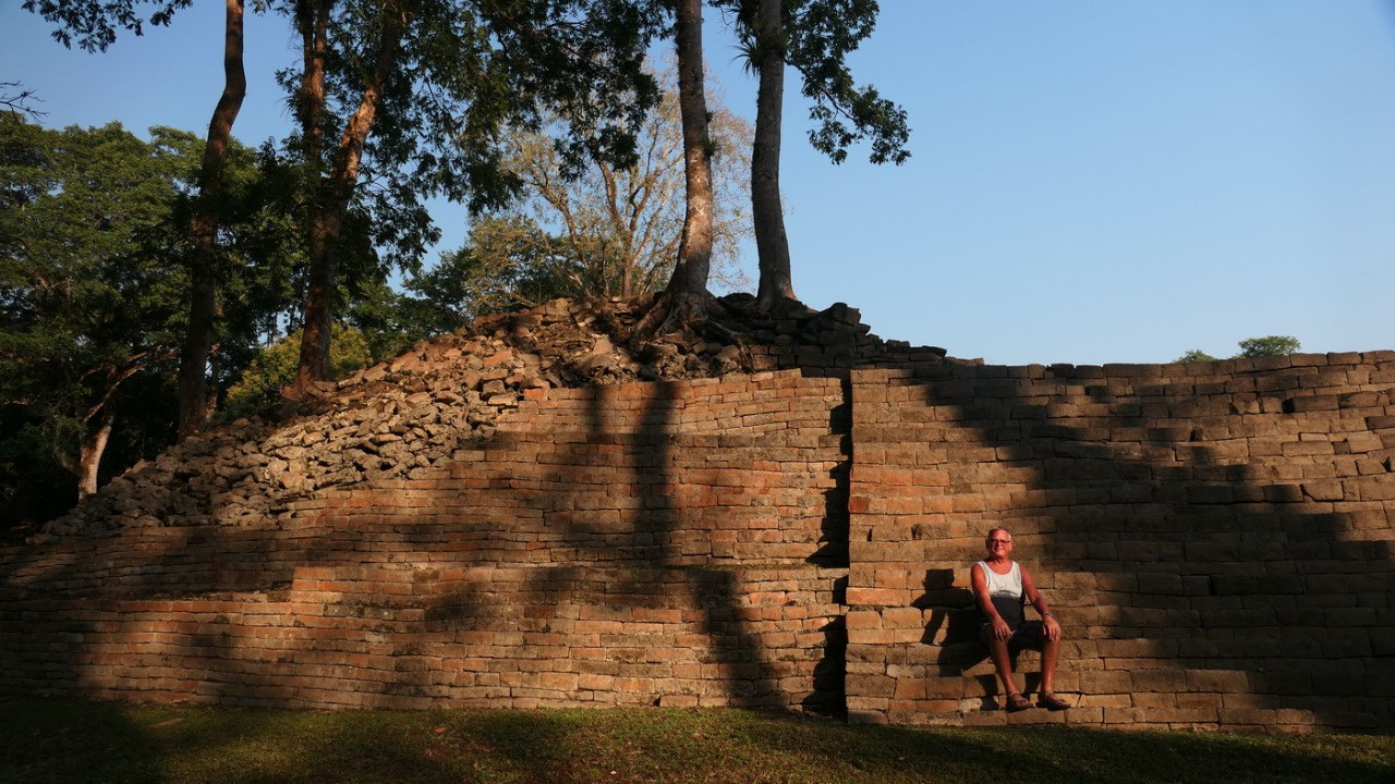
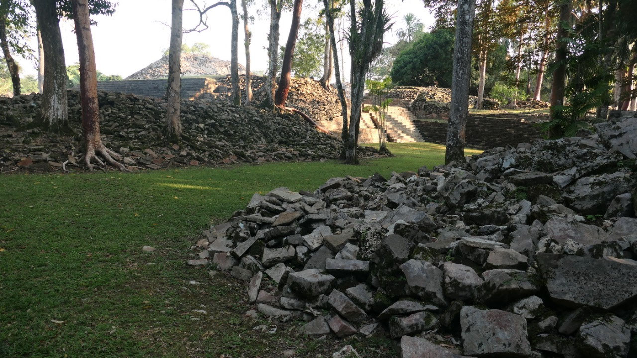
Exploring the ruins:
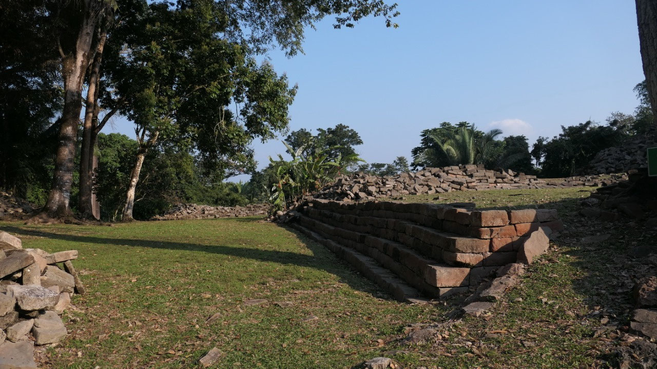
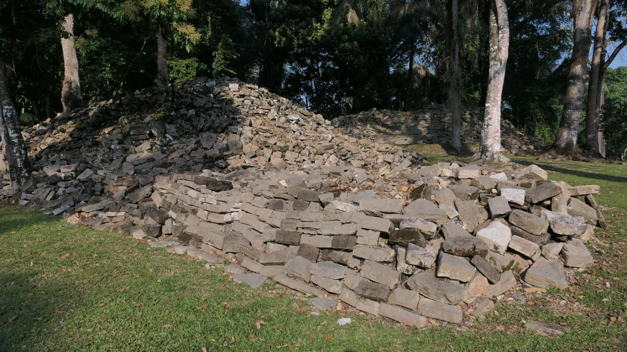
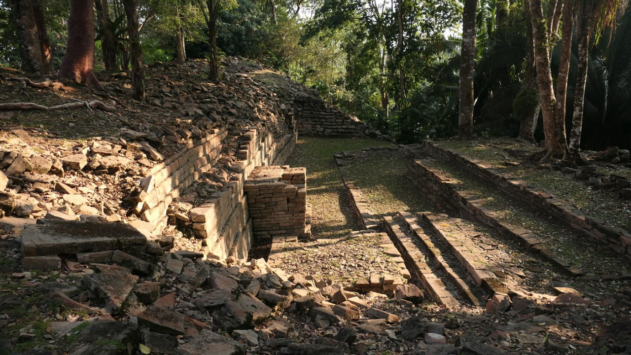
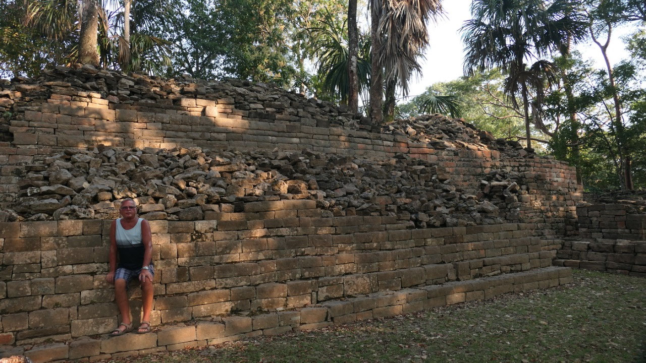
- Ball court: coming in we saw two parallel long stone rubble pile – must be a ball court as per our experts eye, and since none of the piles of stones had a number on it, it took us a while to figure out where we are on the map, but soon Gine got herself oriented while Paul was sitting on the steps – time to start out exploring
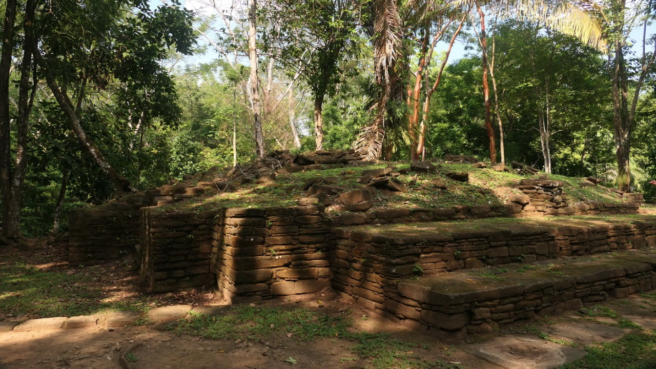
- Structure 12: up to a plaza and there was one big structure, where we admired on how the put the stones together: the bottom part was redone – the top was all still in rubble but sometimes you could really see how it was built – and is that an altar in the middle?
- the big ball court: by another huge rubble pile all the way to the ball court at the other end and this was easy to see: no ball markers? Yes once there were some, but they got all removed in 1915 and are somewhere in a museum (in the little museum on site there was a picture of one with beautiful carvings of players on it) – and from here everywhere are steps going up or down – piles of stones, partial walls – we went up a few steps because here is:
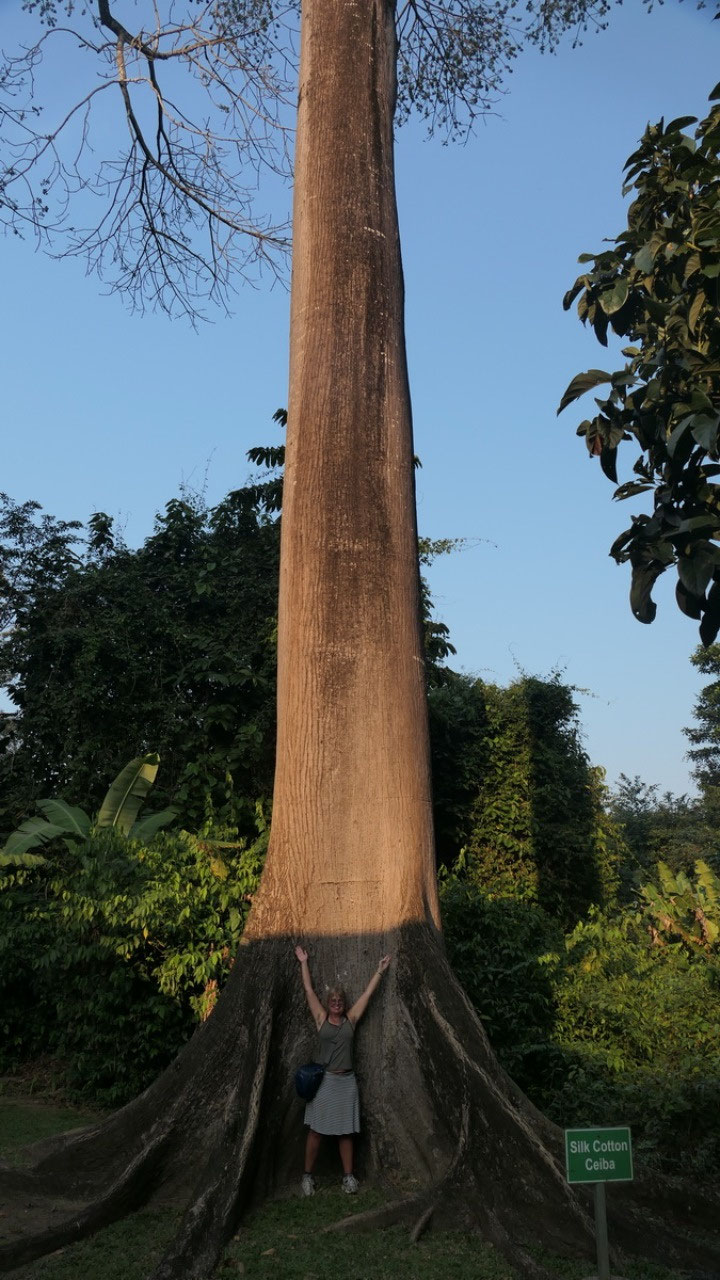
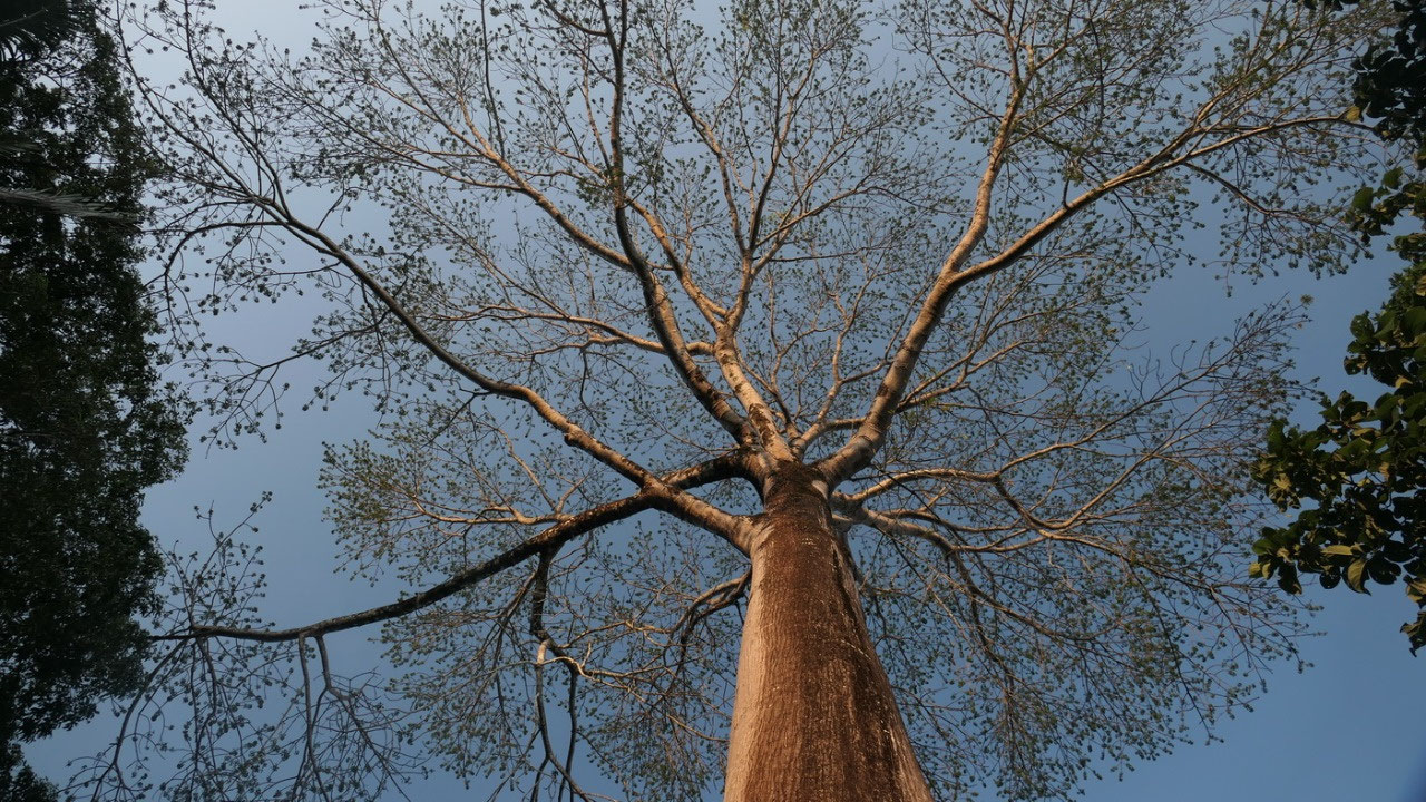
- The Plaza of the Sacred Altar: and here we also could see a lot of cool gumbo trees growing out of the stone piles – and with the evening light it looked so absolutely beautiful. Around the backside and we squeezed ourselves through a narrow opening so that we walked:
- AroundStructure 33: which is very unique with a totally round corner – makes you wonder. As well when we looked around here, even there are no huge mind blowing pyramids, this place gives you the feeling, that you are a tiny person with the big rulers above you.
- Towards the Butterfly Plaza: over more stones – between stone piles and we make our way to the butterfly plaza – here they had 2 raised platforms and they were right at the moment in the sunshine – which gave it a real creepy feeling. To reach this plaza we had to go down some real steep Mayan steps. And then through the stone pile western Ball court we went to the:
- Great Plaza: you stand here and on both sides you can go up stairs to the top of some pyramids: Gine “let’s go up” – Paul “no way” – That means Gine goes up and when looking down Paul looks super tiny, that is when you realize on how big everything is.
A
quick visit to the Museum to learn a bit more about this site and
then it is time to head back to the Chaos Oasis. Now question this Maya site has a lot of stone piles!!
Less
Mosquitos inside
with
no light outside we decided right after our super cool refreshing
shower in the round glass bottle shower: its supper time. We got
sandwiches (by the way we are not good bread buyers – this one
again has sugar) maybe we should get tortillas next time!!! all set
up, Paul opened the can this time correctly – and with the dog’s
near us watching in case there are some crumbs left we enjoyed a
beautiful outdoor picnic.
And
then the sun set and the Mosquitoes are coming – after shower we
didn’t put on bug repellent (which was stupid) and so we started
scratching... and then said: no way we go inside. Took one of the
chairs and then did all our reading and writing behind the screened
doors.... By the way the next morning we discovered that there was a
severe mosquito attack on us!!! we are still arguing who got the most
bites.
Together
to the Bathroom
If
you are in a off-the-grid place you don’t have electric lights
everywhere – so Gine told Paul: we have to go to the bathroom
before sleeping and you have to go with me – you never know what
kind of wild animals are out there. With the flashlights we went over
to the bathrooms – and only the dogs made sure we are save.
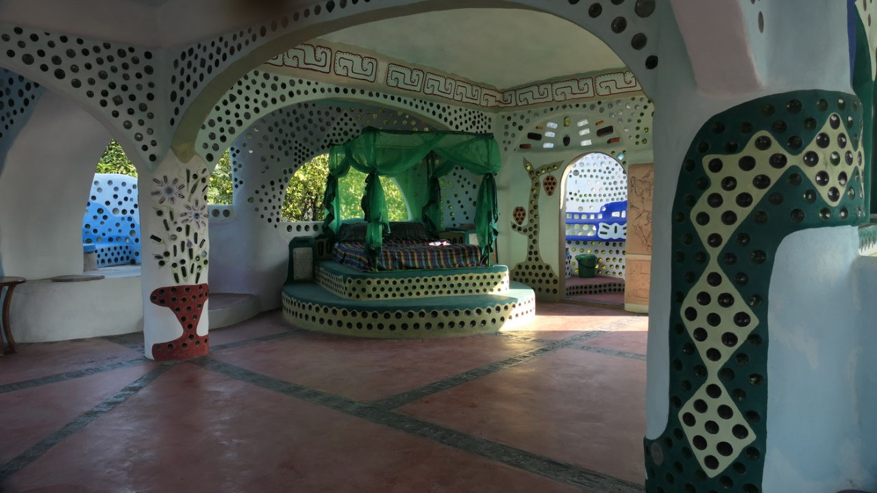
Visiting
the Earth ship
Up
this morning and feeling sorry for our mosquito bites, we went over
for coffee in the earth ship. They only have concentrated rice syrup
to add into the coffee, that means Gine went and got a milk (which we
by the way then forgot on the breakfast table, and remembered it like
4 hours later when we were in Punta Gorda and the milk was not in the
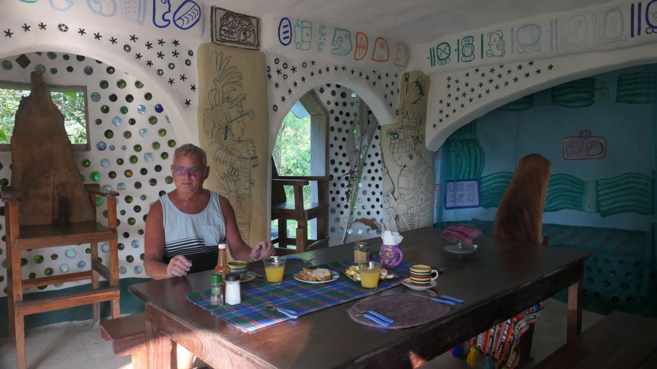
cooler). With super yummy homemade bread and cake – fresh fruit
with cocoa nibles, egg with fried tomate and chicken we are spoiled.
Alisha
then showed us around the earth ship and told us about the movie
which was made to built the earth ship.
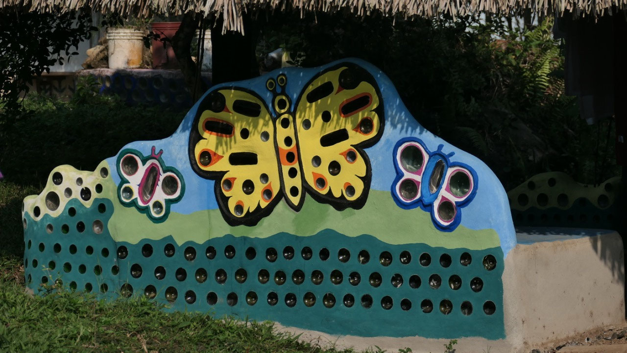
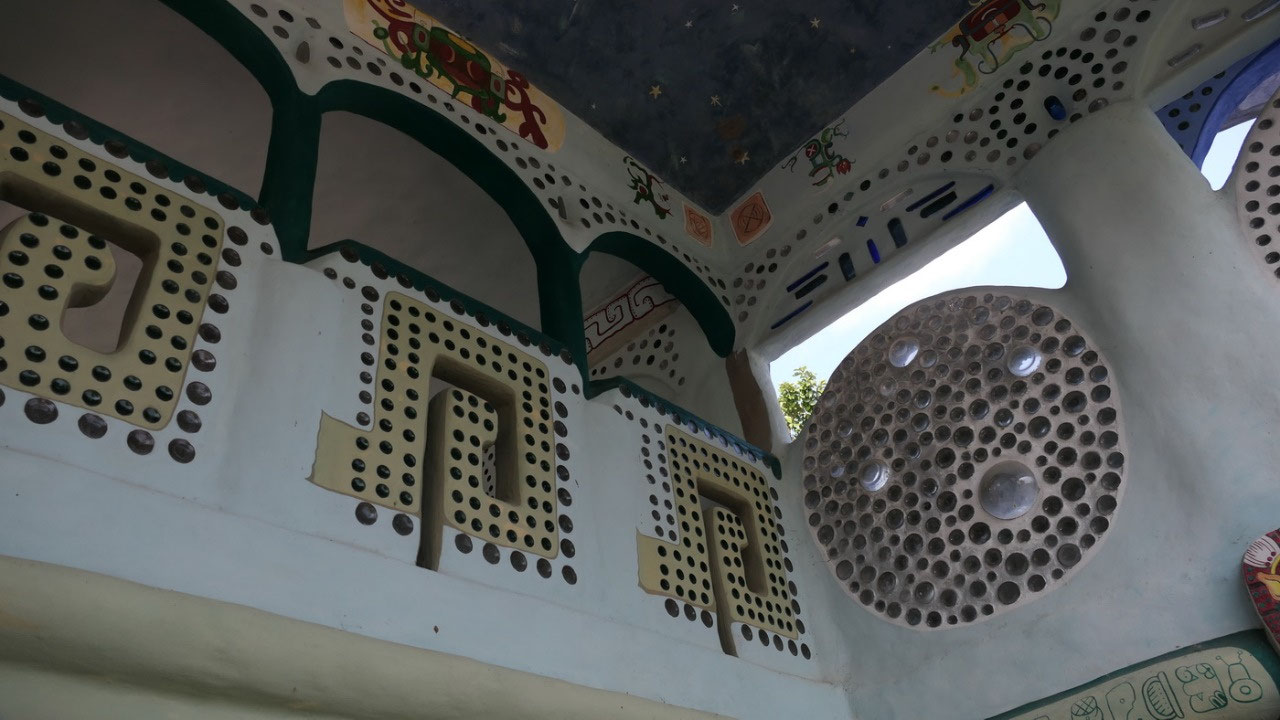
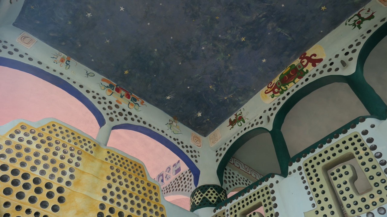
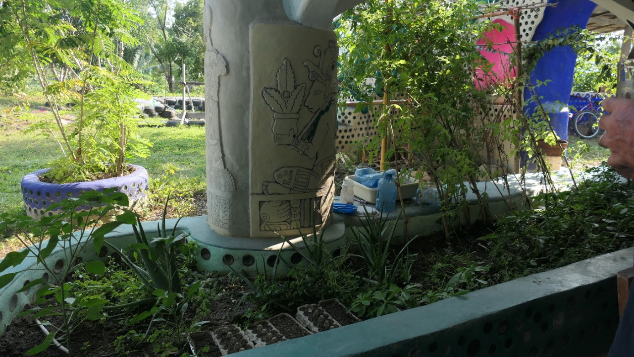
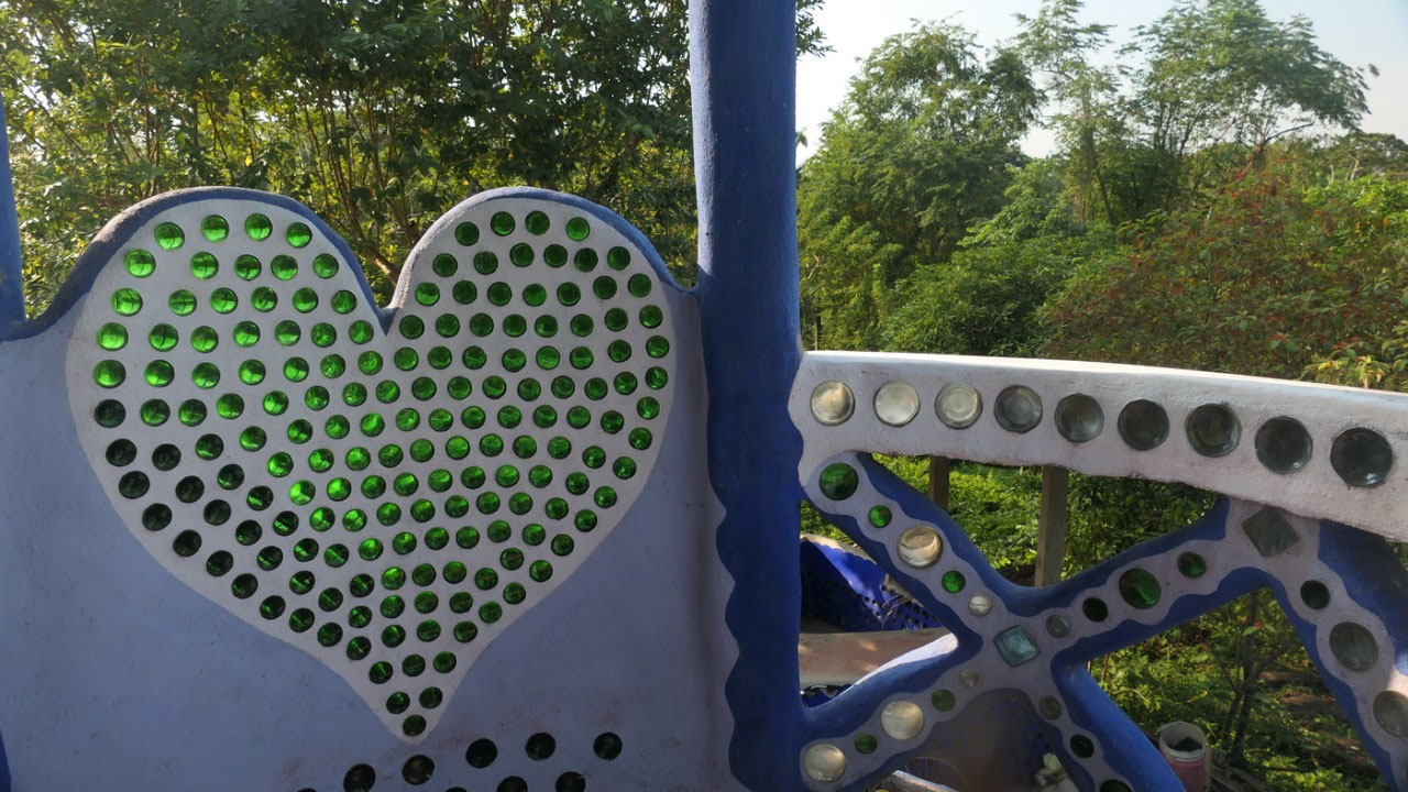
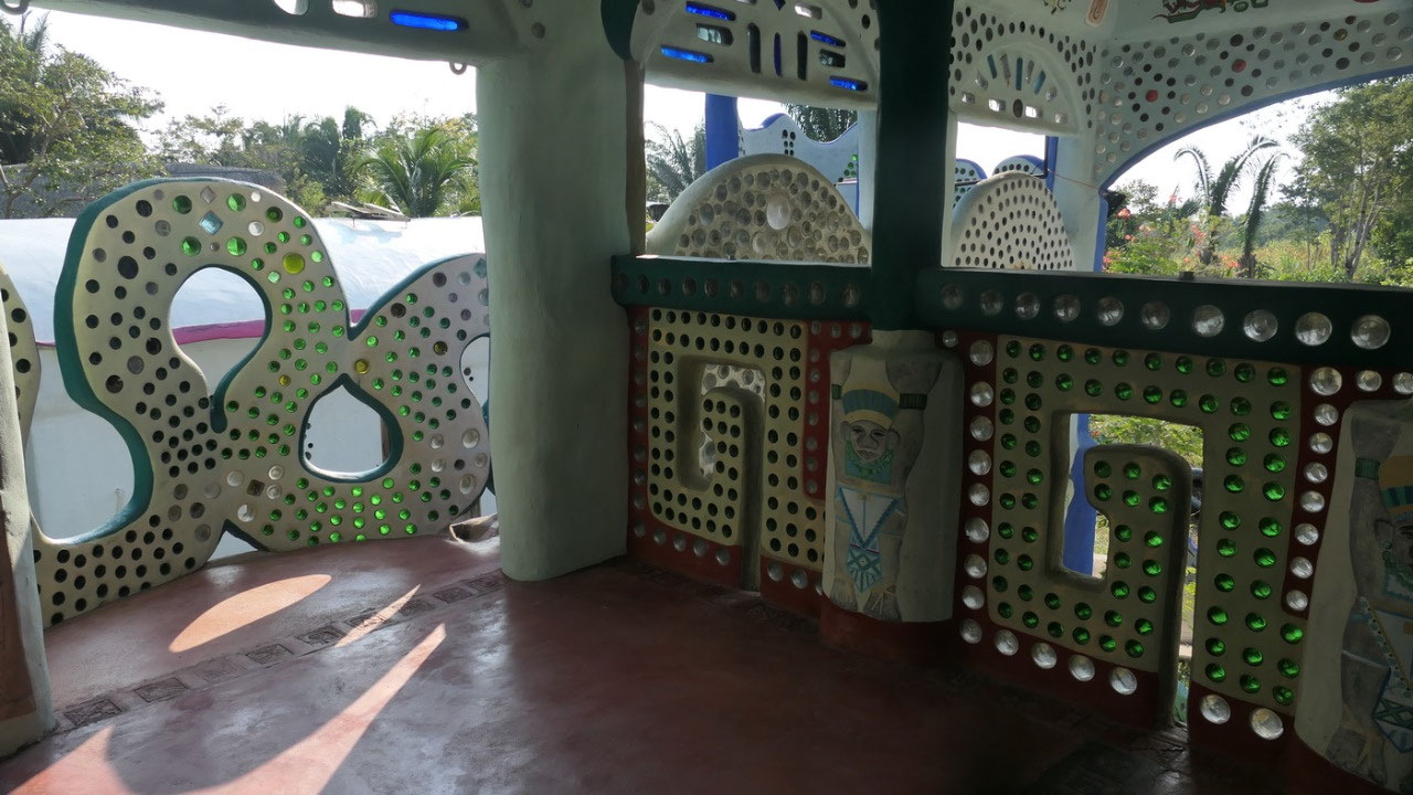
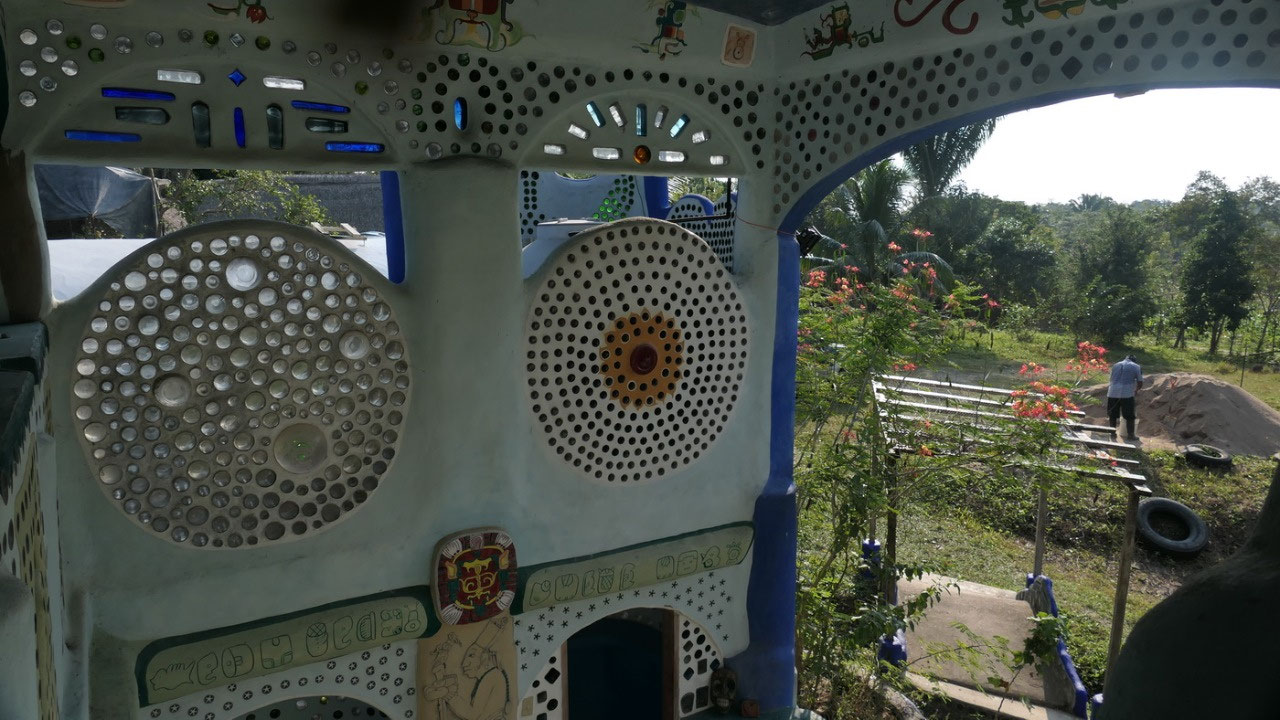
- This earth ship structure is build from recycled bottles, tires all plastered together with cement (at one spot you can actually see how they did it – and they are in the moment building the butterfly house and you can see the tires)
- in the walls are mostly plastic bottles – on the outside walls where you can see: they used glass bottles: which get cut in half: cleaned several times and then 2 bottles get clued together (the leftovers are somewhere buried under benches).
- They get the bottles from recycle and dumps – and there are a lot of bottles and tires stored on side
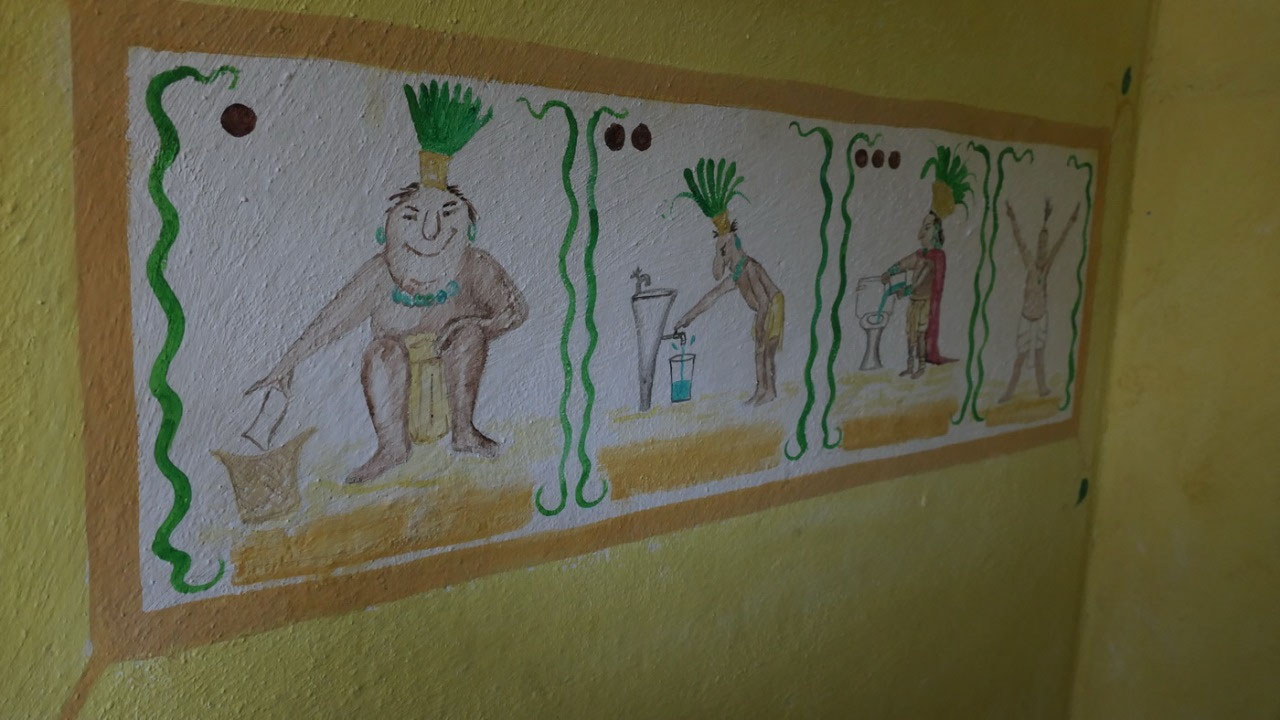
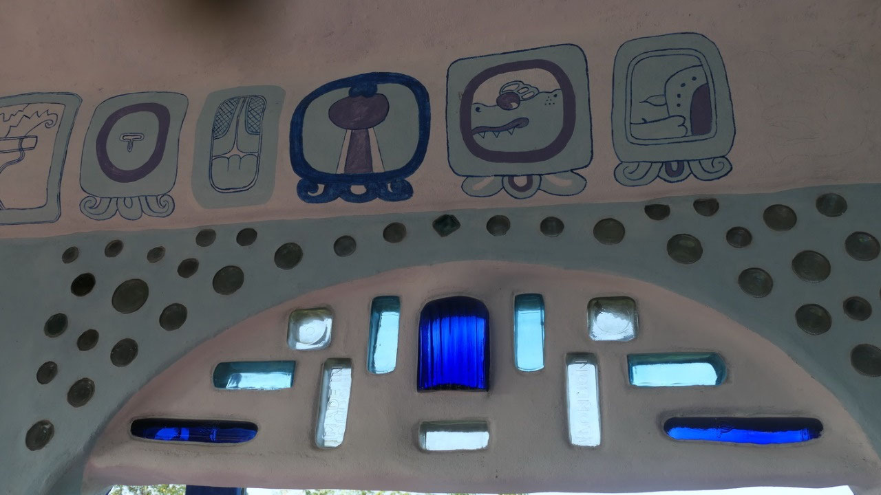
- all is beautiful painted with Mayan motives (you can even find stelae in the yard)
- when you look around you can (if you are fluent in Mayan) read the names of the family as well as their birth dates
- they are not living in the earth ship
- the spot where they are: is just outside the Lubaantun ruins and near the bathroom you can see a rubble hill – which likely is a ruin. As well where the house sits it was once a plaza of the Mayans
- they live off the grid: solar with batteries – no charging of anything during the night – no flushed toilets
- they collect all the rain water from the roofs and keep it for flushing toilets, showers etc they have every year 130 days or 3 month of drought
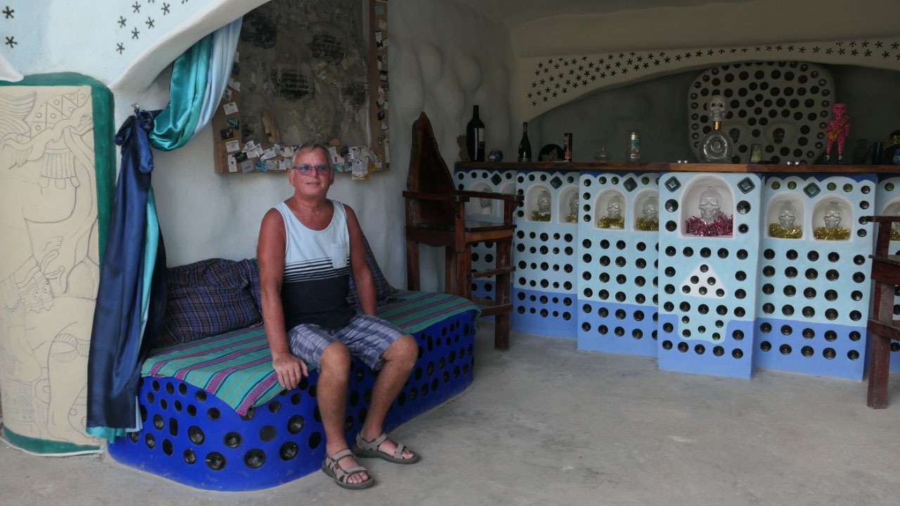
ok
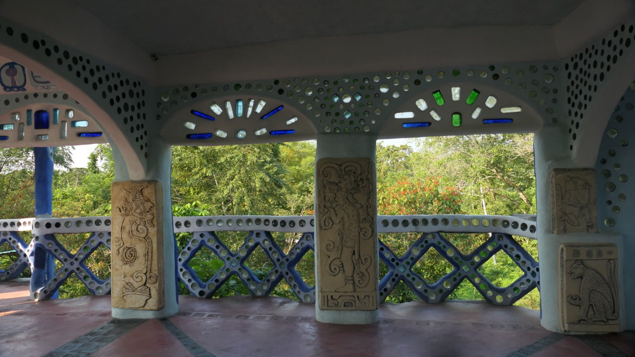
so we had breakfast and admired the nice stelae on the columns and
the Mayan writing – as well the bar is not only made from bottles
but behind you can see a huge skull – very fitting, when you think
that the mysterious “crystal skull” was found next door. When you
walk up the stairs – all is open and you have those little
balconies everywhere – a relaxing zone, the huge bed and the cute
little bathroom and each balcony – window column is different. Even
on the floor you can find the Mayan motives.
I
could look forever and check out each painting, stela and form: you
can find one balcony like a snake, another resembling a mayan symbol
– I think it is not only amazing and fascinating but also very
talented. Guess our house is very boring.
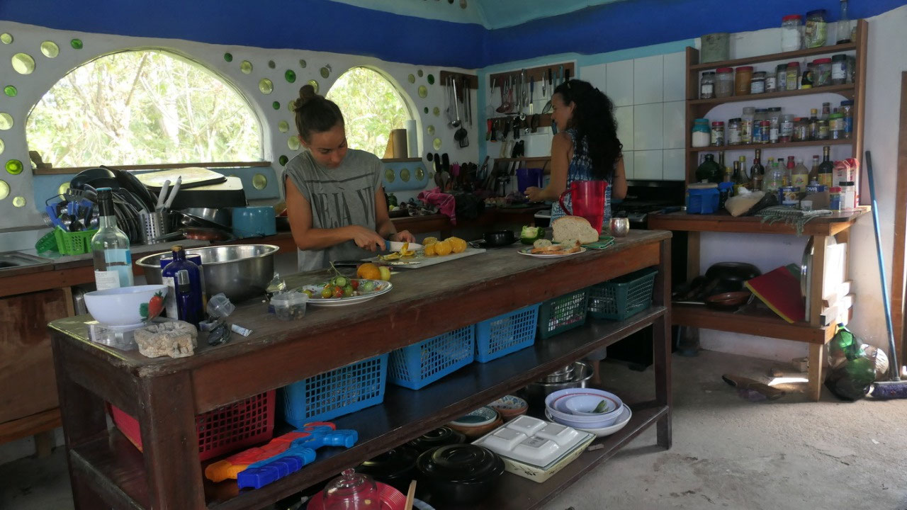
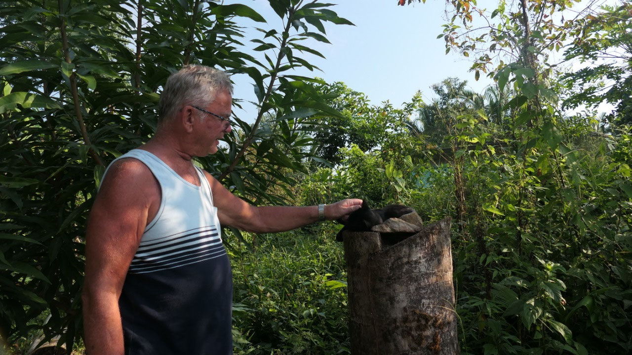
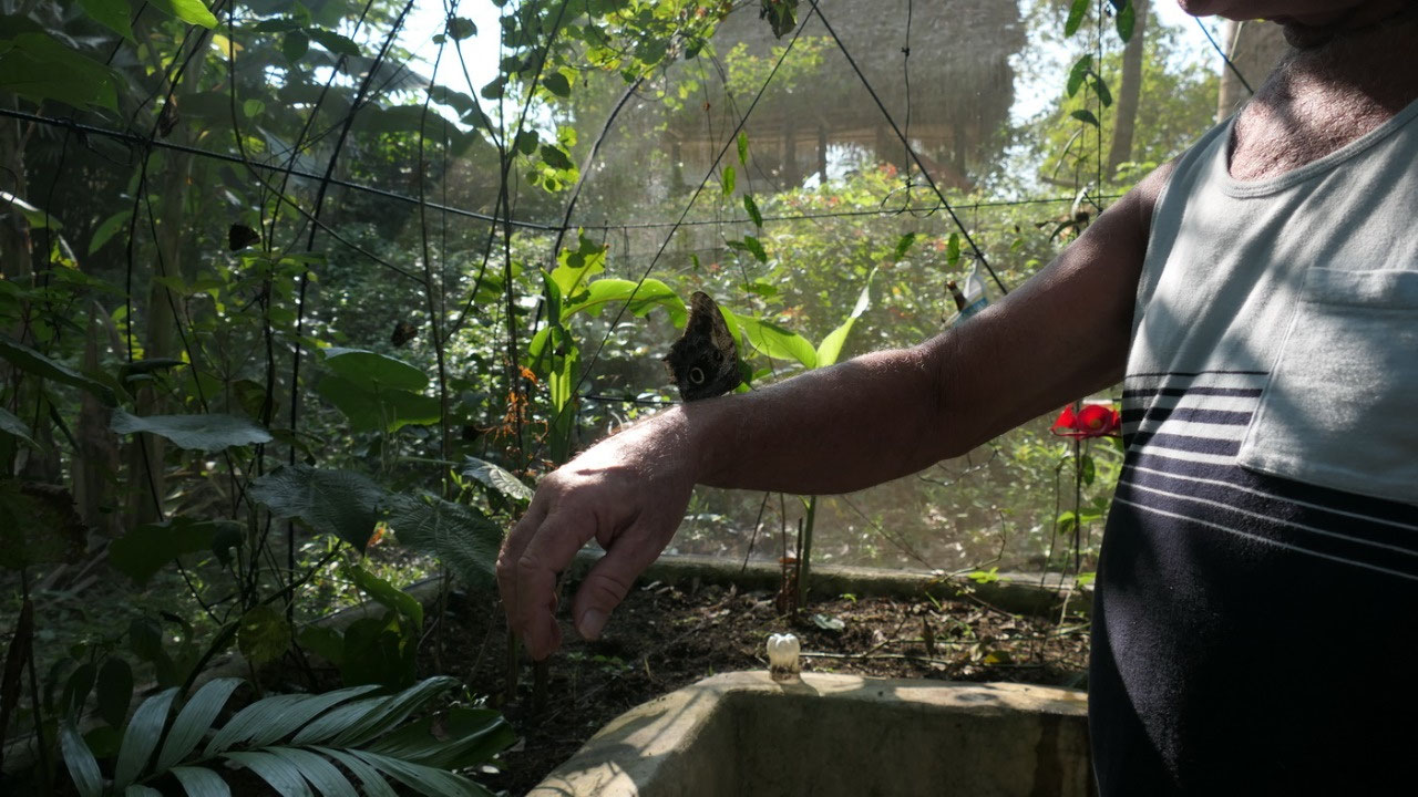
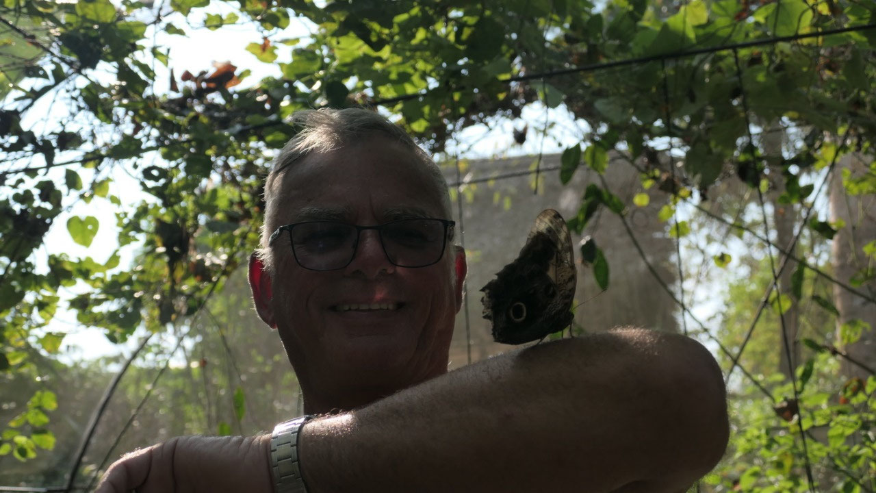
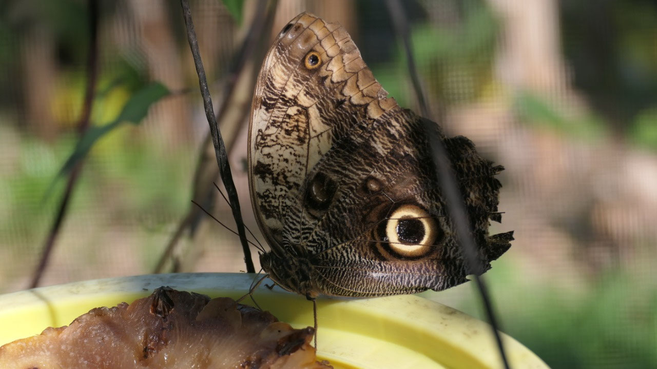
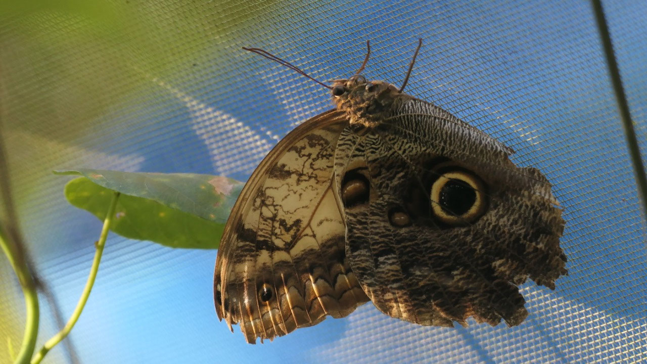
We
also had a peak into the recycle-bottle house kitchen and then before
leaving we visited her butterfly garden, they are like pets at least
some of them were sitting on Paul.
A
super unique experience and I’m so glad we came.
Santa
Cruz – like an outdoor museum
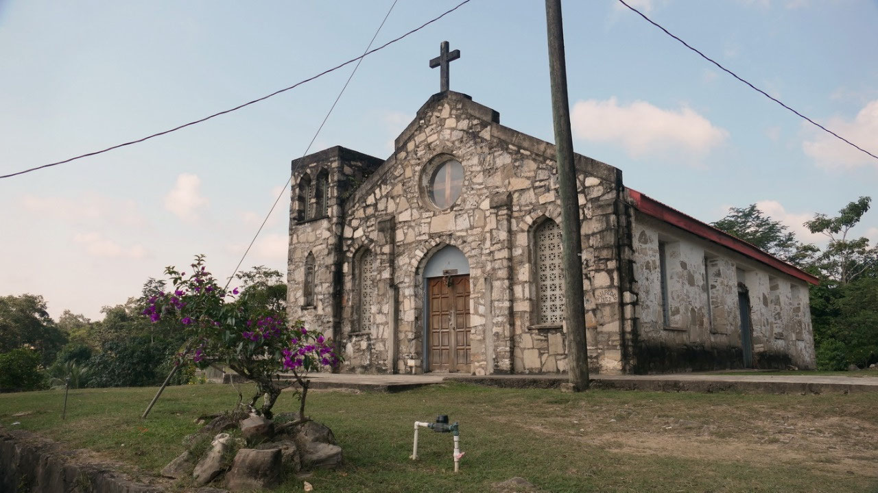
we
decided to drive to the Rio Blanco NP – but on the way there we
wanted to check out a bit more of the Mayan towns. Our first stop was
at the church in San Pedro Columbia, very unique to have it there.
Then we continued to drive to one of the largest Mayan villages: San
Antonio one of the largest Mayan towns – as where San Pedro is
Ketchi, this one is a Mopan Mayan town
Next
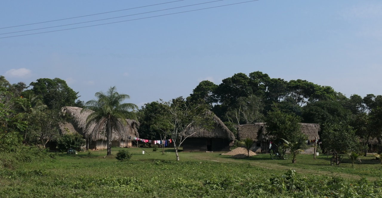
came Santa Cruz: another Mopan Mayan Village – and here we had the
feeling we are driving through an outdoor museum. Nearly all houses
are built in the Mayan style with the Palm-thatched roofs, they are
absolutely beautiful, then you can see once in a while a horse
attached.
- In 1950 a group of families came together to built a community at a site with fertile soil, since most people were catholic they named it Santa Cruz which means Holy Cross
- today Santa Cruz has a population of 500
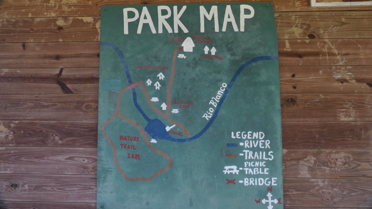
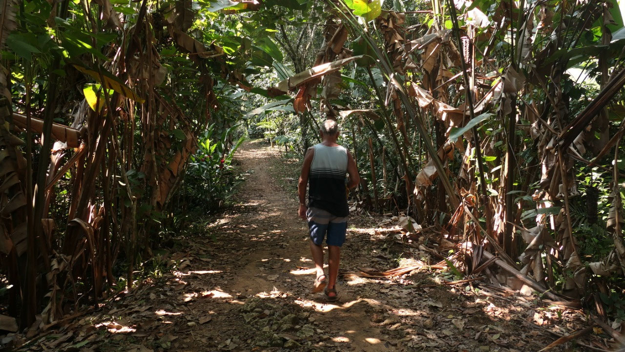
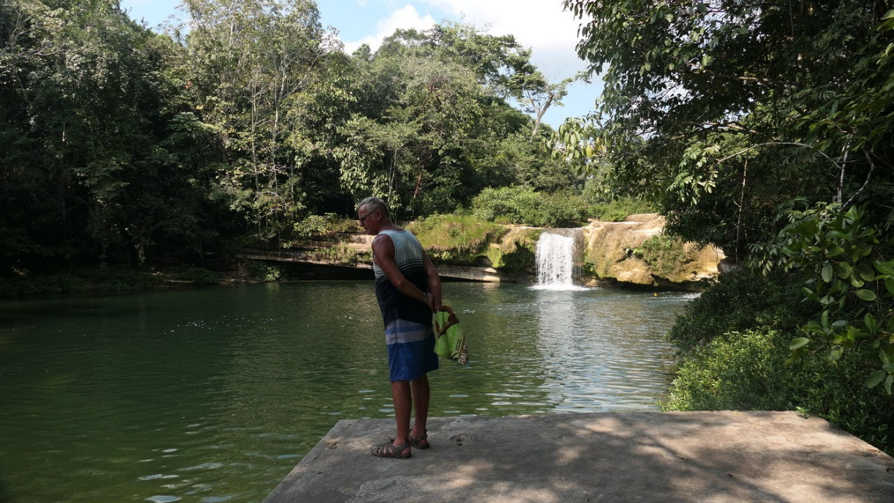
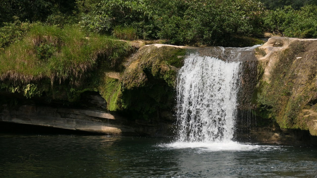
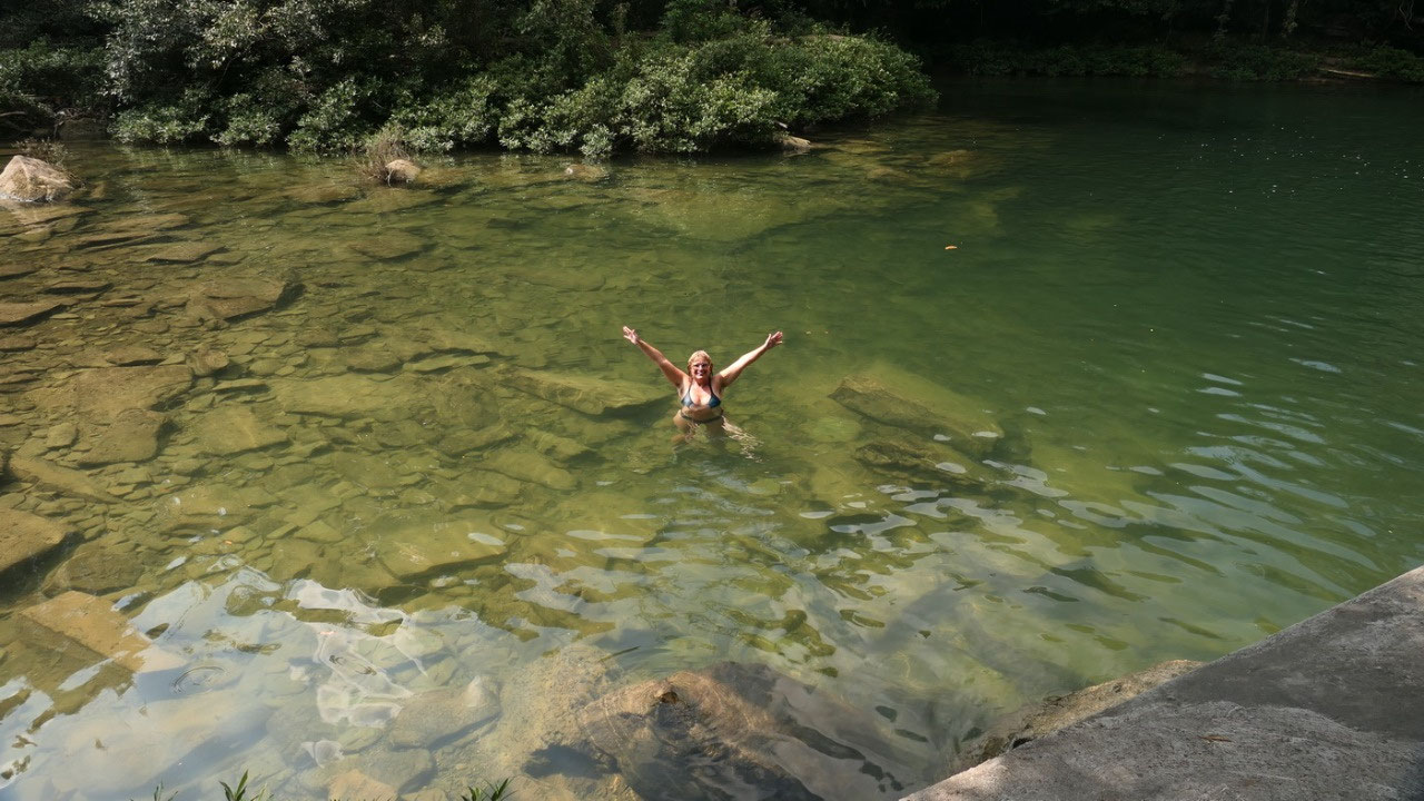
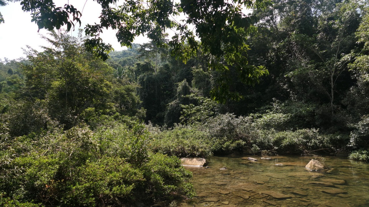
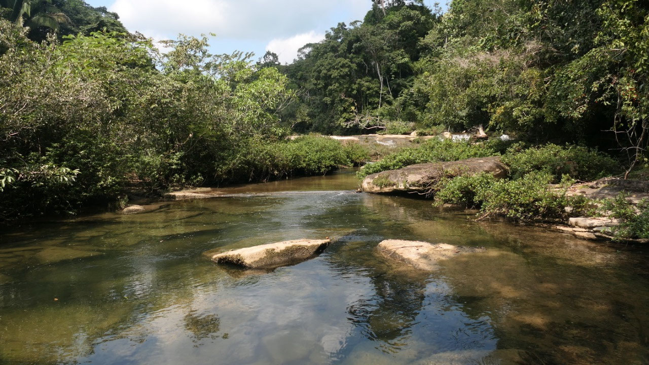
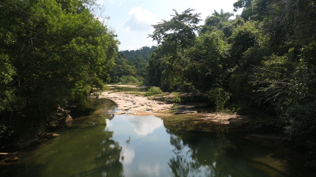
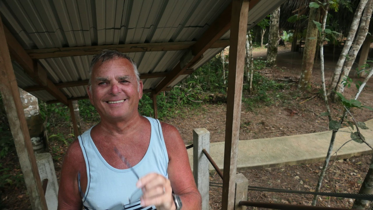
Rio
Blanco National Park
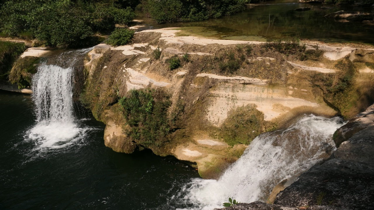
when
we arrived and parked we saw a house with a sign – meaning we are
at the park, but no-one around. We decided to go to the falls and who
knows maybe it is free. Down the path and soon we could here the
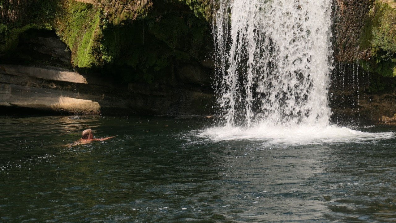
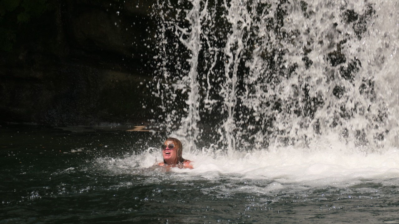
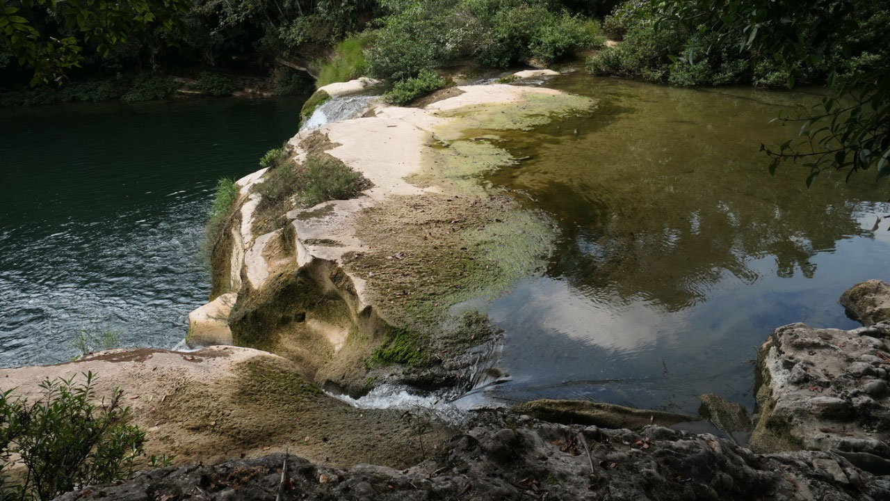
water. Which way: left and that was also the highlight. We came out
and looked on the big pool with the ledge where 2 waterfalls came
down (during rainy season the whole edge is one huge fall). Let’s
got into the cool water - because all our mosquito bites in the
watershoes itch. In we go, Gine swims to and under the waterfall
which is so much fun.... then we walk along in the hope to find a
cool spot to hang in our feet, first we had a great view right above
the falls, and we can see some other falls a bit ahead... so further
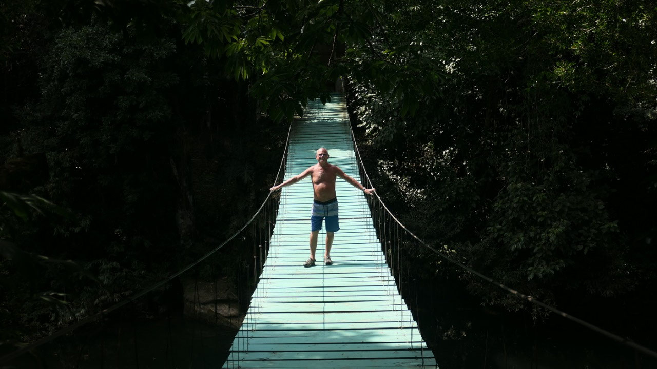
along the river until we meet a whole bunch of guys working with the
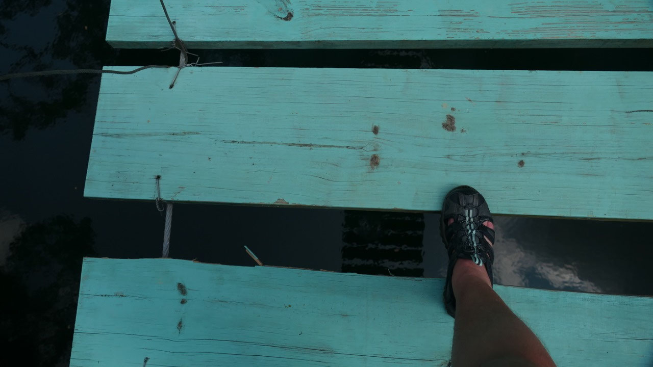
park warden: they had a meeting. And then comes the suspension bridge
– Clearly not Canadian Safety Standard: the gaps between the wood
is super wide a foot can easily slip through and then there is
nothing on the outside to keep you from falling into the water. It
was fun... and we are cooled down.... time to head back pay our
entrance fee


2025-05-22