 San Ignacio, Cayo District, Belize
San Ignacio –
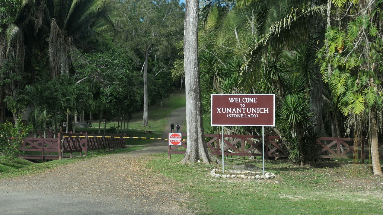
Xunantunich / Cahal Pech
Welcome to San Ignacio and the
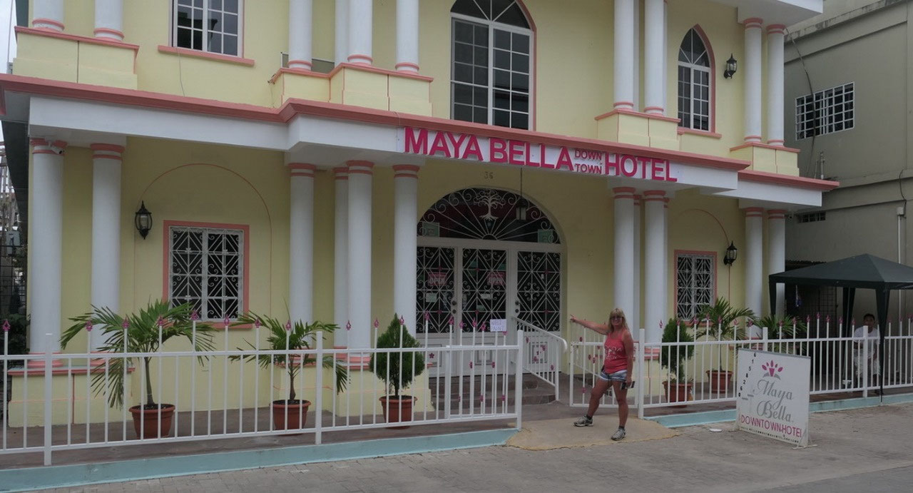
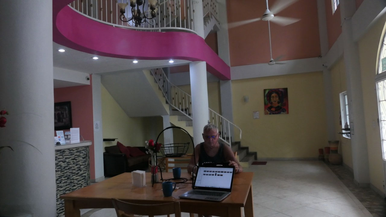
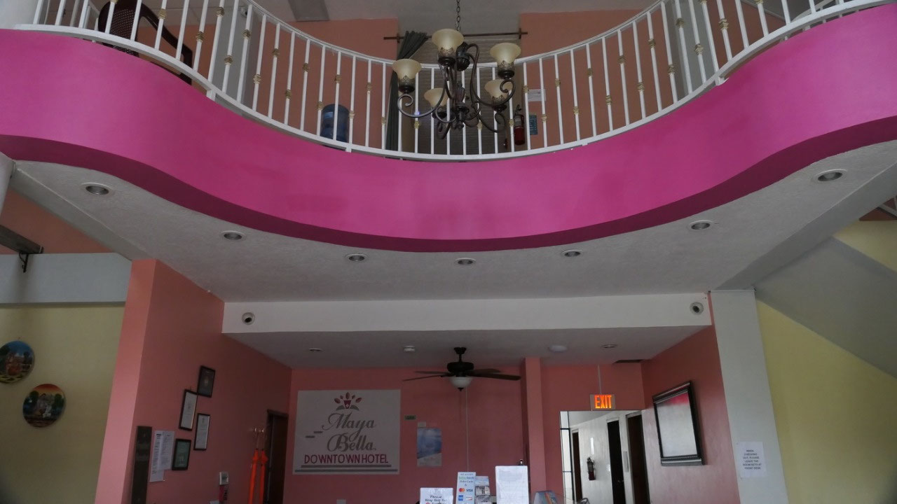
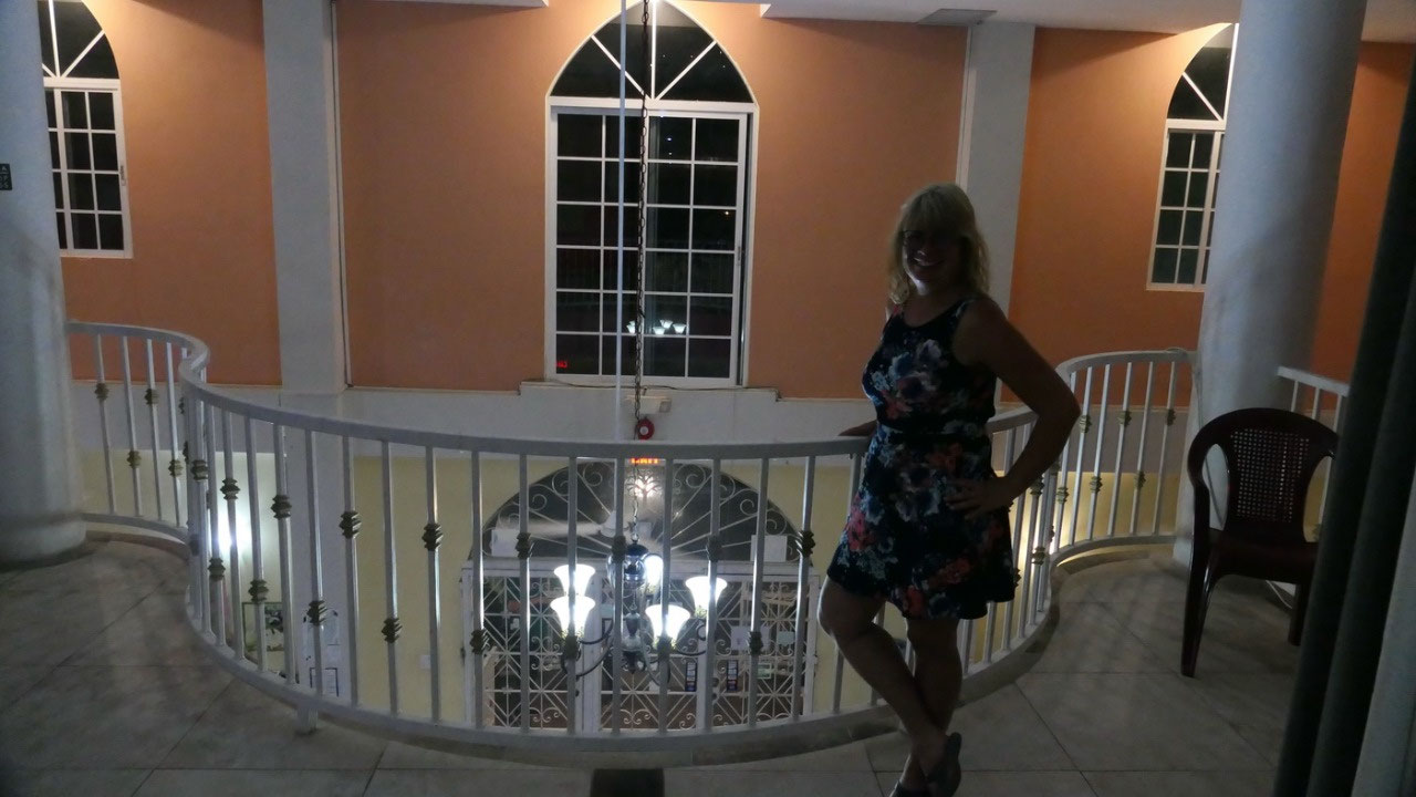
Maya Bella Hotel
and
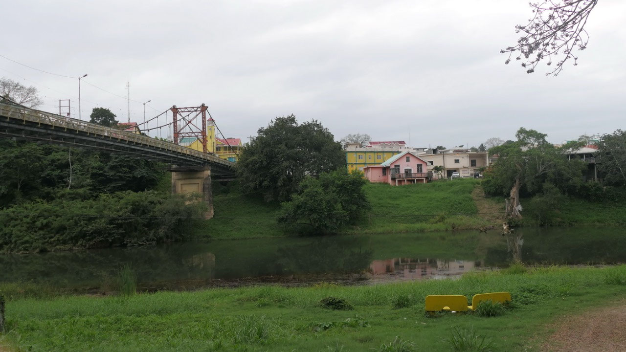
then we cross the tiny bridge from Santa Elena over to San Igancio.
First we had trouble to find the parking for the hotel and then we
did one circle and found the parking: ok the parking spots are not
the largest but as a good driver Paul did it perfectly.
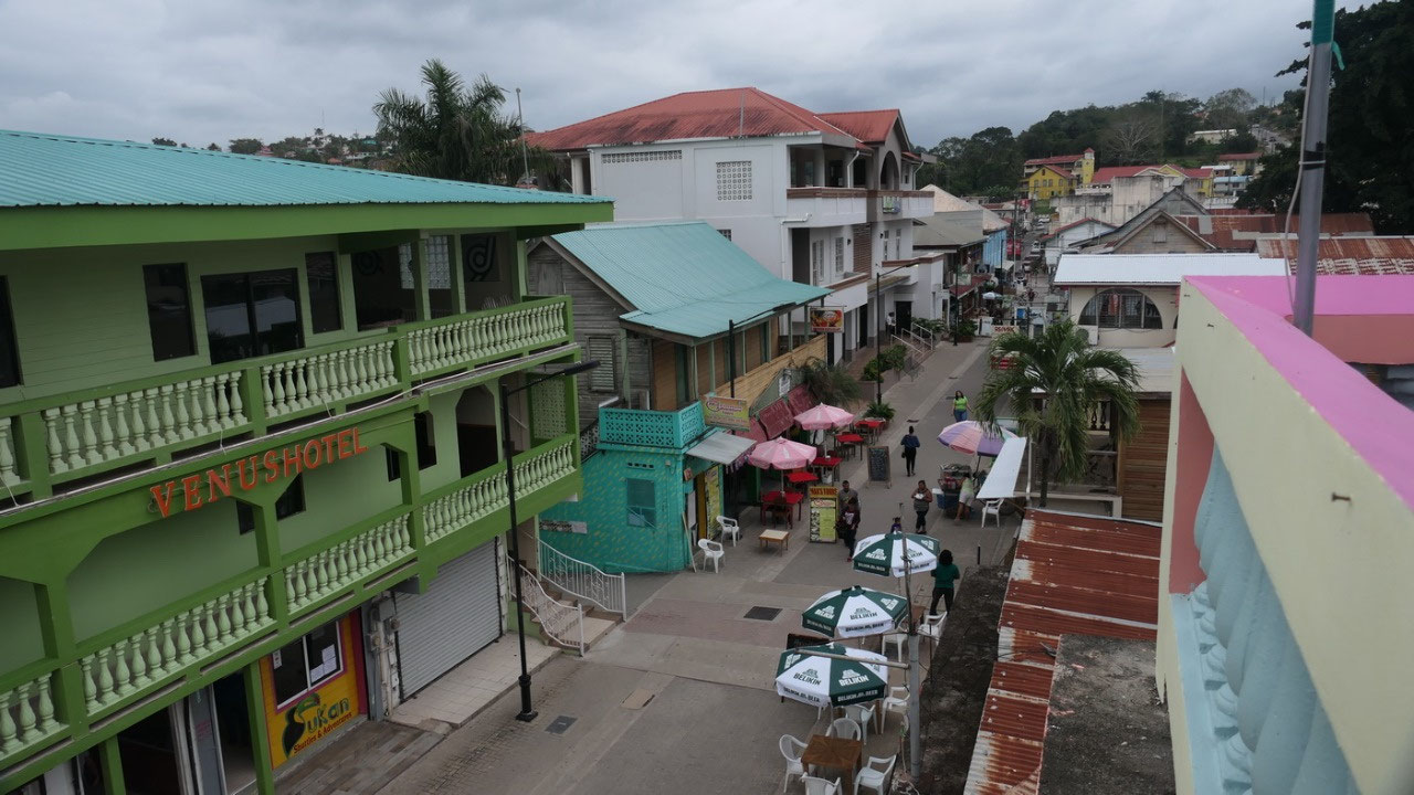
This
hotel is really cute: with white and pink it is super cute and it is
right on the only pedestrian street in town – you can’t be more
in downtown. It looks like a cute old hotel. First we check out our
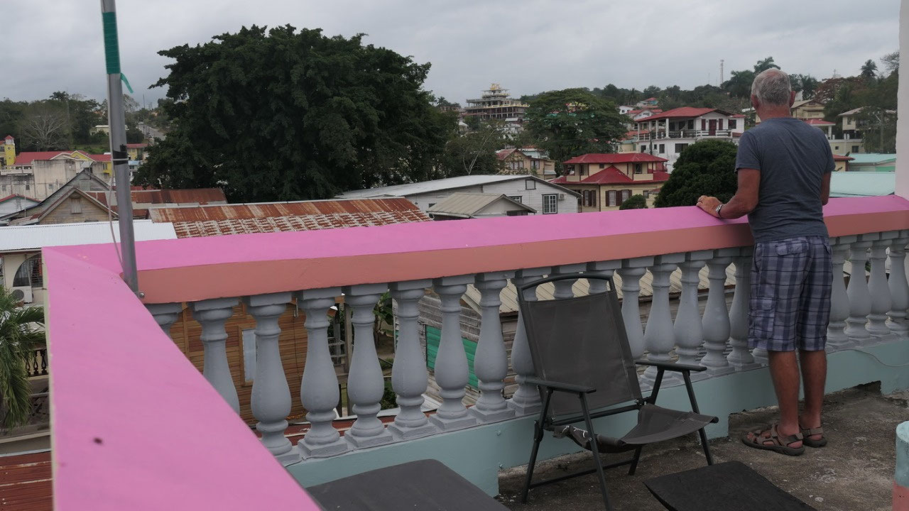
room and also the upstairs balcony.
In
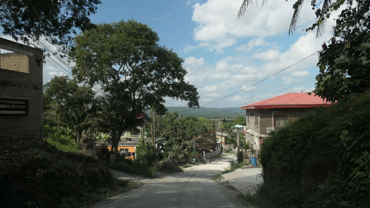
Belize’s 2nd largest City –
San Ignacio:
- with around 20.000 inhabitants it is Belize’s 2nd largest city after Belize City (57.000)
- they say there are less mosquitos (hopefully they are right)
- we are now in the Cayo district: it’s the largest of the 6 Belize Districts - recently they found oil in Spanish lookout
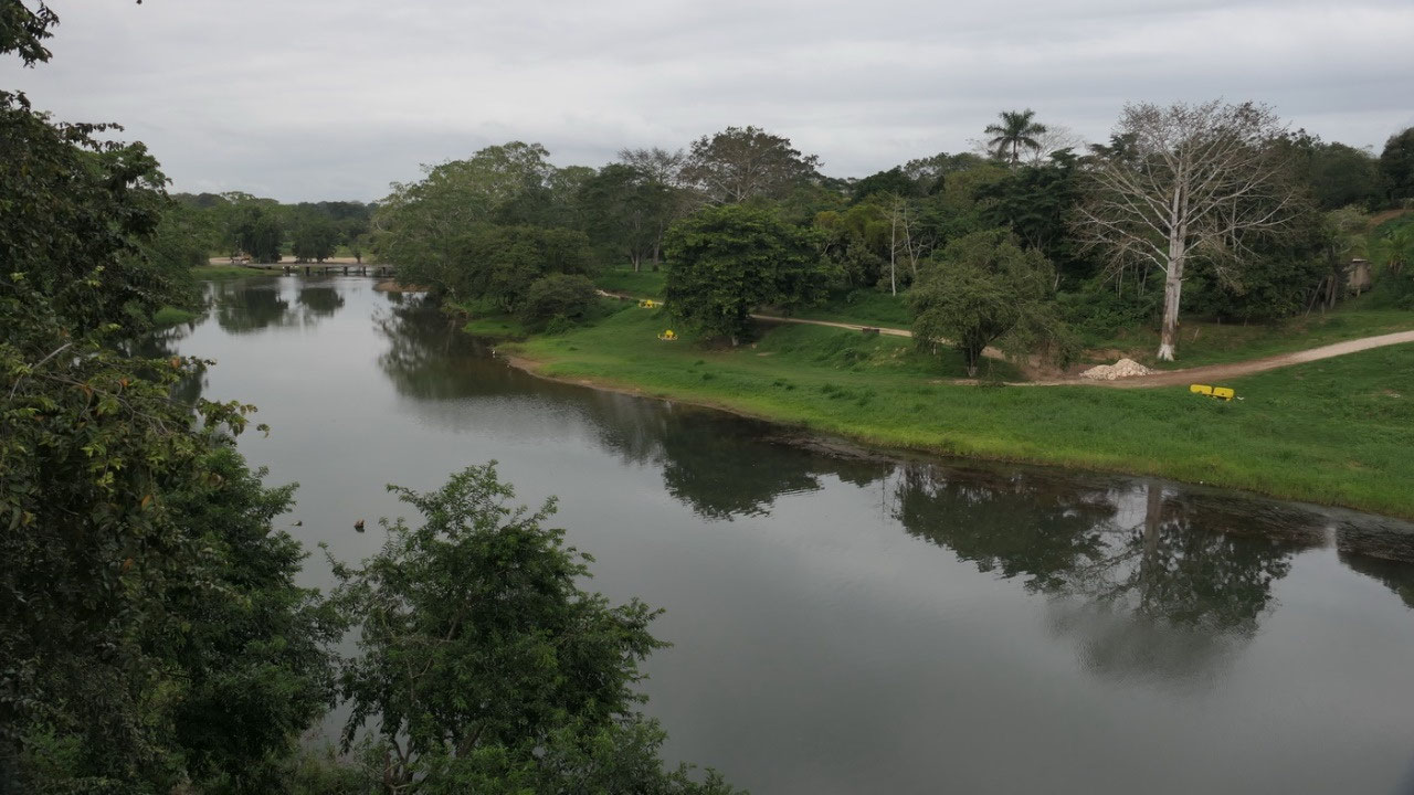
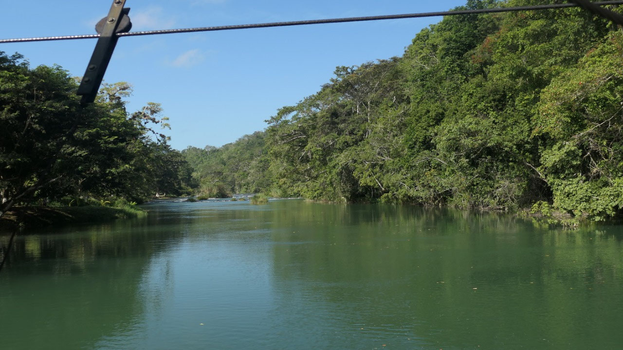
- it got named El Cayo by the Spanish meaning “island” because i’ts ona peninsula between 2 converging rivers (Mascal & Mopan) and it indicates how isolated the European settlers felt
- San Ignaciois separated from it’s sister town Santa Elena by the Mascal River
- the town likely started as a logging camp, and then became a center of chicleros: collectors of chickle gum – when the black market price of Maya artefacts skyrockets, most turned into looking for them
- until 1930 it took around 10 days of paddling to reach San Ignacio from Belize, then they built the Prince George Highway, which then got paved in 1980
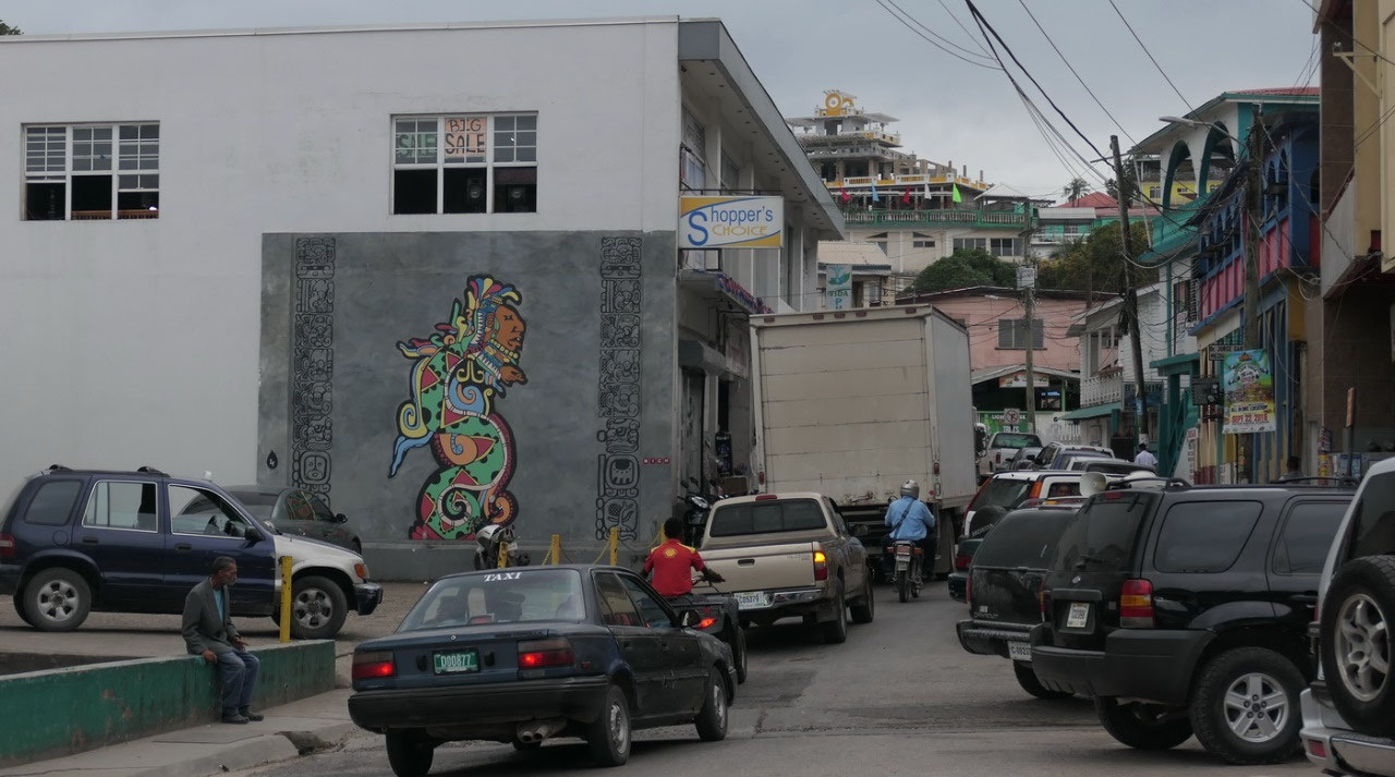
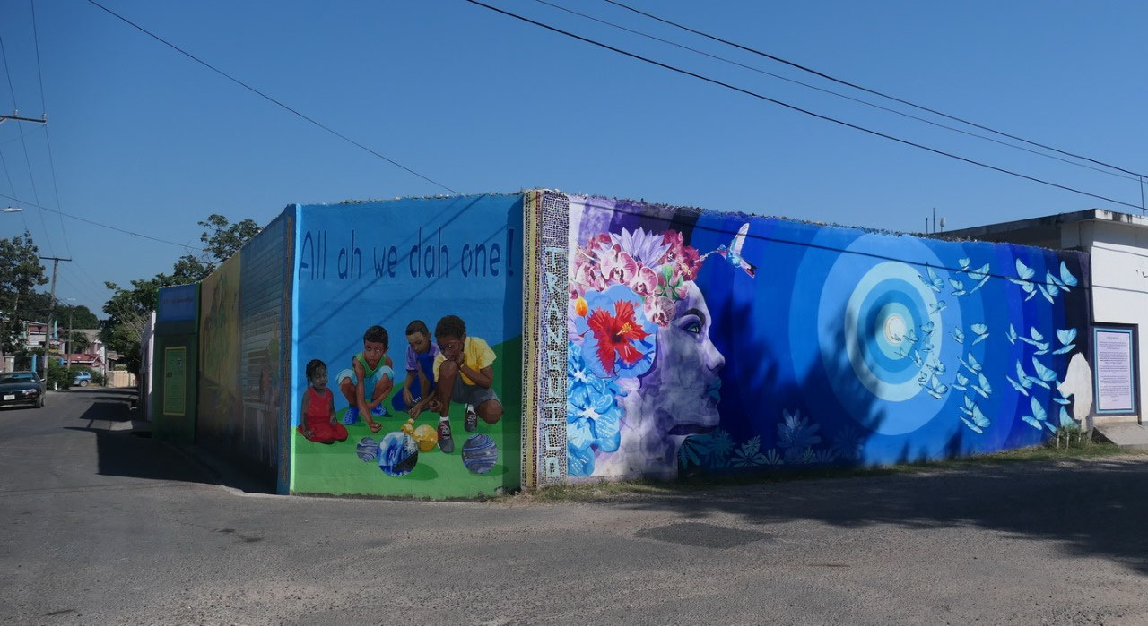
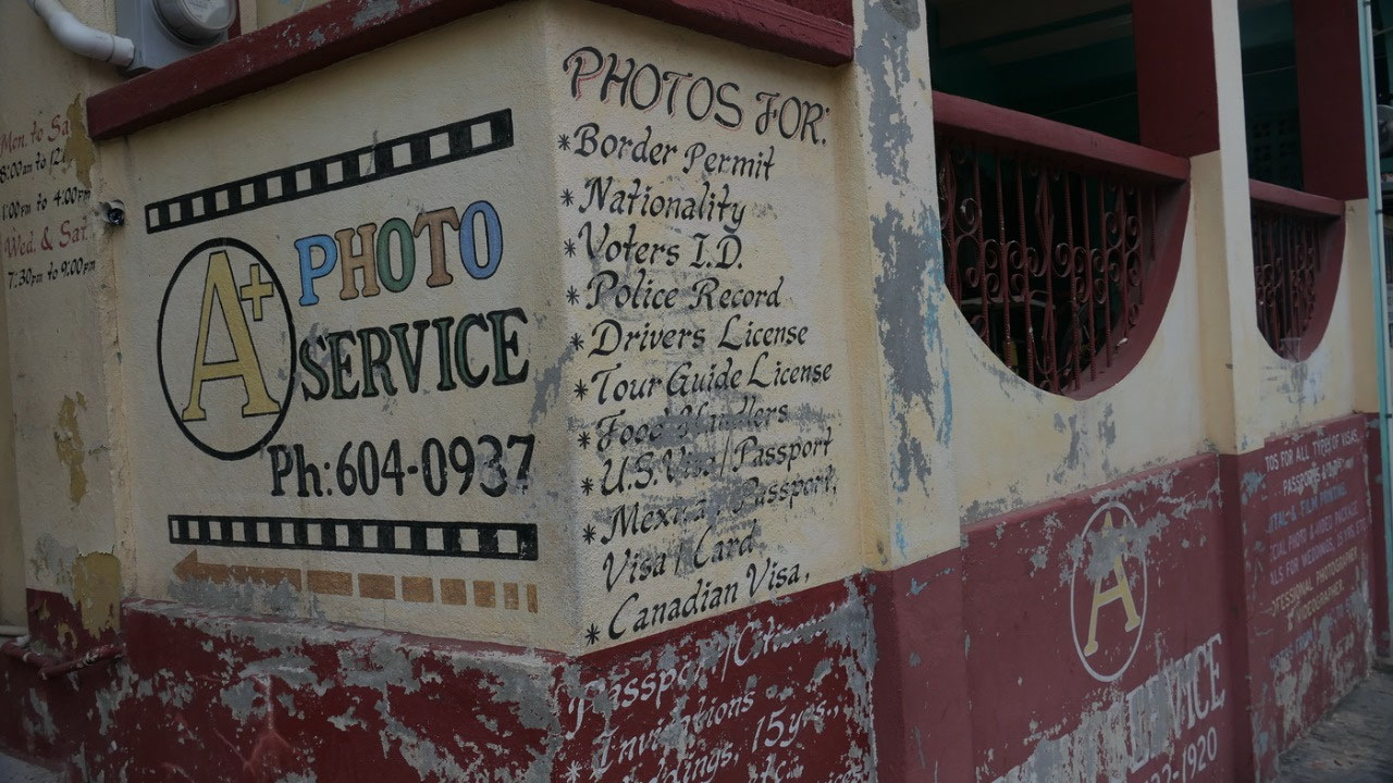
Discovering
downtown San Ignacio
and
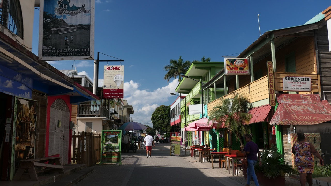
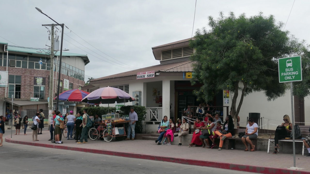
since we arrived early and we have lots of time, we can discover the
town, the pedestrian street is not that long and then we discover a
place which not only serves coffee but also sandwiches – and as it
is coffee time – that is perfect for Paul. Then there is that
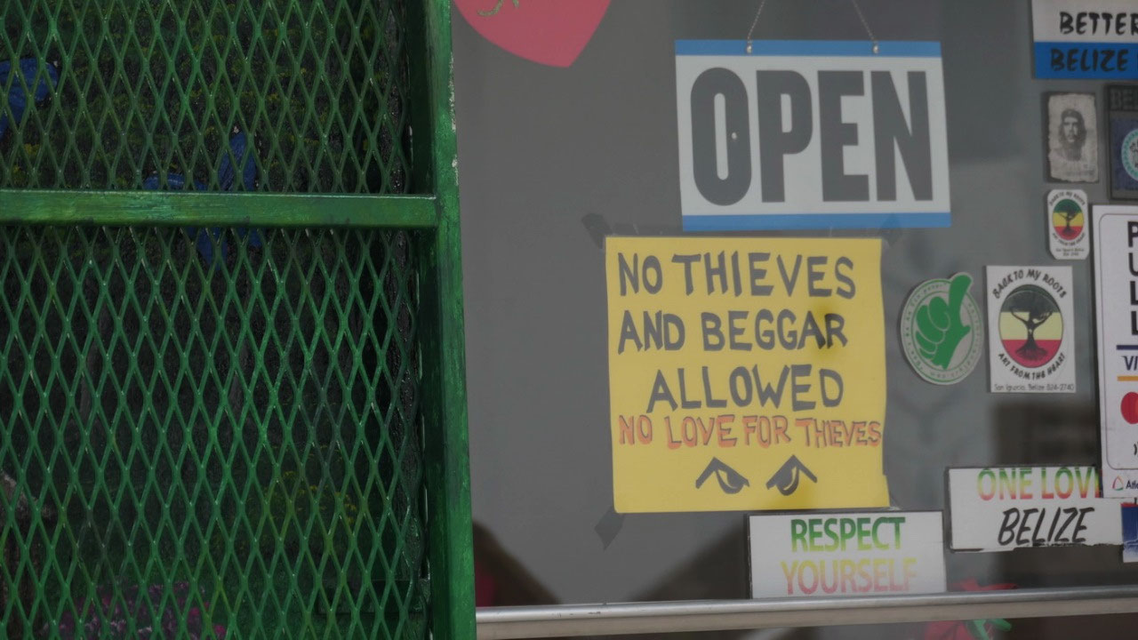
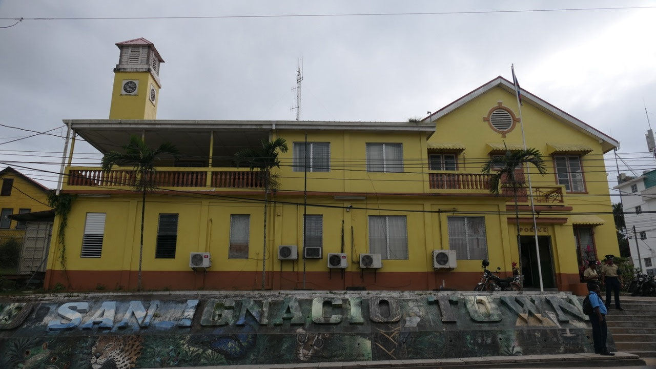
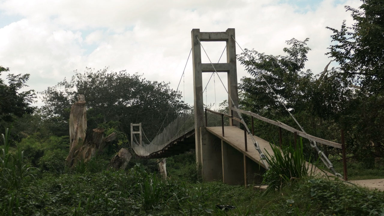
yellow building with a tiny tower: oh yes yellow – it’s the
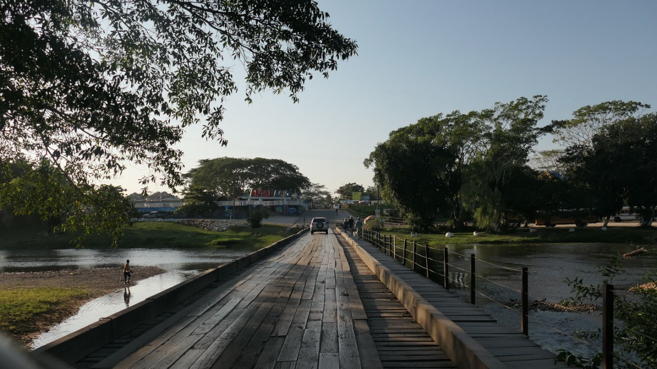
police station and right near it is a small little park , as well as
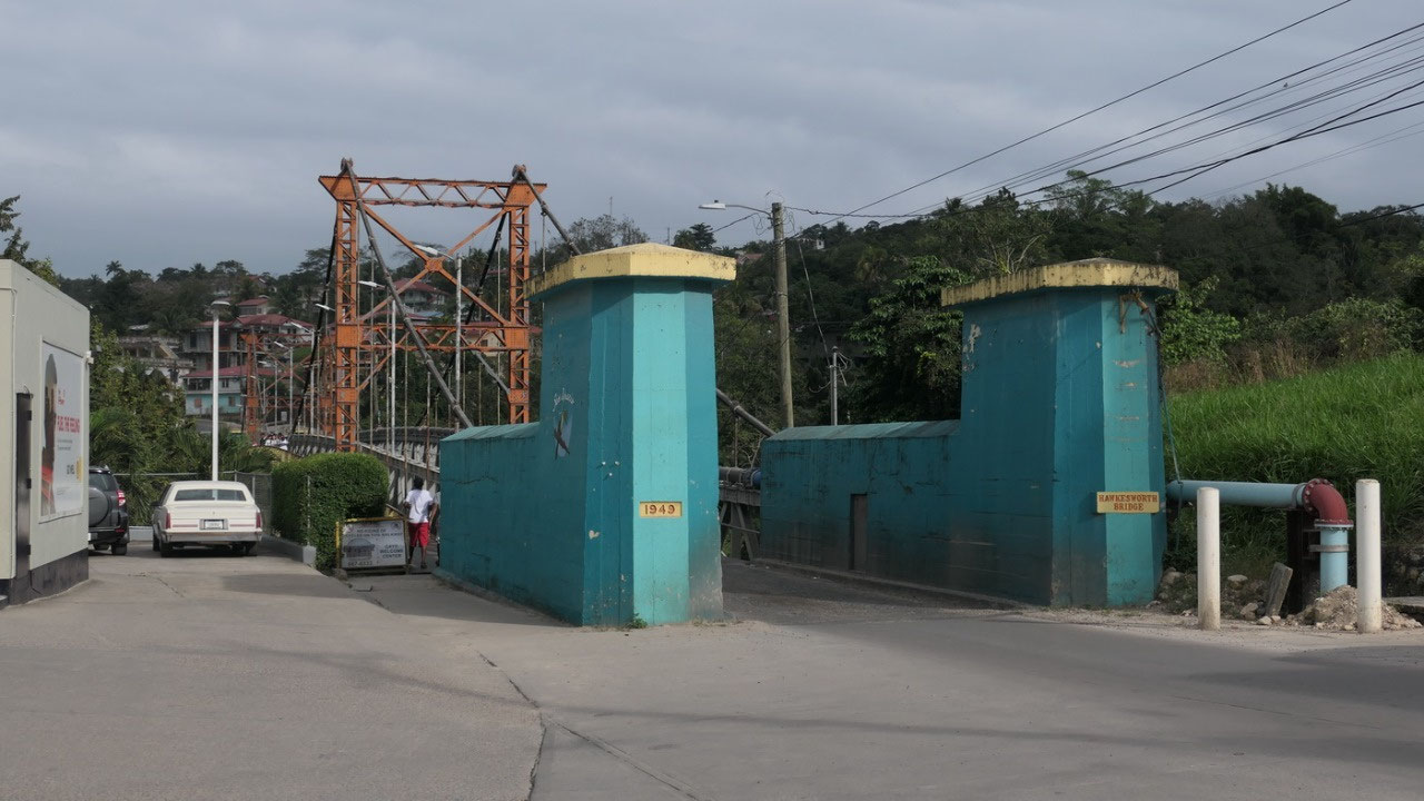
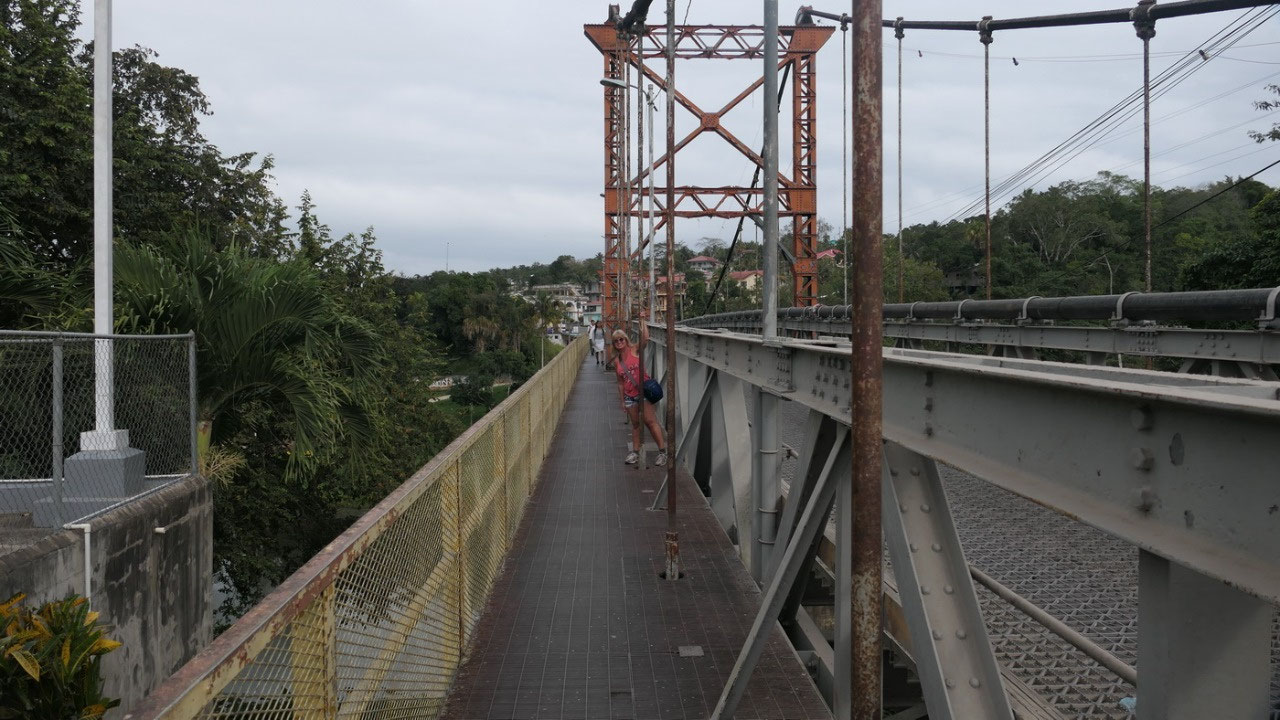
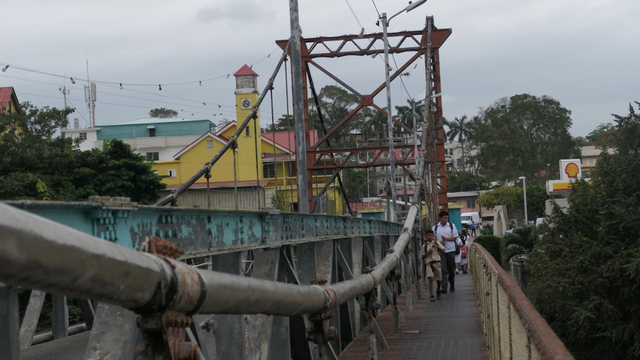
the hanging bridge from 1949 – let’s not forgot it’s the only
suspension bridge in Belize, wow it’s older than Paul!! And it is
quite rusty, when ever a car went over it shakes.
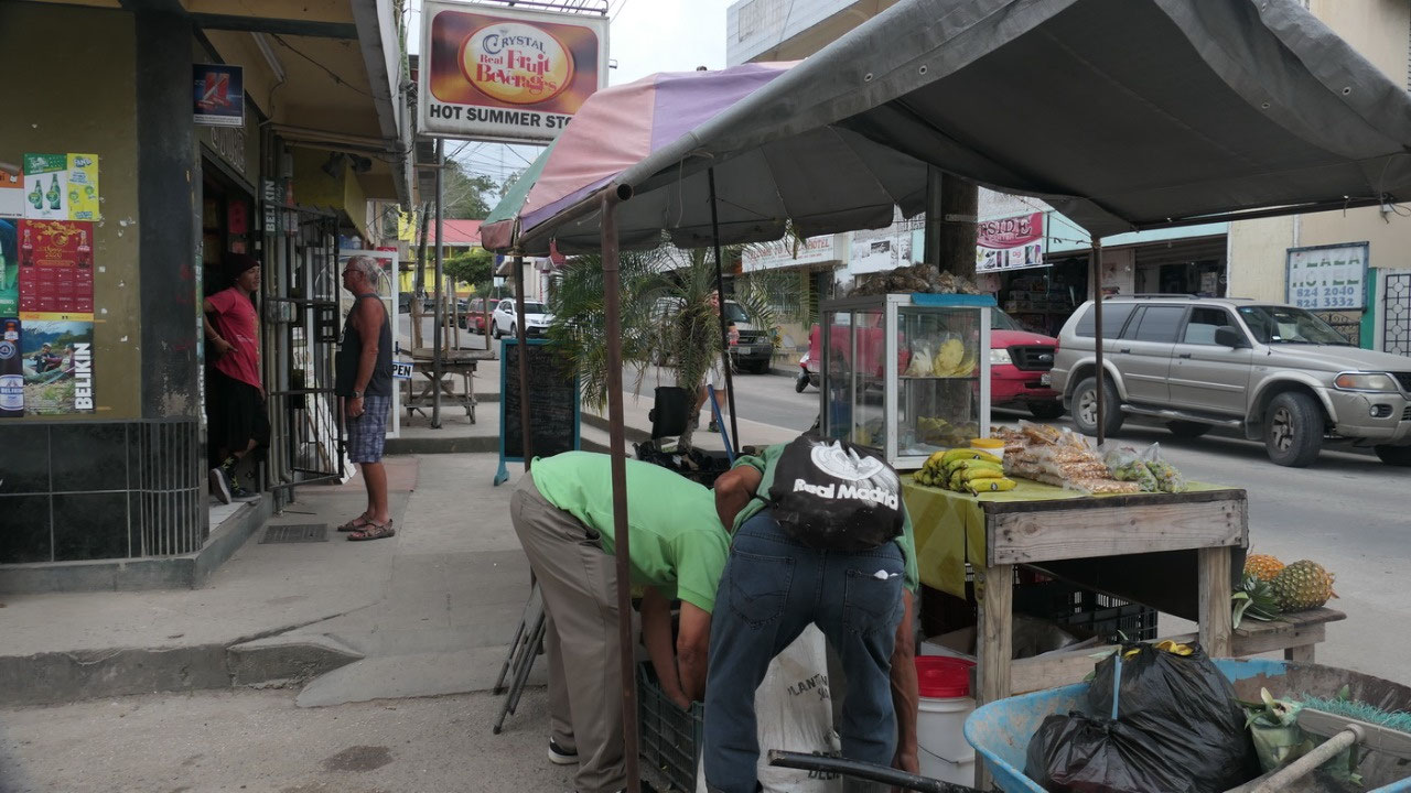
Back
to downtown we have plenty of time to check out the stores, as well
the restaurants. And we got all information we needed at the tourist
information regarding all our excursions we want to do.... so we look
forward to some busy days.
A
lite continental breakfast
this
cute little boutique hotel offers breakfast: the sign says lite
continental breakfast: that means back to the basics: like coffee
with coffeemate & sugar (yes you have to ask if you run out of
something), toast, butter and jam, oh and banana’s if they have
it!! After one guy complained they actually bought and brought some
bananas. The toaster is really funny: the knob to press down doesn’t
work, but if you push the toast down it heats up – and since it
won’t pop out all you have to do keep an eye on it and pull it back
out. And even better the refill bread was super yummy cinnemon bread.
And you constantly run out of something and the refill can be a bit
slow....
We
take along more Canadians
at
breakfast we met a Canadian-British couple Christina & Simon –
they also planned to go to the ruins and asked if they can get a ride
– so we said yes come at 9 am. And with beautiful sunshine we drove
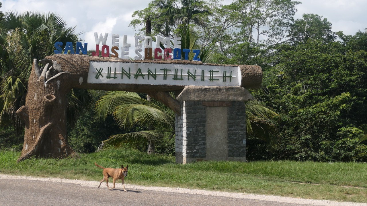
through the country side and see there after 10 Min we are in the
little town of San jose Succotz village and there is:
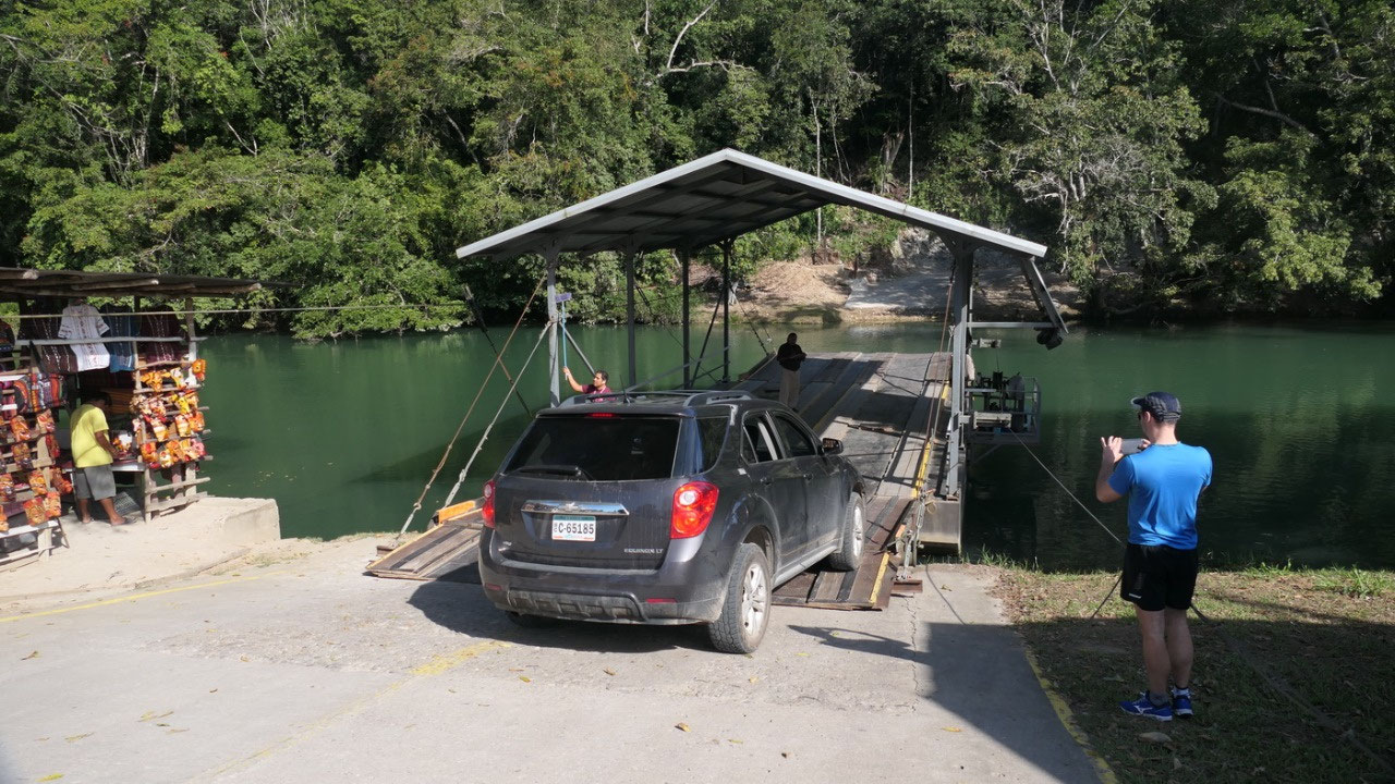
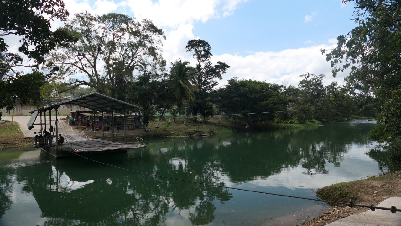
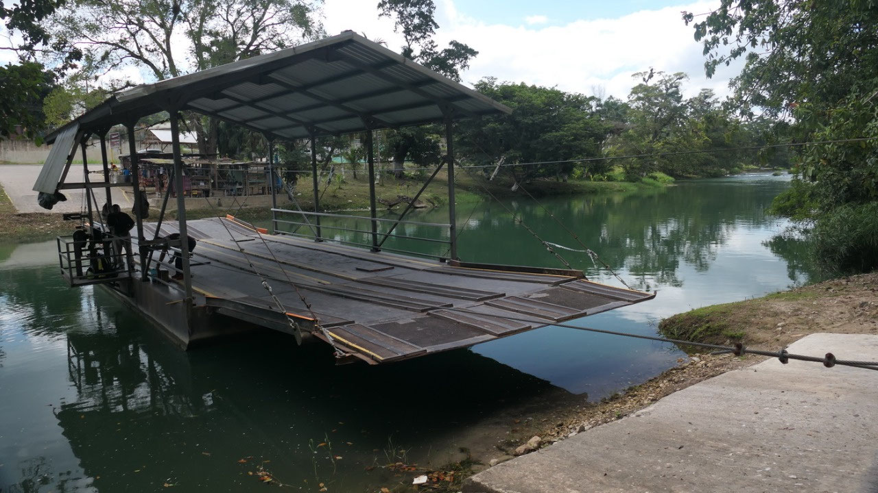
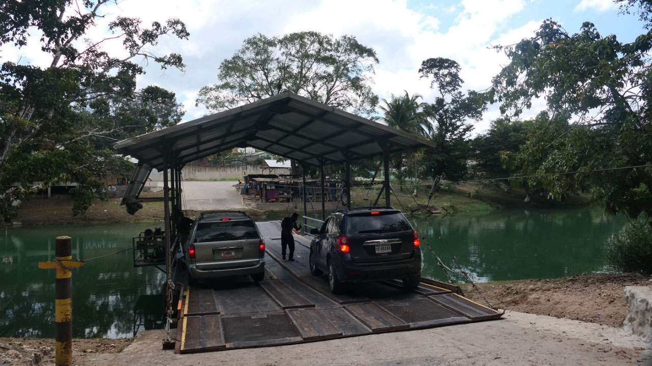
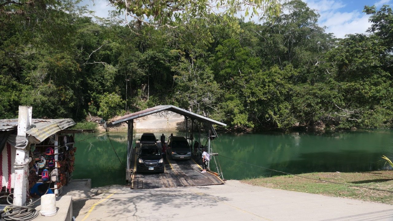
the
hand cranked Ferry
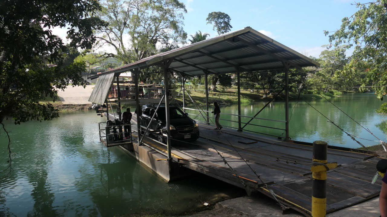
if
you would put twice the ferry it would be a bridge – so once we
came the ferry was empty and waited for us – all passengers out
only Paul alone was allowed to drive on and then we walked on – it
was super funky. And on the other side we all jump back in. And right
there were 2 older lady’s in their 70s and since we felt sorry for
them we asked if they want to hitch a ride if the back passengers
don’t mind being a bit tight. And up the hill it goes to the ruins.
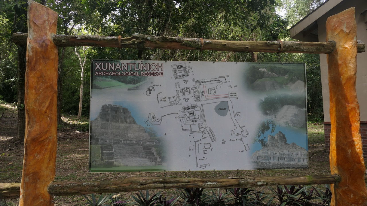
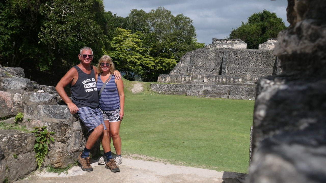
What
is is about the Stone Woman?
- it is at the border to Guatemala on a high ridge overlooking the Mopan river, it sits on a natural limestone ridge with grand views
- Built around 400 and deserted around 1000 AD, but there are traces of humans from 3000 BC
- likely during 670 – 780 AD it was one of the important trade centers, it may also have been under the control of Caracol
- once it was a prosperous place, it was home to 200.000 people and one of the largest Maya sites in Belize
- the name means stone woman: because the site was regularly haunted by the ghost of a woman dressed in white with glowing red-eyes: the original name is lost – it was named Xunantunich by the locals who claimed to see her
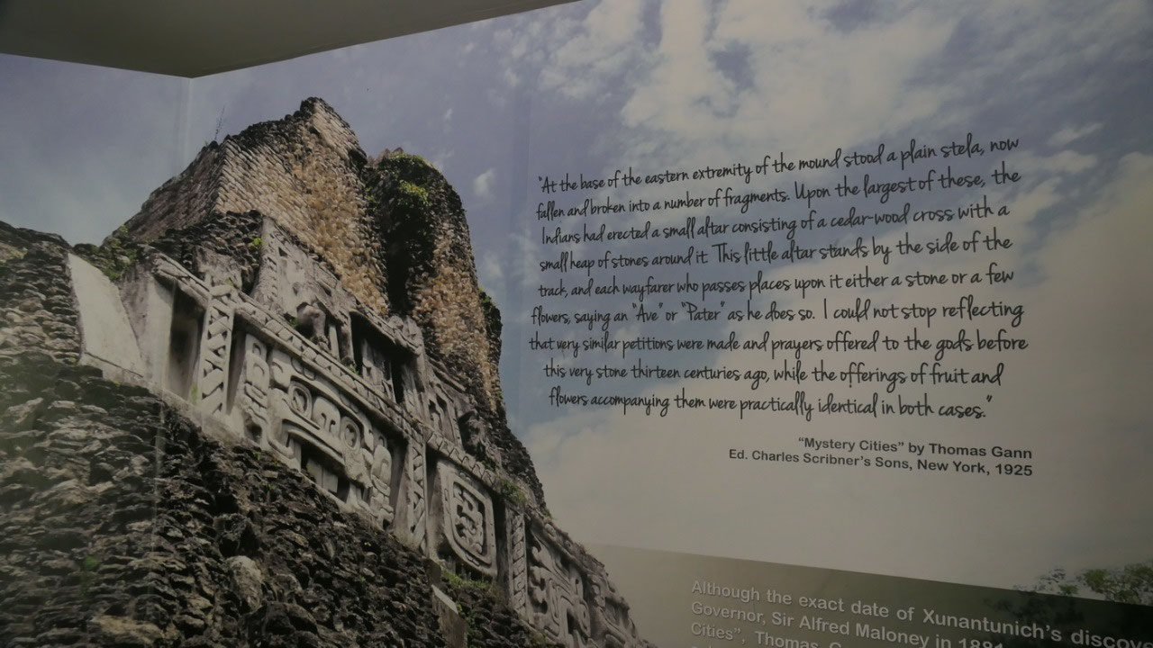
- it is assumed that the locals visited the site for rituals even after it got abandoned aroun 900 AD: there were crosses erected (one of them was discovered when Gann arrived)
- they called it Ka-at Witz of Supernatural mountain – it also could be the name of a ruler, it also could mean clay mountain
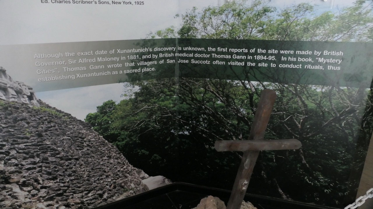
Rediscovering
Xunantunich:
- and in case you wonder how they find a site: they look at large depression and raised areas, they check with people who found artefacts – and you can’t only dig you need a permit from the NICH
- it was first mentioned in 1881 by Sir Alfred Maloney, at this time it was called Mount Maloney (he was the governor of British Honduras)
- Thomas Ghan visited it in 1884: in his book “Mystery Cities”: he wrote that the villagers of SanJose Succotz often visited the site to conduct rituals. He also excavated 2 buildings – he found the East Frieze, he also found Altar 1 and cut it in pieces to ship it to the British Museum
- in 1938 when they worked on group B (which we didn’t even visited)
- 1949 they worked on the famous East frieze and also on the El Castillo, more work was done in 1954/57
- since 1954 it is open for visitors: it was the first Mayan ruin open for visitors
- 1959/60: Euan Mac Kie excavated A11 and A15: and he was the one suggesting that the site was abandoned because of earthquake
- 1971 Joe Palacio repaired the East Frieze after Hurricane Hattie
- 1979: David Pendergast was also here and excavated Group B
- 1991-97 the west frieze was discovered and conserved with Fiberglass
- 2001-2003: excavation and conservation of East Frieze of the El Castillo, East court, ball court
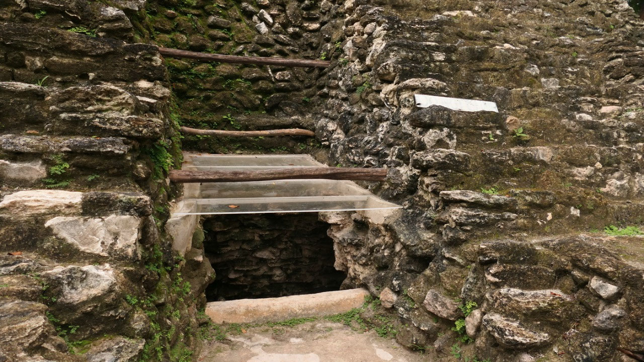
- in 2016 they discovered one of the largest tombs ever in Belize 26 ft deep with a skeleton of a Mayan leader (I think we saw it)
The
End of the Mayans:
- Part of Xunantunich got destroyed by an earthquake: they think that this was when the Mayans lost the belivee in their leaders and saw it as a sign for the gods (also it is reported that Yaxha and Nakum in Guatemala were affected by an earthquake at the end of the classic period)
- During droughts as it occured between 800 -1000 AD, there was also increased activies in the caves of the underworld to the earth spirit and Sun God
- there is also evidence in satellite photos of historic deforestation doen by the Mayans, probably for building material and to create farmland, which could have caught the drought and food shortage
- overcrowding of the cities leading to unsustainable population– leading to food shortage
- it is believed that over time the common people learned to grow food and did not rely on the elite
- some evidence suggests war far and revolt of commons against the elite
- the cities in Belize/guatemala area are from the Classic period and got abandoned around 900 AD – after this the Mayan (post-classic) still existed in the Yucatan
- when the Spanish arrived the Mayan population already had decreased and people moved to smaller communites and only a few great cities remained: a lot of the abandoned Maya cities were already overgrown by the jungle
Xunantunich
ruins
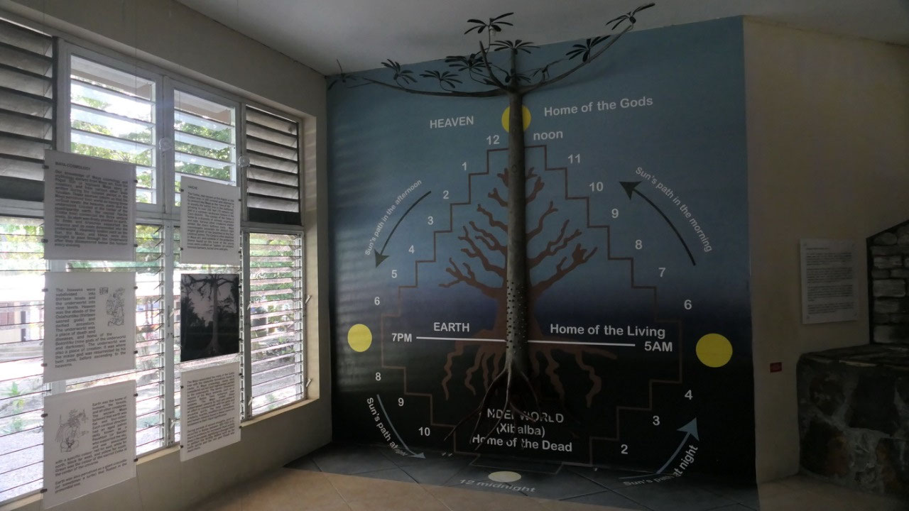
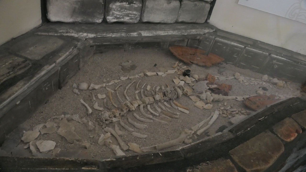
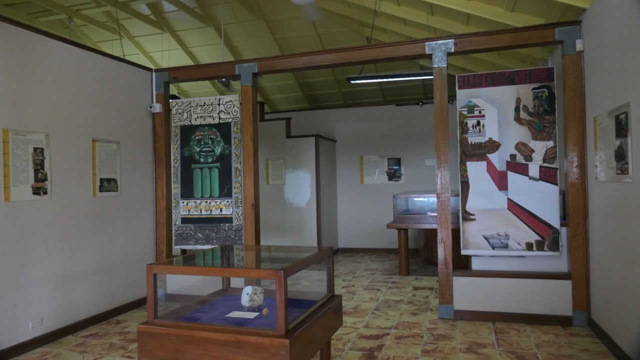
Museum:
here we learned about the heavens and hells of the Mayans, they also
displayed the tomb and burial
which was found in the A4 structure and the remains of a male:
What
happens when you are Mayan and die?
- the Mayans would place the body of the deceased under the floor of the house inside benches, or if they were rulers or elite in tombs or crypts in temples
- so they had the spirits of the deceased ancestors within the home and they could be contacted through divination
- by the way they often exhumed the bones of the ancestors and reburied them in shrines or made heirlooms
- the burial we saw was in A4 from 600-670 AD – before the grave got sealed it was blanked with a thin layer of cinnabar: the red color of the east – symbolic for re-birth
- By the way the Mayan’s
believed in a very scary afterlife which everyone had to travel
through (unless you were lucky and got sacrificed) – there mean
gods were tormenting you (we actually took a trip to visit one of
the access to the underworld)
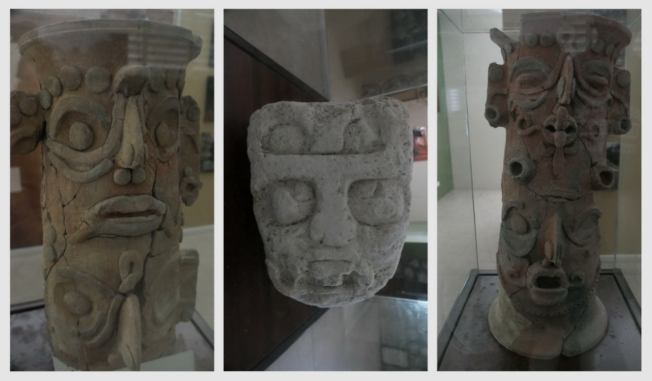
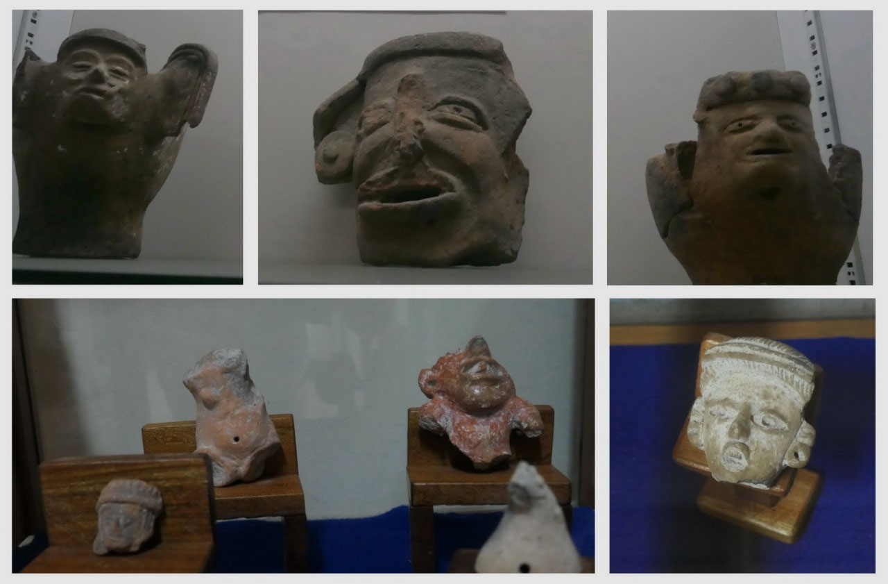
incense
burners: they had several here
and I think it is like a puzzle to put them together – they looked
like faces and they are super fascinating tall vessels.
After
we learned all bout the site (as well on how many cities were around here) we are ready to explore: up the
hill by a tiny ruin, and there is the
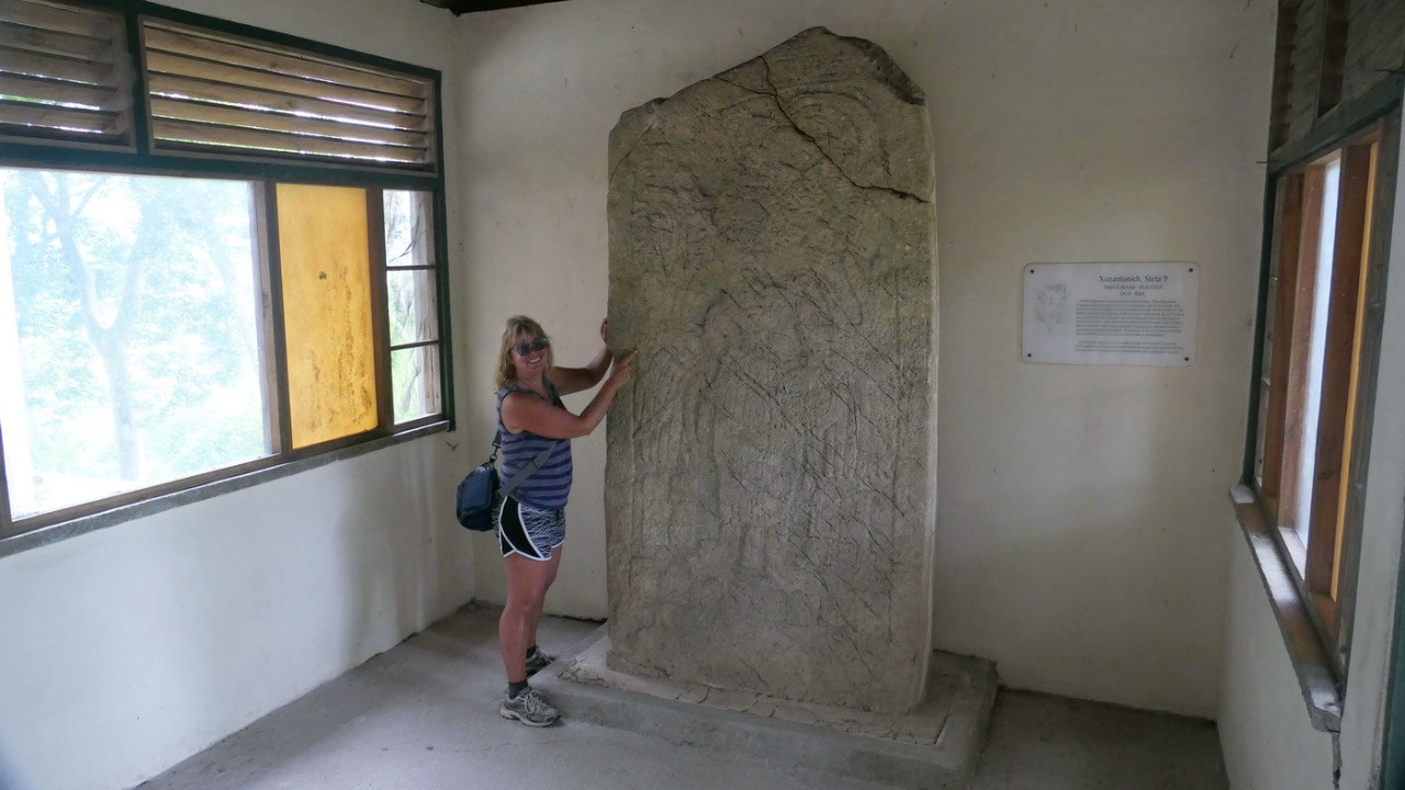
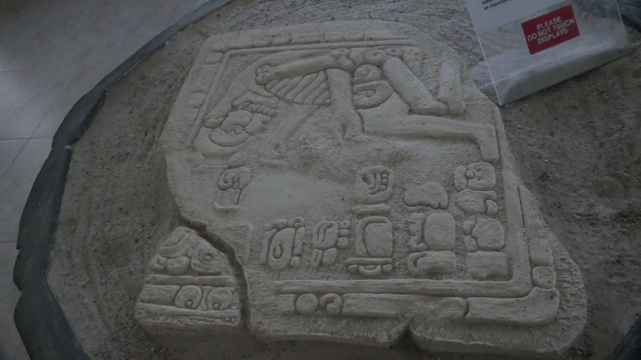
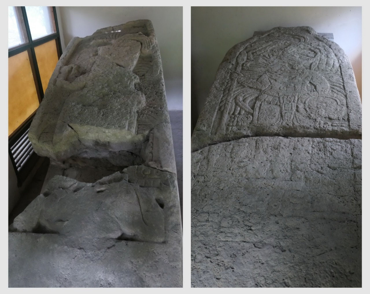
Stela House: and right before entering the site is this small little
house with the
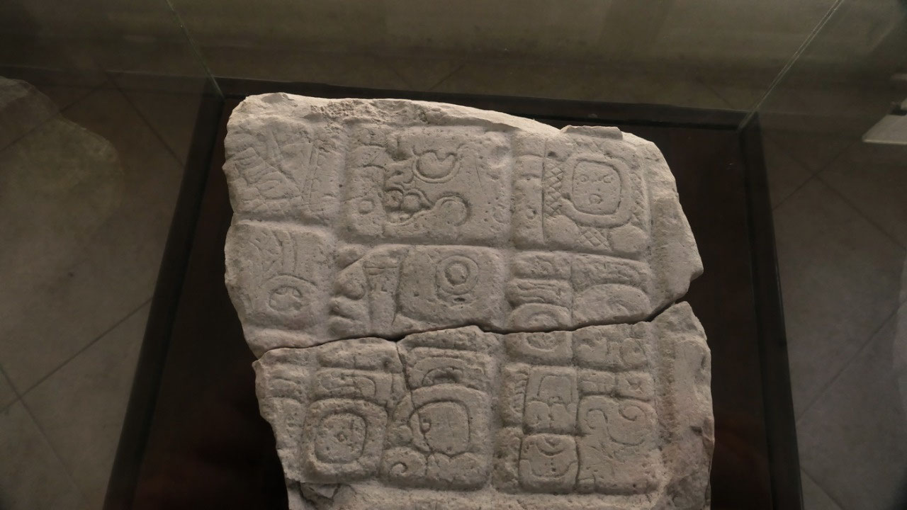
- Stela inside from 830 AD – and once you saw it several times we could see the feathered head dress – the scepter in his right hand and a shield in the left, jade jeweller in his ears and around his neck, a big belt with with a carved stone face
- Stela I from Actuncan: likely from 300 BC with a figure looking to the left (ok looking at it you really need a lot of imagination) – maybe it was clearer when they discovere it in 1956
- Stela 8 from 820 AD: one part was found in the 1960s and the lower part in 1973 – another ruler, but no-one can figure out who it’s unreadable
- Stela I from 849 AD: and again you can see the feathered head – this time the ruler stands on the back of a capitve – indicating conquests??
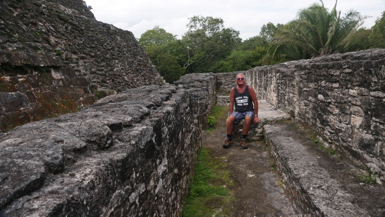
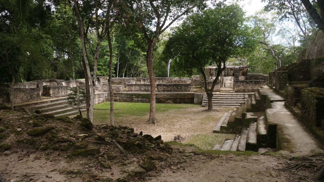
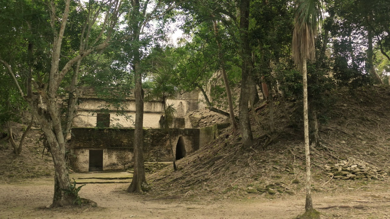
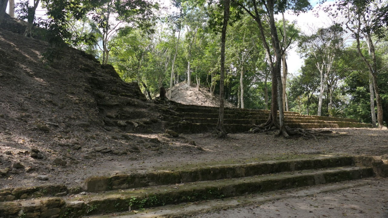
What's to see in Xunantunich:
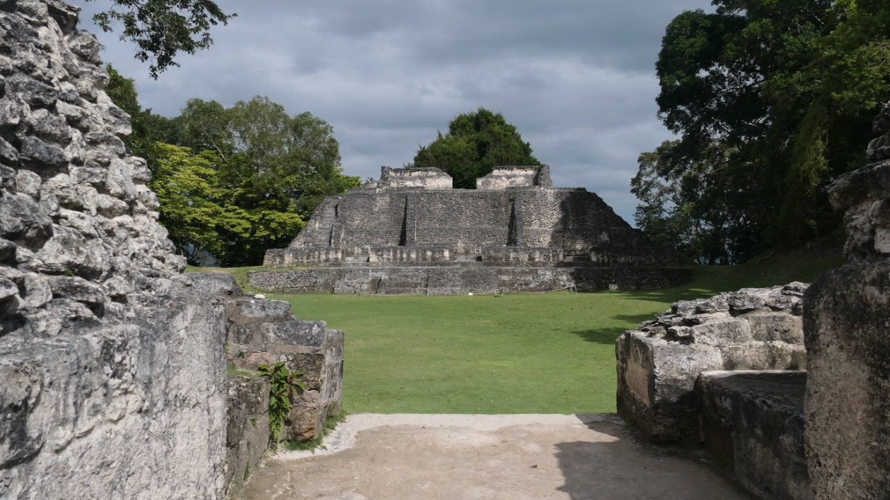
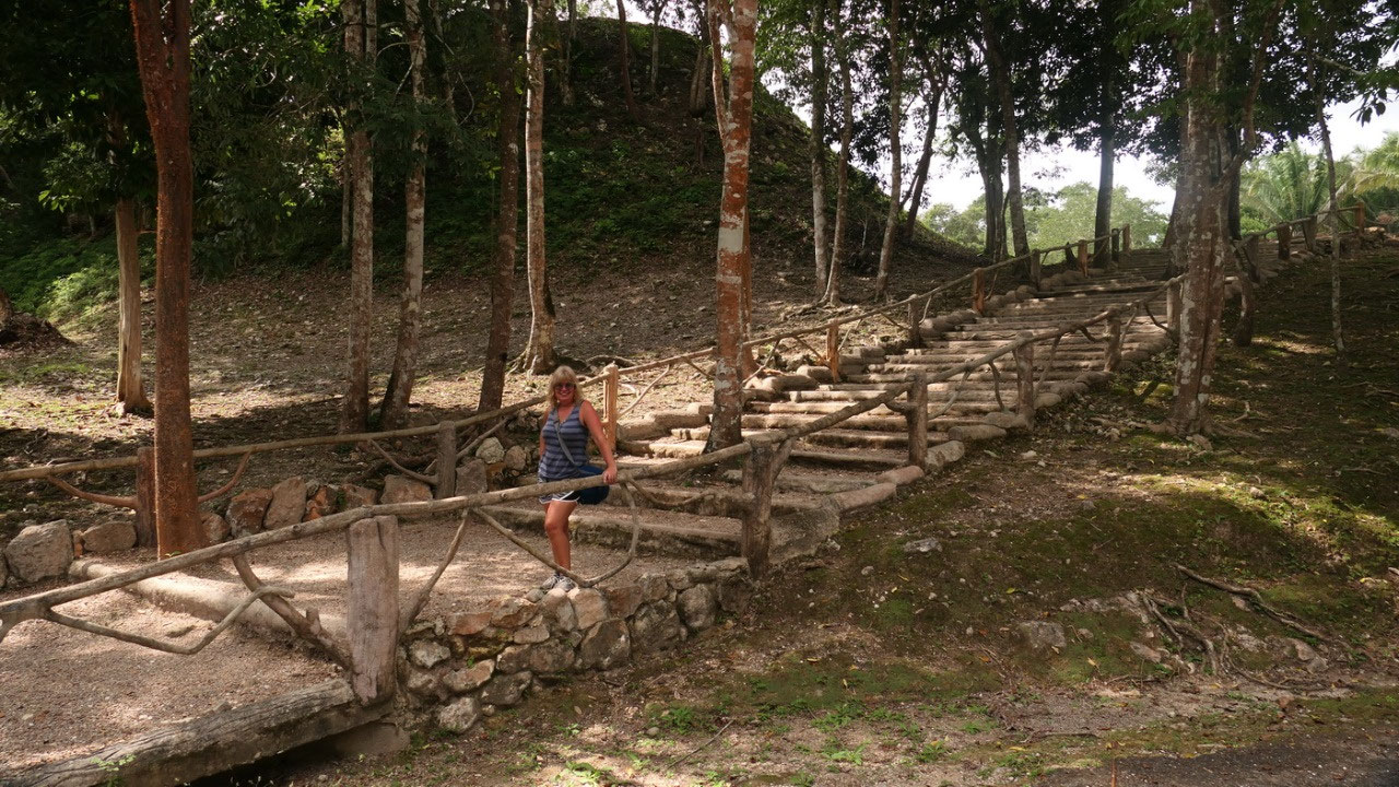
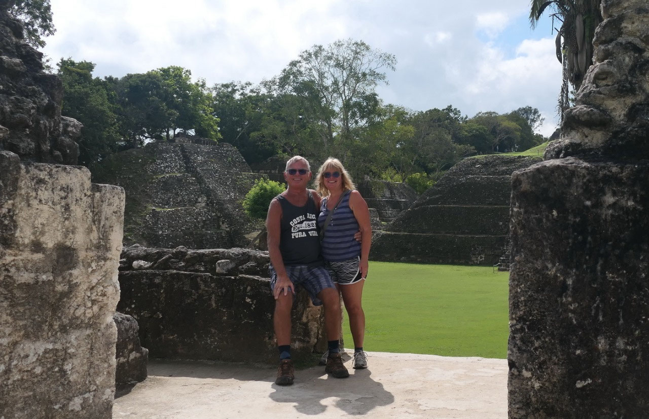
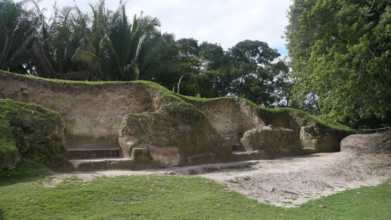
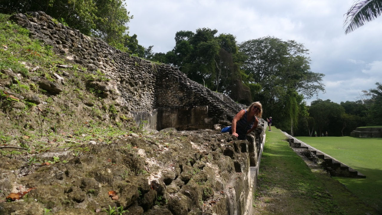
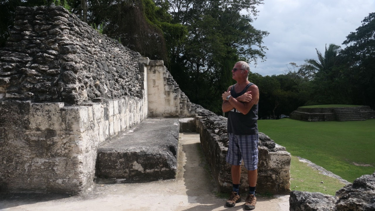
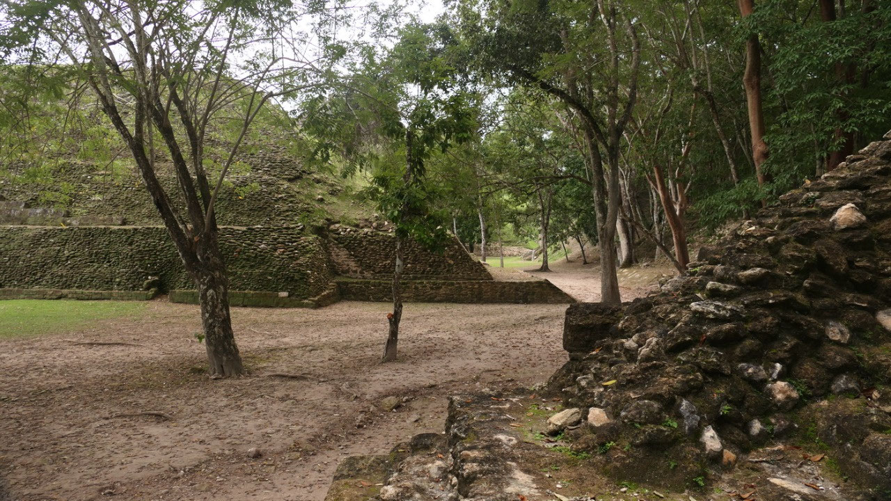
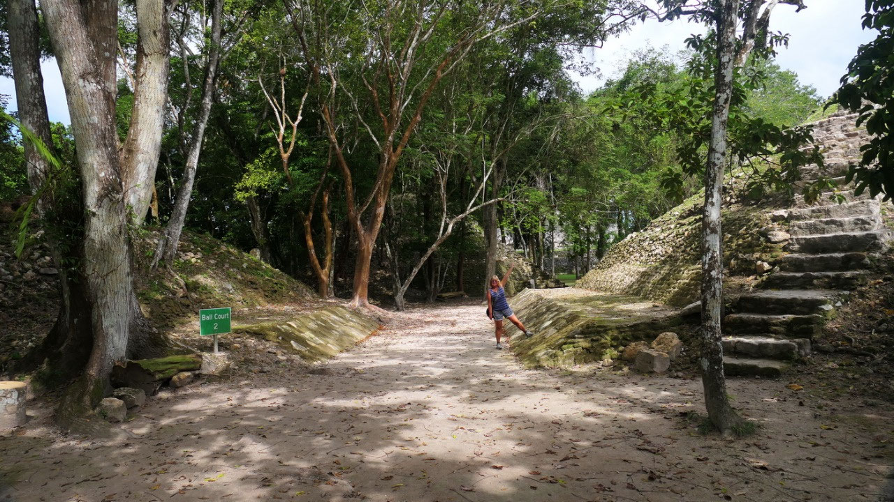
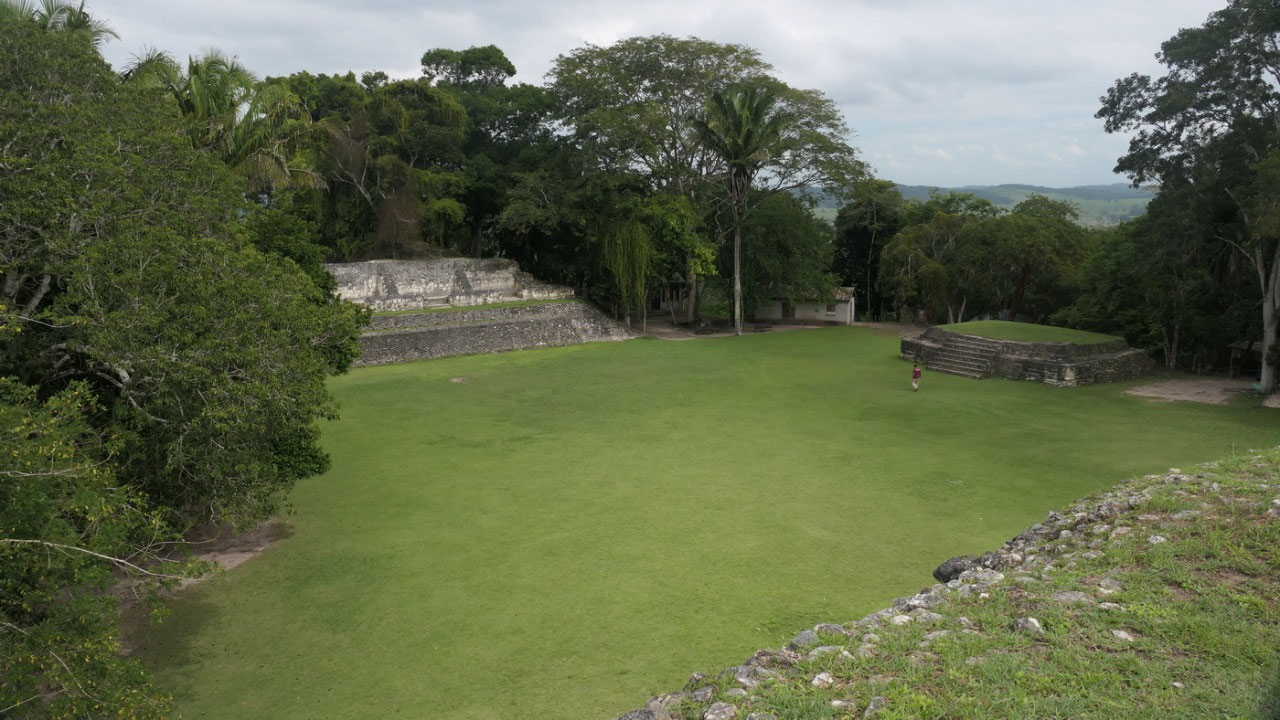
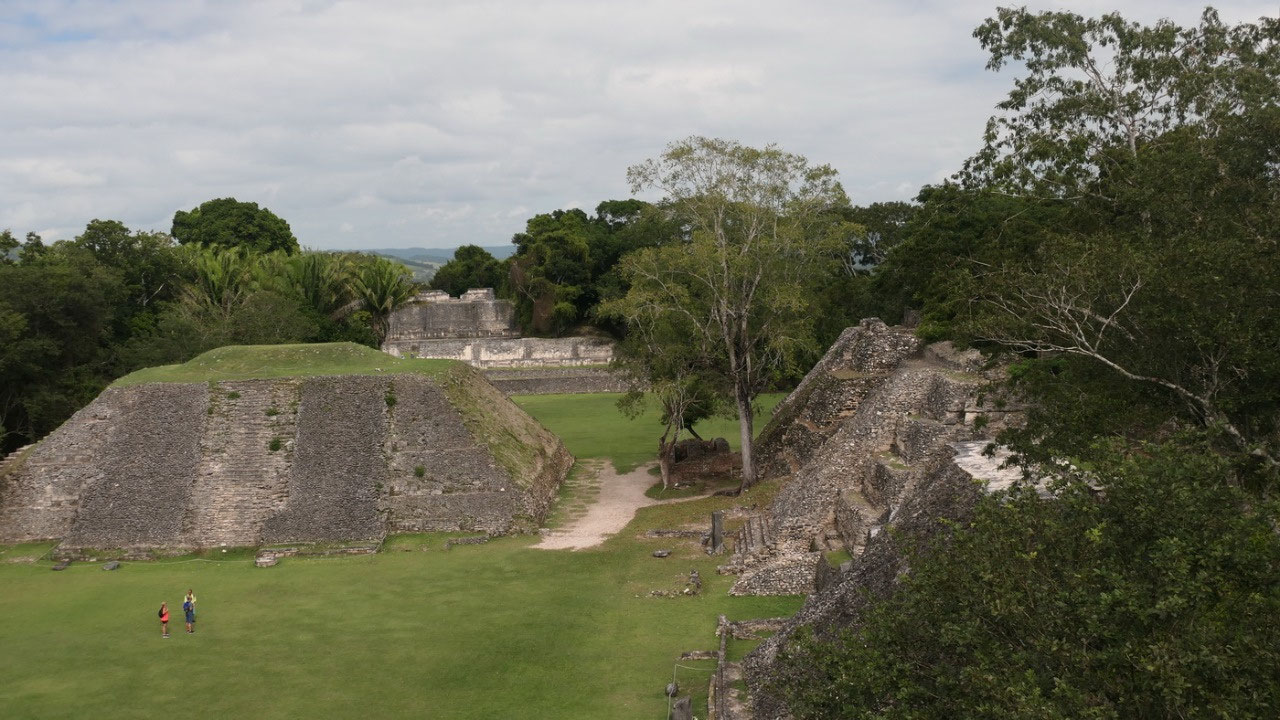
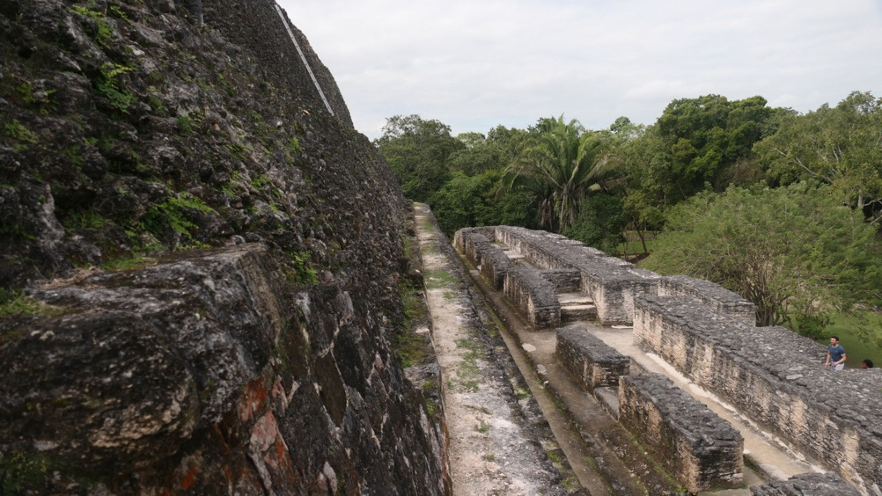
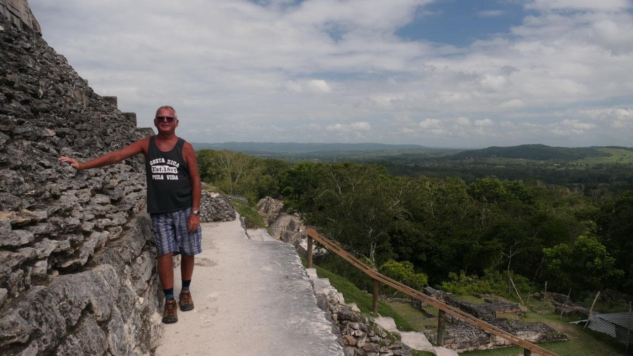
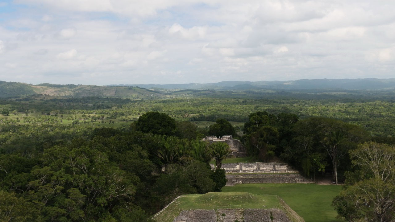
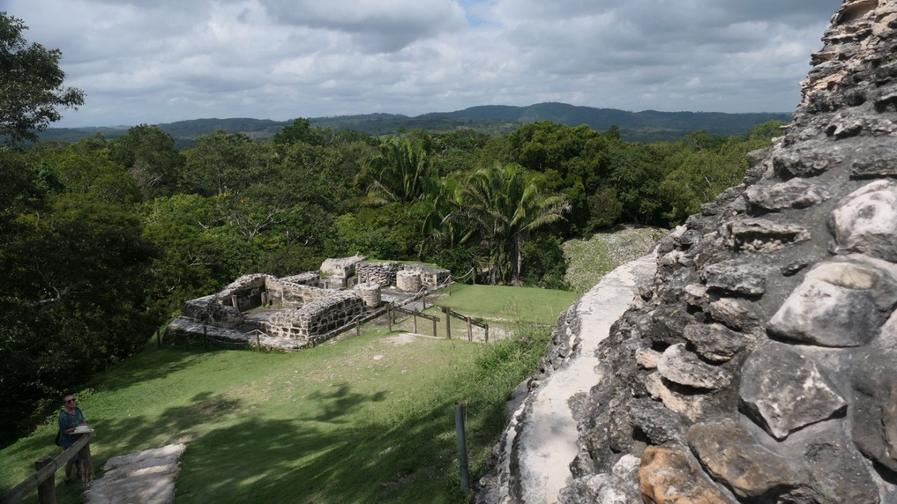
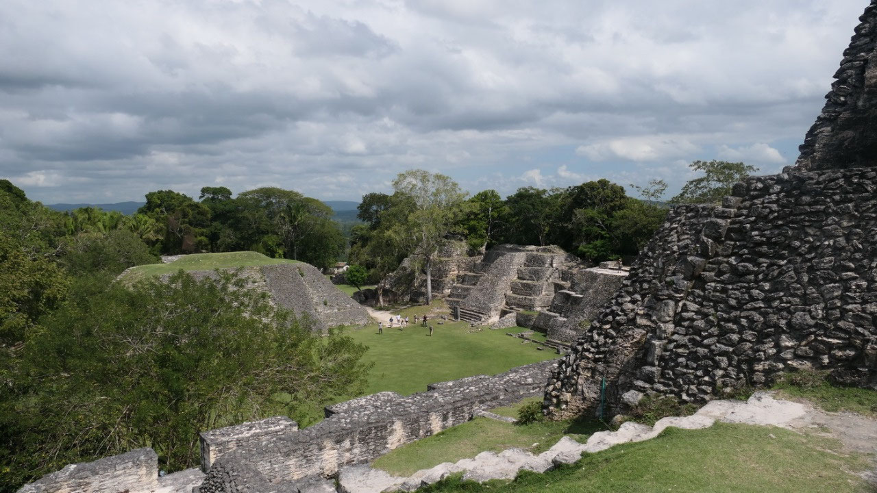
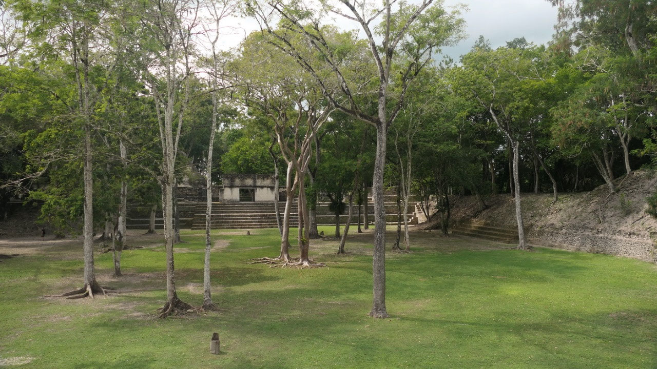
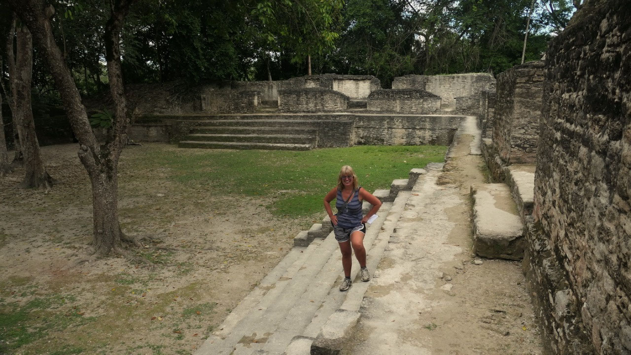
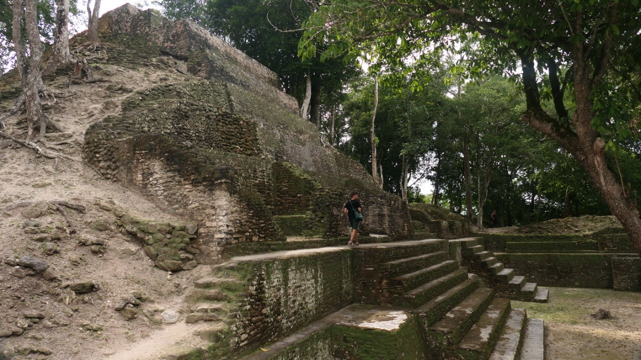
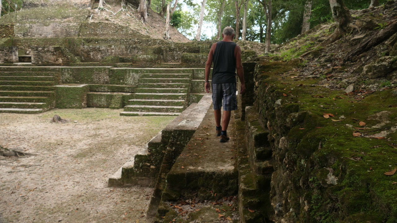
- We entered into Plaza A2: It is always amazing standing in a Plaza and looking around and you see the different temples – here it was kind of cool, since on one side we could see tha A1 structure like sitting in the middle and beyond you could already see the Plaza A1 with the El Castillo – as we knew on the other site all the steps go to another plaza and in beautiful sunshine we walk up those steps towards”
- Plaza A3: already we have some nice views back on the side and on the left hand the A-10 looks like rooms again and are those beds? and in front of us is a temple:
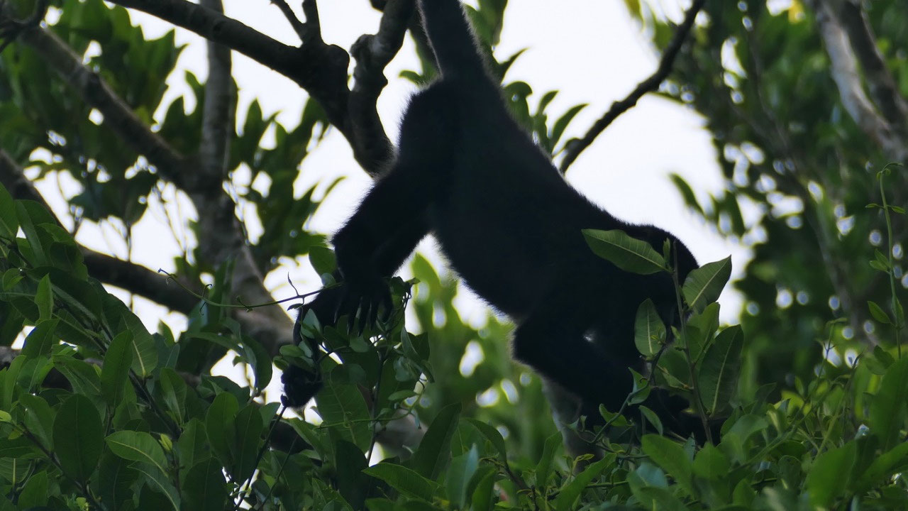
- A11 = the Shifting Palace – and it clearly shows, that no-one knows what really happened, because some even suggest that for a few years this was the royal Palace and not the El Castillo, but then other say it was elite living quarters – so who does the right interpretation or guess work??? Regardless it is another cool temple and from up there we had some more nice views on the forest around us as well as all the way to the El Castillo. We also wondered on how they built: because here it looks like they put stones on top of each other not square cut ones??? And we saw some Howler Monkeys hanging in the trees.
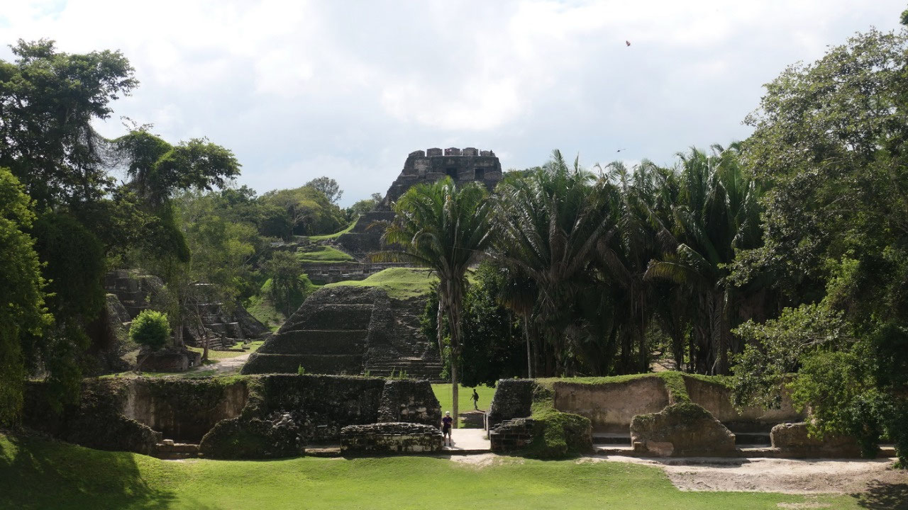
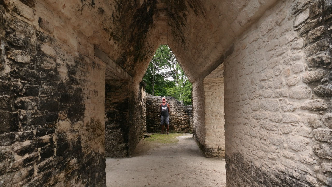
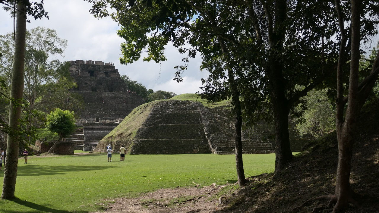
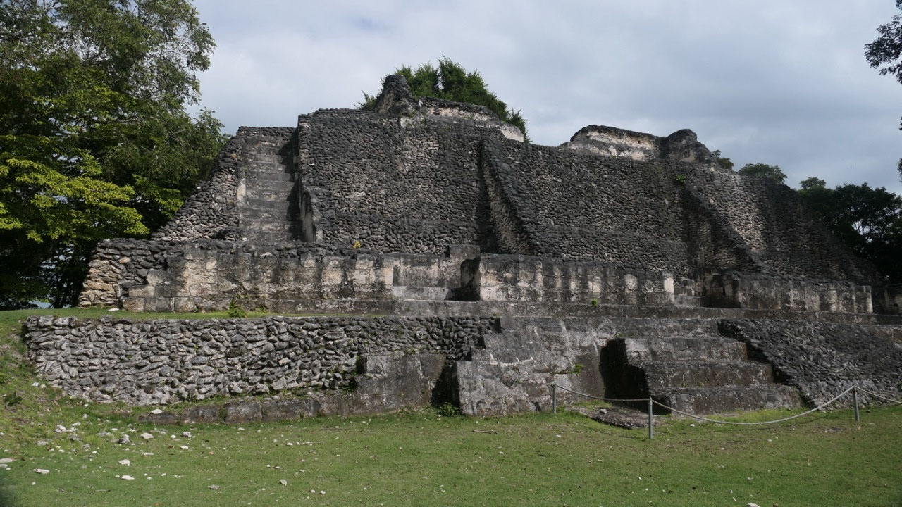
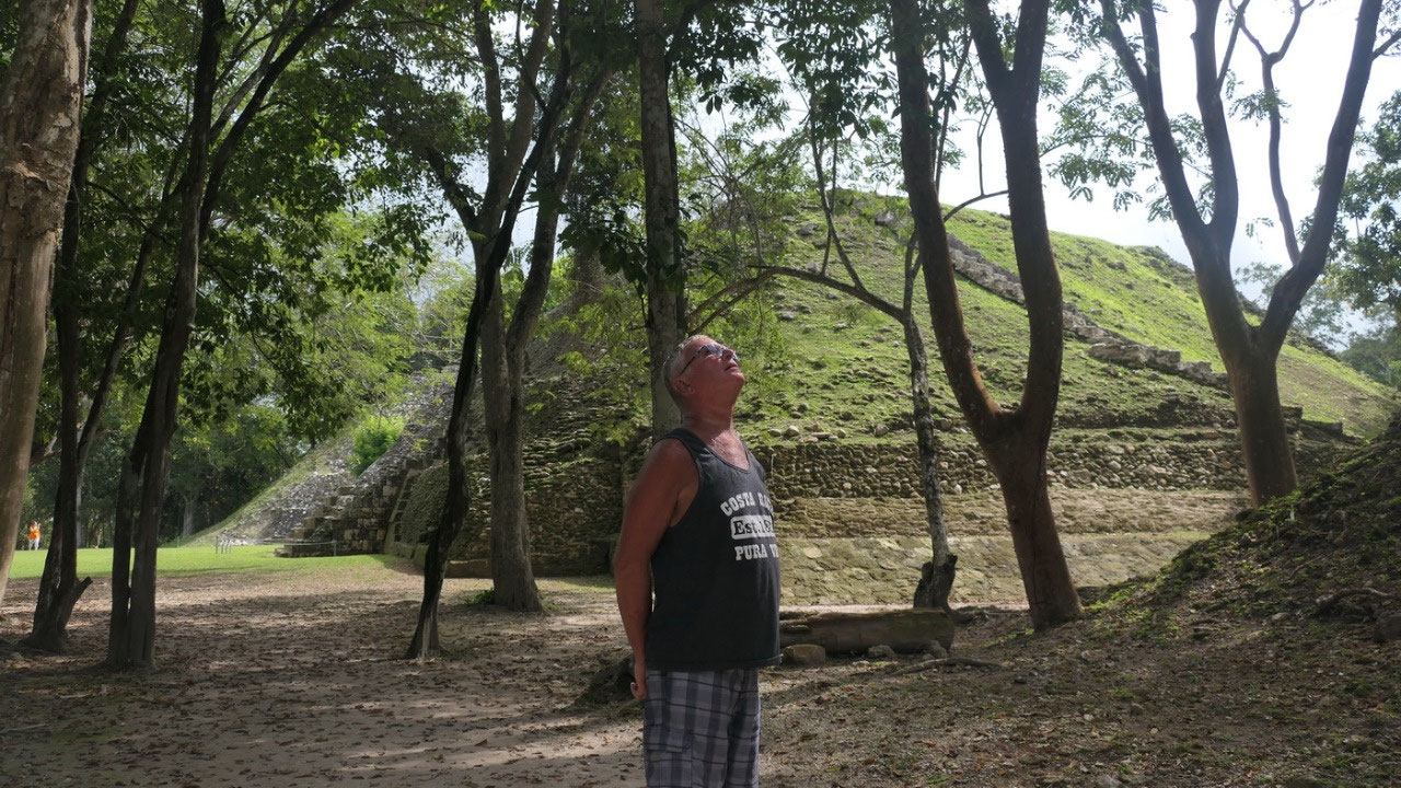
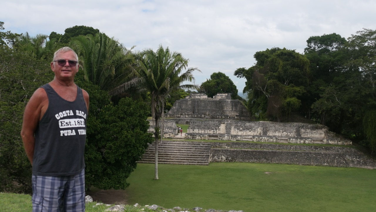
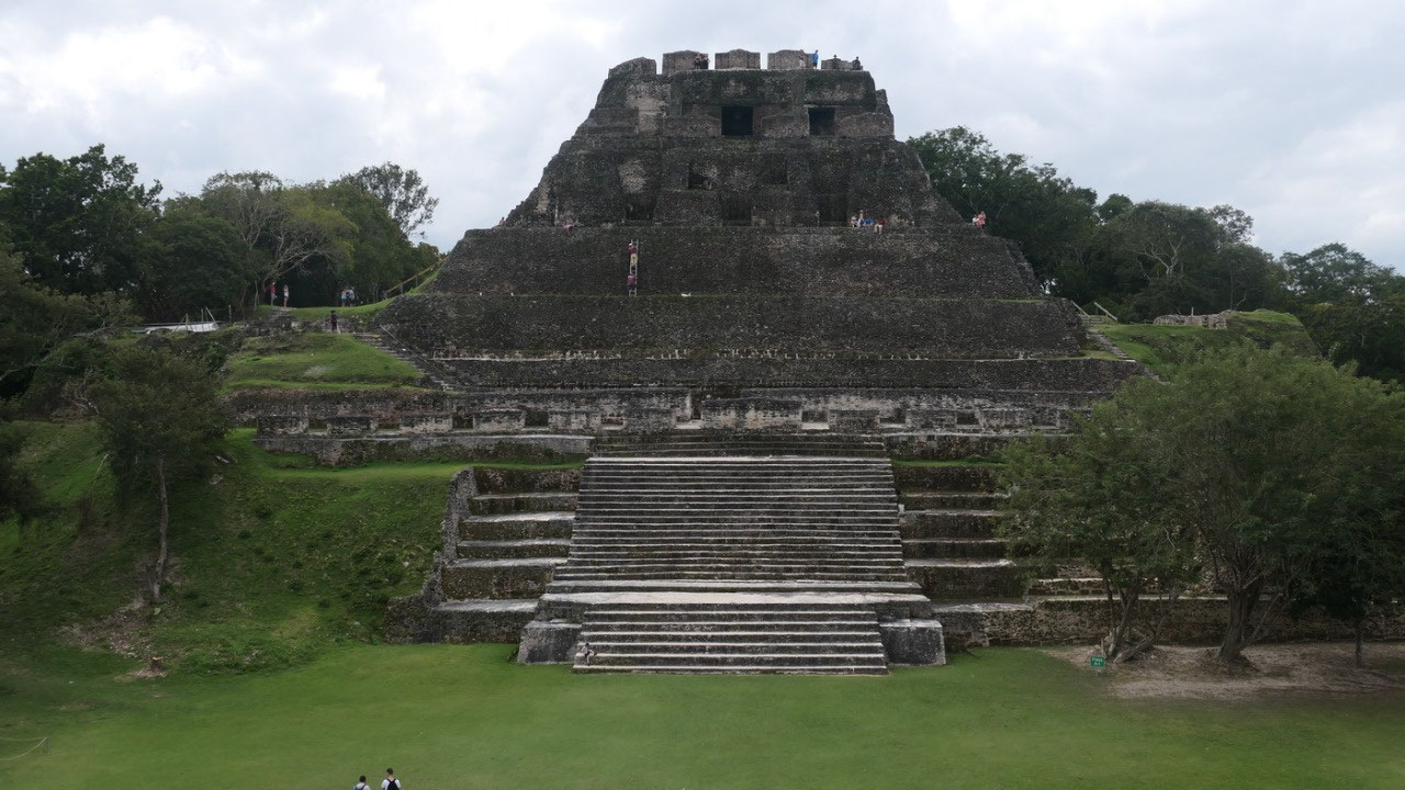
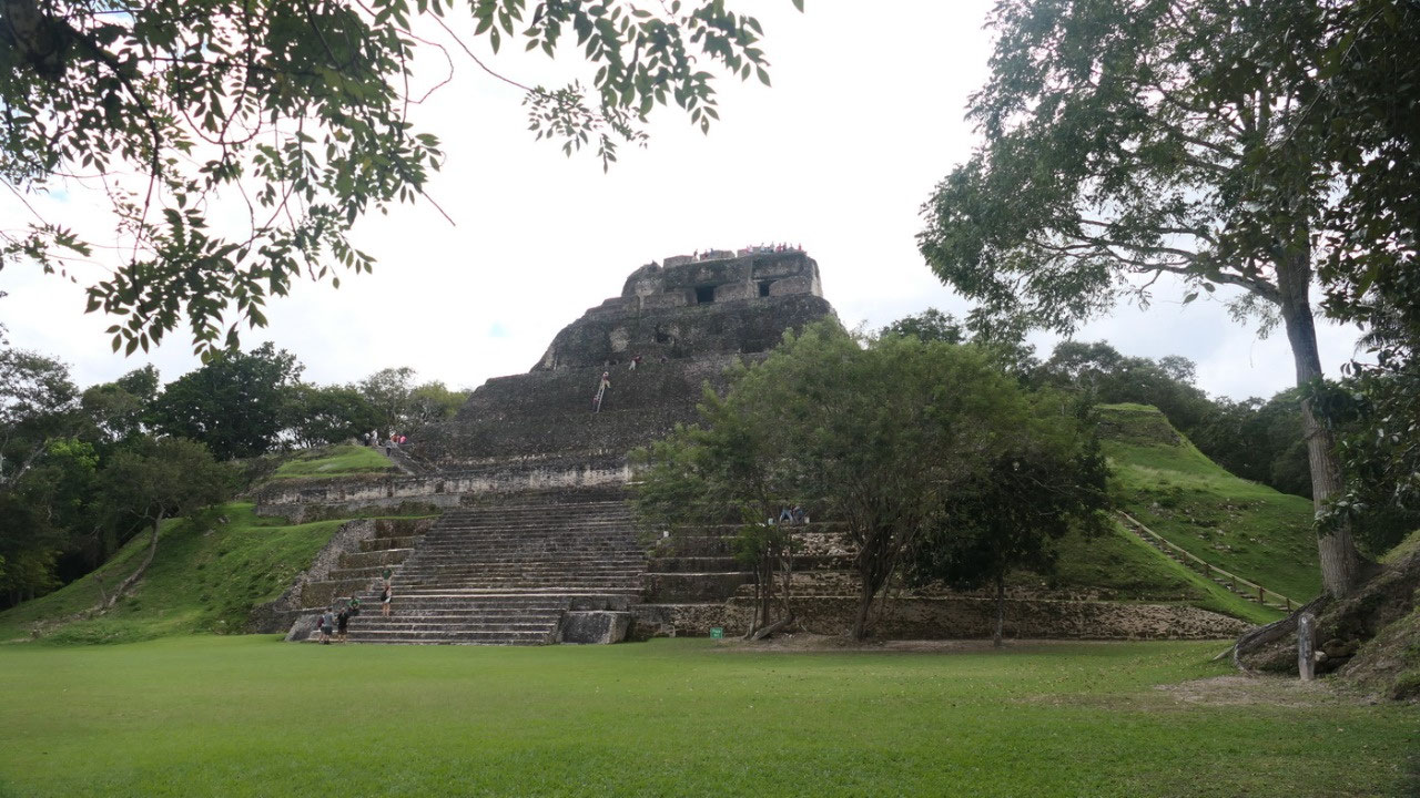
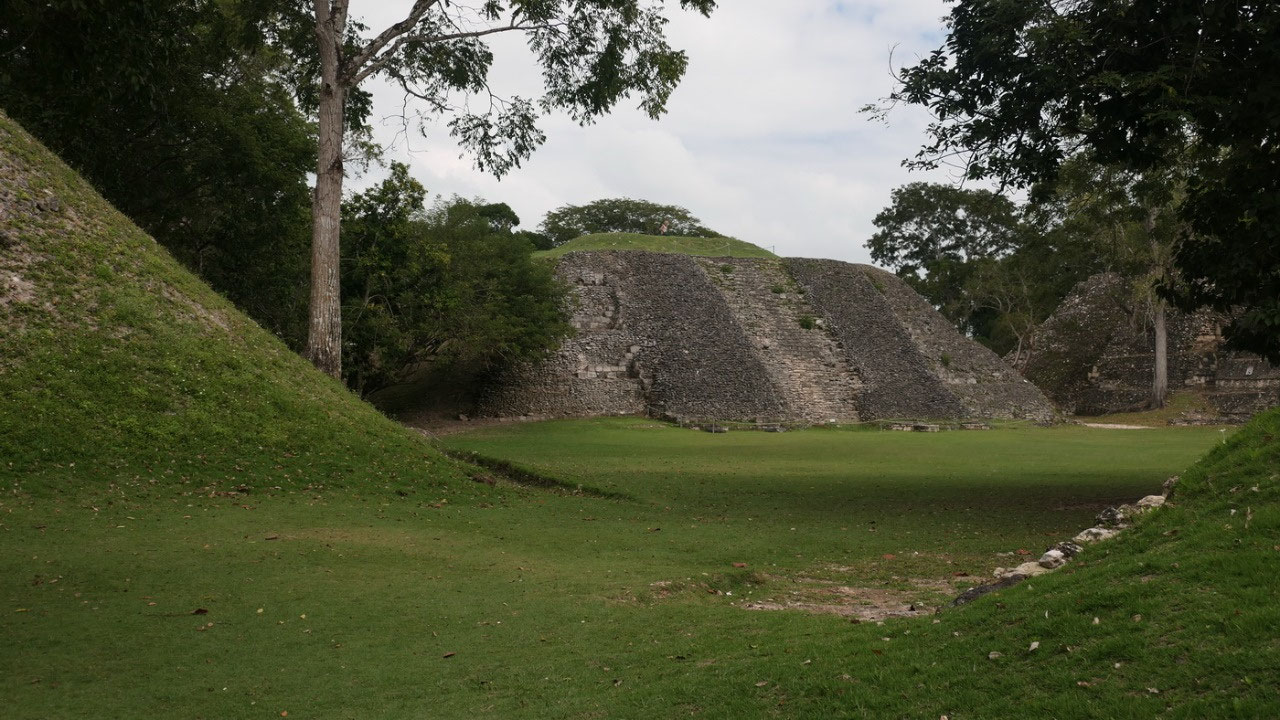
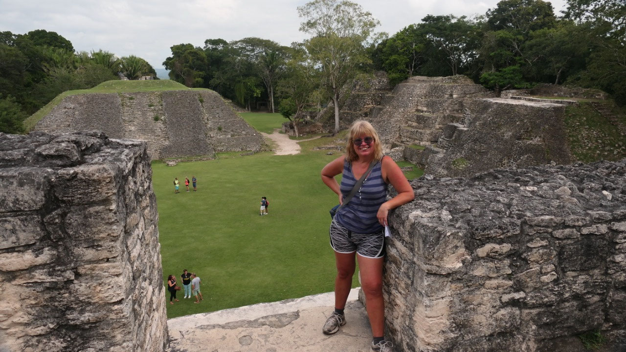
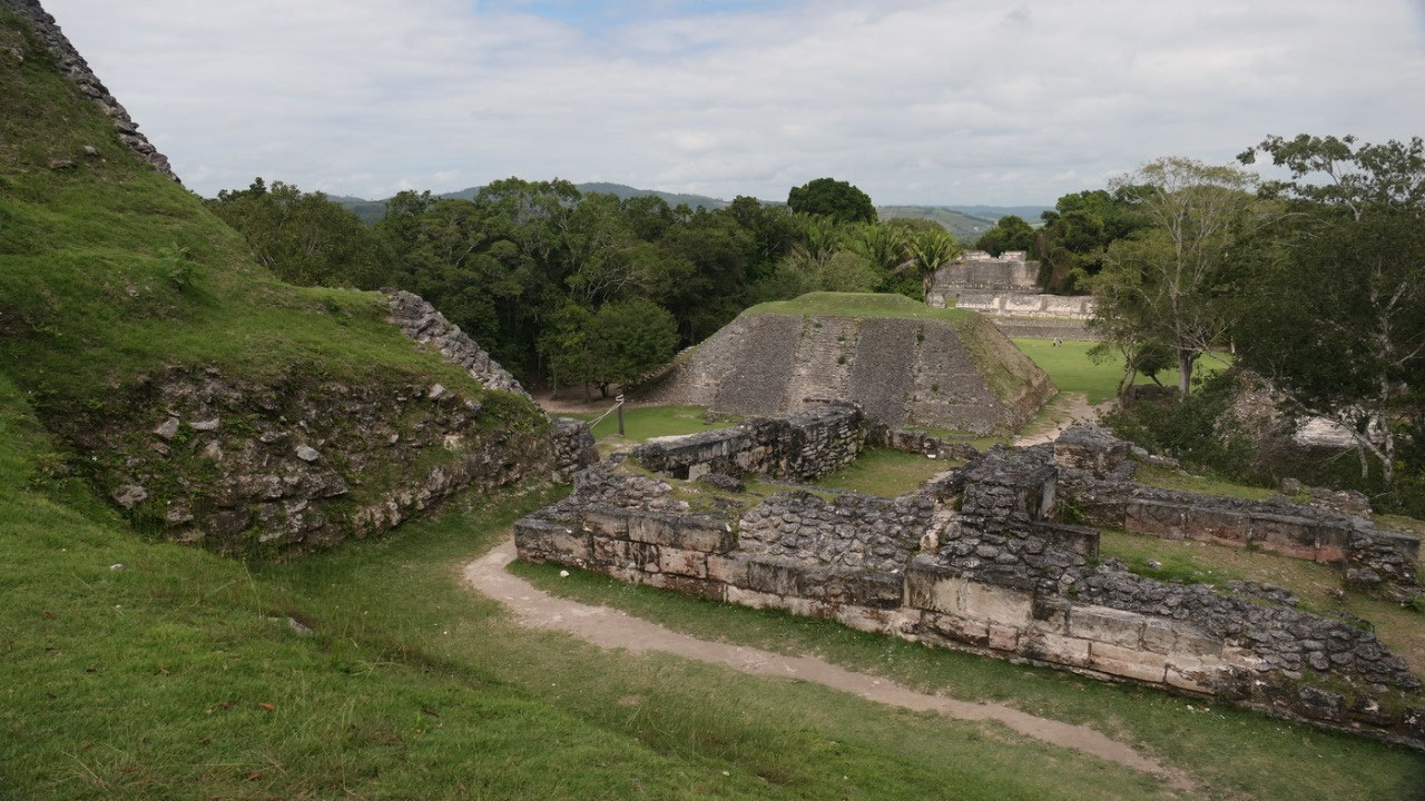
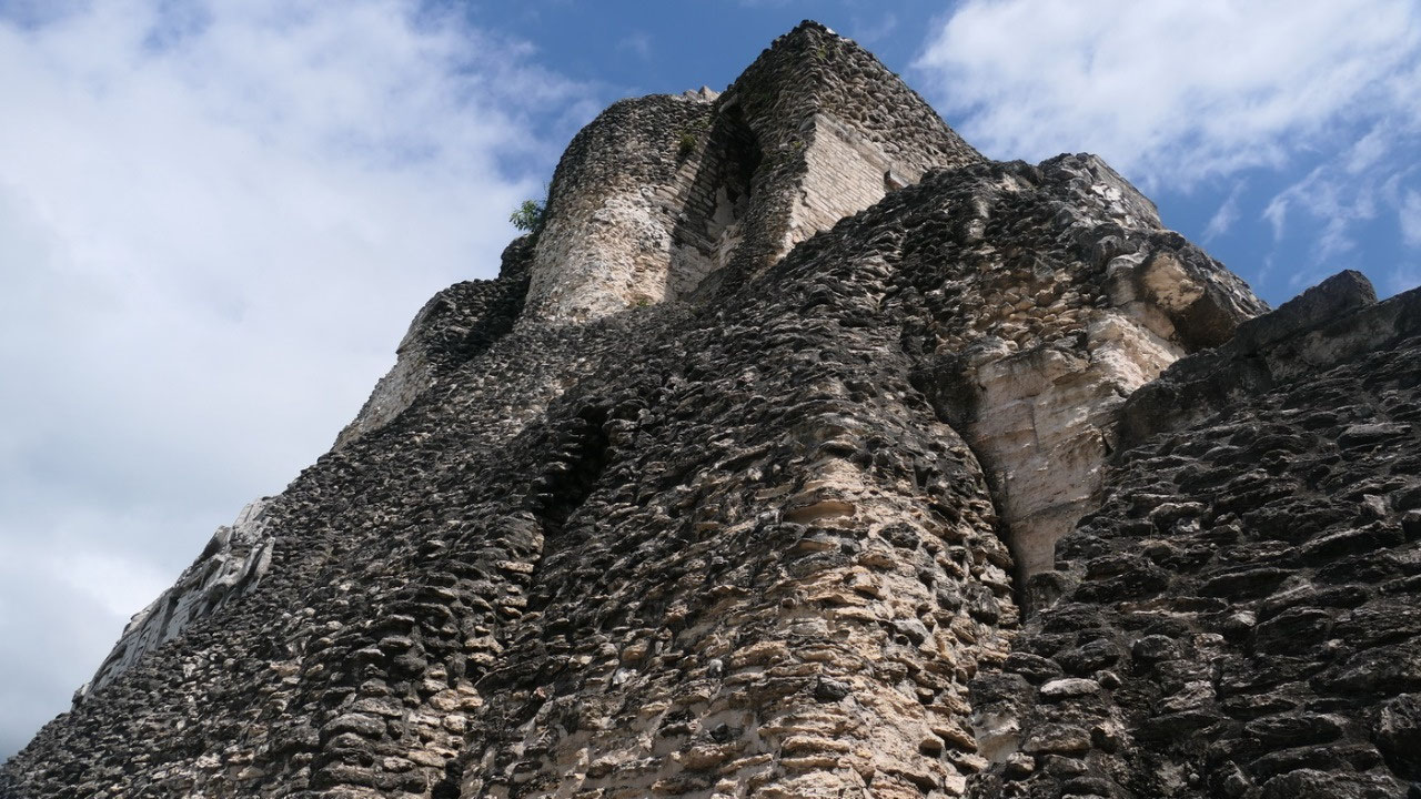
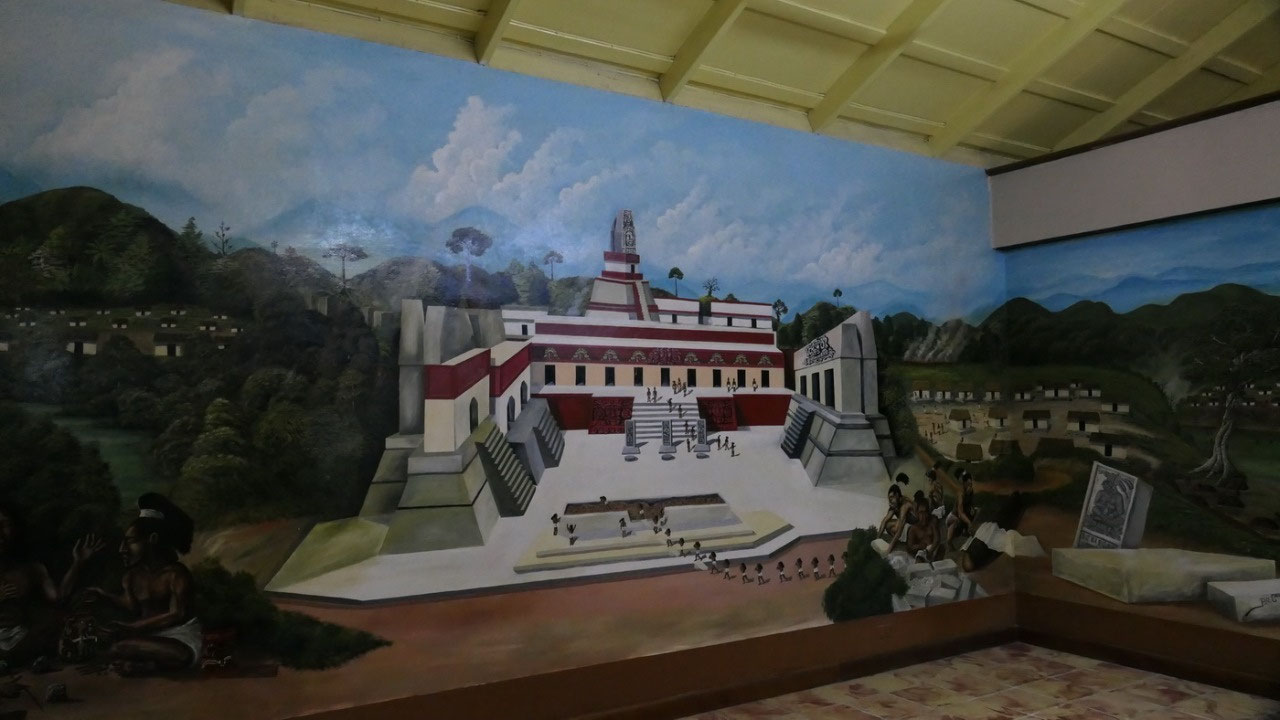
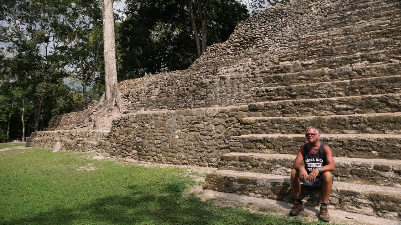
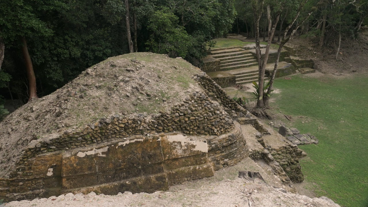
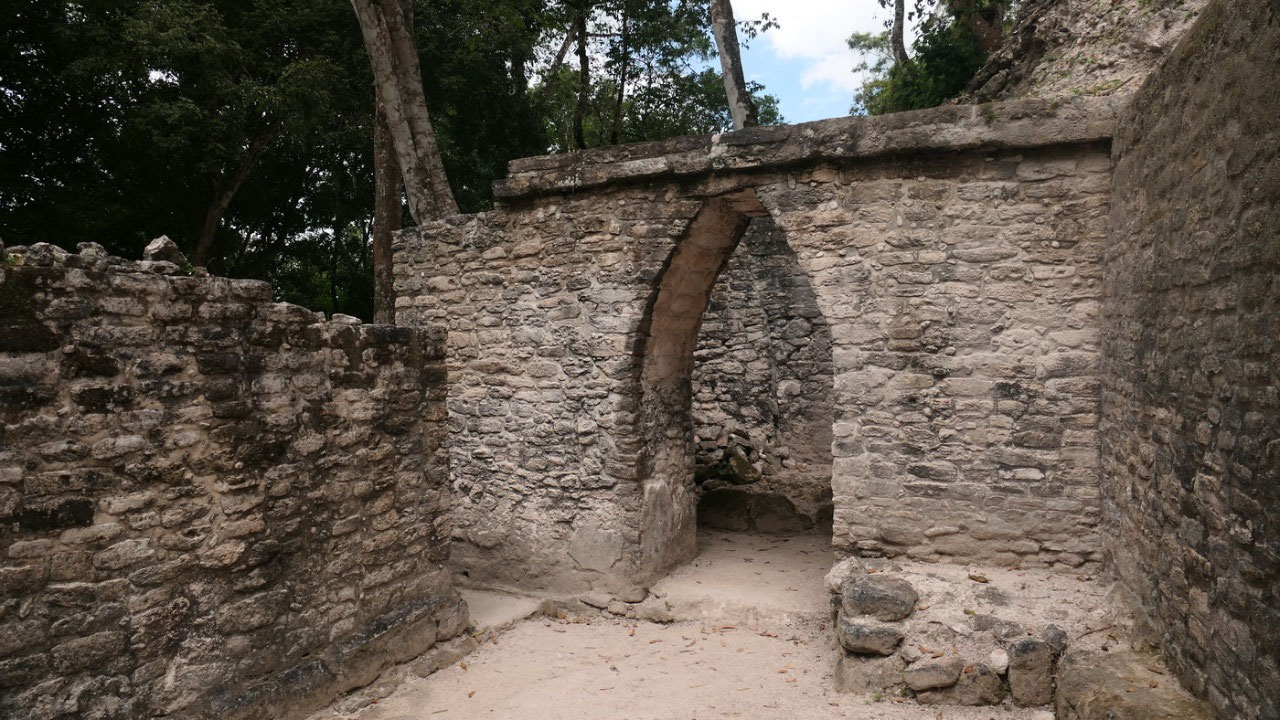
- Back in the A2 Plaza, through a ball court by the not really excavated mound: we went up on the A1 middle temple: the only thing beside grass you can see are the steps and I don’t think they are old – they look to modern – now we have the perfect view on the site in all directions , down toPlaza A1: this plaza is so cool because you are standing in front of the Famous El Castillo – time to explore the famous:
El
Castillo
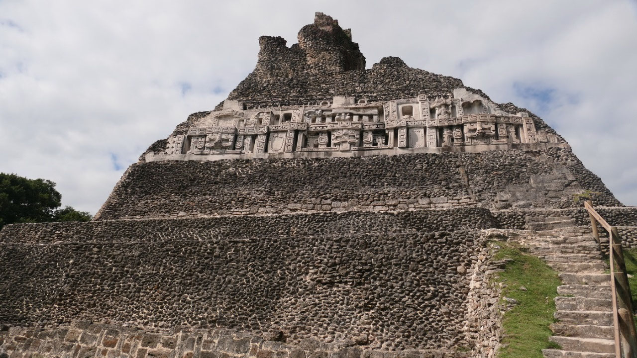
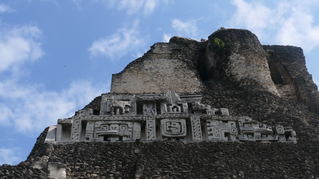
The
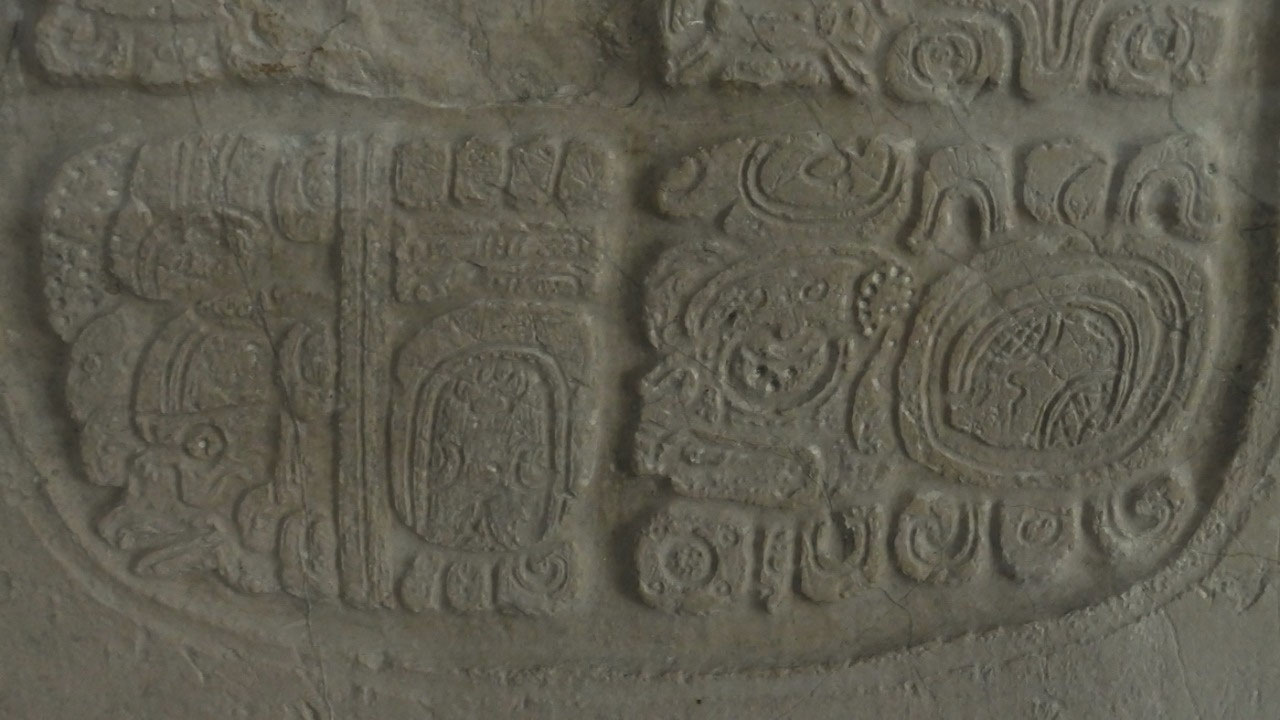
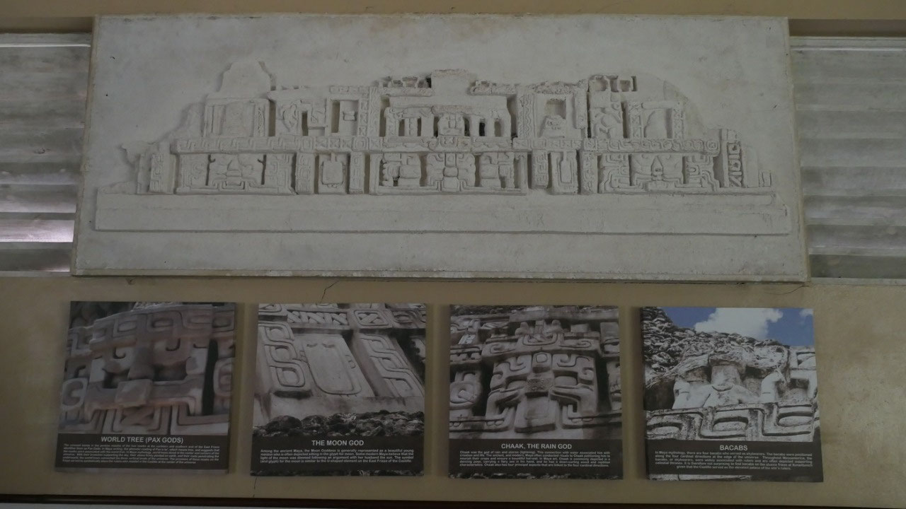
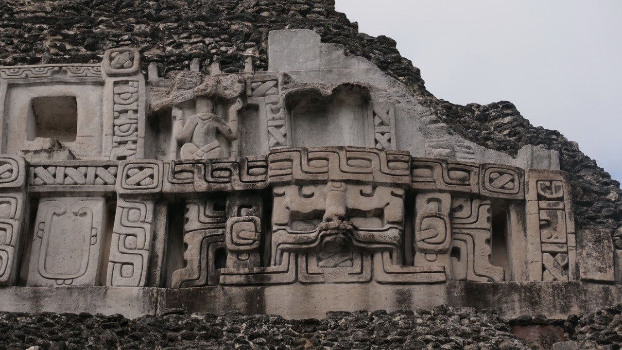
East Frieze at the El Castillo:
when you look up it looks super cool and at one time it went around
the whole pyramid (must have been super impressive) – we only see
this little part and you can see the different gods – and in case
you wonder how come that only this part is so good preserved: as soon
as they discovered it the tropical weather started to take it’s
toll and they made a fiber glass replica in 1996 for the west frieze
and in 2001 for this East Frieze: now we can see it and try to
decipher it:
- the twisted cord represents a supernatural location in the sky where the universe was created
- there are 3 masks – the 2 on the outside are similar: they are the PAX Gods: the World Tree – is on both sides with the crossed bands in the jawless bands: they were at the corner and center of the universe, their branches support the sky, but they are planted in earth and the roots go into the underworld
- the central mask with the long lip is Chaak the Rain god: he is associated with life – he is often in a dancing pose
- The U-shaped elements represent the Moon God:is a beautiful maiden sitting on the moon
- above the central mask is is a throne with an open mouth serpent
- on both sides of the serpent are the Bacabs: they are skybearers (between them and the serpent are niches they likely had figures in there)
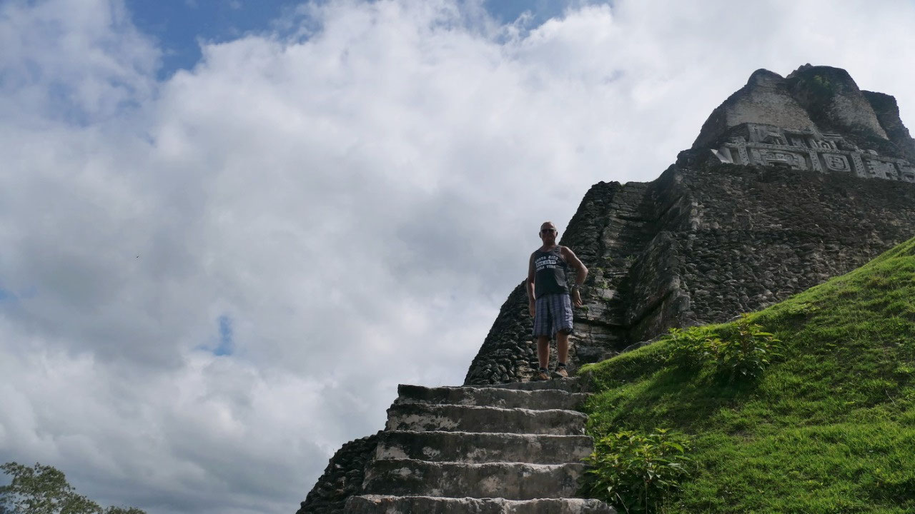
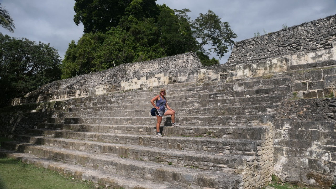
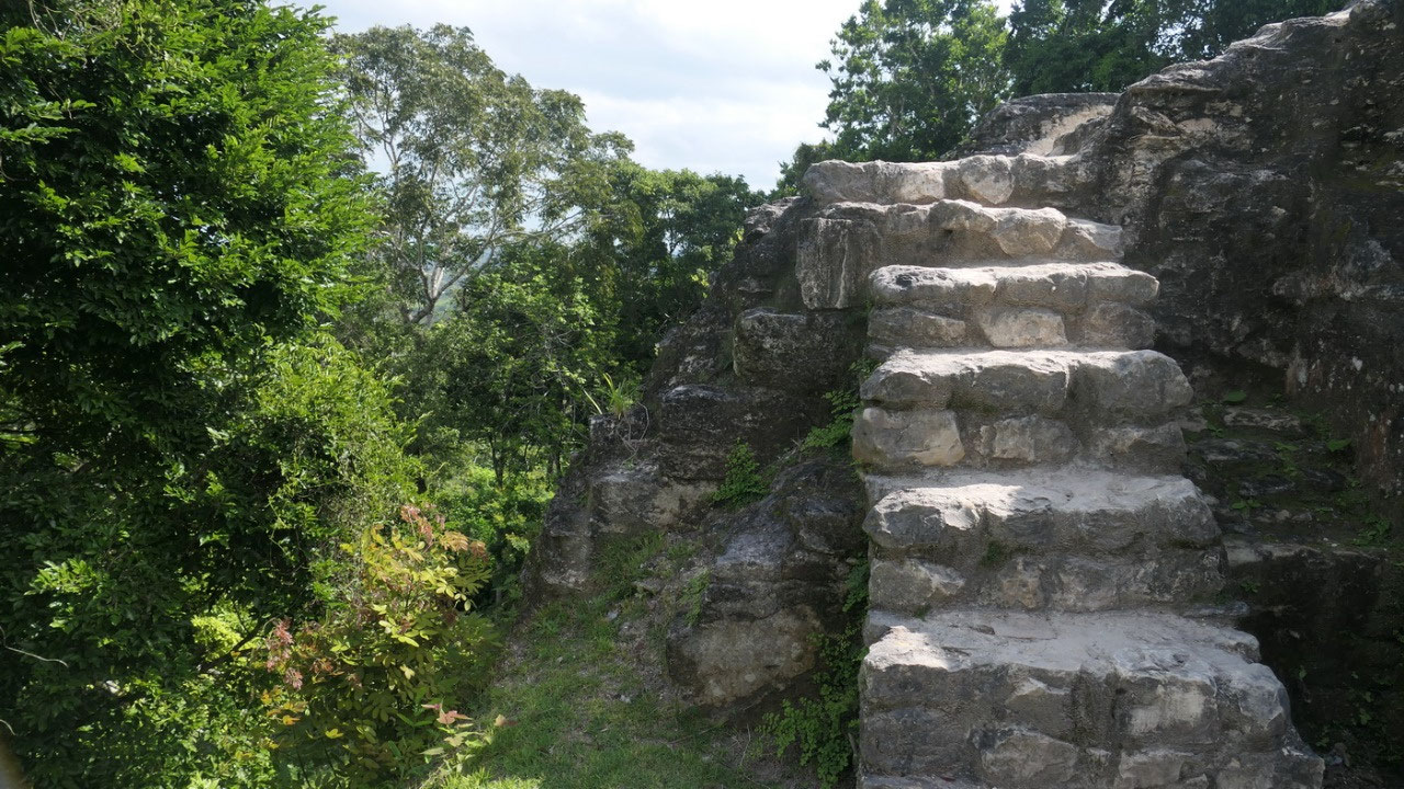
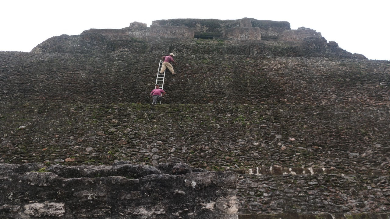
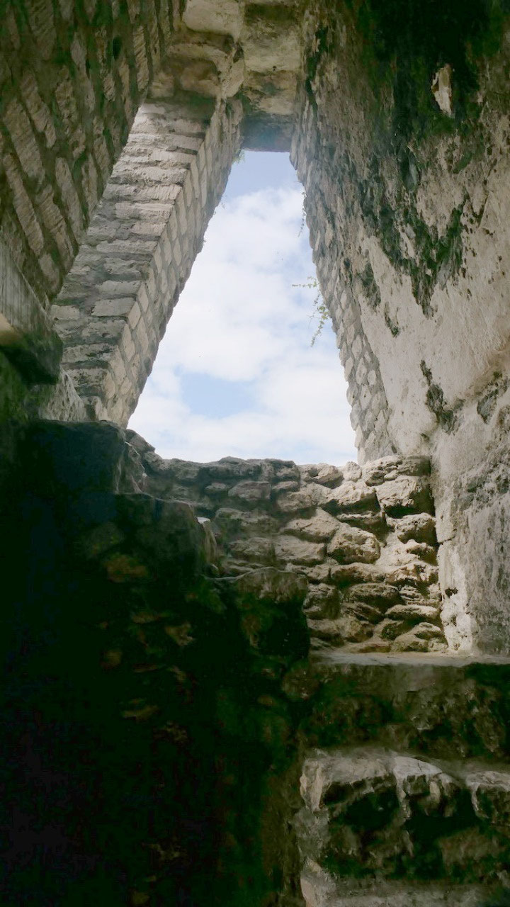
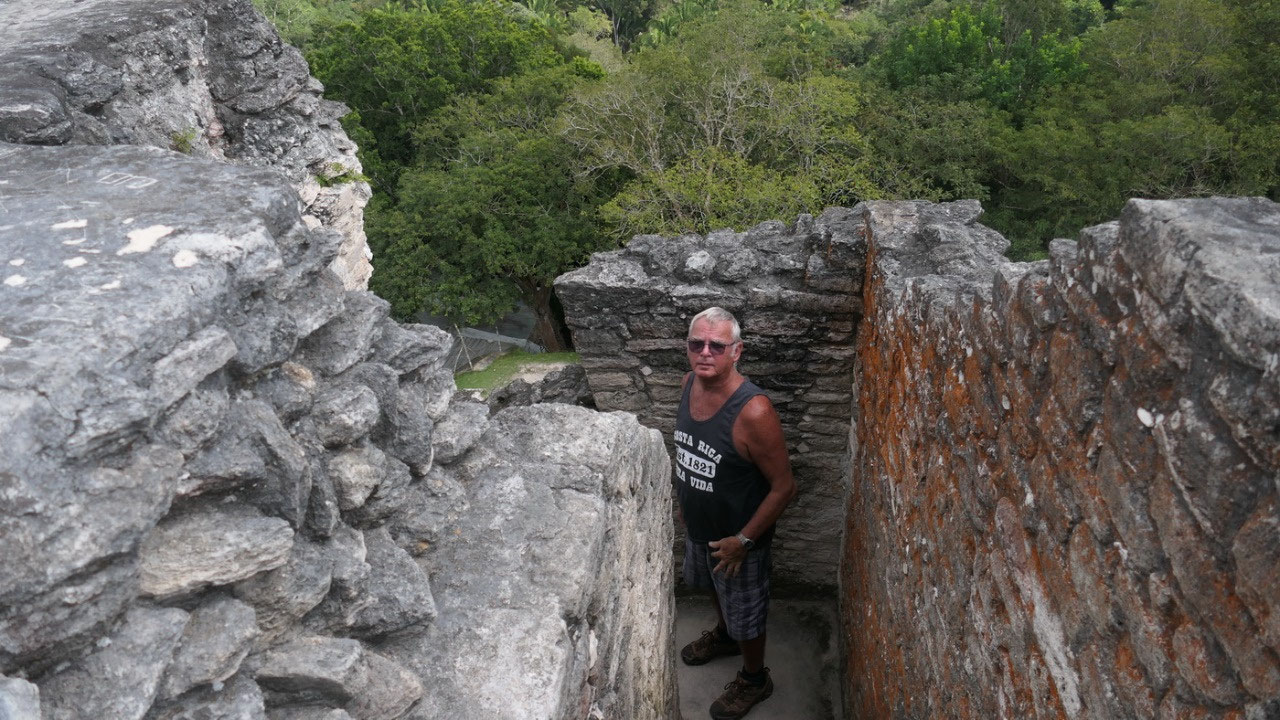
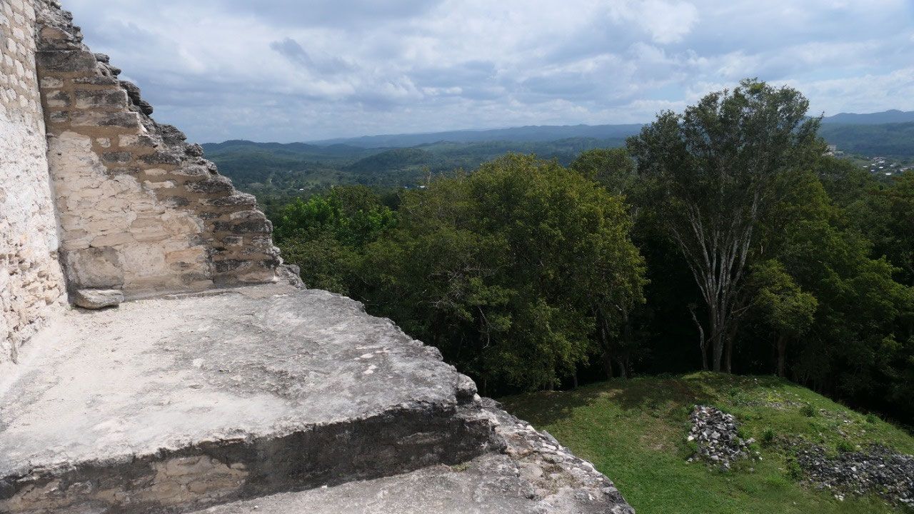
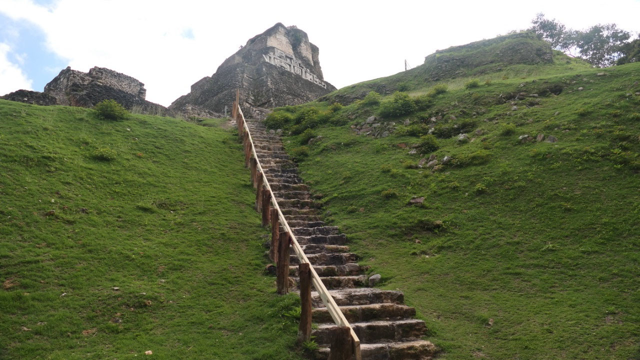
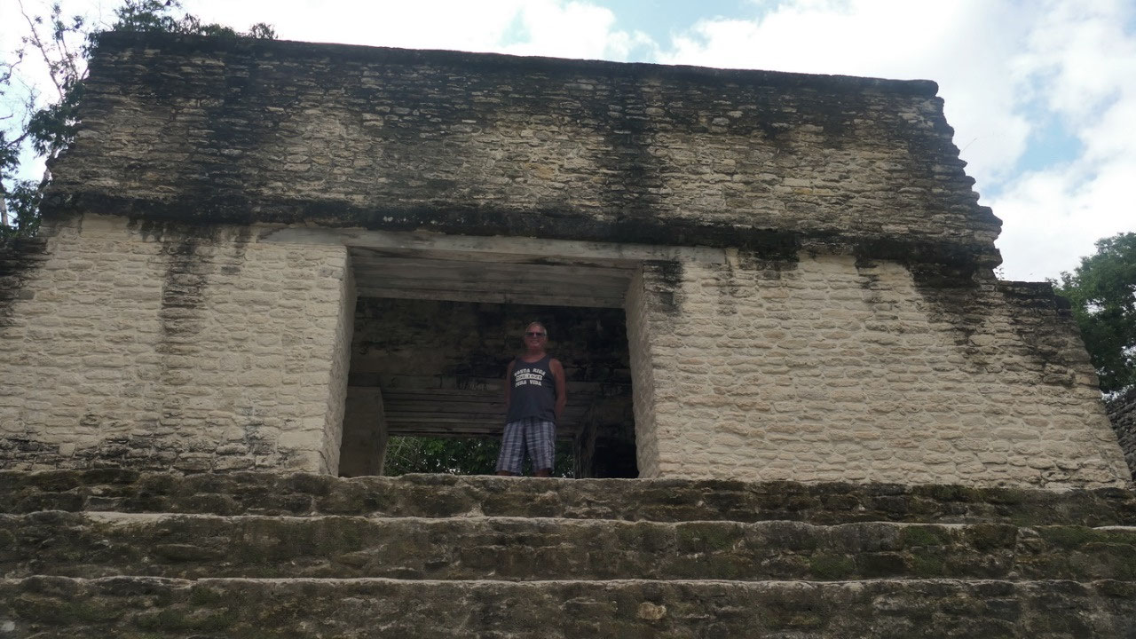
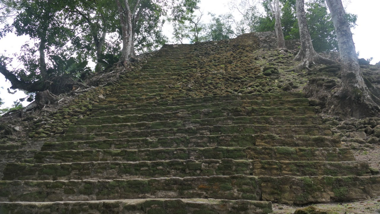
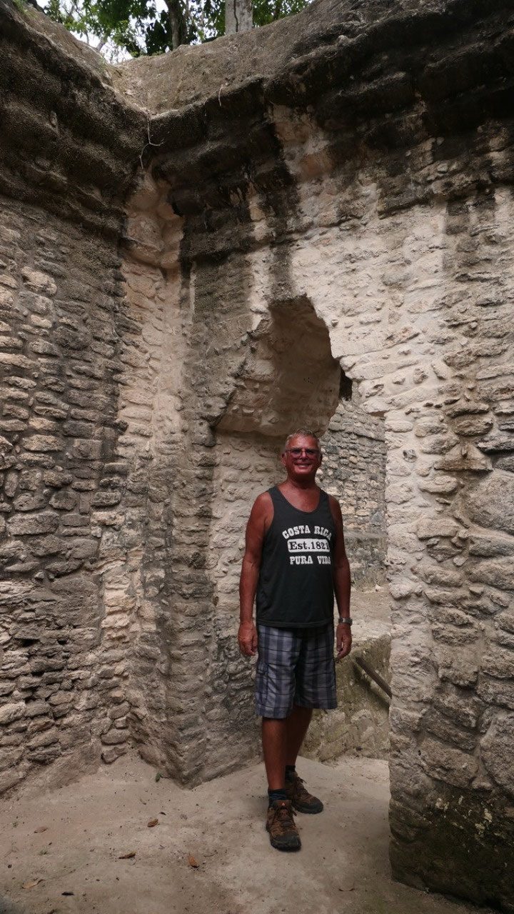
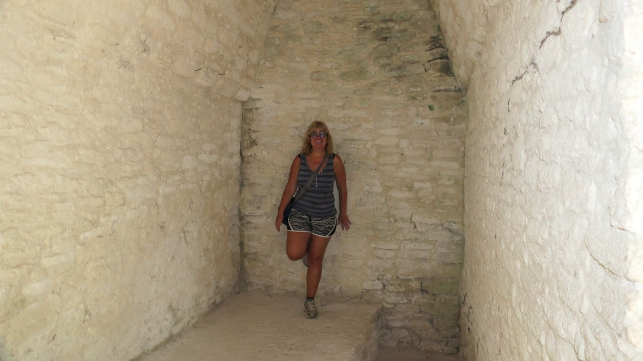
Up
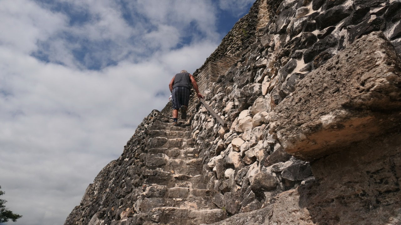
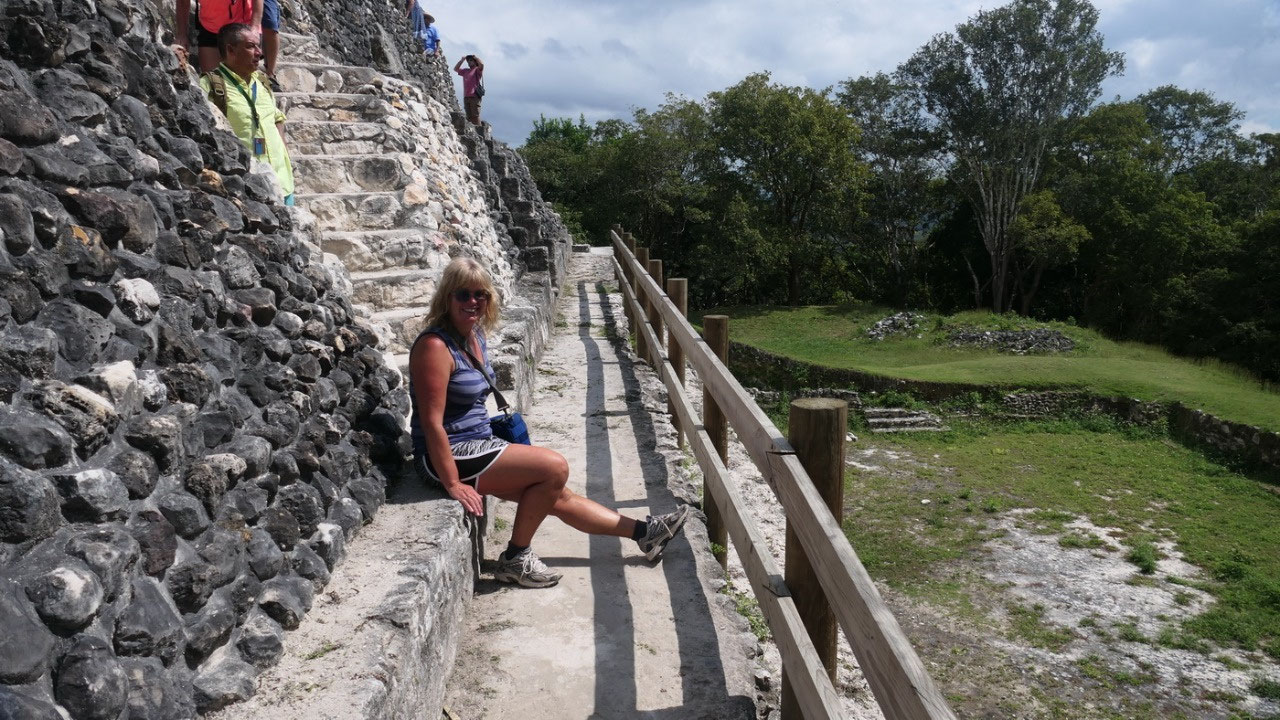
on the El Castillo:
ok so there were a few guys working on the front of the El castillo
which is actually quite steep and then we went up on the site and
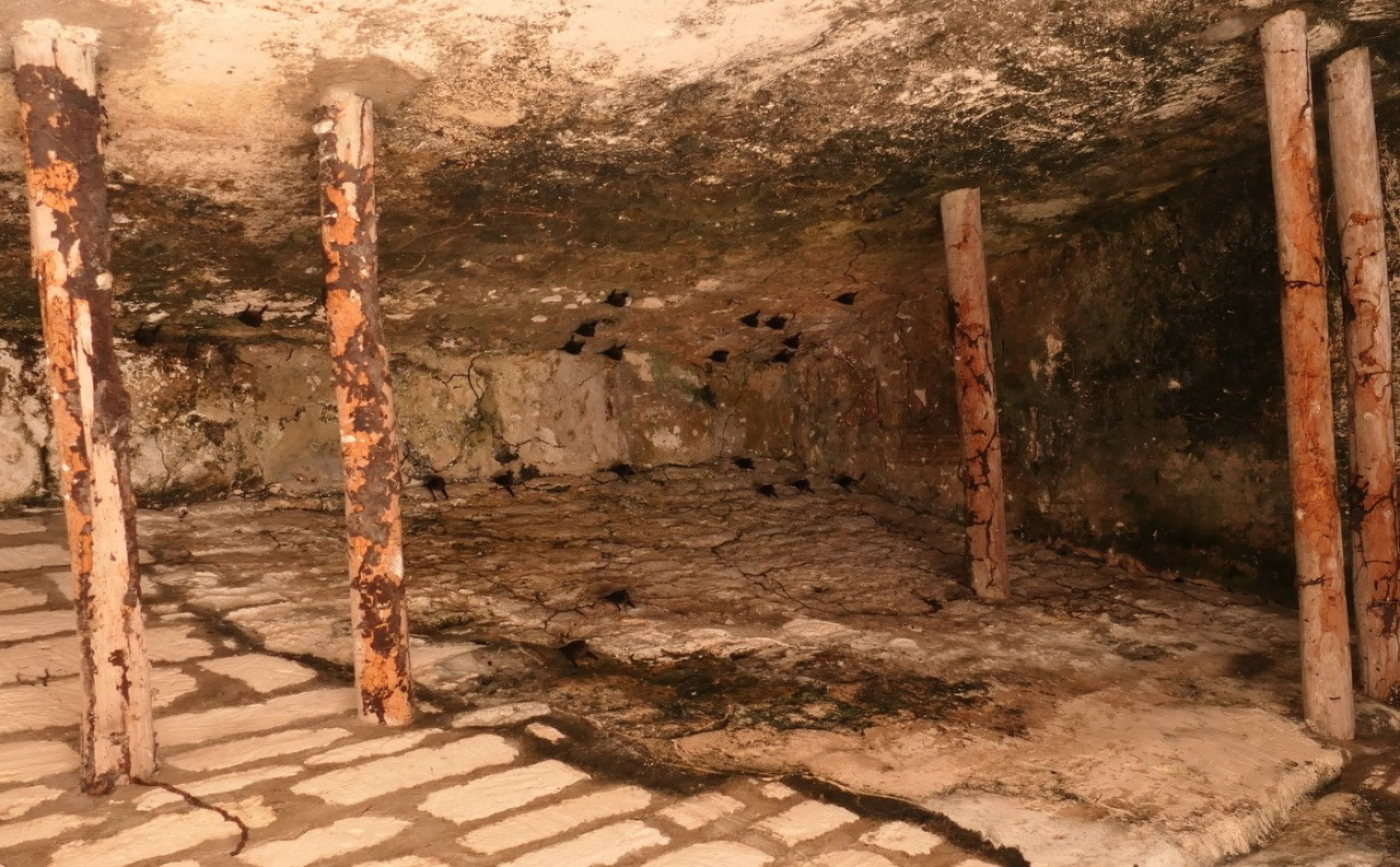
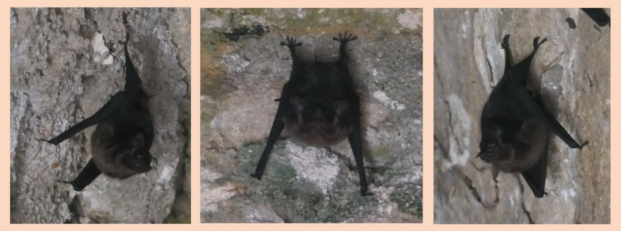
even higher up on the next level: where we could go into a room where
we saw a lot of bats hanging on the ceiling quite eiry (inlcuding a
bats nest) – they are some little creepy creatures.
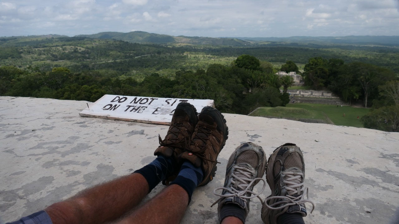
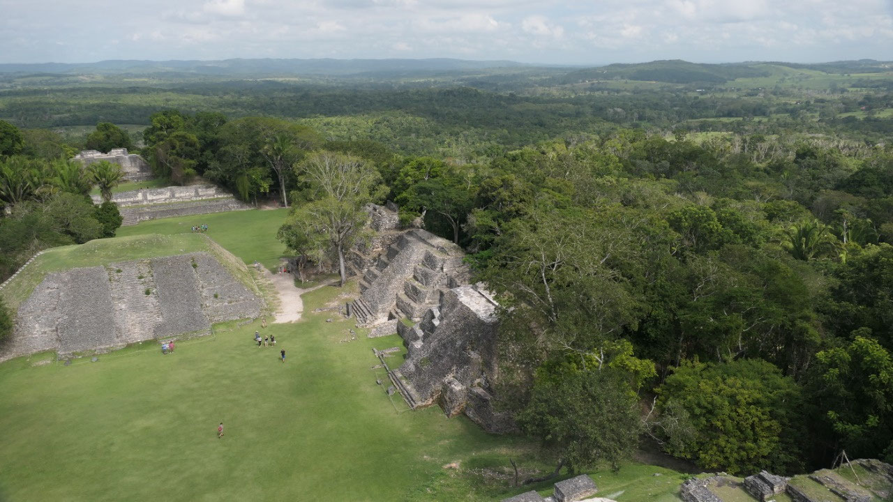
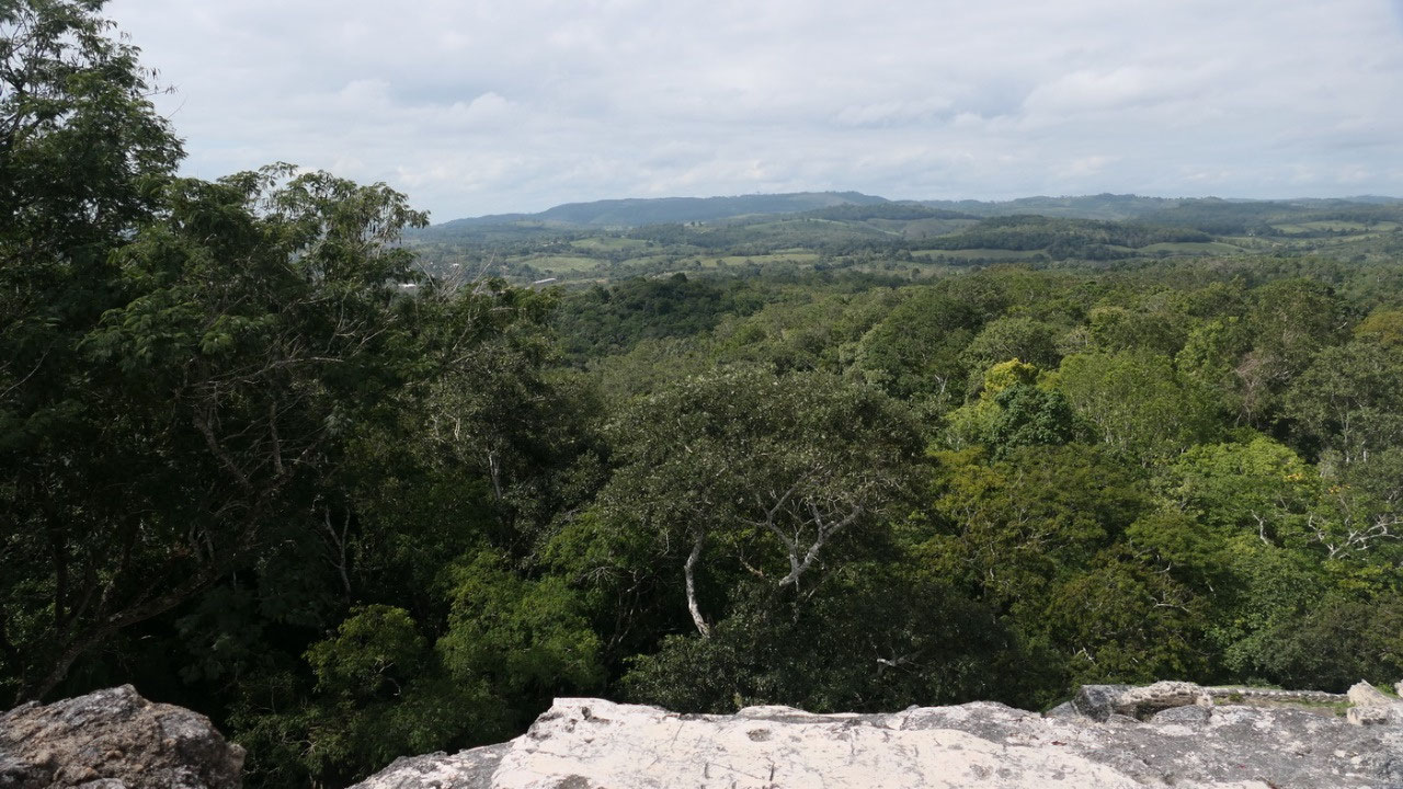
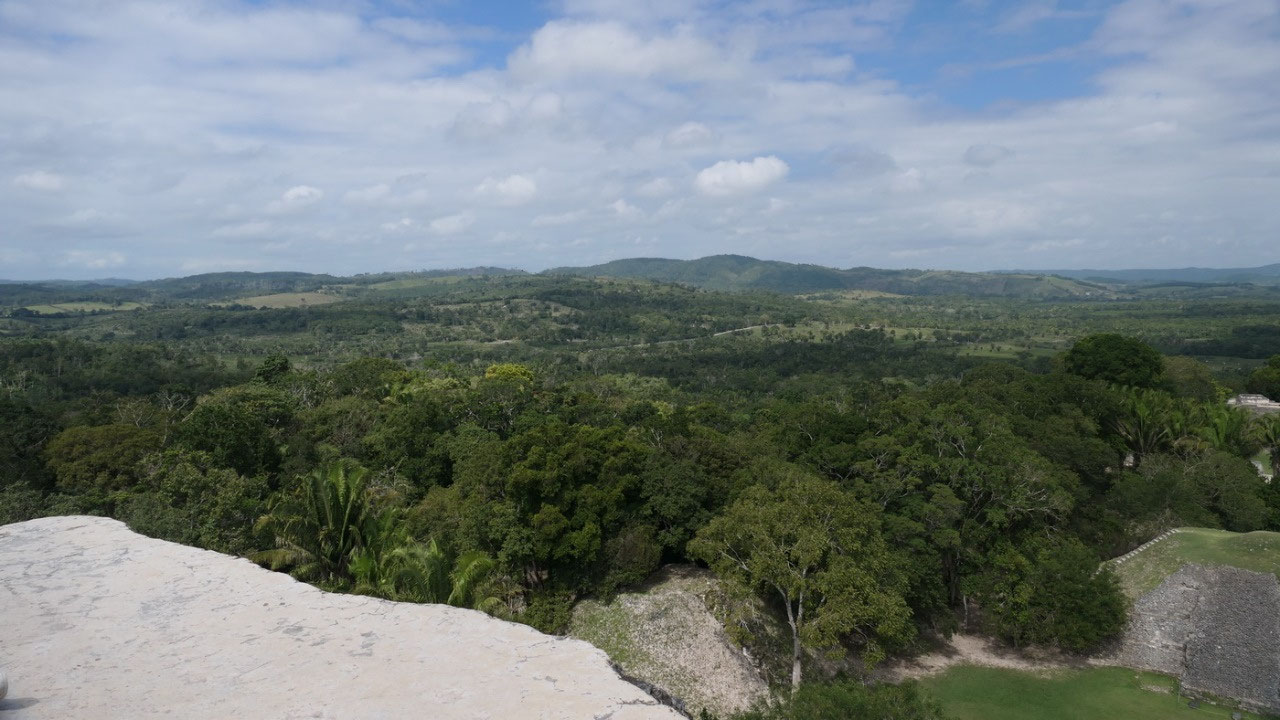
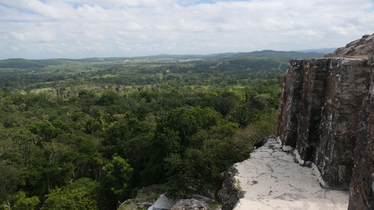
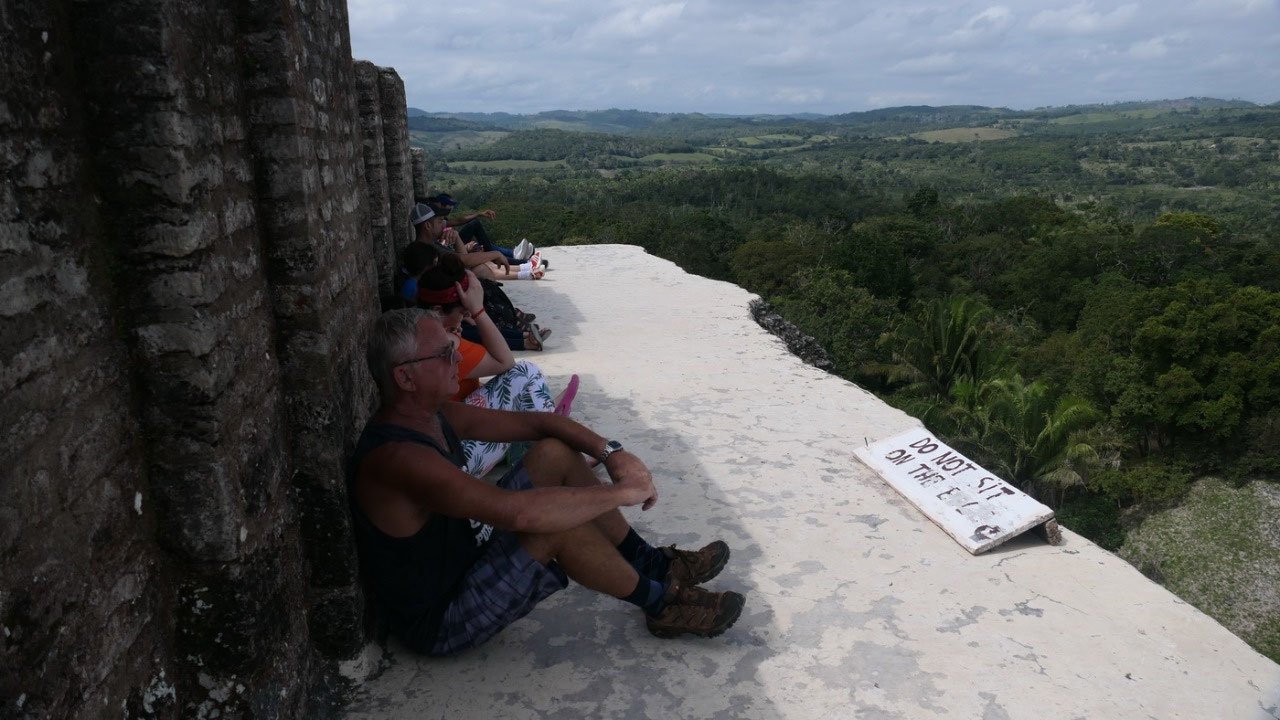
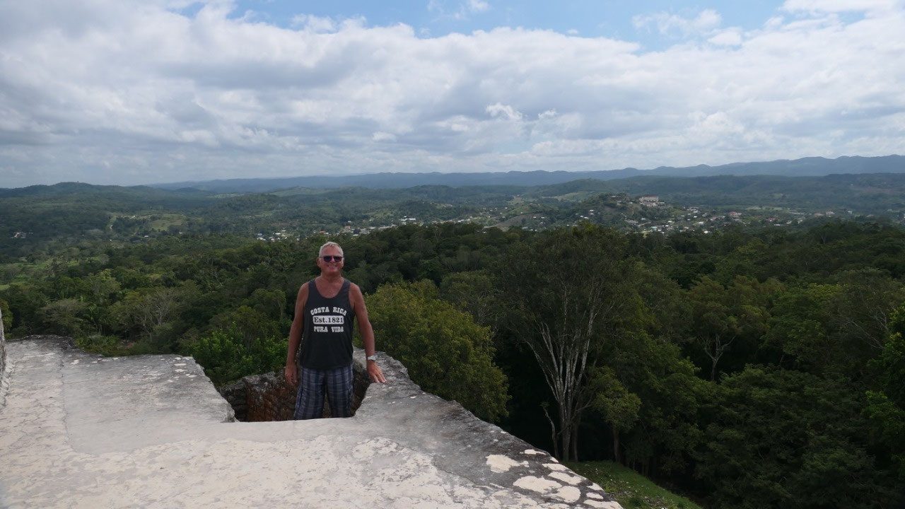
And
from here a some steep stairs went up around the corner and then
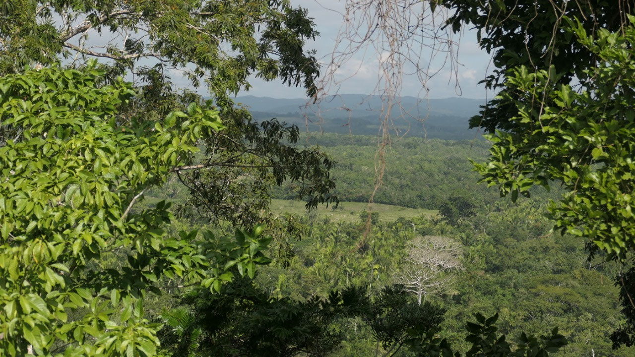
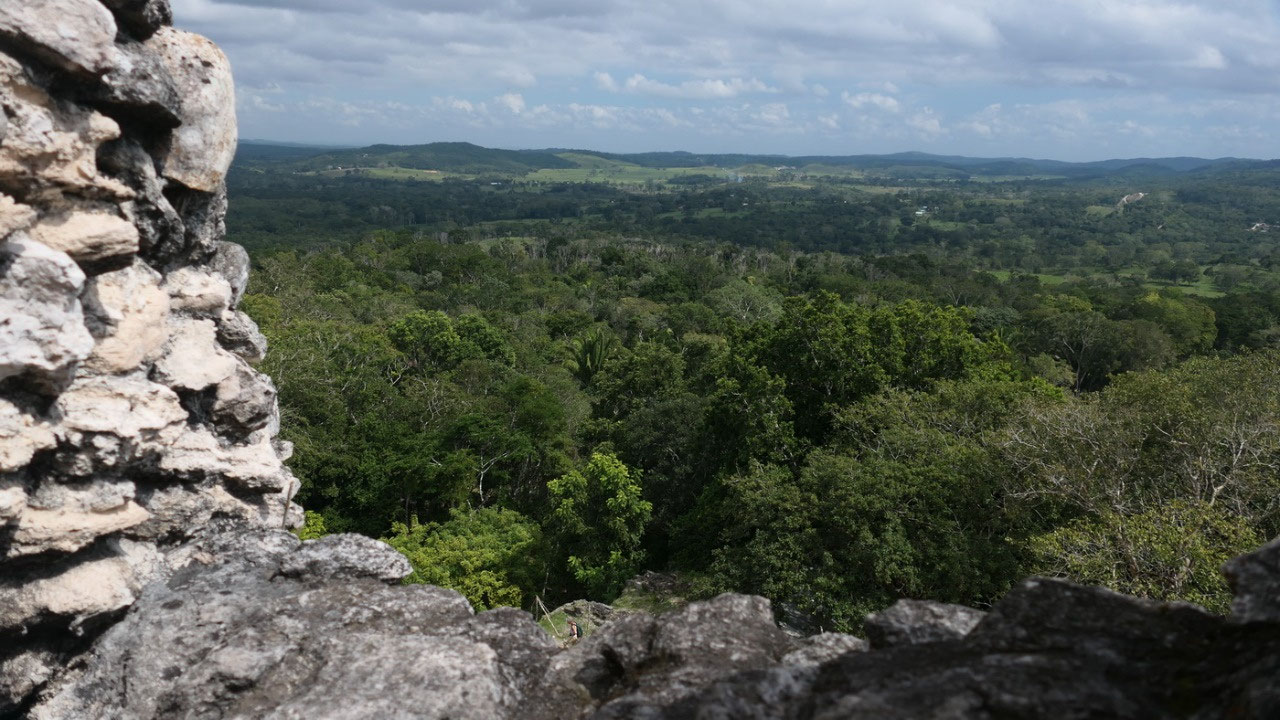
suddenly you are on the top and you look around with an amazing view
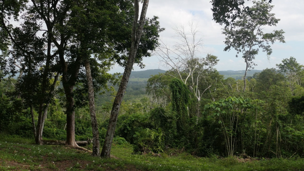
on the Mopan Valley, over to Guatemala, the forest – it was
absolutely amazing, like many others we sat down and let it all soak
in – by the way the say no sitting on the edge: I thought it should
be common sense, especially since that limestone is quite slippery
and it goes super steep down. And you also had an amazing view on the
whole site. Wow – up here the priests really had all the power!! (I
think that this was one of the best views we had on our trip): 360
degrees – We could sit here forever and only look and enjoy.
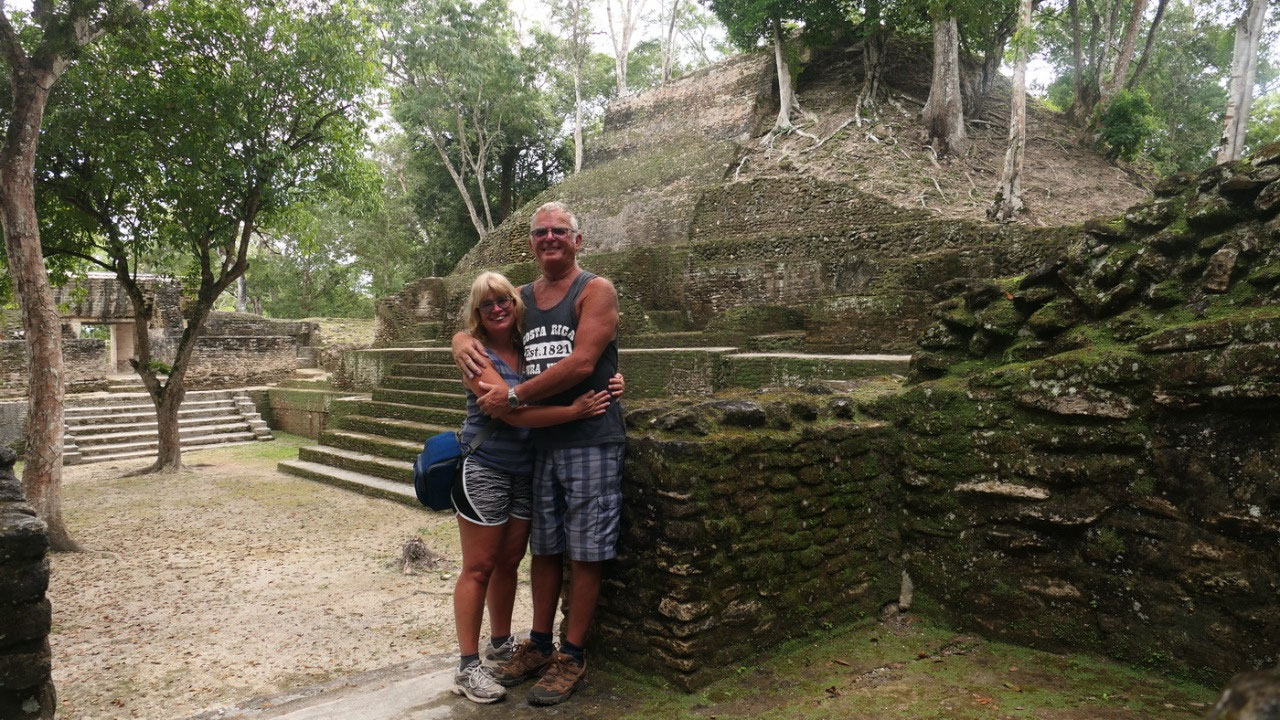
- with 42 m it is the tallest structure on site and the 2nd tallest in Belize (and we were on top of it)
- the absence of tombs and the multi rooms suggests that it was not a temple, but a place where the elite and rulers lived and held court
- it was built in several episodes from 1200 BC until 890 AD
- once the palace was decorated with large colorful stucco freezes
- the A32 structure = Audienca has 13 doorways: a double chambered building (likely for administrative use): the number of doorways symbiotically reflects the 13 levels of the Maya Heaven – it suggests that the elite who lived here resided in the lofty realm of the gods
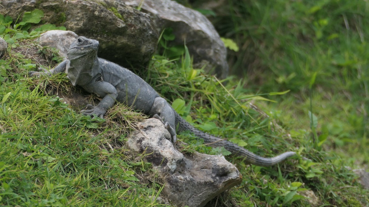
A
20 shrine structure: on the way down we came by this one – and
here we also saw a lot of iguanas bathing in the sun. Oh and it was
be careful, if you sleep it goes down quite steep!! Did I ever
mention when you visit ruins you walk a lot of steps!!
- Here the conducted private rituals (interestingly it looks like there columns)– it is one of the last structures built on Xunantunich
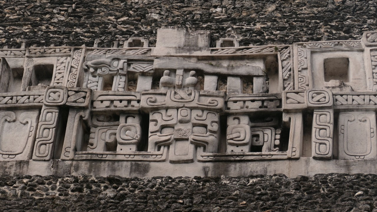
The
West Frieze: looking back up we could see another one of those
supercool friezes, and as we believe the archaeologist we think that
this displays:
- the end mask with the axes in the eye it related to the word Wak also for world tree
- the middle mask with it’s tau tooth resembles the sun god
- between them a face of an axe-eyed creature,
- above at the end a figure on a throne – maybe you can see it is surrounded by a sky band: it properly represents the ruler of the site
And
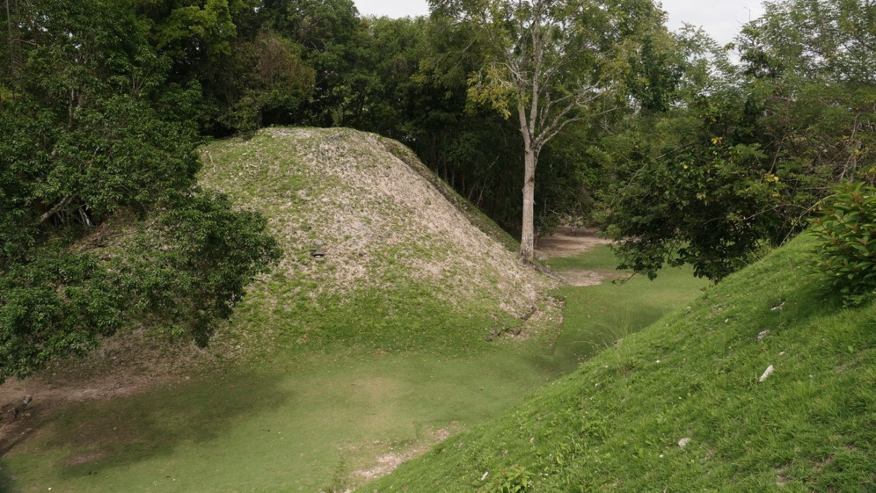
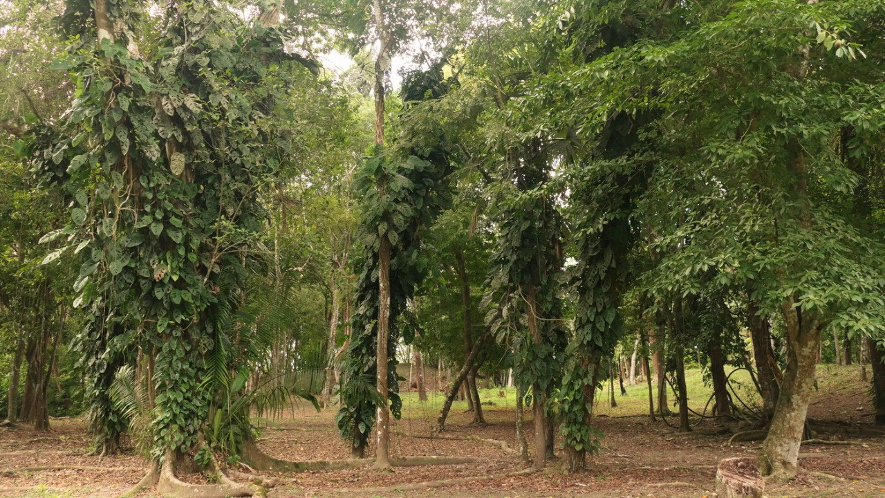
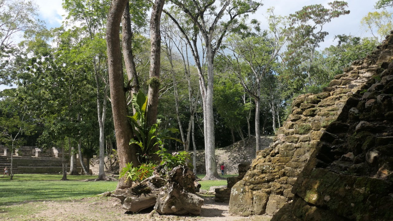
then another ball court and lots of tropical jungle trees and plants
– some stand up stones: likely stela but you can’t read anything
in front of the smaller temples A3 and A4 and we are on the way out. And
with the Ferry back: this time we had to wait in line and the ferry
was nearly full with 4 cars – and then we are back to visit more
ruins, but before:
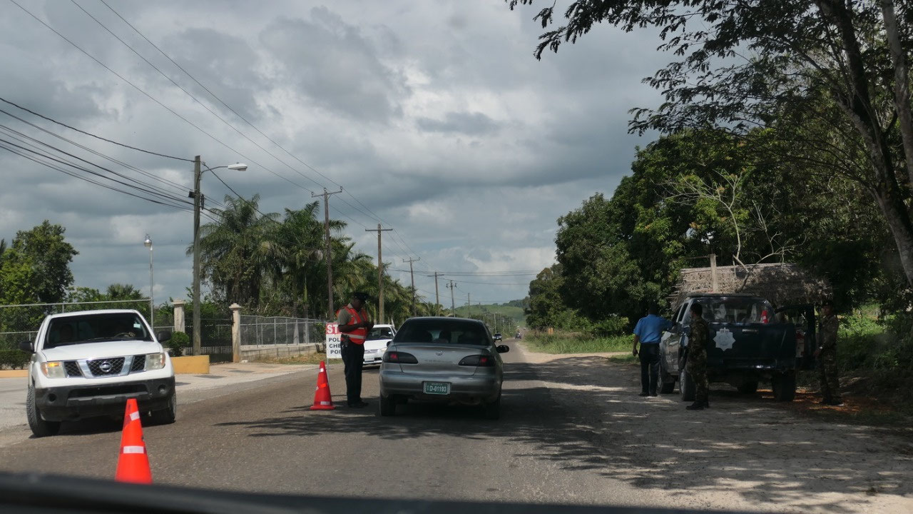
the Police
Checks
they
are happening quite frequently in Belize – you can see the stop
sign often close to a police station: sometimes they want to see the
drivers lisence and asked it if a rental car – and sometimes they
wave us through – and today we went through another one.
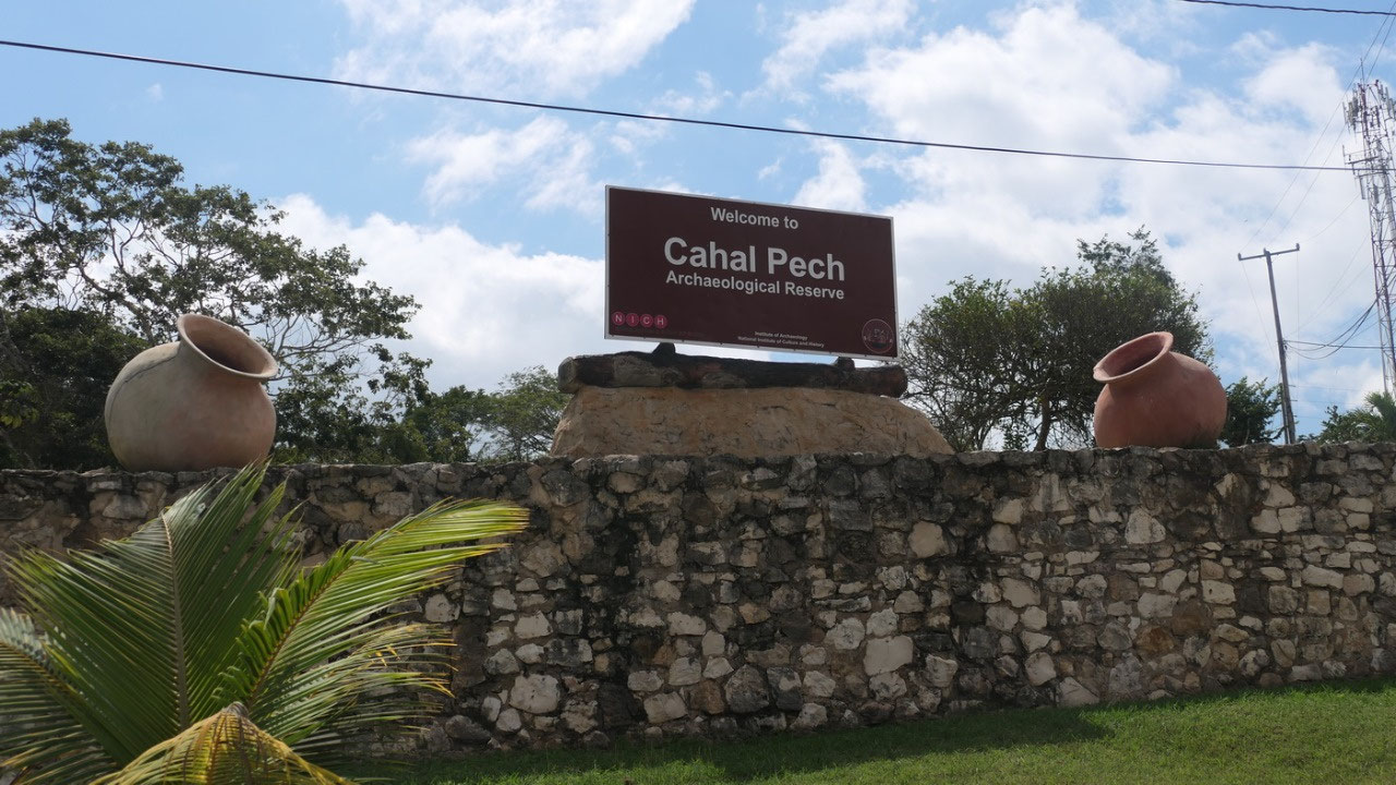
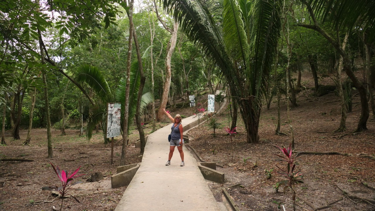
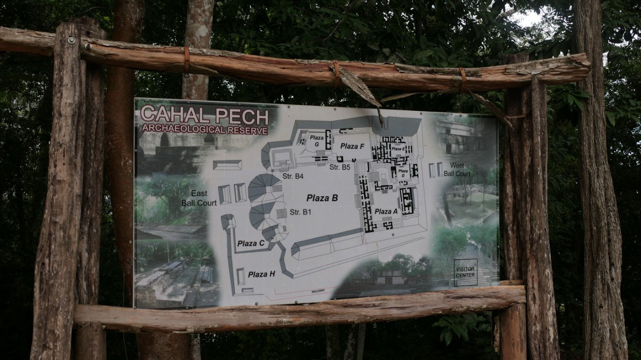
Cahal
Pech Ruins

and
this ruins are nearly right in town – so if we are here we have to
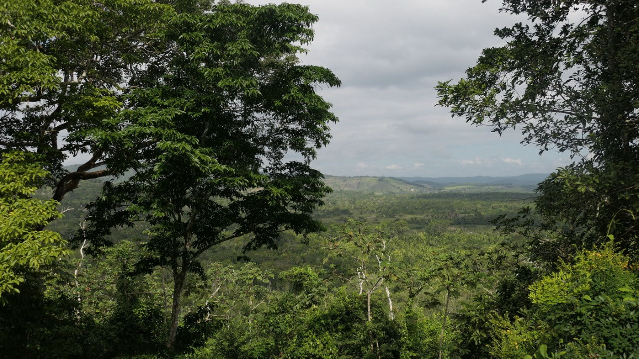
look at them: so up the hill and from the parking lot we had a
wonderful view on the town of San Ignacio.
What’s
to know about the ruin on the hill?
- It means “name of ticks” - it got this nickname in the 1950s,
when the site was surrounded by pastures with tick-infested cattle
- it overlooks the Macal River, which allowed them to control the trade on the river
- they started to settle around 1300 BC and is one of the earliest occupied Mayan sites
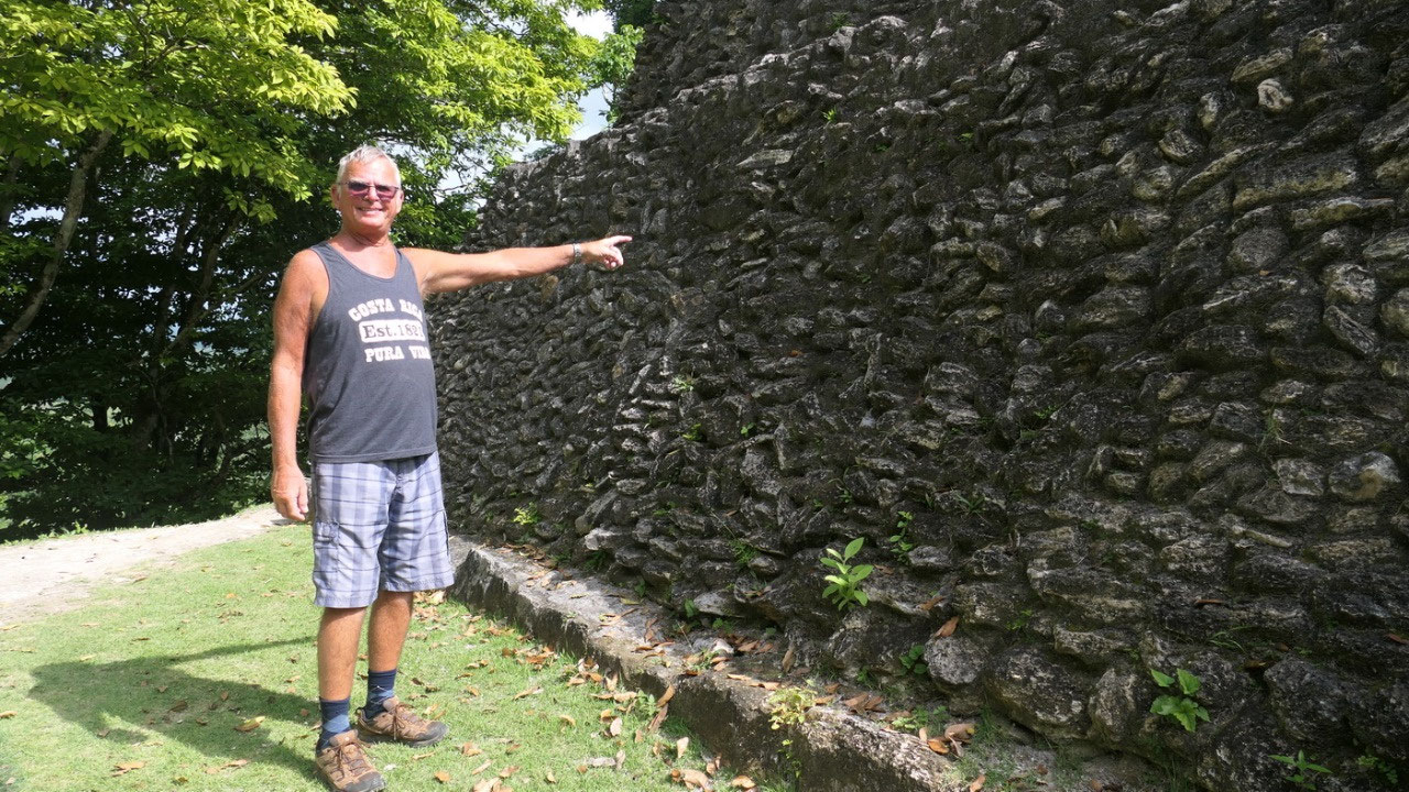
- it has 8 connecting plazas with 34 structures: the limestones are from a nearby Quarry and they are hold together with a lime plaster
- the corbelled arched roofs: here we learned that those “arches” are not very strong like a true arch and can’t hold wide spaces: this is a reason why a lot of the rooms we see with the Mayans are very long and narrow
- the peak was from 600 – 900 AD with around 15.000 inhabitants: they found hundreds of small house mounds surrounding the central area (most are destroyed when building modern San Ignacio)
- here they produced a lot of hand-modeled figurines of humans and animals: most which were found are from 600 BC – 250 AD, they also made ocarinas (whistles) they say they could be used for hunting to imitate animal calls or even war
- there were several other smaller cities like Cahal Pech in the area like Buena Vista, El Pilar, Pacbitun, The Baking Pot – all within 6-10 km distance
- they likely did a lot of trading, since they found Conch Shells from the Caribbean, Obsidian from the Guatemala Volcanoes and Jade – and the currency was the Chocolate seed: Yes back then the money grew on the trees
When did they start to explore and research the site?
- near this ruin was a little Christian Mayan town during the Colonial times, and this was as far as the Spanish penetrated in the 16th century
- the locals knew the site, they found ceramic vessels from the early post classic
- in 1951 first prelimanary investigations were done: they wanted to find carved monumnets and bring them back to the museum in Philadelphia
- research and restoration started in the 1988 by the help of Jaime Awe (who by the way was the 1st Belizean to get a PHD in Archaeology – he was involved in excavating and restoring several Mayan sites as well Xunantunich,, Altun Ha, Lamanai, ATM cave, Lubaantum, Nim Li Punit and others),
- and again in 2002-2002 when they were stabilizing more structures to make it accessible for tourists.
That’s
when we discovered that Gine downloaded a German map and as always we
first start to learn some more by visiting the museum: and here we
saw a lot of the tiny figurines as well we learned more about their
life and rituals (yes I know it is unbelievable but we are now Mayan
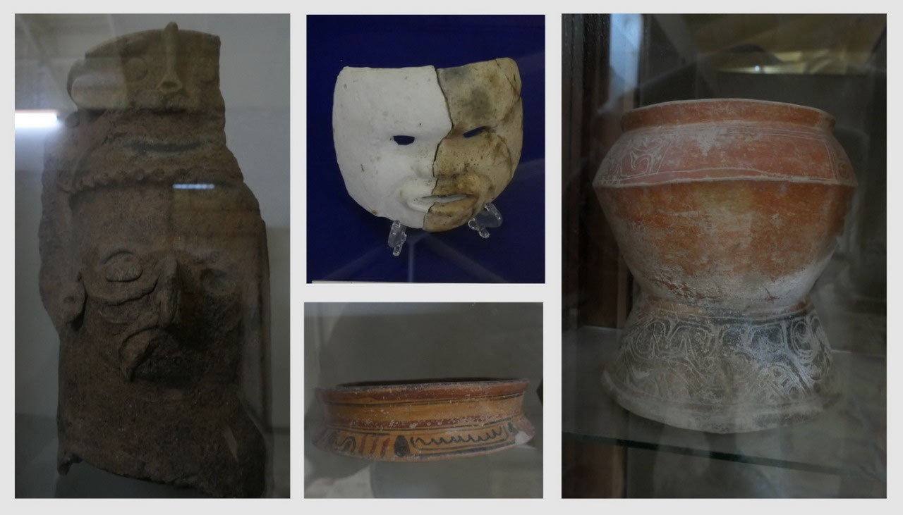
experts) as well they had lots of ceramic vessles, chocolate pots
(looking like tea pots. And we saw some tools: maces and wrenches –
no they did not had metal tools, they used stone.
Here
we also saw the remain of a Stela (but as always imagination is all),
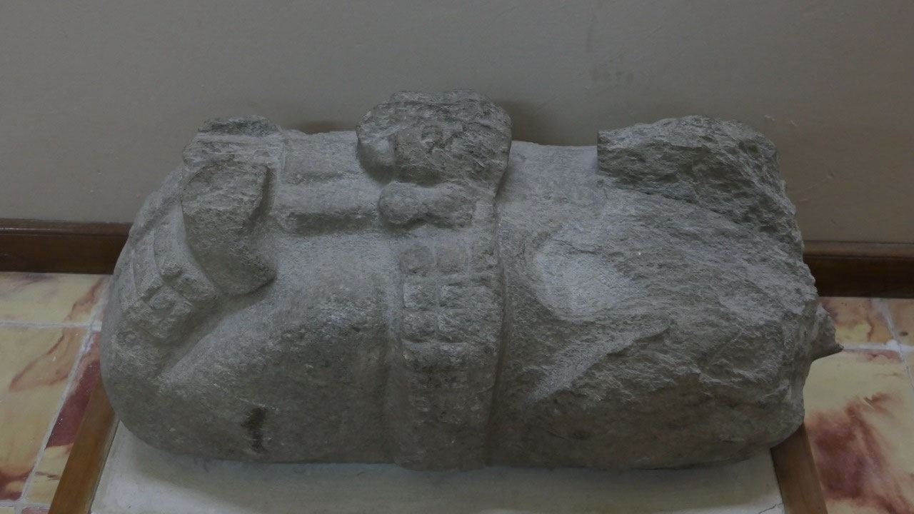
they had here the Bacna Monument I which got discovered by a
Mennonite farmer when he was plowing it’s field: it’s a capitve
lying on it’s stomach (there is no head) and a belt around the
middle – it’s similar to ball court monuments they found on other
sites.
The
smaller the site the more information you get (once you get in a
tourist site like Tikal you will pay extra fee to see the museum):
Some more cool facts we learned about the Mayan's:
- they believed their rulers were divine and communicated with the important deities
- they worshipped different gods contolling different things: Itzamna (earth), Chaac (rain), Kinich Au (Sun), Yum Kaax (corn), Yum Civil (death)
- to get favours they did sacrifices and blood letting: thriving a thorn through the tongue, cutting the foreskin of the penis with a stingray spide or obsedian blade (we touched one of those obsedian blades in the bananda lodge – they are still sharp) or cutting of the tip of a finger: the blood dripped on bark and was burned in an incense burner.
- The high steps of the temple: Mayans were relatively short people – so why are the steps so high? But then the temples were not made to climb: the temples were sacred and rarely used for rituals. Also you have to climb on your hand and feet as a sign of respect to the deities they were about to worship.
- Jade was for them more valuable than gold (there was only a few things in gold found in Lamanaii)
- from the Stela it can be assumed that they were not peaceful but did have a lot of wars going on
and
then we walk between flowers and a few not excavated mounds to Plaza
B and after some turning and orienting ourselves we came in via the
North Entrance:
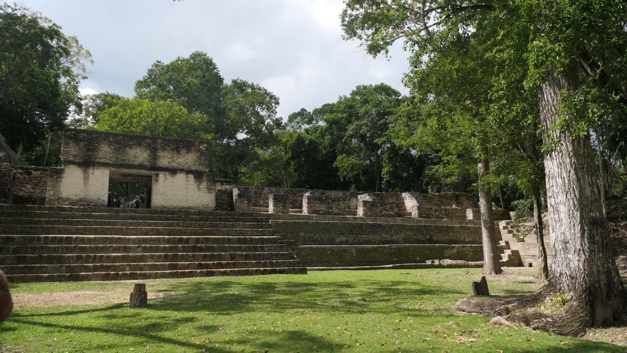
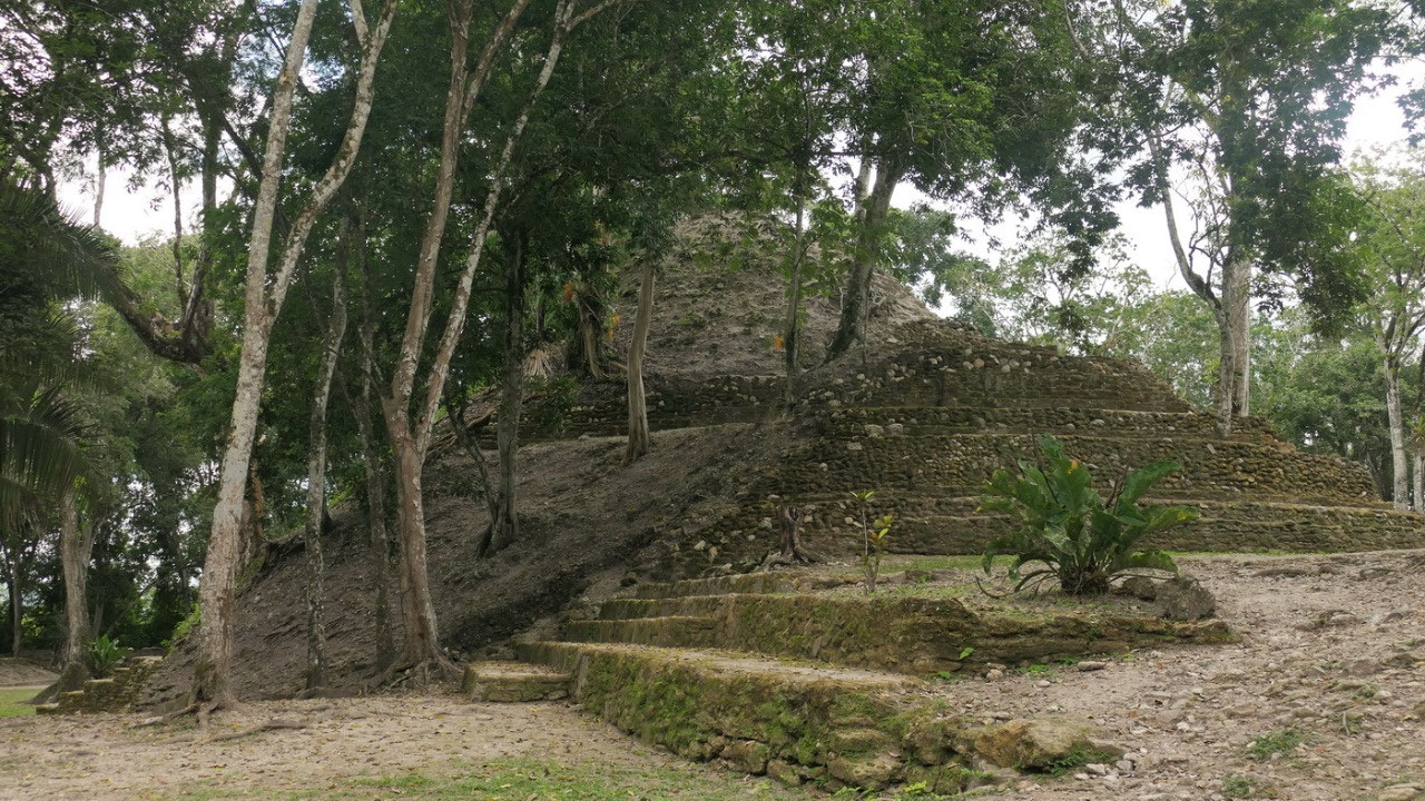
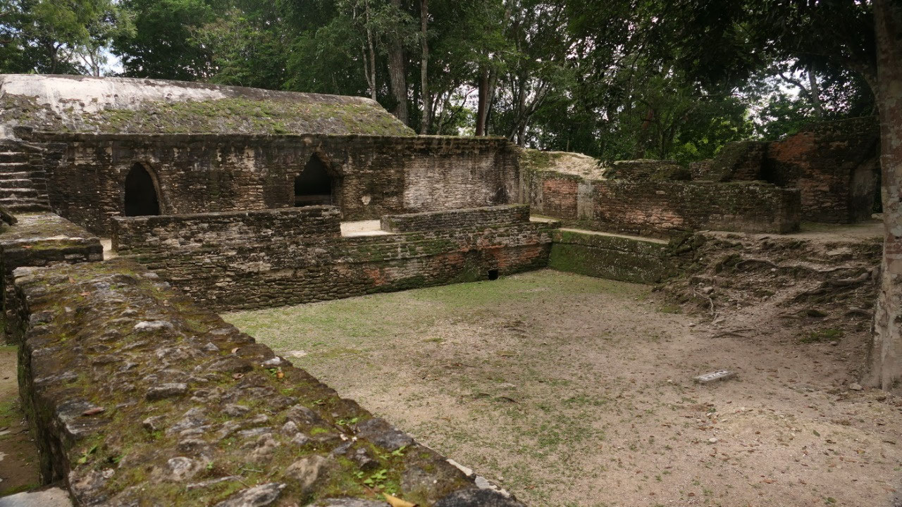
- Plaza B: which by the way the largest plaza here – and as experienced people we right away discovered the E-group (yes that’s the one for the sunrises – and is B1/B2 & B3. Gine went up onto the B1 Temple (the tallest), as where Paul decided to admire it from the bottom (his argument: it is hot and I climbed already a lot of temples and you don’t have to climb them all): and looking down he is tiny. By the way if you look closely you may can see that once there were stela’s in front of each of the 3 temples of the E-group
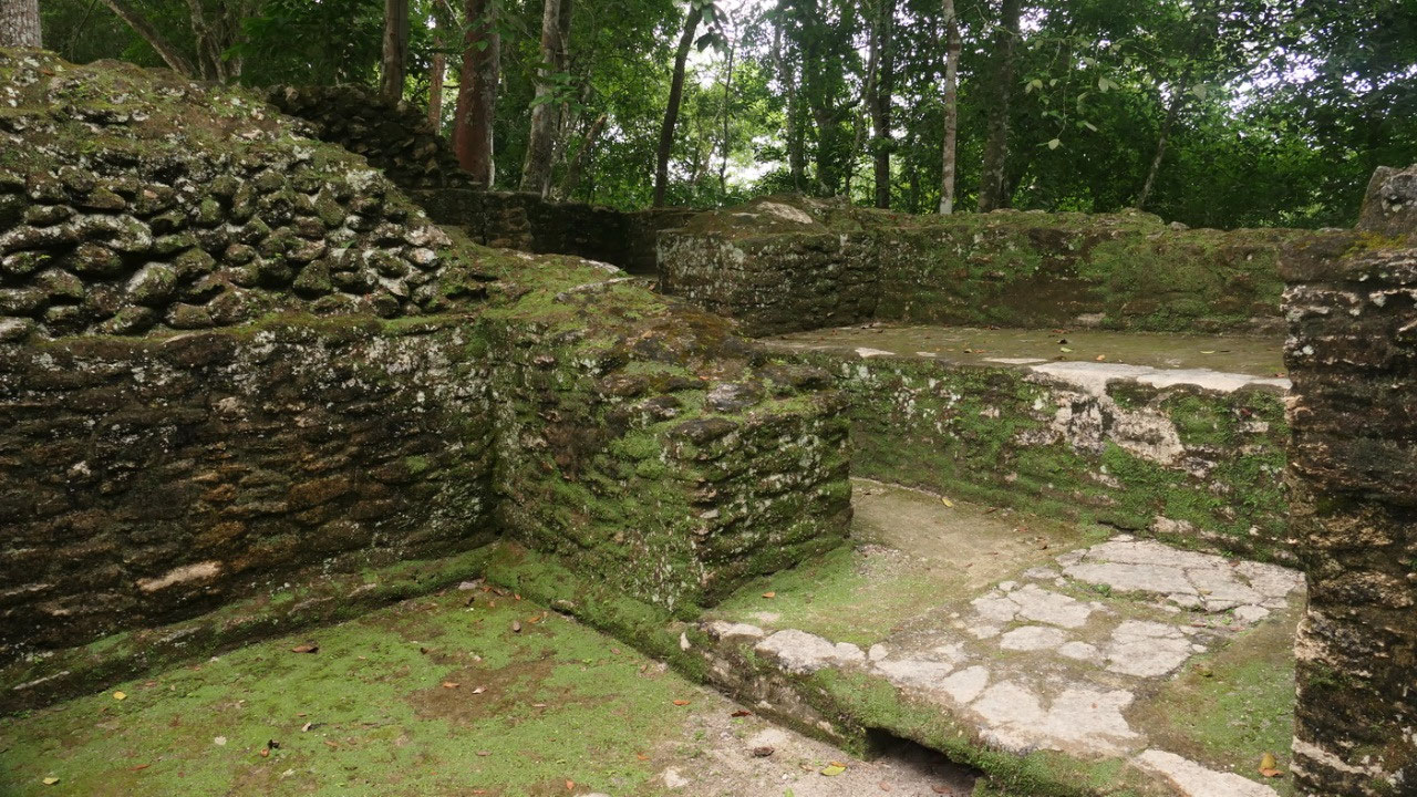
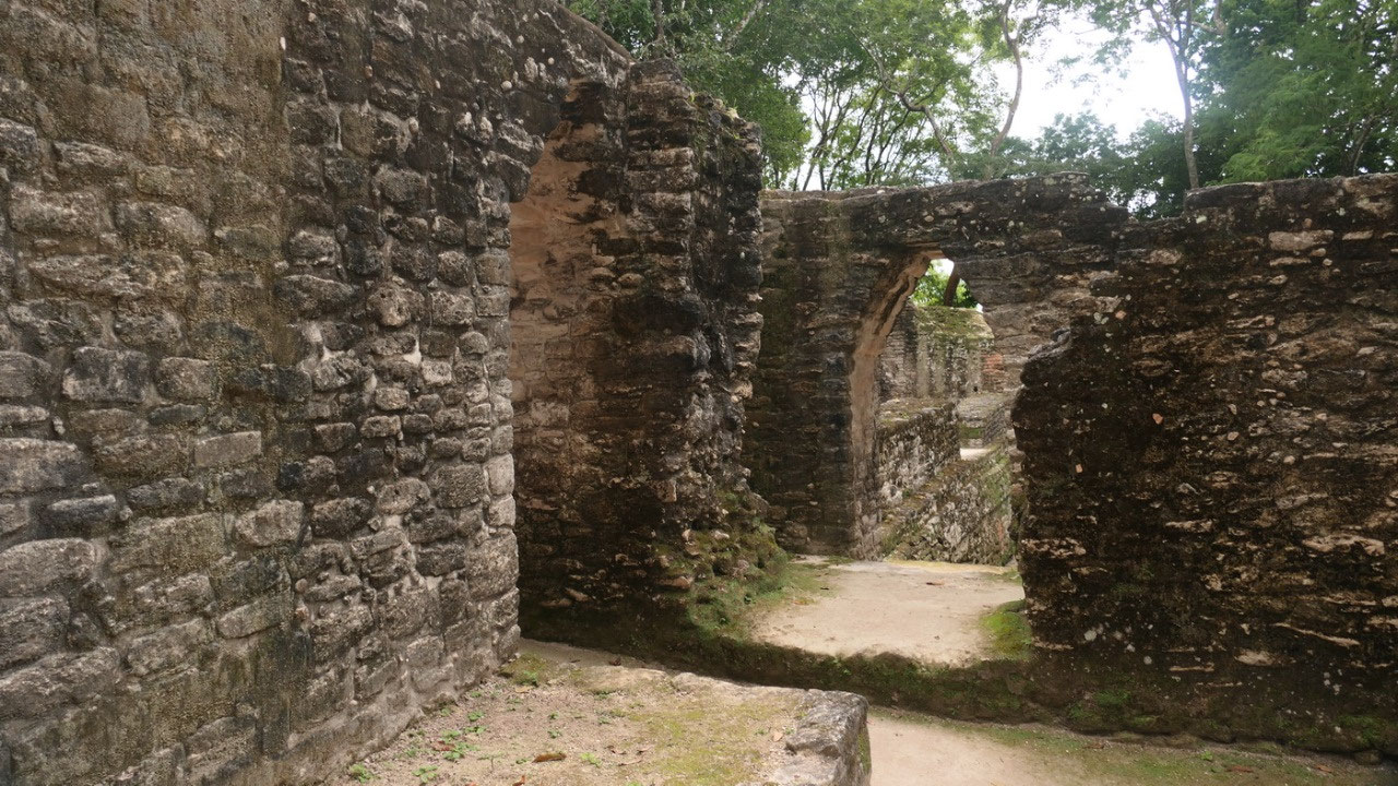
- via the staircase through Structure A2: which has a lot of rooms: Is it the entrance to the next Plaza or living quarters? By the way here were ceilings made of wood, as well we discovered holes, where could have been wooden beams, then the typical arched long narrow rooms we went to
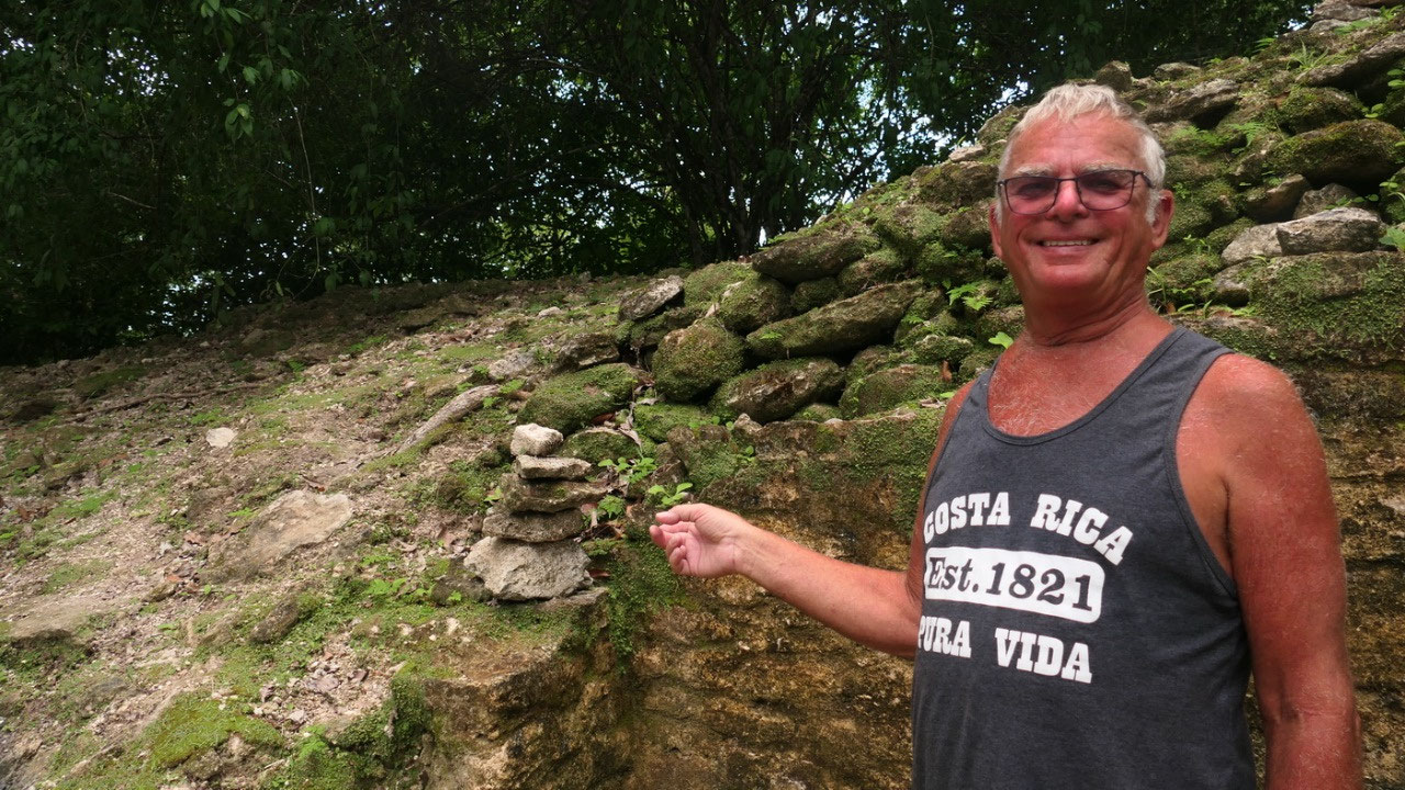
- Plaza A: and here you can also only look because of temple A1 as well as some small buildings around the sunken plaza – to have a view from everywhere we walk around the edge: find more rooms: maybe someone lived here? And there were several “beds” (maybe there are still some skeletons hidden beneath – who knows?. With all the moss on the steps you can see how fast everything grows over again. Paul even built a little rock-stacking from old historic Mayan stones (let’s hope he didn’t mess anything up and now the archaeologist are confused).
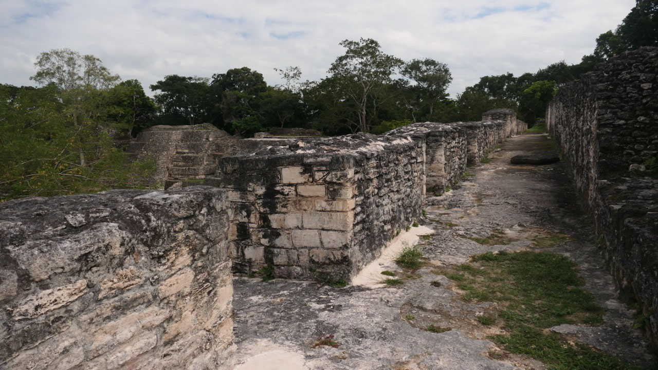
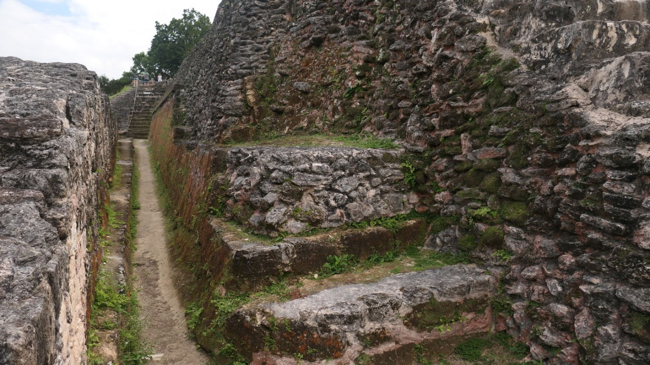
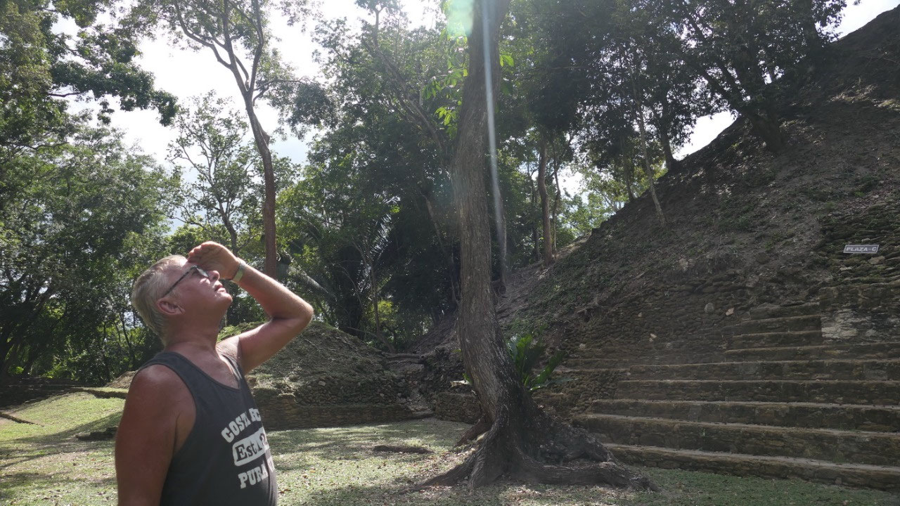
- A1 Temple: it’s the largest structure on side 24 m high (ok we are spoiled so it is not that high for us) but still steep to go up – did I ever mention, that here in Belize you can go nearly on all the buildings and temples, stroll everywhere inside, touch everything – it it kind of cool.
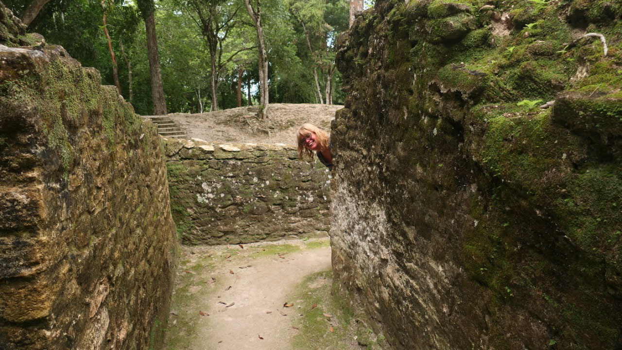
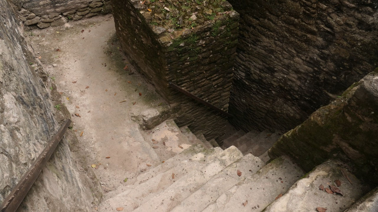
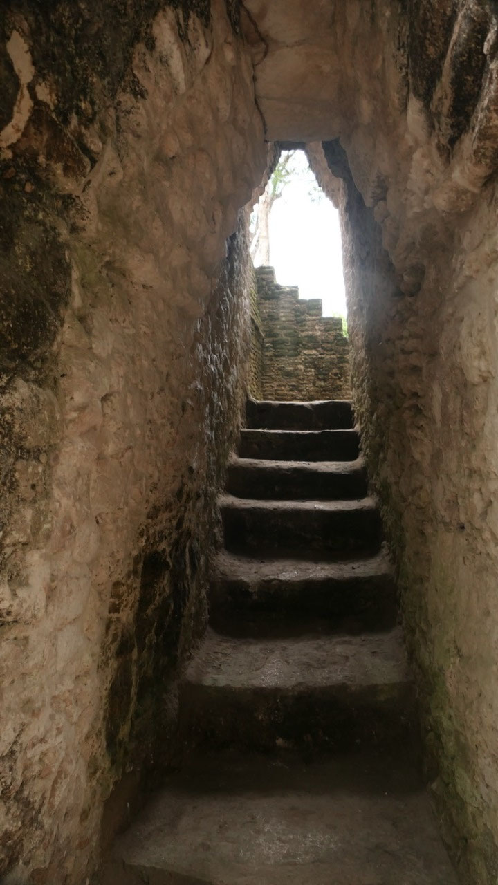
- and then it gets really funky we went into Plaza D and then to Plaza E: I mean it is super cool, but here we see rooms and more rooms around a little plaza: but the best was going underneath arches and then down some inside stairs around corners and finally through a Tunnel so we end up in Plaza F (you nearly can get lost). By the way there are so many little rooms, there is no time to explore them all.
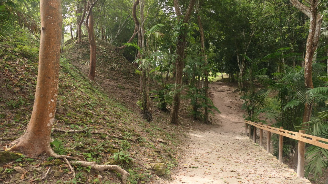
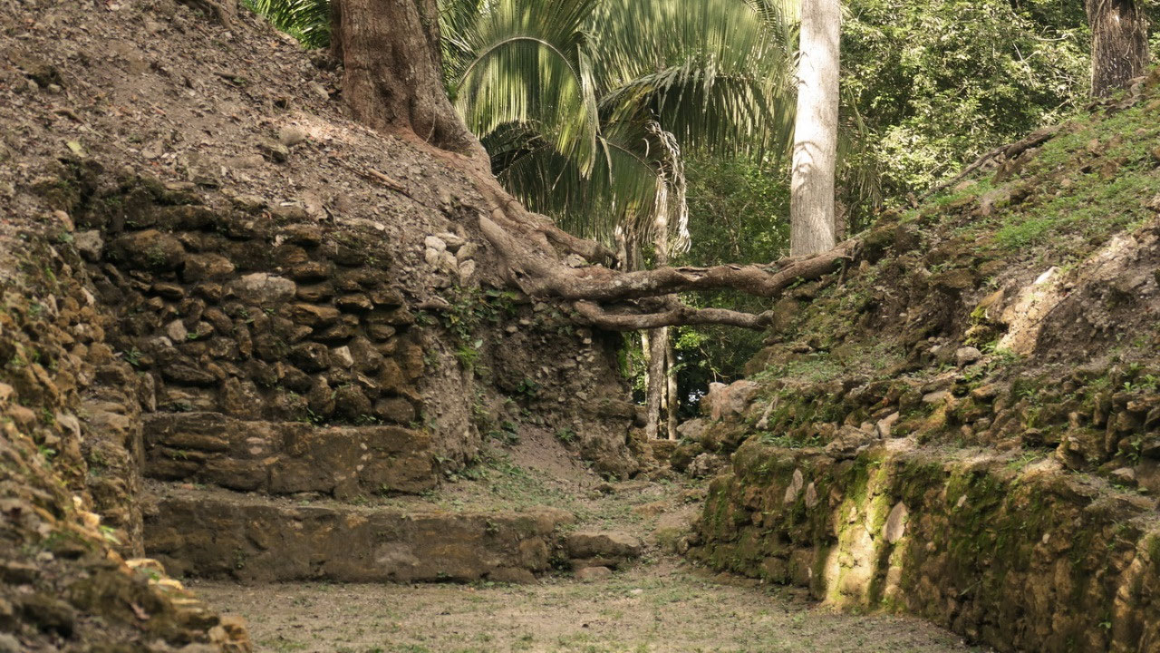
- after a quick look into Plaza G back to Plaza B and from here around the E group to Ball court which leads to Plaza C: the cool thing on that ball court was, that one tree root was growing from one temple over to the backside of the ball court – that shows on how deep all was buried – because they took all the earth underneath out and now you can see the free hanging roots. In Plaza C we see here like in all the other sides a lot of not-restored structures: which means a little hill or stone pile. (Later when driving around the country we always wondered when we drove and there were those perfect little hills: could that been a Mayan temple once too?) We leave and down the steep road to towards the:
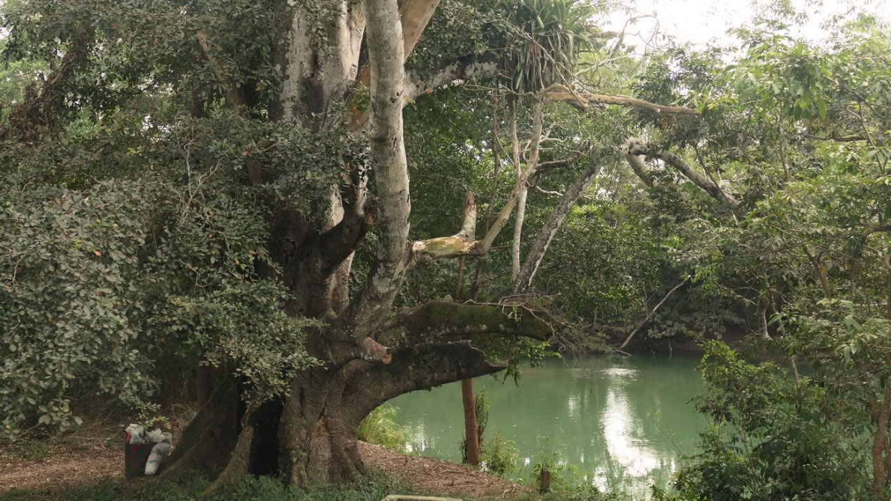
Mouth
Branch Park
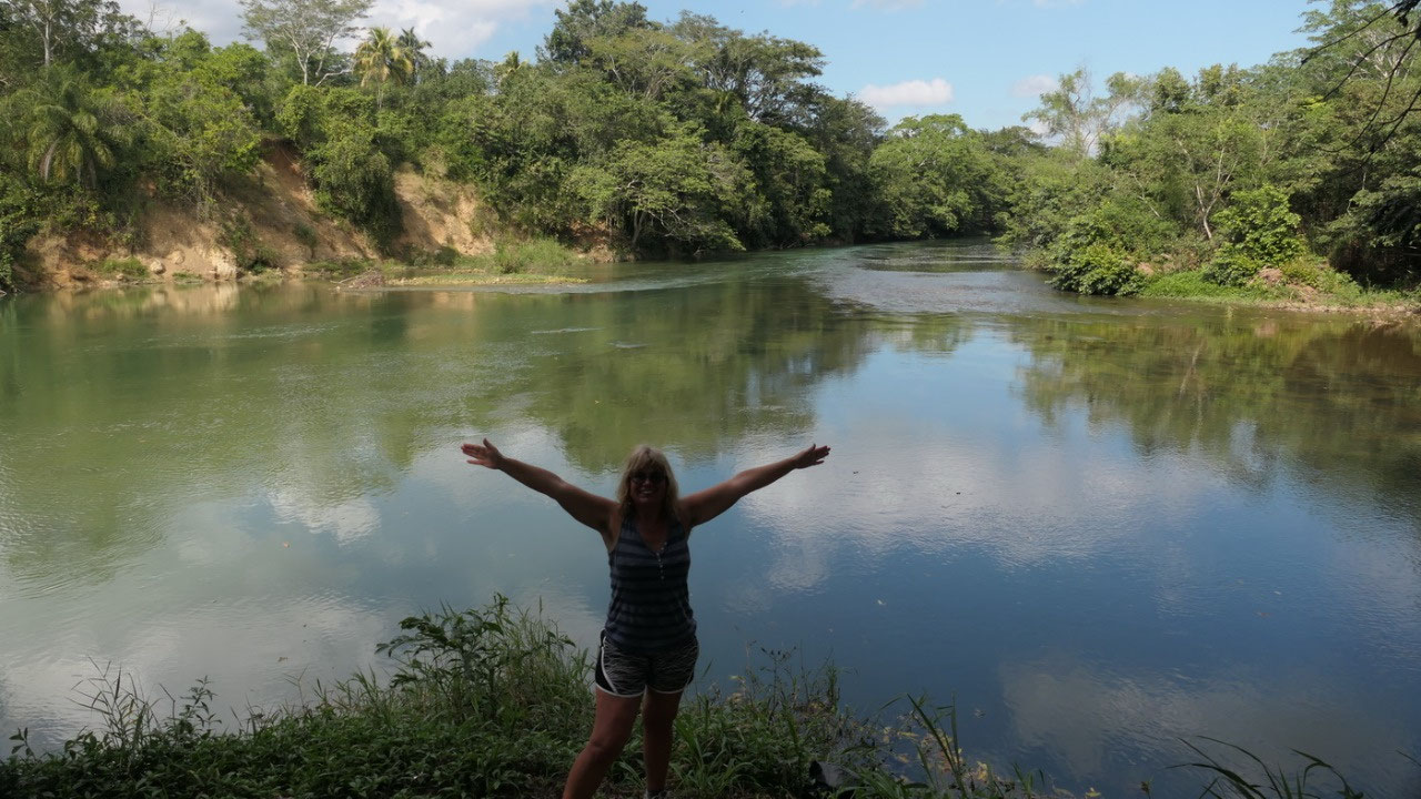
ok
so what should we do – Gine said maybe we should check out this
park this is the Meeting of the River. A bit of Gravel road and we
are at the “Parking lot”:
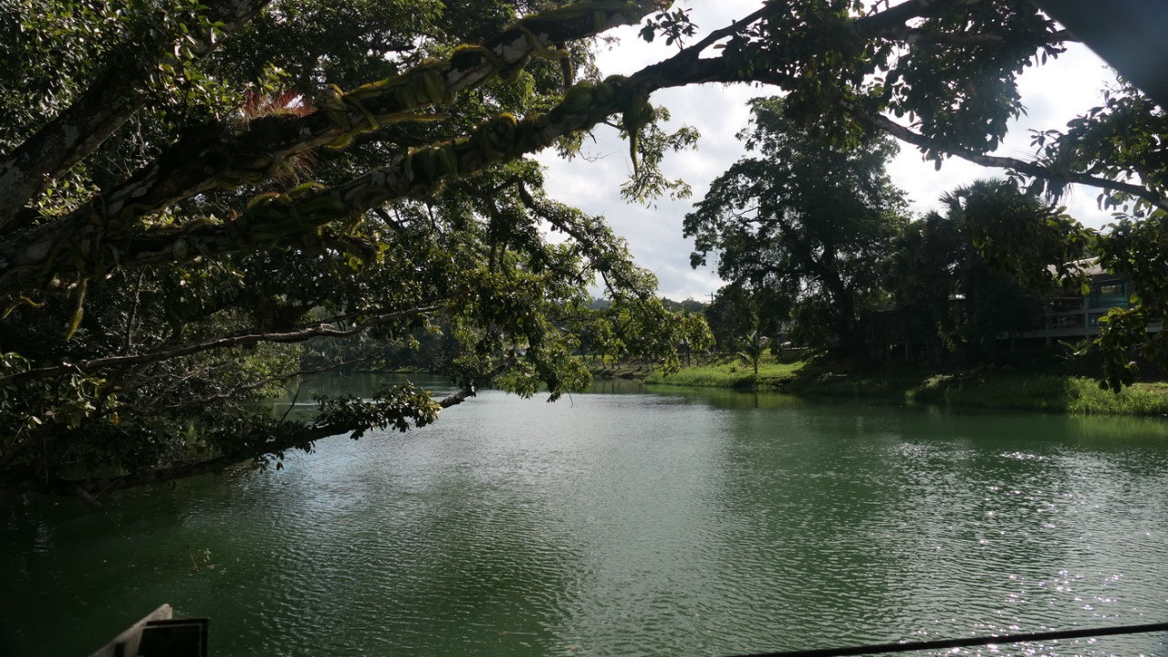
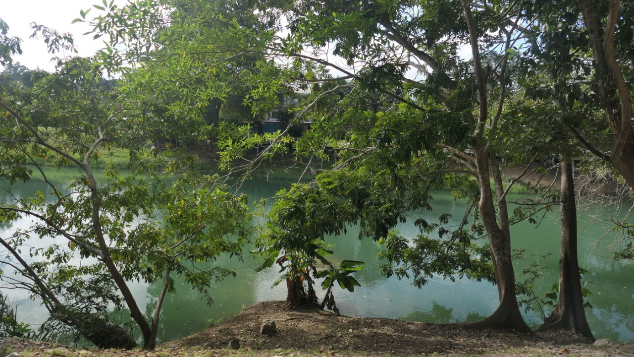
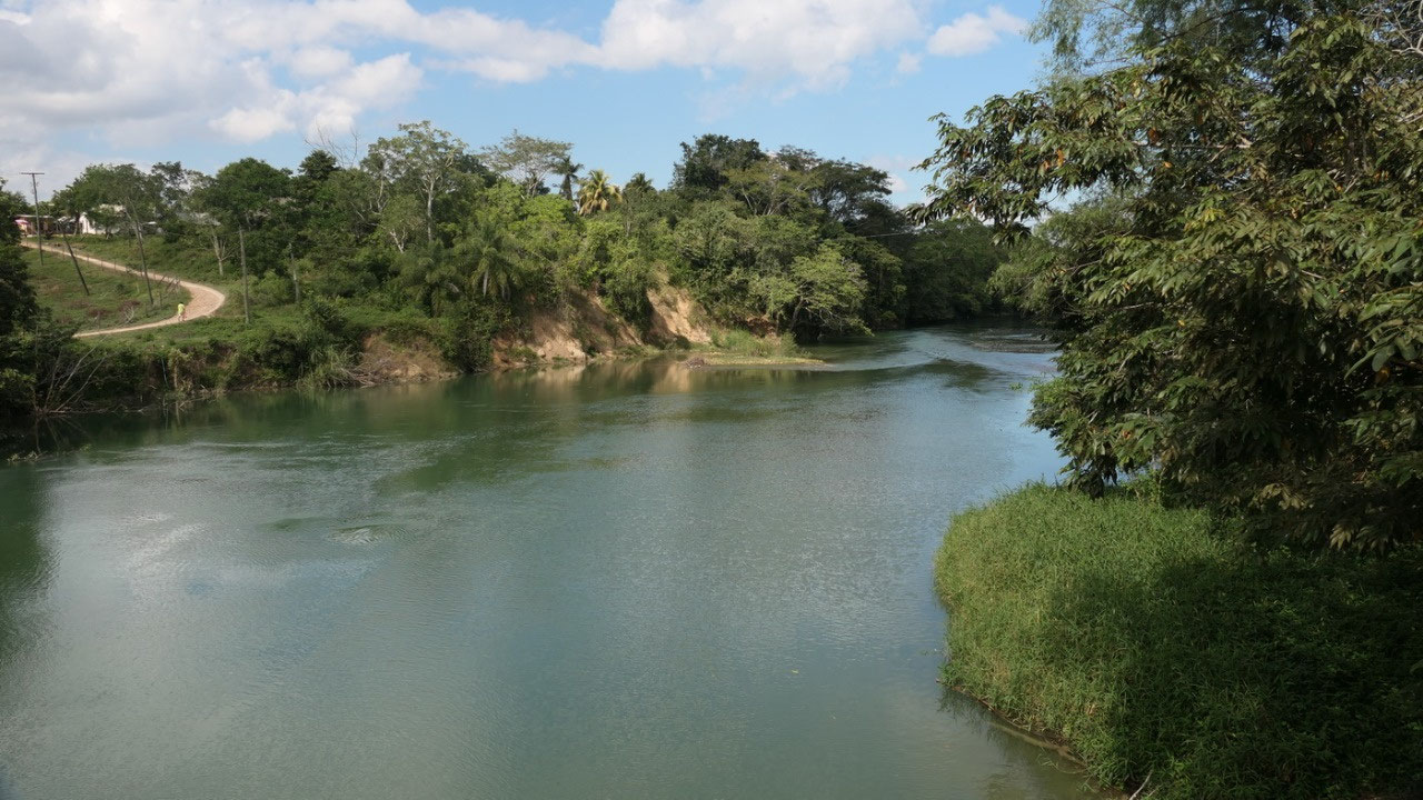
- Here the Mopan River meets the Macal River (which actually starts in the Maya Mountains: they form the Belize river right here in San Ignacio
- the Macal River starts in the Maya Mountains and is named after a beautiful girl Macall
- the Belize river runs 290 km through the center of Belize and goes into the sea at Belize City
- once it was called the Old River
ok
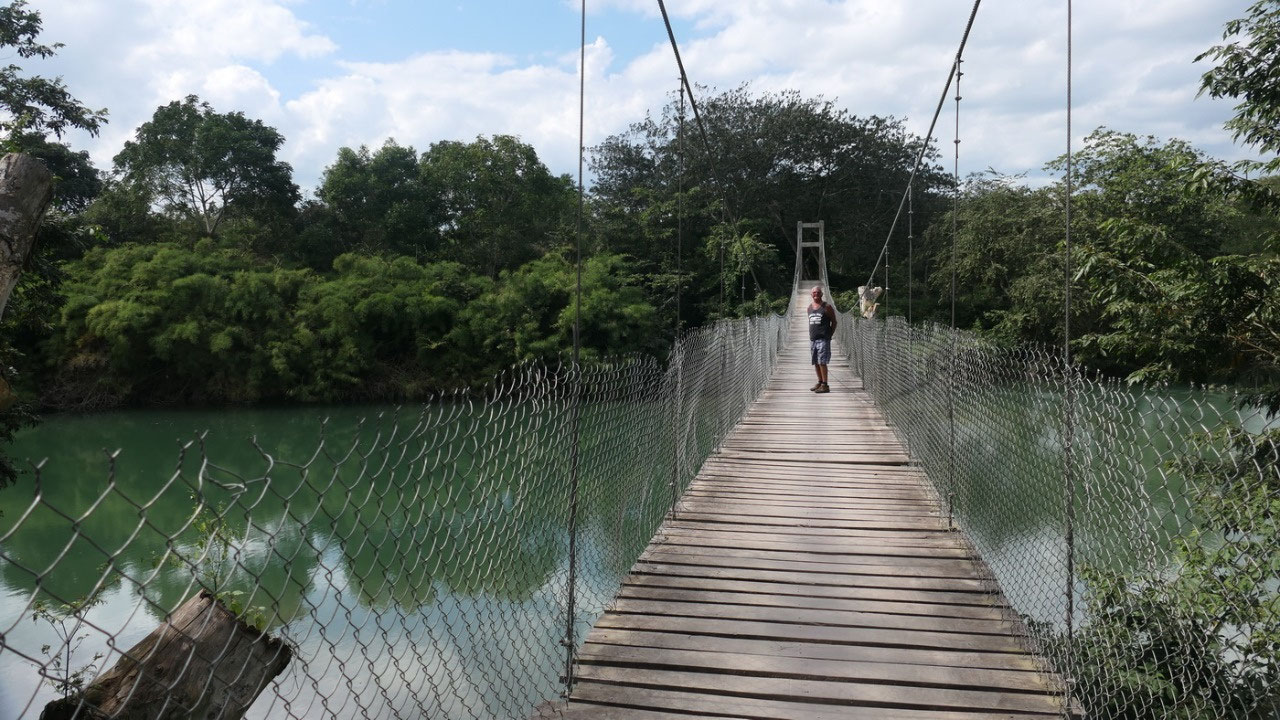
so it doesn’t look the cleanest, there is a hanging bridge and we
walk over: in the middle you can see where the chicken wire got bend
and the locals jump in the water – we decided to skip this
adventure: we don’t know how deep and how clean the river is and as
where we don’t want to pick up parasites or being eaten by
crocodiles we are only looking. Oh and the chicken-wire is very spiky
at the top!! Even better when we were back a guy with a motorcycle
went over, a bit later a taxi dropped and let off a lady to walk
over...
Icecream:
a lot for less in the park
Did
I mention that San Ignacio has a lot of one-way roads and our google
map doesn’t really know them, so it happened, that we drove in the
wrong direction on those narrow roads with deep gutters on the side
(so you don’t want to get stuck in there) and then they park cars
on the road too – and you have nearly no space to drive through).
When
you are hot and sweaty when you come back then you need a cold
refreshing shower and ice cream – and there are a lot of options
here. So we went to Western Dairies where you get a lot for less,
which is true, but maybe it is not the highest quality. So we were
sitting in the park watching people.
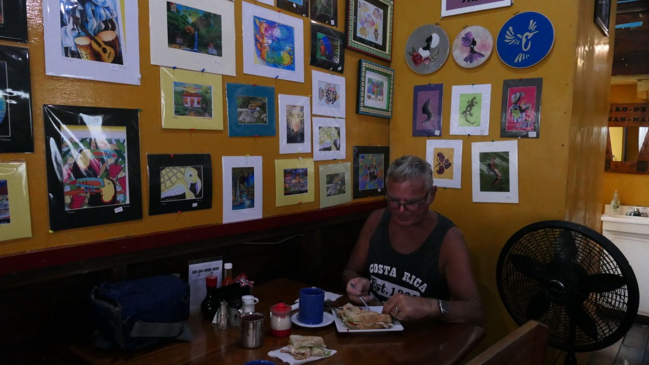
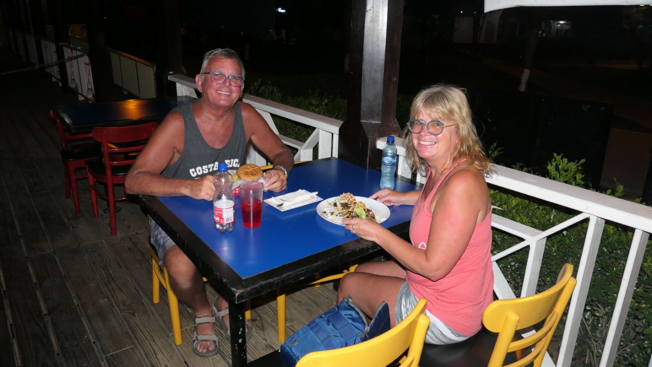
Meeting
on the Balcony
we
decided that we relax a bit on the outdoor rooftop balcony – once
we went up we saw Simon and Christina came too and then we started
talking. I thought it was funny that he also had to go through a
whole lot of trouble to get his credentials transferred to Canada and
they have similar problems with the border, permanent residence car –
as well we discovered we are both independent travellers. And then
it’s time for supper.
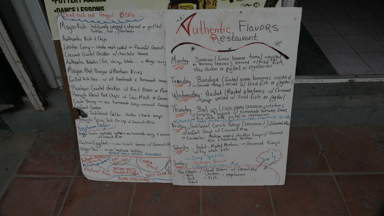
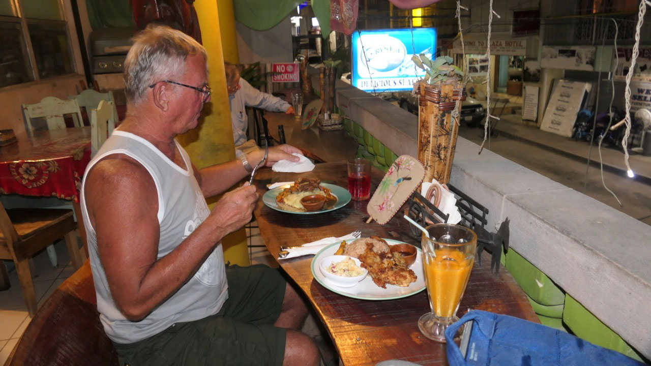
Authentic
flavour
authentic
means we are eating something really Belizean and we choose authentic
flavour and I have to say it is truly authentic and has some very
unique flavours: Paul had pork chops with pinapple glaze and mango
flavoured veggies – super yummy, and Gine had coconut crusted
chicken with chocolate sauce made of organic Mayan Chocolate – I
mean how can it be more special!!


2025-05-22