South Dakota has been an amazing experience and I love every second of it. While I've traveled through these parts before, the older I get - and this trip gives me the opportunity to look a bit closer and see more.
From our last blog in Rapid City, we got up Wednesday morning and took a wonderful morning walk through Canyon Lake
. I remembered the horror of the Rapid City flood in 1972 when over 280 died and more missing when heavy rainfall in the Black Hills sent a wall of water down Rapid Creek taking out the dam at Canyon Lake along with bridges and everything in its path down the floodplain. I was working in Brookings, SD at the Remote Sensing Institute when this occurred, and the photo crew flew an aerial mission over the flooded area and we worked overnight in the photo lab to get photos on the Governor's desk Monday morning.
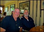
At about 11:30 Wednesday morning we met Gene and DiAnn Deyo at the Millstone in Rapid City for lunch. Gene and I had known each other for years, we met the first time when I was in the Army on active duty at Ft. Carson, Colorado back in the mid 1970's. Gene's unit came to Ft. Carson for training and our unit worked with his. Gene and I had the same job so we worked closely for those few weeks, then years later, after I moved back to South Dakota, we again worked in communication positions within the South Dakota National Guard
. It was great to see Gene again and we had a great time reconnecting after many years. Gene and DiAnn have a section of land about 40 miles east and a bit south of Rapid City where they raise buffalo.
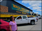
From Rapid City, we headed east on I-90 and made the obligatory stop at Wall, South Dakota and Wall Drug. Dolly fell in love with an old rancher at Wall Drug (see photo) and a saloon wench had eyes for me. From Wall, we headed across South Dakota on Highway 14. Highway 14 provided beautiful views of the western part of the state with its miles and miles of green carpeted grasslands and grazing cattle. We didn't see very much wildlife, an antelope and three mule deer. We arrived in Ft. Pierre and went up highway 1406 to the Oahe Dam campground. The campgrounds are absolutely beautiful with many mature cottonwood trees, manicured grass camping spots, and a nearby marina to pick up basic supplies. The only problem at this campsite was the wifi - they had it and there was sufficient signal strength but the connection process just didn't work
.
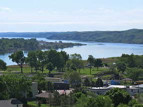
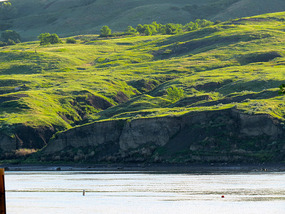
Thursday morning, we got up bright and early and I took a couple of photos along the Missouri River shoreline then we packed up and drove across the (from memory here) third largest rolled earth dam in the world. The Oahe dam is a sight to see rising a couple of hundred feet above the landscape and holds back water to nearly North Dakota. We also stopped at a monument where a french explorer, Verendrye, placed a lead plate on a hill overlooking the Missouri River in 1743. It was discovered by some local kids in 1919.
We arrived in Mitchell during the mid afternoon and set up camp in a very nice KOA about three miles east of Mitchell. A quick shower came through after we were set up and we heard some warnings of tornadoes in the Sioux Falls area, but thankfully they didn't develop.
Next is Sioux Falls to spend some time with son John, his wife Dani and two grandchildren Tanner and Hailee. A softball tournament is on the schedule for tonight and tomorrow!
All for now.
Love ya,
Cheers!
Jan, Dolly and Chi Chi
From Rapid City to Ft. Pierre to Mitchell, SD
Friday, June 06, 2014
 Mitchell, South Dakota, United States
Other Entries
-
28Our Halfway Point!!!
May 1126 days prior McKinleyville, United Statesphoto_camera10videocam 0comment 0
 -
29Northern California Coast
May 1324 days prior McKinleyville, United Statesphoto_camera26videocam 0comment 1
 -
30The California Coast at Trinidad
May 1423 days prior Trinidad, United Statesphoto_camera24videocam 0comment 0
 -
31Bald Eagles on the Trinity River
May 1522 days prior Hoopa, United Statesphoto_camera16videocam 1comment 2
 -
32Plants, plants and more plants
May 1720 days prior Humboldt State University, United Statesphoto_camera19videocam 0comment 0
 -
33Graduation Day!!!
May 1720 days prior Arcata, United Statesphoto_camera19videocam 0comment 1
 -
34Random People at Graduation
May 1720 days prior Humboldt State University, United Statesphoto_camera25videocam 0comment 0
 -
35Arcata Plaza and the Top of the World
May 1819 days prior Arcata, United Statesphoto_camera21videocam 0comment 0
 -
36Its all about SEALS !!!
May 2017 days prior McKinleyville, United Statesphoto_camera25videocam 0comment 0
 -
37Shasta, Bald Eagles, Magpies and Marmots
May 2314 days prior Lakeview, United Statesphoto_camera28videocam 0comment 0
 -
38Sprinkles, 36 degrees, Goslings and a Blue Bird
May 2413 days prior Lakeview, United Statesphoto_camera15videocam 0comment 1
 -
39Agates, Obsidian and critters
May 2512 days prior Lakeview, United Statesphoto_camera19videocam 0comment 1
 -
40Old Faithful, Jackson Lake and the Grand Tetons
May 2611 days prior Colter Bay Village, United Statesphoto_camera32videocam 0comment 1
 -
41Flood, Mule Deer, Register Cliff and Wagon Ruts
May 307 days prior Guernsey, United Statesphoto_camera24videocam 0comment 1
 -
42Wind Cave, Tetonka, Coyotes and Prairie Dogs!
May 316 days prior Hot Springs, United Statesphoto_camera16videocam 0comment 0
 -
43More Bison, some Burros and Sylvan Lake
Jun 015 days prior Custer, United Statesphoto_camera21videocam 0comment 1
 -
44Great Times in the Black Hills
Jun 033 days prior Hot Springs, United Statesphoto_camera21videocam 0comment 0
 -
45From Rapid City to Ft. Pierre to Mitchell, SD
Jun 06 Mitchell, United Statesphoto_camera13videocam 0comment 0
 -
46South Dakota - Great Places, Great Faces.
Jun 104 days later Sioux Falls, United Statesphoto_camera11videocam 0comment 0
 -
47Seward, Fountains and the River
Jun 159 days later Seward, United Statesphoto_camera20videocam 0comment 0
 -
48Muscatine and Great Friends
Jun 1711 days later Muscatine, United Statesphoto_camera12videocam 0comment 0
 -
49Muscatine, the Krueger's and Chicago
Jun 2317 days later Chicago, United Statesphoto_camera12videocam 0comment 0
 -
5010,755 miles, the trip is over!
Jun 2418 days later Waldoboro, United Statesphoto_camera42videocam 0comment 2

 Mitchell, South Dakota, United States






2025-05-22