 Bahundanda, Western Region, Nepal
The Annapurna Circuit Trek is considered one of the world's classic treks, an approximately three-week roughly horseshoe-shaped trek around the Annapurna Massif in the Himalayas in west-central Nepal. Shorter versions of the classic trek are possible since unpaved roads have been built into the region and there’s an airport for flights in and out in Jomsom. These are many other major treks in the Himalayas in Nepal, including the one to Everest Base Camp and others in the Everest region, but for some reason the Annapurna Circuit Trek is the one that’s fascinated me for over twenty years. When I decided to travel to India and Nepal the Annapurna Circuit was a top priority to incorporate into my trip.
My return flights from the Maldives To Kathmandu on Qatar Airway via Doha were one of my best flight experiences since I got bumped up to business first at the gate in Doha
. Having an American (or at least western) passport still has its advantages when traveling in some parts of the world. I spent two days in Kathmandu getting my trekking permits in order and finding a new backpack for about $40 (North Face logos and all) to replace the one I’ve had for a long time on which a strap came loose when I was trekking in the Langtang Valley. Hotel Ganesh Himal, down a narrow land in a gritty part of town a little southwest of the main tourist ghetto in Thamel, had by now become my home away from home on each return trip to Kathmandu. Highly recommended by Lonely Planet guides, it has nice rooms at reasonable rates, a nice garden for sitting outside, and a huge storage room to leave the majority of your belongings when trekking.
I left Kathmandu early in the morning on the "tourist bus" towards Pokhara, tourist bus meaning one with assigned seats purchased for the entire journey rather than a bus with people get off and on all along the way, standing in the aisles, hanging out the door, rising on the roof, etc
. This was my fourth trip of five on the overcrowded, poorly maintained main road westward out of Kathmadu to the Trisuli River Valley. At a busy market crossroads town named Dhumre I switched to a local bus for the two-hour trip to Besi Sahar, the normal start of the Annapurna Trek.
There were a few park and permit registration checkpoints in Besi Sahar. As it was still only mid-afternoon (and Besi Sahar is a large ugly village spread out along a road for two miles) I figured I’d start out on the trek. Two young couples from France and Russia I met on the bus, though, were planning to wait for the local bus to Bhulbhule, normally three or four hours trek. Although taking the bus kind of seemed like cheating, the area was not particularly scenic and at only 840 meters (2,800 feet) elevation it was unpleasantly warm and humid.
We were in fact able to go to Ngadi, an hour’s walk past Bhulbhule, recommended by the locals for having some good accommodation
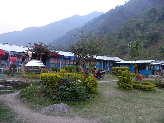
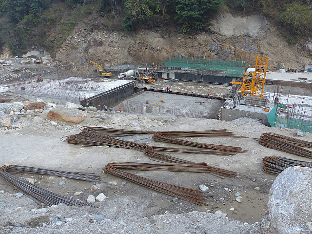
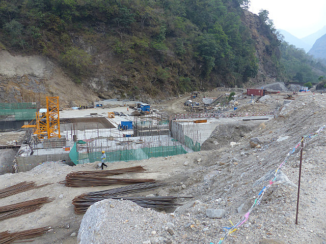
. The bus was the right choice; the lower part of the valley was a muddy mess with many construction sites as part of a Chinese financed hydroelectric project. The trek would have been highly unpleasant. The guesthouse was 100 rupees (about $1) for the night plus dinner. I turned in immediately for a crack-or-dawn start to the day since I knew at that low elevation it would quickly get unpleasantly hot. The rest of this blog entry covers the first and second days of trekking.
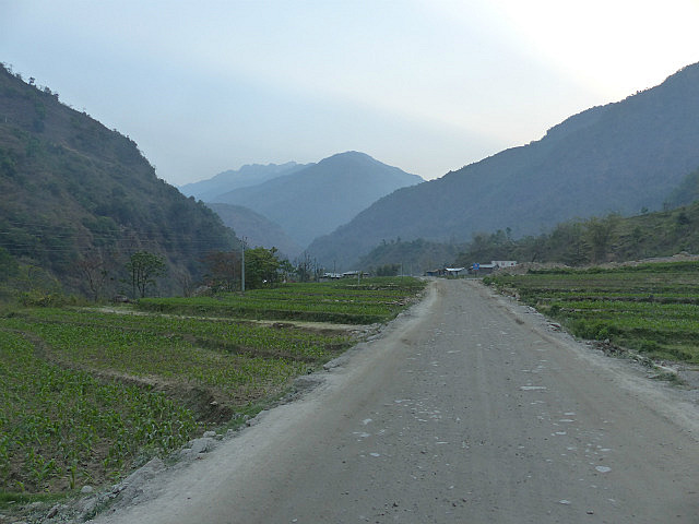
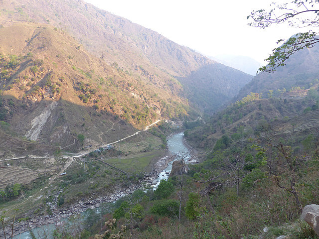
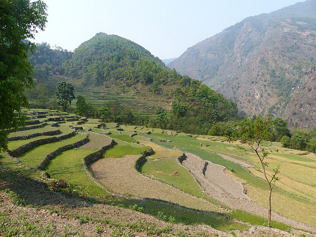
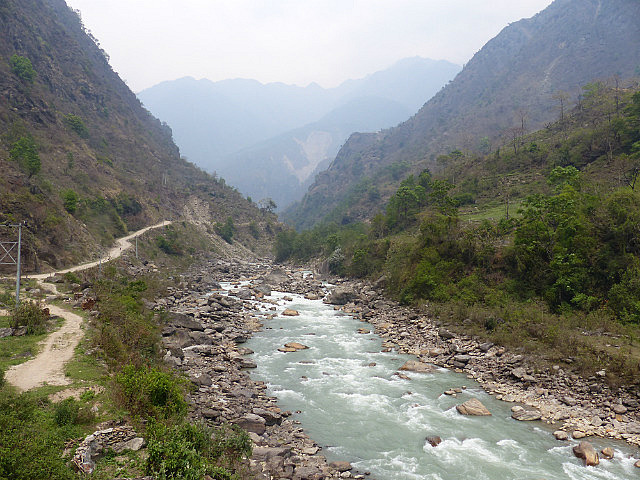
I set off early on the morning of Friday, April 11th without having had breakfast. There was some more dam construction at Upper Ngadi around which I had to make a detour but from there on it was easy walking. The trail followed the Marsyangdi River Valley into the foothills, partly on gravel road, a pattern that would continue well into the trek. Much of the Annapurna Circuit Trek can now be done on the gravel roads that now go much of the distance towards the Thorung La Pass from both sides. The road has the advantage of less steep gradients than some of the trails that can still be done as alternatives
. Much of the trek I would find is actually quite easy in the sense of rather few steep parts since the trek follows one river valley up most of the way to the pass and down the other side of it. This contrasts with a trek I did in the Pyrenees between France and Spain in 2008 was involved lower elevations but just rises and drops through passes and valleys on a daily basis.
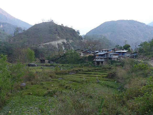
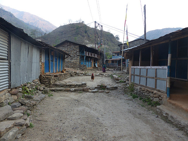
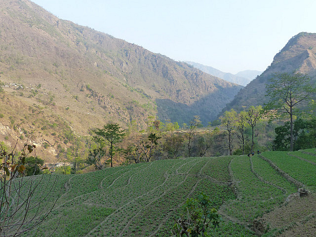
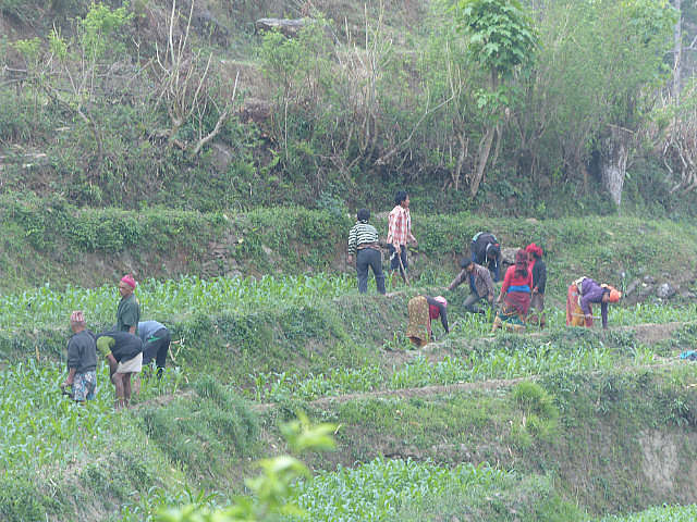
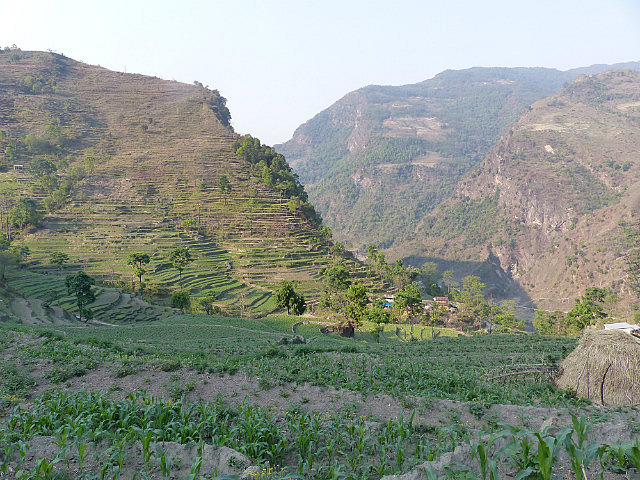
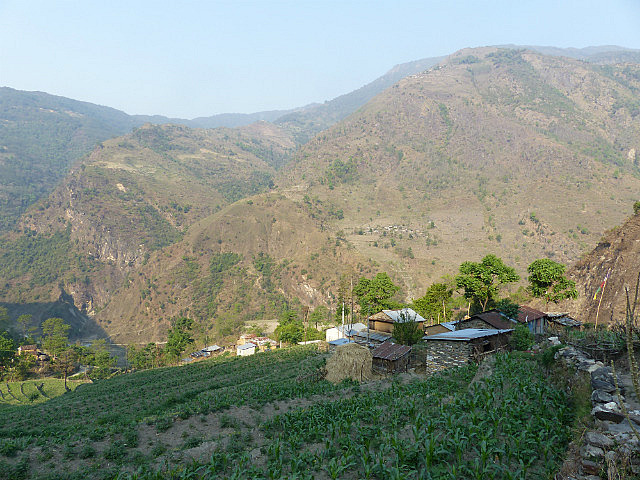
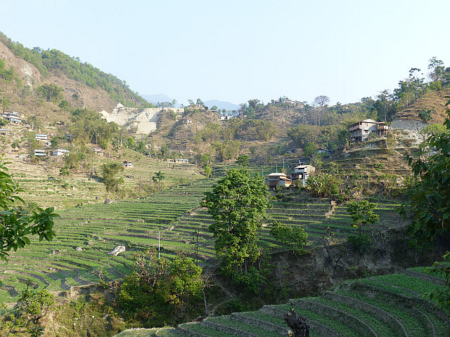
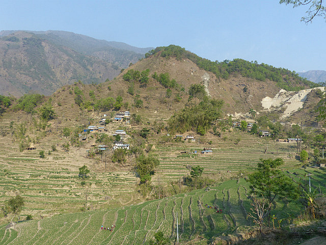
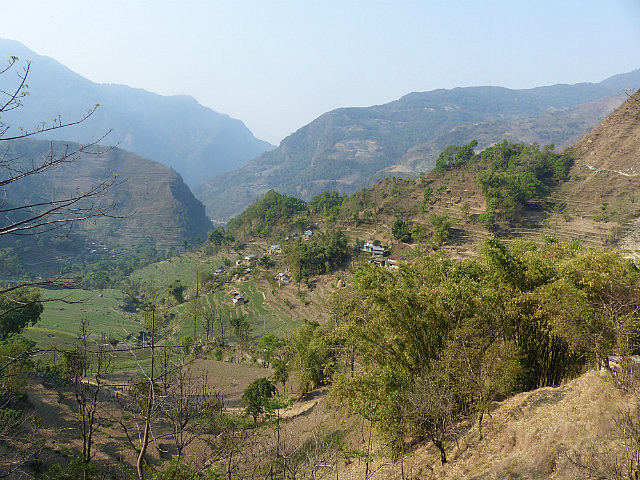
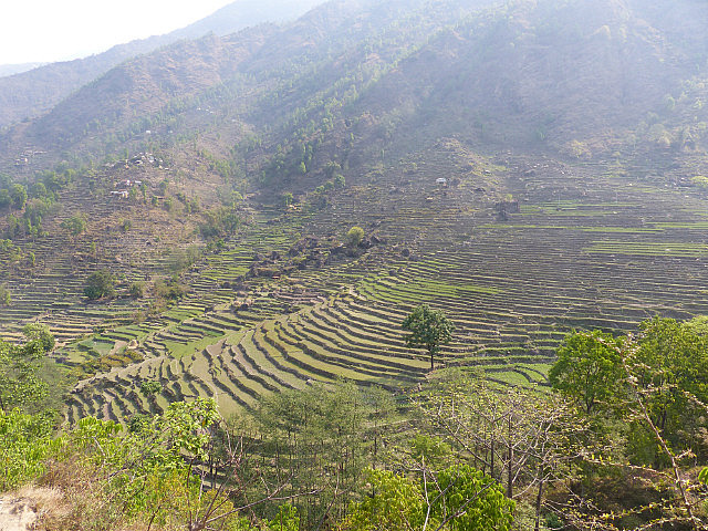
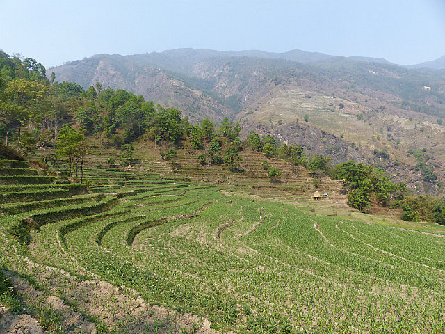
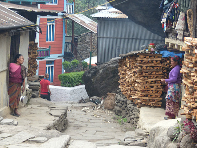
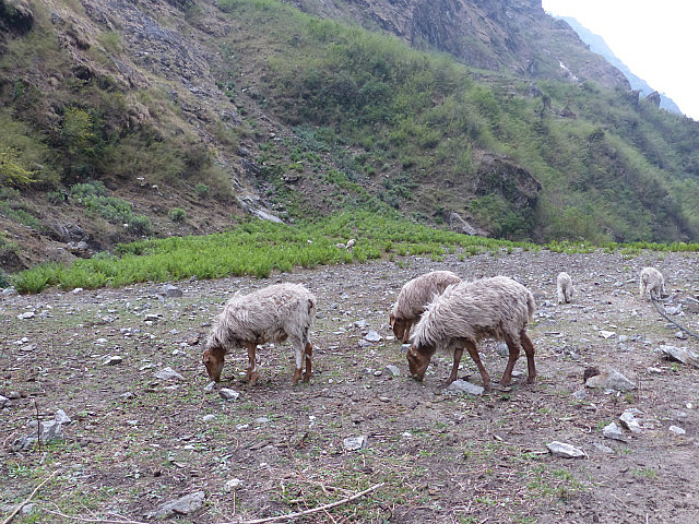
The early part of the trek included passing through several villages and much was through pretty terraced fields in which people were working to take advantage of the cool morning. Through the Annapurna trek there are many different ethnic groups, people in the lower areas being mostly Hindu from such groups as Gurung, Megar, and Brahman, while in the higher valleys are predominantly Buddhist Tibetan-influenced cultures such as Marsyangdis and Thakadis.
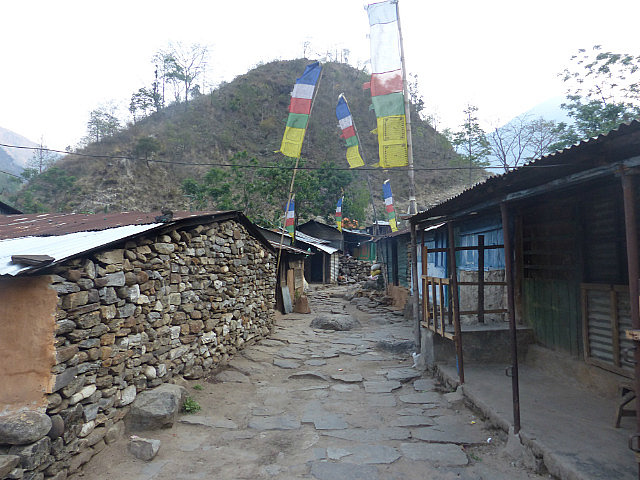
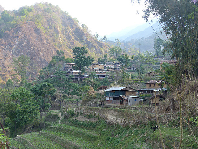
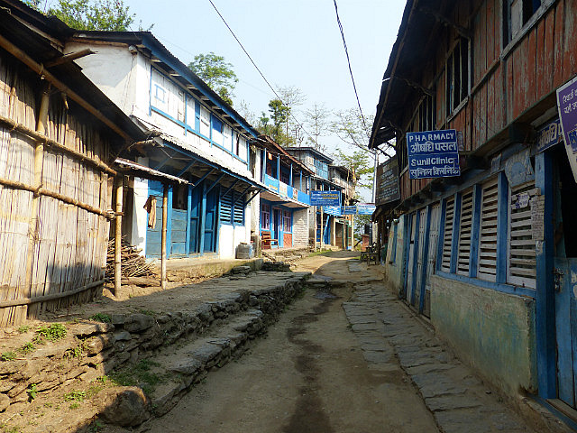
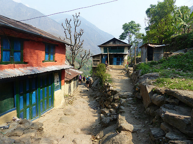
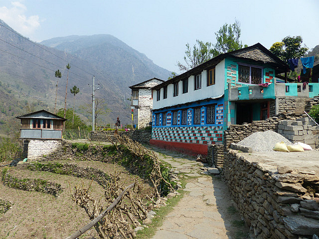
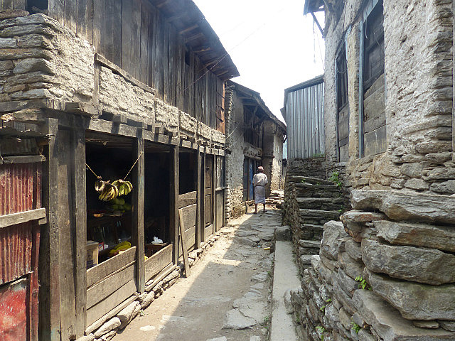
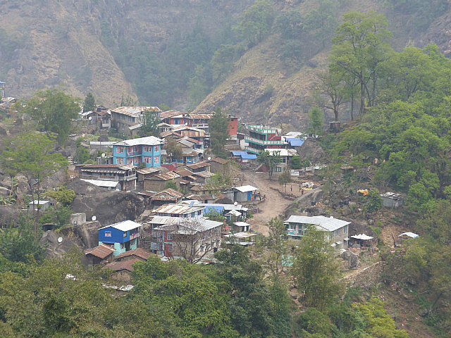
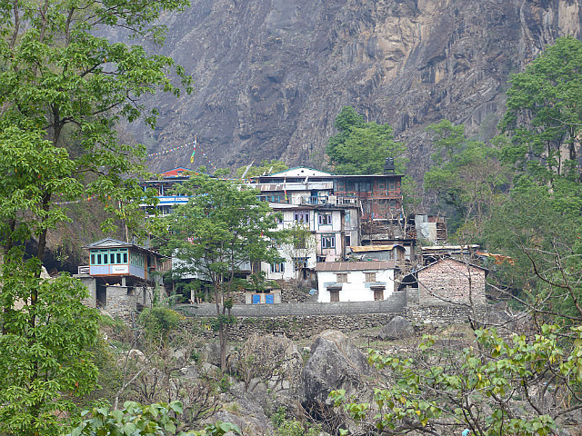
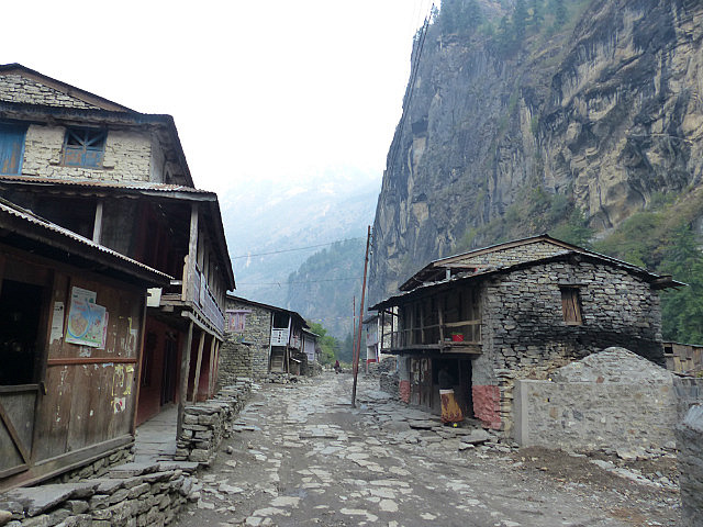
I stopped for breakfast in a hilltop village named Bahundanda where the buildings were mostly painted blue, typical of the Brahman ethnic group in the area
. The Brahmans are members of a Hindu priestly caste from Rajasthan area in western India who moved to Nepal many centuries ago to escape the Muslim invasion of their region. They still seem very Indian.
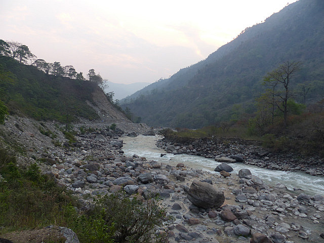
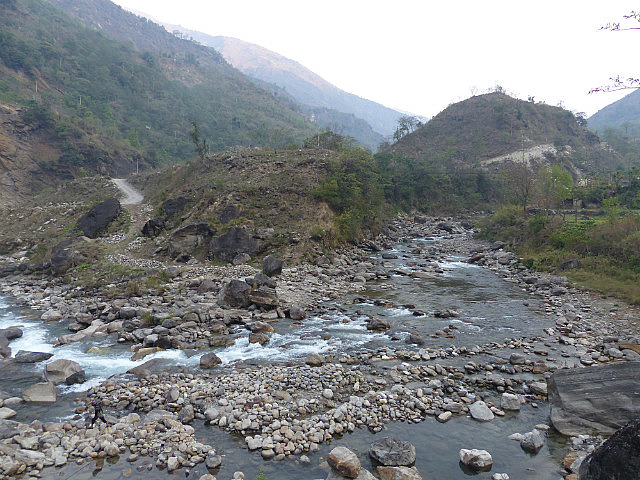
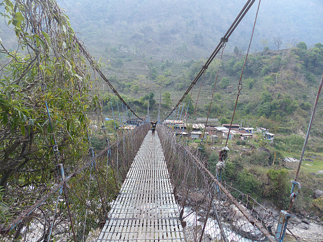
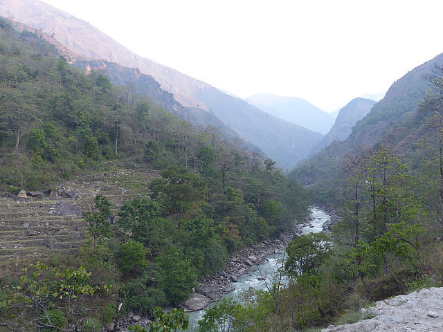
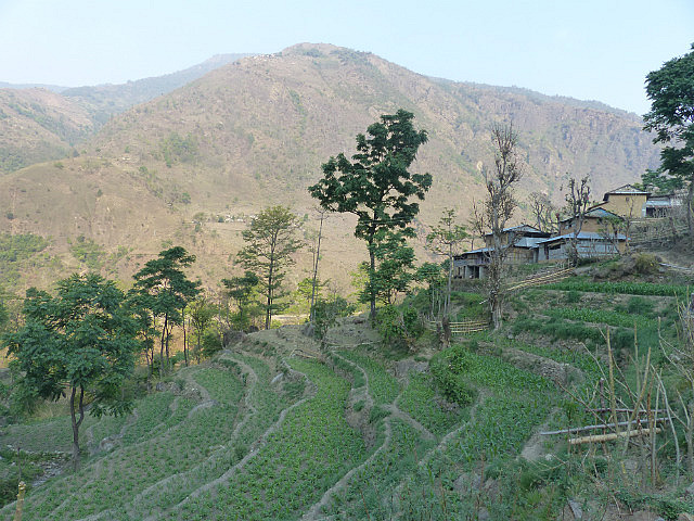
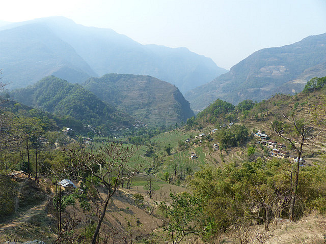
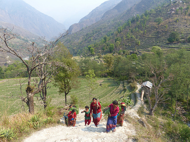
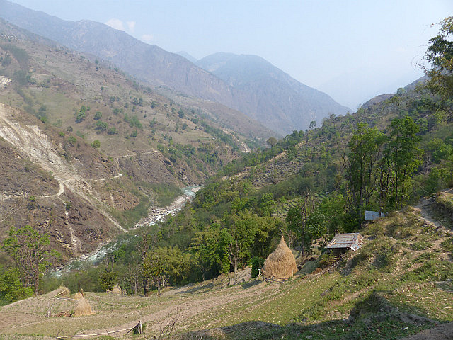
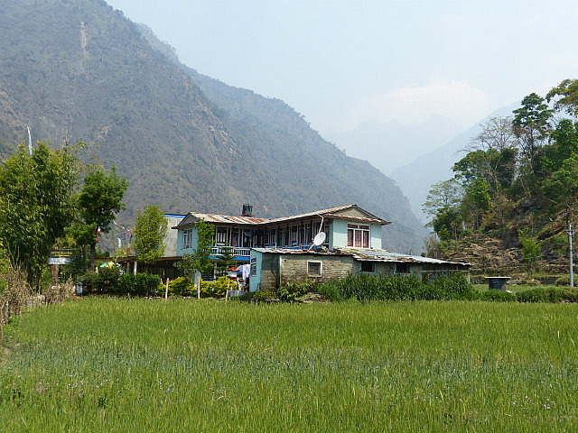
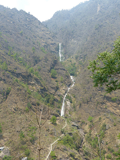
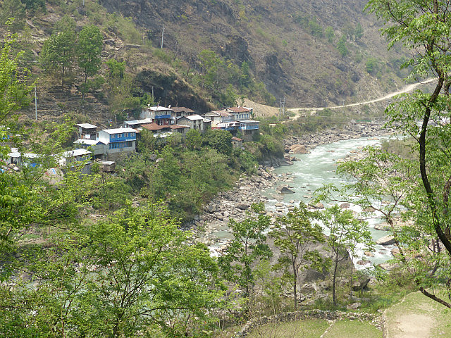
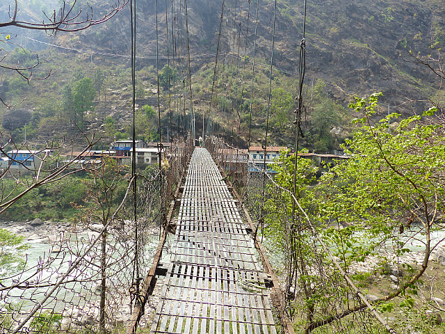
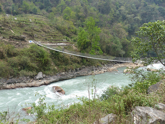
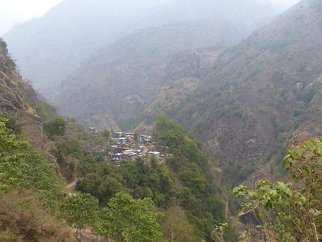
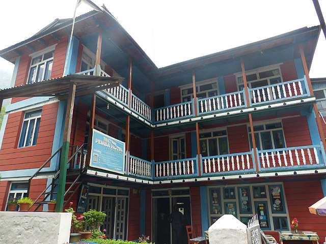
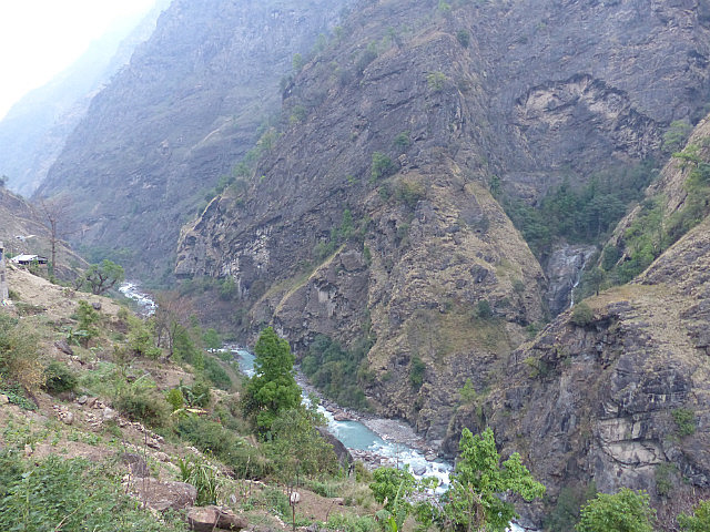
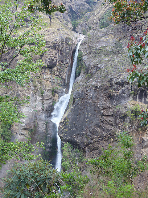
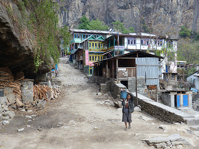
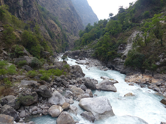
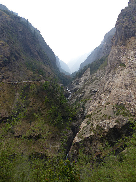
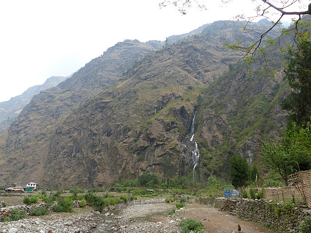
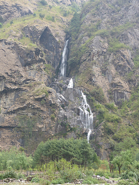
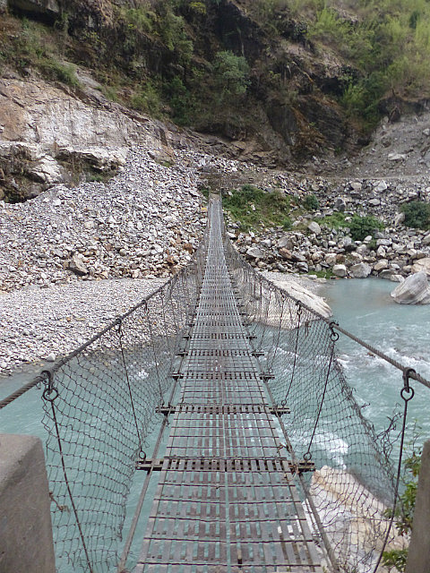
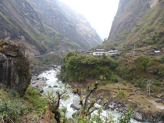
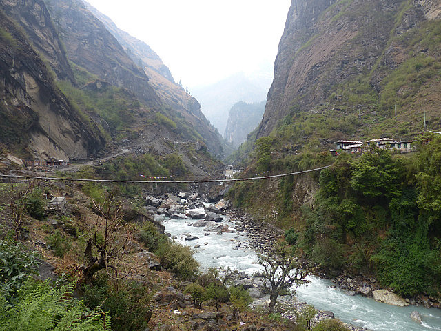
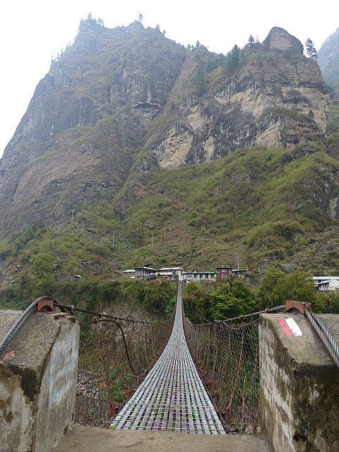
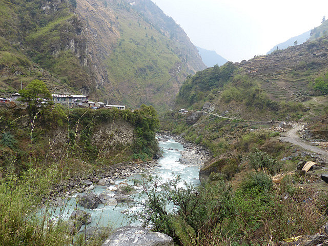
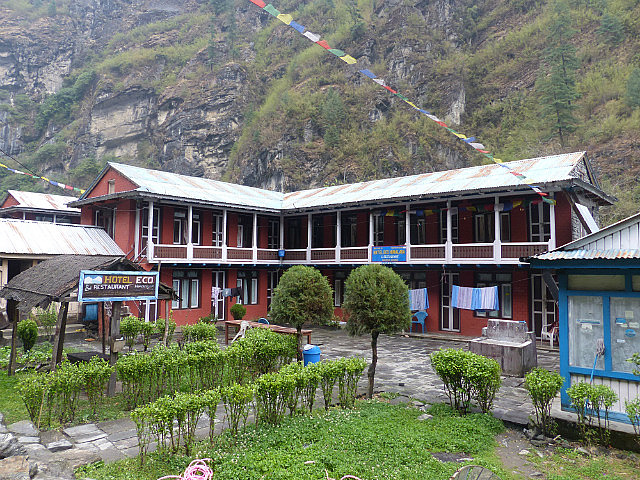
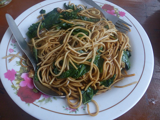
From Bahundanda the trail descended through terraced fields and then stayed scenically high above the Marsyangdi for a few hot hours to a settlement named Ghermu containing a string of nice guesthouses facing a waterfall across the valley. I stopped for chow mein lunch and a rest of a couple hours – it was way too early to call it a day. The trail then dropped down to a suspension bridge across the river to Syange, a dense medieval-feeling riverside village. From there it was a long walk along a dirt road along the river and then switchbacks blasted out of the rock climbing high above the river. By late afternoon I dropped into a Tibetan-cultured village named Jagat, perched high on a ledge above the narrow river gorge, and decided I was home. Jagat’s elevation is about 1,330 meters, so for all my ups and downs through the day I had not risen that mush in elevation
.
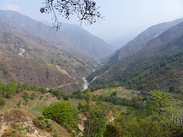
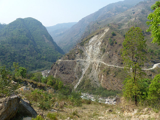
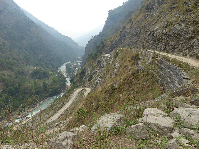
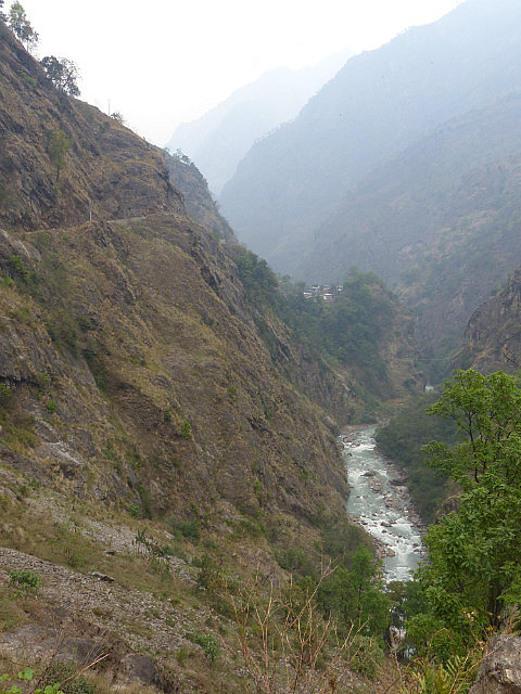
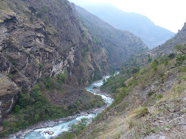
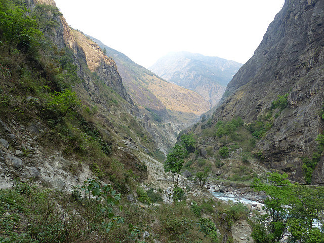
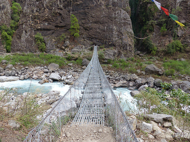
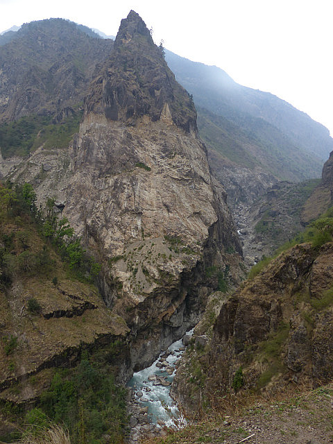
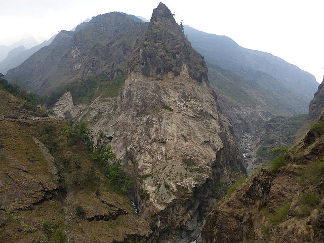
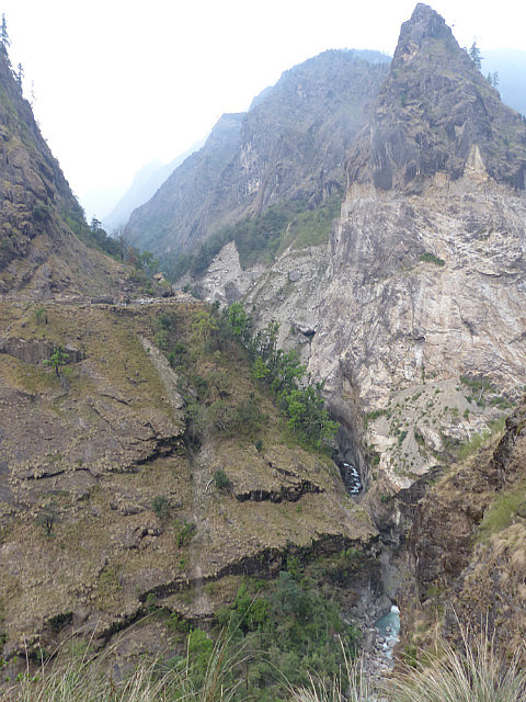
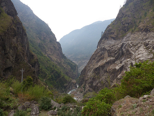
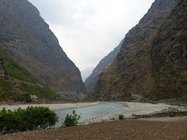
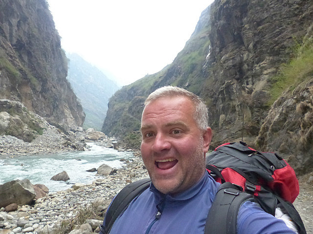
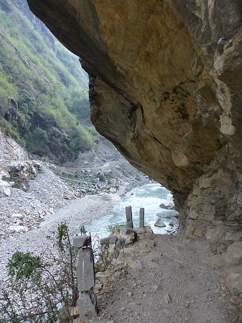
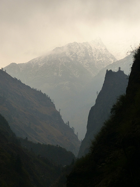
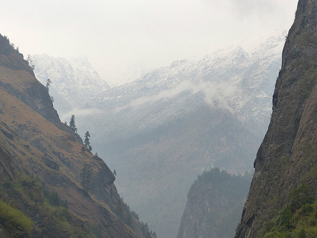
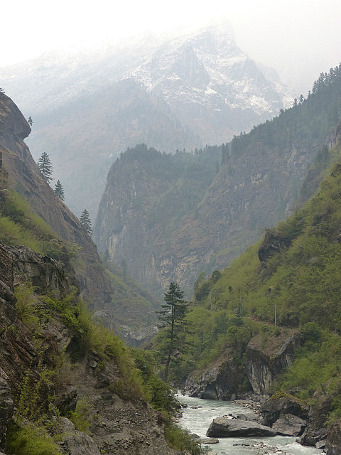
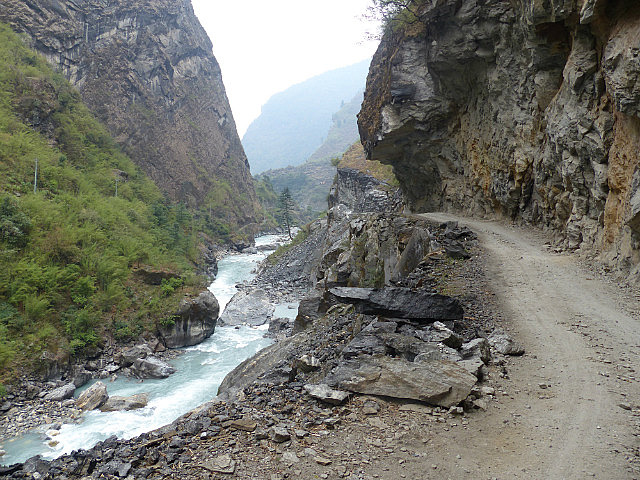
On day 2 I set out again at dawn to take advantage of the coolest time of day, followed the unpaved road for a few miles up the narrowing canyon, and breakfasted in Chamje village. The trail then dropped into the ravine, crossed the river again on a suspension bridge, and climbed spectacularly above the gorge past precariously places farmhouses and fields. The weather turned cloudy and cool with a few sprinkles, not the best light for taking pictures but more pleasant for trekking than hot sunshine. For much of the way I could see the road on the other side of the gorge, hard to imagine how it could be blasted out of sheer rock face so high above the river.
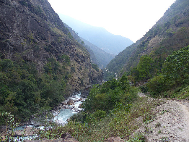
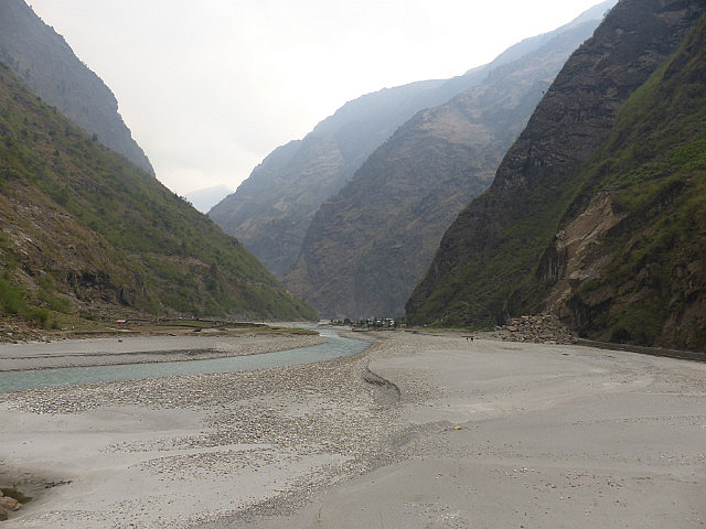
At the top of a long set of switchbacks the valley level out to a flat gravel plain before a tourism-friendly village named Tal where I stopped for lunch just as the heavens opened up. I waited out the rain for a few hours and probably dozed off while attempting to make some progress on “The Fountainhead”
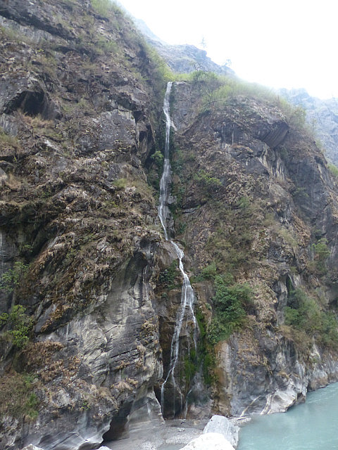
. The area around Tal seemed like something out of Middle Earth in a Hobbit Movie with a fast-flowing river through a flat valley bottom of emerald green fields, surrounded by lush vertical cliffs with narrow waterfalls cascading down.
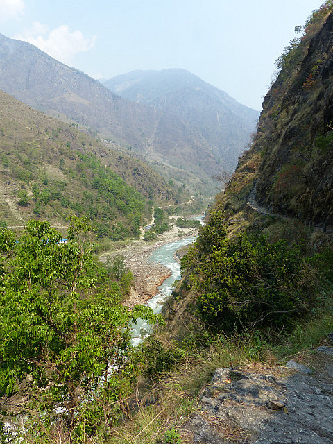
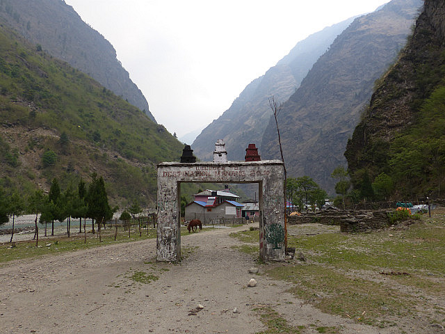
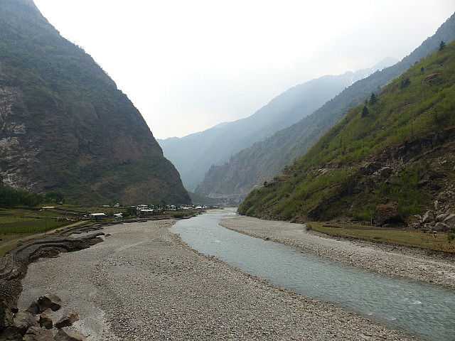
I was soon back in the narrow river gorge, crossed it again on a suspension bridge, and was back on the road. I was able to duck into a Bhatti, an small shelter where local people serve tea and sometimes food, right as a second deluge began. The last stretch for the day was through the gorge on the unpaved road, at places blasted out of the vertical cliff face. The trail officially zigged and zagged and crossed the river on suspension bridges a few times, but I was ready to get to Dharapani and call it a night so stuck to the road. Dharapani’s elevation is about 2,000 meters or 6,600 feet.
Annapurna Trek I - Lower Marshyangdi River Valley
Friday, April 11, 2014
 Bahundanda, Western Region, Nepal
Other Entries
-
Mar 3012 days prior Male, Maldives
 -
Apr 056 days prior
Felidhoo, Maldives -
Apr 11 Bahundanda, Nepal
 -
Apr 132 days later
Chame , Nepal -
Apr 143 days later
Upper Pisang, Nepal -
Apr 154 days later
Manang, Nepal -
Apr 176 days later
Manang, Nepal -
Apr 198 days later
Manang, Nepal -
Apr 209 days later
Muktinath, Nepal -
Apr 2211 days later
Jomsom, Nepal -
Apr 2413 days later
Tatopani, Nepal -
Apr 2716 days later
Ghorepani, Nepal -
May 0221 days later
Pokhara, Nepal -
May 1332 days later
Kodari, Nepal -
May 1736 days later Tingri, China
 -
May 1938 days later
Everest Base Camp, China -
May 2039 days later
Lhatse, China -
May 2241 days later
Shigatse, China -
May 2342 days later
Gyangze, China -
May 2443 days later
Lungsang La, China -
May 2544 days later
Lhasa, China


2025-05-22